-
Posts
1,728 -
Joined
-
Last visited
Content Type
Profiles
Blogs
Forums
American Weather
Media Demo
Store
Gallery
Everything posted by MattPetrulli
-
2022 Atlantic Hurricane season
MattPetrulli replied to StormchaserChuck!'s topic in Tropical Headquarters
No point in beating a dead horse and saying it's dead, we know it is. That being said it's quite likely we still get at least a FEW more named storms. Whether it be noteworthy or not who knows, but we're guaranteed at least one or two more named storms (this will bite me in the ass in 2 months lol). That being said, Euro/EPS ensembles say watch that wave coming off Africa, some EPS members develop it and it gets to the islands so its something to watch. Also GEFS ensembles say increasingly watch CAG. -

2022 Atlantic hurricane season whining/banter
MattPetrulli replied to GaWx's topic in Tropical Headquarters
Somebody dying from cold because power went out is still a death related to that system lol Not sure what you're arguing, seems like you're just saying one poison is worse than the other poison. Not really a point in arguing this. -

2022 Atlantic hurricane season whining/banter
MattPetrulli replied to GaWx's topic in Tropical Headquarters
February 15-20 2021 Winter Storm- At least 29 fatalities February 13-17 2012 Winter Storm -Hundreds estimated but 290 confirmed fatalities, costliest natural disaster in US history January 2018 Blizzard - 18 fatalities March 2017 Blizzard- Unconfirmed 16 fatalities January 2016 Blizzard - 55 fatalities Dec 2015 Snowstorm - 59 fatalities Point is, snowstorms definitely kill people and can be very costly. All forms of weather one way or another kill people and cause damage. Too much sun and dry weather? you get wildfires and droughts. Too much rain? You get floods. There's not a possible way to balance things out and some random guy named Joe in the state of Wyoming obsessed with this stuff isn't gonna change the way the weather works at all. The morality debates are stupid and pointless. -

2022 Atlantic Hurricane season
MattPetrulli replied to StormchaserChuck!'s topic in Tropical Headquarters
Idub has been trolling about hurricanes on this forum for like 5 years now. Stop giving him attention and his trolling will stop. Everyone here has been trying to get through to him for a while so nothing is going to change. I commend the consistent and persistent trolling, however. Anyways Euro on 12z wants a piece of Earl to break off and form a new tropical cyclone around Bermuda this weekend. Supported by a number of EPS ensembles too. -

2022 Atlantic Hurricane season
MattPetrulli replied to StormchaserChuck!'s topic in Tropical Headquarters
4 areas of interest at hour 96 from 12z Euro Earl, 20/50 area, potential GOM area (?), and AEW coming off Africa But season is over!!!!!! -

2022 Atlantic Hurricane season
MattPetrulli replied to StormchaserChuck!'s topic in Tropical Headquarters
Agreed, I think the obvious thing is weaker= more west. Next 24-48 hours of organization will truly determine 91L's fate, as the weaker models go more west and stronger ones go north. A good example is demonstrated by GEFS ensembles -

2022 Atlantic Hurricane season
MattPetrulli replied to StormchaserChuck!'s topic in Tropical Headquarters
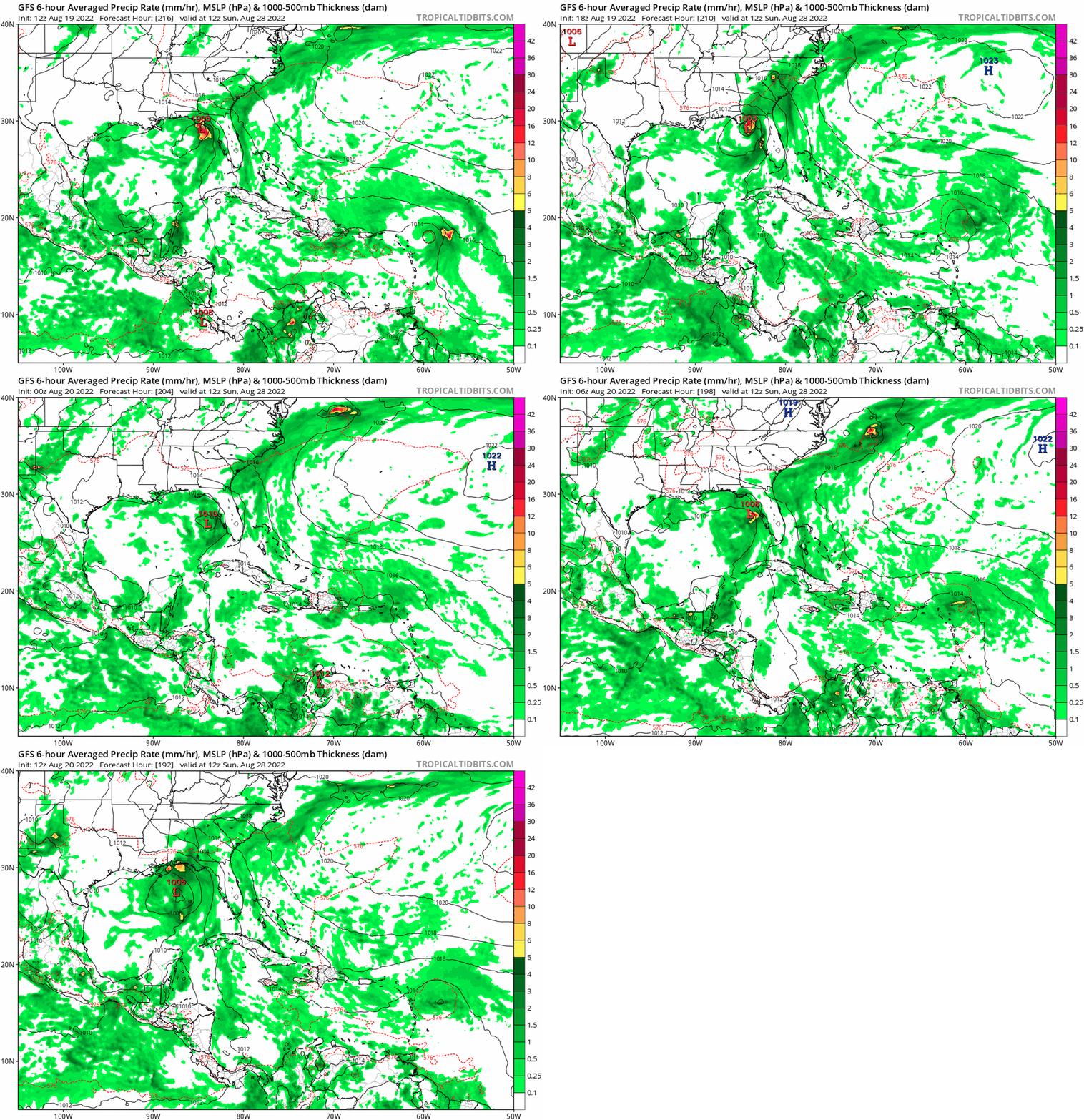
I don't really think it's appropriate to look at specifics over 240 hours besides the pattern and the fact a storm may/may not develop. Shouldn't get named storms comparisons at this stage at all, unless it's referring to a pattern analog. Besides that, something that has seemingly slipped under the radar (haha nice pun), GFS has been showing development in the GOM for the past 5ish runs, and has some ensemble support. Euro hasn't been showing anything, and CMC has been showing a little bit of development. Something to watch imo -

2022 Atlantic Hurricane season
MattPetrulli replied to StormchaserChuck!'s topic in Tropical Headquarters
A lot more of a consensus for next week on 12z suite, as a result NHC has added a hatched area 0/20 for this system -
Also am curious if this is a boundary or not, will be interesting to see any interaction with that cell entering NW suburbs of Knoxville or any cell that nears us later
-
Curious if thats a tornado watch or not, the mature cells NW of Knoxville are showing at least mid-level rotation
-
Winds were quite high end for our area last night which probably helped the fire explode. I am really curious to see how high the winds really were in those areas (I believe Cove Mountain gusted to 81 MPH0), and how high-end the winds were for our climate.
-
Debris signature SE of Gilmer and a confirmed tor near Crockett, TX
- 355 replies
-
Besides the massive tornado up north, the cell to the east of Austin has organized and is looking healthy
- 355 replies
-
- 355 replies
-
- 1
-

-
Agreed, this is quite a look for tomorrow afternoon/evening
- 355 replies
-
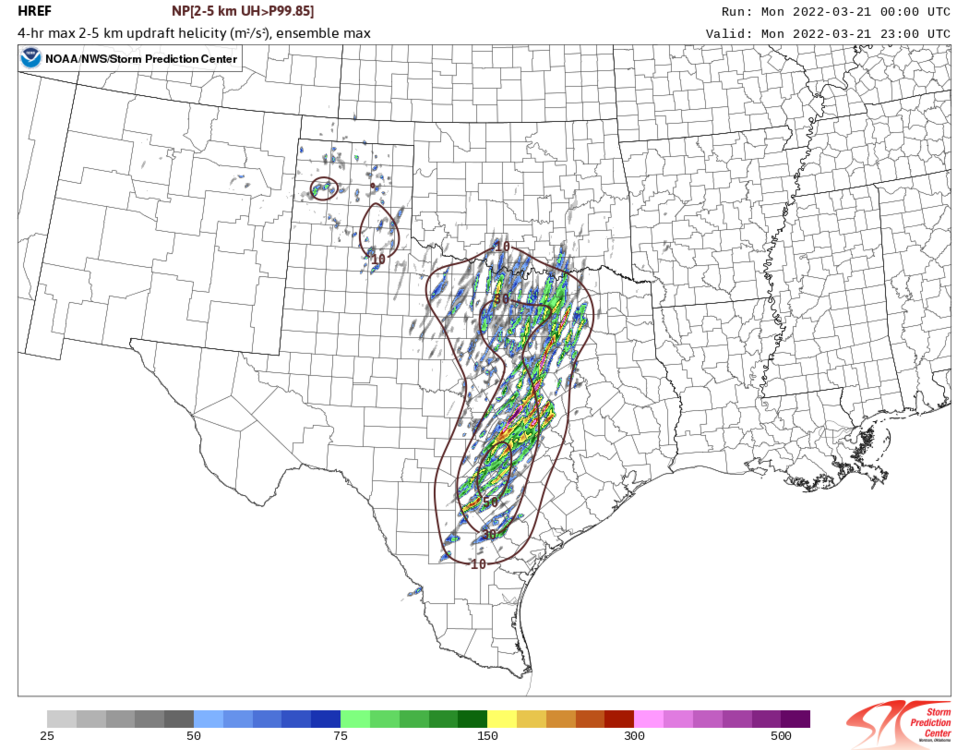
I like Monday the most right now in terms of discrete supercells producing tornadoes. Tuesday looks messy storm mode wise and we've seen time and time again setups that didn't reach their full potential due to that, that being said we've also seen significant outbreaks from that same mixed mode. Just in terms of discrete potential I like Monday more. Going for Tuesday, I have seen a 4/13/19 comparison being thrown around and gotta say that's what I think about when I see this setup. Mixed mode tornado outbreak from East Texas to AL. Suffered some things like mixed storm mode that limited its full potential too given the parameter space. Just my unprofessional opinion though. POTENTIAL is definitely there for something high end either of those 2 days or both, though.
- 355 replies
-
- 2
-

-
Starting to fear we won't end up with a dusting, extremely disappointing as there isn't even a single flake on the ground here yet.
-
Besides a few mixed in flakes, no consistent snow here at all. Has been a light drizzle all day.
-
Ah yes the random Sevier County snowhole At least there's a solid sleet/mixing band heading up towards the area
-
Sunshine here in Pigeon Forge Hoping for an inch or 2 at this point as HRRR suggests with backside snow later on, then move on to Thursday/Friday
-
Given downslopping, am just hopping for 2 inches in Pigeon Forge at this point. Pretty disappointing but we got 5-7" in the system a few weeks ago so it buffs out I guess.
-
I am curious about the HRRR part because if I recall correctly, the HRRR did not do great at all last event and it ended up drier than expected in southern mid state and East TN.
-
MRX seems to have upped snow accumulation a little


