MazooWeather
-
Posts
3,866 -
Joined
-
Last visited
Content Type
Profiles
Blogs
Forums
American Weather
Media Demo
Store
Gallery
Everything posted by MazooWeather
-

Nov 28-30th Post Turkey Day Winter Storm
MazooWeather replied to Chicago Storm's topic in Lakes/Ohio Valley
Hoping it trends back up -
Fall 2025 Medium/Long Range Discussion
MazooWeather replied to Chicago Storm's topic in Lakes/Ohio Valley
Euro and gfs both have good hits now Might need a thread Monday if it keeps up -
There's been multiple times IWX or GRR could have issued one and just didn't and did Special Weather Statements instead
-
11/8-11/10 First Snow and Lake Effect Event
MazooWeather replied to Geoboy645's topic in Lakes/Ohio Valley
Snow is coating the grass rapidly here, God I've missed it -
Fall 2025 Medium/Long Range Discussion
MazooWeather replied to Chicago Storm's topic in Lakes/Ohio Valley
Looking like lake effect is gonna kick into gear after that system next week -
Major Hurricane Melissa - 892mb - 185mph Jamaica landfall
MazooWeather replied to GaWx's topic in Tropical Headquarters
They just got an 892 extrapolated so it's strengthening while they're in the eye. Unreal. -
Major Hurricane Melissa - 892mb - 185mph Jamaica landfall
MazooWeather replied to GaWx's topic in Tropical Headquarters
Officially a Cat 5 -
Major Hurricane Melissa - 892mb - 185mph Jamaica landfall
MazooWeather replied to GaWx's topic in Tropical Headquarters
120 at 2 am update. -
Would have been prolific for inland snow amounts, I think this is probably one of our all time inland lake effect rain events ever. Got two inches in my gauge already.
-
This really is the best time of the year temperature wise
-
GFS has Northern WI getting first flakes late this week lol Incredibly unlikely

-
Watching all the rain explode into nothing from the dry air after crossing the lake makes me sad, our farmers need it
-
At this rate in the next few weeks if we don't get one east of the Mississippi this might be the first time in a couple years most of us haven't had a nasty summer derecho
-
Just got about 4 inches of rain in an hour from a little thunderstorm being stationary overhead
-
Two summers of smoke I am so ready for winter
-
2025 Short Range Severe Weather Discussion
MazooWeather replied to Chicago Storm's topic in Lakes/Ohio Valley
Chicago Storm wins again -
105 dead in Texas with dozens missing still from the flooding. Horrific.
-
We've had not many MCS's making it east at all this summer, wonder if this might be the first summer without being affected by a derecho in years
-
Was a nice little thunderboomer with some pea sized hail i love pop up storms
-
And this ladies and gentlemen is what we call "tempting fate"
-
Iowa Derecho 2.0
-
Some people not really expecting severe weather could get quite a surprise if the Derecho keeps up steam
-
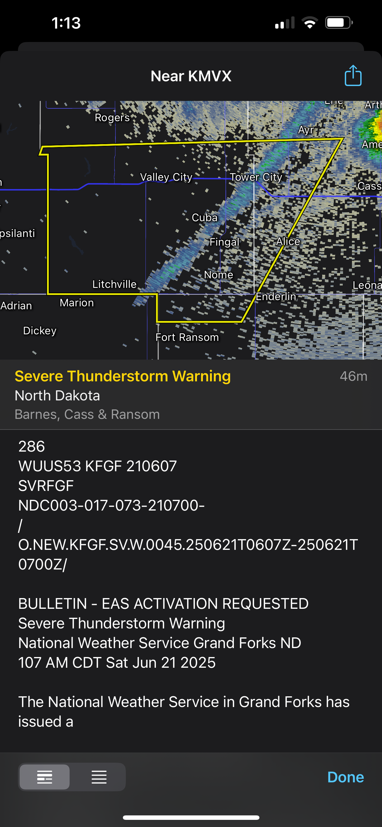
??? to grr

-
Sunny as can be and muggy here Got the feeling
-
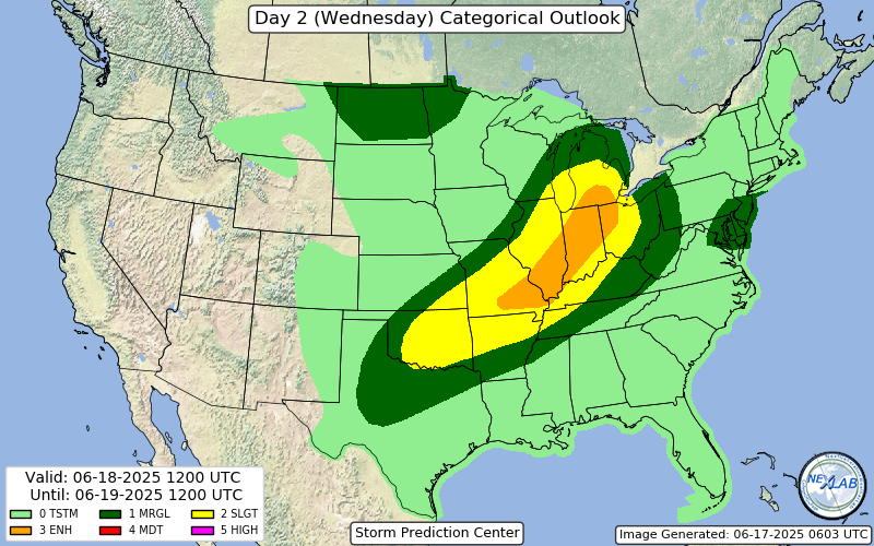
Wind driven enhanced introduced, could see a 10% TOR getting added if the nastier solutions look more likely