gymengineer
-
Posts
3,358 -
Joined
-
Last visited
Content Type
Profiles
Blogs
Forums
American Weather
Media Demo
Store
Gallery
Everything posted by gymengineer
-
>75 kt flight level wind on this pass. That may be enough for the upgrade.
-
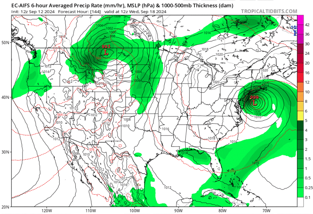
Matt Lanza (theeyewall.com) pointed out that AI Euro had the best performance for landfall location with Francine: 15 straight runs between Vermillion Bay and Grand Isle. So, out of curiosity, I checked out what it generated in today's 12Z run: a Sandy-esque hook toward NJ but doesn't make it to shore, drifts offshore for a day, and eventually heads towards Virginia Beach to bring us our rain.
-
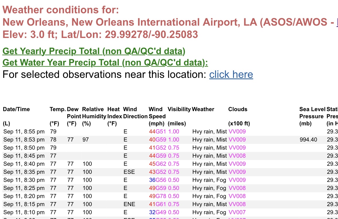
And, add in at 8:20 pm CT a 49 mph/G 78 mph report from New Orleans International. I wonder if there’s something I’m missing about the observations from the airport that is considered “non-standard?”
-
New Orleans International Airport already recorded a couple of gusts over 60 mph.
-
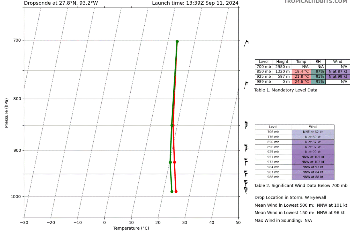
I don't disagree with any of the thoughts posted so far this morning. I just wanted to point out that Francine has generated its most impressive dropsonde so far from the western eyewall.

-
Dropsonde verifies- 996 mb on a 5-kt surface wind.
-
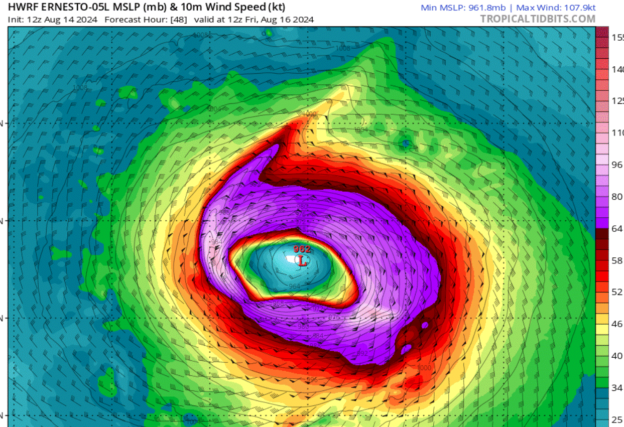
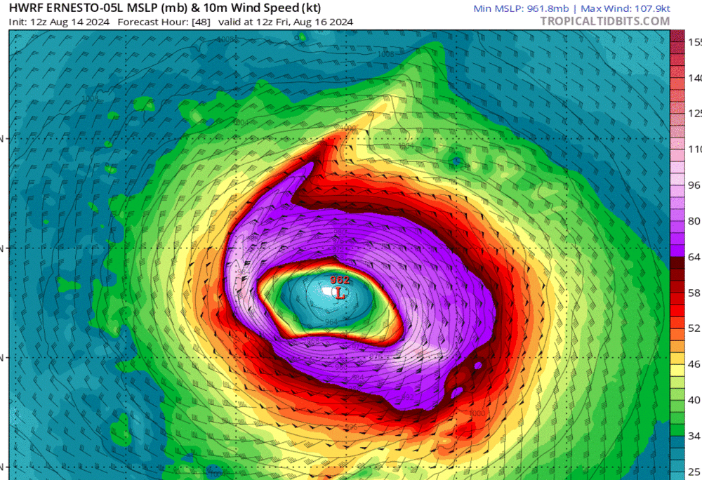
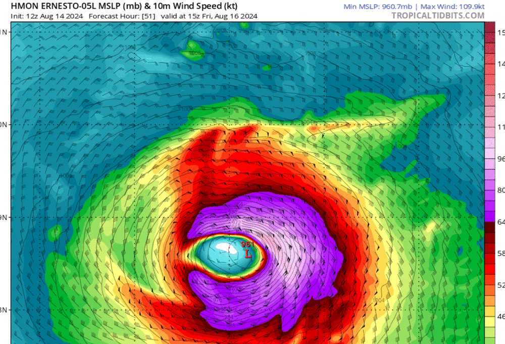
I am not saying that these modeled representations are going to bear out, but I'm just showing the peak panels from the latest 12Z run.
-
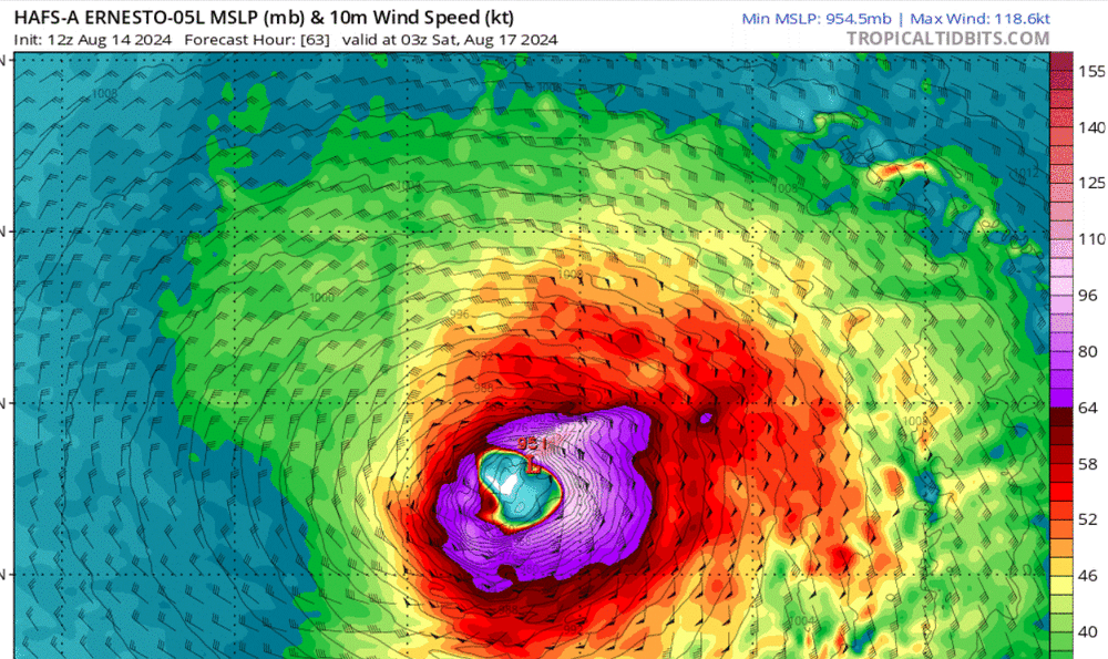
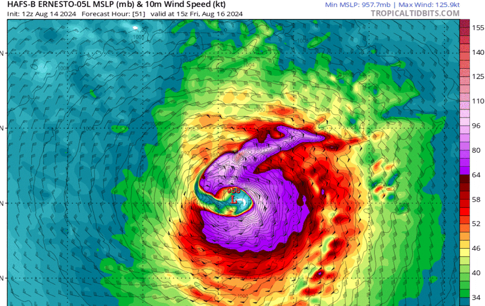
I think this graphic pulls from a model cycle behind. If you just click though the 12Z runs of the hurricane models, all 4 get Ernesto to above a 105 kt peak strength with the HAFS-A and HAFS-B having Ernesto reach category 4 strength.
-
Tropical Storm Debby: Mid-Atlantic Impacts
gymengineer replied to WxWatcher007's topic in Mid Atlantic
Having been a DC area lifer, rainfall busts on the eastern side of tropical systems don’t matter all that much. The most interesting effects still usually occur on the eastern side, or what others call the “dirty” side, regardless of rainfall totals. David 1979, Bob 1985, Fran 1996, Isabel 2003- those were all relatively lower precip events on the east side of the storm but had very consequential effects on that side. A SE wind will down so many more trees than a N or NE wind in our region. And of course, storm surge in the bay completely depends on S and SE winds. -
Tropical Storm Debby: Mid-Atlantic Impacts
gymengineer replied to WxWatcher007's topic in Mid Atlantic
0.75" already at IAD since noon. This first batch of spotty cells definitely has winners. -
Tropical Storm Debby: Mid-Atlantic Impacts
gymengineer replied to WxWatcher007's topic in Mid Atlantic
A couple of the NC folks in the main thread- I don't get what their posting perspective is. Were they expecting to get more from a minimal TS than: 130,000 outages across the state at peak, numerous fallen trees, damaging tornados, flooded roads (e.g. below from a recent LSR), and major flood stage crests in multiple rivers across the state in a couple of days? Edited to add: Thanks @TSG for explaining that one of them is just always down on the NWS/NHC. 0130 PM Flash Flood 3 NE Rolesville 35.96N 78.43W 08/08/2024 Wake NC Trained Spotter Many streams and creeks continue to flood and several roads remain flooded in northern Wake county. Water was across NC 98 between NC 96 and Moores Pond Road. -
Don't you mean ~4"? 3.99" https://forecast.weather.gov/data/obhistory/KRDU.html
-
2024 Atlantic Hurricane Season
gymengineer replied to Stormchaserchuck1's topic in Tropical Headquarters
The pre-naming era seasons on that list had absolutely legendary storms. 1886: The 925-mb landfall Indianola Hurricane caused the TX county seat to be abandoned after being destroyed. 1926: The Great Miami Hurricane, repeated, would be the most expensive hurricane in US history by far. 1933: Imagine the tracking pandemonium on this board for two major hurricane landfalls only a day apart in FL and TX. Also, the Chesapeake-Potomac Hurricane turned Assateague into an island and created a new Ocean City, MD, inlet. -
That remnant eyewall is *still* producing gusts above 80 mph about 100 miles inland (Conroe) via the latest NHC position update.
-
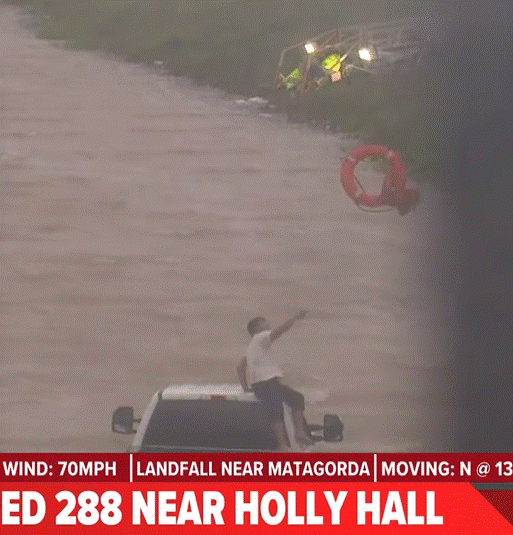
Rather dramatic water rescue attempt carried live on KHOU- Edited to add: They were successful.
-
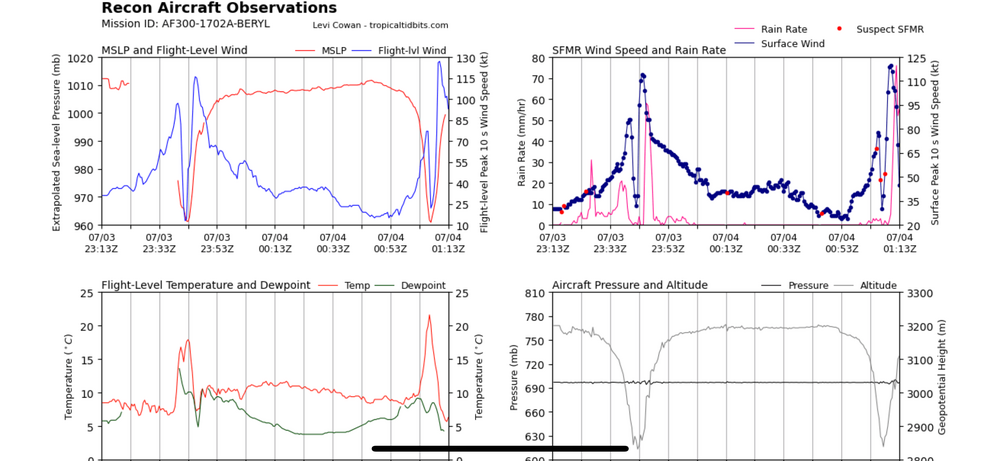
This came in too late to make it into the 8 pm advisory, but confirmation tonight of pressure dropping:
-
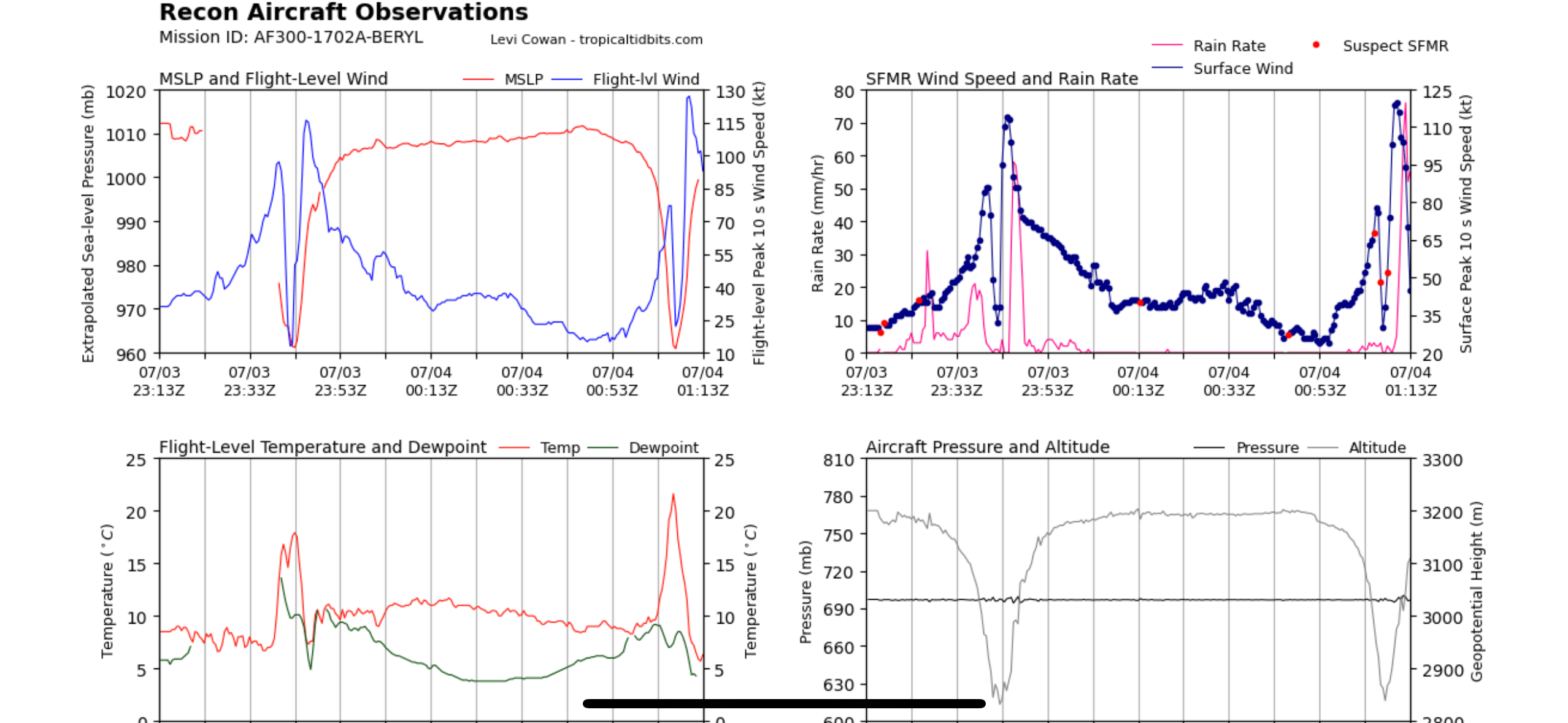
Recon indicates Beryl’s center made it to the Gulf of Mexico.
-
Matt Lanza’s always helpful write-ups for The Eyewall: https://theeyewall.com
-
That part of the TX coastline has the same forecasting challenge as FL. In a system predominantly heading north toward landfall, small changes left or right in the forecast can propagate to significant changes in the final landfall location- like with Ian.
-
I think that was a glitch, not representing reality. Hr-6 is right now- Beryl did not relocate to north of the Yucatan in the past 6 hours.
-
Both HAFS's are losing where Beryl's center is this afternoon and are fixing on a "false" center of circulation north of the Yucatan peninsula by hour-6 during the run.
-
Quote to bump this radar loop. Still looking formidable in the last frames. Recon also finding winds stronger than what all models were showing by this time.
-
It’s been every night- recon checks and winds are roaring despite any satellite presentation
-
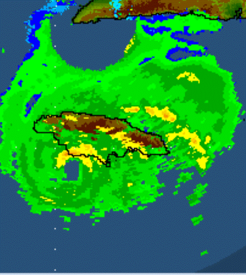
This was the southwest "corner" I was talking about in an earlier post- the Treasure Beach area.