Phelps
-
Posts
97 -
Joined
-
Last visited
Content Type
Profiles
Blogs
Forums
American Weather
Media Demo
Store
Gallery
Everything posted by Phelps
-

2023-2024 Fall/Winter Mountain Thread
Phelps replied to The Alchemist's topic in Southeastern States
Obviously not focusing on one single model run but if we could get something like the 12z GFS that would make for a nice little wintery stretch heading into new years for the high elevations. (in stark contrast to the last few years) -
2023-2024 Fall/Winter Mountain Thread
Phelps replied to The Alchemist's topic in Southeastern States
Probably the same model that was spitting out 5-7 for earlier this week lol -
2022-2023 Fall/Winter Mountains Thread
Phelps replied to BlueRidgeFolklore's topic in Southeastern States
Dropped to 29.8 at 4am. Currently 34.6. -
2022-2023 Fall/Winter Mountains Thread
Phelps replied to BlueRidgeFolklore's topic in Southeastern States
31.2 here on Beech. Not sure the models are going to tell me much more at this point. It will snow when the ULL moves through tomorrow but I have no idea how much. But preparing myself for the changeover to take longer than I want it to. -
2022-2023 Fall/Winter Mountains Thread
Phelps replied to BlueRidgeFolklore's topic in Southeastern States
Wow, GSP with 8-12 across most of Avery County. Not sure I saw that coming overnight. @MotoWeathermanis it going to be raining or snowing when we wake up Sunday morning on Beech? -
2022-2023 Fall/Winter Mountains Thread
Phelps replied to BlueRidgeFolklore's topic in Southeastern States
Lol. Dusting was absolutely the wrong way to describe that. But much less than 3.5. -
2022-2023 Fall/Winter Mountains Thread
Phelps replied to BlueRidgeFolklore's topic in Southeastern States
As is often the case 500-1000’ on beech makes a big difference. Just a dusting so far at my place but coming down pretty good.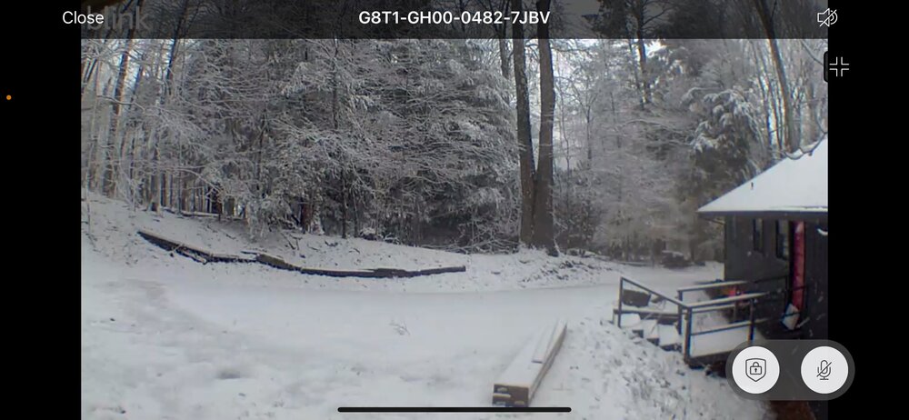
-
2022-2023 Fall/Winter Mountains Thread
Phelps replied to BlueRidgeFolklore's topic in Southeastern States
GSP downplaying the next one. The clown maps may be incorrectly showing some of the rain as snow before the NWF starts up. Profiles will quickly fall below freezing through the column and any lingering low-level moisture will eek out some light snow showers in the favored upslope zones along the NC-TN border and the spine of the Appalachians. Only light, sub-advisory accumulations are currently expected, even at the higher elevations of the northern mountains. Flurries may continue well into the day Thursday...not ending entirely until early afternoon, as CAA begins to falter and residual valley moisture is finally exhausted. -
2022-2023 Fall/Winter Mountains Thread
Phelps replied to BlueRidgeFolklore's topic in Southeastern States
It's been a great snowy day on Beech but there has been a lul in the action for a while. Not sure we'll post a big number but doesn't mean it wasn't awesome.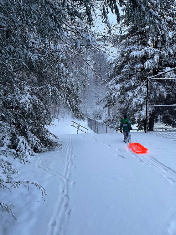
-
2022-2023 Fall/Winter Mountains Thread
Phelps replied to BlueRidgeFolklore's topic in Southeastern States
I was going to leave for Beech tomorrow but I’m biting the bullet and heading up this evening (through the squall line lol). Road conditions aren’t my primary concern as much as Friday evening tourist traffic. 4wd and chains can’t help when there’s a fort mill minivan pile up on food lion hill. I have a feeling it could get pretty gnarly. -
2022-2023 Fall/Winter Mountains Thread
Phelps replied to BlueRidgeFolklore's topic in Southeastern States
Man would I ever take the GFS to the bank. No travel issues Friday night. Wake up Saturday morning and it’s snowing and doesn’t stop until it’s time to head out Monday. (Obviously would love a more widespread storm for the forum too) -
2022-2023 Fall/Winter Mountains Thread
Phelps replied to BlueRidgeFolklore's topic in Southeastern States
This may or may not work out but not sure I'd hit the panic button a week out. But agree that getting skunked from Christmas to mid-jan is pretty brutal. And February has been crappy for the last several years but maybe this year is better. Separately, Brad seems surprisingly bullish here for the weekend. Yeah there could be some flakes flying and they were able to refresh the slopes with some man-made snow but not seeing much in the way of actual snow. -
2022-2023 Fall/Winter Mountains Thread
Phelps replied to BlueRidgeFolklore's topic in Southeastern States
Was wondering if we’d get a little moisture in the mix with the cold -
I don't know anything about TS tracking but the GFS has this thing pulling out of Charlotte by daybreak Saturday and the NAM even earlier. Euro lingers a bit. No idea if I should trust it but the trends sound like they are for less of an impact for this area. Clemson/NC State is not going to be the mess we initially thought it was going to be.
-
2021-2022 Fall/Winter Mountains Thread
Phelps replied to BlueRidgeFolklore's topic in Southeastern States
Hit 60 today. Now it’s snowing. -
2021-2022 Fall/Winter Mountains Thread
Phelps replied to BlueRidgeFolklore's topic in Southeastern States
A healthy inch or so where I am on the mountain. Let's see what the NWF can do. The temperature drop was impressive. -
2021-2022 Fall/Winter Mountains Thread
Phelps replied to BlueRidgeFolklore's topic in Southeastern States
Wondering if we can squeeze out an inch or 2 tomorrow up top. Seemed to be looking promising yesterday but the hi res are not looking so hot this morning. Probably just a wait and see given how borderline the temps are. -
2021-2022 Fall/Winter Mountains Thread
Phelps replied to BlueRidgeFolklore's topic in Southeastern States
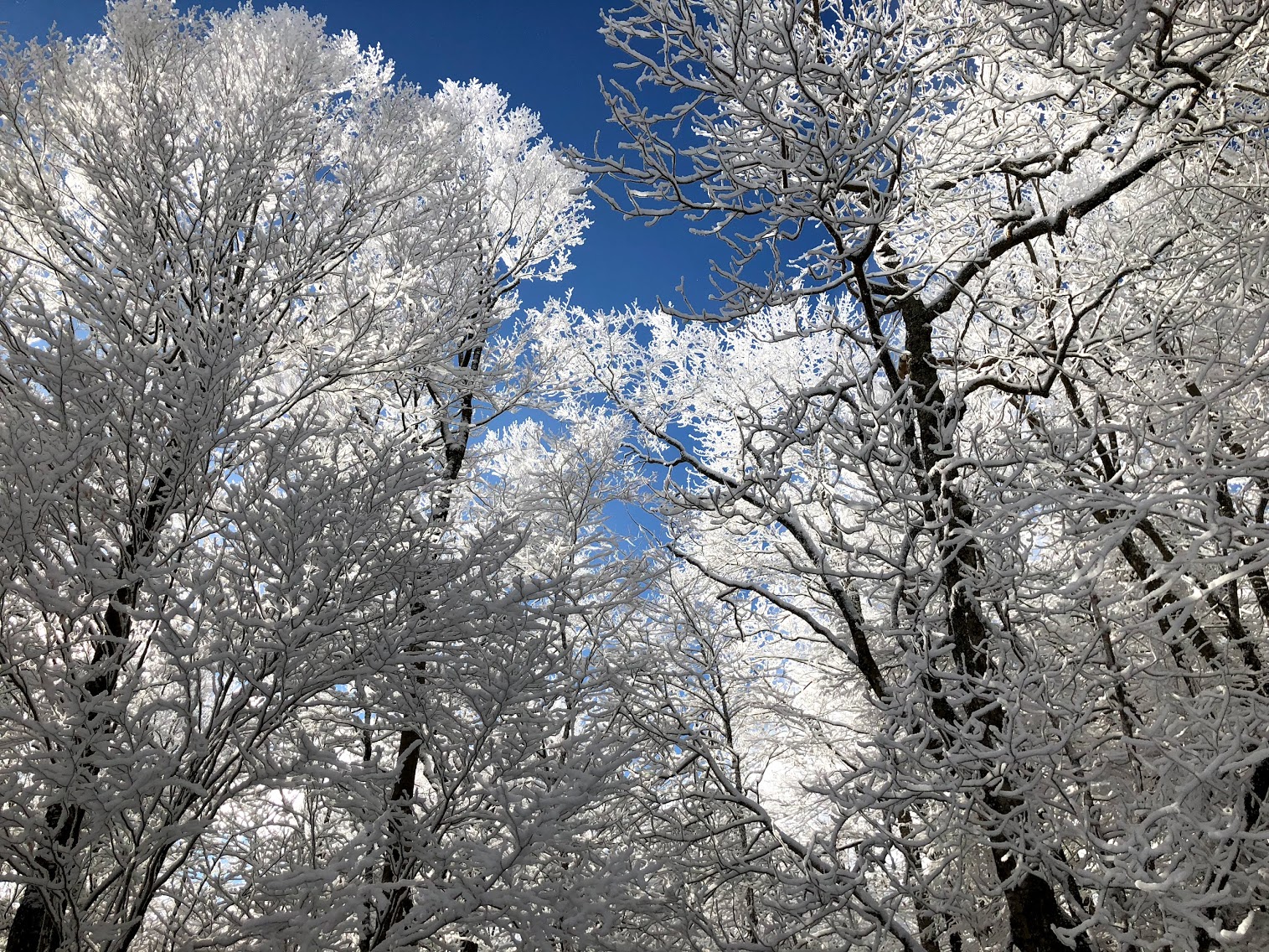
I left Beech yesterday and all that snow from a week ago seemed to be showing no signs of going anywhere anytime soon. Still a really good scene up there.
-
Charlotte always seems too far east to get snow, except situations like this when it's too far west.
-
Half whining half serious question... I understand it is difficult (perhaps impossible) to predict sensible weather 7+ days out. It doesn't surprise me at all that models spit out a variety of solutions and many are wrong. But it just seems to me like something has to be broken if your model routinely spits out a scenario that happens on a few times a century. I guess it doesn't matter because the purpose of these tools is not to predict sensible weather at this range.
-
2021-2022 Fall/Winter Mountains Thread
Phelps replied to BlueRidgeFolklore's topic in Southeastern States
Ray mentioned this in his winter forecast in regards to his assessment of 202/21: "The biggest “miss” was at higher elevations along the western escarpment where NW flow snow were few. We have not seen a good NW flow snow in a few years. -
Living in Charlotte I am so scarred by WAA and mixing that I can't help but find the warmest looking model and assume it might be even warmer than that. We've just had our hopes crushed too many times in the last 10 years.
-
2021-2022 Fall/Winter Mountains Thread
Phelps replied to BlueRidgeFolklore's topic in Southeastern States
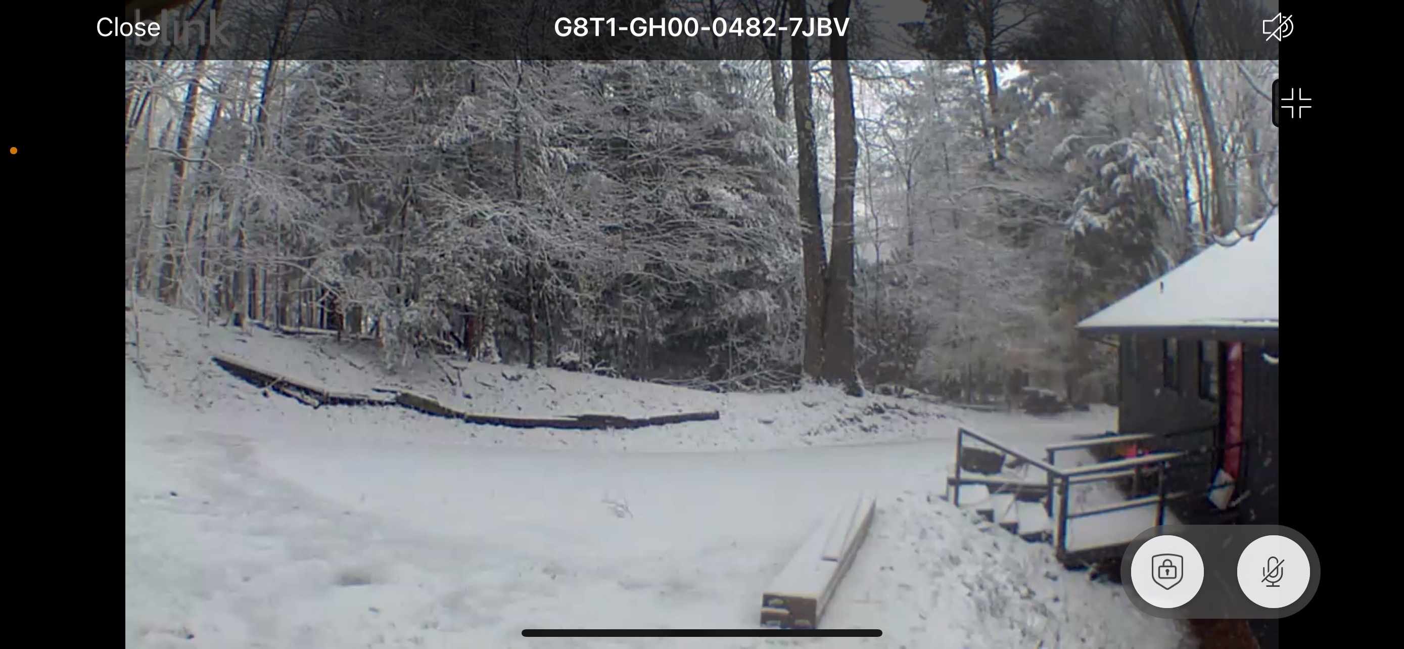
Got going here around 4 am. This was at 7. Maybe 8” where I am on Beech Nice to have winter return. 44 and midnight down to 23 right now. https://imgur.com/a/6sVttQe -
2021-2022 Fall/Winter Mountains Thread
Phelps replied to BlueRidgeFolklore's topic in Southeastern States
So do we commend the GFS for being on this from the beginning or ridicule it for putting out 2 foot snow totals? I guess that's a question for tomorrow afternoon! -
2021-2022 Fall/Winter Mountains Thread
Phelps replied to BlueRidgeFolklore's topic in Southeastern States
So does the GFS think it's going to snow 3"/hr for 6 straight hours lol? (in some places)