

nw baltimore wx
-
Posts
11,077 -
Joined
-
Last visited
Content Type
Profiles
Blogs
Forums
American Weather
Media Demo
Store
Gallery
Everything posted by nw baltimore wx
-
Frankly, I’d rather read that nonsense than listen to all the pushback you all get when you try to clean things up. Let it go. It’s easy to read through.
-
I’m reading it and watching Misery for the umpteenth time, and it matches well with some of the posts in the main thread.
-
I understand the confusion. You make me wonder if at that distance from the earth, the shadow would be really insignificant. Kind of like the shadow of a small bird flying overhead to us. For comparison, the Webb is about a million miles away while the Hubble is a mere 340.
-
“The sun shield is always between the the sun/earth/moon and the telescope.”
-
No. Apparently they position it so that the sensitive equipment is always facing away from the sun.
-
https://www.inverse.com/science/james-webb-reaches-its-final-destination
-
I thought one of the advantages of the Webb is that it will never be in the shadow of the earth. But I never know anything so I may be wrong.
-
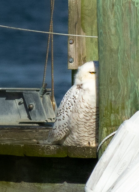
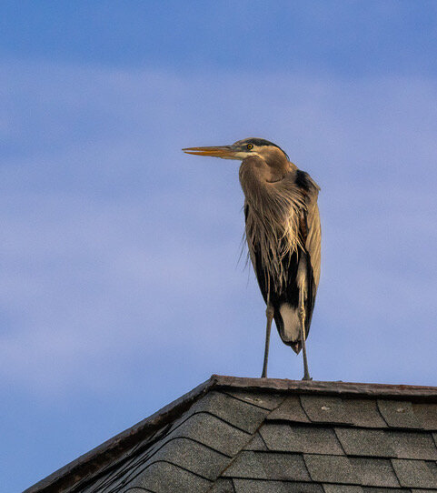
Thanks, man. I just bought a waaaay too expensive lens for myself (you’re only drunk and 59 once), and yesterday was the first time trying it out. The owl was probably 75 yards away and that was too far for any chance at sharpness. The heron was closer but I’m impressed with how well the lens handled it. For perspective, here’s a phone photo of the heron that was taken by a buddy standing next to me.
-
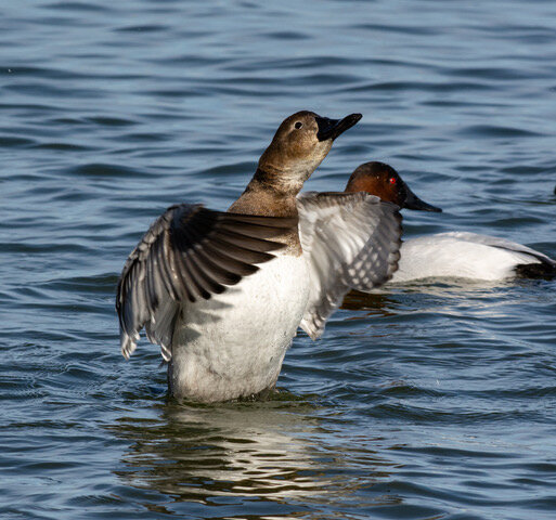
Went to Cambridge yesterday and though I was able to spot the snowy owl that’s wintering there, he was very shy and hid from his audience. Attached a couple others too.
- 96 replies
-
- 19
-

-
Buy buy buy!
-
Noonan edit: damn
-
Awesome!!!
-
I’m so glad to see @losetoa6and his optimism posting in our forum again. Now where’s @mitchnick?
-
Was this posted already? https://www.washingtonpost.com/weather/2022/01/22/canaan-valley-low-temperature-record/
-
If everyone other than a mod would stop replying, or quote and reply in banter, it might keep the model threads cleaner. And use ignore!
-
Just catching up in the banter thread and sorry to hear of your troubles. Hopefully it’s passed. I had some back pain about five years ago and had an X-ray. They called me later and asked which side of my back hurt because I have an 8mm stone on the other side. Well, it was 8mm five years ago. It’s probably bigger than that now. My back pain then was totally unrelated. I guess one day it’ll have to be removed.
-

Jan 21 - 22 Weekend SE VA and Eastern Shore Snow
nw baltimore wx replied to stormtracker's topic in Mid Atlantic
We’ve made a day or weekend of it. We like to do road trips and if there’s snow, all the better. -
Mountains are making up for their slow start. Cameras look awesome out there.
-
Jan 21 - 22 Weekend SE VA and Eastern Shore Snow
nw baltimore wx replied to stormtracker's topic in Mid Atlantic
Man, me and @Scraff going full weenie mode! -
Jan 21 - 22 Weekend SE VA and Eastern Shore Snow
nw baltimore wx replied to stormtracker's topic in Mid Atlantic
So, tell me if this logic makes sense. Since the front took longer to cross the area this morning than modeled just last night, then isn’t it possible that it won’t sag as far south as modeled now in the next 24 hours? And if it doesn’t go as far south, isn’t it possible that the storm modeled Friday night at hour 42 of the current euro run could be, oh, say 100 miles west of what it shows? eta: -
Archambault events described here… http://easternmassweather.blogspot.com/2019/03/pacific-archambault-signal-for-equinox.html
-
An easier read and Cliff notes… https://www.baltimoresun.com/news/bs-xpm-2005-12-16-0512160423-story.html
-
This is way more info than one needs… https://www.ncdc.noaa.gov/snow-and-ice/rsi/docs/kocin-and-uccellini-2004.pdf
-
January Medium/Long Range Discussion
nw baltimore wx replied to WinterWxLuvr's topic in Mid Atlantic
Chuck said that big storms aren’t usually a feature when going from a positive to negative pna. I know, I know… Shut up @nw baltimore wx -
Thursday 1/20/22 Stat Padder Discussion and Observations
nw baltimore wx replied to stormtracker's topic in Mid Atlantic
I don’t think so. They closed high schools because they had a scheduled half day, but elementary and middle were on a two hour delay. But I could be wrong.


