WestMichigan
-
Posts
1,232 -
Joined
-
Last visited
1 Follower

About WestMichigan

Recent Profile Visitors
4,161 profile views


-
Was it cloudy at the other sites?
-
Some very light snow flakes falling this morning. Not accumulating but a couple of months ago this would have been mood flakes. Now it is just a nuisance given the time of year and prior warmth.
-
And Sault Ste Marie
-
Everything including the kitchen sink in this forecast.
-
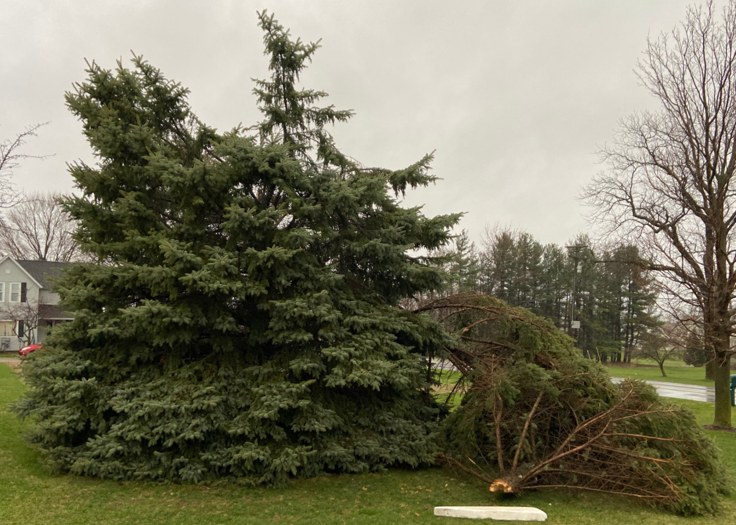
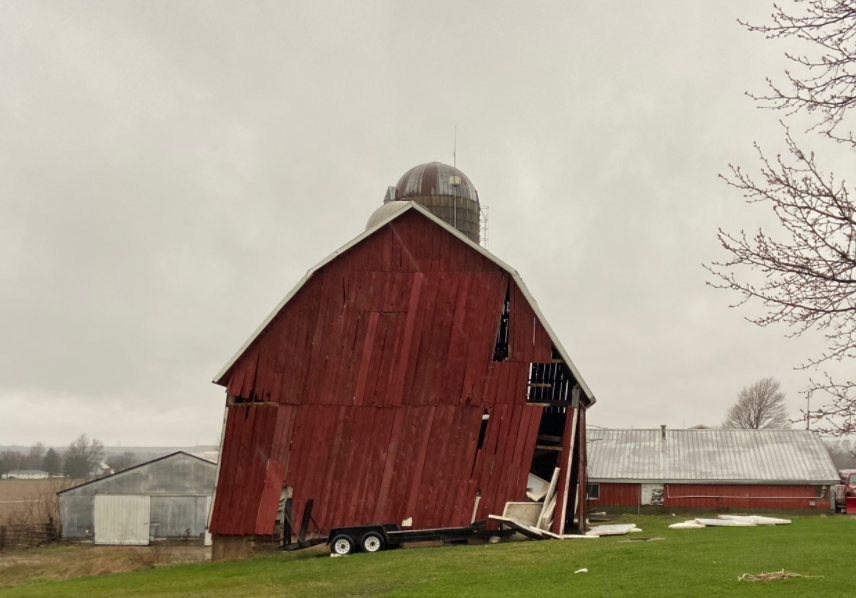
The highlighted report was form my weather station. My yard My neighbor's barn

-
-

Spring 2025 Medium/Long Range Discussion
WestMichigan replied to Chicago Storm's topic in Lakes/Ohio Valley
It isn't just the SW. Draw a diagonal line from there to Minnesota then go 500 miles either side of that. Many parts of this sub forum are pretty dry also. -
Fall/Winter '24 Banter and Complaints Go Here
WestMichigan replied to IWXwx's topic in Lakes/Ohio Valley
I lived just SW of the Avery Rd and Hayden Run Rd intersection and that was a snowstorm I won't forget. -
We can't even pull off a good rainstorm this year. Yesterday the forecast was for about 1.4" at GRR. At this point breaking 0.5" might be a challenge. This lack of precipitation better change soon or it is going to be a long, hot, dry summer.
-
Fall/Winter '24 Banter and Complaints Go Here
WestMichigan replied to IWXwx's topic in Lakes/Ohio Valley
The UP is having a huge snow year and Weatherbo has been completely silent. Anyone have any idea what happened to him? -
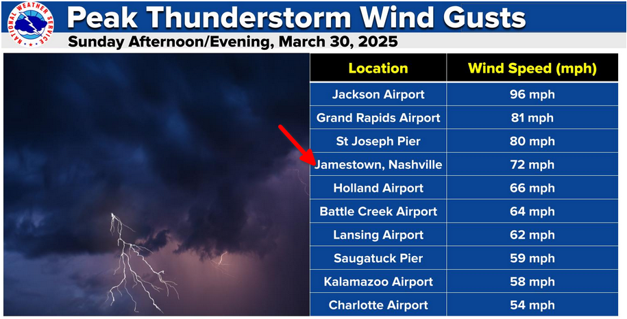
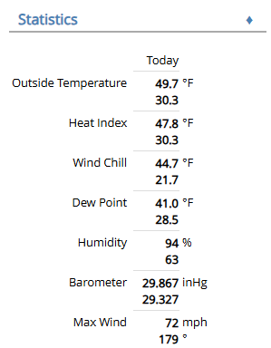
It got a little windy here today. I think outside of hurricane Ike when I lived in Central Ohio this is the highest wind I have ever recorded.
-
Winter 2024-25 Medium/Long Range Discussion
WestMichigan replied to michsnowfreak's topic in Lakes/Ohio Valley
Given this week's drought monitor update it would sure be nice to see some active and wet weather. A lot of the region needs precip regardless of what form it takes. -
Same thing here. December and January started out with snow and melted it all off in the final few days. February is starting to feel like the movie Groundhog Day.
-
Had a mix resembling white rain but leaning towards snow here. Didn't accumulate though.
-
Let’s talk winter!! Ohio and surrounding states!! 24'-25'
WestMichigan replied to buckeye's topic in Lakes/Ohio Valley
What about consecutive days, vs the snow then melt then snow dilly84 referenced?