StormyClearweather
-
Posts
617 -
Joined
-
Last visited
Content Type
Profiles
Blogs
Forums
American Weather
Media Demo
Store
Gallery
Everything posted by StormyClearweather
-
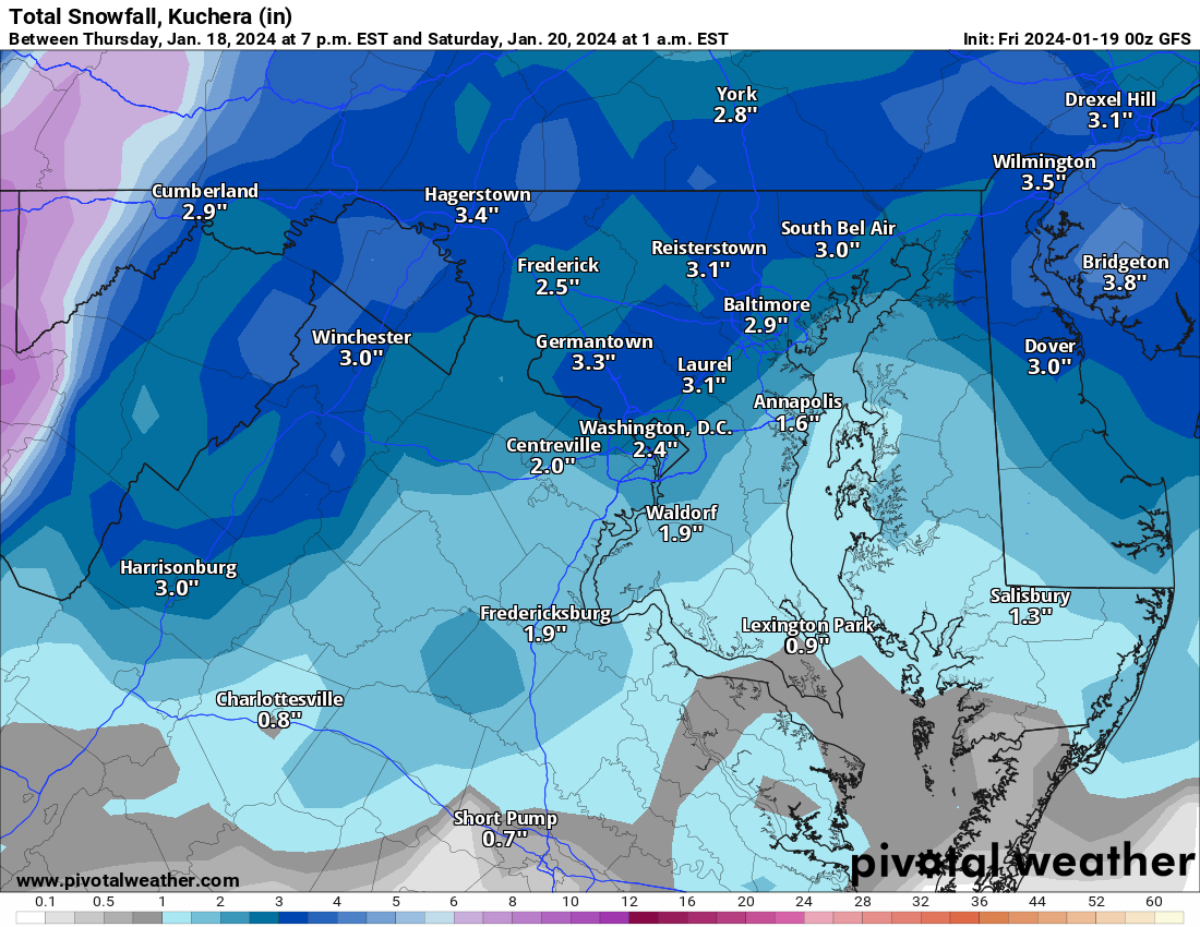
Have you measured lately? You're close enough to me that I find it easier to use yours than walk outside and do it myself.
-
CMC is a similar 2-4.
-
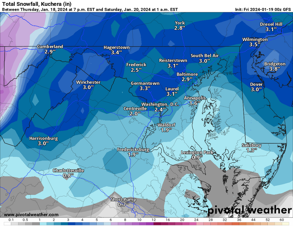
But what about conservatives? GFS Snow Map (see? this wasn't a wasted post)
-
It's aight.

-
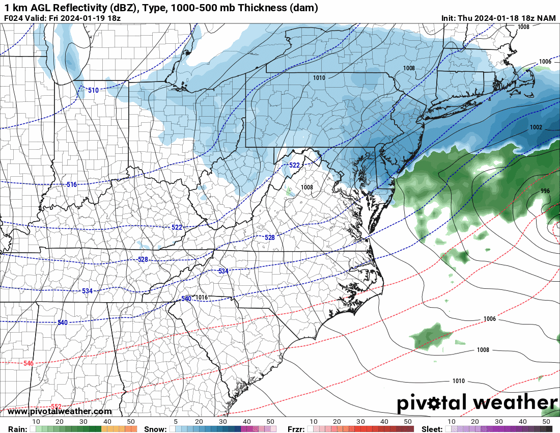
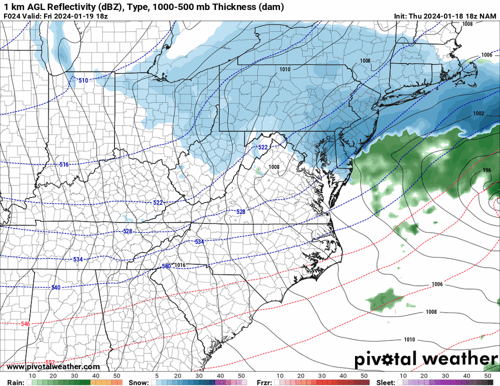
Models don't appear to be picking up the "precip" streaming overhead, while it looks like HRRR takes a couple of hours after precip starts for it to start hitting the ground. Maybe, just maybe, the stuff falling now helps moisten the column, reducing virga when the real stuff gets here?
-
Latest from LWX: PRECIP ALOFT HAS BEEN NOTED ON REGIONAL 88DS AND GPM MICROWAVE IMAGER OVER THE PAST 6 HOURS ACROSS NORTH CENTRAL AND NORTHEAST MARYLAND, BUT NO SFC OBS HAVE SHOWN ANYTHING REACHING THE GROUND AS LOW-LEVEL DEWPOINT DEPRESSIONS REMAIN AT OR ABOVE 20C PER 19/00Z IAD SOUNDING. NEW SET OF 18Z GUIDANCE DOES NOT SHOW ANY APPRECIABLE CHANGES TO SPEAK OF ABOUT FRIDAY'S FORECAST. STRONG SHORTWAVE-TROUGH AND ASSOCIATED VORT MAX WILL PASS THROUGH THE AREA AROUND MIDDAY FRI SUPPORTING STRONG LIFT TO GENERATE SNOW. HOWEVER, THE SYSTEM WILL LACK DEEP MOISTURE TO MAKE THIS A MAJOR STORM IN ADDITION TO BEING FAIRLY PROGRESSIVE. BLENDED TPW PRODUCT SHOWS PWAT VALUES GENERALLY LESS THAN 0.4 INCHES WITH NO SIGNIFICANT AREAS OF HIGHER MOISTURE LIKELY TO ADVECT IN. FOR BIGGER STORMS, TYPICALLY 0.5 INCH PWAT VALUES AND HIGHER ARE NEEDED UNLESS IS A SUPER COLD AIR MASS. ALL OF THESE FACTORS, IN ADDITION, LACK OF A CLOSED 850-700 MB CIRCULATION, SUGGEST WARNING LEVEL SNOW ACCUMULATIONS SEEM UNLIKELY. OVERALL, THE FORECAST AND SNOW AMOUNTS SEEM ON TRACK AND WILL REMAIN UNCHANGED TONIGHT. FCST SNOW AMOUNTS ACROSS THE FAR SOUTHERN AREAS LIKE FREDERICKSBURG VA MAY BE SOMEWHAT OVERDONE DUE TO LACK OF MID-LEVEL SATURATION WHICH MAY INHIBIT SNOWFALL RATES. IT STILL LOOKS LIKE THE HEAVIEST ACCUMULATIONS OUTSIDE OF THE MOUNTAIN AREAS WILL OCCUR ALONG AND NORTH OF THE I-70 CORRIDOR WITH UP TO A FOOT POSSIBLE ACROSS THE APPALACHIAN REGION. HEAVIEST ACCUMULATION IS EXPECTED IN THE 13Z-19Z FRI TIME FRAME.
-
Me likey.
-
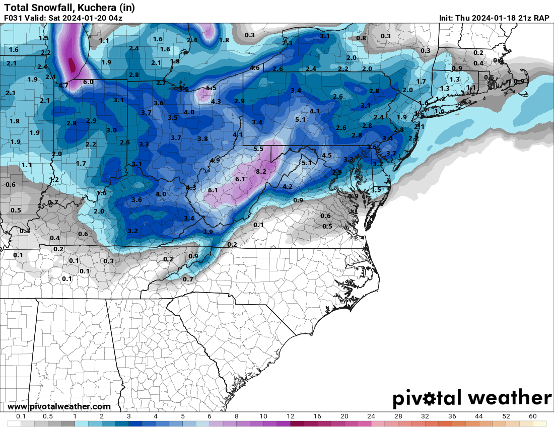
3k has precip breaking out in the northern zones at 6Z and encroaching DC by 8Z.
-
 Yeah, but the RAP...
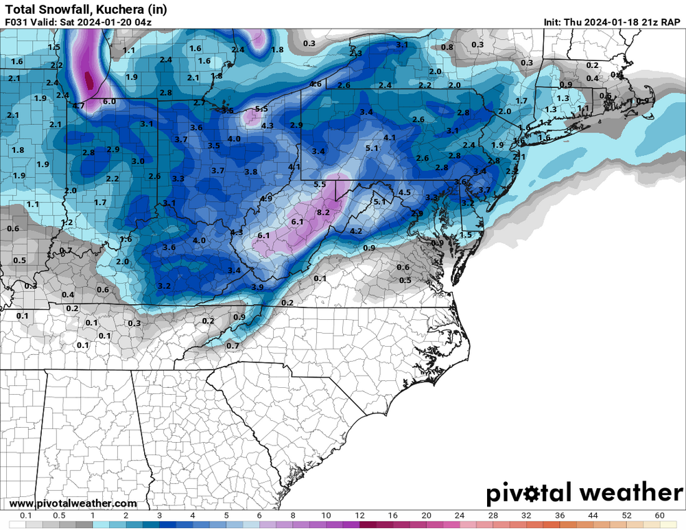
-
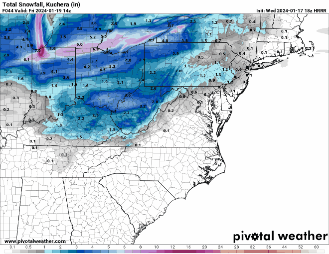
I mean, I know it's LR HRRR, and I know HRRR sucked last time, and I know I probably shouldn't, but... Obviously, precip is still ongoing at this point, but it's a very nice trend for most of us.
-
I mean that's really the only thing that matters, so I think you're golden.
-
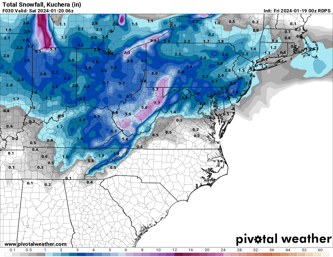
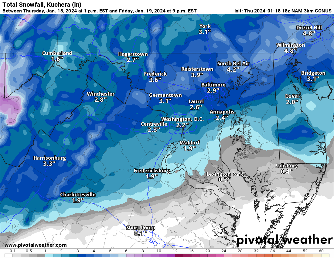
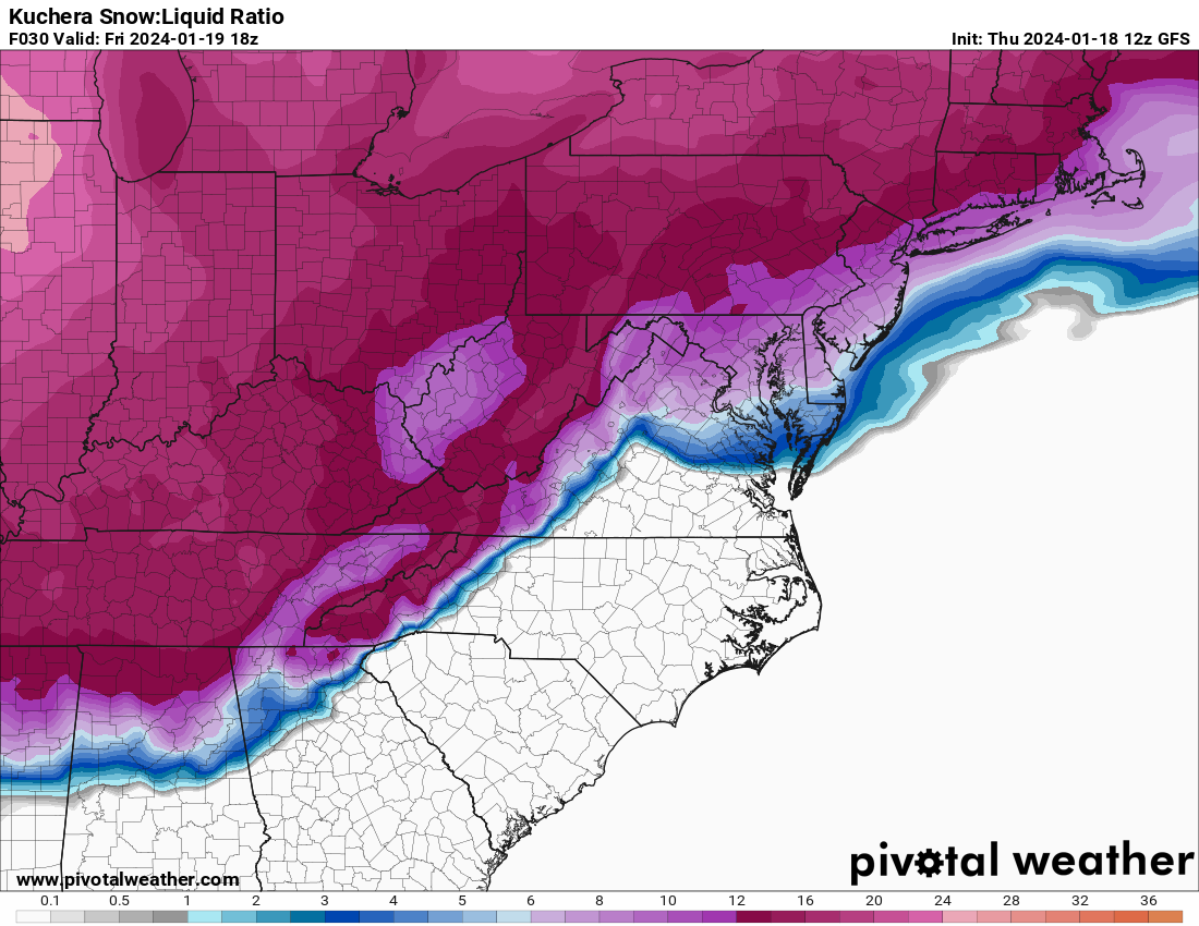
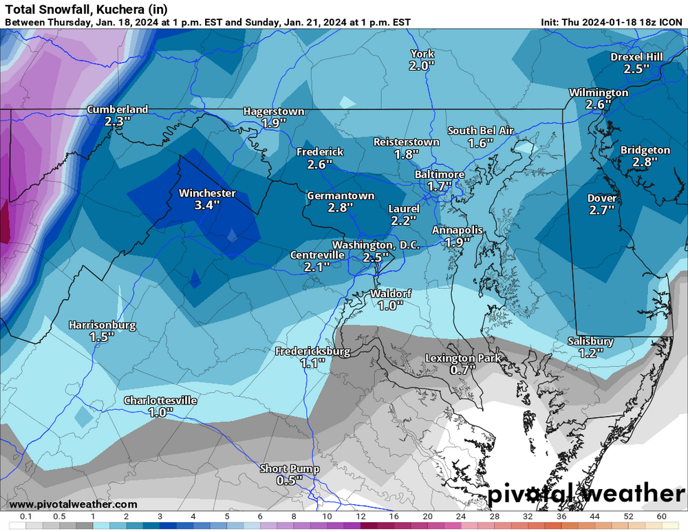
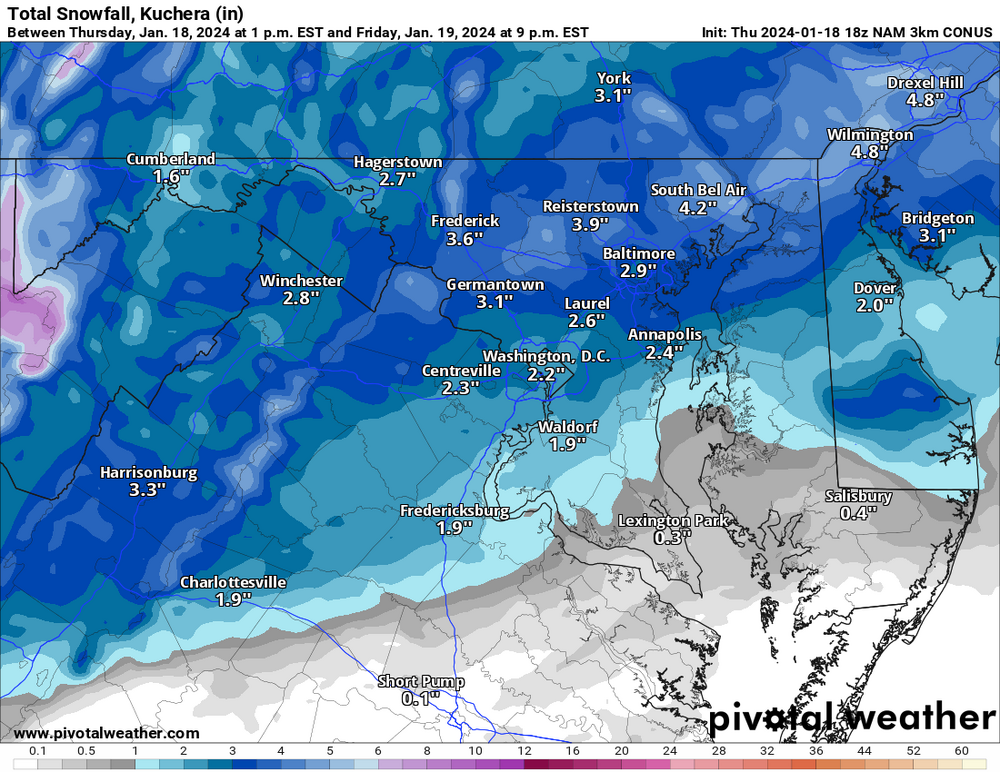
And Kuchera because it's prettier.
-
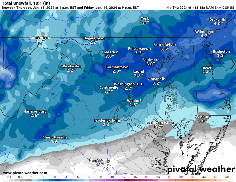
For those who want to compare Kuchera with non-Kuchera. It's the same for MBY, but pretty different for some.
-
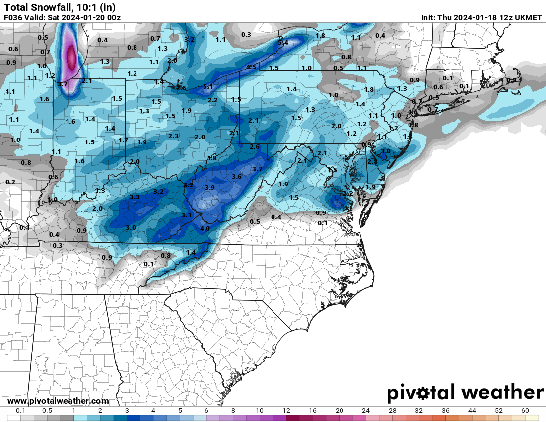
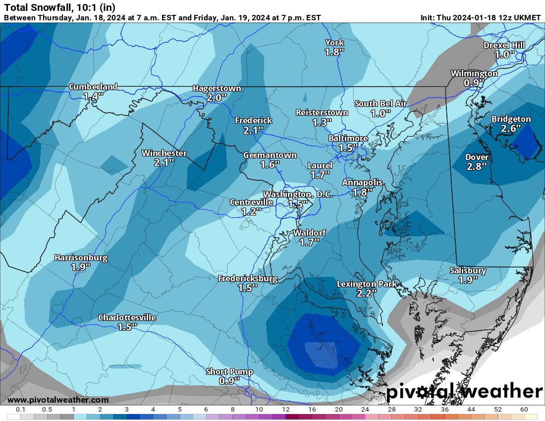
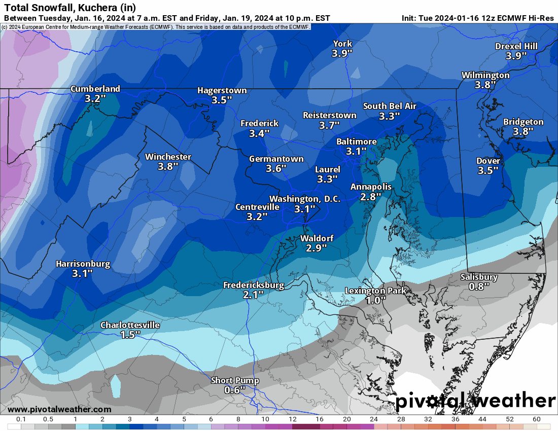
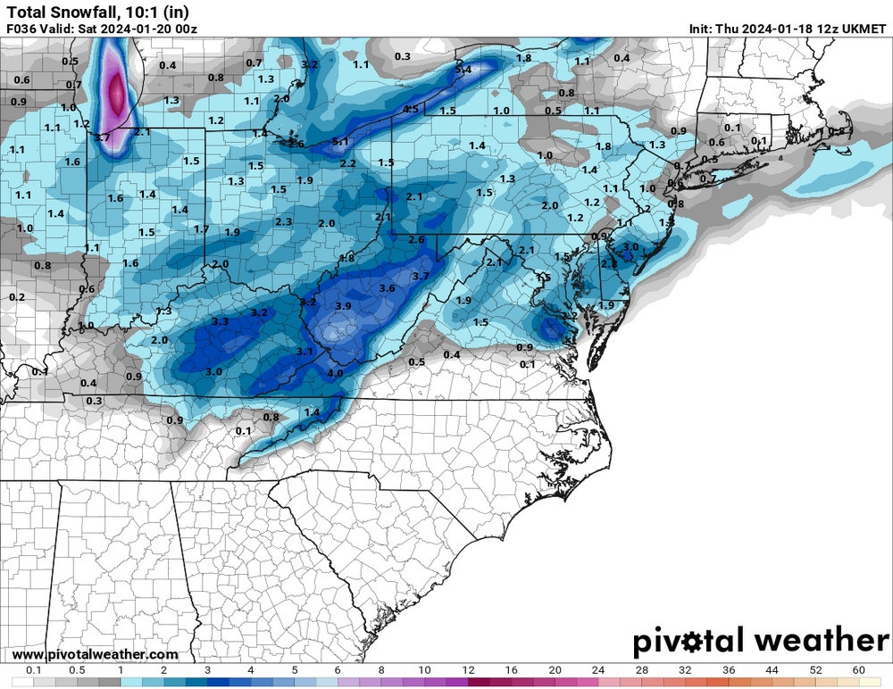
UKIE is slightly improved as well.

-
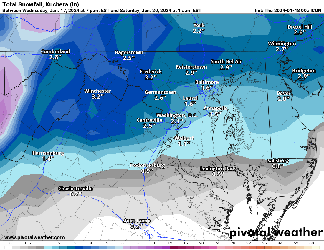
ICONic (relative to everything else, anyway).

-
Jan 18-19 Storm Threat: Bob Chill made me do it
StormyClearweather replied to stormtracker's topic in Mid Atlantic
Let's hope it's an 18Z fluke and not the start of a trend. As said above, it matches the GFS pretty well.
-
Jan 18-19 Storm Threat: Bob Chill made me do it
StormyClearweather replied to stormtracker's topic in Mid Atlantic
Light snow across most of the area at 12Z Friday, just getting started. -
Jan 18-19 Storm Threat: Bob Chill made me do it
StormyClearweather replied to stormtracker's topic in Mid Atlantic
Euro looks a good bit drier through 60, but hopefully, it'll wind up just being noise. -
Jan 15-16 Storm Thread 3: Obs and Disco
StormyClearweather replied to stormtracker's topic in Mid Atlantic
LWX's prelim storm reports: https://www.weather.gov/lwx/pnsmap?type=snow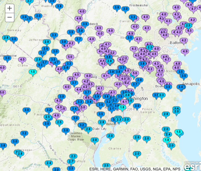
-
Jan 18-19 Storm Threat: Bob Chill made me do it
StormyClearweather replied to stormtracker's topic in Mid Atlantic
Is that a good or bad thing in this setup? -
Jan Medium/Long Range Disco 2: Total Obliteration is Coming
StormyClearweather replied to Jebman's topic in Mid Atlantic
What's the insta again? Asking for a friend. -
Jan 15-16 Storm Threat Thread: The Return of Hope??
StormyClearweather replied to stormtracker's topic in Mid Atlantic
No real changes. -
Jan 15-16 Storm Threat Thread: The Return of Hope??
StormyClearweather replied to stormtracker's topic in Mid Atlantic
To your point, here's Nashville's disco tonight, FWIW: It`s snowing!!! All of our observation sites are reporting snow this hour with the heaviest falling along and south of I-40. We`ve already received a report of 0.5" of snow in Bellevue. Looking at the latest run of the HRRR tonight, boy did it come in hot. It paints a narrow band of higher totals ranging from 6-8 inches from Wayne County all the way through to our furthest NE counties on the Plateau, including Nashville. This solution would mean this event overachieves a little further north than originally forecasted and it pumps out more snow in any heavier bands that move through. This will be something to watch as the night progresses. There were talks of bumping up QPF along our northern border to match up with this latest run of the HRRR, but for now, we`re going to hold off on that to see what the next round of models show since this is only 1 run. Our sounding tonight shows a textbook snow event; big, healthy layer of moisture right in the snow growth region with all layers below 0 degrees Celsius. As for temperatures, they have tanked. Most everyone is sitting right around 20 degrees and dropping. We will be back with a full forecast update in the next several hours. In the meantime, stay safe, stay warm, and enjoy the snow! -
Jan 15-16 Storm Threat Thread: The Return of Hope??
StormyClearweather replied to stormtracker's topic in Mid Atlantic
Seems like noise to me more than anything. Maybe responding to the HRRR?