StormyClearweather
-
Posts
716 -
Joined
-
Last visited
Content Type
Profiles
Blogs
Forums
American Weather
Media Demo
Store
Gallery
Everything posted by StormyClearweather
-

Jan 15-16 Storm Threat Thread: The Return of Hope??
StormyClearweather replied to stormtracker's topic in Mid Atlantic
You love to see it.
-
Jan 15-16 Storm Threat Thread: The Return of Hope??
StormyClearweather replied to stormtracker's topic in Mid Atlantic
Happy 12Z ICON run, for those who celebrate: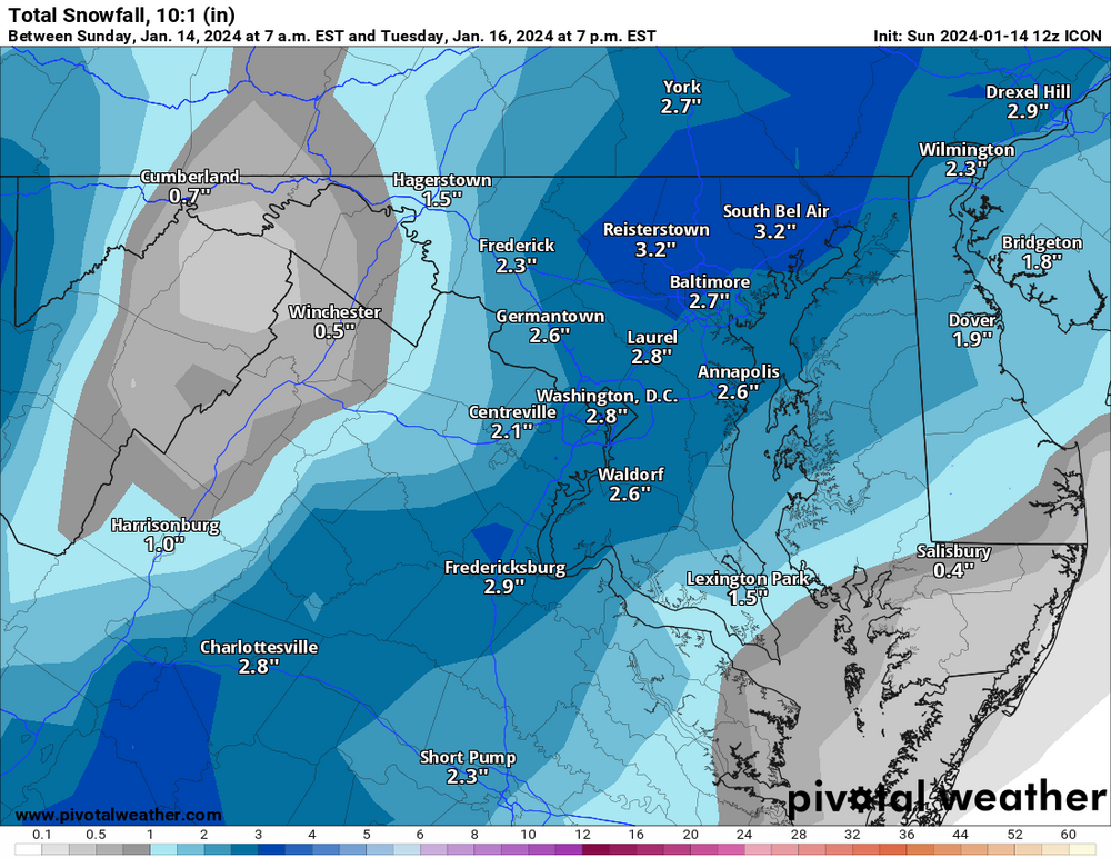
-
Jan 15-16 Storm Threat Thread: The Return of Hope??
StormyClearweather replied to stormtracker's topic in Mid Atlantic
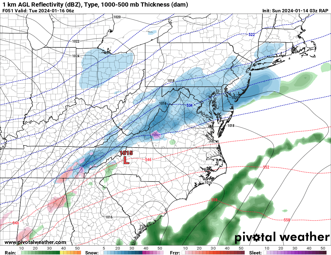
While y'all are getting NAMed, I'm geting... uh... RAPPED. (Had to be careful there.) Snow ongoing at this point.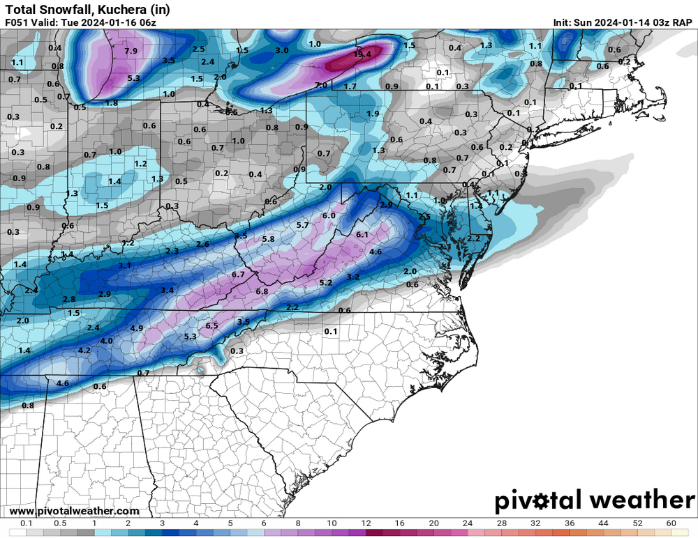

-
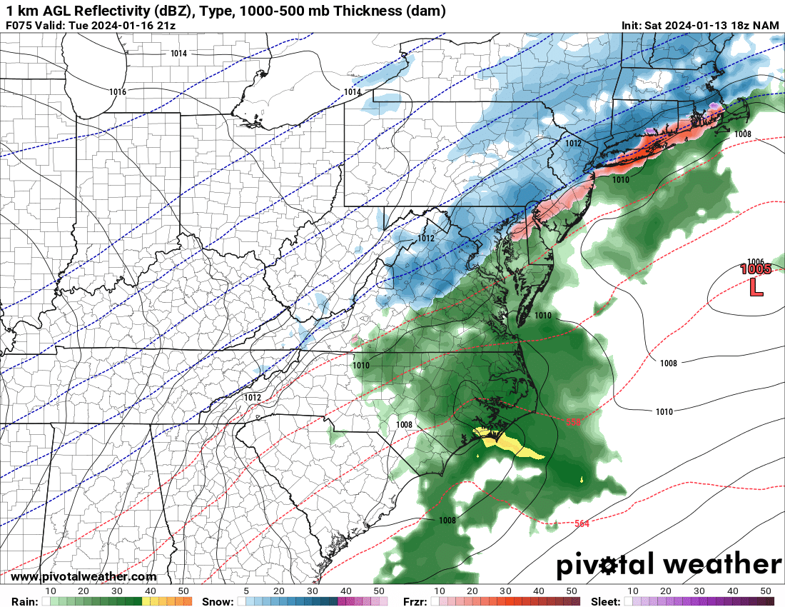
Jan 15-16 Storm Threat Thread: The Return of Hope??
StormyClearweather replied to stormtracker's topic in Mid Atlantic
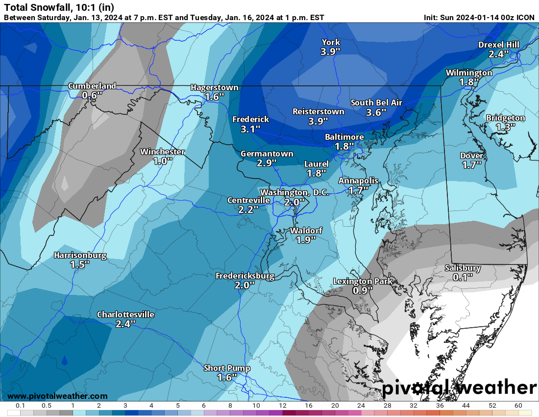
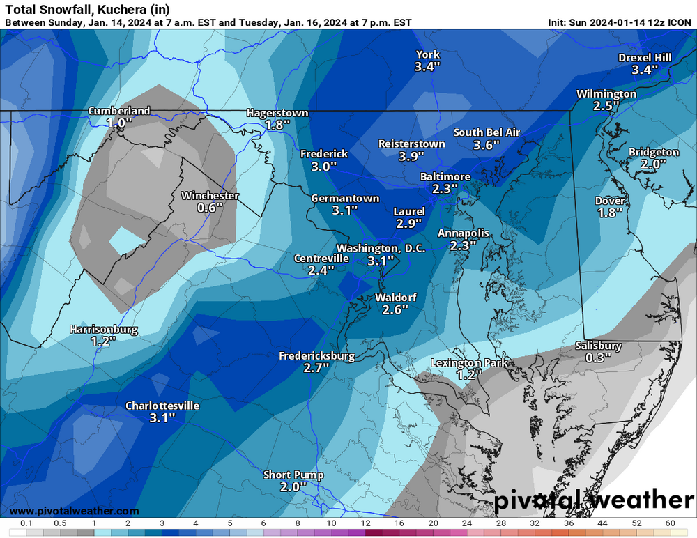
ok thx Anyway, ICON is fine:
-
Jan 15-16 Storm Threat Thread: The Return of Hope??
StormyClearweather replied to stormtracker's topic in Mid Atlantic
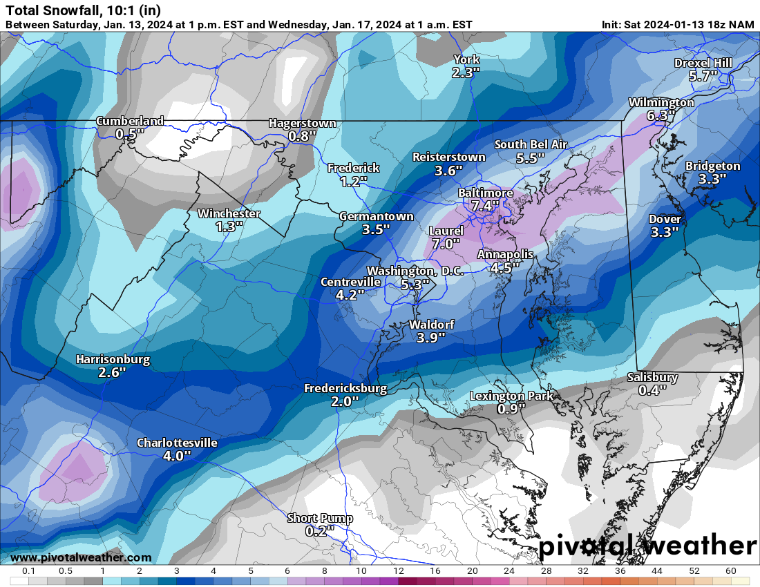
Not bad for a day's work. Better than the alternative anyway.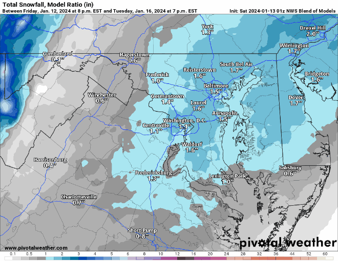
-
Jan 15-16 Storm Threat Thread: The Return of Hope??
StormyClearweather replied to stormtracker's topic in Mid Atlantic
Maybe because it's virga prior to? PV shows 0 QPF through 18Z.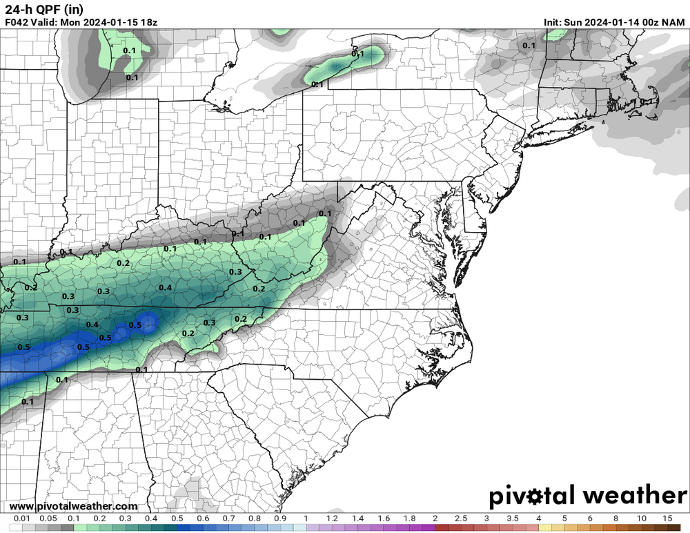
-
Jan 15-16 Storm Threat Thread: The Return of Hope??
StormyClearweather replied to stormtracker's topic in Mid Atlantic
I hate this model and this obsession hobby.
-
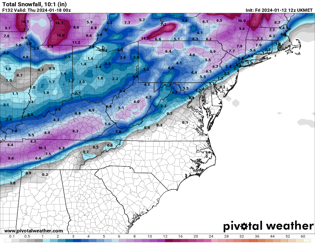
Jan 15-16 Storm Threat Thread: The Return of Hope??
StormyClearweather replied to stormtracker's topic in Mid Atlantic
Lol a proper NAMing. It hits some of us with the first slot, and then hits us again Tuesday. "Hit" is a very relative term, of course.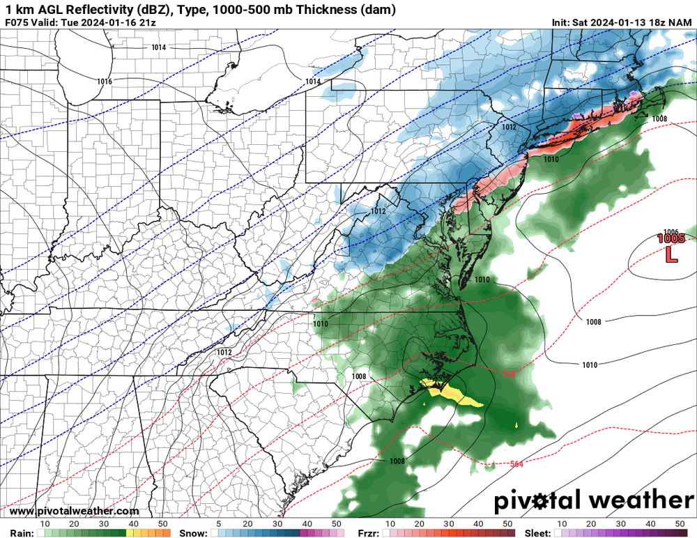
-
Being from Greenville and having moved up here a bit over two years ago, I can vouch for this. And to your point, where I lived in Greenville got 8 inches in a January 2022 storm. It was a fluke, proving they can still happen, but that was the sort of thing that happened roughly every 5-6 years, not that long ago.
-
Jan 15-16 Storm Threat Thread: Do we finally win or get Saltburned?
StormyClearweather replied to H2O's topic in Mid Atlantic
- 425 replies
-
- 2
-

-
- jinx
- kiss of death
- (and 3 more)
-
Jan Medium/Long Range Disco 2: Total Obliteration is Coming
StormyClearweather replied to Jebman's topic in Mid Atlantic
That's the 0Z Here's 12Z.
-
Jan Medium/Long Range Disco 2: Total Obliteration is Coming
StormyClearweather replied to Jebman's topic in Mid Atlantic
Ukie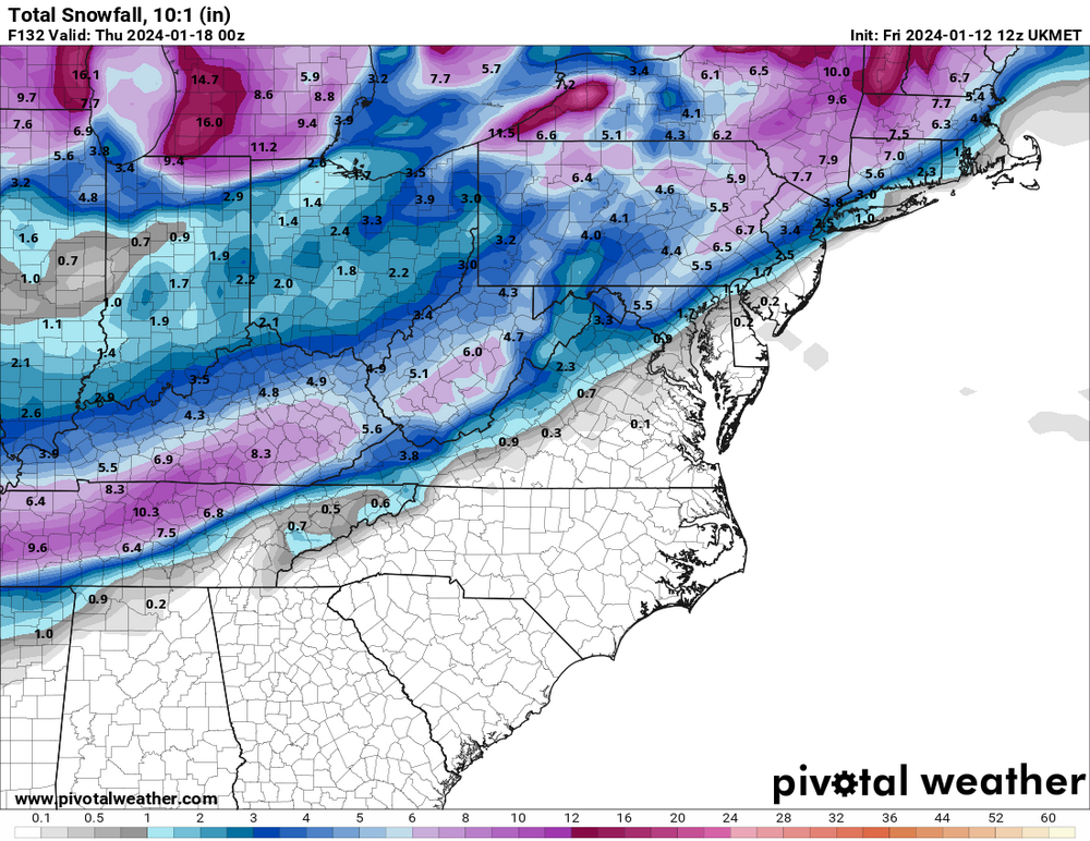
-
Jan Medium/Long Range Disco 2: Total Obliteration is Coming
StormyClearweather replied to Jebman's topic in Mid Atlantic
That reminded me of the "AI" version of the Euro, which you can find here: https://charts.ecmwf.int I have no idea how accurate it is and all that, but it ran at 0Z and certainly looks better than the base Euro to my untrained eye. You can read more about it here: https://deepmind.google/discover/blog/graphcast-ai-model-for-faster-and-more-accurate-global-weather-forecasting/ Edit: The screenshot cut off, but that's at 18Z on Tuesday.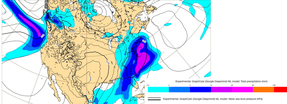
-
Jan Medium/Long Range Disco 2: Total Obliteration is Coming
StormyClearweather replied to Jebman's topic in Mid Atlantic
Understandably, the focus is on Tuesday, but can anyone speak to how things are looking as we head into late month/Feb.? I don't remember seeing much talk about the longer term after the 12Z runs, but maybe I missed it. -
Jan Medium/Long Range Disco 2: Total Obliteration is Coming
StormyClearweather replied to Jebman's topic in Mid Atlantic
According to the GFS many of us go below freezing this Sunday morning and are still below freezing next Sunday at 18Z and counting. Seems unlikely, but would be wild. -
Jan Medium/Long Range Disco: Winter is coming
StormyClearweather replied to stormtracker's topic in Mid Atlantic
I feel like Jan. 2022 (or at least the first system that month) was a little like this. Granted, I had just moved here, so maybe I just wasn't paying attention. Either way, it was fun. -
Jan Medium/Long Range Disco: Winter is coming
StormyClearweather replied to stormtracker's topic in Mid Atlantic
This is my ignorance and weenieism talking, but is there genuine reason to believe it could continue? -
God I hate the NAM.
-
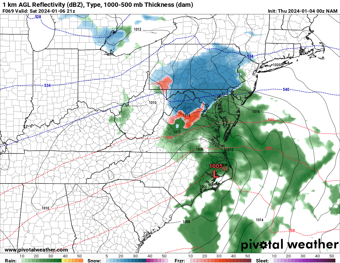
January 6-7 Storm Discussion: we’re due?
StormyClearweather replied to WxUSAF's topic in Mid Atlantic
Looking far better at good ole 69, FWIW
-
January 6-7 Storm Discussion: we’re due?
StormyClearweather replied to WxUSAF's topic in Mid Atlantic
Column cools quicky though once precip starts, so ignore me. -
January 6-7 Storm Discussion: we’re due?
StormyClearweather replied to WxUSAF's topic in Mid Atlantic
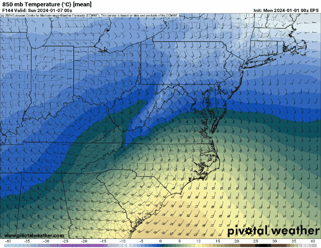
Yes, but... which is significantly warmer than 18Z NAM.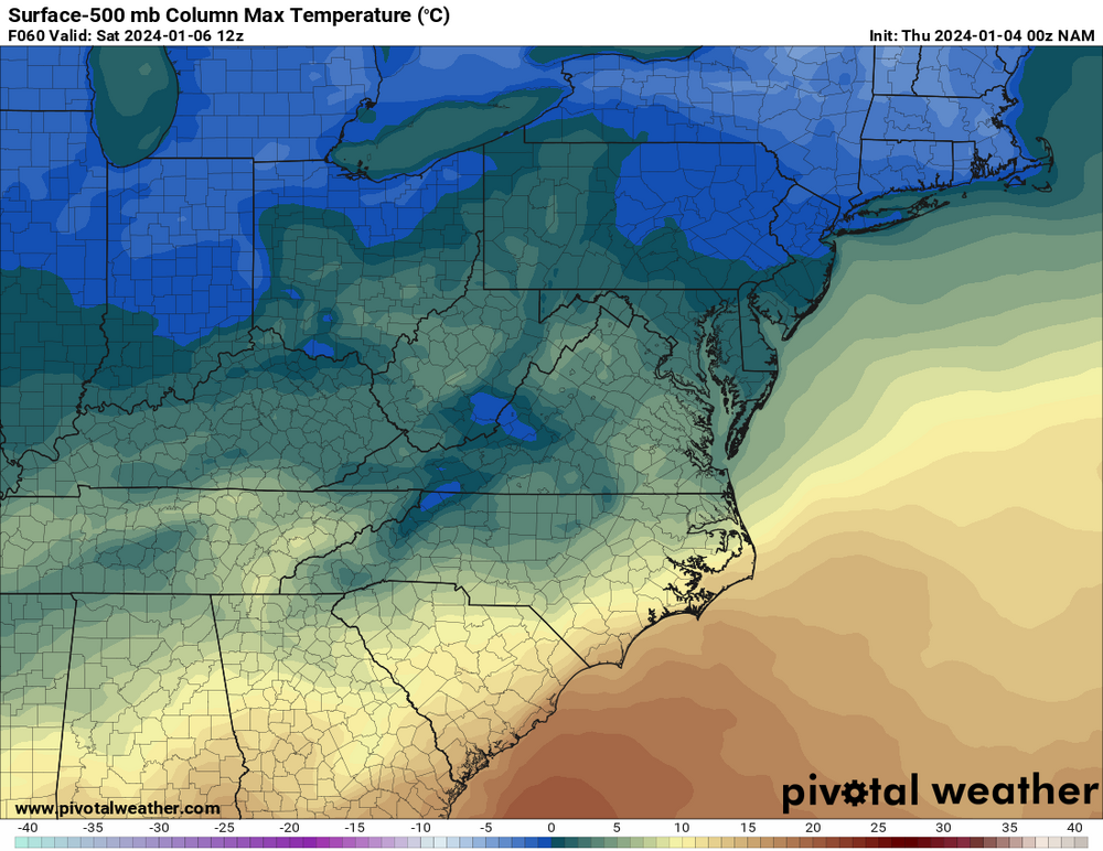
-
January 6-7 Storm Discussion: we’re due?
StormyClearweather replied to WxUSAF's topic in Mid Atlantic
NW of 95, but literally at 299 feet. Fortunately, I live about halfway down the hill, so it's a short walk to 300. -
January 6-7 Storm Discussion: we’re due?
StormyClearweather replied to WxUSAF's topic in Mid Atlantic
Probabilities appear down significantly. QPF? -
Jan Medium/Long Range Disco: Winter is coming
StormyClearweather replied to stormtracker's topic in Mid Atlantic
Thanks, you're right. I wasn't thinking about the speed-up. -
Jan Medium/Long Range Disco: Winter is coming
StormyClearweather replied to stormtracker's topic in Mid Atlantic