StormyClearweather
-
Posts
617 -
Joined
-
Last visited
Content Type
Profiles
Blogs
Forums
American Weather
Media Demo
Store
Gallery
Everything posted by StormyClearweather
-
Right where we... want... it?
-
Pretty good for this far out.
-

December 22-23, 2022: Warm Rain to Arctic Chill
StormyClearweather replied to WxUSAF's topic in Mid Atlantic
I'll take it!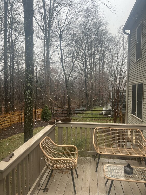
-
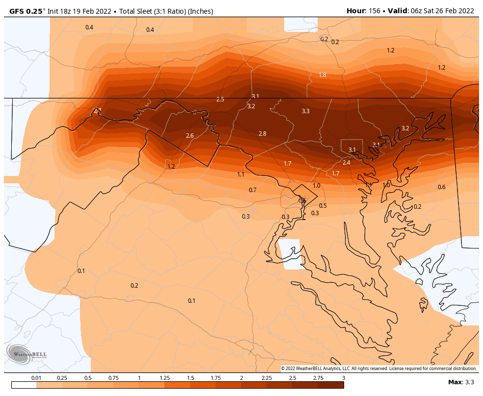
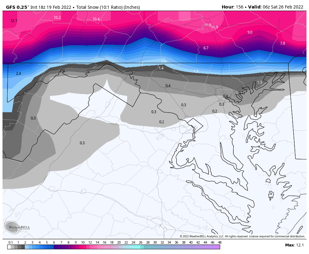
But gives us a nice little backend burst, for whatever that's worth.
-
Dec. 29 showing another opportunity, too.
-
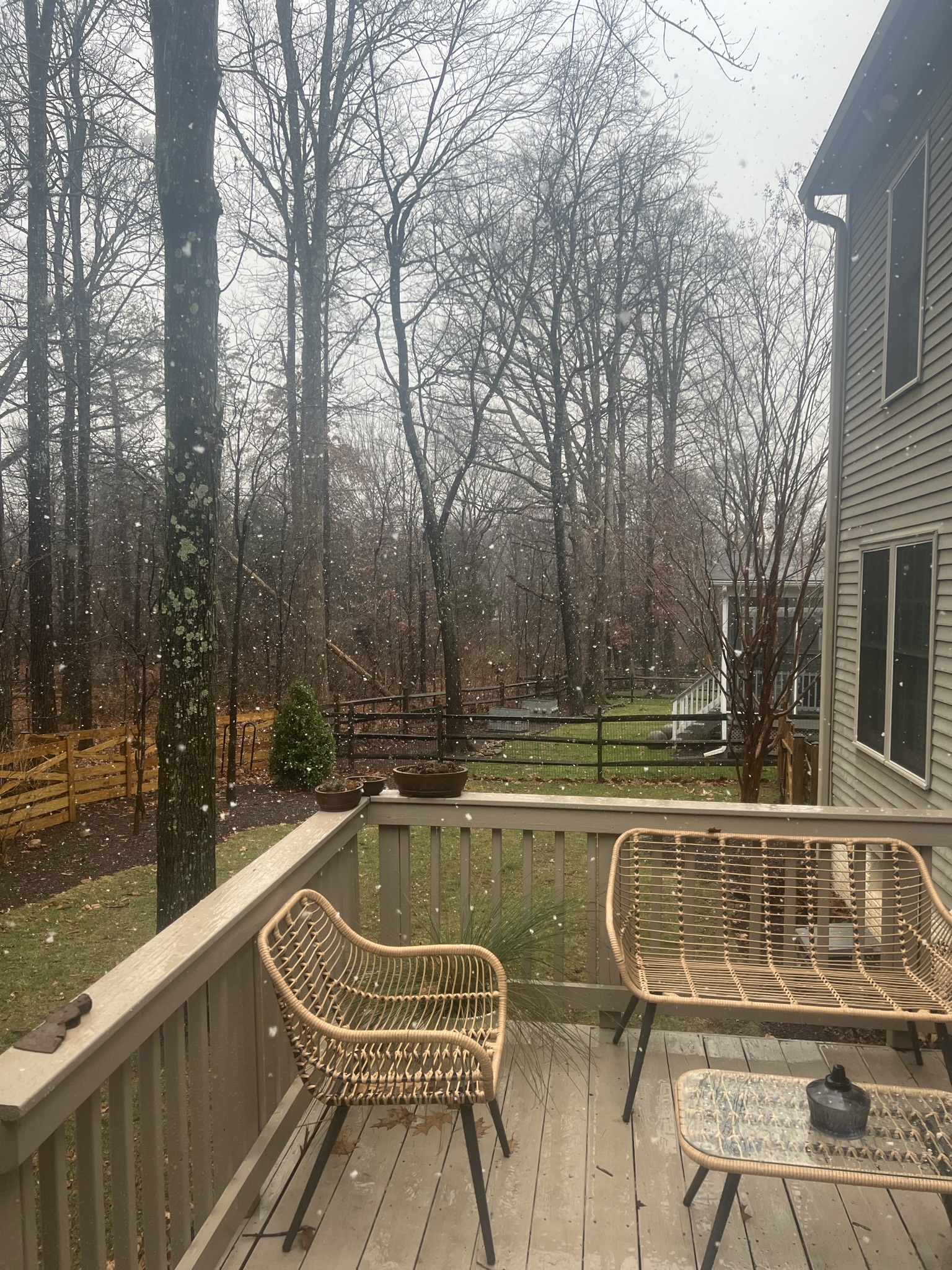
Damn that's pretty.
-
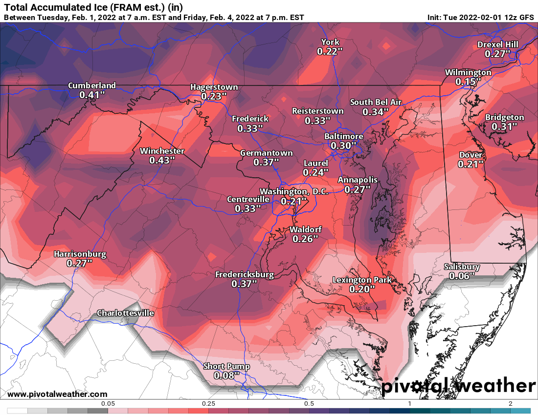
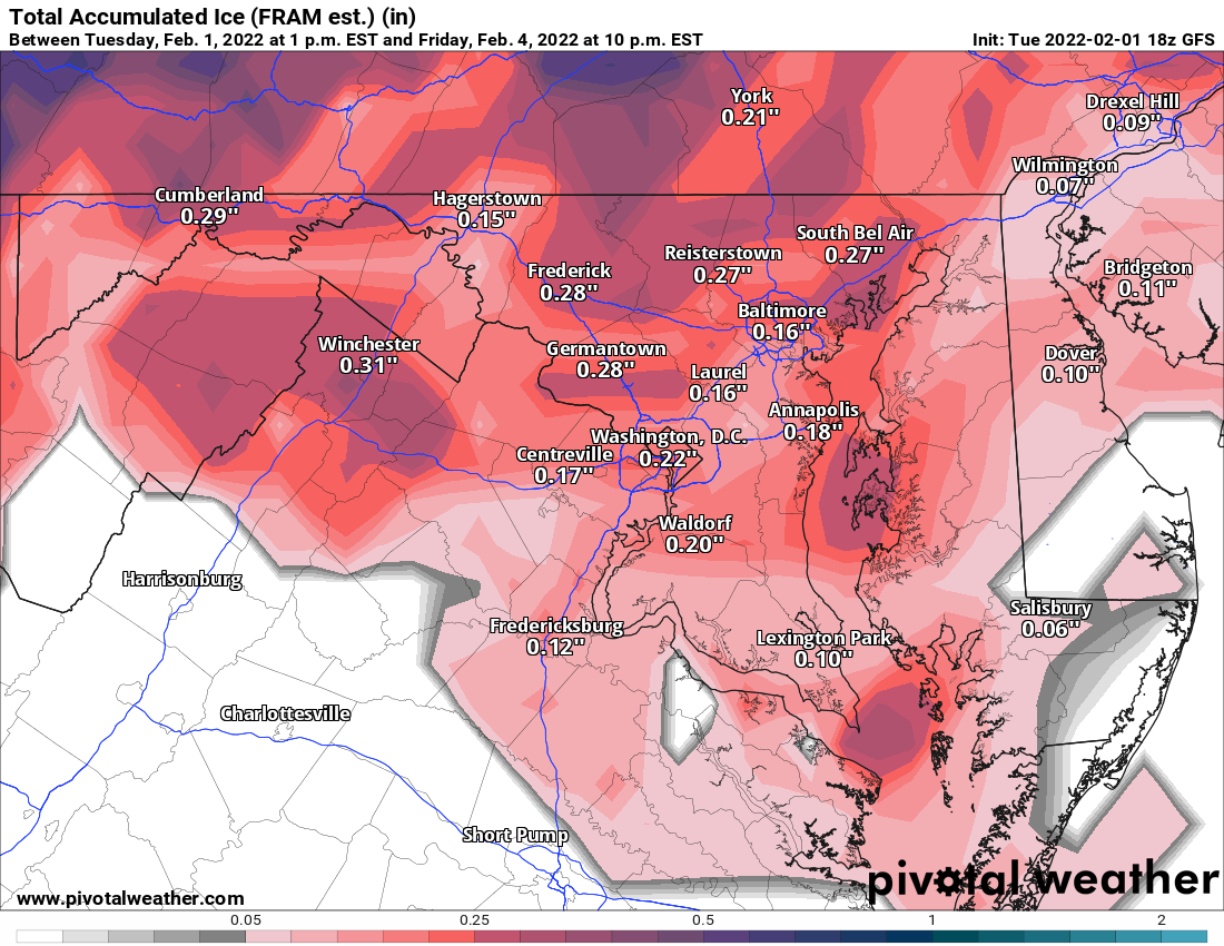
I know you said "sanding" instead of salting, but still an interesting piece on the issues with salting vs. brining. Road Salt Works. But It’s Also Bad for the Environment. - The New York Times (nytimes.com)
-
February Medium/Long Range Discussion
StormyClearweather replied to snowmagnet's topic in Mid Atlantic
It's a decent step, fwiw: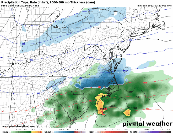
-
February Medium/Long Range Discussion
StormyClearweather replied to snowmagnet's topic in Mid Atlantic
I'm still pretty new to this area, but isn't CAD generally underdone at this range? Or maybe not since this is not the traditional CAD look? -
February Medium/Long Range Discussion
StormyClearweather replied to snowmagnet's topic in Mid Atlantic
18Z GFS remains wintry for the Thu PM/Fri period.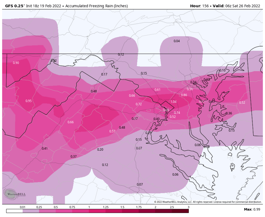


-
February Medium/Long Range Discussion
StormyClearweather replied to snowmagnet's topic in Mid Atlantic
LWX alluded to that in their disco and seemed to be saying they think the CAPE is underdone. They don't say why, though. ENSEMBLES AND DETERMINISTIC MODELS HAVE NEARLY 80 KNOTS OF WINDS AT 850 WHICH SUGGEST THAT WE WILL HAVE SHEAR WELL OVER 60 KNOTS AS THIS FRONT PASSES THROUGH THE REGION. ALTHOUGH CAPE AT THIS RANGE IS FORECAST TO BE RELATIVELY LOW, I SUSPECT THE CAPE IS BEING UNDERDONE. IF WE ARE ABLE TO GET EVEN A FEW HUNDREDS OF CAPE COMBINING WITH 60+ KNOTS OF SHEAR, THE REGION COULD SEE A DECENT SVR THREAT. -
Concur.

-
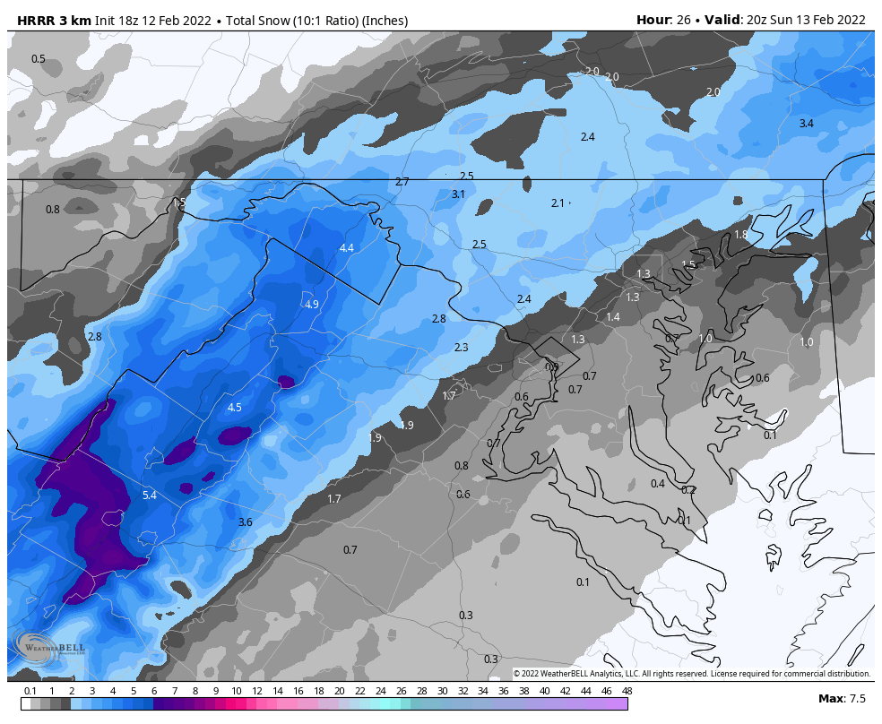
Sure, I guess if you were expecting more than a 1-2 (for most of us). Also shows a little snow band Sunday night too, for whatever that's worth. Still going in Baltimore at this point.

-
Ya HRRRRRd?

-
12Z

-
It's the HRRR toward the end of its run, but quite warm nonetheless. Precip is mostly gone by this point. Trended warmer since its 18Z run.

-
February Medium/Long Range Discussion
StormyClearweather replied to snowmagnet's topic in Mid Atlantic
Perhaps we should start a thread on how to name and organize the threads. Anyway, not bad in the 10–14-day period.
-
Late January and February Medium/Long Range Discussion
StormyClearweather replied to WinterWxLuvr's topic in Mid Atlantic
Definitely a much warmer trend for Friday on the 6Z guidance, which isn't surprising. Assuming it holds, does this combined with the Sunday storm debacle mean the GFS sucks again? Just want to make sure I have my talking points right. -
Late January and February Medium/Long Range Discussion
StormyClearweather replied to WinterWxLuvr's topic in Mid Atlantic
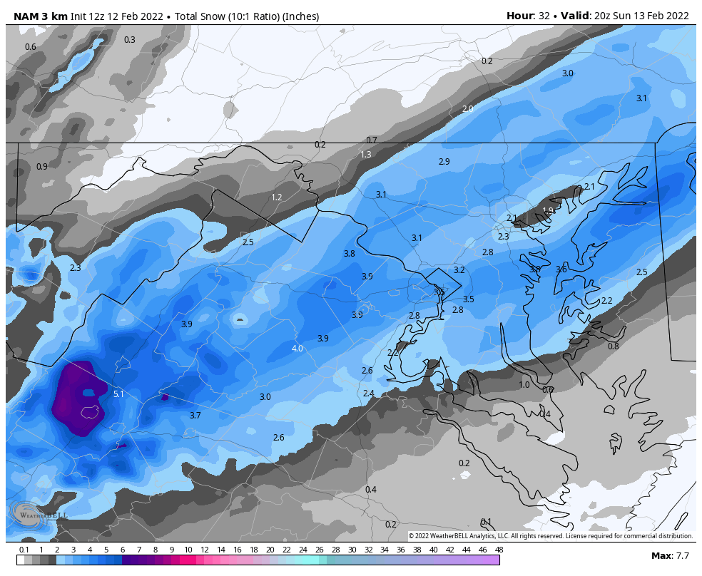
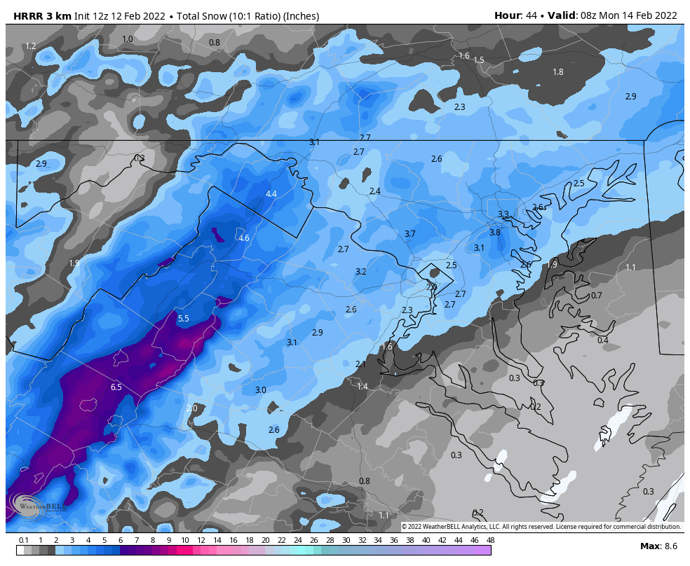
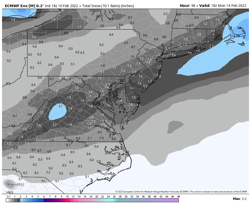
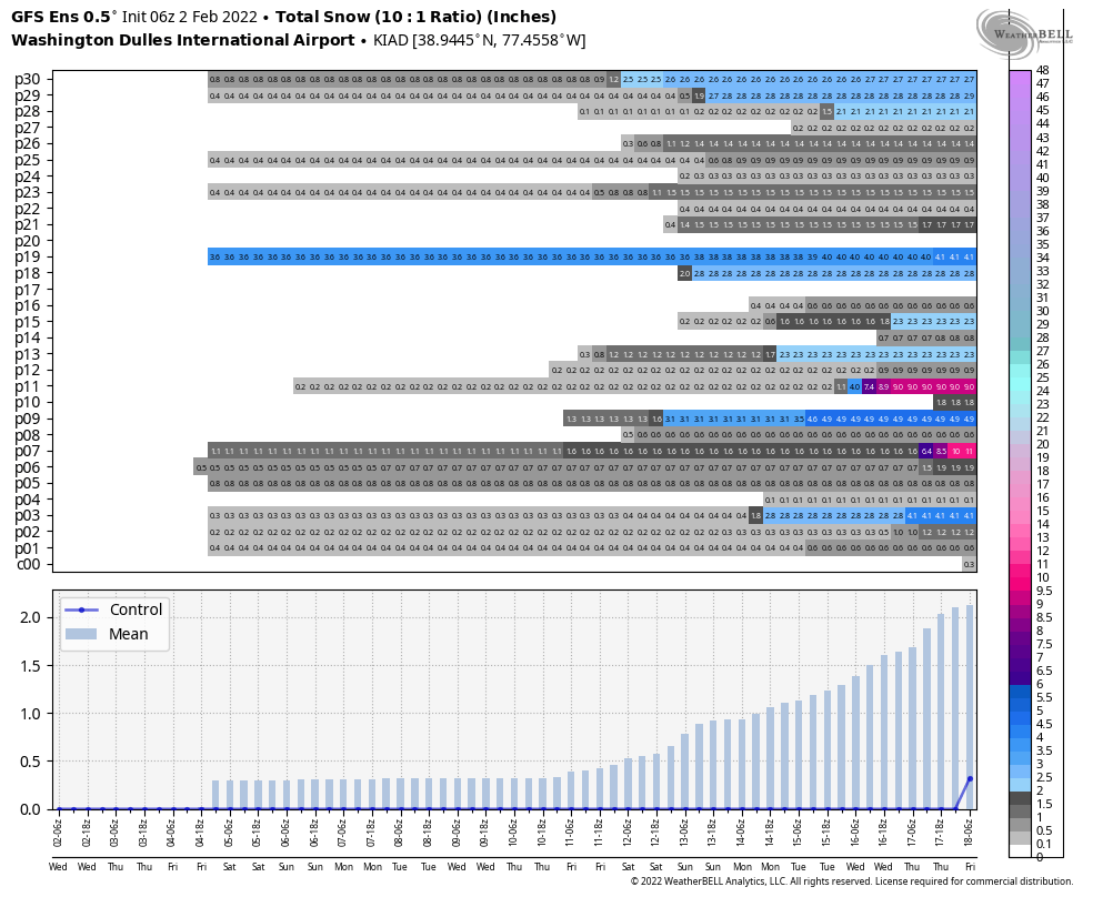
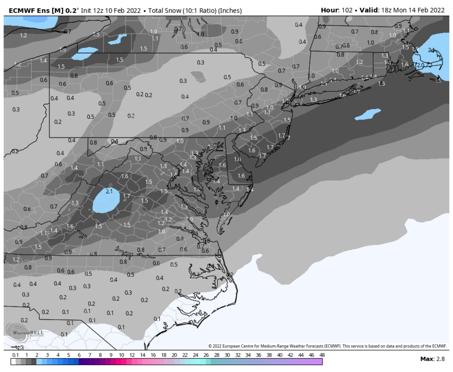
I post the snow map because none of the others seem to have loaded yet on WB (weirdly enough). It's north of 12Z for sure.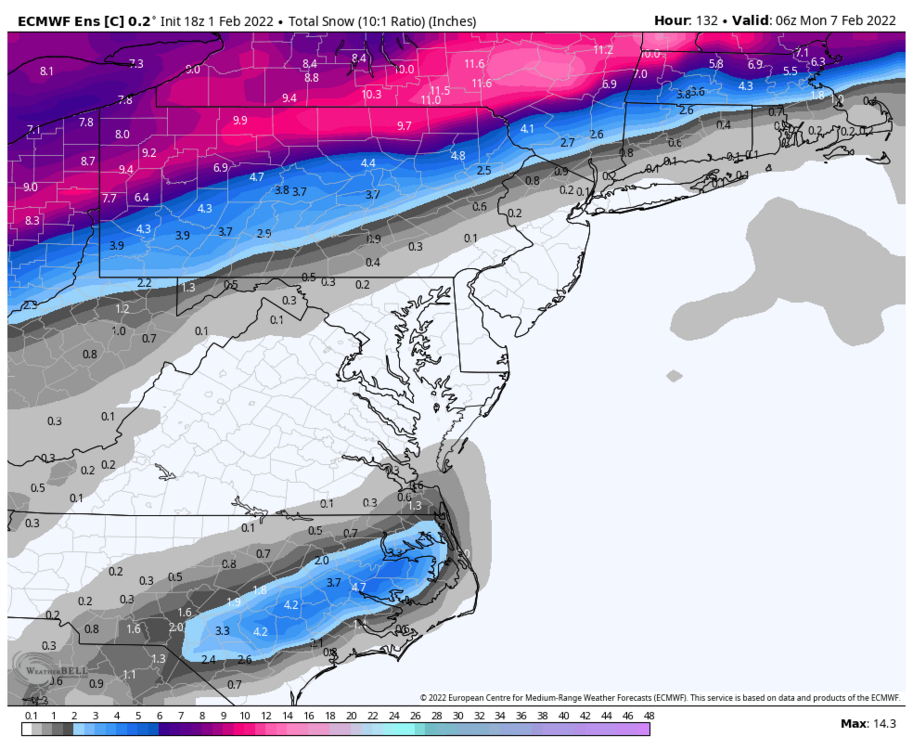
-
Late January and February Medium/Long Range Discussion
StormyClearweather replied to WinterWxLuvr's topic in Mid Atlantic

-
Late January and February Medium/Long Range Discussion
StormyClearweather replied to WinterWxLuvr's topic in Mid Atlantic
Yeah, Sunday storm goes south of us (most of us anyway).
- 4,130 replies
-
- 4
-

-

-
- prime climo
- cold canada
- (and 1 more)
-
Late January and February Medium/Long Range Discussion
StormyClearweather replied to WinterWxLuvr's topic in Mid Atlantic
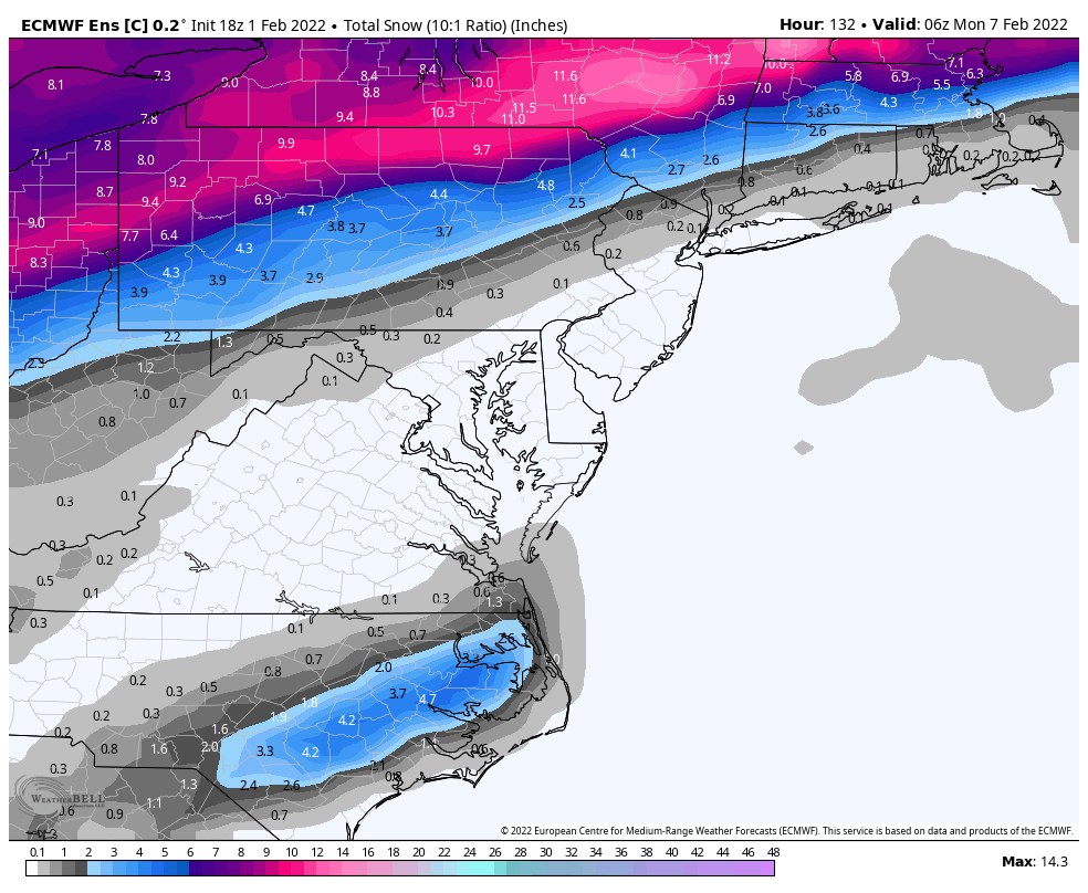
GFS and the Euro definitely seem to be meeting in the middle -- although wouldn't surprise me at all now if they just pass each other right by. *edit wrong run posted originally

- 4,130 replies
-
- 1
-

-
- prime climo
- cold canada
- (and 1 more)
-
Late January and February Medium/Long Range Discussion
StormyClearweather replied to WinterWxLuvr's topic in Mid Atlantic
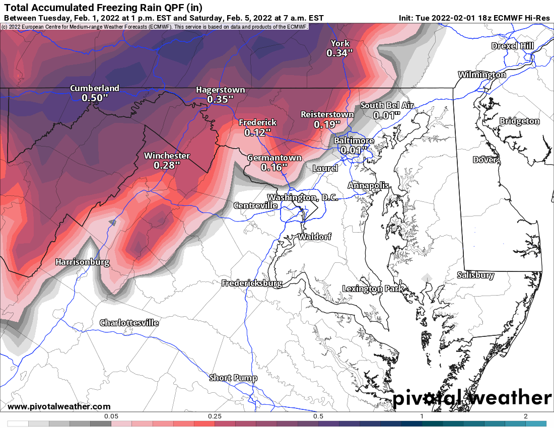
LWX alludes to this in their discussion today: THERE IS A CONCERN FOR A LITTLE FREEZING RAIN AT THE ONSET OF PRECIPITATION WEDNESDAY NIGHT. SOME HIRES GUIDANCE IS INDICATING THIS. HOWEVER, CONFIDENCE IS VERY LOW BECAUSE MOST GUIDANCE THAT IS INDICATING THIS, SHOWS MAX TEMPS WEDNESDAY TO BE IN THE LOWER/MIDDLE 30S UNDERNEATH LOW CLOUDS THAT DO NOT MIX OUT. HOWEVER, THE LAYER APPEARS TO BE SHALLOW, SO LATEST THINKING IS THAT THE LAYER SHOULD MIX OUT LATE IN THE MORNING/AFTERNOON, CAUSING HIGHER MAX TEMPS THAT WHAT THAT GUIDANCE IS SHOWING. THIS WOULD KEEP THE THREAT MORE ISOLATED (PERHAPS HIGHLAND COUNTY OR WESTERN MD).- 4,130 replies
-
- 1
-
-
- prime climo
- cold canada
- (and 1 more)
-
Late January and February Medium/Long Range Discussion
StormyClearweather replied to WinterWxLuvr's topic in Mid Atlantic
Is there any precip left by then?