StormyClearweather
-
Posts
617 -
Joined
-
Last visited
Content Type
Profiles
Blogs
Forums
American Weather
Media Demo
Store
Gallery
Everything posted by StormyClearweather
-

January 6-7 Storm Discussion: we’re due?
StormyClearweather replied to WxUSAF's topic in Mid Atlantic
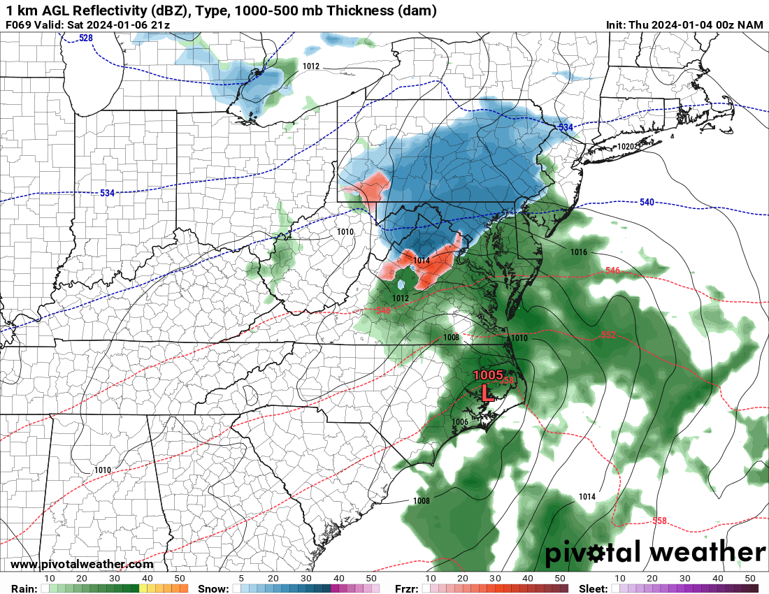
Looking far better at good ole 69, FWIW
-
January 6-7 Storm Discussion: we’re due?
StormyClearweather replied to WxUSAF's topic in Mid Atlantic
Column cools quicky though once precip starts, so ignore me. -
January 6-7 Storm Discussion: we’re due?
StormyClearweather replied to WxUSAF's topic in Mid Atlantic
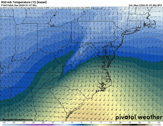
Yes, but... which is significantly warmer than 18Z NAM.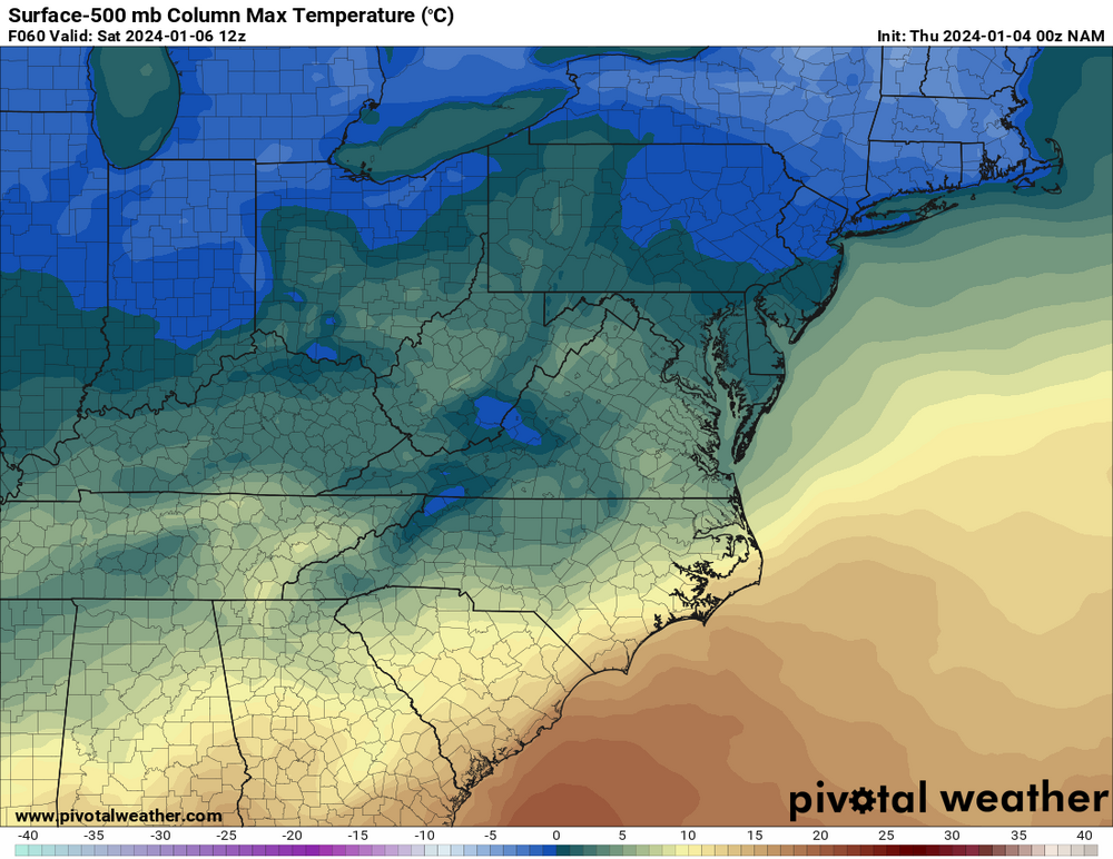
-
January 6-7 Storm Discussion: we’re due?
StormyClearweather replied to WxUSAF's topic in Mid Atlantic
NW of 95, but literally at 299 feet. Fortunately, I live about halfway down the hill, so it's a short walk to 300. -
January 6-7 Storm Discussion: we’re due?
StormyClearweather replied to WxUSAF's topic in Mid Atlantic
Probabilities appear down significantly. QPF? -
Jan Medium/Long Range Disco: Winter is coming
StormyClearweather replied to stormtracker's topic in Mid Atlantic
Thanks, you're right. I wasn't thinking about the speed-up. -
Jan Medium/Long Range Disco: Winter is coming
StormyClearweather replied to stormtracker's topic in Mid Atlantic
-
Jan Medium/Long Range Disco: Winter is coming
StormyClearweather replied to stormtracker's topic in Mid Atlantic
Mercy.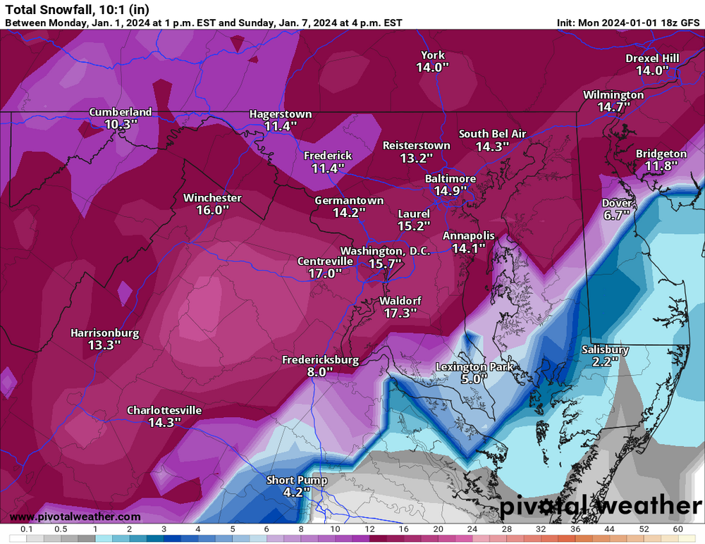
-
Jan Medium/Long Range Disco: Winter is coming
StormyClearweather replied to stormtracker's topic in Mid Atlantic
This is obviously a year old, but FWIW Looks to be true. I don't see much when I google GEFS v13 other than some talk about what's coming/etc.
-
Jan Medium/Long Range Disco: Winter is coming
StormyClearweather replied to stormtracker's topic in Mid Atlantic
Euro is even faster than the GFS. Has precip breaking out by 18Z Saturday. -
Jan Medium/Long Range Disco: Winter is coming
StormyClearweather replied to stormtracker's topic in Mid Atlantic
Definitely faster evolution this time. Roughly comparable with the ICON timing-wise. -
Jan Medium/Long Range Disco: Winter is coming
StormyClearweather replied to stormtracker's topic in Mid Atlantic
HRRR says why wait until next weekend
-
Pretty wild for ~36 hours out. From the LWX discussion this afternoon. THE TWO 12Z DETERMINISTIC MODELS VARY GREATLY STARTING AFTER 12Z WEDNESDAY. THE 12Z GFS TAKES THE LOW PRESSURE E OFF OF CAPE HATTERAS ON WEDNESDAY, WHEREAS THE 12Z ECMWF BRINGS IT TO ORF, THEN OVER DELMARVA AND UP THE NJ SHORE. WHILE BOTH MODELS GIVE A STEADY RAIN IN THE MORNING, IT IS WHAT HAPPENS AFTER 18Z THAT WILL DETERMINE THE LEVEL OF IMPACT OF ADDITIONAL AFTERNOON AND EVENING RAINS. WITH THE 12Z GFS BEING OFF CAPE HATTERAS, THE AFTERNOON AND EVENING RAINS WOULD REMAIN LIGHT TO MODERATE AT TIMES. HOWEVER, THE 12Z ECMWF GIVES MUCH HEAVIER RAINFALL TOMORROW AFTERNOON AND EVENING, WITH TOTAL QPF AROUND 2-2.5 INCHES BY 06Z THURSDAY. IT SHOULD BE NOTED THAT THE 12Z HREF 24-HR QPF ENSEMBLE MAX IS IN THIS BALLPARK.
-
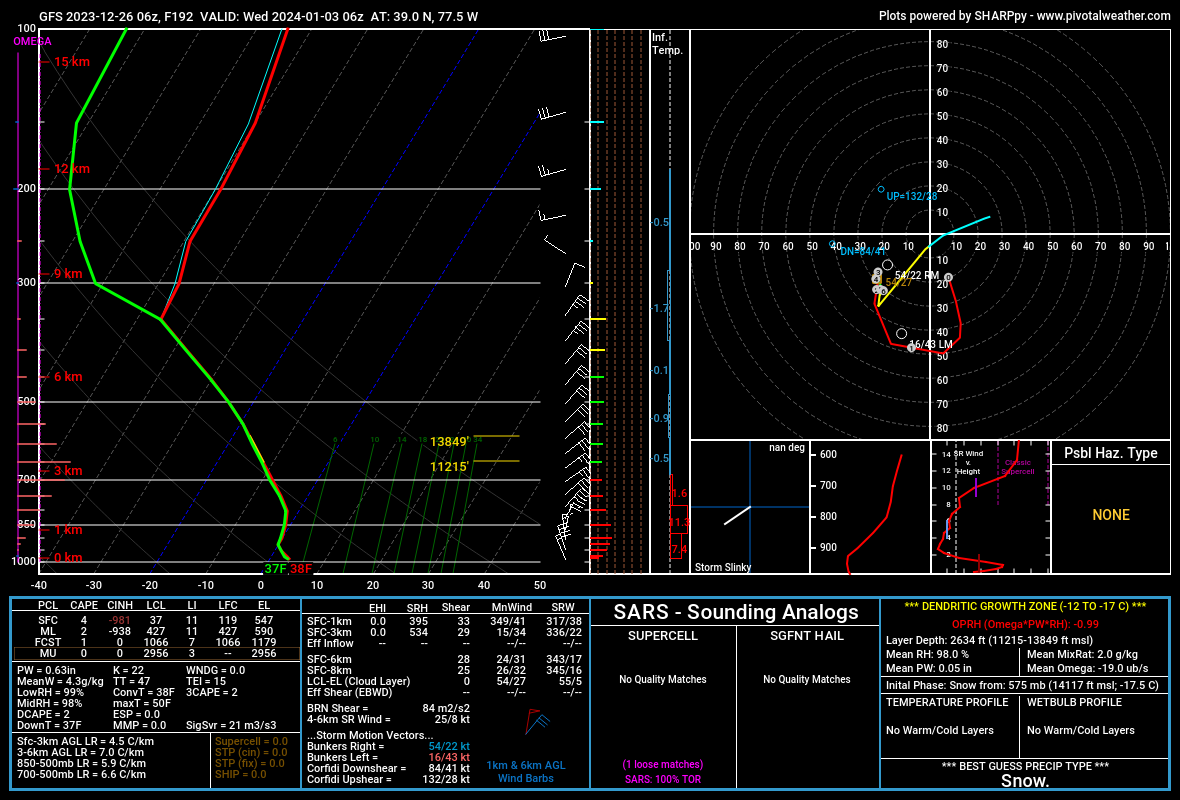
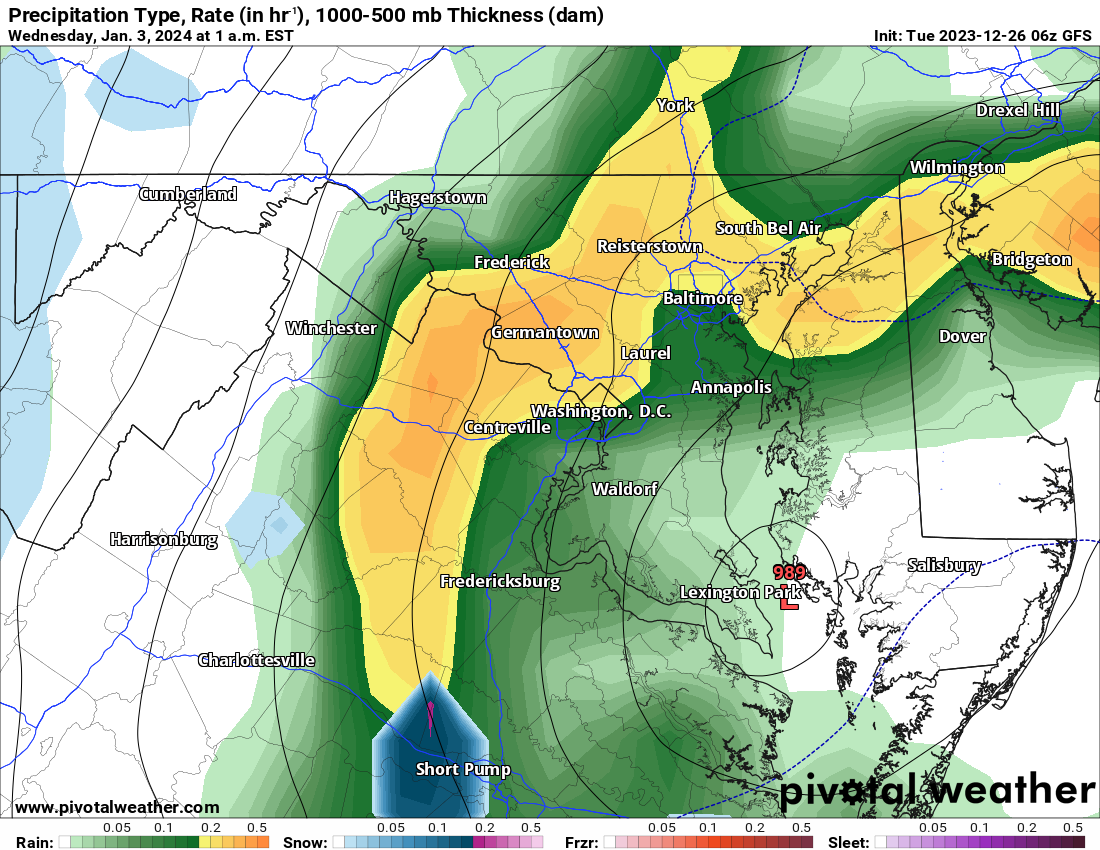
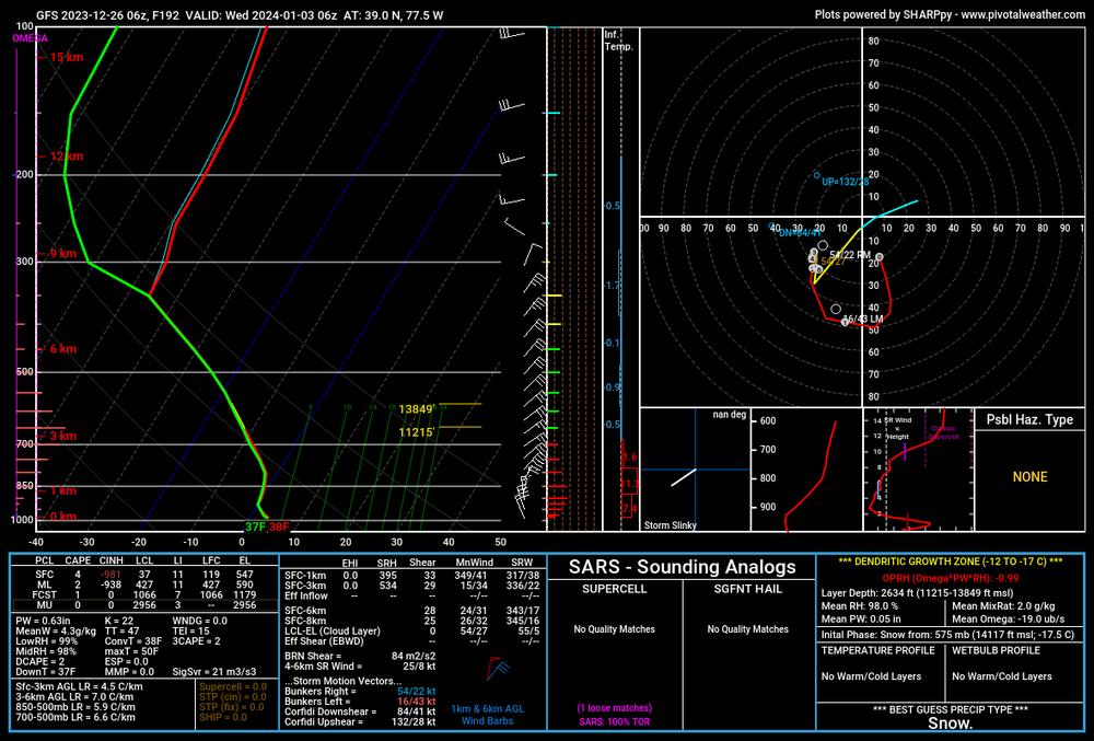
I don't know much of anything here, but when I click on the handy-dandy sounding from Pivotal, it shows a best guess of snow at 192. Maybe that doesn't matter, or maybe that just goes to show how borderline it is, which in itself is concerning? And yes, I realize 37/38 isn't ideal regardless of how you spin it. Edit: Oh, and at least Short Pump goes over to snow, based on the p-type map.

-
12/10-11 Disco / Obs - Rain/Snow/Wind Event
StormyClearweather replied to nj2va's topic in Mid Atlantic
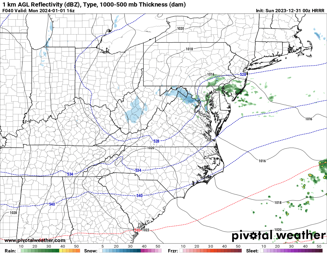
I hear you, but I'm getting some sleet mixing here. Other obs are backing it up. Maybe it's the rates?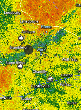
-
12/10-11 Disco / Obs - Rain/Snow/Wind Event
StormyClearweather replied to nj2va's topic in Mid Atlantic
Sleet mixing in, and down to 38.4. -
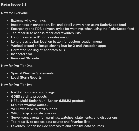
Pretty awesome updates to Radarscope launched today. I know it hit iPhone and Mac, and assume it launched on other platforms as well.
-
Gross
-
Interesting stuff: https://apple.news/AJjVIzjlMTee4jcq35fbgjA I was wondering when we’d see an "AI" forecast model. Looks like they’re already here.
-
Sick burn bro.
-
March Medium/Long Range Discussion
StormyClearweather replied to WinterWxLuvr's topic in Mid Atlantic
This is helpful. For mostly ignorant people like me, the lack of digital blue=cave to GFS, even if that's not what's really happening. But if the GFS shows digital blue at 12Z, then I'll immediately become terrified snow won't happen because GFS... even though I'm presently terrified because the GFS is not showing digital blue. Scary part? I'm not even really kidding. -
March Medium/Long Range Discussion
StormyClearweather replied to WinterWxLuvr's topic in Mid Atlantic
Nailed it. -
March Medium/Long Range Discussion
StormyClearweather replied to WinterWxLuvr's topic in Mid Atlantic
Reasonable discussion: FOR FRIDAY THOUGH, A MORE SPLIT FLOW DEVELOPS IN THE UPPER- LEVEL JET PATTERN. MODEL GUIDANCE IS VERY SPLIT IN TERMS OF HOW THIS DEVELOPS AND THE SPECIFIC IMPACTS TO OUR REGION. THE UPPER DISTURBANCE WITHIN THE SUBTROPICAL JET LOOKS TO BE PLENTY STRONG TO PUSH THE SUBTROPICAL RIDGE TOWARDS THE EAST, OPENING THE DOOR FOR A POTENTIAL COASTAL LOW. THIS LOW LOOKS TO DEVELOP FRIDAY ALONG THE GULF COAST OR IN THE SOUTHEAST (DEPENDING ON EXACTLY WHERE THE UPPER LOW TRACKS). FROM THERE, THAT IS WHERE THE BIG QUESTIONS FOR US COME. THERE ARE 3 SCENARIOS THAT COULD PLAY OUT, AND THEY ALL ARE DEPENDENT ON WHEN/IF THE POLAR AND SUBTROPICAL JETS ARE ABLE TO PHASE. THE FIRST SCENARIO WOULD TAKE THE SYSTEM TO OUR SOUTH AND WELL OFFSHORE IF THE NORTHERN STREAM ENERGY SIGNIFICANTLY OUTPACES THE SOUTHERN STREAM ENERGY. THE SECOND SCENARIO PHASES THE TWO PIECES OF ENERGY TOO EARLY, TAKING THE PRIMARY LOW TO OUR WEST, GIVING US THE POTENTIAL FOR RAIN, BUT LIKELY NO WINTRY WEATHER. COULD EVEN SEE A SCENARIO WHERE THIS COULD PRODUCE SEVERE WEATHER. NOW, FOR SCENARIO THREE WE WOULD NEED THE UPPER LOW TO JUST TRACK BETWEEN THE FIRST TWO SCENARIOS. THIS COULD OCCUR IF THE SUBTROPICAL RIDGE GETS POSITIONED JUST RIGHT OR IF THE TWO SYSTEMS WERE TO MANAGE TO PHASE IN THE RIGHT SPOT, WHICH SEEMS UNLIKELY AT THIS POINT. THIS THIRD SCENARIO WOULD PRODUCE SOME WINTRY PRECIPITATION FOR AT LEAST SOME PORTIONS OF THE AREA. AT THIS TIME RANGE THOUGH...THAT IS GOING TO BE NEARLY IMPOSSIBLE TO NAIL DOWN EXACTLY RIGHT. MONITORING TRENDS IN THE COMING DAYS WILL BE KEY TO THIS FORECAST, AND RECENT TRENDS HAVE BEEN SNOWIER... SO, AS THIS GETS CLOSER ON OUR RADAR, HOPEFULLY SOME GOOD SAMPLING FROM UPPER AIR DATA WILL START TO HELP GUIDANCE CONVERGE ON A COMMON SOLUTION. FOR NOW, THIS IS JUST SOMETHING TO MONITOR. -
January/February Mid/Long Range Disco IV: A New Hope
StormyClearweather replied to stormtracker's topic in Mid Atlantic
-
Yes.