

HWY316wx
-
Posts
806 -
Joined
-
Last visited
Content Type
Profiles
Blogs
Forums
American Weather
Media Demo
Store
Gallery
Everything posted by HWY316wx
-
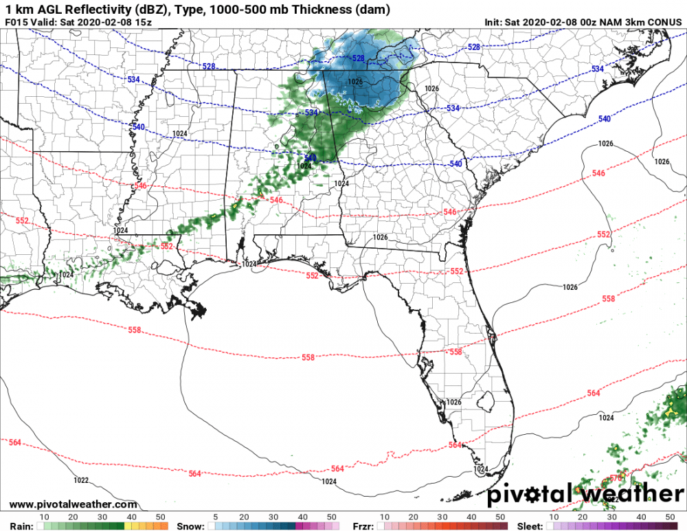
For sure. Looking at temperature panels, those are a big bust for this morning. Again, not sure what that will mean down stream. Also, moisture on radar is not reaching the ground in Alabama so let the virga storm begin. LOL
-
What is interesting is the moisture falling right now in Alabama is not on any of the maps at this hour. The HRRR and the NAM are all too slow by 3-4 hours for the development of moisture. My temp at my house is 4 degrees below forecast and even as I type this is falling. I am not sure what it will mean downstream for snow development but I can say with a lot of confidence the model guidance at this hour does not match up on timing and the moisture is more robust than modeled.
-
It can when it looks like this. The line of disappointment will be sharp today in GA.
-
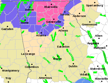
Winter Storm Warning up for NE GA counties. I am one county out of the game but pretty excited that my forecasted temp is currently 4 degrees colder and rain is ahead of schedule in Alabama.
-
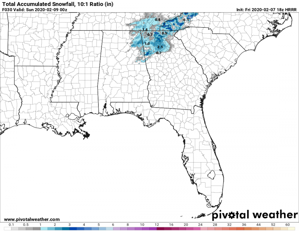
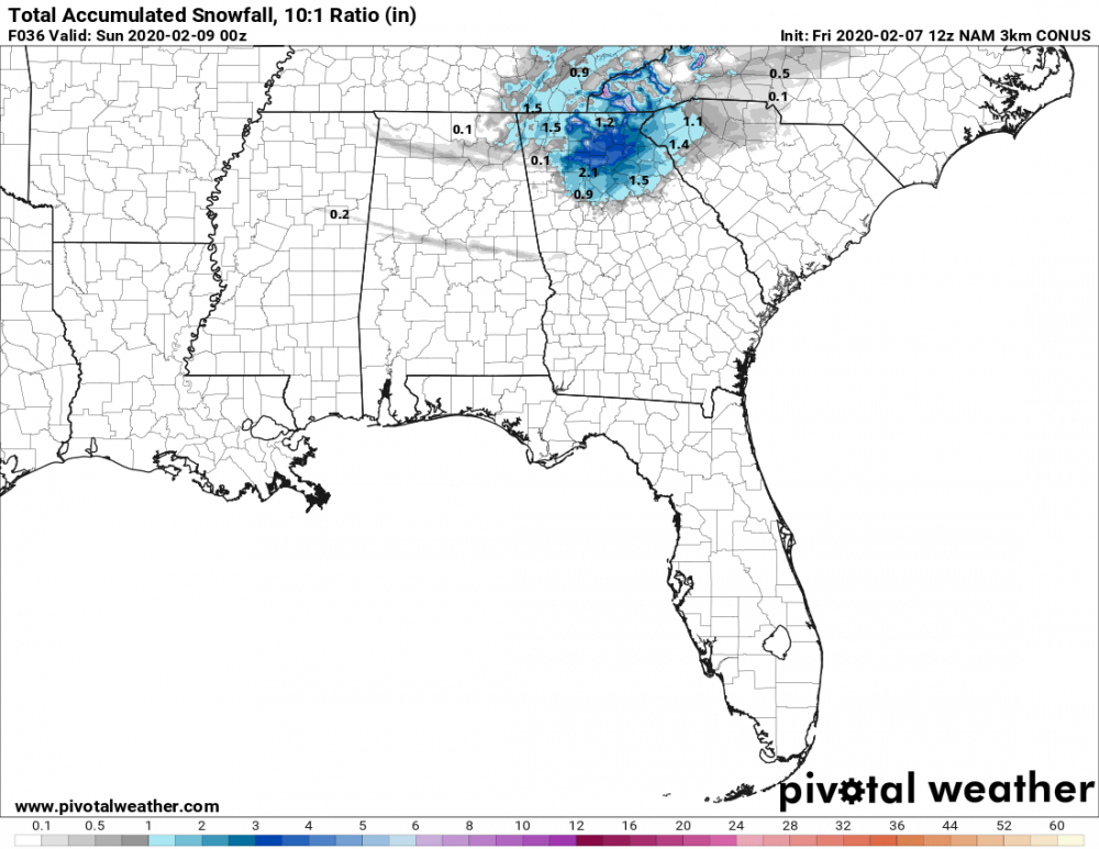
This 18Z Run of the NAM is the juiciest so far for North GA.
-
Let's ride.
-
LOL... Not holding my breath. This pattern is awful.
-
What am I missing? Moisture looks anemic. Thats the coldest 2mm temps I could find and those only last for 3 hours.
-
Just throwing this in since it's closer than the big dog in the 8+ Day range...
-
NWS reasoning for expanding the Winter Storm Watch in Georgia: Area Forecast Discussion National Weather Service Peachtree City GA 945 PM EST Fri Dec 7 2018 .UPDATE... Main adjustment this evening was to expand the Winter Storm Watch farther west and south given growing concern for some freezing rain accumulations in a strengthening wedge Saturday night into Sunday. This was based on some higher resolution guidance advecting the subfreezing low level temps/wetbulbs farther into the area, including the local WRF which has resolved past wedges quite well. There is still much uncertainty with temps, timing, and amount of moisture but the fact that models which typically perform better with the local terrain and smaller scale microphysical processes are bringing in some freezing rain mainly north of the I-20 corridor and impinging into the far northeast Atlanta metro was justification enough to expand. Also even higher snow totals could be realized in the NE mountains. The watch area could be upgraded to either a Warning or Advisory in future updates so please watch for any changes. Previous discussion follows.
-
The December to Remember 7th-8th blue turd winter threat thread.
HWY316wx replied to lilj4425's topic in Southeastern States
I am just going to leave this right here.
-
The December to Remember 7th-8th blue turd winter threat thread.
HWY316wx replied to lilj4425's topic in Southeastern States
Great run for us Georgia folks... I'll take it. -
The December to Remember 7th-8th blue turd winter threat thread.
HWY316wx replied to lilj4425's topic in Southeastern States
For those of us in Georgia the EURO, NAM, CMC and members of the GEFS have given us some eye poppers. I for one am happy to see some areas of GA that don't normally get snow, being shown to cash in on many of these runs. Our media outlets down here are super conservative right now. James Spann has sounded the lookout for the Atlanta area and the Atlanta Mets will not jump on that train. I get being conservative but if models continue down the path they've been on, they will have no choice but to start to get serious about talking about it publicly. Personally, I want it to come a little more North but I will be happy just to see flakes fly and folks that usually miss out get some snow.


