Metasequoia
-
Posts
698 -
Joined
-
Last visited
Content Type
Profiles
Blogs
Forums
American Weather
Media Demo
Store
Gallery
Everything posted by Metasequoia
-
Snow is mixing in Battery Park City.
-
FWIW - NAM outside of its useful range, looks more promising. I still don't like the placement of that high though.
-
0Z RAP Not so bad...
.thumb.png.1e7f4c1e624bf96a3d887bed0275e611.thumb.png.b8278d537f5136958deefbacf8cd20b8.png)
-
Link to free EURO site. https://weather.us/model-charts/euro/2021031100/colorado/acc-total-precipitation/20210317-0000z.html
-
Still snowing in southern Manhattan...never stopped.
-
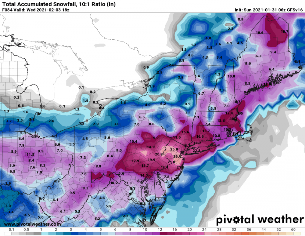
What are the odds that NYC breaks its all-time snowfall record?
-
That mixing line is sure racing north through NJ fast...
- 1,932 replies
-
- 1
-

-
- heavy snow
- wind damage
- (and 1 more)
-
I think there are going to be some all time snowfall records toppled in the region this week.
- 1,932 replies
-
- 1
-

-
- heavy snow
- wind damage
- (and 1 more)
-
06Z Para GFS would do just fine for about everyone. Model has been amazingly consistent.

- 2,426 replies
-
- 1
-

-
- heavy snow
- ice pellets
- (and 3 more)
-
Yeah... I'm not talking about all the meteorological mechanics (which are cool), but the geographic spread / depth of accumulations and long duration. Has still a ways to go though.
-
Some of the models tonight almost make this storm look like Jan 2016 redux.
- 2,426 replies
-
- 1
-

-
- heavy snow
- ice pellets
- (and 3 more)
-
Yeah...always exceptions. I remember that one. I experienced my first thunder sleet. 2 inches of LE sleet. Still a pretty cool storm for many.
-
In theory, the size of the wobbles diminish every subsequent model run and we are only 48 hours out.
-
Seems like with these types of events it's very difficult to predict where the thermal boundary sets up. I certainly don't trust the forecast 3 or 4 days out. I'd rather be in Poughkeepsie for this, but I think NYC has a shot at a prolonged period of frozen precipitation. As crappy as this Winter has been, I'll take it.
-
Seems like we need several things to go right for decent accumulating snow near NYC because of the marginal temps...hence it would be wise to keep evs weenie hopes in check. Basically, it's a no go unless there is a very strong low bombing out south of the area, taking a benchmark track. A beautifuly placed 990 mb low ain't going to cut it...nor will a 970 mb low tucked into the coast. I'm holding out some hope for perfection, but the odds are not on our side.
-
Looks like it's a tad north and east...
-
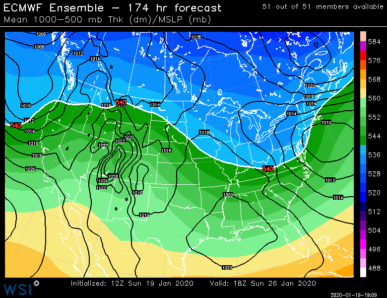
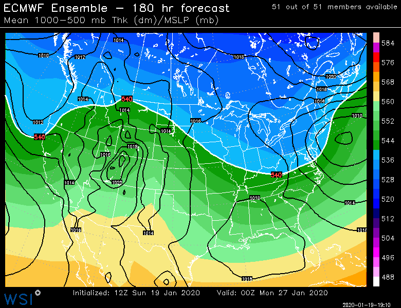
Per the New England folks. EPS looks promising at this range.
-
https://www.pivotalweather.com/model.php?rh=2020011912&fh=loop&dpdt=&mc=&r=us_ma&p=prateptype_cat_ecmwf&m=ecmwf_full# Much better website for EURO.
-
Wintry mix potential weekend of Jan 18-19, 2020
Metasequoia replied to wdrag's topic in New York City Metro
Snow is actually sticking to things other than car tops...nice change of pace for Manhattan. -
Wintry mix potential weekend of Jan 18-19, 2020
Metasequoia replied to wdrag's topic in New York City Metro
Snowing in Battery Park City. -
That and the banding on either side of NYC isn't that strong.
-
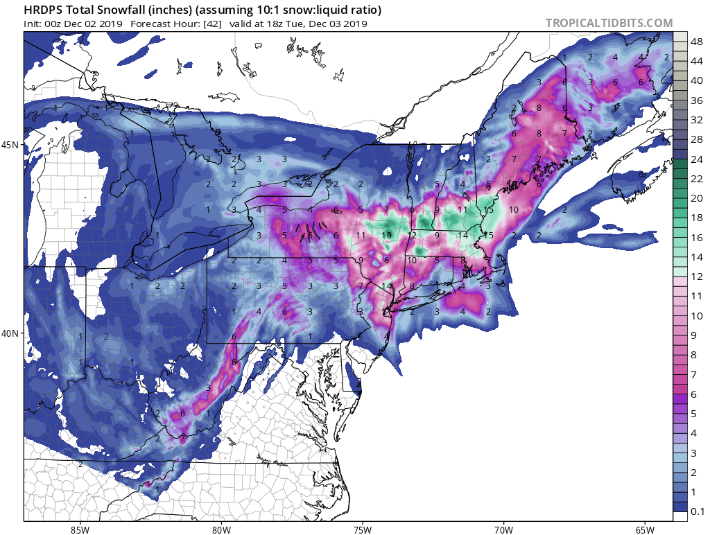
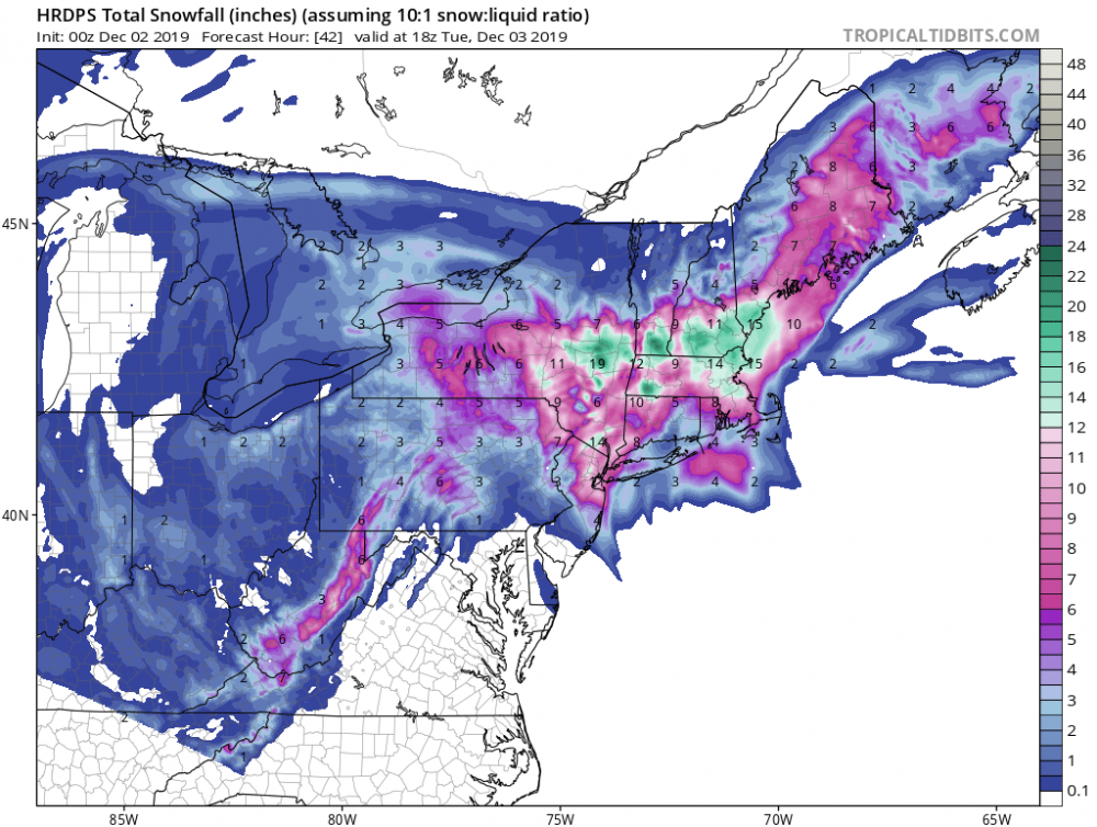
Possible Dec 1-3 Winter Storm
Metasequoia replied to Zelocita Weather's topic in New York City Metro
-
Possible Dec 1-3 Winter Storm
Metasequoia replied to Zelocita Weather's topic in New York City Metro
I'm cherry picking obviously, but this wouldn't suck.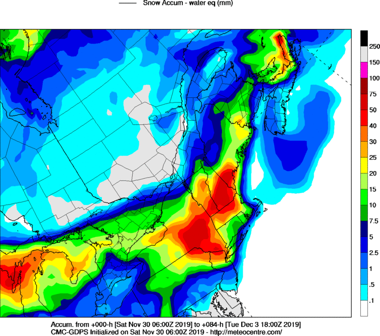
-
November 2019 General Discussions & Observations Thread
Metasequoia replied to Rtd208's topic in New York City Metro
Can't quite tell what latesr Ukie run indicates. Saw this on NE forum...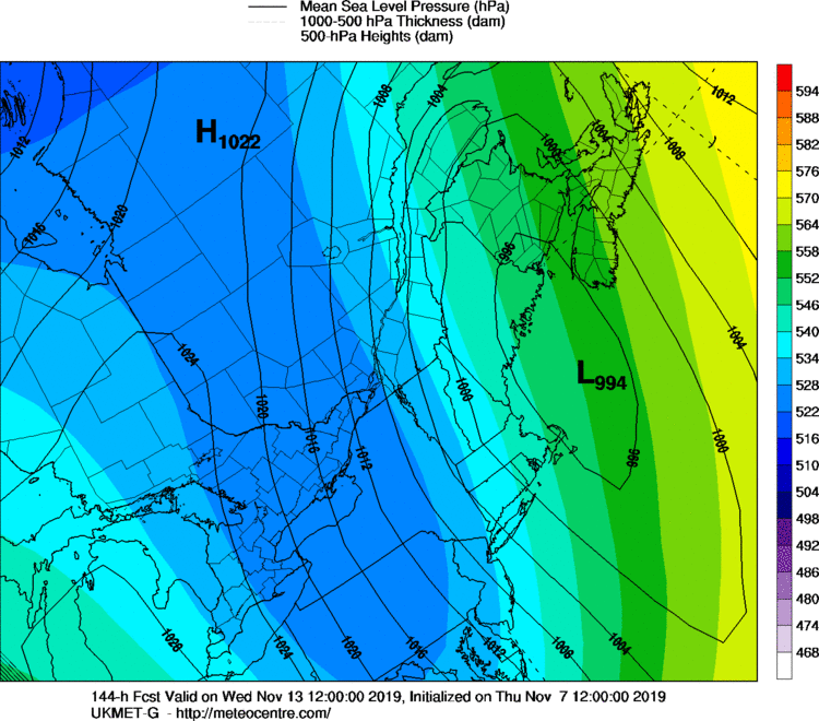

.thumb.png.1e7f4c1e624bf96a3d887bed0275e611.png.520dca164777c0e580531ea6a75b05cd.png)