Metasequoia
-
Posts
698 -
Joined
-
Last visited
Content Type
Profiles
Blogs
Forums
American Weather
Media Demo
Store
Gallery
Everything posted by Metasequoia
-
NAM is known for run to run inconsistency and this is a complex setup...
-
Interesting...
-
Euro has been looking better each run as of late.
-
Are ensembles of much use 24 hours before a storm?
-
I would really like to hear a mets perspective on this latest euro run.
-
Seems like the timing and rate of intensification of the low will significantly determine snowfall. This is one of more difficult things to predict. I think we need more time to figure this out.
-
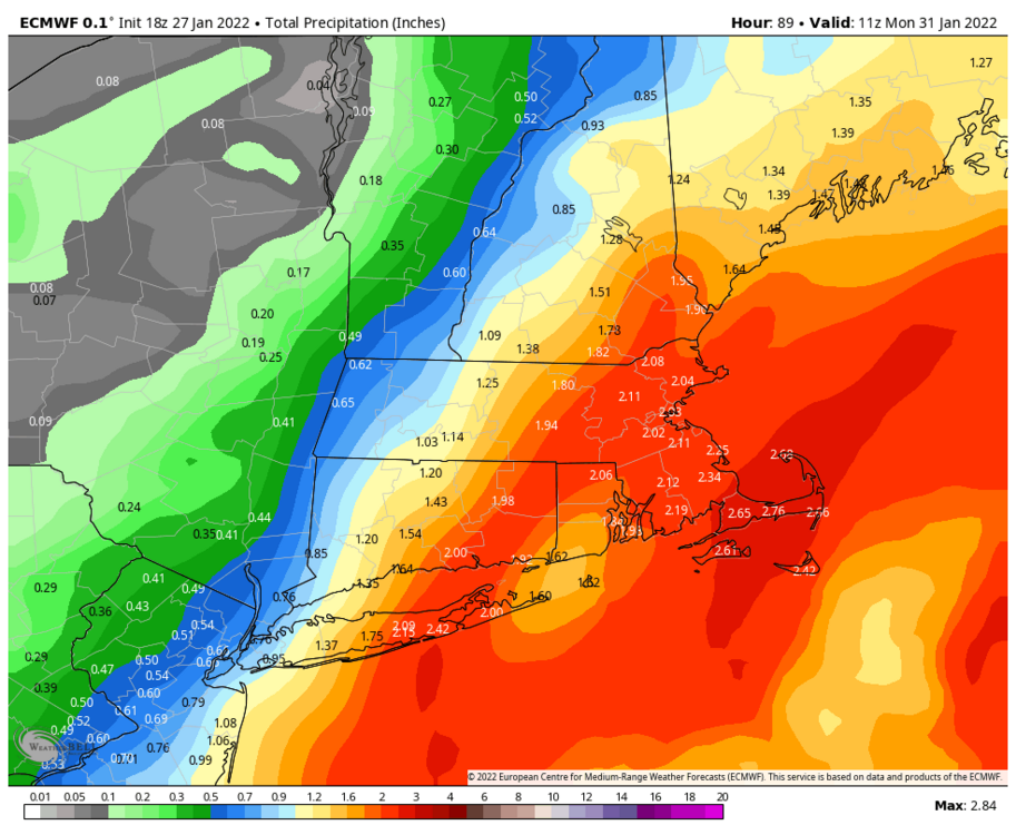
I think 5 to 20 is on the table for NYC.
-
Well...EURO is no longer the western most solution. That's quite the change.
-
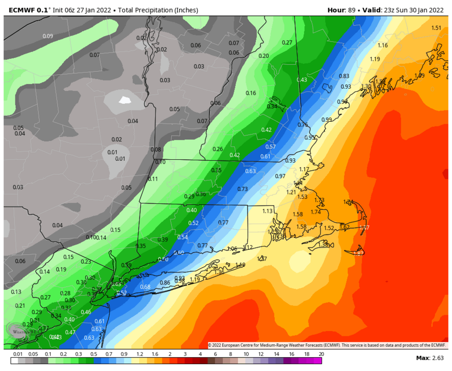
The precipitation shield to the north west of the low on the 0Z NAM just doesn't look right... looks too small for such a strong low. It's not like there's a monster high to the north.
-
That's only 12 hours of precip too by the looks of the map legend.
-
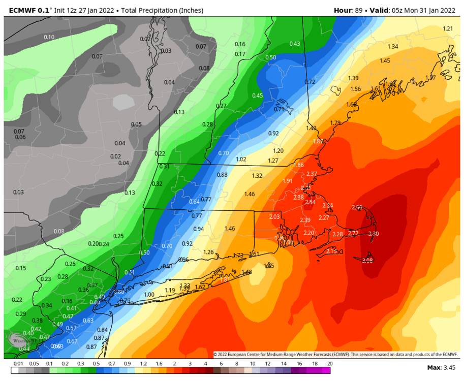
0Z CMC looks like 24 plus hours of snow, inline with its mesoscale brother.
-
Good point and all without significant blocking. I love a long duration snowstorm.
-
Fairly long duration as modeled.
-
I wonder if the models are under doing the western extent of the precipitation. Seems under done for a sub 980 mb low.
-
As Forky suggested, let's wait until the wave arrives in the SW second half of tomorrow before getting excited or dejected. This is an important feature in the evolution of this storm.
-
New England forum says ICON is way east.
-
Keeps hope alive for the Weenies!
-
I would sure like some more support for a KU from other models...
-
Before we get hopes too high, we need the other real models to output significant hits for the region. They are trending that way, but slowly. It was nice to see the 12Z RGEM handling the SW energy like the EURO.
-
January 26th, 2016 and January 4th, 2018 blizzards were south/east of the benchmark and unloaded on the region. Part of this is where the lows came from prior to arriving near the benchmark.
-
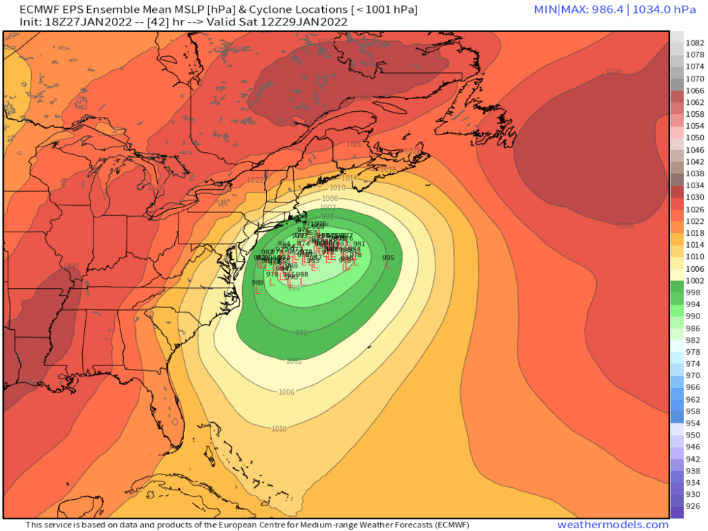
952 mb near the benchmark. How doesn't this bury the metro?
-
This you having fun with us or do you really think we get shafted again like 2015? Painful memories...
-
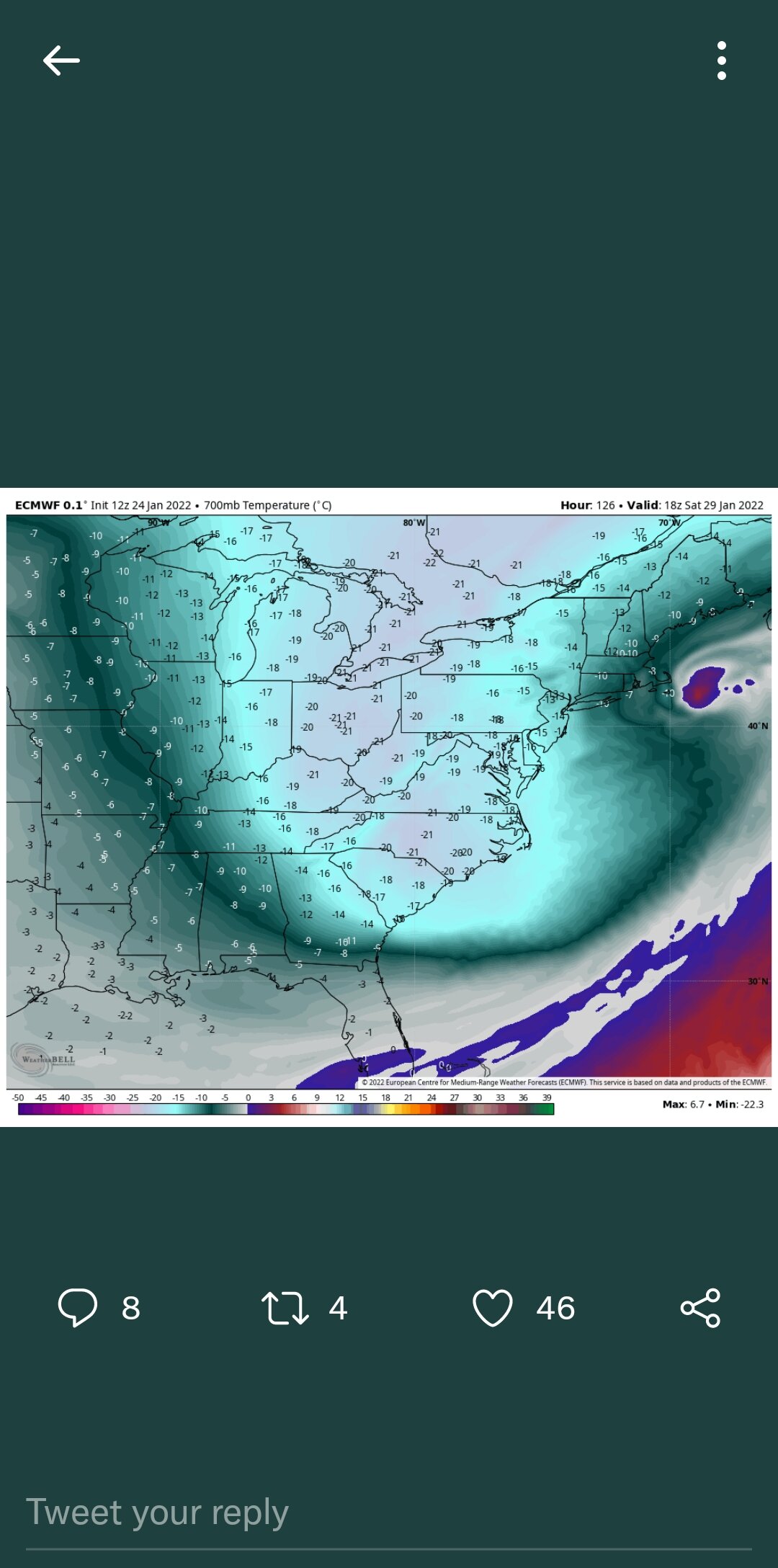
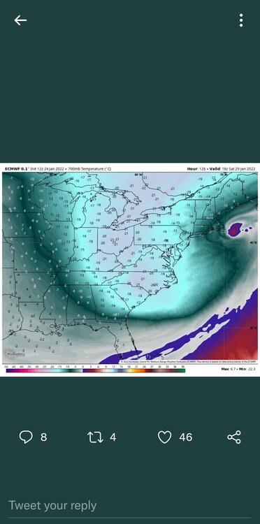
Anyone have a good rationale how this storm could develop a warm core as depicted by the EURO?
-
Yeah...tenuous at 5 days out. Inland runner and whiff still on the table IMO. Whiff still my biggest concern...but we could all be hoping for an eastern correction in the days ahead. Still nice to see these runs tonight.
-
What's to stop this from running inland? I know the Atlantic blocking isn't that strong...that's part of the answer.