EastonSN+
-
Posts
7,917 -
Joined
-
Last visited
Content Type
Profiles
Blogs
Forums
American Weather
Media Demo
Store
Gallery
Everything posted by EastonSN+
-
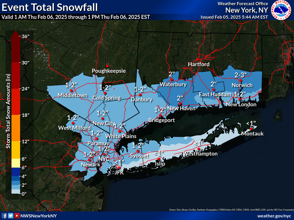
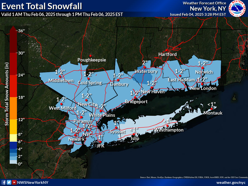
 Still snow in Easton Connecticut.
 -
Track looks to be a little further south than this one too.
-
Thanks Walt. As for this system I have seen it so many times in my day where we change over much quicker than expected (this type of setup), especially when the high pressure has moved off the coast.
-
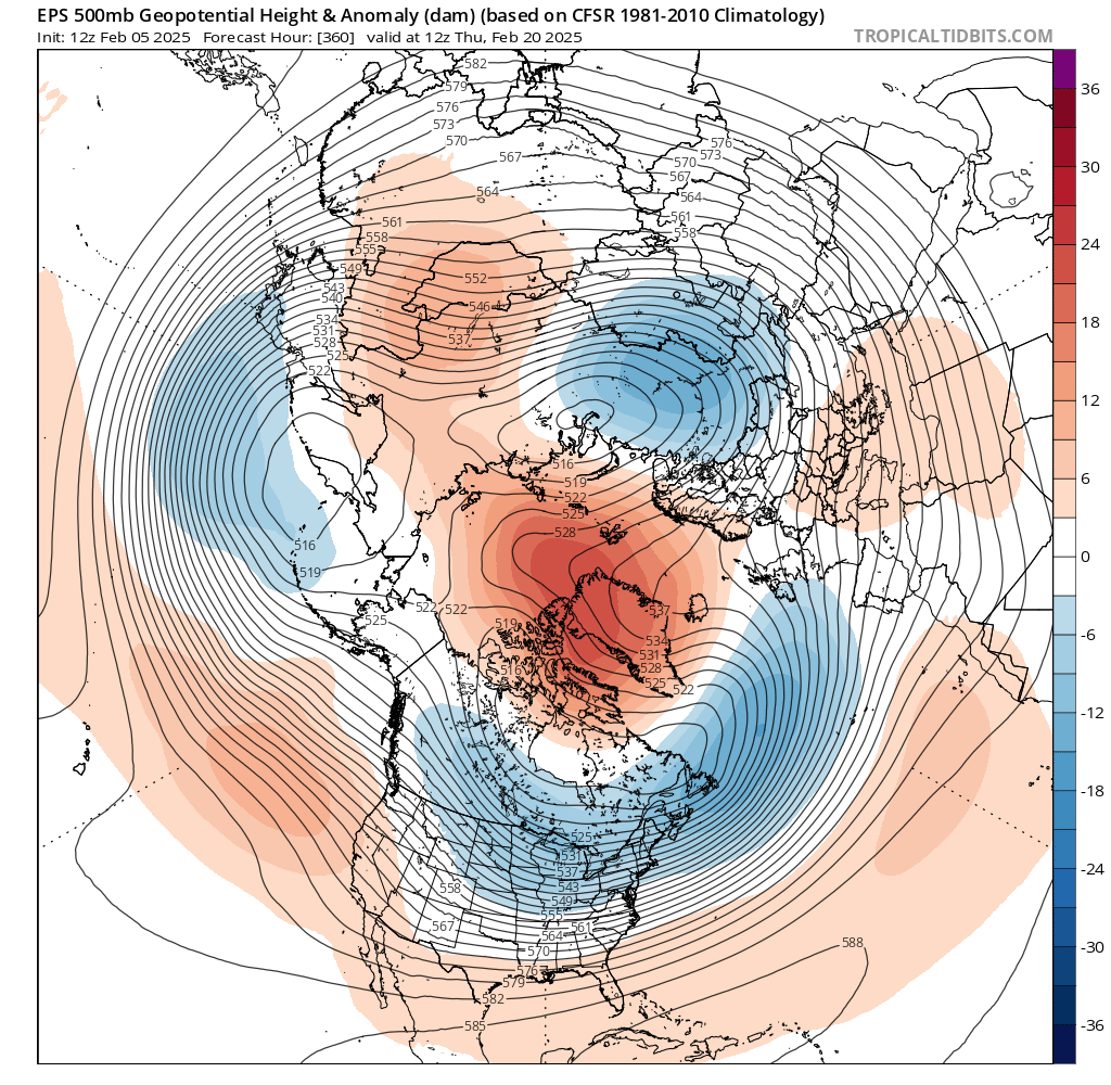
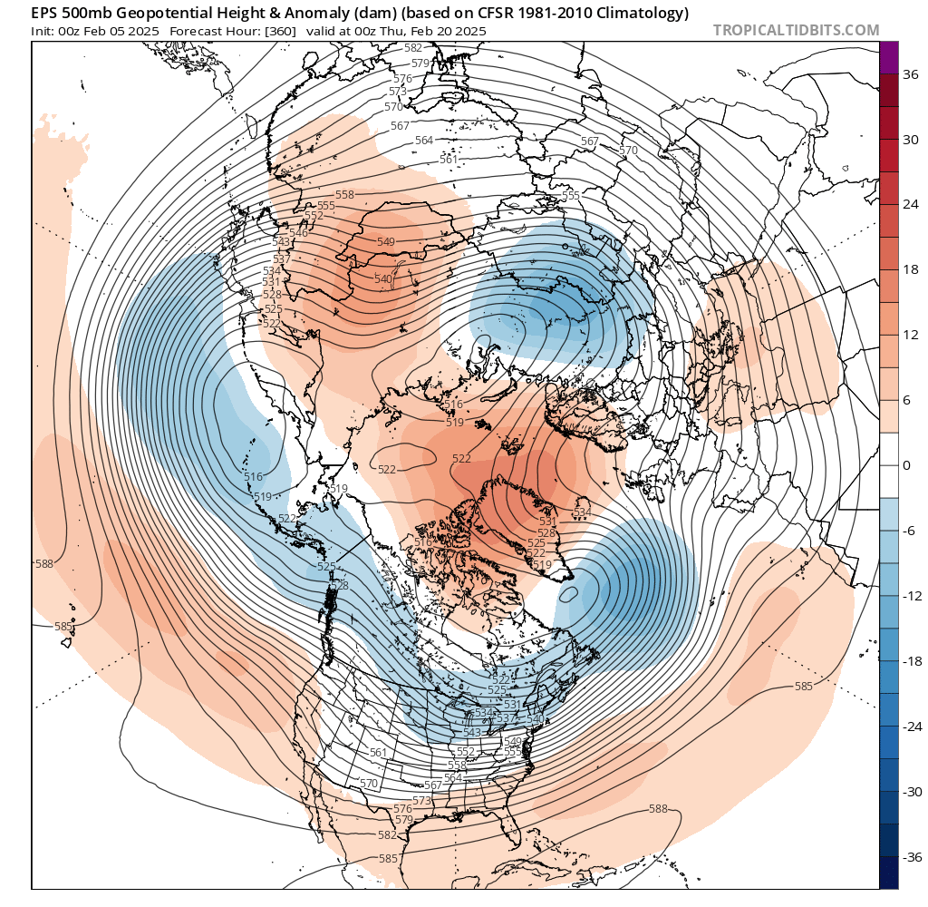
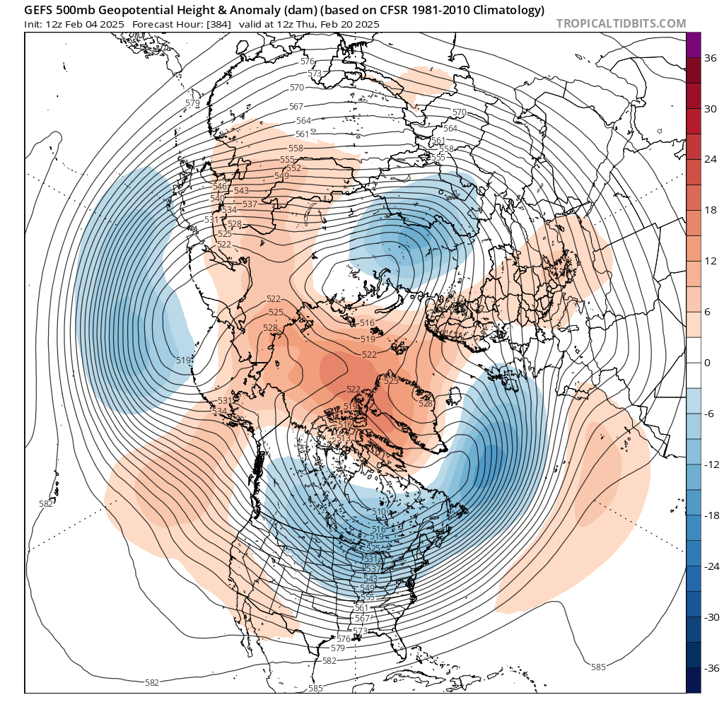
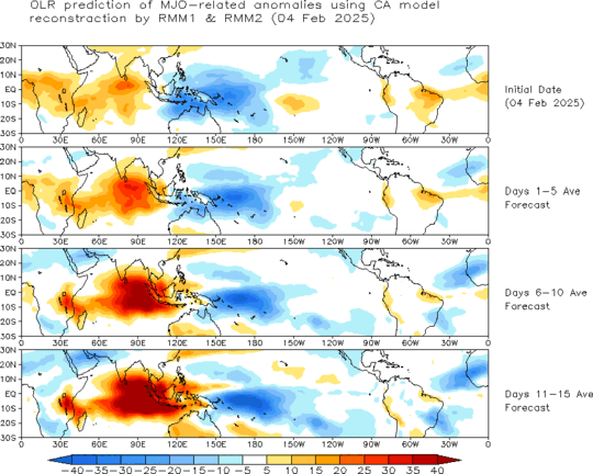
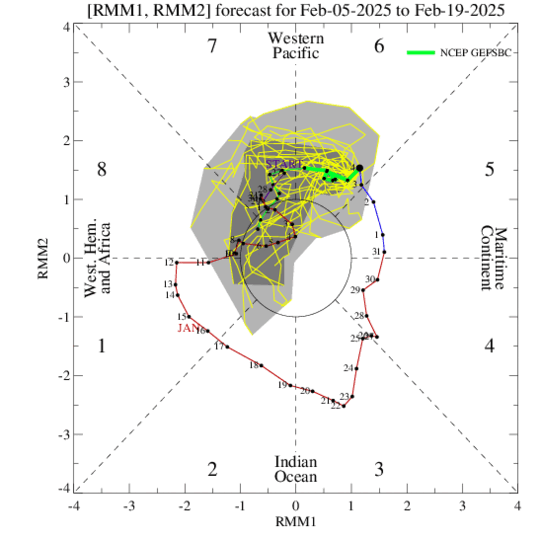
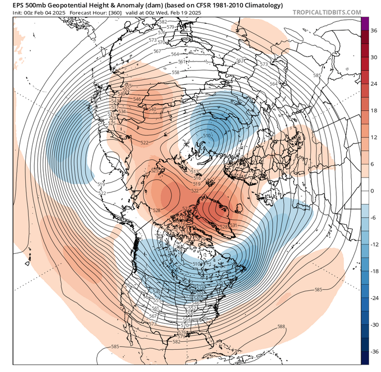
Interesting when you play the frames the EPO pinches off and heads toward the Scandinavian ridge which collides into the AO region. In any event Southeast ridge is muted from the block although the air will not be all that cold. That said average temps are plenty for February. Mjo should be heading through 8 at this juncture.

-
Drought buster.
-
Given the guidance so far I believe the map that the NWS published makes the most sense.
-
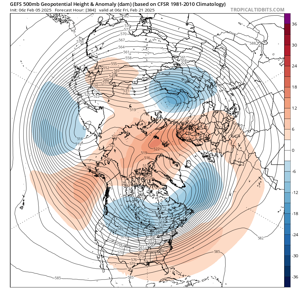
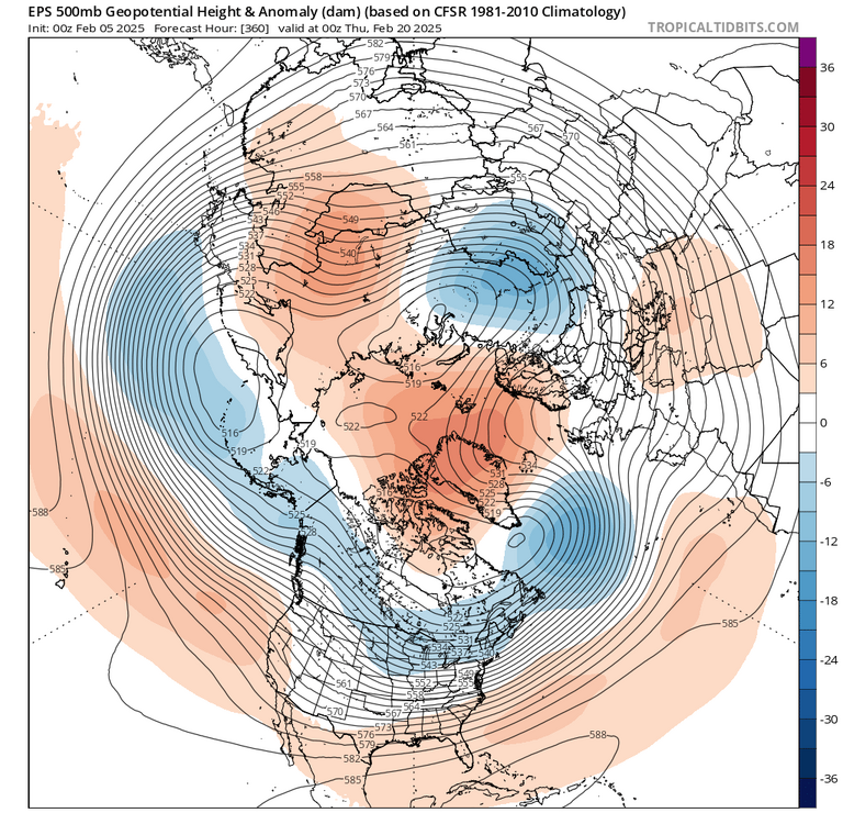
Showing the gefs which is now starting to reflect the mjo passage in the longer range. Key differences to the eps from a negative perspective is the presence of an actual Southeast ridge, however, where are the EPS loses the negative EPO, the gefs keeps a semblance of it therefore there would be colder air nearby.
-
You will do much better of course with SWFEs and pure Miller A's. What you'll do worse on our low pressures due south where there tends to be a dry slot in Central and Eastern Connecticut. Long Island never seems to get into the dry slot possibly due to the Long Island sound. In March of 2018 we're supposed to get one to two feet and ended up with one to three inches due to cold dry air draining down the Connecticut River valley.
-
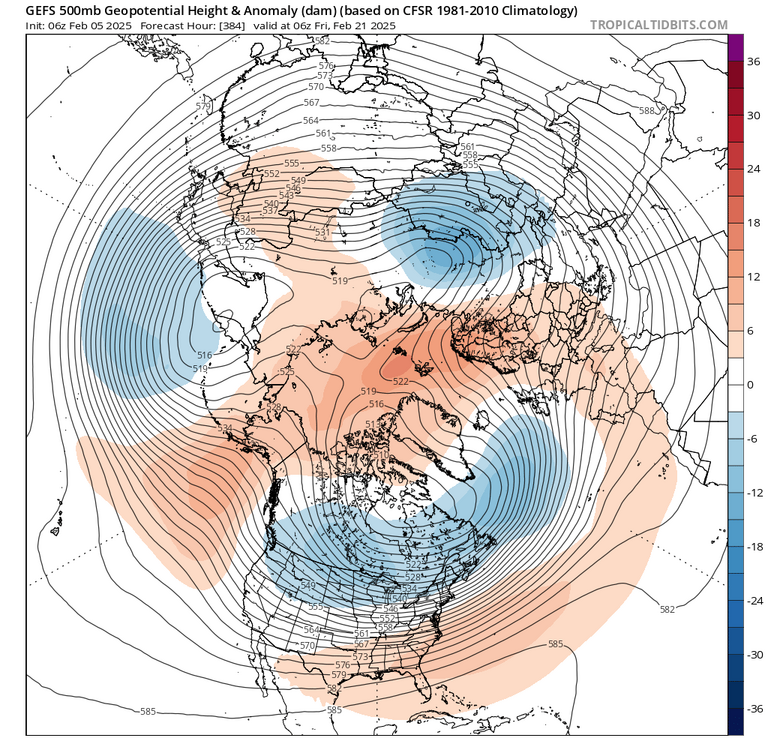
The wave has finally amplified per below. We remain on track for phase 8 for late February.
-
Looking further out as the block decays we could have additional snowfall as this look is not overly suppressive (a bit of a WAR). Yes with the EPO as presented the temperatures will not be that cold, however plenty cold enough for late February (this has a look of average temps). Again average temps with precipitation due to the war is a good look for late February.
-
RGEM pretty much held from 12z
-
I will be honest neither one of those frames look good for our area for snowfall. The old one had more of a spread while the newer run looks more realistic and probably from a storm amping out west. What we ended up doing was trading a deeper RNA for stronger blocking.
-
Blocking Did strengthen even though the trough is a little deeper out in the West. After this time frame is when the trough migrates East. That ridge may be due to an amped up Storm cutting which has been on the models.
-
-
I will be honest, I'm not sure I understand why the look going past President's Day is not a better than average look for snowfall. The blocking remains, therefore pure cutters should be limited. Is the problem that the block is too far north? If anything it seems we are following the same pattern as the last passage through eight one and two, where we had a large snow storm at the start of The blocking period which favored the Mid-Atlantic, which the GFS is currently showing, followed by a wave providing a light to moderate snowfall with a GFS is showing, followed by a trough in the east which the ensembles are showing. Therefore I would believe past President's Day, obviously not forever but for a week or two, should be at the very least colder than average with the main risk being suppression just like the last passage through eight one and two.
-
I see what you're saying as the operationals are ensemble member in and of themselves. That being said isn't the normal progression of blocking from the nao region Westward to the AO region and finally to the EPO region? It seems that the Middle Atlantic form is pretty certain that the EPO will only be positive for a short time before returning negative which would align with the migration of The blocking.
-
It seems as though there are two distinct periods for possible snow events, or time frames that are conducive to snow. The first is now through the large storm next week. Then we have a brief Southeast ridge, followed by a much colder time frame reference below. Hopefully we can cash on both
-
Wow.
-
I believe this may be what forky was referring to when he was not a fan of the compressed flow.