EastonSN+
-
Posts
7,917 -
Joined
-
Last visited
Content Type
Profiles
Blogs
Forums
American Weather
Media Demo
Store
Gallery
Everything posted by EastonSN+
-
I like to multi task
-
 Basically tonight's event is for the northern half of this forum and Tuesdays will likely be for the southern half of this forum. Hopefully there's not a dead zone between.
 -
Different thread. Walt is talking about the next two events next week which are both before the favorable time period that Blue Wave and Brooklyn WX were talking about, remember these events are before the block gets established. At that point the risk will be suppression not change over. That said I would still monitor Tuesday especially the southern half of this forum. The later storm looks like a pure cutter.
-
NYC could have some vast difference between Staten Island and Bronx.
-
12z CMC basically the same. A smidge north but increased CPK from 1.7 to 1.9 via Kutchera.
-
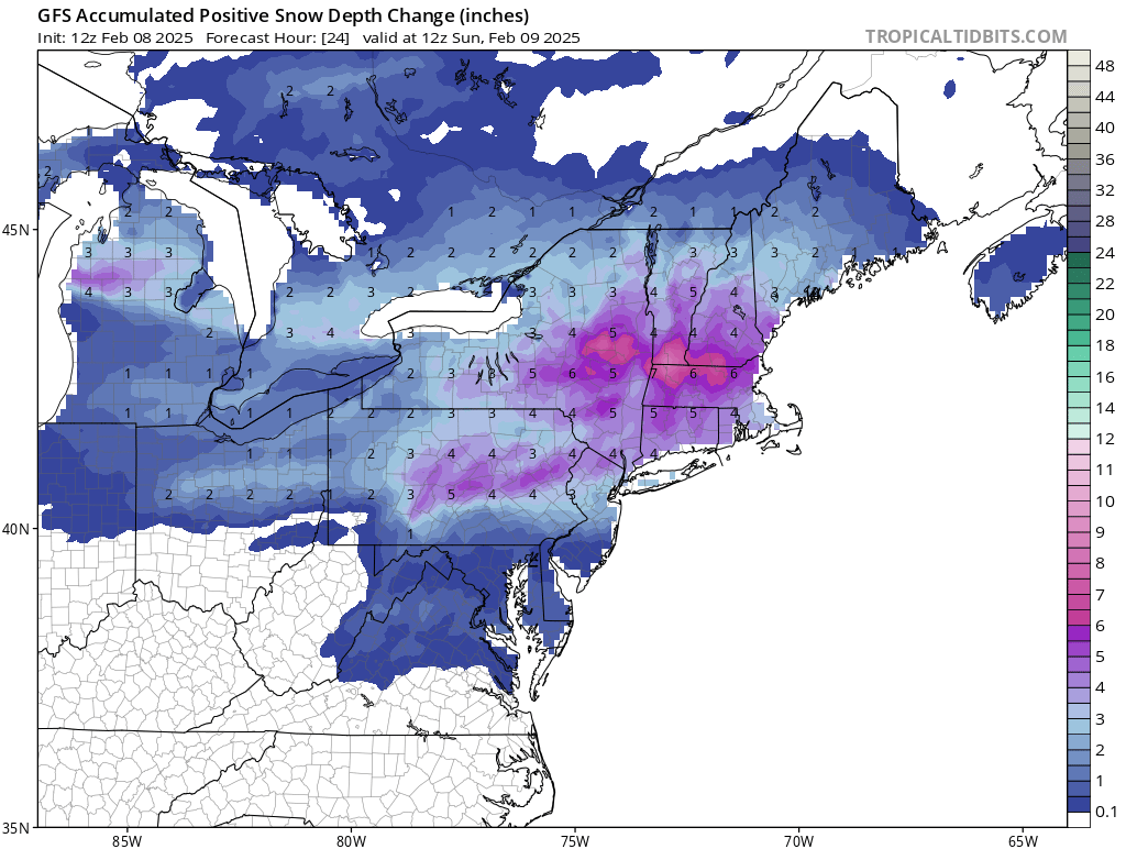
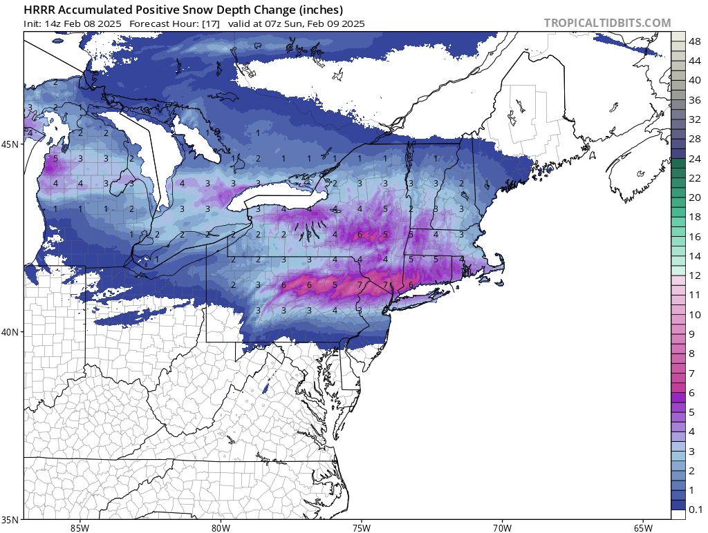
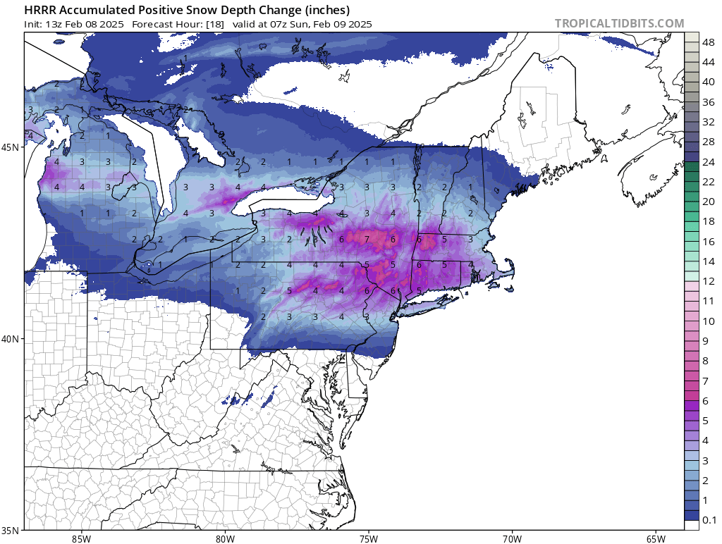
So far the RGEM, HRRR and GFS are in that 3 to 5 for Central Park and inline with NWS.
-
The difference between the more snowy models and the nams is not the rain snow line or the changeover line, but the actual thump. The nams do not have the initial thump and are dry before the changeover. Was there a 6z euro?
-
So far given the least snowy nams and the more snowy Canadians, the href is really in the middle. I think Don's assessment is the most logical.
-
Nemo was my second favorite storm of all time only second to the Blizzard of '96 which gave my town at that time, 27 inches Norwalk Connecticut. Nemo gave my talent of Norwalk 22 inches. It was an amazing storm with multiple components the first one was heavy wet snow and the rain snow line made it all the way to the Costa Connecticut then crashed back. Then lighter snows. Got to an actual dry slot at 10 inches. Then The heavy band moved in and in the end ended up with 22.
-
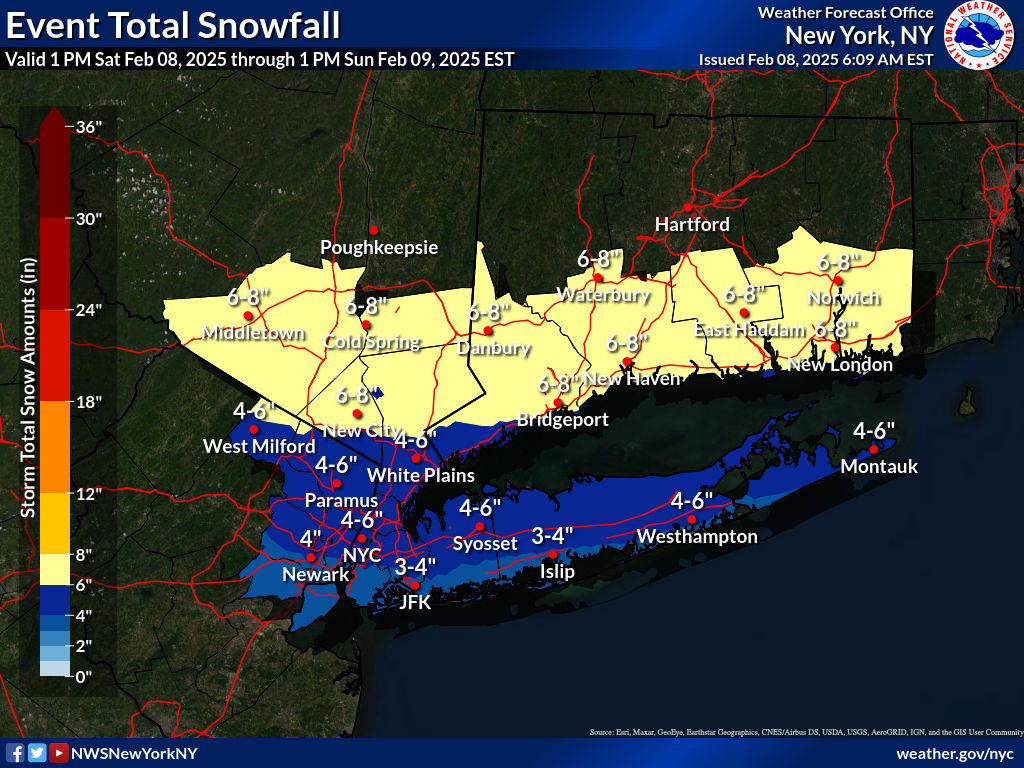
Thanks Don this is the national weather service and weather channel snow forecast almost identically. Suspect if this cuts back we'll see the aforementioned services cut back as well
-
Very strange just watched The weather channel and they doubled down on New York City getting 5 inches. They must be going off to href that Don posted. Not surprised that they are not deviating from the national weather service though. They have 80% of Long Island 6 Plus.
-
The worst power about the whole thing was the local forecasts and the national weather service stuck to their guns up until early in the morning even though the euro was the last and only to fall because the nam fell earlier.
-
Ouch That was the most depressing heavy snow event in my lifetime. Felt bad after getting seven inches of snow LOL.
-
I disagree with that post that was provided. The whole point of having these tools at our disposal are to have an idea of what type of pattern is coming up. It is a fact that it is a better than average pattern to get snowfall. What is the point of developing this technology if all we're going to do is say oh darn it didn't snow I'm never looking at the future again and see a good pattern and think it's going to snow. End users should know better than to think that a better than average pattern is going to guarantee a great outcome, same as looking at a pattern that's going to give us 70° weather is definitely not going to give us snow same as February 2018. Our alternative would be to stop developing the technology and stop utilizing the long range forecasting. That is taking a step back in progress. As a hobbyist I want to share the excitement of a good period that is coming up. If it doesn't pan out and we get nothing or close to nothing I'm not going to stop looking at the long range forecast and say hope it's never going to work again. Never understood why posters want to post their feelings instead of posting perhaps a counter to the h5 look with additional material to explain why it won't work out other than it hasn't so far so why should it in the future.
-
Normally I wouldn't post maps like that that far in advance however just wanted to show the models perhaps are picking up on the blocking that is setting up in that time frame
-
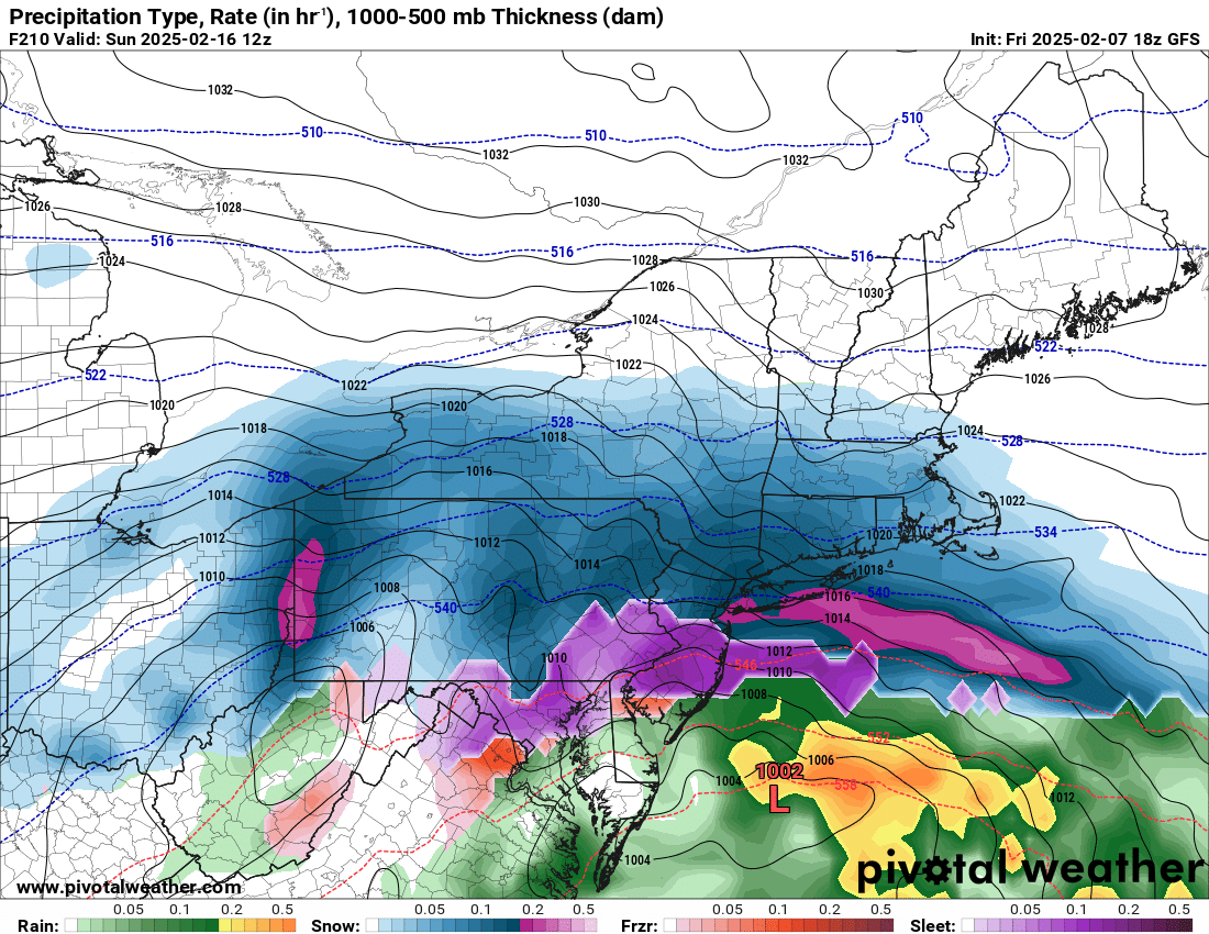
It will change 100 times and change dates too if it occurs but here is as far north as the mix gets. That dark red south of Long Island is extremely heavy snow.