beanskip
-
Posts
2,055 -
Joined
-
Last visited
Content Type
Profiles
Blogs
Forums
American Weather
Media Demo
Store
Gallery
Everything posted by beanskip
-
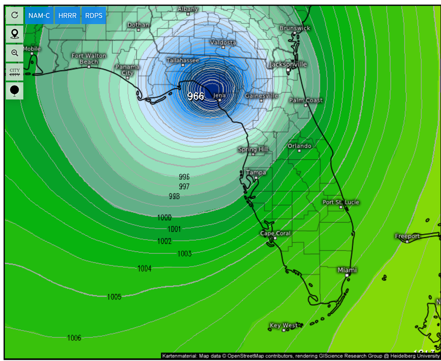
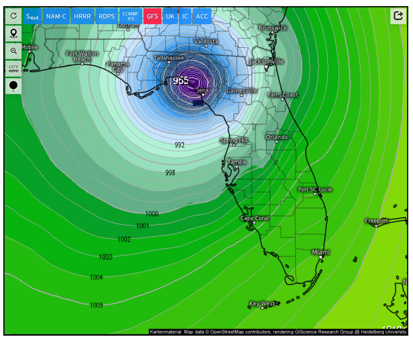
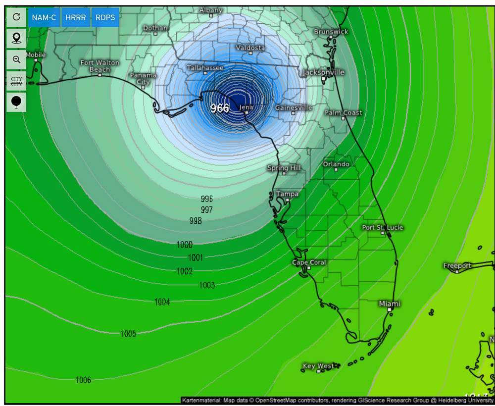
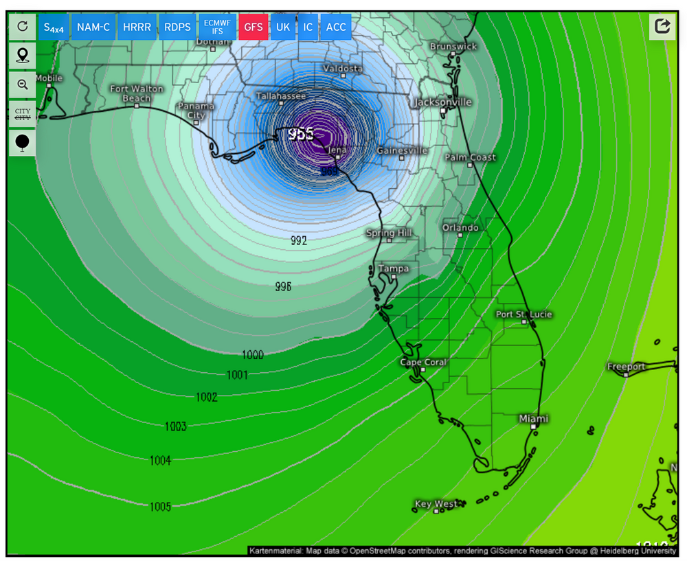
0z UKMET had the storm at 993 mb at 10 am. What's 53 mb among friends?
-
This is a good point -- have heard a lot of people pooh pooh an other-than-Tampa landfall, but Sarasota, Bradenton, Venice, Englewood, Ft. Myers, etc have plenty of population.
-
No kidding -- at 11 am Thursday on the 12z run the storm was well out into the Atlantic. I remember storms with wide envelopes of track, but not sure I remember one with such disparity on the timing of landfall.
-
Verbatim 12z Euro literally takes the eye right up the mouth of Tampa Bay into Hillsborough Bay and the Tampa docks. Will never happen (gulp) but quite a breathtaking track.
-
Hurricane models really showing this pre-landfall weakening -- 12z HAFS-B show about 60 mb of weakening in the last 20 hours before landfall.
-
2024 Atlantic Hurricane Season
beanskip replied to Stormchaserchuck1's topic in Tropical Headquarters
Yeah, almost Cat 2 by landfall near Tampa. No bueno given the surge they just had. -
2024 Atlantic Hurricane Season
beanskip replied to Stormchaserchuck1's topic in Tropical Headquarters
Classic example of diminished media (and weather board?) interest because of a lack of crazy wind/mb model runs, but practical impact is off the charts with these potential rain totals. -
2024 Atlantic Hurricane Season
beanskip replied to Stormchaserchuck1's topic in Tropical Headquarters
Hope everybody doesn't ignore the potential Gulf low because of its dwindling chances to become a hurricane. Because the models just show it parking in the gulf, the QPF maps are insane. 12z GFS through hour 234 shows over a foot of rain for almost the entire peninsula from I-4 south. 0z CMC had 20 inches confined to southern part, but now shows the 20-inch blob staying offshore. Anyway, it could all be overdone, but doesn't seem so crazy given that pretty much every models keeps low pressure wandering around in the Gulf for 10 days with a front draped over the peninsula. -
So given that Helene is now east of 84N, is this less-than-a-day-old run considered good verification? Is asking why the NHC deferred so strongly away from the globals and toward the spaghetti models still a dumb question?
-
A LOT. The NHC ignored the global models ... then, for the last 24 hours, the hurricane models and went with spaghetti plots in the face of pretty good agreement from all the other models on planet earth.
-
Yeah so Tallahassee went from "the black line is right over my head" to OUT OF THE CONE! Yeah, yeah, yeah, impacts will be still be great, but can we please have a post-storm discussion about wtf happened here?
-
Well, upon further review, doing the math comparing 2 p.m. and 4 p.m. NHC statements, it moved .9 degrees north and .3 east. If that continued, it would cross 84W before landfall, which would be consistent with those 18z plots.
-
I agree -- not making enough eastward progress at the moment.
-
Allan -- who is a fantastic met -- used a great visual to make the point that has been made here over the last 2 days. https://x.com/RaleighWx/status/1839374056753451138
-
I sure hope not - that's not how forecasting is supposed to work.
-
Needless to say, game-changing development for Tallahassee.
-
Oh yeah, the surge story has been written. Can't change it now. But wind damage -- still some wiggle room depending on track.
-
Totally agree- - 25-50 miles of eastery trend would make a massive difference for TLH.
-
So the latest IR frame appears to put the eye at 84.9W 24.8 N. Is that actually the eye? I ask because if you plot that on the 11 a.m. NHC track, it's already almost out of the cone to the right.
-
No actually, that's not right - I am a little peeved. This board used to be a place where a met wouldn't mock you for asking questions and trying learn. I want to understand the apparent disconnect between the spaghetti plots and operational runs - not just that there IS a difference but WHY? I want to learn and understand why the operational Euro -- the KING -- is outside the NHC cone 18 hours from landfall. I've been on this board for more than a decade. I think i've earned some respect and some continuing education. Instead -- "get out of here." So yeah, if my stuff is going to be ridiculed, you better get the trends right or I'm going to call it out.
-
Not mad at all. Seems like if we are going to say a model run trended a certain direction or speed it ought to be right.
-
Nope, this isn't right either for GFS -- it's slightly southEAST. Landfall at exact same time, just to the right.
-
6z GFS:
-
Shifted northwest ... from what? Oz GFS:
-
Latest fix of the center from recon: 2504N 08537W That's on the right side of the 8am NHC track.