

Ravens94
-
Posts
1,674 -
Joined
-
Last visited
Content Type
Profiles
Blogs
Forums
American Weather
Media Demo
Store
Gallery
Everything posted by Ravens94
-
No shocker but the RGEM is north some. Still way off but the icon is good
-
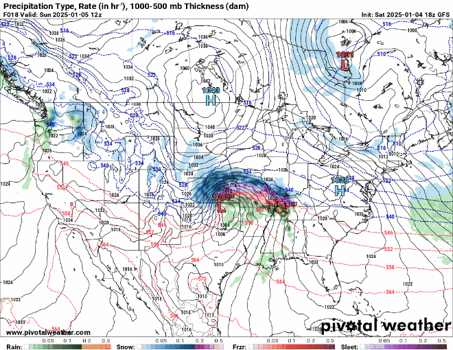
FV3
-
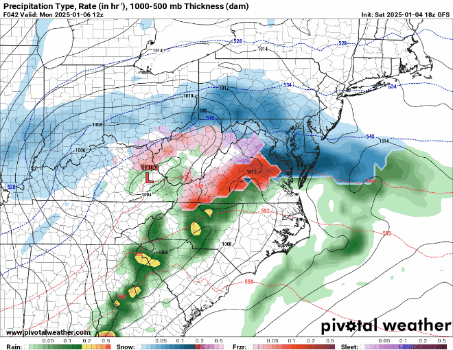
FV3 sets up a nice band along the Mason Dixon Monday
-
Damn there is a ton of lightning out west
-
-
RAP
-
Little less but trying to narrow down these bands is going to be impossible. Still dumps 9-10 here I'll take it and run vs the Euro showing 2 yesterday
-
Current radar
-
Going to be a great run area wide Pre coastal
.thumb.png.1d409367aa7db28fb86438187d6bd3ea.png)
-
-
RAP
.thumb.png.2417dd4da3ef961165052376fc9997a4.png)
-
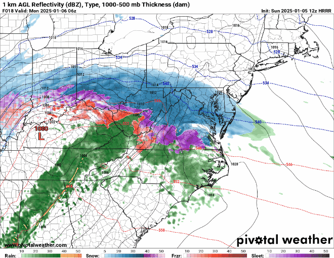
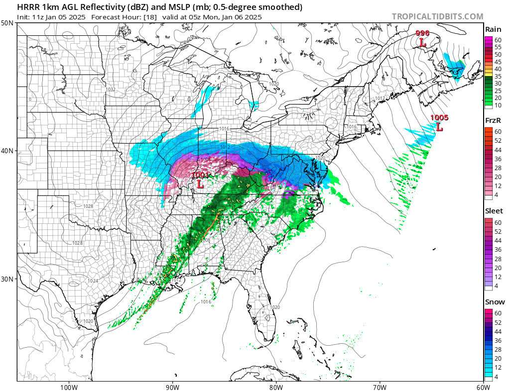
HRRR looks good

-
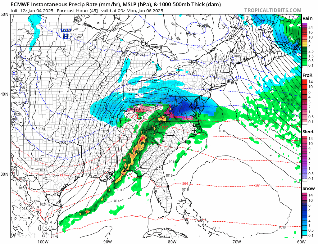
Euro trending north the last 3 runs in a row shocker.

-
Omg.. just getting better and better
-
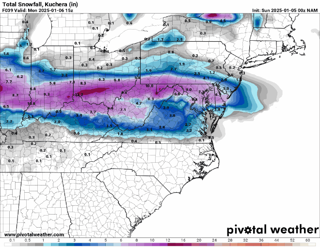
Damn georgetown bullseye Nice back end love too
.thumb.png.31212db895a8291372958ca055f357d5.png)
.thumb.png.fdf26237eaa79e97e75f39f15fbff5f6.png)
-
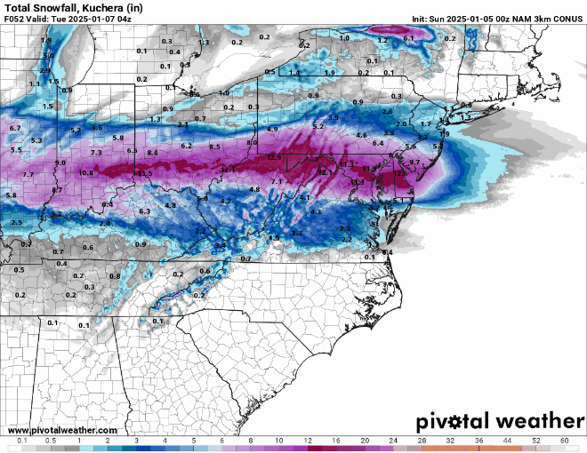
Nam is wetter still snow to go
-
.thumb.png.6388a60c1e39300e36b2fa54b97d82a7.png)
.thumb.png.5af2429d208cb54e4df96def689bb5bf.png)
-
Nice to see the euro caving to the Americans. We been here before where it's consistently wrong till the bell. NAM is Juicy looking
-
At this rate 12z. I find it hard to believe these high res models are going to all fail and they been locked up for days
-
1050 PM EST Sat Jan 4 2025 MDZ003>006-008-011-505>508-051200- /O.CON.KLWX.WS.A.0002.250106T0300Z-250107T0600Z/ Washington-Frederick MD-Carroll-Northern Baltimore-Cecil-Southern Baltimore-Northwest Howard-Central and Southeast Howard-Northwest Harford-Southeast Harford- 1050 PM EST Sat Jan 4 2025 ...WINTER STORM WATCH REMAINS IN EFFECT FROM SUNDAY EVENING THROUGH LATE MONDAY NIGHT... * WHAT...Heavy snow possible. Total snow and sleet accumulations of 5 inches or greater and ice accumulations up to one tenth of an inch possible. A localized band with up to 10 inches of snow is possible if heavy banding sets up this far north.
-
-
More push on the NW side
-
.thumb.png.6b1eb774b5176b2a9ec44e231bd286f9.png)
-
WRF is also a beaut some model changes gotta happen tonight. Real time data out west should get into these runs and fix the spread.
-
Fv3 bam
.thumb.png.632817bd5137935dfcff6f4a1df8bee5.png)

.png.00b7b2ef638ce16badb12dc8396aa028.png)


.png.561c3bae3a2f17ecf2305535e1fcc9ca.png)

.png.d5265c03fab68ec021d3c836f27c175f.png)
.png.ec5a2e8137876cc5801c7b641a76faba.png)
.png.a58761115d3435c346559d3c370b86ae.png)
.png.c46f499ed6baaa1c8c9a38312a59bdbc.png)

.png.8a6bb8f60ed8c16c7b14afe065e00f17.png)

.png.c50eacafd63426c4bb59d211df23c64a.png)
