qg_omega
-
Posts
3,797 -
Joined
-
Last visited
Content Type
Profiles
Blogs
Forums
American Weather
Media Demo
Store
Gallery
Everything posted by qg_omega
-
January ended when Prismshine started this thread. No brainier
-
The pattern is horrific, one of the worst ones we have experienced in years. Give me back last winter all day
-
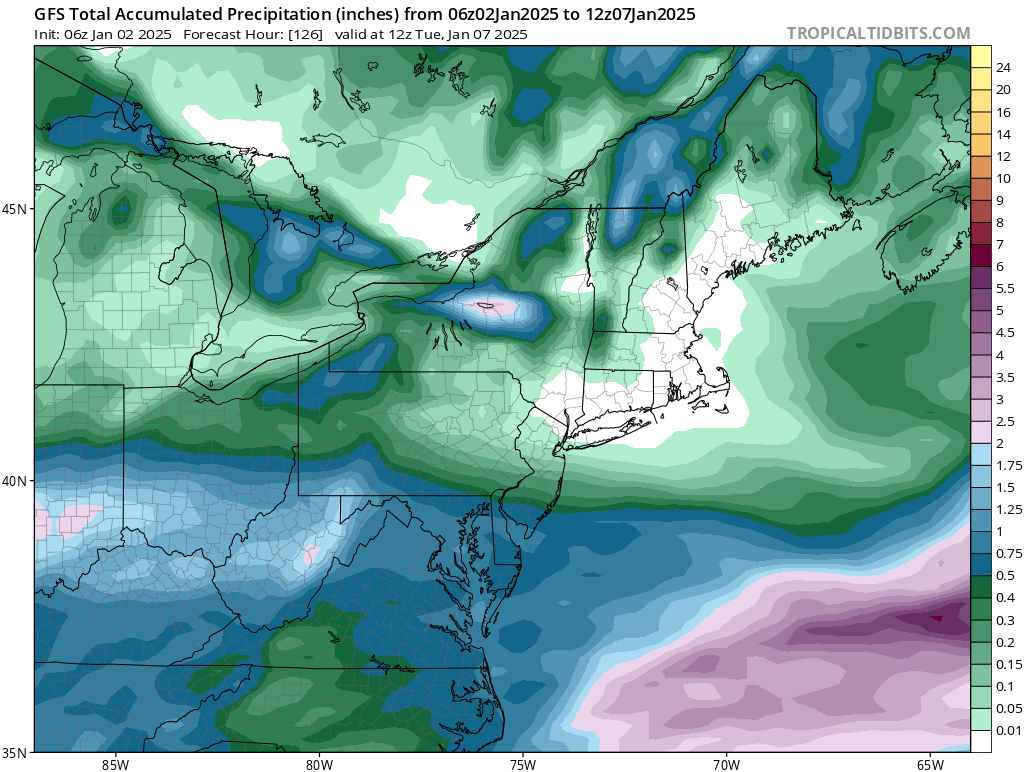
Snowfall NYC subforum Jan 6 and OBS if needed
qg_omega replied to wdrag's topic in New York City Metro
bannable -
Snowfall NYC subforum Jan 6 and OBS if needed
qg_omega replied to wdrag's topic in New York City Metro
It’s the same people living in H5 at 300 hours -
Snowfall NYC subforum Jan 6 and OBS if needed
qg_omega replied to wdrag's topic in New York City Metro
Yup, SE. -
Snowfall NYC subforum Jan 6 and OBS if needed
qg_omega replied to wdrag's topic in New York City Metro
Epic H5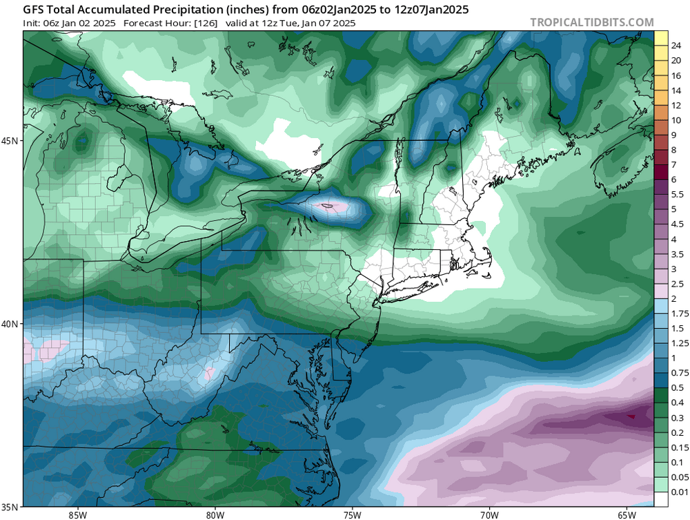
-
Looks like normal to slightly below
-
December 2024 - Best look to an early December pattern in many a year!
qg_omega replied to FXWX's topic in New England
What a cold December -
Never seen such a quiet stretch of weather modeled, we can go 0.00 QPF for weeks in the heart of winter
-
850s never come close to -20, there is nothing bone chilling about the upcoming "polar vortex"
-
I’ll take SWFE all day vs what we have coming up, at least we can snow before the rain. Upcoming pattern is straight torture
-
Congrats Mexico
-
I’ll take an +NAO +PNA and -EPO. We have a cutter pattern with record warmth transitioning to a shredder pattern with below normal but far from record cold. Just nothing to look forward to for weeks on end during the heart of winter
-
Have a cutter tomorrow
-
Ok
-
They really missed the snowfall....
-
posting 384 OP snow maps use to result in a ban.....in the old days
-
XMAS week special
-
The southeast deserves it, congrats to DT
-
NYC is 70 degrees?
-
Most likely honestly
-
Would be epic LES and Upslope for the mountains
-
Can’t snow without the cold, just need the main trough axis a bit more west which is still very possible
-
Big change from last year which is enabling lows to actually be normal to below normal for a change
-
Looks like a cutter pattern on the ensembles