

qg_omega
-
Posts
3,133 -
Joined
-
Last visited
Content Type
Profiles
Blogs
Forums
American Weather
Media Demo
Store
Gallery
Posts posted by qg_omega
-
-
16 minutes ago, 40/70 Benchmark said:
I had +1 to +3 this month, so 1.9 would work.
Yup, I’ll take the over on +3 despite the next week of weather. Torch will trend very impressive to end the month, warmest of the month despite temps over 60 today
-
 1
1
-
 1
1
-
-
Biggest mistakes a forecaster can make is observing what is actually happening and thinking A + B doesn’t equal C
https://x.com/jhomenuk/status/1733920472092356620?s=46&t=m4Eqkekadb-JCXTm7k-Txg
-
Storm is a full bag of meh as expected
-
6 minutes ago, Typhoon Tip said:
Unfortunately ( well ... not for you
") but for the winter enthusiasts), the numerical teleconnection spread shuts down cold loading into North America, ~ after the 20th. This is also in conflict with the erstwhile consensus for wintry turn at the end of the month, interestingly.
but for the winter enthusiasts), the numerical teleconnection spread shuts down cold loading into North America, ~ after the 20th. This is also in conflict with the erstwhile consensus for wintry turn at the end of the month, interestingly.
I've been keeping track ...about 3 or 4 days ago, the WPO projection flipped sign. As of last night, all the way up to +2SD. And then out around the 20th or so, the EPO goes positive mode. There is a lag correlation between the two, where preferentially ... the EPO will eventually modulate toward where the sign of the WPO - given time. So the EPO rising isn't a surprise considering -
So, that giant Chinook generator pattern is not a terrible fit for the strengthening +WPO/+EPO ... state that would (also) be in conflict for the consensus idea that things would turn inimically better during the end of the month.
None of this hugely confident. Even relative to climo/modeling climo that is so. We've been observing wholesale hemispheric modulations that are unusual - considering the mass of the whole thing? Definitely either a artifact of modeling (somehow) or something weird is happening... where pattern simulacrums that no sooner, blow up and become something else entirely about ever 3 days. So I'm not completely sold that the above Pacific scaffolding is going to become history.
I’m a huge winter enthusiast, if their were encouraging sings for winter I’ll post them. Unfortunately their are no signs of winter for most of the country, north east included for the next month
-
2
-
-
On 12/8/2023 at 9:04 PM, brooklynwx99 said:
pattern changes up after Christmas, most likely
-
 2
2
-
 1
1
-
-
51 minutes ago, bluewave said:
That Pacific Trough will be off the charts for the 2nd half of December.
Increasing signs of a torch Xmas to New Years
-
2
-
-
-
1 hour ago, jm1220 said:
For us (maybe not E Suffolk) it looks like it's becoming more of a heavy rain vs wind threat. The front and developing low are trending east which means the resulting wind east of the front doesn't get going until later and after the front is past. But the rain is still very much a threat and there could be training heavy rain for a while as the low gets going. And the developing low could keep precip going well behind the front which means snow mixes in NW and especially in the higher elevations. Just about at our latitude a 700mb low closes off on the NAM/GFS which will help precip persist behind the low.
Winds look only for SNE, NAM is tame until it gets to the forks to SNE, whole system has shifted, slightly better chance of a flip to snow but will see
-
33 minutes ago, jm1220 said:
I still have the access!
")
However I haven’t checked that site out in forever. Way better free tools out there now. I also obsessed over JB back then, haven’t cared what he’s had to say in the same just about forever.
Golden age of Accu pro and the JB videos, his and the count pointer count show
-
2
-
-
15 minutes ago, RUNNAWAYICEBERG said:
QQtrollmega just quit the board…
We laugh
-
3
-
-
So easy to torch these days vs going below normal, sad times
-
3
-
-
No signs of any pattern change as we head into Jan
-
1
-
-
What a terrible pattern for the rest of the month
-
1
-
-
7 minutes ago, Allsnow said:
This needs to improve before anyone can start talking snow

This
-
5
-
-
32 minutes ago, bluewave said:
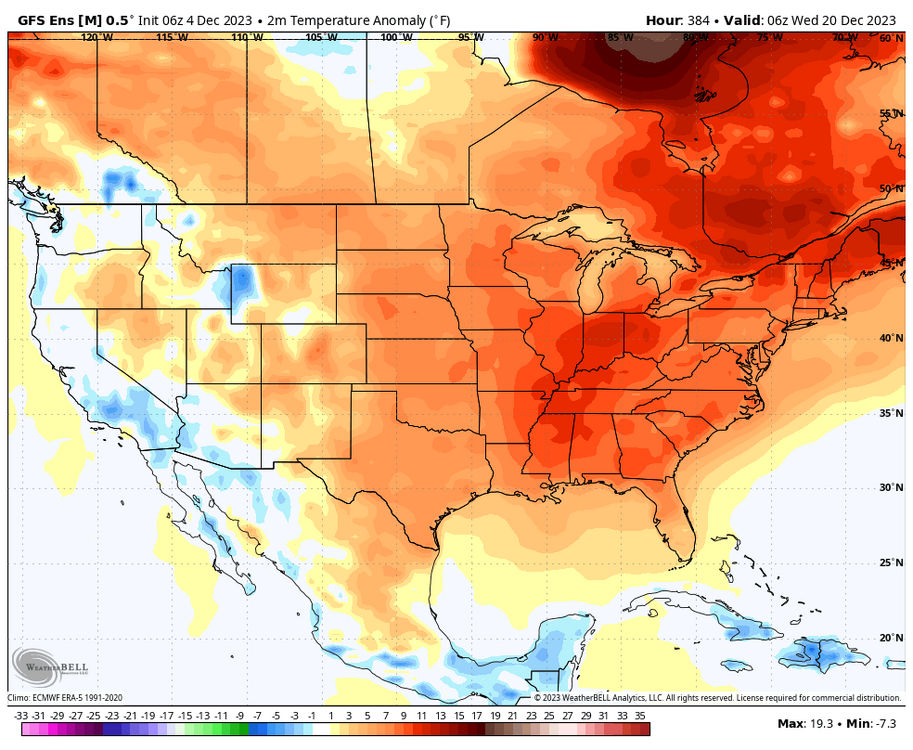
This is going to be a rinse and repeat forecast right up to the Solstice and Christmas. We get a mix of days closer to normal and +5 to +10 days. So the back and forth between normal and days well above normal should keep us in the +2.5 to 5.0 temperature departure range. All the Arctic air will be on the other side of the globe for the foreseeable future.


Really ugly look for us
-
2
-
-
11 minutes ago, bluewave said:
The MJO is slowing in 4-7 and nobody said this month would be +13. So not sure where you are reading from. The bias corrected Euro RMM is matching the GFS and Euro VP anomalies.

Huge change and kudos to you for understanding the impact of the very warm waters in 4 5 6 slowing down the convection
-
1
-
-
57 minutes ago, bluewave said:
What do you consider a torch? To me any December over 40° in NYC is warm.
40s are normal and cold for NYC in December, multiple 50s to 60s have become the new normal and we likely see that this weekend and very likely additional days this month
-
1
-
1
-
-
9 minutes ago, brooklynwx99 said:
there will always be Pacific air in Ninos. they aren't super cold or anything, just stormy
Agreed, but cold and stormy hype pays the bills
https://x.com/bigjoebastardi/status/1730904418617352518?s=46&t=m4Eqkekadb-JCXTm7k-Txg
-
Winter severe season looks to get going this weekend
-
2
-
-
1 minute ago, 40/70 Benchmark said:
What would you like to see in order to feel optimistic about winter prospects?
MJO spending sufficient time outside of the warm phases, not seeing any evidence of that yet. Cold moving to our side of the globe (currently opposite) and an improved PAC. Basically the opposite of what we will have for December
-
2
-
 1
1
-
-
51 minutes ago, dendrite said:
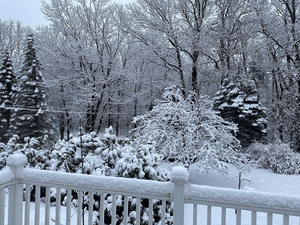
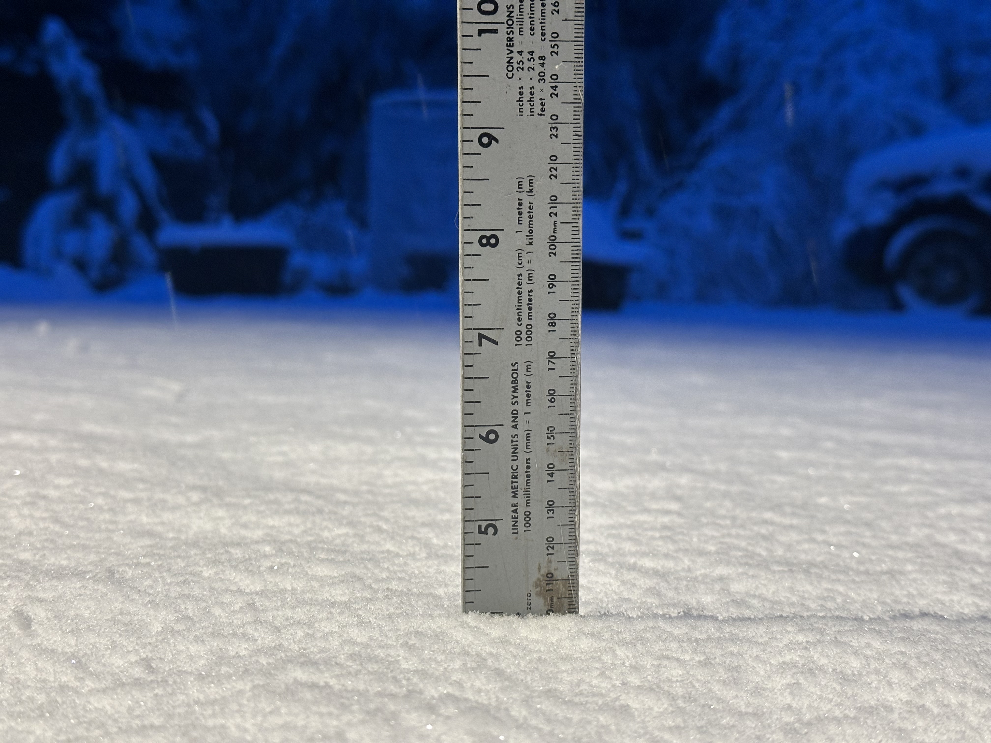
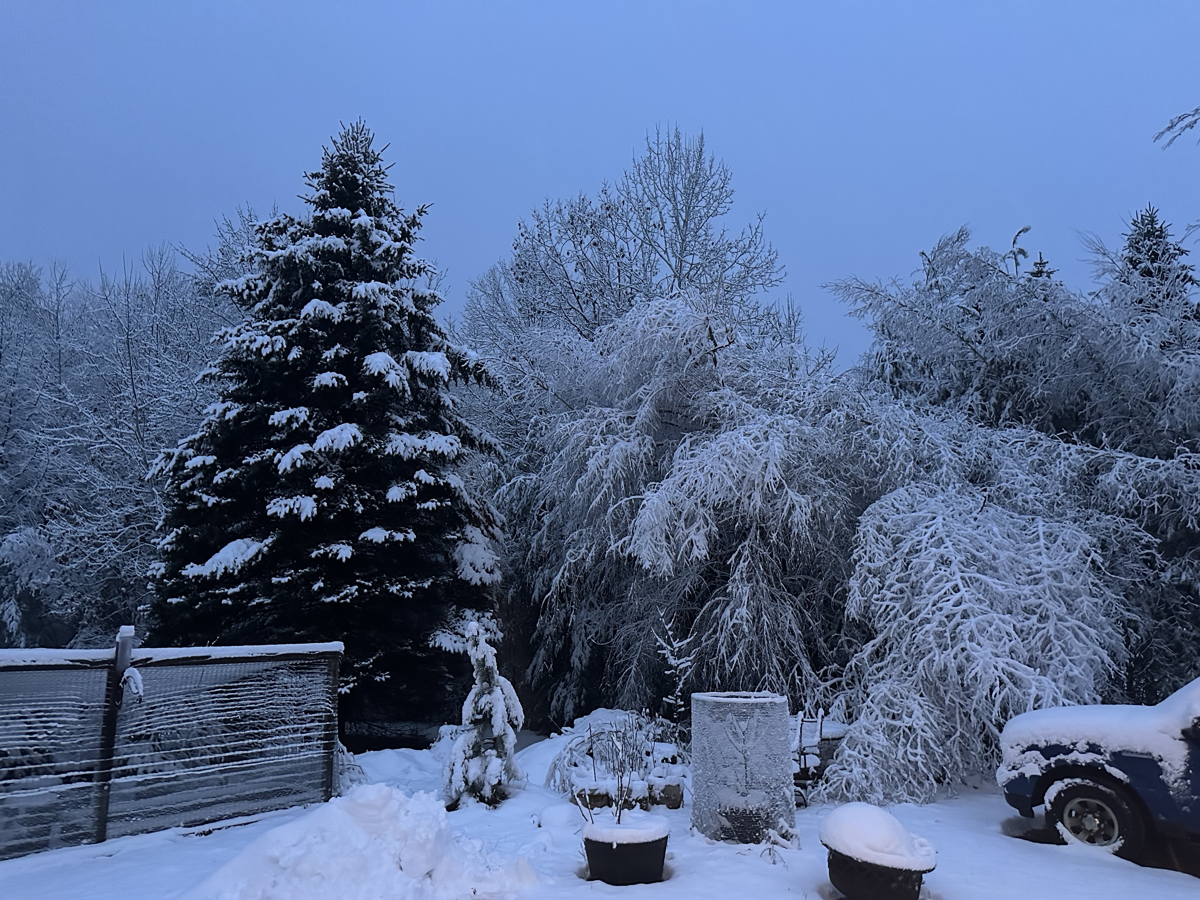
Lost a few birches. Let’s melt it all this weekend.


You scored on the early season “cold” pattern, unfortunately that looks to change now for the next 4 to 6 weeks
-
 2
2
-
-
We winter
-
2
-
1
-
2
-
-
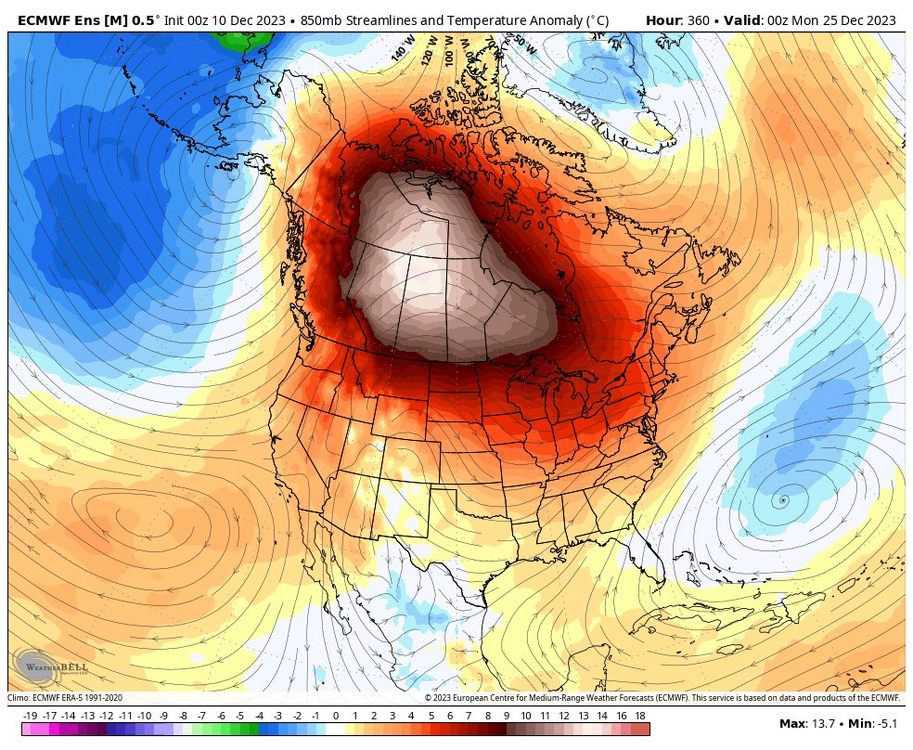
Mid month torch, can call these years out at this point
-
1
-
1
-
-
16 minutes ago, bluewave said:
Those RMMs are chasing convection to the east. The actual VP anomaly charts from Euro and GEFS never get the actual forcing past 4-7 for the next few weeks. But this is to be expected with the record +30C SSTs from near the Dateline to the Maritime Continent. Strong forcing near the Dateline is still in the warmer phase 7.


Spot on, incredible analysis as usual from you
-
2
-
1
-
2
-


December 2023
in New England
Posted
MJO stalling in 7 as predicted by many is a likely cause