frontranger8
-
Posts
370 -
Joined
-
Last visited
About frontranger8

Recent Profile Visitors


-
2026-2027 Super El Nino
frontranger8 replied to Stormchaserchuck1's topic in Weather Forecasting and Discussion
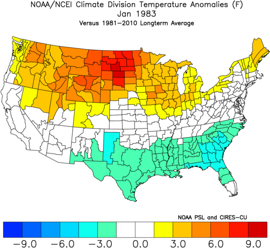
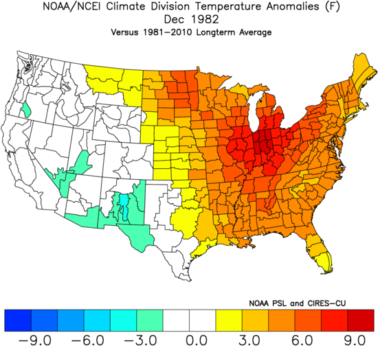
Bigger picture for 1982-83. Interesting how Jan/Feb had nearly identical anomaly patterns.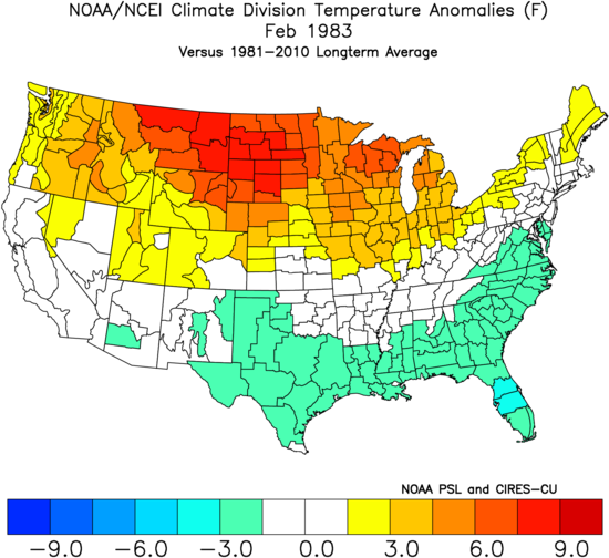
-
Models are insistent that rains return next week with a surge of monsoonal moisture. Really hope so...camping with fire bans sucks.
-
Occasional Thoughts on Climate Change
frontranger8 replied to donsutherland1's topic in Climate Change
Thankfully, it appears some relief is imminent.
-
97 for DEN. Highest temp of the year, fourth time they've touched it.
-
2026-2027 Super El Nino
frontranger8 replied to Stormchaserchuck1's topic in Weather Forecasting and Discussion
The northern tier trough signal was more apparent looking at the past 30 days. Focused in the middle of the country.
-
Feel lucky to only be getting 95 here lol.
-
Looks like the hottest stretch since July 2022 coming up.
-
Occasional Thoughts on Climate Change
frontranger8 replied to donsutherland1's topic in Climate Change
This east coast heat wave was not in the same ballpark as what just occurred in Europe. Historically inaccurate to make a real comparison between the two. -
2026-2027 Super El Nino
frontranger8 replied to Stormchaserchuck1's topic in Weather Forecasting and Discussion
Goofus at 246 hours....here is what latest Euro shows for same time.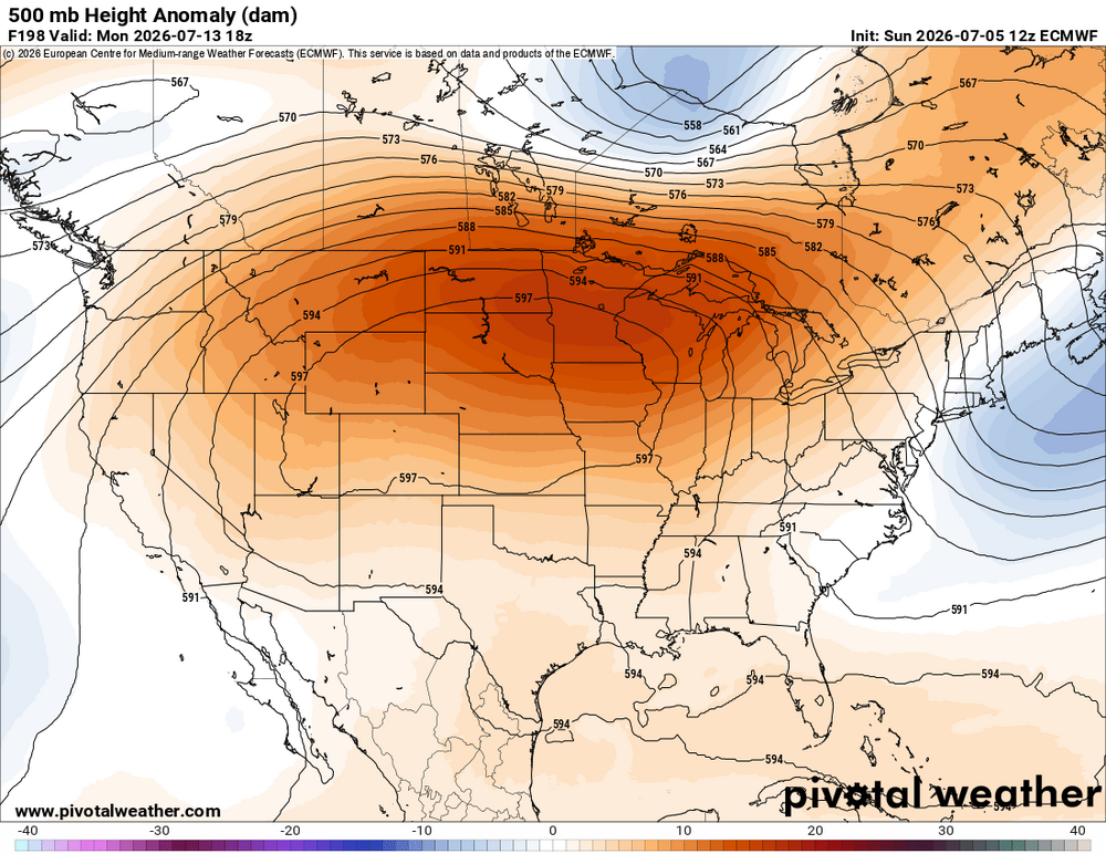
-
2026-2027 Super El Nino
frontranger8 replied to Stormchaserchuck1's topic in Weather Forecasting and Discussion
Have to consider where the cold is and what areas are being melted out. The low hanging fruit that isn't as far north has been melted out over the past few weeks. -
Occasional Thoughts on Climate Change
frontranger8 replied to donsutherland1's topic in Climate Change
I think to me what really stands out is the heat just isn't spread out evenly. And the climates that have seen the most summer warming tended to be fairly similar. -
2026-2027 Super El Nino
frontranger8 replied to Stormchaserchuck1's topic in Weather Forecasting and Discussion
Yeah, strong Ninos almost always deliver at least one 12"+ storm here. Most commonly late Oct-mid Dec and then Mar/Apr. -
2026-2027 Super El Nino
frontranger8 replied to Stormchaserchuck1's topic in Weather Forecasting and Discussion
That's definitely true here in CO. Many of our biggest storms have been early/late in El Nino winters. -
Occasional Thoughts on Climate Change
frontranger8 replied to donsutherland1's topic in Climate Change
Breathing fire, eh? Extreme, unprecedented hyperbole warning! -
Another .3" here on Thursday.