NEOH
-
Posts
3,274 -
Joined
-
Last visited
Content Type
Profiles
Blogs
Forums
American Weather
Media Demo
Store
Gallery
Everything posted by NEOH
-
Interesting 12z Euro run with a 1040 HP pressing in from the NW. Not certain I can see a low moving NW and bullying that out of the way.
-
That's normally a great spot for LES. The snow was definitely localized... it snowed quite heavily under the heavier cells. We have a great snow pack out there for a change. Hopefully it can survive next weeks warm up and rain. Maybe we will see a few changes in the models over the coming days.
-
That’s weird. Where in Chesterland do you live? Some of the heavier snow showers were localized but they must have moved through chesterland before moving south down this way. I’m in the far eastern part of south Russell near the Newbury border
-
Picked up a quick inch of snow between 5am and 6am. Should get a good view of the ice cover on the lake today.
-
Snow globe in Chagrin right now. Best snow of the day so far.
-
Definitely faster than modeled. Looks like the last batch is forming out west and moving east. Almost a convective nature to the snow right now. It dumps large flakes under some of these returns.
-
Back and forth from light to moderate snow but the heavier returns are moving in. Just over an inch so far. This snow seems much more dense than yesterday. Wonder if the snow will last until the evening as the back edge looks to be in western ohio.
-
Snow has started in Chagrin. Smaller flake size but snowing well under the lighter returns.
-
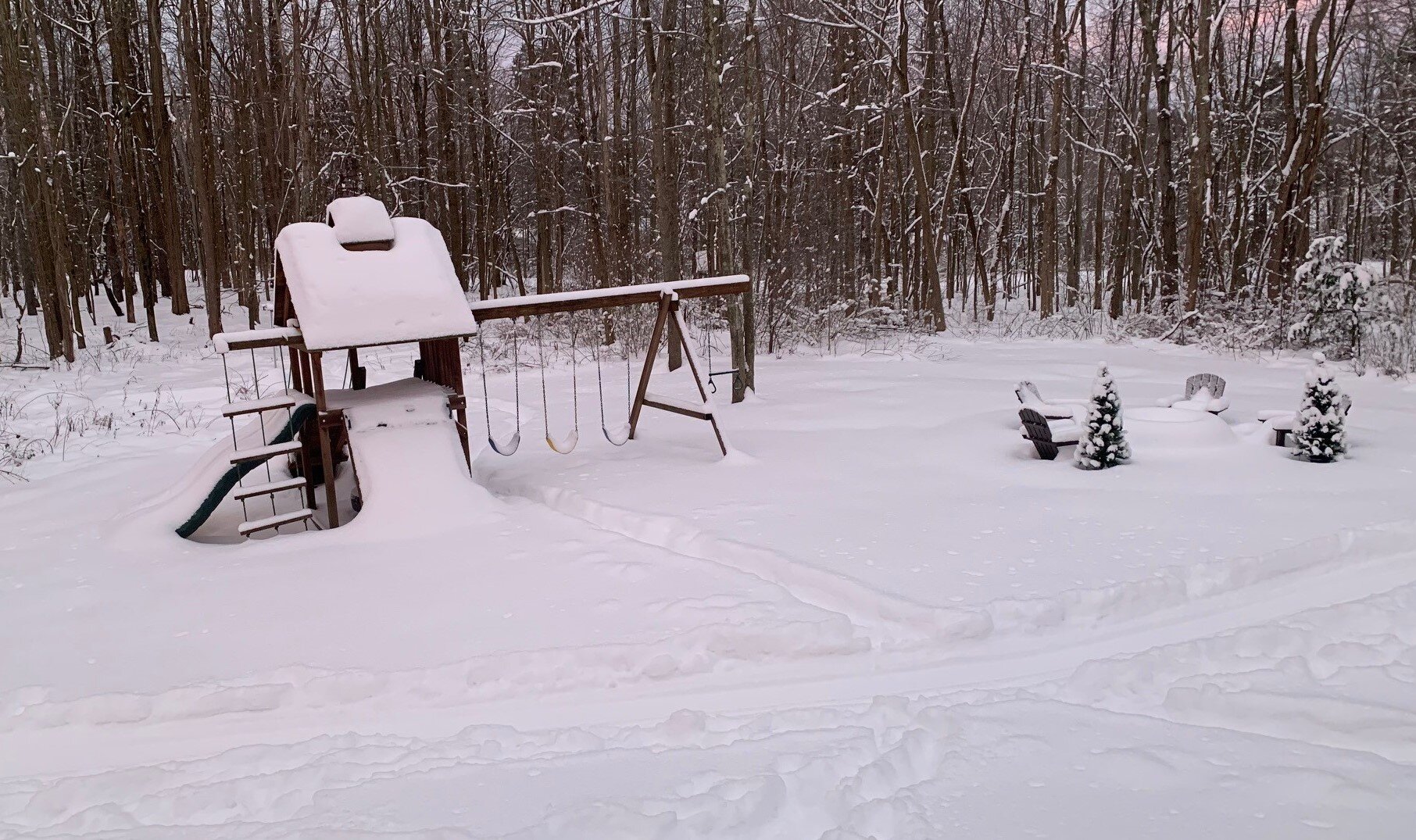
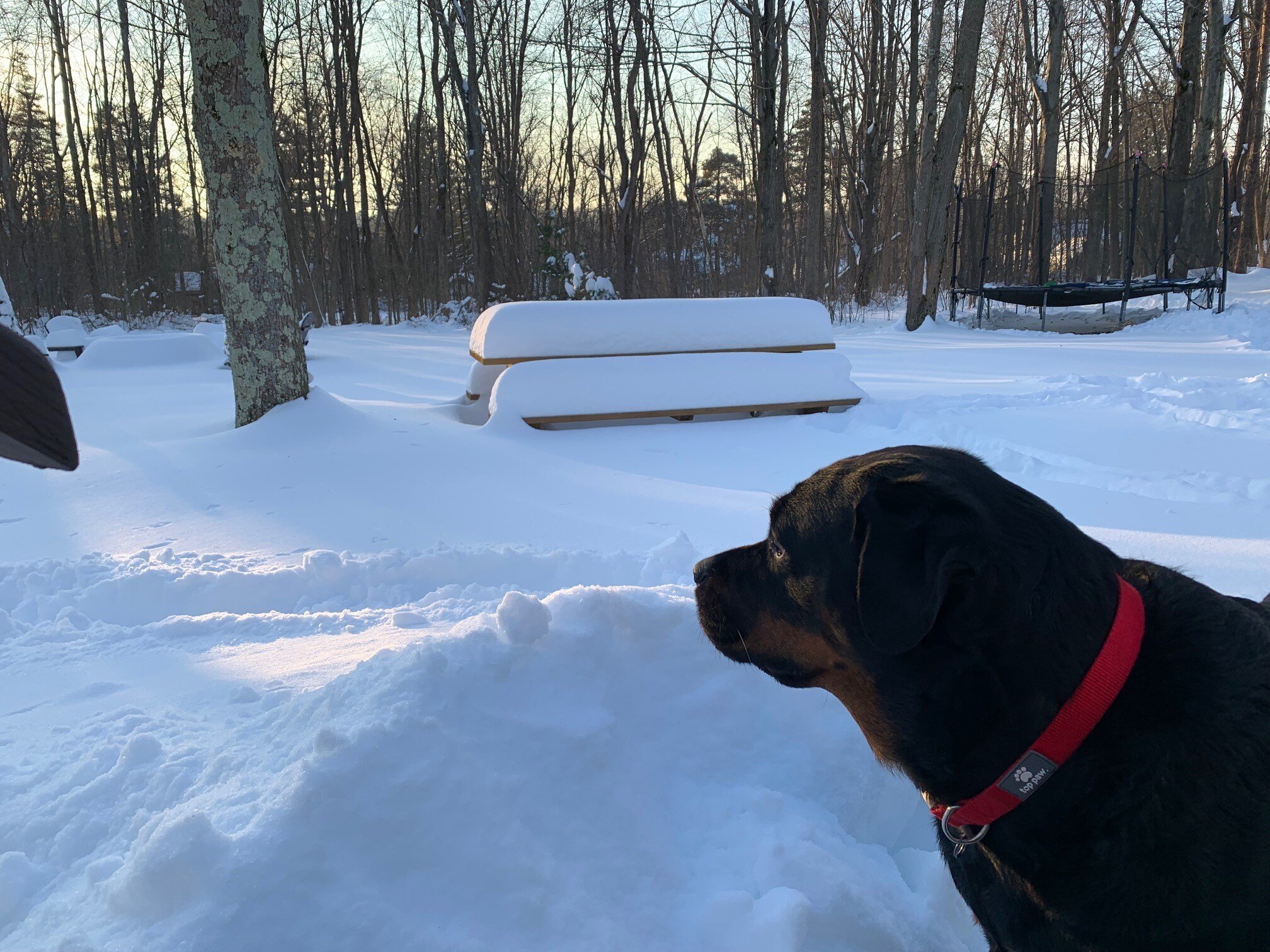
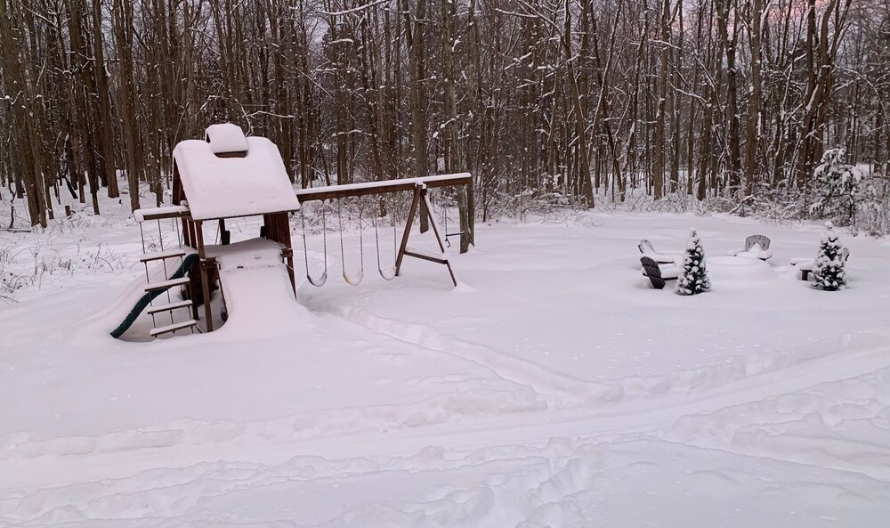
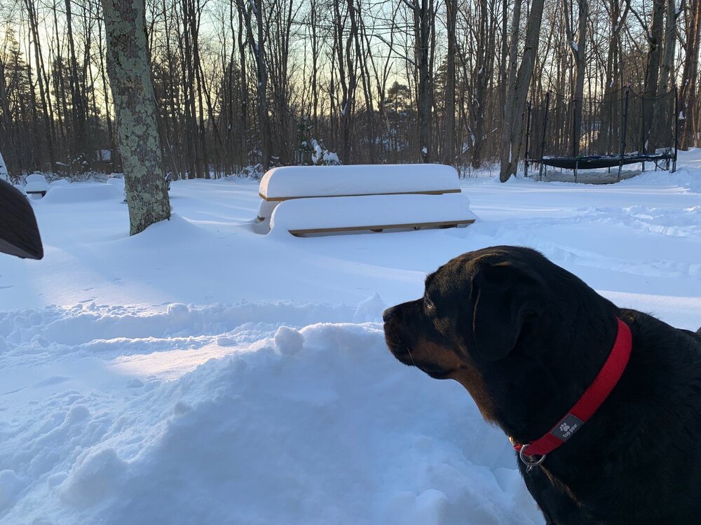
Picked up just over 5" yesterday. Backyard is getting buried... been awhile since we've had a snowpack like this.
-
Nice to wake up to snow falling and increased snow totals. Radar looks great.
-
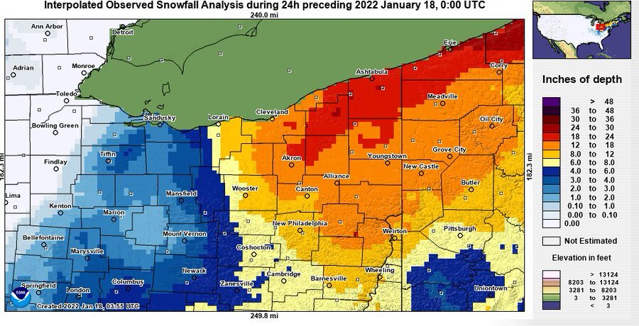
18z NAM and HRRR look pretty good for the first clipper. 3-5" across Northern Ohio. Nice to see the increase in precip.
-
This area was just east of the good stuff yesterday. It was interesting to watch the bands coming south off the lake then shift west and hug the 271 corridor. I had to drive up to Kirtland yesterday evening and it was dumping snow under the heavier returns. Definitely looks and feels like Winter out there. I'd image the lake will be mostly ice covered over the next couple of days.
-
The snow band has been hanging out around the 271 corridor for awhile now. Probably a narrow corridor that gets a few inches. Noticed that CLE put out a snowfall map for 4-6" this morning. Tough to forecast with such narrow bands. Looks like we will potentially be out the game this far east.
-
Just noticed the WWA. The Huron band is meandering back west. Looks it might be stalling out a bit in western geauga/eastern cuyahoga. Pretty much what the RGEM was showing. That model seems to have the hot hand with LES.
-
Getting a few decent bursts of snow off of the lake. These dry arctic air masses are never good for LES. Been awhile since we've had a lake huron connection this far west so that will help. Looks like the lake huron band is currently coming through Ashtabula county and headed west.
-
High res models are showing a lake huron band through the eastern suburbs... and even back west to CLE. Will be interesting to see if that develops. Not expecting much with the dry air though. Hopefully the clipper train can bury the picnic table.
-
Looking at CLE's snowfall map the NAM seemed to have a good handle on snowfall totals.
-
Storm total of 18.5" here. Picked up an additional 4.5" after 6am yesterday. The snow did compact a bit with the strong winds yesterday.
-
Its still coming down nicely but definitely starting to lighten up on radar. I measured just over 14" at 6am. No idea how much has come down since then but 19" probably isn't too far off.
-
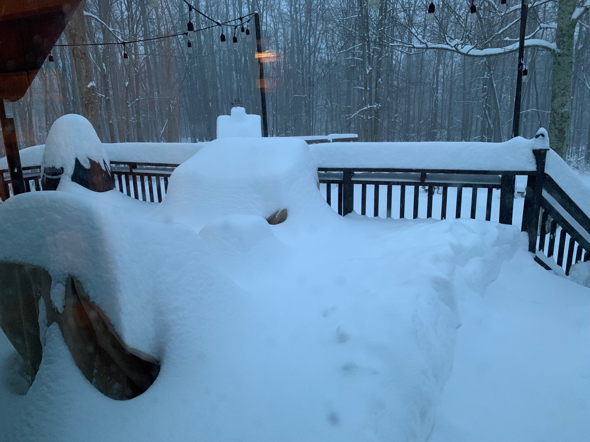
This will likely be a top 10 storm IMBY for synoptic snow. The flake size with the lake enhanced band has increased and its dumping. Drove into the office and it seems the plows have given up for the time being. Buried deck earlier this morning...

-
I measured just over 14” at 6am. Looking at the radar we could push 18-20”. Awesome storm with the winds picking up.
-
Wow. Wasn’t expecting to wake up to this much snow. Looking at the radar loop we got smoked overnight. Eyeballing 12+ already.
-
Snow started around 5:45… couple hours earlier than expected. Snowing nicely, everything is covered and the radar looks great. Stopped looking at the models after 12z today. Going to be a nice storm for much of the area.
-
06z models with another nudge west which give a little more breathing room. Shaping up to be nice storm. Erie PA looks like the jackpot zone. We should do well in the northeast counties as well.
-
Just noticed that. Maybe they don’t buy the higher amounts. Today’s runs have increased a bit with most showing 8-12+ across lake and Geauga. 18z nam bumped a bit as well.