NEOH
-
Posts
3,368 -
Joined
-
Last visited
Content Type
Profiles
Blogs
Forums
American Weather
Media Demo
Store
Gallery
Everything posted by NEOH
-
Seems even worse this morning. The sun is no longer visible and visibility is low. Crazy stuff.
-
AQi is in the 400-500 range. This is the worst smoke I've seen around here. Strong smell as well.
-
You don't see 15"+ rainfall estimates very often. The island area took a beating last night. We could really use more rain here locally... heaviest rains have been hit or miss.
-
Nice. We had some decent wind but nothing too crazy. We did pick up much needed rain 1"+ - it has been dry here since Memorial Day weekend.
-
CLE finished May -3.2 degrees. Back to back mornings IMBY with a low of 43. No complaints though as the weather has been beautiful in the afternoons over the past week.
-
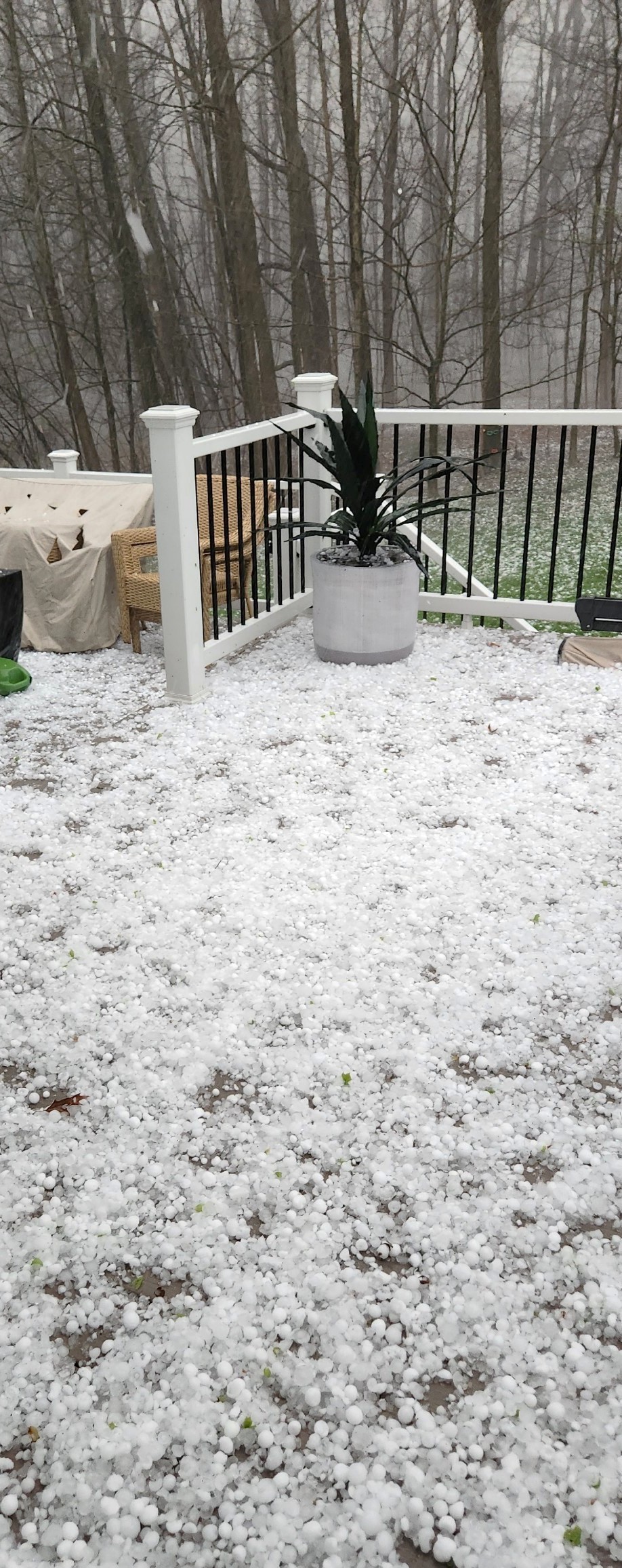
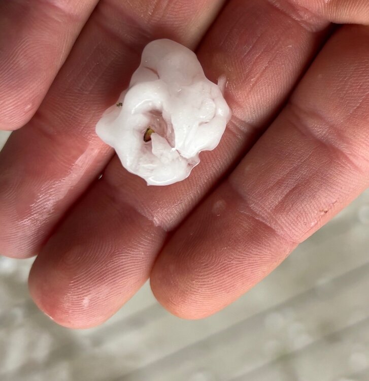
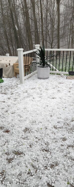
Most of the hail was around 1" - 1.50". A lot looked fractured like this picture. It was so dense I'd imagine there was a lot of breaking as it fell. We were on the northern edge of the heaviest. Solon/Bentleyville on east through Southern Geauga seemed to get the worst.
-
Crazy amount of hail with the storm yesterday evening. Quite a bit of damage around with many car windows broken.
-
I have family that live on Fairmount right in that location. The damage was spotty but intense where it dropped down. Rain gauge is showing 2.47" so far this week. We could use a week of dry weather.
-
Between the high winds last Friday, meteor and lake effect it has been a crazy week. Looks like Medina county is the place to hunt for fragments. NASA SUMMARY NASA Meteoroid Environment Office finds that this was a 2m diameter object weighing around 6 metric tons - more of a small asteroid than a large meteoroid. Signatures of falling meteorites are seen in data from three weather radars, KCLE (Cleveland), the Cleveland airport radar TLVE, and KPBZ (Pittsburgh). The Geostationary Lightning Mapper (GLM) instrument on the GOES East weather satellite observed the meteor. The ground track passed north to south over western Cleveland, producing sonic booms heard across that city.
-
It was definitely a unique sound and loud. Almost like multiple crashes/explosions. https://www.news5cleveland.com/news/local-news/meteor-could-be-cause-of-loud-boom-in-northeast-ohio "Cooke said the meteor was moving 44,000 mph"
-
Sounds like it was a confirmed meteor. Wild week of weather.
-
Wow. That was probably the loudest explosion I've heard. The band is just north of here... sitting between 87 and 322.
-
Did we just have an earthquake? Huge boom and the office shook. Seemed way to loud for thundersnow.
-
Crazy winds yesterday. Lots of trees and power lines down. I think Burke had a peak wind gust of 85mph.
-
The snowpack is just about melted. Still a good 2"+ in shaded areas. Hopefully we can move on to Spring at this point. Feels great out there at 52 degrees.
-
With the heaviest snow falling during daylight yesterday it was relatively low impact on main roads that were salted. Turned out to be a nice late season event. Can't believe such little snow fell at CLE though... the airport specifically always seems to miss .
-
Measured anywhere from 10-11”… 2-5” was in the forecast today. Looks like deep Winter out there but time to move on to Spring.
-
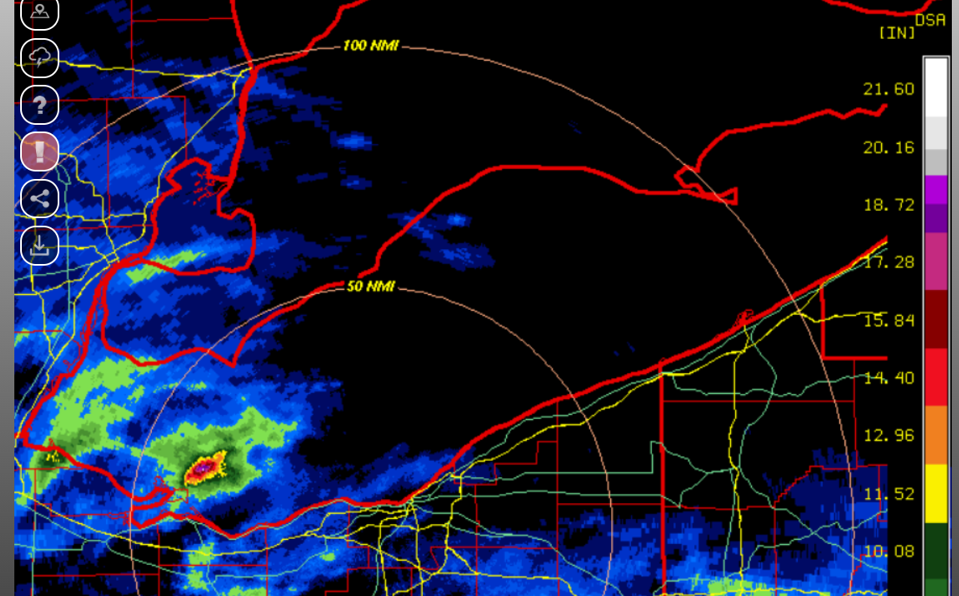
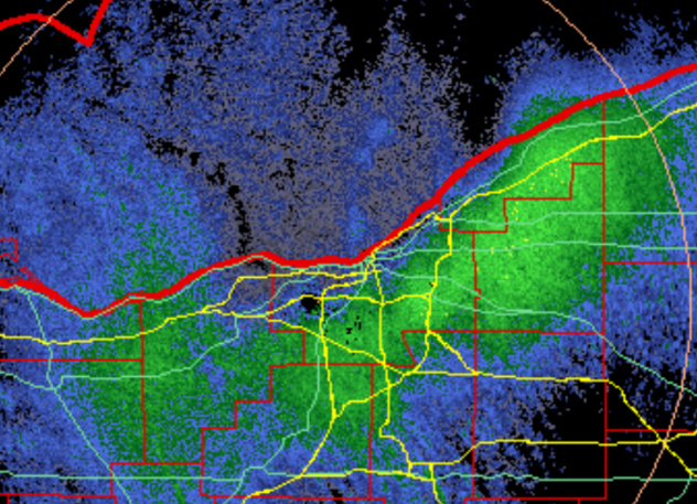
This pretty much sums up what the radar has looked like all day. Higher elevations are doing quite well. Despite the cold temps and mod/heavy snow it is having a hard time sticking on the roads due to sun angle.
-
It was nice to see the grass for awhile. Closing in on 6" IMBY. Surprisingly heavy snow, not the usual fluff.
-
No complaints on this end with mud season kicking into high gear from the snow melt
-
It has held on longer than expected. The sunny/open areas are grassy while shaded areas are still mostly snow covered. I'm starting to get in Spring mode. I'd still take a big storm but with the October sun angle out there is just isn't the same. Birds are out... and first signs of rabbits and skunks around so Spring is near.
-
The snowpack is slowly fading away and should be gone in the next day or two with warm temps and rain. We've had two good years in a row for snowpack retention so no complaints. Still hoping to hit 100" for the season... not too far away at this point.
-
Temps way overperformed today. Back down to 46 imby now as the winds shifted. Really feels like Spring out there. Took some measurements around the yard... anywhere from 8" - 14" on the ground. Going to be a slow melt as this will freeze up solid tonight.
-
Sam here on the eastside of CLE. We had freezing drizzle earlier this morning as well. Hopefully the squalls deliver later today.
-
One of the rare seasons that we are close to Chardon for total snowfall. Areas south of Rt. 87 have had a great season.