

NEOH
-
Posts
3,275 -
Joined
-
Last visited
About NEOH

Recent Profile Visitors
3,809 profile views


-
Brutal to wake up to snow on the ground this morning. Looks like we are stuck in this pattern for awhile.
-
Picked up 1.2” last night. Hopefully that’s the last of it for the season. Looks scenic out there but I’m ready for Spring.
-
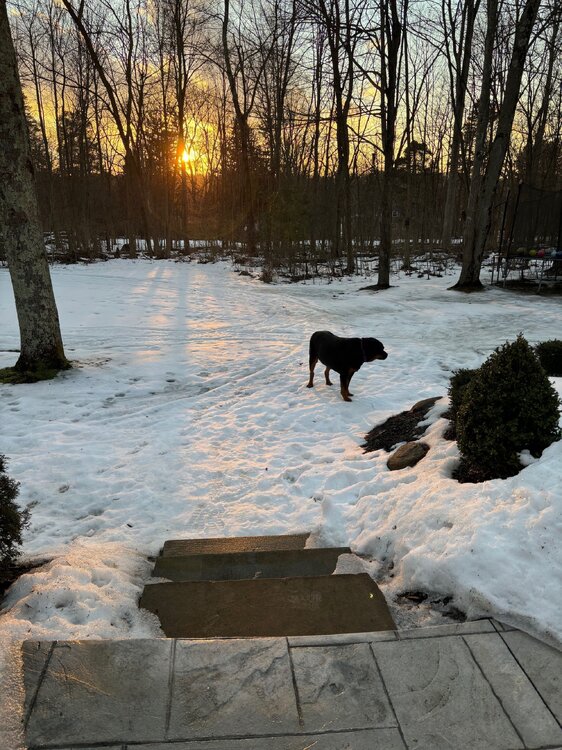
Really enjoying the longer sunsets. The remaining snowpack should be mostly gone by Friday. Nearly 2 full months of snow cover imby.
-
This year might be the longest we've had snow cover since I moved out to Geauga county. Despite snowfall being around average, we managed to avoid the big warm-ups and/or heavy rains.
-
The snowpack has taken a beating the past few days. Still solid cover IMBY but some patches of grass showing up in exposed areas. At this point I'm looking forward to warmer weather. It was a great Winter for snow on the ground.
-
Picked up an inch last night/this morning. 2-4" in the forecast today.
-
Great day yesterday. Picked somewhere around 7 - 8"... hard to tell with the strong winds blowing everything around. The storm was much better than expected.
-
Rain just flipped to ice and snow here. The temp didn’t get above 36 last night… still some snow remaining from part 1. Radar looks good to the west.
-
Recent model runs keep the low a little further southeast of here. Your area might flip to snow fairly quickly tomorrow morning. A low near PIT is usually a good track for northern Ohio.
-
A little over 2” here. Temp is up to 34 now. Hopefully there is good thump tomorrow. 12z models have decent snow across northern Ohio.
-
It has been snowing nicely since 7am... huge cotton ball flakes. Enjoying it before the changeover later this morning.
-
Not sure what to expect this weekend. Typically a low near the panhandle of WV / or just north is a pretty good spot for snow in northern Ohio. Hopefully we'll see a SE trend today. Still have a solid snow/ice pack although there are patches of grass. It just refuses to melt at this point.
-
Looks like the low will pass near CLE tomorrow with rain unfortunately. The weekend looks interesting. Let's revisit today's 12z gfs and cmc runs on Sunday.
-
Everything is caked in ice this morning. Looks pretty with fog rolling in.
-
Snowfall has been bad around Northern Ohio the past few years. Its all relative though... 50" of snow in the snowbelt just east of Cleveland is considered a bad Winter. There are areas east of Cleveland that have likely had 90"+ already this Winter so the airport location is not a great representation of the entire area. 34 straight days of snowcover imby this year so no complaints compared to the past two winters.


