

512high
-
Posts
2,294 -
Joined
-
Last visited
Content Type
Profiles
Blogs
Forums
American Weather
Media Demo
Store
Gallery
Posts posted by 512high
-
-
my Davis .82" since this am, 72F
-
Nashua, heavy rain few rumbles, great light show, seems to be moving fast east
-
1 minute ago, CoastalWx said:
Mon-thurs near 90 or above now. Grab the Charmin people.
private hs school starts first day in ASH Tuesday, lol not sure if it has a/c
-
any idea how fast they are moving roughly?
-
On 8/4/2019 at 4:40 PM, CoastalWx said:
83/67 on the cape. We beach.
Just got done cleaning pool, heavy down pour in ASH, was a beautiful day
-
Just now, 40/70 Benchmark said:
ETA Novie 2nd, but I have a hunch that we will be trick or treating in the delivery room.
Well congratulations to you both !!!
-
 1
1
-
-
6 minutes ago, 40/70 Benchmark said:
Thanks, Brian...mother nature owes me an el nino, so hopefully the atmosphere can deliver it haha
congrats....
-
 1
1
-
-
530am/52F took the dogs for a nice walk ,what a beauty this am, nice not to have swamp *ss this early! enjoy the day
-
1 minute ago, 40/70 Benchmark said:
I just mean that it didn't work out...I was confident, but I ended up with egg on my face because it was wrong....its an expression.
Ray nice to see you back starting to "dig" a bit as we go forward, just SAY it will be better for snow lovers this coming season even if its not true!(lol) soooo done with humidity , but the days are getting shorter, enjoy the rest of summer, look forward to your updates
-
Davis @ home so far .88", what a dump of water that was !
-
17 minutes ago, CoastalWx said:
In all seriousness, those temps with dews were impressive. Seems a tad drier today so maybe actual temps respond?
Very Impressive! but time for this stuff to go.....last year a lot of 90s and dews, however, yesterday........no thanks
-
3 minutes ago, OceanStWx said:
Yeah like fella said, it's officially midnight, but NWS runs climate at 440 pm to make sure we capture that high "most" days.
lol thanks you, that's what I was after........
-
When gathering "high" for the day is it by 4pm est or 5pm? is there a time cutoff what I'm trying to say that is considered the "official high" for the day
-
Just now, HoarfrostHubb said:
Anyone else getting swarmed with annoying, tan, medium sized (similar to Japanese beetle) beetles?
pretty sure they are in my pool skimmer............
-
Boy these cells seem slow moving and keep hitting ASH, I'm showing 1.77" so far!
-
69F ASH, winds about 5-8 mph with sun, not sure if incoming from VT/Keene will effect seem to be dropping more south
-
50 minutes ago, DomNH said:
ASH storm earlier was a bust.
lol left and right, however dews lower than yesterday...........
-
crappy winter, crappy spring.......................next!
-
2
-
 1
1
-
-
Pope! Days away, but is Monday a total wash or off and on rain?
-
Down to 33F, trace remains on the lawn etc, actually didn't think I was going to see that.....
-
1
-
-
46 minutes ago, Lava Rock said:
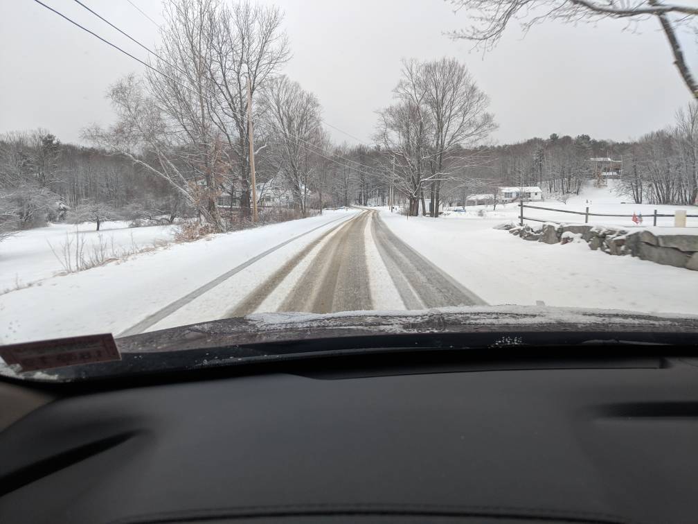
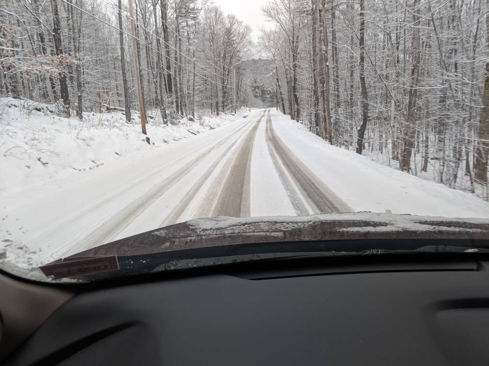
0.75". Roads were terrible
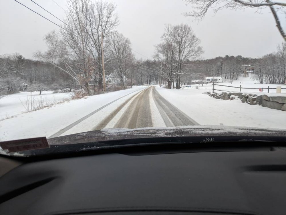
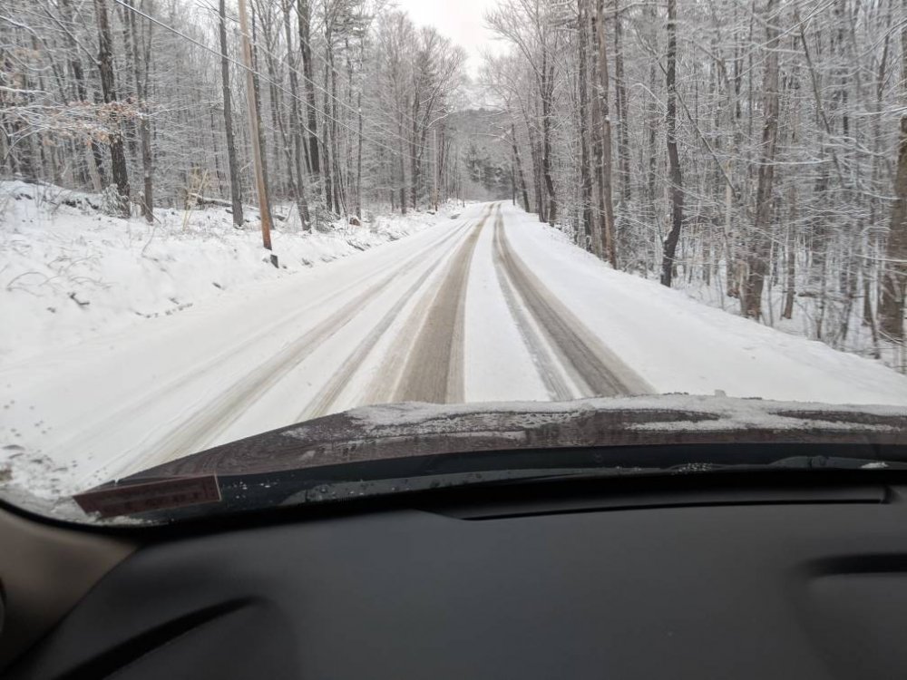
Sent from my Pixel 2 using Tapatalk
Nice pictures, looks like a December day !
-
1 minute ago, Typhoon Tip said:
Omg, 00z Euro if one is a spring enthusiast!
Just get us to Friday, baby.
That day transitions definitively in the morning ... from a cold rad overnight into a whopper diurnal recovery. By 00z Saturday ( 8 pm ) ... large high pressure has moved well SE of Cape Cod. Return flow is well established ...unabated, with no indication of warm frontal pressure contouring/contaminating skies intervening... Given that 12 to 18 hour synoptic evolution from dawn to dusk, that was quite likely ample open sky sun. 850 mbs are running +9 to +11 C and with deep layer WSW flow that's well mixed and probably closer to maxing potential.
If that evolution verifies .. I could see that being 72 F around 2 to 4 pm across the region (...away from the S. coast). Saturday has a shot at upper 70s ...as that pattern is slow to transition and the Kevin mentioned... the SE ridge is exerting. Looks like Saturday has a fairly high lunch launch pad with +12 C at 850s ... similar deep layer well mixed, with more sun early...
we take....
-
maybe a scam thing, ? who knows
-
I THINK there were a lot "in your window" type of comments...borderline
August 2019 Discussion
in New England
Posted
I thought that was only coast/islands? Please don't say inland now....wtf