
superjames1992
-
Posts
10,023 -
Joined
-
Last visited
Content Type
Profiles
Blogs
Forums
American Weather
Media Demo
Store
Gallery
Everything posted by superjames1992
-

Southeast Sanitarium - A Place to Vent
superjames1992 replied to Jonathan's topic in Southeastern States
LOL, if the NW trend doesn't stop, that could be true! It'll be a Big Frosty special! -
Southeast Sanitarium - A Place to Vent
superjames1992 replied to Jonathan's topic in Southeastern States
I'm sitting here on my beachfront hotel balcony in San Juan listening to the waves and refreshing model runs for a storm which I won't experience affecting a locale (NC) in which I no longer live (granted, my parents do and I go back somewhat often). I'm not sure what this says about me! Meanwhile, I'm becoming more and more jealous, wishing I was there, as modeling trends look better and better for GSO. -
Southeast Sanitarium - A Place to Vent
superjames1992 replied to Jonathan's topic in Southeastern States
The German model doesn't handle General Winter very well. I'm going to side with the Russian model for winter weather, personally. -
Southeast Sanitarium - A Place to Vent
superjames1992 replied to Jonathan's topic in Southeastern States
Yeah, the NAM would require switching the max along the I-85 corridor and slashing totals for ENC and RDU. Yikes. -
Southeast Sanitarium - A Place to Vent
superjames1992 replied to Jonathan's topic in Southeastern States
My amateur Wilkes-inspired call map for NC drawn on my iPad... -
Southeast Sanitarium - A Place to Vent
superjames1992 replied to Jonathan's topic in Southeastern States
http://meteocentre.com/models/explorateur.php?lang=fr&map=na&run=00&mod=dwd_icon&stn=TT850&comp=1&run2=00&mod2=dwd_icon&stn2=TT850&hh2=066&fixhh=1&stn2_type=prog&mode=latest&yyyy=latest&mm=latest&dd=latest&hh=054 Looks like you'd be all-snow in southern Wake on the six-hour 850 mb panels, though you just know there's some warm noses at other layers in there ready to bring the taint. Here is the ICON meteogram for RDU: -
Southeast Sanitarium - A Place to Vent
superjames1992 replied to Jonathan's topic in Southeastern States
That's the truth. Gulf convection and unmodeled, surprise warm noses are the best! The storm on the DWD-ICON is sure something, though it looks like a pretty big outlier right now. I think you're in a decent spot, though. -
Southeast Sanitarium - A Place to Vent
superjames1992 replied to Jonathan's topic in Southeastern States
I wouldn't think surface temps themselves will be an issue, but sneaky warm layers elsewhere could be - 925 mb, 750-800 mb. It seems these levels are most prone to screwing us over in the South, based on my limited experience. -
Southeast Sanitarium - A Place to Vent
superjames1992 replied to Jonathan's topic in Southeastern States
Oh yeah, sure, it just seems unlikely to me we see widespread negative single digits or highs in the single digits like I've seen on some model output. -
Southeast Sanitarium - A Place to Vent
superjames1992 replied to Jonathan's topic in Southeastern States
Cold is almost always overdone with snowpack, IMO. -
Southeast Sanitarium - A Place to Vent
superjames1992 replied to Jonathan's topic in Southeastern States
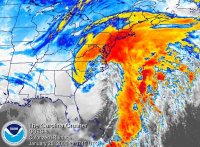
-
Southeast Sanitarium - A Place to Vent
superjames1992 replied to Jonathan's topic in Southeastern States
It's German. Good improvement on the latest run there! I love the precip maximum in the mountains, including Boone. Very typical! The mountain folks (some) whine about it not being their storm, and such, and yet will probably outperform the western Piedmont, per usual! -
Southeast Sanitarium - A Place to Vent
superjames1992 replied to Jonathan's topic in Southeastern States
18z DWD-ICON doesn't look too good, either. http://meteocentre.com/models/explorateur.php?mod=dwd_icon&run=18&stn=PNMPR&hh=078&map=na&stn2=PNM&run2=18&mod2=dwd_icon&hh2=078&comp=1&fixhh=1&lang=fr&yyyy=latest&mm=latest&dd=latest&mode=latest&stn2_type=prog&date_type=dateo -
Southeast Sanitarium - A Place to Vent
superjames1992 replied to Jonathan's topic in Southeastern States
It wouldn't shock me, especially if the other modeling goes the way of the NAM tonight! -
Southeast Sanitarium - A Place to Vent
superjames1992 replied to Jonathan's topic in Southeastern States
The Para NAM is a disaster. The 21z SREF doesn't look too hot, either. Luckily, we have so many models these days, I am sure we can cherry pick some that look good. -
Southeast Sanitarium - A Place to Vent
superjames1992 replied to Jonathan's topic in Southeastern States
The 00z runs are getting off to a rockin' start! -
Southeast Sanitarium - A Place to Vent
superjames1992 replied to Jonathan's topic in Southeastern States
This storm is making me miss Greensboro. -
Southeast Sanitarium - A Place to Vent
superjames1992 replied to Jonathan's topic in Southeastern States
This is the South, man. Warm noses are always a problem! Hardly have I ever had a significant storm where we didn't taint (most recent being Fab Feb '15 aside from a few isolated sleet pellets). -
Southeast Sanitarium - A Place to Vent
superjames1992 replied to Jonathan's topic in Southeastern States
Beware of the sneaky warm nose in the 750-800 mb range. You won't find these on the conventional maps, and will have to look at soundings. I've been bitten by that one too many times. Of course, that's a chore for closer in. -
Southeast Sanitarium - A Place to Vent
superjames1992 replied to Jonathan's topic in Southeastern States
Boone is never out of the game. A magical tongue of precip may find its way up there yet, a la Christmas Day 2010. -
Southeast Sanitarium - A Place to Vent
superjames1992 replied to Jonathan's topic in Southeastern States
EE Rule in effect! Storm cancel! -
Southeast Sanitarium - A Place to Vent
superjames1992 replied to Jonathan's topic in Southeastern States
The DWD-ICON model will be coming into range soon. -
Southeast Sanitarium - A Place to Vent
superjames1992 replied to Jonathan's topic in Southeastern States
MBY gets blanked in all scenarios, at least, LOL. I'm in San Juan right now, anyways. It's currently 81 with a wonderful sea breeze. If the 12z GFS miracle somehow verified, I might blow a gasket, though. GSO got 30" on that run. Did I move away one year too early??? -
Southeast Sanitarium - A Place to Vent
superjames1992 replied to Jonathan's topic in Southeastern States
Well, it can only go downhill from here after that 12z GFS run... -
Southeast Sanitarium - A Place to Vent
superjames1992 replied to Jonathan's topic in Southeastern States
We're basically in nowcasting range, anyways. Throw the models out and go with your heart. The models are of no use within 168 hours.