CT Valley Snowman
-
Posts
5,357 -
Joined
-
Last visited
Content Type
Profiles
Blogs
Forums
American Weather
Media Demo
Store
Gallery
Everything posted by CT Valley Snowman
-
Probably gonna be a 42-43 diurnal here today
-
Yep about 20 degrees difference between me and Kev as well last 2 mornings.
-
26 to 66. It's a beauty out there.
-
You might be the warmest place in all of CT right now.
-
26.4. Nearly 20 degrees colder than DIT. And by afternoon I'll be 5 degrees warmer.
-
I have a Tacoma with 327K, still going strong. My 18-year-old son is driving a 07 Corolla. Our main family van is newer, but I have no shame in using older vehicles as well. I have 2 young drivers 17 and 18 years old on my insurance policy which is very expensive.
-
Looks like the GFS was hitting the bong at 12Z.
-
Low of 25.7
-
Yeah, we long done here. Already down to 34 and this will be the 5th night below freezing. It's just different microclimates. That's what makes weather interesting. And yeah, I would trade frosty fall mornings for more snow in general and a 1K climate in SNE. But as long as I live in the valley, I'll enjoy the things here like large diurnal swings, cad, big heat in the summer and big time radiational cooling. But it sure is frustrating getting downsloped to hell on a big-time snowstorm.
-
It's great out there no doubt, perfect for outdoor activities. Also a snooze fest in terms of any real excitement.
-
My back yard is filling up with leaves. Foliage maps say we're heading into peak, but at least locally, things were more vibrant late last week. Will probably get a second wave of color as different species begin to change.
-
Still managed a pretty good frost this morning.
-
Foliage seems to have dulled a bit locally after wind, rain, and a couple of freezes.
-
Low of 25
-
38. Wind going closer to calm.
-
Still 41 here as a light wind is holding on.
-
Another meh warned storm here.
-
Hit 79 here. Beautiful day.
-
1.85" at home. 0.0" so far up here in Maine.
-
People travel for beautiful scenery and what interests them. Seeing fall foliage in New England is on the bucket list for many people who enjoy traveling. It's become more and more popular. Most people wouldn't travel to experience exciting weather, but many of us here would because that's what interests us.
-
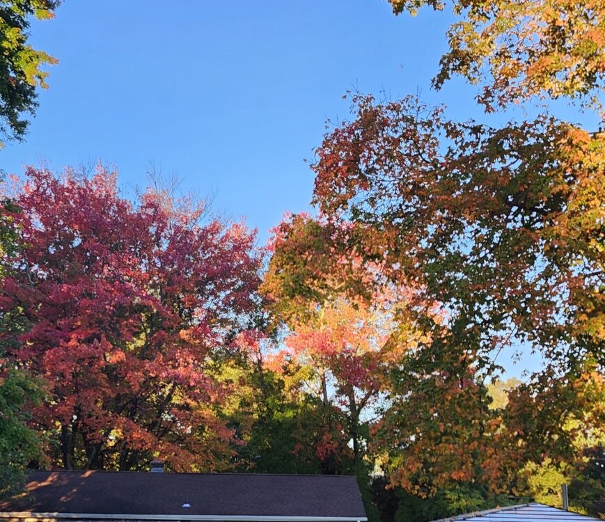
Yup, that area and Litchfield County are the best overall, but nice scenery can be found everywhere. HelI, I just wake up, drink coffee and look at these trees in my backyard and I'm happy.
-
If you're really into it, it is another level of scenery up there, but for me it's not worth the crowds/traffic and the leaves down here are just fine.
-
People get locked on that weekend for convenience and I feel like it's sometimes marketed that way for business/tourism. Also, the foliage reports tend to run behind real conditions with some of their reporting. Columbus Day is usually more a CNE down to SNE high terrain deal. Even the highest terrain CNE can be past peak.
-
I think going below average is fine, but I have too much respect for SNE climo, the CC related propensity for more extreme precip events including large snowfalls, and the 2nd half of winter "wildcard" pattern like 82-83 to just go complete ratter. I'd probably honestly go 25-40" in Boston rather than 15-30" if one was using 15" increments.
-
There was some damage up here near the border, Enfield/Suffield/Granby area. I recall a burst of strong winds. We were right on the edge.