mikeysed
-
Posts
233 -
Joined
-
Last visited
Content Type
Profiles
Blogs
Forums
American Weather
Media Demo
Store
Gallery
Everything posted by mikeysed
-
Just went through it in Northwestern Essex County, 0 t storms
-
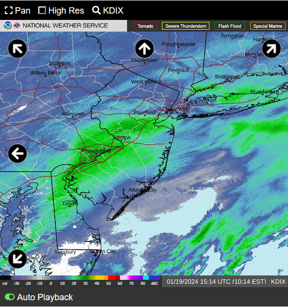
The radar on TWC from 5-7 pm looks pretty bad, the NWS is not really calling for flash flooding, if that happens there will be a lot of it.
-
 I have a 345pm flight tomorrow out of Newark. I assume I shouldn't have any issues because especially in that location it would be starting for maybe an hour max and I can't foresee issues with delays. I would anticipate they want to get the plane out ASAP. Thoughts?
 -
Absolutely wild. Had heavy snow and then heavy sleet. Now it is back to heavy snow. Essex Fells NJ, elevation ~525
-
100% . Just measured 1.7" in last hour. 535 elevation in essex fells NJ
-
The band over Manhattan has been over and just a touch less now over northwestern essex county since 430pm. There is close to 6 inches here. 520' elevation
-
Latest mesoscale model. I'm in the >1" /hr rates and it's serious. I'd say about 2 inch an hour rates. 500' elevation northwest essex county.
-
When can we expect snow to start at a good clip at the game? It looks about 20 miles to the west of Philly on radar only.
-
2 footer . Woo
-
For those "this is underperforming or sad." Hate to be the grinch but the models beyond some ones discredited earlier showed dusting to 2 inches. That seems to be the exact thing happening...
-
Moderate snow will be at 1 inch soon in Essex Fells NJ - 512' elevation. Big difference from 250 and under elevation in fairfield and livingston when I was driving.
-
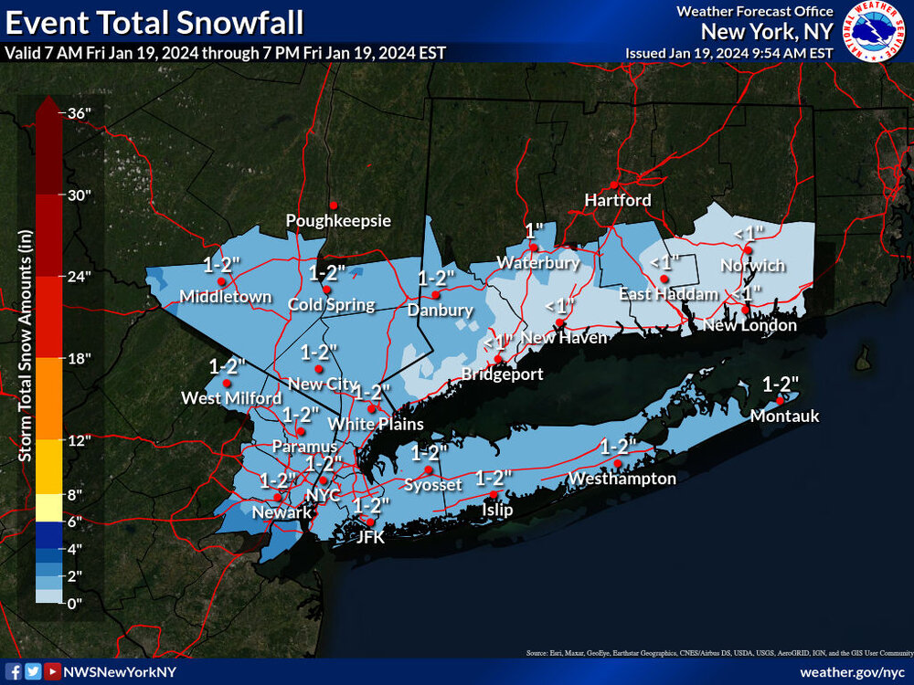
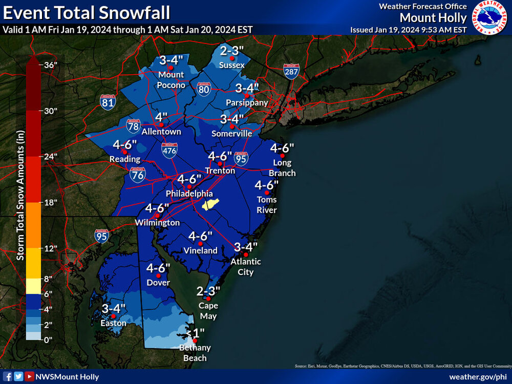
High Point NJ - Elevation 1800 just hit 21" of snow. Insane
-
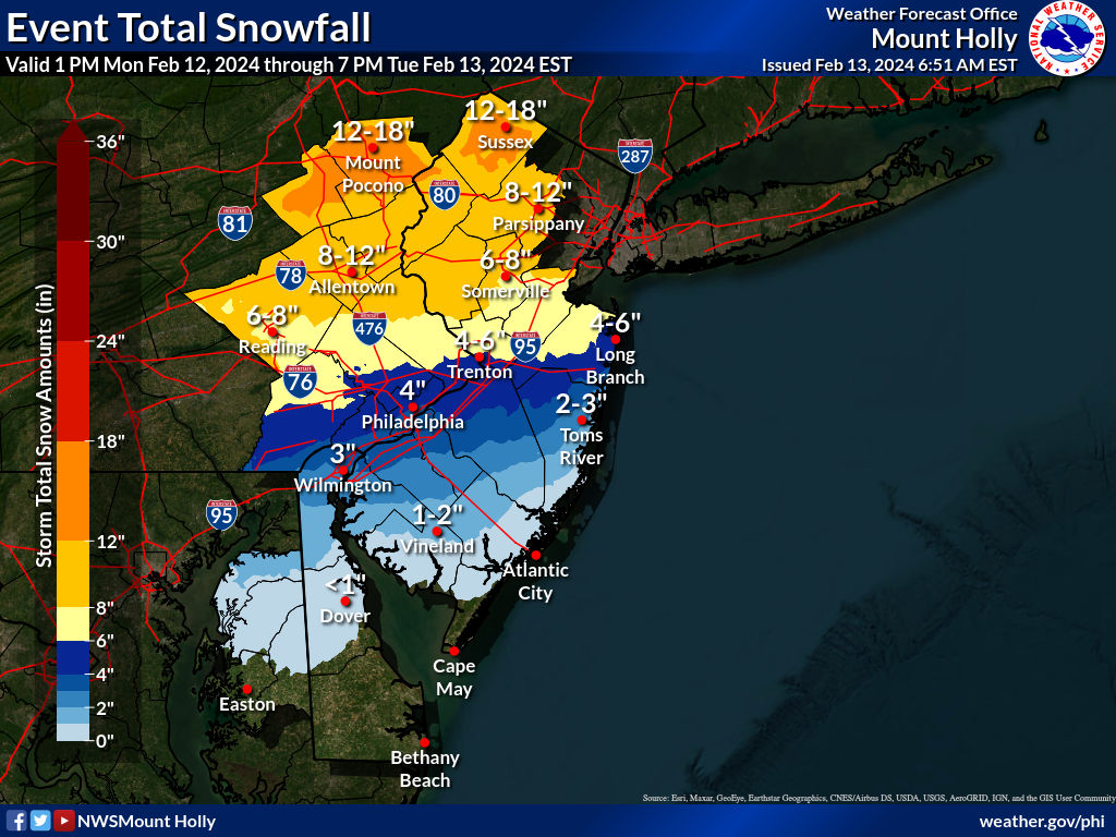
2/13 Significant/Major Winter Storm Discussion & Observations
mikeysed replied to Northof78's topic in New York City Metro
Mt holly playing catch up. No update from upton yet who's way off in their northern areas.
-
Mt Holly banking on this banding making it to northern morris county:
-
Yet Upton lowered amounts
-
Mt Holly went backwards and upped totals: In the last 12 hours they've shifted a lot of 4-6 to 2-4 now 3-4". I am assuming they feel the heavier echos will make it more north.
-
Do you have a link to this radar?
-
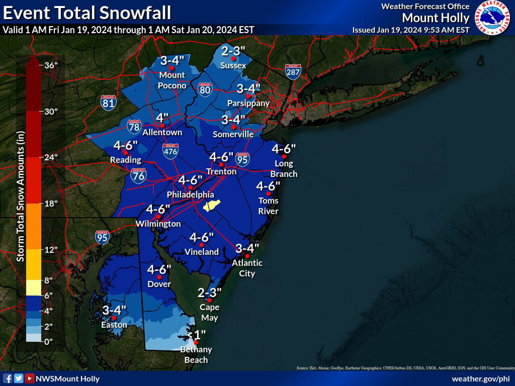
Beautiful virga to begin this 1-2" State of Emergency in Southern Morris County
-
Two Mdt to high impact events NYC subforum; wknd Jan 6-7 Incl OBS, and mid week Jan 9-10 (incl OBS). Total water equiv by 00z/11 general 2", possibly 6" includes snow-ice mainly interior. RVR flood potential increases Jan 10 and beyond. Damaging wind.
mikeysed replied to wdrag's topic in New York City Metro
Does Sussex county have any snowpack left or did it melt the 10 to 13 inches? -
Two Mdt to high impact events NYC subforum; wknd Jan 6-7 Incl OBS, and mid week Jan 9-10 (incl OBS). Total water equiv by 00z/11 general 2", possibly 6" includes snow-ice mainly interior. RVR flood potential increases Jan 10 and beyond. Damaging wind.
mikeysed replied to wdrag's topic in New York City Metro
Just about to hit 3" of rain here in Southern morris County. Another inch+ coming Friday. I can't imagine what pine brook area is going to look like come Saturday.- 3,610 replies
-
- 1
-

-
- snow
- heavy rain
- (and 5 more)
-
Two Mdt to high impact events NYC subforum; wknd Jan 6-7 Incl OBS, and mid week Jan 9-10 (incl OBS). Total water equiv by 00z/11 general 2", possibly 6" includes snow-ice mainly interior. RVR flood potential increases Jan 10 and beyond. Damaging wind.
mikeysed replied to wdrag's topic in New York City Metro
2.67 inches of rain so far today. Temp is 56. Highest wind gust 54 mph. Southern morris County.- 3,610 replies
-
- 2
-
-
- snow
- heavy rain
- (and 5 more)
-
Two Mdt to high impact events NYC subforum; wknd Jan 6-7 Incl OBS, and mid week Jan 9-10 (incl OBS). Total water equiv by 00z/11 general 2", possibly 6" includes snow-ice mainly interior. RVR flood potential increases Jan 10 and beyond. Damaging wind.
mikeysed replied to wdrag's topic in New York City Metro
Wish I could upload a video of 2 inch rates an hour. Won't let me. Puking at 1300 ft vernon NJ Sussex county -
Two Mdt to high impact events NYC subforum; wknd Jan 6-7 Incl OBS, and mid week Jan 9-10 (incl OBS). Total water equiv by 00z/11 general 2", possibly 6" includes snow-ice mainly interior. RVR flood potential increases Jan 10 and beyond. Damaging wind.
mikeysed replied to wdrag's topic in New York City Metro
9" Sussex County. Middle of vernon 1300 elevation. Heavy snow. Measured 2 inches last hour. Pulling atm- 3,610 replies
-
- 2
-
-
- snow
- heavy rain
- (and 5 more)