LakeEffectKing
-
Posts
4,476 -
Joined
-
Last visited
Content Type
Profiles
Blogs
Forums
American Weather
Media Demo
Store
Gallery
Everything posted by LakeEffectKing
-

Upstate/Eastern New York
LakeEffectKing replied to BuffaloWeather's topic in Upstate New York/Pennsylvania

-
Crap...I thought the contest was min pressure/max wind before LF... I screwed up...
-
899 150kts
-
Lol! Potential for about 5-7 landfalls in FL and the N GOM coast within two days!!
-
Upstate/Eastern New York
LakeEffectKing replied to BuffaloWeather's topic in Upstate New York/Pennsylvania
2.5" Overnight in Cazenovia.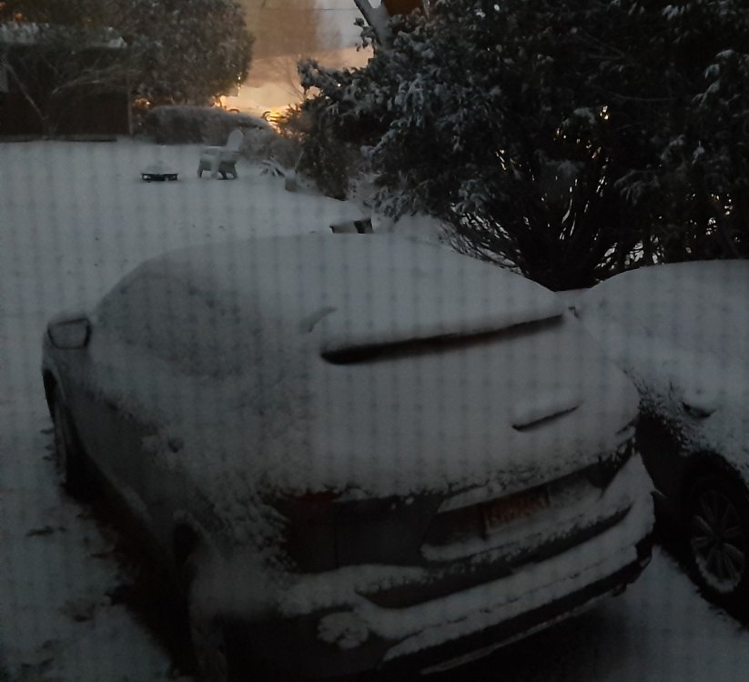
-
Upstate/Eastern New York
LakeEffectKing replied to BuffaloWeather's topic in Upstate New York/Pennsylvania
Eta!!!!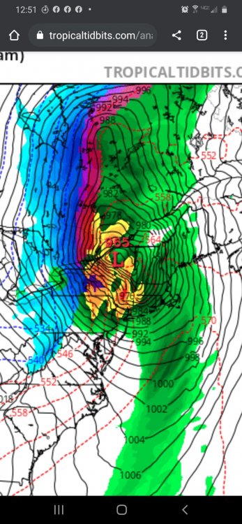
-
Upstate/Eastern New York
LakeEffectKing replied to BuffaloWeather's topic in Upstate New York/Pennsylvania
BUF NWS completely disregarding GFS for Wed.- Sat....."Cool and dry" BGM at least mentions the threat.... -
If the eye clears in the next 4-6 hours, and the eye radius isn't too large, and with 12-18 hrs. of favorable conditions, Cat 4 is back on the table. before any anticipated weakening.
-
Ummm.....Marco already was a hurricane in the GOM.....before Laura...
-
The soon to be named Josephine will become a hurricane in 2 or 3 days, with a chance of RI when the shear is projected to drop to zero. MH threshold is not out of the question. Thereafter, I could see a pretty rapid weakening (decoupling) in about 4-6 days, if the shear values that are progged come to fruition.
-
Upstate NY Banter and General Discussion..
LakeEffectKing replied to wolfie09's topic in Upstate New York/Pennsylvania
N95 masks will offer the wearer a decent amount of protection...it's why medical professionals wear them. A cloth "face covering" certainly protects "others" more than the wearer, however, I'd argue that even a cloth covering does offer varying degrees of protection to the wearer vs. nothing, depending on a multitude of factors. -
Upstate NY Banter and General Discussion..
LakeEffectKing replied to wolfie09's topic in Upstate New York/Pennsylvania
I'm guessing/estimating that (now that testing is "better") we can look at the data and make some rudimentary (fitting into commonsense) deductions that the daily death counts in a particular area, are going to lag behind the "confirmed" cases by 10 days or so */- a few days..... ….thus, it's nice to see Italy's daily confirmed cases on a nice, prolonged downward slope. -
Upstate NY Banter and General Discussion..
LakeEffectKing replied to wolfie09's topic in Upstate New York/Pennsylvania
I read another article that Drs. were perplexed because they were getting really low oxygen levels in the blood of patients, yet CT scans/x-rays of lungs weren't "that bad".....it sounds like (from my modest biology knowledge) that this virus may indeed be more of an inhibitor of the normal uptake of oxygen at the red blood cell membrane level, and not so much a "respiratory" (aka...SARS) disorder. Thus, blood transfusions/100 oxygen hoods, and potentially hydroxychloroquine/Zithro treatments may be a better option than vents.....just thinking out loud as a layperson... -
Upstate NY Banter and General Discussion..
LakeEffectKing replied to wolfie09's topic in Upstate New York/Pennsylvania
Interesting read... http://web.archive.org/web/20200405061401/https://medium.com/@agaiziunas/covid-19-had-us-all-fooled-but-now-we-might-have-finally-found-its-secret-91182386efcb -
Upstate NY Banter and General Discussion..
LakeEffectKing replied to wolfie09's topic in Upstate New York/Pennsylvania
I wonder how many of those 2200 tests are people who reside in Onondaga Co. I know many outside the Co. Were being sent to the drivethrough testing site in Syr.... -
Now that is an objective take! Much different from the first few pages of this awful thread!
-
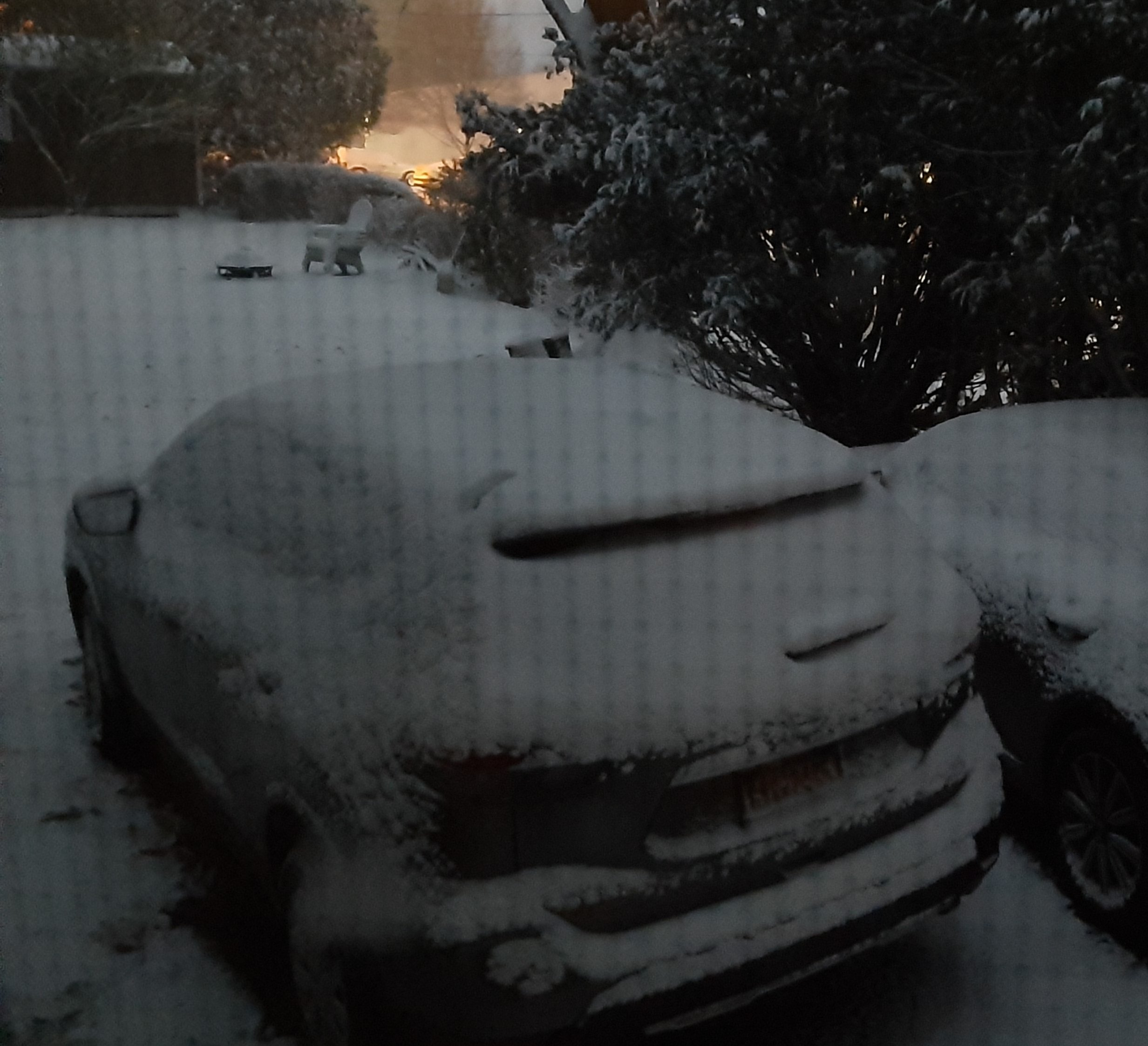
Blizzard Of Feb 8, 2013 around 10 Pm
LakeEffectKing posted a gallery image in Members Albums Category
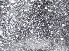
From the album: 7"/hr. near Hartford
My Aunt took this photo during what has been deemed "the death band" of the Blizzard of 2013...unofficially 7"/hr. -
7"/hr. near Hartford
Images added to a gallery album owned by LakeEffectKing in Members Albums Category
Blizzard 2013 -
-
Here's another cool example of having fun with methane!
-
What if "thy neighbor" has 2 Hummers and a 10,000sq. ft. home??? And if they love you just enough to take the bus into work a couple times a week....will he/she be vindicated of their environmental crimes in your eyes, because they indeed have "sacrificed" to an extent? Questions to ponder.....
-
I'm thinking a couple of cows were hanging out by the monitor....but it's just a hypothesis....
-
LMAO!! Classic!
-
You missed my question....Does this recent discovery of an "explosion" of methane that the OP is hyping, indicate a heightened fear or is this just part of the "normal" AGW apocalyptic fear? I'm getting the feeling from reading this thread that I should take shelter.....
-
Well, if anything, this "alarming" release should provide a further testing for global temperatures. So does this mean that the thoughts recently opined by many AGW proponents (that we may have a 2 decade stall in global temps) are out the window??? Or is this explosive methane release already factored in? What's the prediction NOW for the next few decades....because as it sounds like right now, if we have stable temperatures over the next 2 decades, it would be consistent with AGW....or if we have rapid warming, it will be DUE to AGW.
-
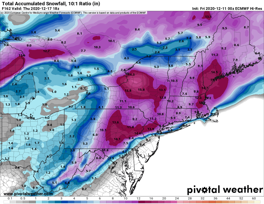
The Hudson Valley Thread
LakeEffectKing replied to IrishRob17's topic in Upstate New York/Pennsylvania
If the Euro verifies as depicted, you guys get a once in 50 year or more storm! Sub 970, slowing down, originating from the GOM....30"+ amounts would be common....esp. in the hills.....let's all breathe!!!! Even in CNY, less qpf, but better ratios.....probably 18"