-
Posts
4,475 -
Joined
-
Last visited
Content Type
Profiles
Blogs
Forums
American Weather
Media Demo
Store
Gallery
Everything posted by LakeEffectKing
-

Upstate/Eastern New York
LakeEffectKing replied to BuffaloWeather's topic in Upstate New York/Pennsylvania
Snowing at about 2" per hour in Caz. -

Upstate/Eastern New York
LakeEffectKing replied to BuffaloWeather's topic in Upstate New York/Pennsylvania
73 Degrees here and Cazenovia with partly Sunny skies. Semi not looking for to 1 to 3" of snow on Monday, lol!! -

Upstate/Eastern New York
LakeEffectKing replied to BuffaloWeather's topic in Upstate New York/Pennsylvania
-

Upstate/Eastern New York
LakeEffectKing replied to BuffaloWeather's topic in Upstate New York/Pennsylvania
Check out the New England forum. There is your max pain!!! -

Feb 26-29 Synoptic/LES
LakeEffectKing replied to BuffaloWeather's topic in Upstate New York/Pennsylvania
Many of the mesoscale models last night indicated it would lift north of Watertown for a bit ahead of the shortwave.... and a couple of them didn't have the band sweet completely through. They have it reoriented over Southern Oswego Onondaga and into Madison counties -

Feb 26-29 Synoptic/LES
LakeEffectKing replied to BuffaloWeather's topic in Upstate New York/Pennsylvania
2.5" here in Cazenovia since the flip at 5:45am....moderate snow, back edge about 1 to 1.5 hours away. -

Feb 26-29 Synoptic/LES
LakeEffectKing replied to BuffaloWeather's topic in Upstate New York/Pennsylvania
Maybe... but ....you can mark my words if you want, but I think you're in prime location. As stated earlier, I think most of the models are a bit too far north with the main band. There's something about a multi late band connection that seems to drive it further south over Lake Ontario verses what the models depict. -

Feb 26-29 Synoptic/LES
LakeEffectKing replied to BuffaloWeather's topic in Upstate New York/Pennsylvania
The tremendous in flow into the bands warrants the blizzard warnings... it looks like they will be shifting around bit... so even if you're not completely inside the band, blizzard conditions will exist. I think it's quite warranted. -

Feb 26-29 Synoptic/LES
LakeEffectKing replied to BuffaloWeather's topic in Upstate New York/Pennsylvania
With regards to the LE band off Ontario, it is my experience that if we do in fact have upper lakes connection, many models tend to place the band a bit too far north. Though trivial to some, I'd slide the heaviest amounts south by 10-15 miles to include central/N. Oswego Co. (and the northern half of Oneida Co.) The Tug hill area of S. Lewis Co. will, of course, be hit hard as well, as the band broadens inland/upslope. Areas like Parish, Mexico, Camden, IMO, will/should be included in the 2-3' contour. Could see some thundersnow as we progress into Thurs. night/Friday morning. Wolfie/swva will get clobbered. -

Upstate/Eastern New York
LakeEffectKing replied to BuffaloWeather's topic in Upstate New York/Pennsylvania
I think this is going to be "your" event Wolfie…..finally!!! -

Upstate/Eastern New York
LakeEffectKing replied to BuffaloWeather's topic in Upstate New York/Pennsylvania
6" on the dot in Cazenovia. -

Upstate/Eastern New York
LakeEffectKing replied to BuffaloWeather's topic in Upstate New York/Pennsylvania
Well I can Say that and 2007, I received 40 inches in 8 hours in Parish... during which time I had several hours of 8 inches per hour.... And near the end of that time frame the snow was settling at about 1.5 inces per hour. -

Upstate/Eastern New York
LakeEffectKing replied to BuffaloWeather's topic in Upstate New York/Pennsylvania
Hang tough!!! It is a great area to experience winter's love!! Lived up in Parish my whole life....and we had our share of "down" years....but seeing 7+"/hr. and many 40+" events is well worth the few years that are "down". -

Upstate/Eastern New York
LakeEffectKing replied to BuffaloWeather's topic in Upstate New York/Pennsylvania
Three and a half inches of slop in Cazenovia. Air seems super moist so I'm wondering if we'll get a surprise with the frontal passage later. -

Major Winter Storm 2/6-2/7 OBS
LakeEffectKing replied to PaulyFromPlattsburgh's topic in Upstate New York/Pennsylvania
From BGM: NEAR TERM /THROUGH TONIGHT/... 655 AM Update... Things really coming together early this morning, with snow line already reaching Syracuse-Cortland-Ithaca-Corning and edging eastward, and the surface low bombing/cloud tops cooling. Tweaks made to forecast to account for more incoming guidance, continues the trend of being more robust with this system. Confidence is even higher now, for a few locations in the heaviest axis to exceed a foot of snow. -

Major Winter Storm 2/6-2/7 OBS
LakeEffectKing replied to PaulyFromPlattsburgh's topic in Upstate New York/Pennsylvania
IMO, this will be an overperformer for most of CNY....I think 12+" for most areas and some lollies of a foot and a half...maybe 20", with most falling in a 8-12 hour period. -

Major Winter Storm 2/6-2/7 OBS
LakeEffectKing replied to PaulyFromPlattsburgh's topic in Upstate New York/Pennsylvania
I think the main issue has always been how much qpf was going to fall as ZR/IP and the ratios early on. I'm in Cazenovia now, and we are icing up fast! 06z RGEM just coming in, and seems to want to turn over to SN+ a bit earlier than previous runs, for most of CNY. -

Major Winter Storm 2/6-2/7 OBS
LakeEffectKing replied to PaulyFromPlattsburgh's topic in Upstate New York/Pennsylvania
Hey everyone. Haven't been posting a ton, lots of life going on. This event looks great for most of Upstate.... my largest concern for big snow totals is if there is a ton of convection to the east of the storm track... will it rob some of the moisture being thrown back into the frontogenical forcing?.... -

Upstate/Eastern New York
LakeEffectKing replied to BuffaloWeather's topic in Upstate New York/Pennsylvania
S+ in Caz right now. -

Upstate/Eastern New York
LakeEffectKing replied to BuffaloWeather's topic in Upstate New York/Pennsylvania
Moderate snow here in my new home (new wife) in Cazenovia. Ground covered....A ping every 20 seconds. -

Upstate/Eastern New York
LakeEffectKing replied to BuffaloWeather's topic in Upstate New York/Pennsylvania
For all the abuse the NAM takes, it has seemed to always be a great thing to see when lead times shorten, but qpf increases dramatically as the event approaches -
Now that is an objective take! Much different from the first few pages of this awful thread!
-

Blizzard Of Feb 8, 2013 around 10 Pm
LakeEffectKing posted a gallery image in Members Albums Category
From the album: 7"/hr. near Hartford
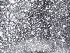
My Aunt took this photo during what has been deemed "the death band" of the Blizzard of 2013...unofficially 7"/hr. -

7"/hr. near Hartford
Images added to a gallery album owned by LakeEffectKing in Members Albums Category
-
Here's another cool example of having fun with methane!


