Math/Met
-
Posts
248 -
Joined
-
Last visited
1 Follower
.thumb.jpg.9707d4addca3d84715ae3d888c5c10d6.jpg)
About Math/Met

Recent Profile Visitors
2,823 profile views


-
Currently the heaviest snow of the event under one of those bands. Bigger flakes too.
-
You can tell on radar that low level instability has increased over the past couple of hours. More distinct bands.
-
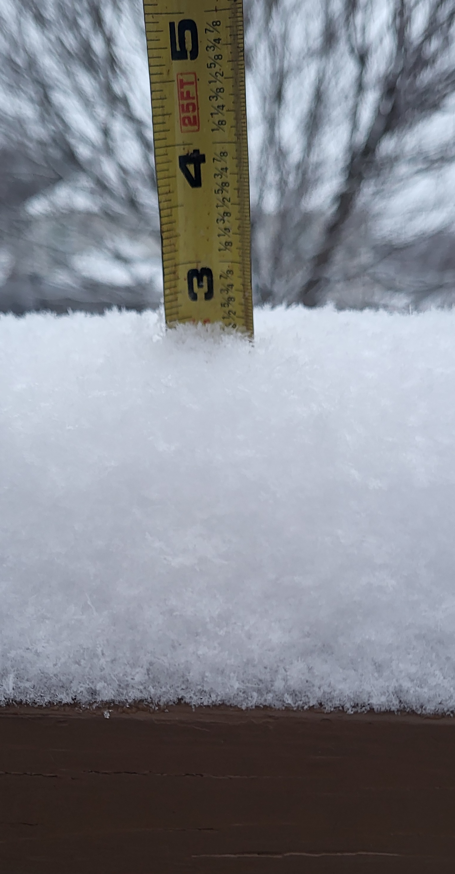
Similar rates here. I have just over 3 inches of accumulation now, so about .5 inch increase in about 45 minutes.
-
Not bad. Still snowing and continuing to accumulate.
-
Snow has picked up in Greene Co. Most of the snow from earlier today melted, but it's starting to accumulate again now.
-
I like to use short range models to monitor when 850mb temps of -10 to -12C get advected into the area. The radar usually start to fill in when that happens. Just have to know how your area does in these situations.
-
Model soundings later tonight (after about 09z in my area) make me optimistic too. Good saturation/depth in the DGZ. The DGZ dropping below 850mb usually helps and steep lapse rates extend into the snow growth layer. There's definitely potential for some areas to overperform under these high ratio bands.
-
Light snow falling with 1 inch of snow in Greene Co.
-
Downslope is always a concern with southerly flow at 850mb, but I'm actually becoming less concerned about that as we get closer to the event. The southerly flow at 850mb is pretty weak. 925mb winds are northeast over NE TN. The surface wind is down valley with a bit of an inverted trough along the mountains. In my opinion, this could minimize downslope potential. With limited moisture to work with, we need to limit any downslope in those areas.
-
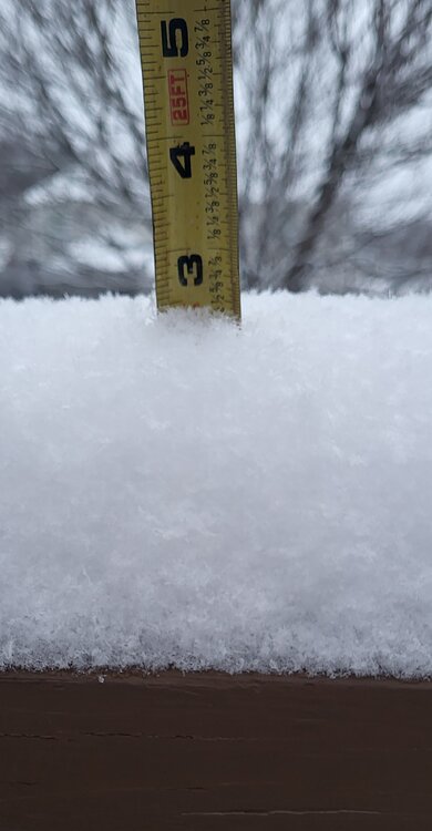
Got just over 3 inches of snow at my house in Greene County with light snow still falling. Considering this was a system with southerly flow over the mountains, I'm satisfied with the results. Fortunately the downslope was actually pretty minimal for my area. Camp Creek never reported downslope winds. There was a brief period in southwestern Greene County with southerly winds and a brief temperature response. I'm not sure how that affected totals in that area. The core of the 850mb winds staying south prevented this from being a more significant downslope problem for more of the county.
-
There are definitely parts of Greene Co that struggle with getting a good snow. I used to live in one of those areas. Areas on the eastern half do better on average. I've had a few snows in the last decade over 5 inches. Last year was definitely not fun though.
-
When 850mb winds are southerly, there will be some negative effects for areas adjacent mountains. That's the unfortunate reality. (Its also why parts of Greene Co do well in NW flow events). However, how the 850 LLJ develops makes a huge difference. If the stronger winds develop to the west and move into the mountains, that is more of a true downslope wind. When the core of the LLJ stays to the south or builds in from the south, low level convergence can offset the downslope effects and there's only small decrease in precip amounts. Small changes in the evolution make a very significant difference.
-
That's my thought at the moment as well. I've seen the NAM go crazy with bringing the LLJ too far north and too strong many time while looking at wind events. It tends to hold on to that look until the last minute. Hopefully that's the case this time.
-
I'm pretty sure the gust of 93mph at Camp Creek overnight was the highest ever recorded at that station...unless I'm forgetting something. I think the previous record was 92mph. I'm certain there were other stronger events (2004 was the strongest I can remember), but there weren't reliable data at that point.
-
Great video. Thanks for sharing. Hopefully you enjoyed your trip.