dilly84
-
Posts
4,076 -
Joined
-
Last visited
Content Type
Profiles
Blogs
Forums
American Weather
Media Demo
Store
Gallery
Everything posted by dilly84
-
Yep. Mainly because lows are similar, outcomes way different.
-
Euro looks great. Has some good winds as well.
-
Might as well add that the NAVGEM has a 999mb low near Morgantown
-
UK met precip totals.
-
I'd agree but purple on top of it would be sleet lol
-
Makes no sense.. I'll just give up trying to understand it.


-
Remember that line I said? Cincinnati to Lisbon lol. Now go look at the ptype. Majority of that all the way to Knox county would be sleet and zr lol
-
Hey Jim, read above and explain my question. You're probably one of the most intelligent on this board maybe you can answer. Was the longer post
-
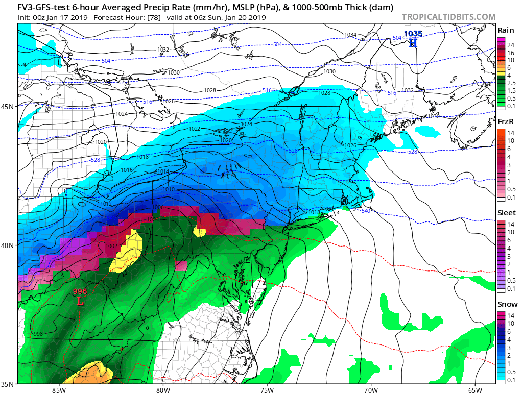
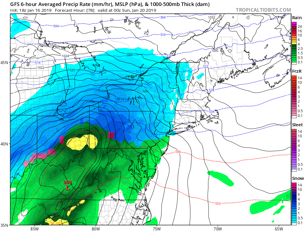
Fv3 gonna do the same as the GFS? Low in NW Arkansas at hr 60, but can already see where the rain snow line will set up it appears. I'll guess a line from Cincinnati to Lisbon. I mean I dont wanna look stupid, but I just can't make sense of where some of these models show the low, yet not much snow with em.
-
Idk, depends on if you're basing your forecast on the location of the low or the strength of the low overpowering the high. We all know WAA is a killer around here but not usually in a setup like this. For example... on the GEM the low makes it from central KY to Wheeling yet stays snow further southeast than the GFS who's low was further south and never really comes close to Wheeling. That alone makes little sense to me. Maybe someone more knowledgeable can explain it.
-
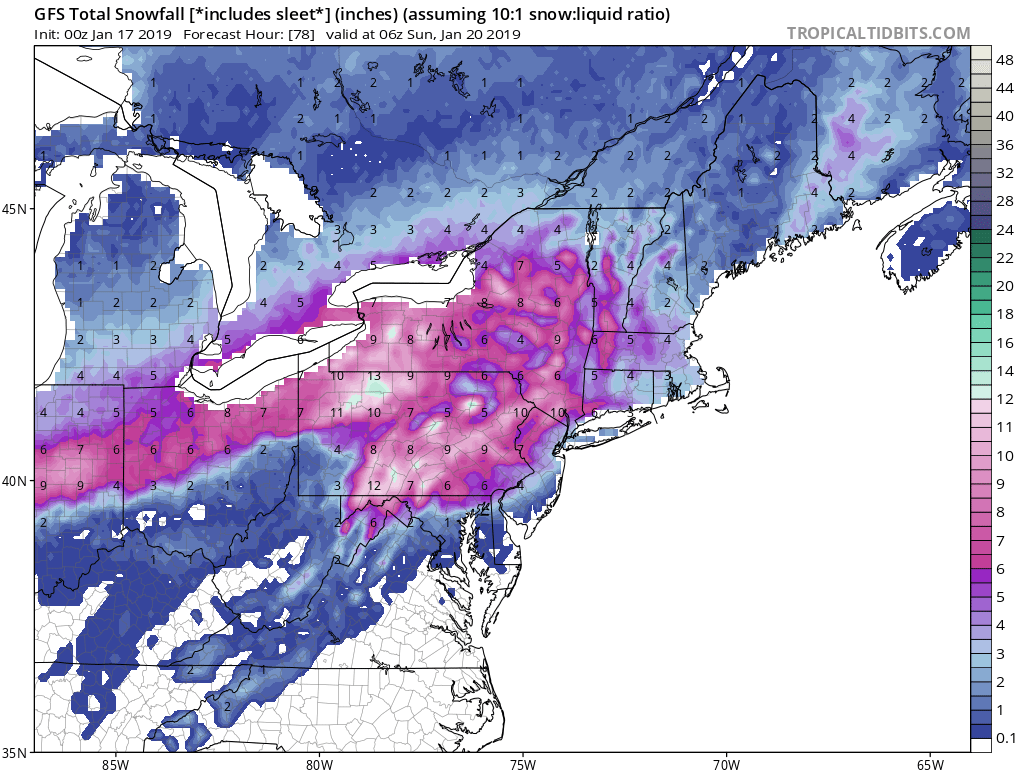
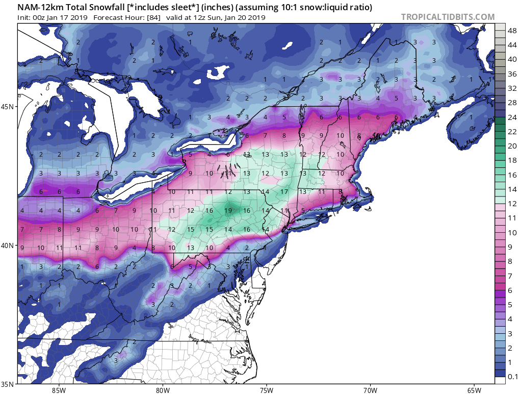
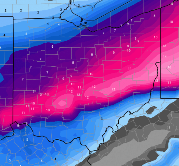
Gem gives a band of 11-15" across central ohio just north of i70
-
Was horrible. 2" for you
-
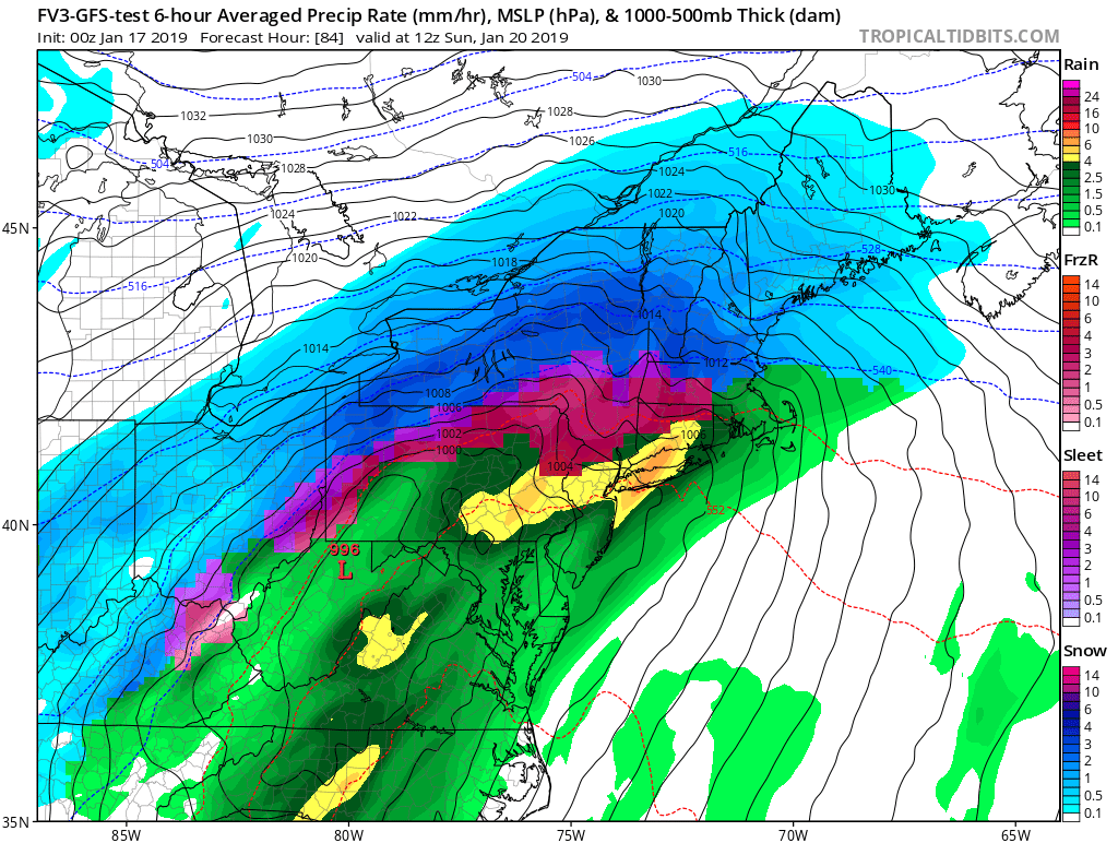
GFS and ICON essentially carbon copies. The low on the nam gets closer than both those models but dont show the rain like these two.
-
That's the thing hes got it all snow the whole time in marion and says max of 5-8". Makes no sense to me. Edit: he must be going gfs lol
-
But he literally made no sense. He said it's a decent setup but not one that can give a high snow amounts. Go to nbc4 Facebook and watch it. Was flabbergasted that he flat out said it's not possible to get more than 8" and to essentially ignore any weather that says otherwise. As someone who gets paid to inform the public it seems irresponsible to make bold claims that this won't be massive. When some models show otherwise.
-
Storm team 4 met David Mazza prediction 3-5" with a max of 5-8 more north. Says any model showing more than 8 is wrong lol
-
Oh I know. Itd be close to 20" of snow.
-
Icon is going to absolutely pummel I70 and north. Higher winds as well. Would be a full blown blizzard assuming it stayed snow
-
I even went and looked at kuchera maps to make sure I didnt miss something like zr lol.
-
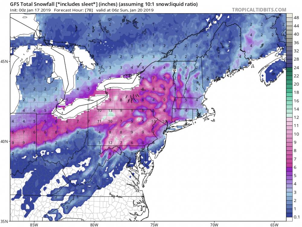
What are you looking at? Lol has 8-12 almost all the way to Ohio river

-
Ptype maps still showed mixing issues. And I'll be honest, it kind of worries me that many are showing it. While I like the position of the low, the fact they're showing mixing issues tells me they know something I dont.
-
Fv3 further north again. Let's get this thing sampled already. Lol
-
Usually that track is perfect. Never gets further than that and goes east through southern ky. Should be perfect but isn't. I'm sticking with ptype issues from the models. Makes little sense to have cold air rushing in with a low in southeast ky and still raining.

-
Icon similar to 12z takes low to KY then redevelops in VA. Same ptype issues though where it brings thunderstorms which buckeye and I was talking about earlier not thinking that's correct.
-
I'm cle.