thunderbolt
-
Posts
840 -
Joined
-
Last visited
Content Type
Profiles
Blogs
Forums
American Weather
Media Demo
Store
Gallery
Everything posted by thunderbolt
-
Thanks I’ll try my best. Maybe you and I could sit down and have a beer and we can talk about next year
-
For those who were picking the super not happening, maybe next year -0.7 -0.7 -0.6 -0.3 -0.2 0.1 0.2 0.3 0.3 WL 2017-2018 0.1 -0.1 -0.4 -0.7 -0.8 -1.0 -0.9 -0.9 -0.7 -0.5 -0.2 0.0 WE 2018-2019 0.1 0.2 0.5 0.8 0.9 0.8 0.8 0.7 0.7 0.7 0.5 0.5 2019-2020 0.3 0.1 0.2 0.4 0.5 0.6 0.5 0.5 0.4 0.2 -0.1 -0.3 ML 2020-2021 -0.4 -0.6 -0.9 -1.2 -1.3 -1.2 -1.1 -0.9 -0.8 -0.7 -0.5 -0.4 ML 2021-2022 -0.4 -0.5 -0.7 -0.8 -1.0 -1.0 -1.0 -0.9 -1.0 -1.1 -1.0 -0.9 WL 2022-2023 -0.8 -0.9 -1.0 -1.0 -0.9 -0.8 -0.7 -0.4 -0.2 0.1 0.5 0.8 ME 2023-2024 1.1 1.3 1.6 1.8 1.9 ENSO Type Season JJA JAS ASO SON OND NDJ DJF JFM FMA MAM AMJ MJJ
-
How’s your 2.3 working out for you? And you’re super El Niño not gonna happen when all said and done you’re gonna lose anyway, I hope you have a great new year
-
Bye-bye
-
Lol
-
That won’t last long it will be below 2 in let’s say two weeks at max
-
Relax buddy I didn’t mention your name
-
No, it’s not I guess for those who were predicting a super El Niño now I guess they will just have to wait for the next El Niño for those who were predicting a strong El Niño Congratulations.
-
https://x.com/chris88808568/status/1735098825801433259?s=42&t=9oYN55kJQkQ18l6qbtT9mw It’s over for those who are predicting a super El Niño
-
Nice work there GA
-
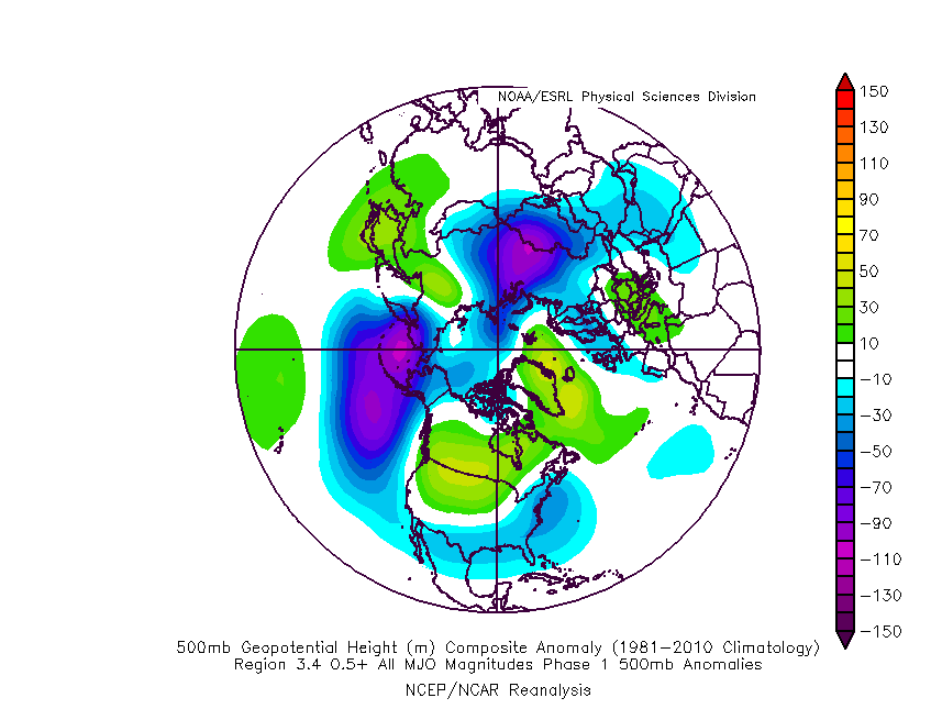
By chance do you have a composite that shows a warm look with a .5 or greater with El Niño
-
That also goes for number two

-
One is not a warm phase for December
-
Winter '23-'24 Will Be A Lesson In Relativity
thunderbolt replied to 40/70 Benchmark's topic in New England
Did you post your outlook ? -
Phase1 when El Niño is greater than .5
-
Lol
-
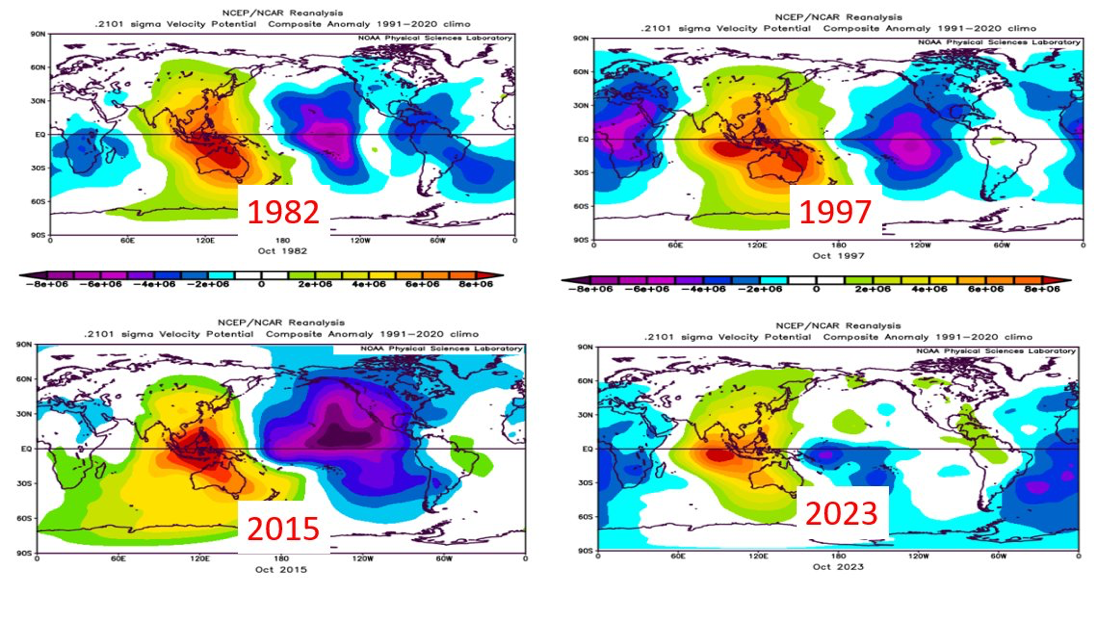
As we've discussed extensively in our recent client reports and Webinars, while ocean temperatures are suggestive of a strong El Nino event, the atmospheric response in the central/eastern tropical Pacific looks nothing like other recent strong El Nino events. Here, you can see the tropical atmospheric response, illustrated by the 200 mb velocity potential, from the month of October for 1982, 1997, 2015, and 2023. You don't have to completely comprehend what the heck velocity potential is to see that the 2023 event has a much weaker, more smeared signal in the central/eastern tropical Pacific than the other events did. The previous events were characterized by strong rising motion (blues/purples) east of the dateline, while the current event is characterized by weaker rising motion closer to the dateline. tweet from Todd Crawford

-
Yes, I don’t know how far west it’s going to be from there, but regardless, it should be on a dirty side of the storm storm surge should be pretty intense with definitely some heavy rains and very strong winds
-
David Birch ocean, data analyst
-

-
How is El Niño shaping up? While referencing a 30-year sea level record, @NASA scientists are tracking changes in ocean height. This year’s El Niño seems modest compared to extreme events in 1997 and 2015, but it could still intensify.
-
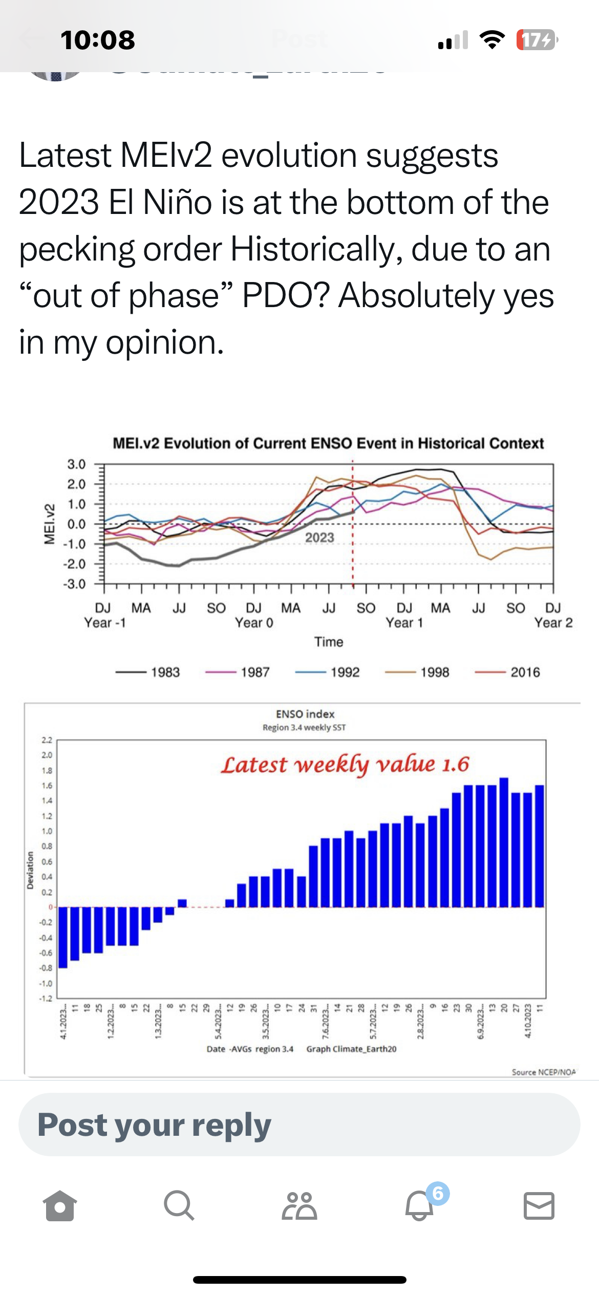
https://x.com/climate_earth20/status/1709898677857206599?s=42&t=9oYN55kJQkQ18l6qbtT9mw
-
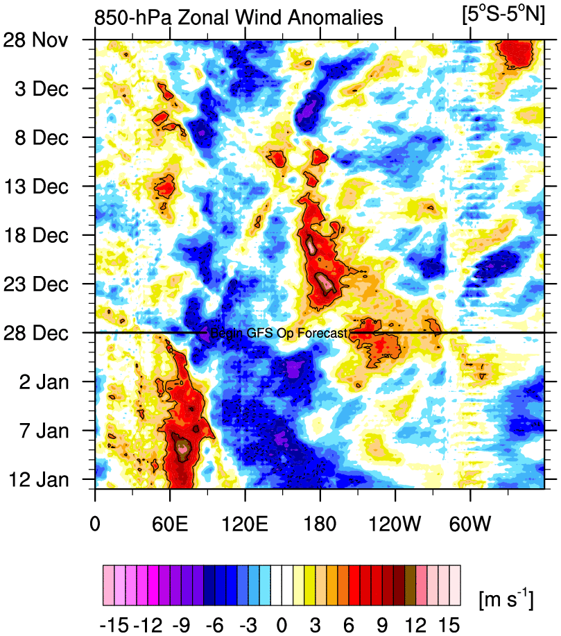
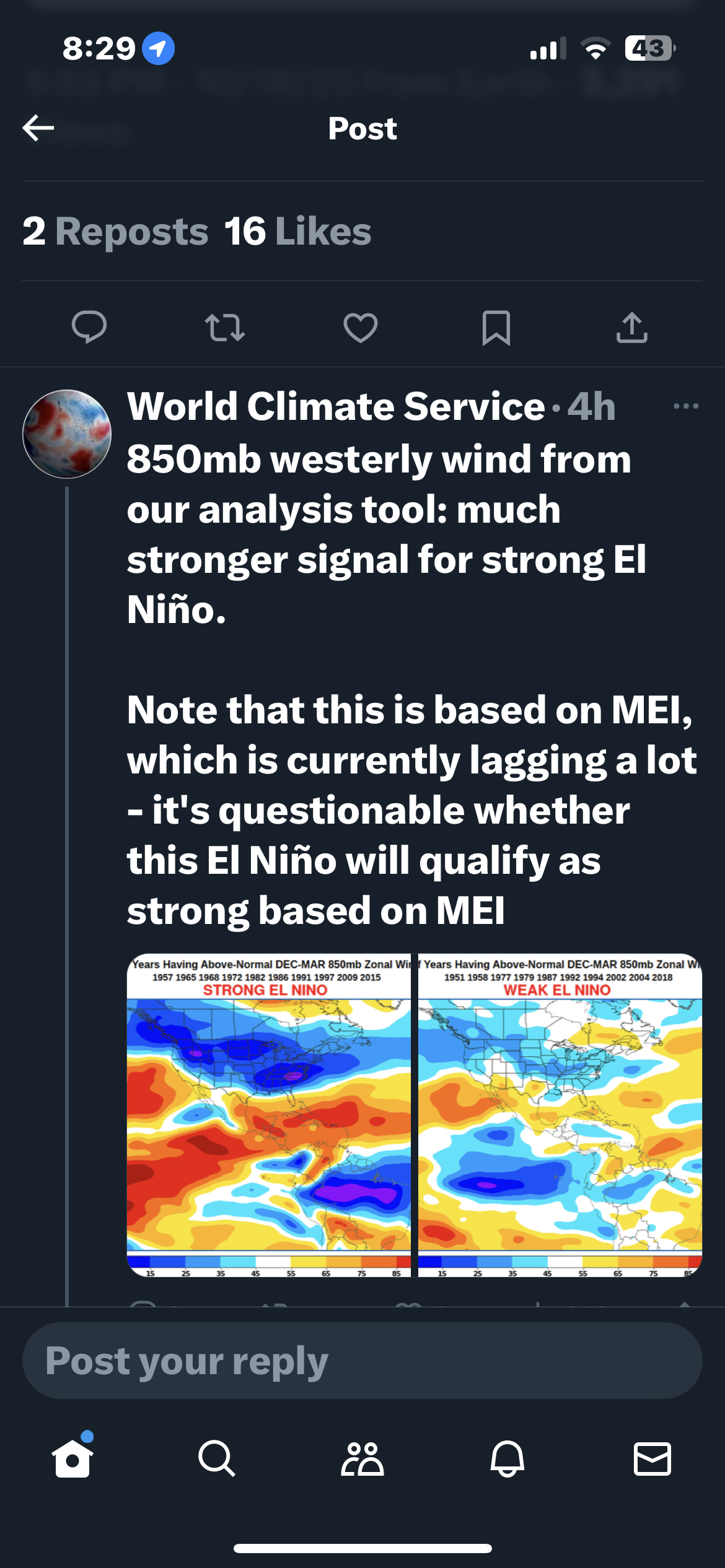
https://x.com/worldclimatesvc/status/1708214486182592584?s=46&t=0Oumv6zHO3syasHyhUQrgQ
-
https://x.com/blizzardof96/status/1705905438200410159?s=42&t=9oYN55kJQkQ18l6qbtT9mw