CCHurricane
-
Posts
541 -
Joined
-
Last visited
Content Type
Profiles
Blogs
Forums
American Weather
Media Demo
Store
Gallery
Everything posted by CCHurricane
-

January 2026 regional war/obs/disco thread
CCHurricane replied to Baroclinic Zone's topic in New England
Likely increase these by 50%-100% for all areas in New England. Ratios should be 15-20:1 with temps ~20 or lower. -
January 2026 regional war/obs/disco thread
CCHurricane replied to Baroclinic Zone's topic in New England
16.5" for Barnstable, MA -
January 2026 regional war/obs/disco thread
CCHurricane replied to Baroclinic Zone's topic in New England
Ratios should be killer, could be ~15/20:1 for most. Won't take that much moisture to produce +6". ICON bump north below (00z vs. 12z) -
January 2026 regional war/obs/disco thread
CCHurricane replied to Baroclinic Zone's topic in New England
00z GFS-AI well south...on to tomorrow! -
Rise of the Machines: January 18-19 Winter Storm Obs Thread
CCHurricane replied to WxWatcher007's topic in New England
Last burst on Cape overlooking Nantucket sound ~ 9AM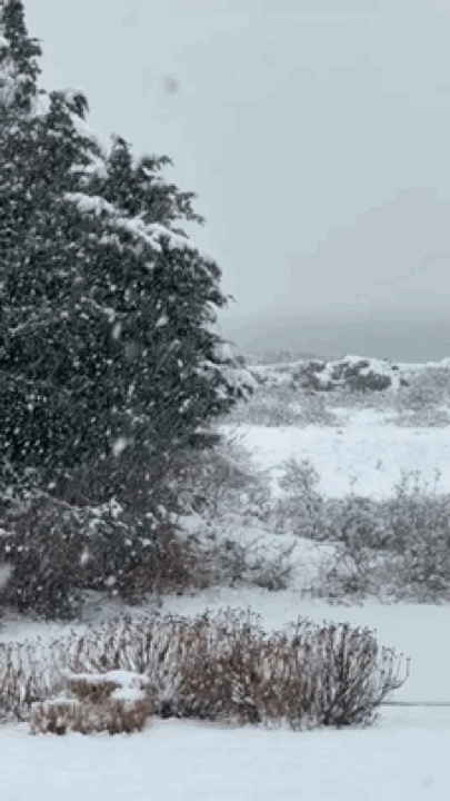
-
Rise of the Machines: January 18-19 Winter Storm Obs Thread
CCHurricane replied to WxWatcher007's topic in New England
4.0” OTG in Barnstable, storm event likely closer to 4.5”-5.0”. Can see a distinct layer of melt at bottom of snow. -
Rise of the Machines: January 18-19 Winter Storm Obs Thread
CCHurricane replied to WxWatcher007's topic in New England
Another rare winter storm with minimal wind. Snow falling almost vertical so very easy to measure. Right around 3.75”, should end up +4” of heavy wet paste. Performing well on Cape Cod despite accumulation not beginning until after 4PM.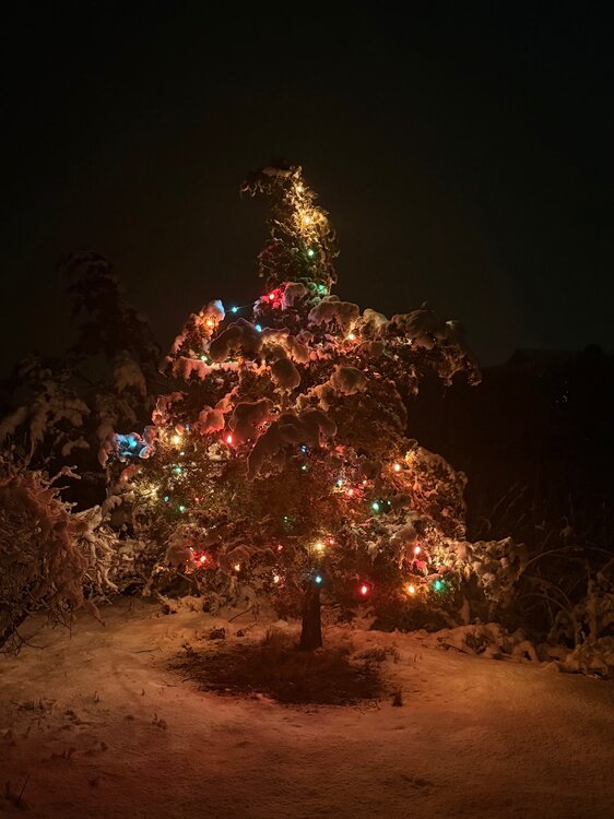
-
Rise of the Machines: January 18-19 Winter Storm Obs Thread
CCHurricane replied to WxWatcher007's topic in New England
Talk about a wet snow… -
Rise of the Machines: January 18-19 Winter Storm Obs Thread
CCHurricane replied to WxWatcher007's topic in New England
These became mostly automated at some point in the recent past, correct? Feel like they’ve been far too volatile / unreliable vs. the previous iteration. -
Rise of the Machines: January 18-19 Winter Storm Obs Thread
CCHurricane replied to WxWatcher007's topic in New England
2.5” @ 8:30PM here in Barnstable/Hyannis. -
Rise of the Machines: January 18-19 Winter Storm Obs Thread
CCHurricane replied to WxWatcher007's topic in New England
1.75” here in central Cape Cod @ 7PM (Barnstable). -
Rise of the Machines: January 18-19 Winter Storm Obs Thread
CCHurricane replied to WxWatcher007's topic in New England
Returns under this band are pretty lackluster unfortunately. -
First Legit Storm Potential of the Season Upon Us
CCHurricane replied to 40/70 Benchmark's topic in New England
Widespread 3-6 should get the job done for all of SE New England. -
First Legit Storm Potential of the Season Upon Us
CCHurricane replied to 40/70 Benchmark's topic in New England
I believe it was the QB draw to the left side, the play before the deep pass interference inside the 10-yard line. Payton clarified in his press conference. -
First Legit Storm Potential of the Season Upon Us
CCHurricane replied to 40/70 Benchmark's topic in New England
HRRR has much more consolidated LP look, which helps all. -
First Legit Storm Potential of the Season Upon Us
CCHurricane replied to 40/70 Benchmark's topic in New England
Did see a modest jog west on 12z AIGFS, bump up from 6z. -
First Legit Storm Potential of the Season Upon Us
CCHurricane replied to 40/70 Benchmark's topic in New England
Skynet is capitulating. Decent shift SE on precip shield and precip totals for all outside of extreme SE New England. -
First Legit Storm Potential of the Season Upon Us
CCHurricane replied to 40/70 Benchmark's topic in New England
Cuts down on precip across interior New England, increases in southern and southeastern. -
New Years Day 2026 - 1st snows of the new year possible
CCHurricane replied to Baroclinic Zone's topic in New England
Conditions in Barnstable were whiteout there for 30 min. Visibility < 100 yards. -
Wounded Duck Strikes Back: Dec 26 & 27th Winter Storm Obs
CCHurricane replied to WxWatcher007's topic in New England
Snowfall on Cape Cod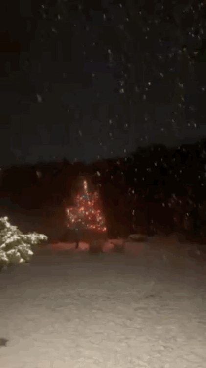
-
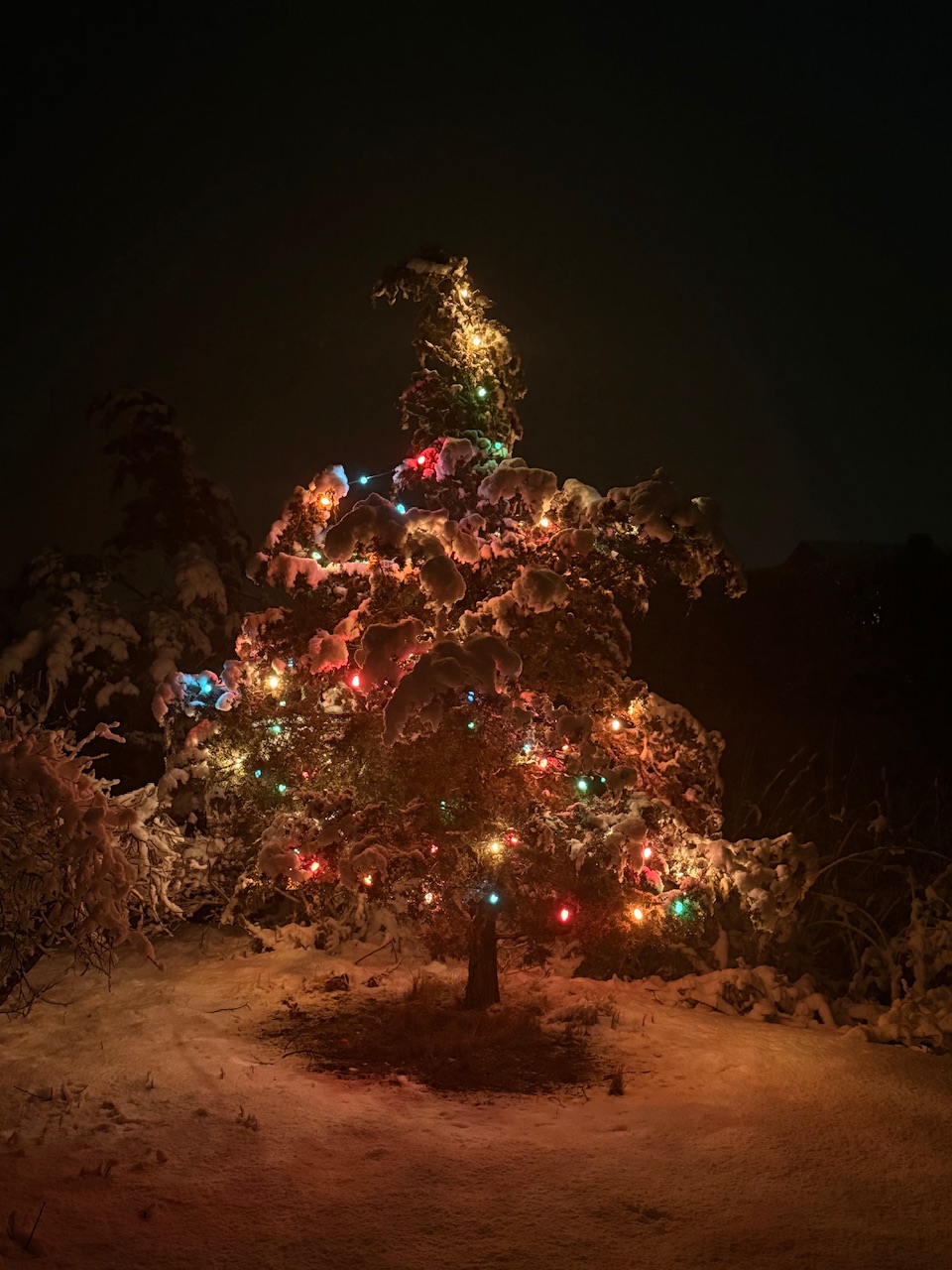
White Christmas Miracle? December 23-24th
CCHurricane replied to Baroclinic Zone's topic in New England
Hard to beat the recent run the Cape has seen. Has had either snow falling, or snow on the ground Christmas Eve / Christmas for 3 of the last 4 years. The 2022 ocean effect band (west to east instead of the normal north to south!) was one to remember. This afternoon in Barnstable. -
December 14th - Snow showers or Plowable snow?
CCHurricane replied to Sey-Mour Snow's topic in New England
A parting view on the ride out of town last night.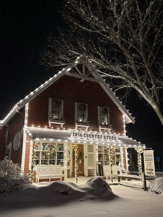
-
December 14th - Snow showers or Plowable snow?
CCHurricane replied to Sey-Mour Snow's topic in New England
Roads pretty rough on Cape. A day of two storms; A calm wind bringing 3” of wet snow until 4PM, followed by dropping temps, winds gusting to 30mph out of the NW, and +3” additional inches of fluff. -
December 14th - Snow showers or Plowable snow?
CCHurricane replied to Sey-Mour Snow's topic in New England
Just a hair under 6” here in Barnstable. -
December 14th - Snow showers or Plowable snow?
CCHurricane replied to Sey-Mour Snow's topic in New England
Right around 4.5" in Barnstable at the moment. Will see if we can sneak out another 1" before it wraps up.