TSG
-
Posts
675 -
Joined
-
Last visited
Content Type
Profiles
Blogs
Forums
American Weather
Media Demo
Store
Gallery
Everything posted by TSG
-
I don't have much to add past what I posted already. Just want to say I appreciate your thoughts/perspective on things, thanks for the reply. You have any recommended reading on this topic?
-
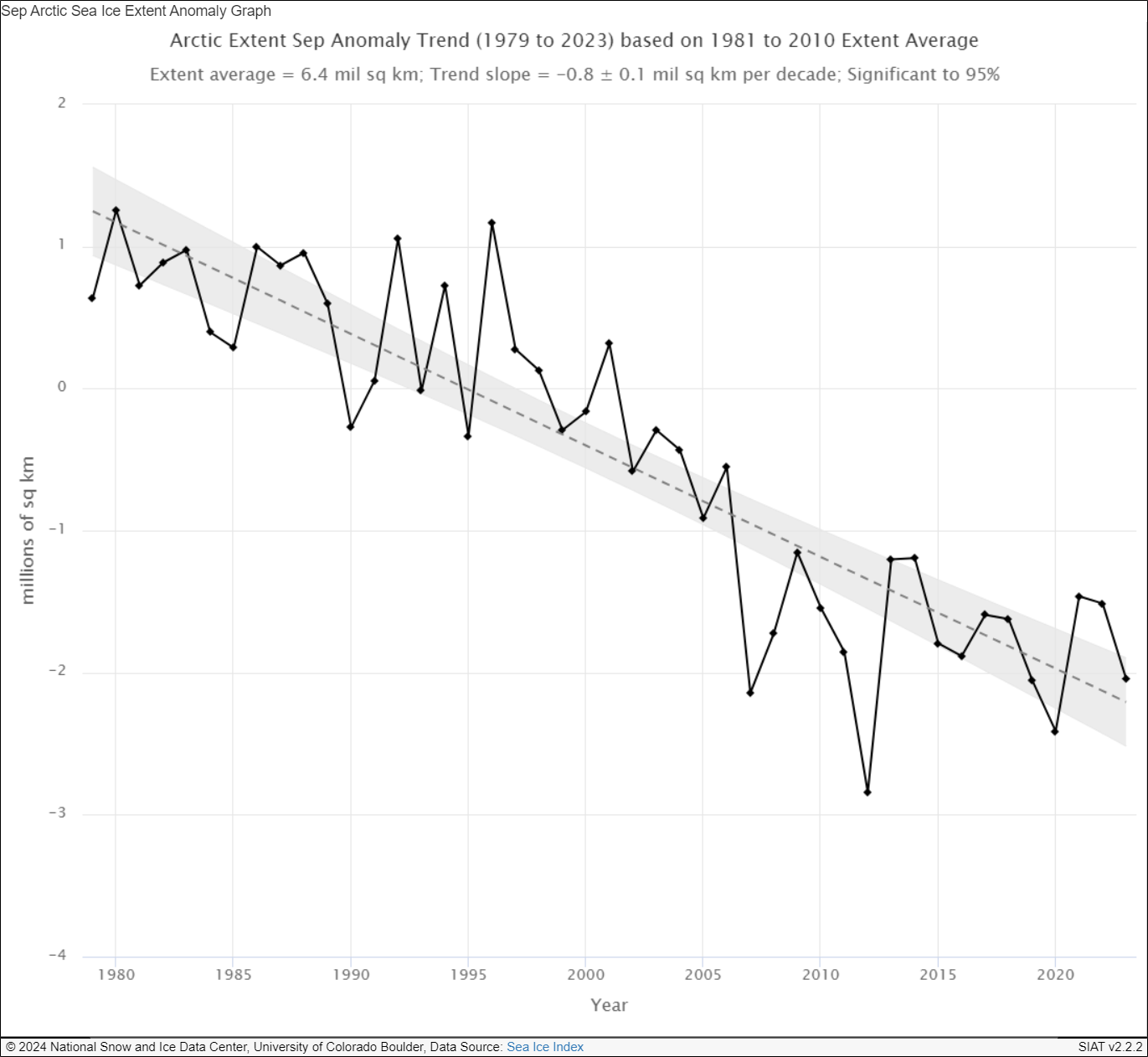
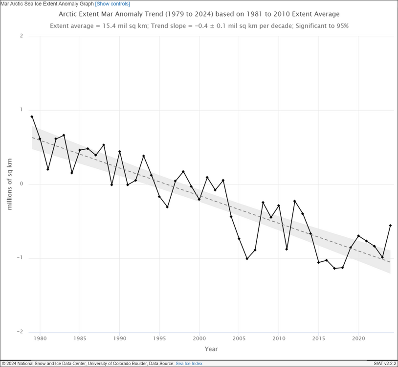
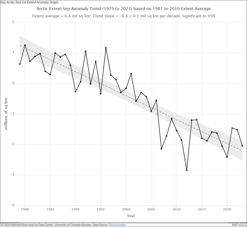
I'm very curious what effects the changes in the arctic have had on our local patterns. I've loosely tracked the seasonal ice coverage for the past ~10 years now. There's been some clear patterns but I'm not sure what to make of most of them. One of the interesting points becoming clearer the last few years is that there was a major step change in terms of summer minimum ice coverage around 2007. You can see a similar pattern in winter maximum ice extent but it's not nearly as pronounced. This largely has to do with the geography at play, the latitudes where sea ice could continue forming late winter are largely occupied by land, so there's a limit on the variation possible here compared to summer minimums. EDIT: @Stormchaserchuck1Found an interesting paper on this exact topic. https://iopscience.iop.org/article/10.1088/1748-9326/abc047 "The behavior of Arctic sea ice during recent years has perplexed the scientific community. The ice extent has attained or flirted with new record lows during winter and spring months every year since 2012, raising the specter of hitting a new minimum in September. Instead, however, the ice-loss trajectory took a sharp turn in August or early September (except in 2020), averting a broken record. Responsible for the cessation was the formation of low pressure over the region, which brings clouds, reduced insolation, and winds conducive for expanding the ice cover. The consistency of this occurrence begs the question: why is it happening? Here we offer evidence that the dramatic negative trend in spring snow cover over high-latitude land areas—one of the most conspicuous indications of anthropogenic climate change—may be an important contributor to this behavior. The early loss of snow cover creates a belt of positive temperature anomalies that distorts the typically monotonic poleward temperature gradient by creating an additional peak. Through the thermal wind relationship, a split jet is more likely to form, favoring conditions that trap and amplify Rossby waves that have been implicated in causing extreme summer weather events over northern hemisphere continents."
-
I drove from Cville to Harper's Ferry this afternoon via 81. It was pretty wild going over the BR on 64. Socked in and foggy on one side, blue skies on the other
-
Maybe in some very specific spots. I just checked the VT mesonet sites for Canaan Valley and the lowest I saw there was 37F at Bald Knob
-
Temp dropping quick with the sun down. CHO was still at 79 at 7:45, down to 73 now
-
Dudes in the Leesburg office were signaling they were fully torqued from yesterday's weather as well
-
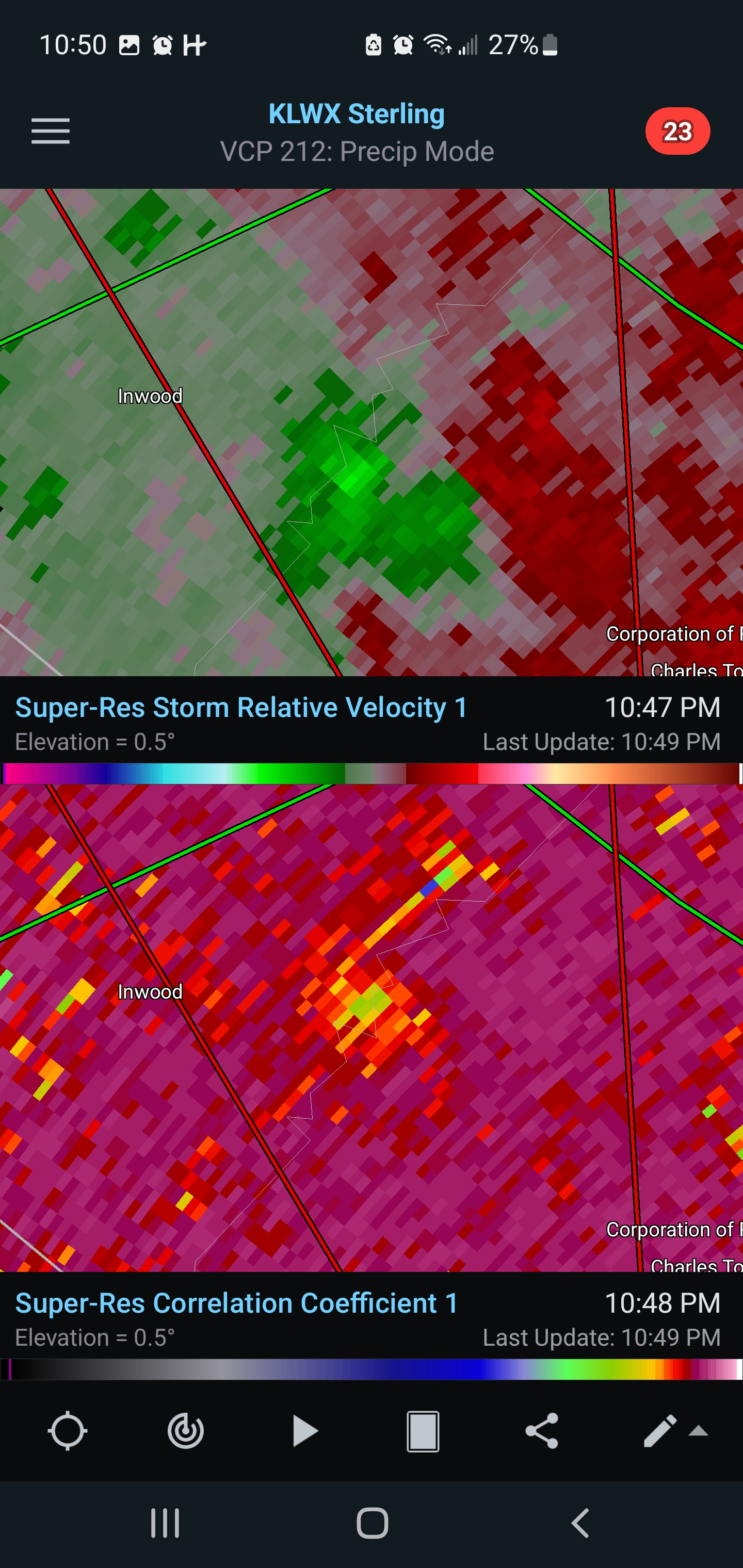
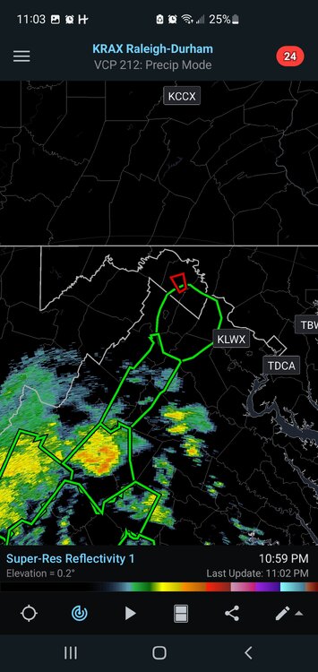
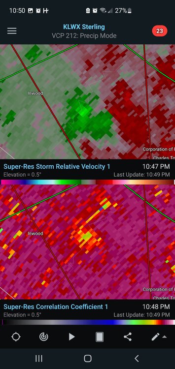
I think we have a debris ball sig on that cell in WV
-
his favorite pastime is underplaying weather events discussed on these boards. He was doing the same thing in the tropical threads last year. Not sure if it's hatred towards the NWS/NHC or what, but he's consistent lol RDU is well over 4" for the event already


-
Was just about to say this. It looks like it's kind of wobbling SW
-
First pass missed the center
-
Live shot of @EastCoast NPZ
-
Charlottesville getting demolished. We might need a flash flood warning if these cells keep firing right over town.
-
Beautiful stratiform rain and the occasional rumble of thunder behind the central VA band of convection. I can't remember the last time we got an extended period of that down here.
-
I threw some old red-skinned taters I'd left in the pantry too long in a planter last summer. It went surprisingly well, was gifted with probably 3x what I started with 2 months later.
-
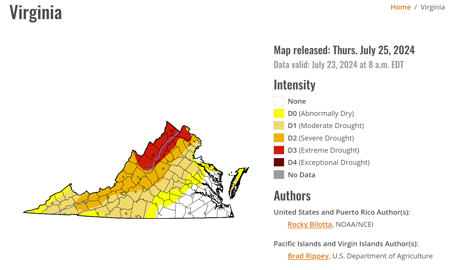
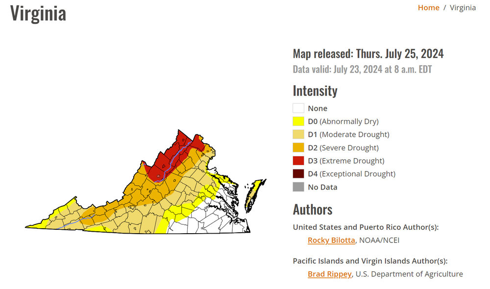
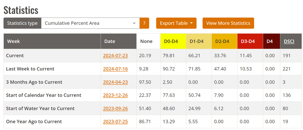
Lots of improvement for the SE half of the state. Things continue to get worse behind the Blue Ridge. DSCI for VA dropped overall since last week and should continue to do so, but not because of things happening in much of this subforum. @MN Transplant you can really see the "flash drought" in the statistics. 3 months ago the idea of being where we are now was laughable
-
pouring in Hooville. Temp dropped from 84 to 75 and the DP is now 73.. soupy out there.
-
so refreshing to have a dreary day finally. Overcast since sunrise and raining off and on since 10am
-
Anyone know why CHO is now only reporting hourly? 5 mins obs stopped coming in around 2:15am yesterday and haven't returned
-
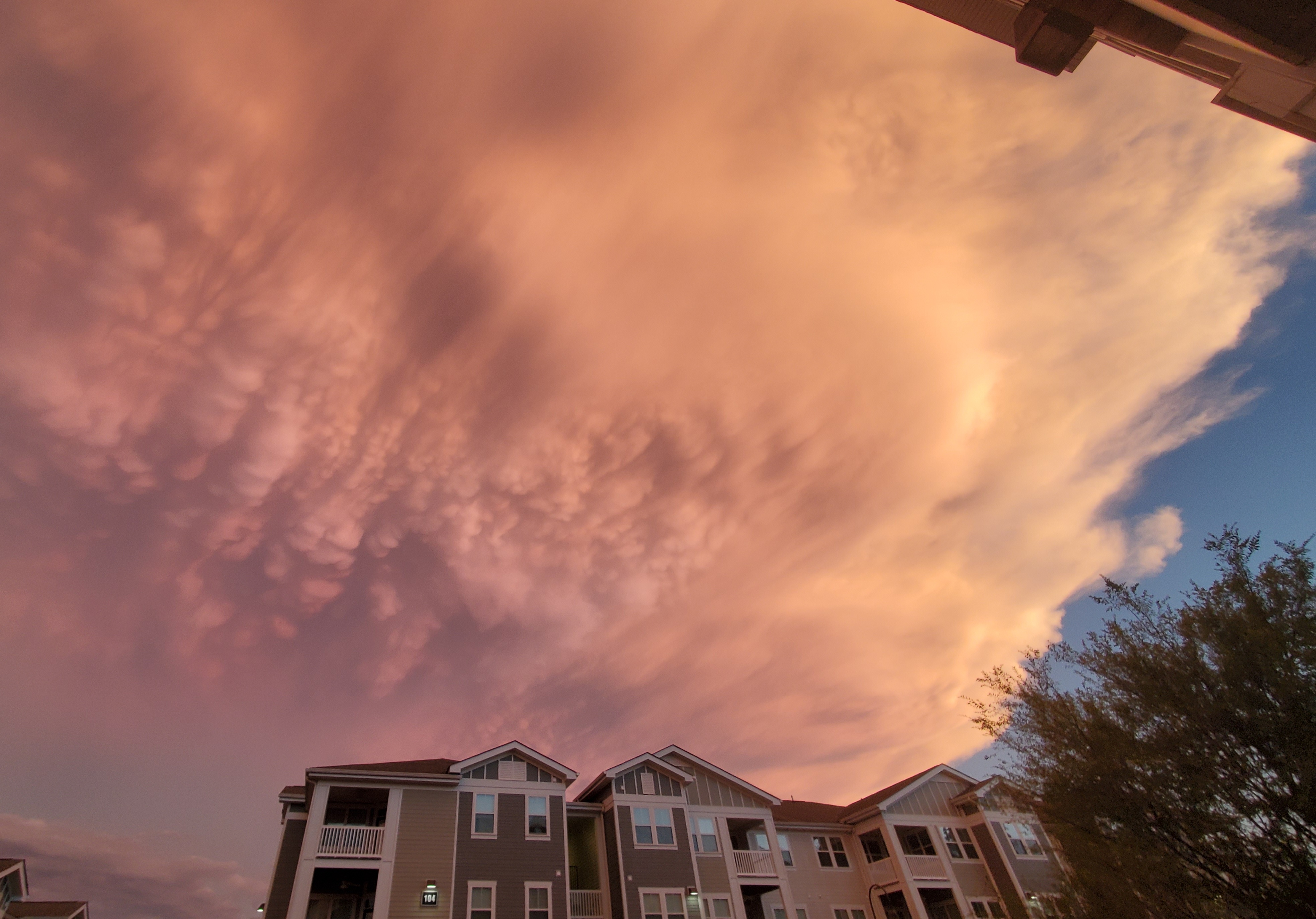
Mammatus last night at sunset

-
I'm upset about it. We got some brief gusty showers in cville proper and then the line absolutely exploded about 5 miles to our East...
-
Same here. My parents witnessed chipmunks stealing hummingbird food this week (we're assuming) for the water content. First time they've seen that in 20+ years of having that feeder out. They're getting their bird bath out of storage to help out the local critters
-
 Down to 985
 -
It's miserable out there. I'm in Falls Church visiting my parents, went out to test fit some new sunshades on my car, was dripping sweat within 10 mins
-
20z HRRR says we're in for a fun evening
- 1,696 replies
-
- 1
-

-
- severe
- thunderstorms
- (and 5 more)
-
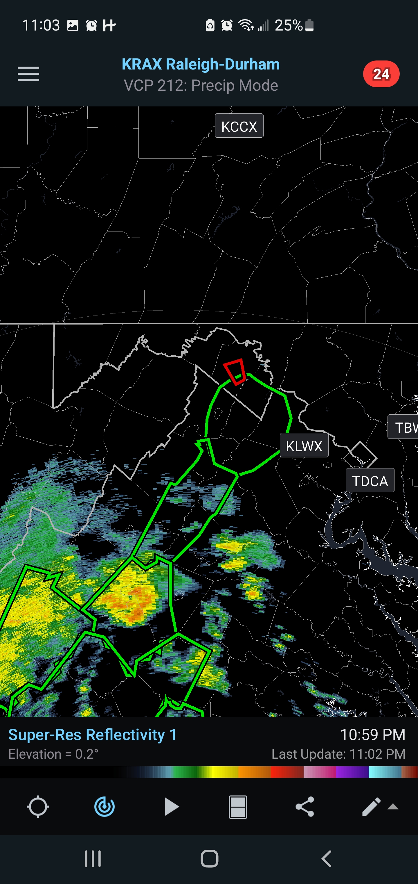
the main show isn't until later y'all, like 11pm-1am
- 1,696 replies
-
- 4
-

-
-
- severe
- thunderstorms
- (and 5 more)