TSG
-
Posts
675 -
Joined
-
Last visited
About TSG

Recent Profile Visitors
6,966 profile views


-
The skylight cover/window over the stairwell in my row house in DC was lifted off the building and disappeared into the sky that day. Pretty sure the pressure differential between inside and out during one of the gusts is what popped it free. Epic indeed.
-
this board's negative feelings about wind will never fail to amuse me. I love it. I wish we had more days like this
-
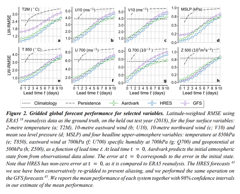
Not trying to be mean here but that article is trash. "10 times better?" Over what time scale? what variables? wtf does better even mean in this context? nothing is explained. That's an AI hype piece masked as a "the revolution is here!" feel good story Their "revolutionary" model has slightly lower RMSE values when compared to the GFS in most areas. It also runs at a 1.5 degree (~110 miles) horizontal resolution compared to the GFS's 0.25 (17.4 miles) or the ECMWF HRES's 0.1 (5.5 miles). Vertically it's also nothing close. The GFS divides the surface to the mesopause into 127 layers. The ECMWF has 137 layers. This AI model has 5. It's providing orders of magnitude less information about the atmosphere, and it's only slightly more accurate at the points it does forecast. Actual Study: https://cdn.roxhillmedia.com/production/email/attachment/1700001_1710000/865aa96b274c128474186cf6f77b2556fe008b92.pdf
-
"Pot, meet kettle."
-

-
From the science perspective, that likely contains very high NOx and SO2 particulates compared to current levels. Peak poor air quality (from those two offenders) was around 97/98. NOx dropped off quickly after 2000 and SO2 was only a few years behind. We're down about 90% on those emissions since 1995. Some environmental researcher may be mildly interested.
-
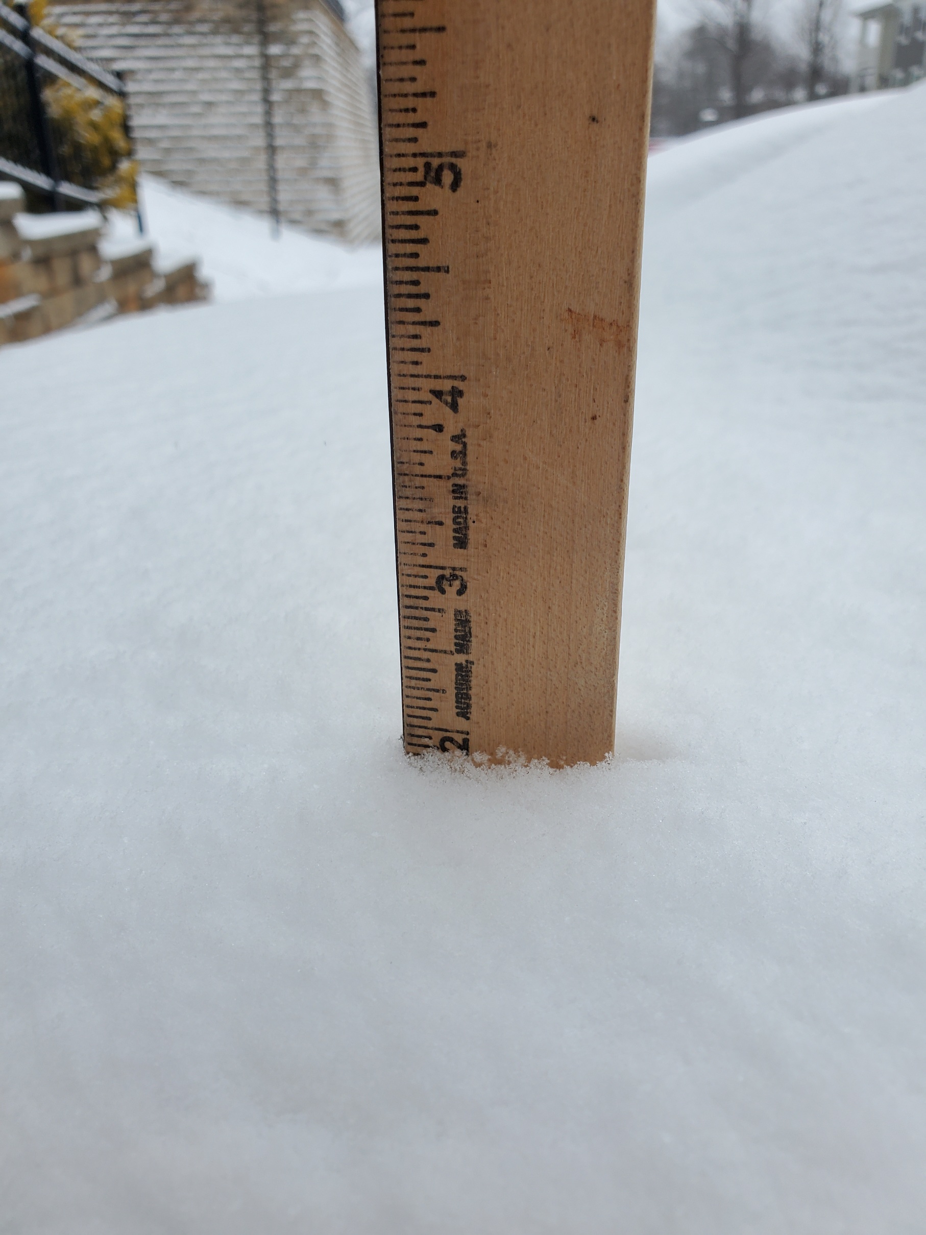
Just about done here. One of the most visually impactful 2" storms in recent memory

-
Back end approaching quick down this way. This may end up my 2nd favorite event this year due to the temps. I honestly prefer a frigid 2-3" over a sloppy 6-8" type deal like we had last week.
-
Somewhere near 2" now in Charlottesville. 19/14, mod snow, 0.5 mile vis
-
Some nice banding setting up over Albemarle. Approaching an inch here but it feels like a lot more with the temps preventing any melting. Salt did nothing this morning, roads caved instantly and have stayed covered. 18/12, moderate snow, vis. 1.25 miles
-
Yeah well half the people on this thread were doing the same so not sure this place is much of a step up. I guess if you're ignoring anything that isn't from a red tagger or like 3-4 other accounts it's fine lol. Posting any NAM output that's over 48hrs needs to be banned on here, not even kidding. These weenies need to have some sense knocked into their head. Like you might as well be posting the results of a coin flip..
-
well that was impressive to witness CHO went from 39F at noon to 55F at 1:30pm
-
Boundary layer temps continuing to run well below forecast down this way 12z NAM3k @ 1pm - 57F CHO @ 12:25pm - 45F
-
whatever survives down this way is going to become concrete overnight Temps are also way down compared to forecast. the 3kNAM had CHO at 50F by noon and they've only managed to get up to 38 here at 11:30..
-
can confirm that's a great family. I'm the same age as his youngest son. Went to JMU with them both