paulythegun
-
Posts
976 -
Joined
-
Last visited
Content Type
Profiles
Blogs
Forums
American Weather
Media Demo
Store
Gallery
Everything posted by paulythegun
-
You *DO* need one hard freeze in late March though. Gotta trick all the bugs into coming out and then just when they're ready to become annoying? Kill them all off.
-
It feels like every 3 years or so when the PV breaks down and we get a perfect track cold late April rain storm
-
Remember April 7, 2018? A decent amount of snow was modeled up until a couple days before the event. Then I believe it fizzled. https://www.washingtonpost.com/news/capital-weather-gang/wp/2018/04/04/snow-chances-for-saturday-remain-but-the-accumulation-forecast-is-complicated/
-
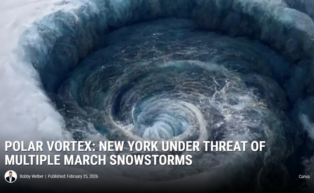
Every couple weeks, I do a google news for "polar vortex" for Lols. here's a sampling: Death of Polar Vortex showing when winter will lose its grip on Michigan https://www.yahoo.com/news/articles/death-polar-vortex-showing-winter-221130257.html Polar Vortex: New York Under Threat Of Multiple March Snowstorms https://hudsonvalleypost.com/polar-vortex-to-bring-multiple-snowstorms-in-new-york-next-month/
-

Outta gas and Outta Time: Early March Winter Storm finale
paulythegun replied to Ji's topic in Mid Atlantic
So much juice
-
That was like 1.5"+ QPF in the form of sleet on top of 4-8" of snow with temps in the teens followed by record cold. Once in a generation thing.
-
2/26 - Follow-up Hopium Battlezone Storm
paulythegun replied to DDweatherman's topic in Mid Atlantic
Precip max between 10am and 1pm. can't catch a break. -
Feb 22nd/23rd "There's no way..." Obs Thread
paulythegun replied to Maestrobjwa's topic in Mid Atlantic
Just ran out into the middle lane of the Beltway to take a measurement. Just a trace. -
Feb 22nd/23rd "There's no way..." Obs Thread
paulythegun replied to Maestrobjwa's topic in Mid Atlantic
Light snow into puddles in NE DC. Not sticking to anything, local station has 35/34 -
Feb 22nd/23rd "There's no way..." Obs Thread
paulythegun replied to Maestrobjwa's topic in Mid Atlantic
When does the diabetic cooling start? -
Feb 22nd/23rd "There's no way..." Obs Thread
paulythegun replied to Maestrobjwa's topic in Mid Atlantic
Haha ok, on it. Plus it's hrrr, who cares? -
Feb 22nd/23rd "There's no way..." Obs Thread
paulythegun replied to Maestrobjwa's topic in Mid Atlantic
Compared to 18z, 00z HRRR is a MASSIVE jump east. -
Thank you for this. People act like the storm is going to call up the Pacific Ocean tomorrow and ask it what to do. Nina/nino has a marginal impact on long wave patterns, not storms wobbling a little to the east or west
-
Dropped the high end scenarios too
-
Snow totals lowered
-
NAM 3k verbatim has snow in DC from 10am Sunday to 3pm Monday
-
Feb 22nd/23rd "There's no way..." Storm Thread
paulythegun replied to Maestrobjwa's topic in Mid Atlantic
Wetbulbs for Sunday 7pm, DC: ICON: 34F RGEM: 35F NAM3k: 33F ECMWF (6z): 33F GFS (6z) 32F -
Feb 22nd/23rd "There's no way..." Storm Thread
paulythegun replied to Maestrobjwa's topic in Mid Atlantic
I kind of love these debates. I guess with Monday rush hour potentially in play (albeit barely), they can use their discretion and go under the 5" floor for a warning? Rare that they'd do that with the watch though. But yeah the actual NWS forecast right now is 1" through 7am Monday so gotta see that move up first....and it's going to FLY above freezing so fast monday.... -
Feb 22nd/23rd "There's no way..." Storm Thread
paulythegun replied to Maestrobjwa's topic in Mid Atlantic
if you think 12z NAM 3k is a whiff, check out 13z HRRR! it shows 0" of snow through the end of the run!!!!! -
There are two schools of thought for baseline expectations Sunday: School 1: It only counts as snow if it accumulates on the Beltway, ideally during rush hour, but we'll begrudgingly count non-rush hour snow: Baseline of T-0.5" of snow. School 2: It counts as snow if it accumulates on my 30' high north-facing metal deck but then melts whenever there's a 10+ minute lull: Baseline of 2-3" of snow. Anything above and beyond that: Gravy.
-
Feb 22nd/23rd "There's no way..." Storm Thread
paulythegun replied to Maestrobjwa's topic in Mid Atlantic
This is very insightful. So much to consider. But in terms of GFS...it was great to see that we could still score on a coastal with a slightly different 500mb map. The trailing vort was a bit off starting around hour 48 but things still worked out. -
Feb 22nd/23rd "There's no way..." Storm Thread
paulythegun replied to Maestrobjwa's topic in Mid Atlantic
Looks more amped through 0 hours -
Feb 22nd/23rd "There's no way..." Storm Thread
paulythegun replied to Maestrobjwa's topic in Mid Atlantic
My heart swells with jingoistic pride when I watch the underdog AMERICAN GFS model somehow prevail, against all odds. While we await its latest nugget of wisdom, please enjoy this song -
Feb 22nd/23rd "There's no way..." Storm Thread
paulythegun replied to Maestrobjwa's topic in Mid Atlantic
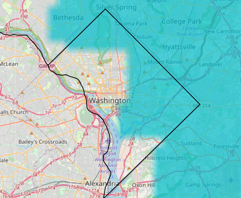
17z product here. chance of warning level snow through monday 7am.
-
Feb 22nd/23rd "There's no way..." Storm Thread
paulythegun replied to Maestrobjwa's topic in Mid Atlantic
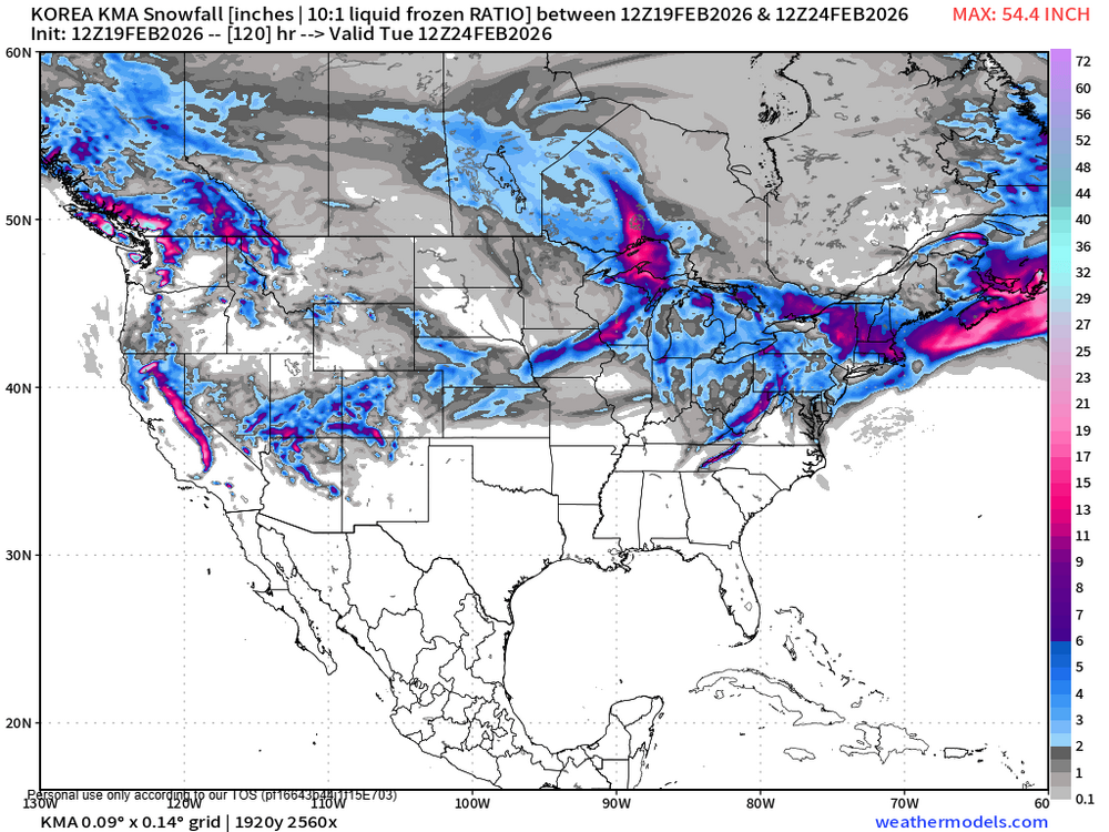
KMA stays very progressive, doesn't even give us much in the form of IVT snow. The PANGU-IFS model is a bit better, but not great. And 12z ARPEGE is about as bad as KMA.