paulythegun
-
Posts
808 -
Joined
-
Last visited
Content Type
Profiles
Blogs
Forums
American Weather
Media Demo
Store
Gallery
Everything posted by paulythegun
-
April 1st Ice Storm!!!!
-
BOOM!
-
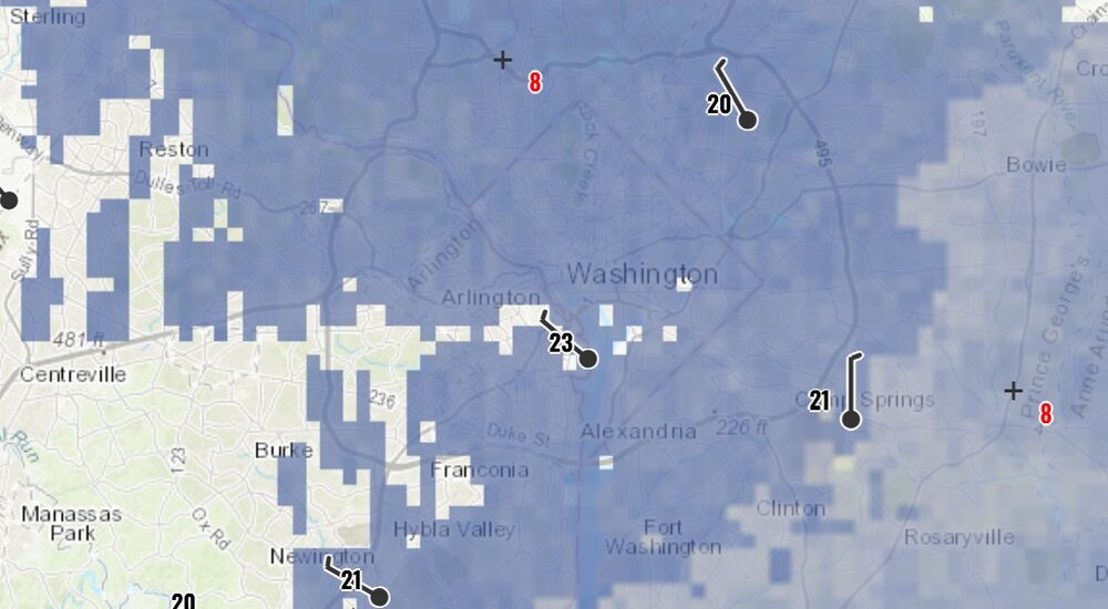
22/3F with violent, 2dBz virga downtown DC.
-
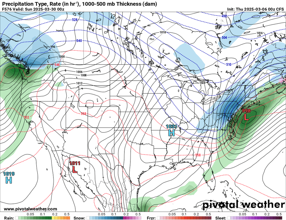
SREF shifts south AGAIN. And takes all its plumes with it.
-
Do any websites have a real time 500mb vorticity radar?
-
SREF shifted NW a bit and juiced the precip!!!! Let’s do this! PLUMES ARE LEADING THE WAY!!!
-
HOLD ON! Sampling the storm!!!
-
- 385 replies
-
- 14
-

-

-

-
-
Less spread than 06z, but still plenty. A tick faster than 06z.
-
While we wait for 12z GEOS-5, to come in, here’s 0z GEOS-5 for comparison (out to sea)
-
The…(??) MOGREPS-G not fully on board yet
-
If it was measured at the top of the DC's Mighty Mount Hamilton then that could have pushed the totals up. I live downslope from that beast so my snow totals are always diminished https://www.peakbagger.com/peak.aspx?pid=27611
-
While we wait to extrapolate the 18z 12k NAM, I'm pleased to inform you that the ACCESS-G model is on board for 8"+ regionwide.

-
-
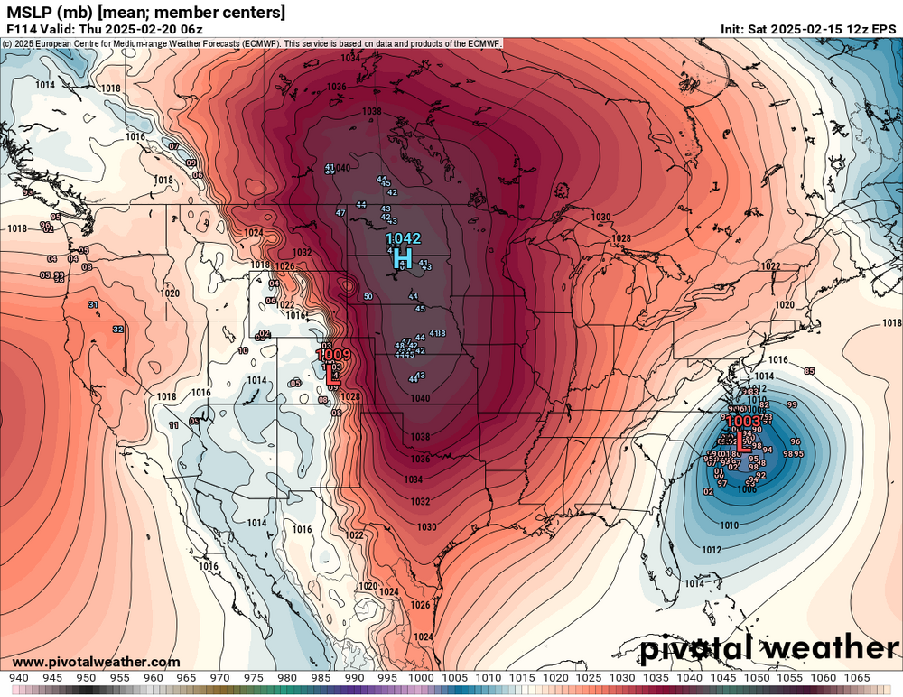
Atmospheric memory momentum!
-
Adding this to my folder of Great Snowmaps in History
-
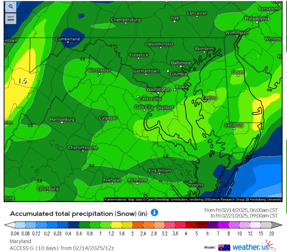
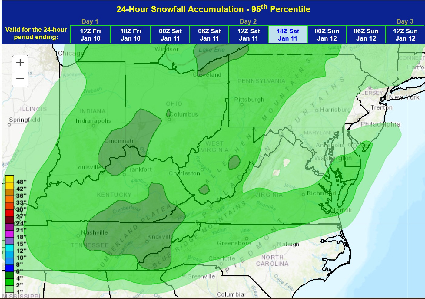
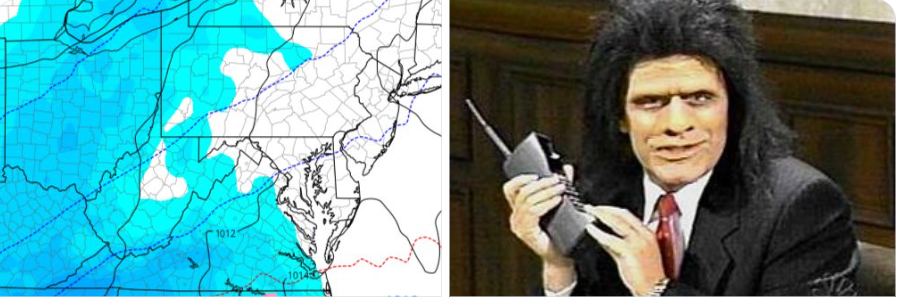
FWIW, SREF (which was very tightly packed around 0-0.2" of QPF yesterday) now has a bunch of juicier solutions ranging .06" to 0.57" of QPF for DCA. WPC 95th percentile though...not seeing those higher end solutions. Big sad face for this map.

-
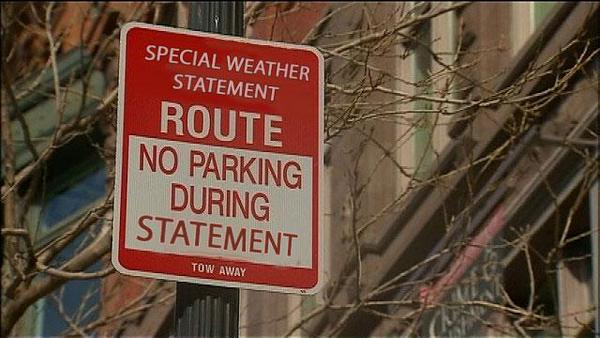
Special Weather Statement Warning for the entire region. Please move your cars until the expiration of the statement.
-
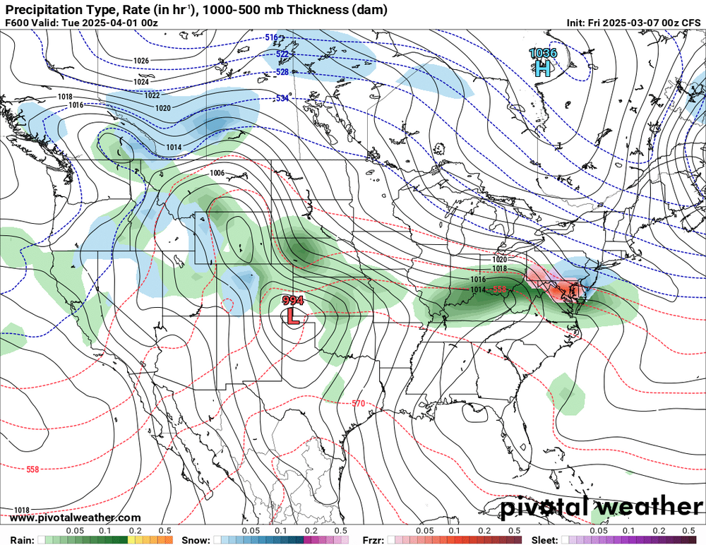
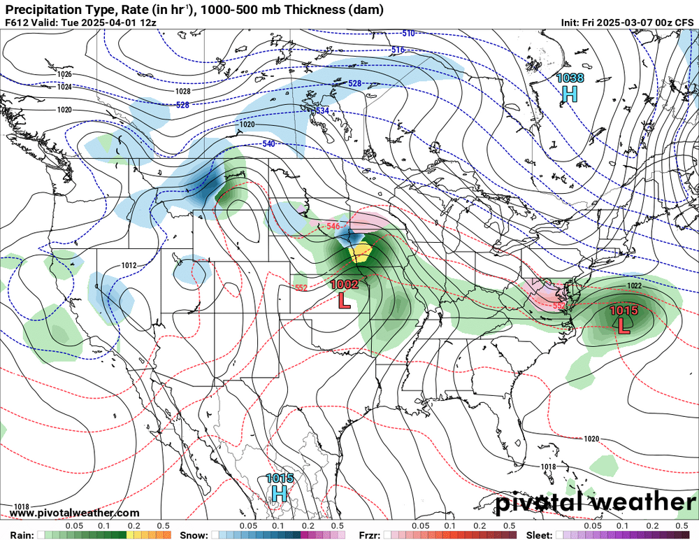
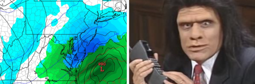
Checking 18z GFS. Much stronger. 972MB low off the SC coast with 0.4" in QPF already falling in D--- just kidding, another nothing to see here, more of the same, an inch or two regionwide, maybe. It WAS a bit wetter than 12z for Richmond/Tidewater though.
-

January Medium/Long Range: A snowy January ahead?
paulythegun replied to mappy's topic in Mid Atlantic
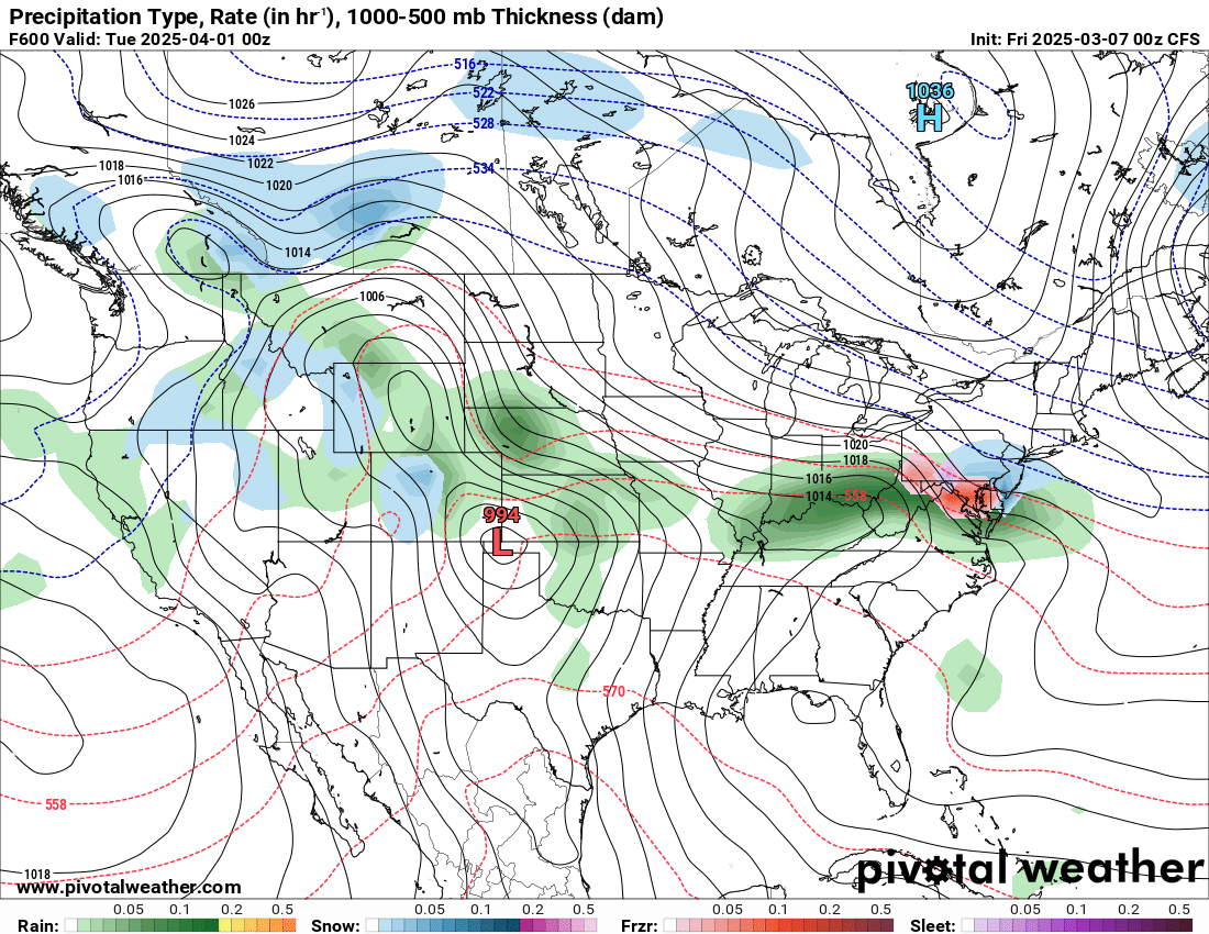
the way this is trending (looking at the last 8 GFS runs), by game time we'll have a Great Lakes Bomb Cyclone -


.gif.9426e9169e8962c495269e5f0e14d1d4.gif)