RIC Airport
-
Posts
2,586 -
Joined
-
Last visited
Content Type
Profiles
Blogs
Forums
American Weather
Media Demo
Store
Gallery
Everything posted by RIC Airport
-
Richmond Metro/Hampton Roads Area Discussion
RIC Airport replied to RIC Airport's topic in Mid Atlantic
-
Richmond Metro/Hampton Roads Area Discussion
RIC Airport replied to RIC Airport's topic in Mid Atlantic
Radar is starting to light up around Richmond.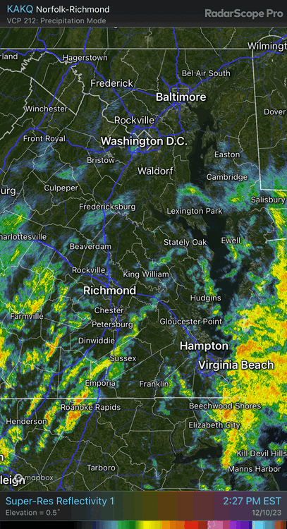
-
Richmond Metro/Hampton Roads Area Discussion
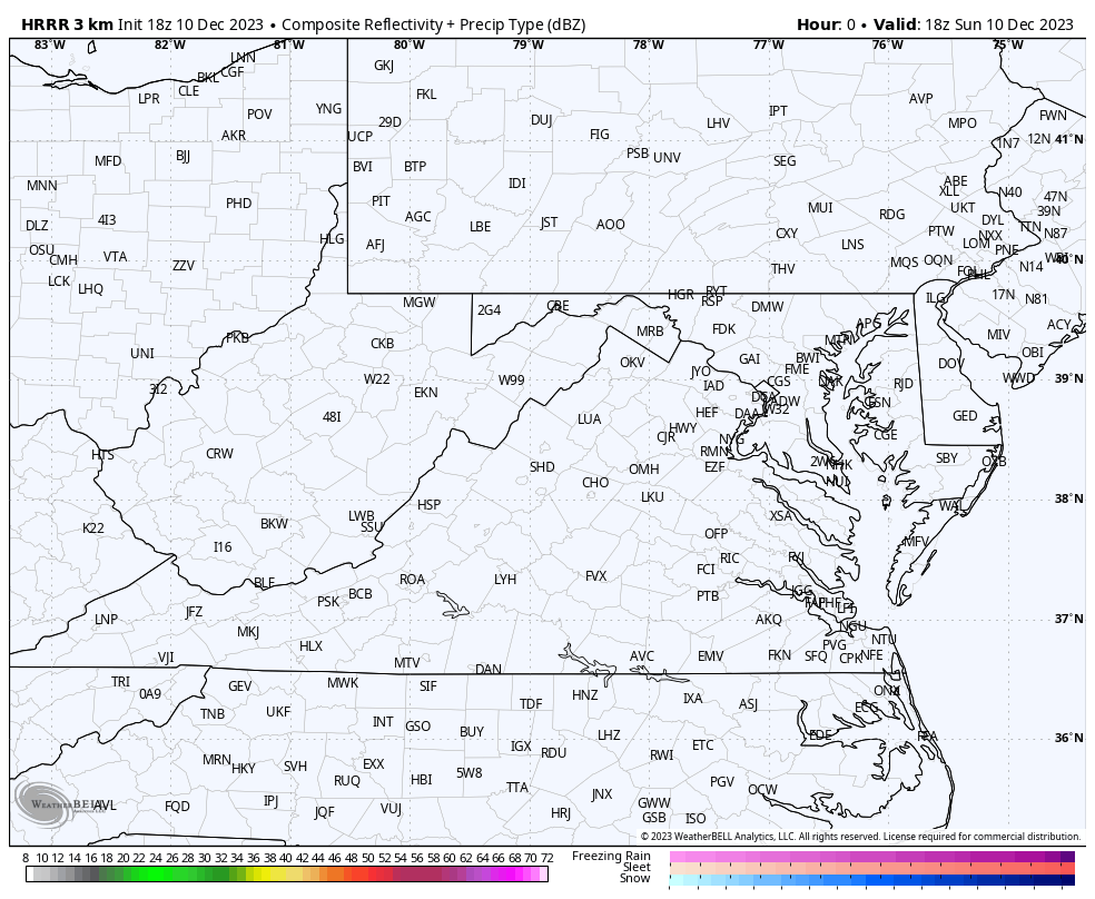
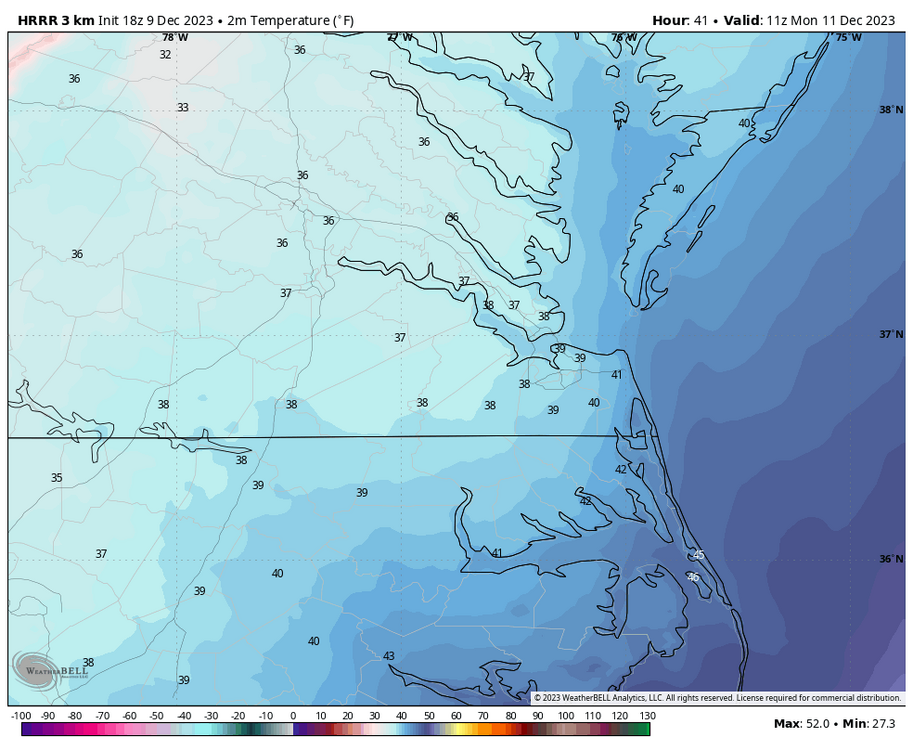
RIC Airport replied to RIC Airport's topic in Mid Atlantic
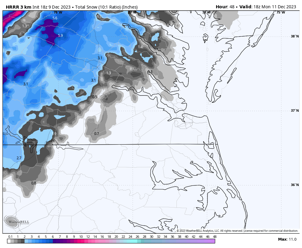
Here is the 18z HRRR model's depiction of this evening and the transition to snow in the western Tidewater and Piedmont overnight.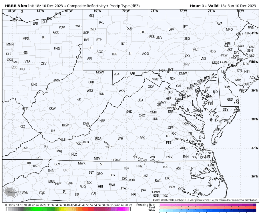

-
Richmond Metro/Hampton Roads Area Discussion
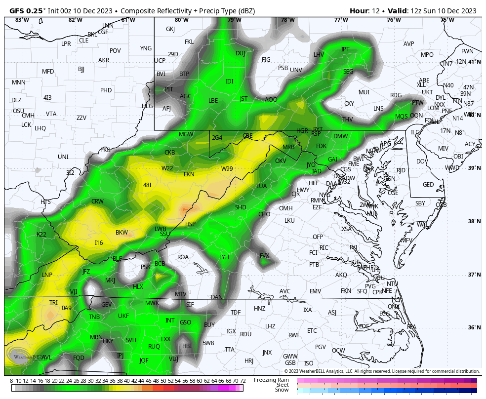
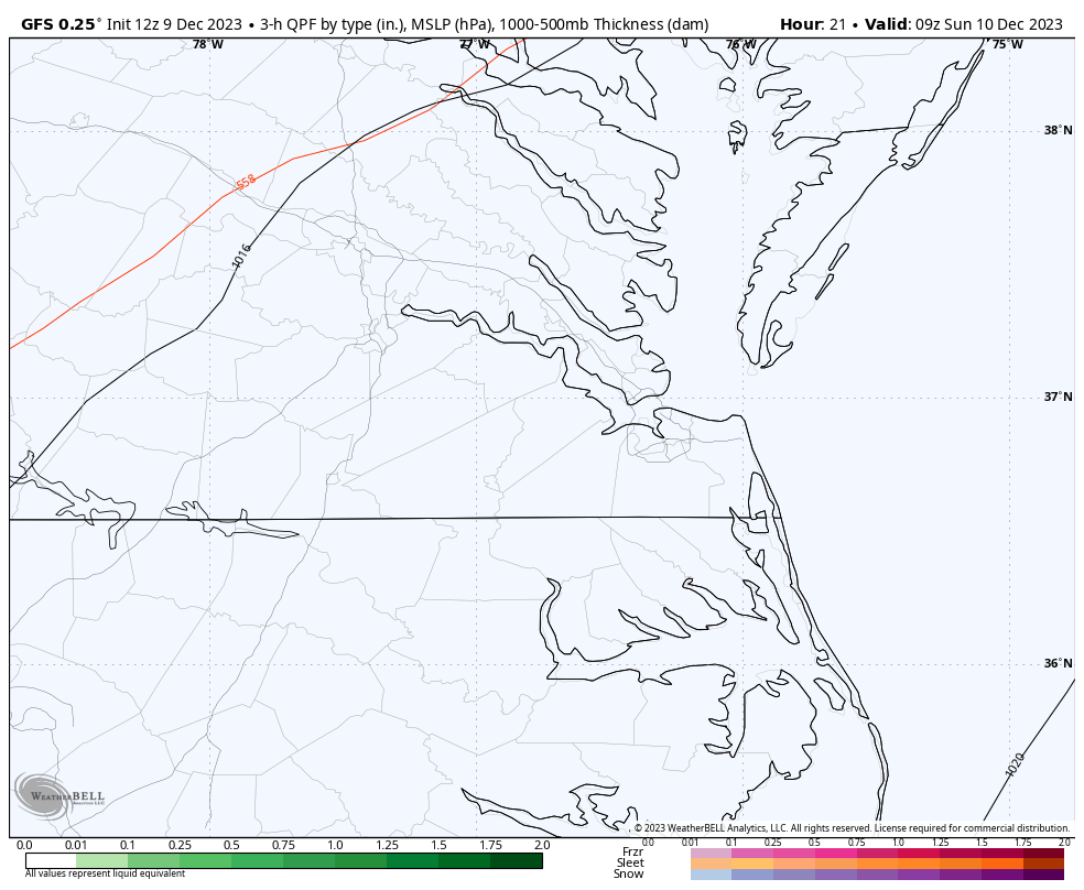
RIC Airport replied to RIC Airport's topic in Mid Atlantic
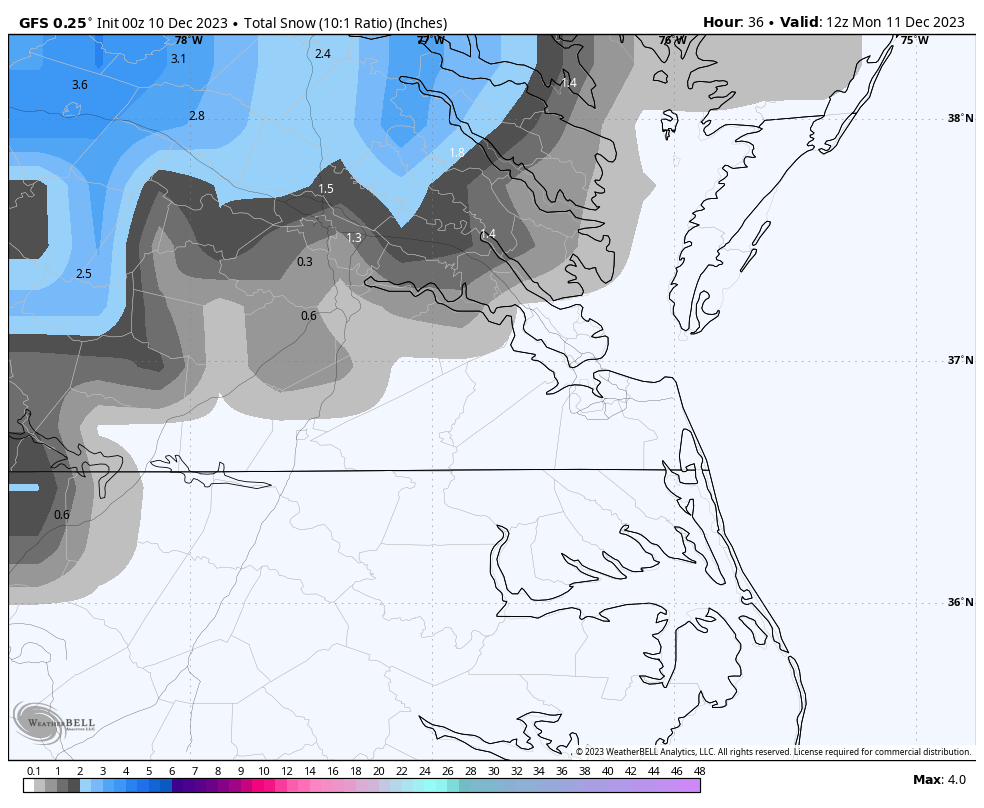
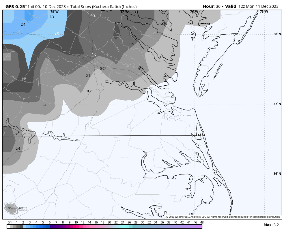
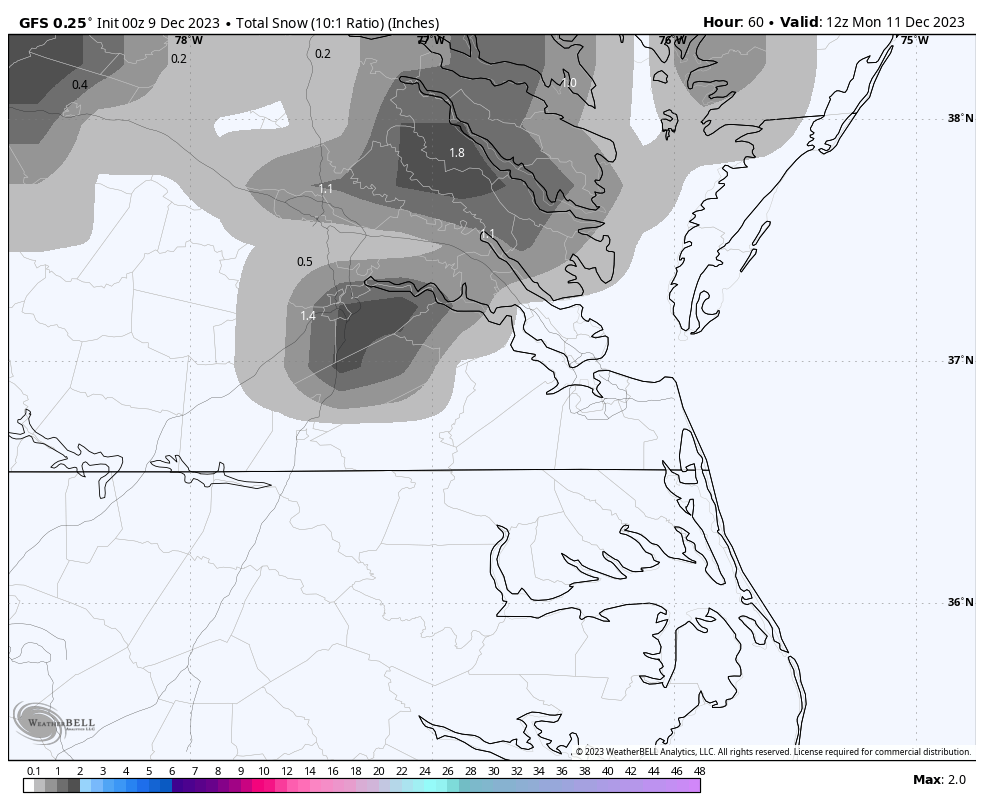
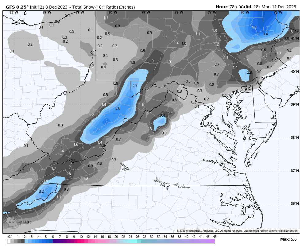
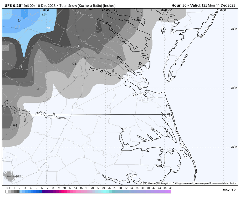
The 00Z GFS has rain changing to snow in the Richmond metro area after 1 or 2 am. It maintains the earlier idea (along with other models) of a brief period of snow lasting several hours. Surface temps remain above freezing, although some areas that see heavier rates could see snow coat surfaces before it winds down closer to sunrise. Widespread 2-3" of rain is still likely. GFS has some spots exceeding 4".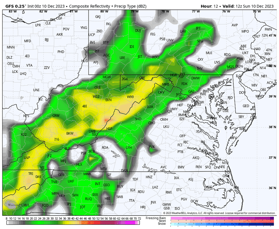


-
Richmond Metro/Hampton Roads Area Discussion
RIC Airport replied to RIC Airport's topic in Mid Atlantic
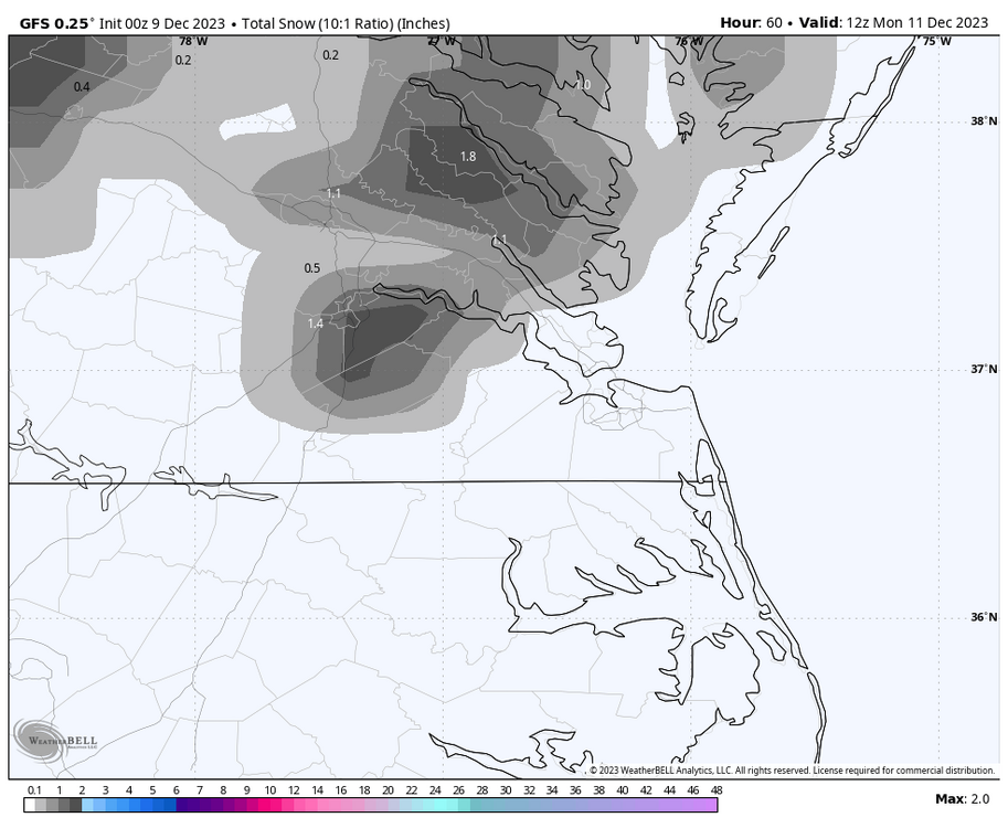
That seems about right, @Rhino16. It will be interesting to see how late the bulk of the precip reaches I-95 in the Richmond area tomorrow. That will potentially determine whether you are a bit too high for the 10th. I think I will go with a trace of snow at RIC for the 11th, the first of the season which gets RIC on par with stations like DCA and IAD. -
Richmond Metro/Hampton Roads Area Discussion
RIC Airport replied to RIC Airport's topic in Mid Atlantic
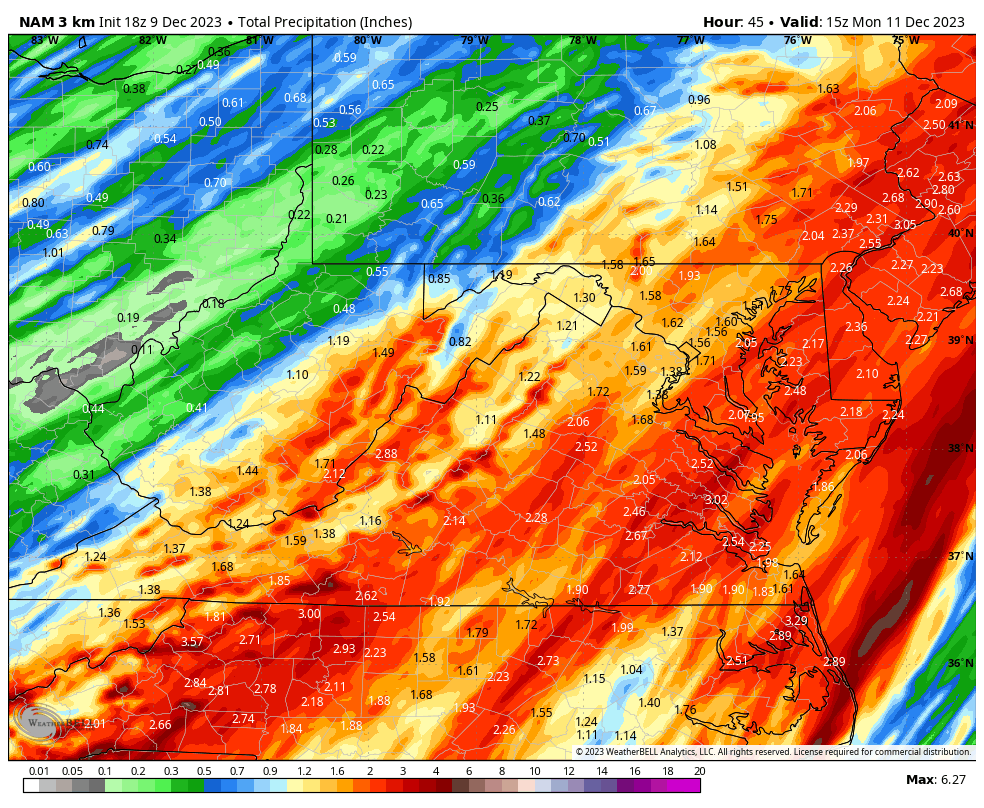
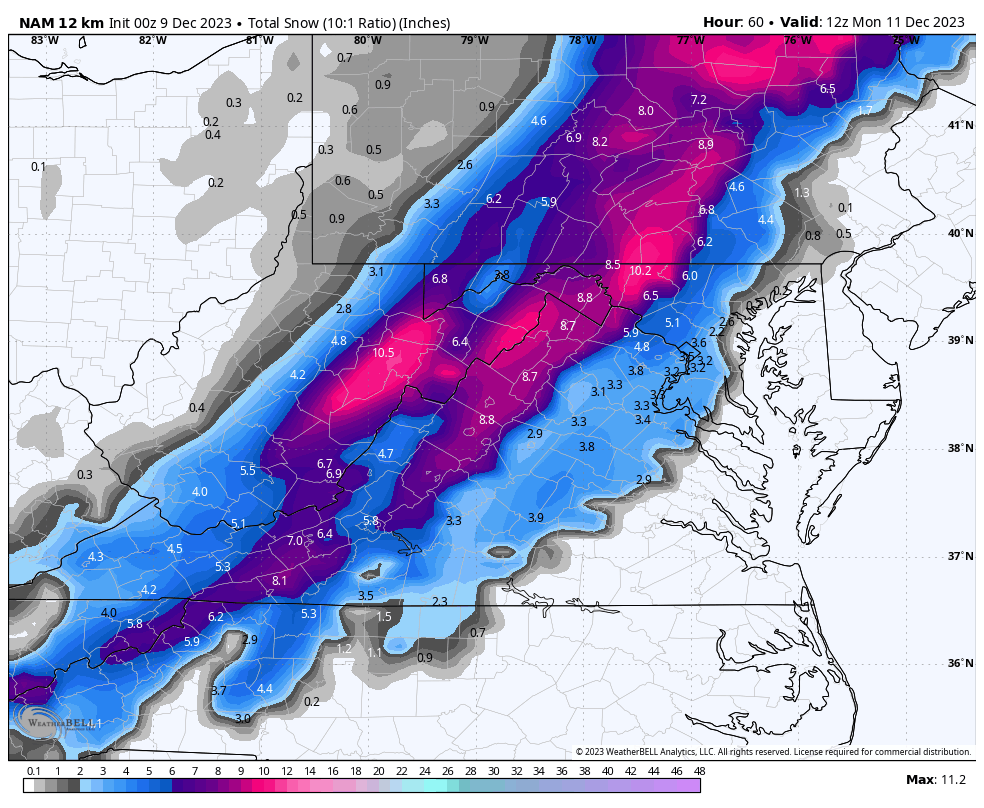
The 18z NAM follows suit and is slightly more aggressive with the changeover to snow. It also has widespread 1-3" overall precipitation totals through 10am Monday.

-
Richmond Metro/Hampton Roads Area Discussion
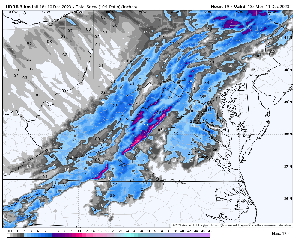
RIC Airport replied to RIC Airport's topic in Mid Atlantic
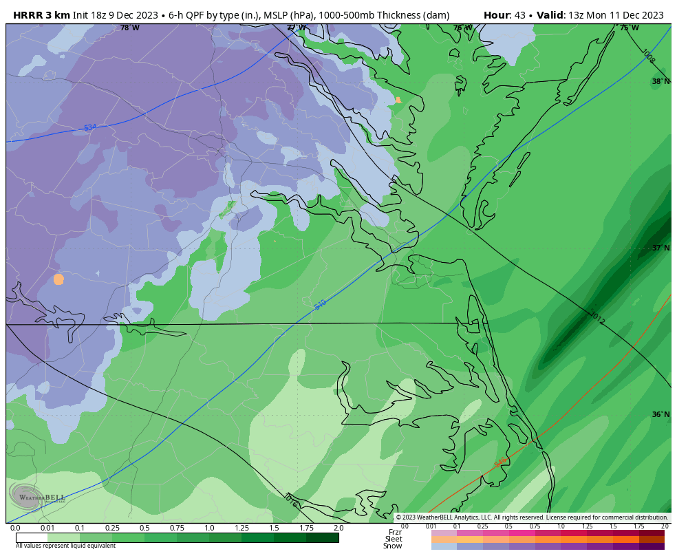
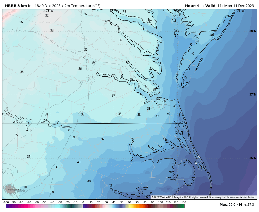
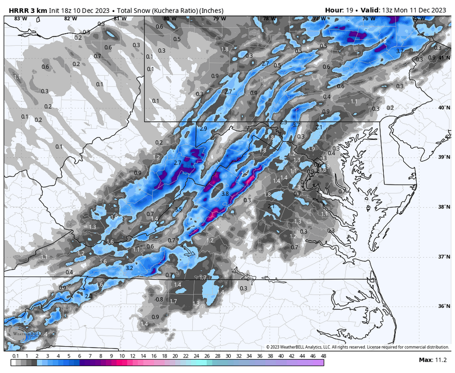
The short-term HRRR model, in its 18Z update, has the transition to snow for the western Tidewater and Piedmont areas of Virginia. Surface temperatures are in the mid-30s, so accumulations, if any, will only be dependent on rates and probably melt as soon as the precip lightens up. This will be an interesting development as every model now has showed a transition to snow for much of the state.
-
Richmond Metro/Hampton Roads Area Discussion
RIC Airport replied to RIC Airport's topic in Mid Atlantic
The 12Z GFS continued the idea of bringing a brief period of snow tomorrow night after the front passes. If true, the changeover looks to start occurring around 1am in the Richmond area and it could snow for a few hours. According to the GFS, rain could even change to snow as far SE as Williamsburg or the upper end of Newport News and York County. Surface temps remain above freezing, so any snow will struggle to accumulate. That said, any heavier rates could cause dynamic cooling sufficient enough to coat colder surfaces in spots. The GFS has area of heavier rates from Richmond and points NE toward Tappahannock and the northern neck.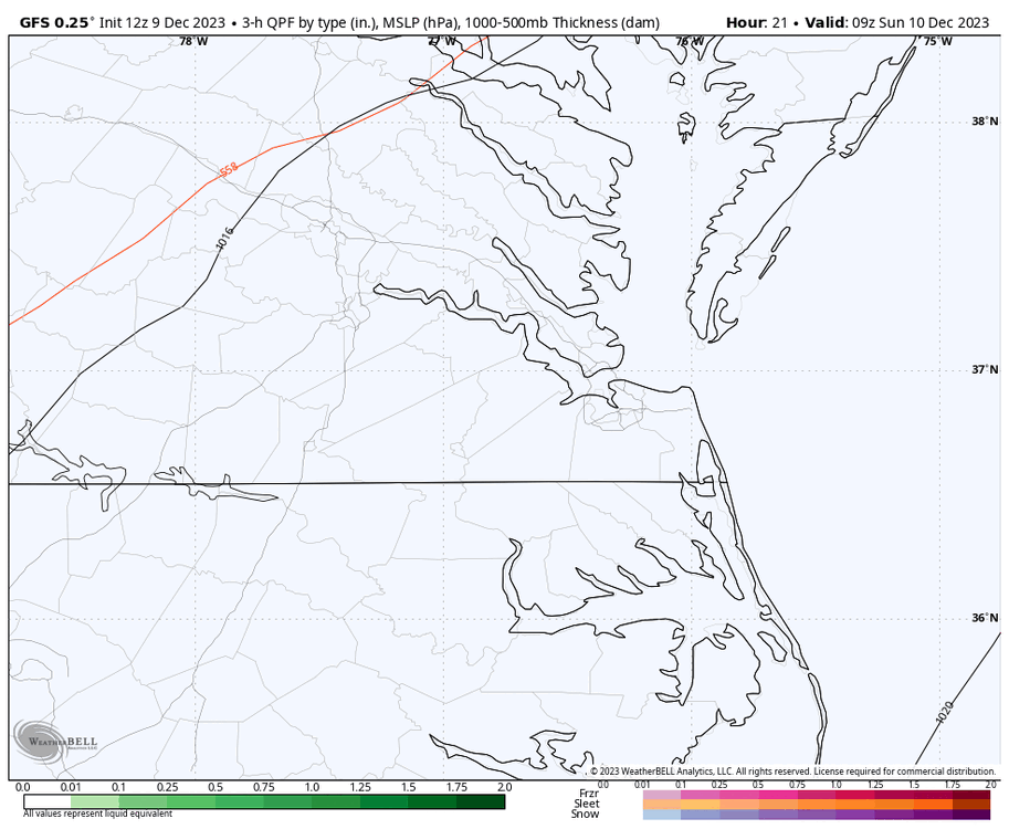

-
Richmond Metro/Hampton Roads Area Discussion
RIC Airport replied to RIC Airport's topic in Mid Atlantic
The GFS is now on board with the idea of a period of snow along I-95 and parts of eastern VA Sunday night. The 00z run is the first to show this possibility. Surface temperatures remain above freezing, but perhaps if the snow falls heavy enough it could coat some surfaces.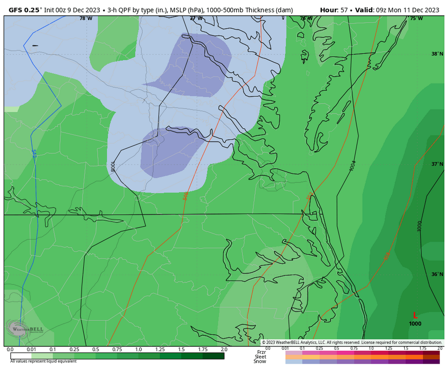

-
Richmond Metro/Hampton Roads Area Discussion
RIC Airport replied to RIC Airport's topic in Mid Atlantic
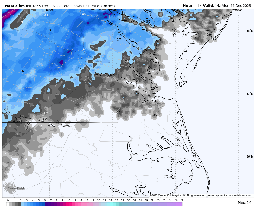
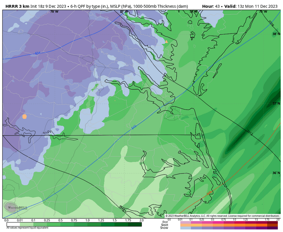
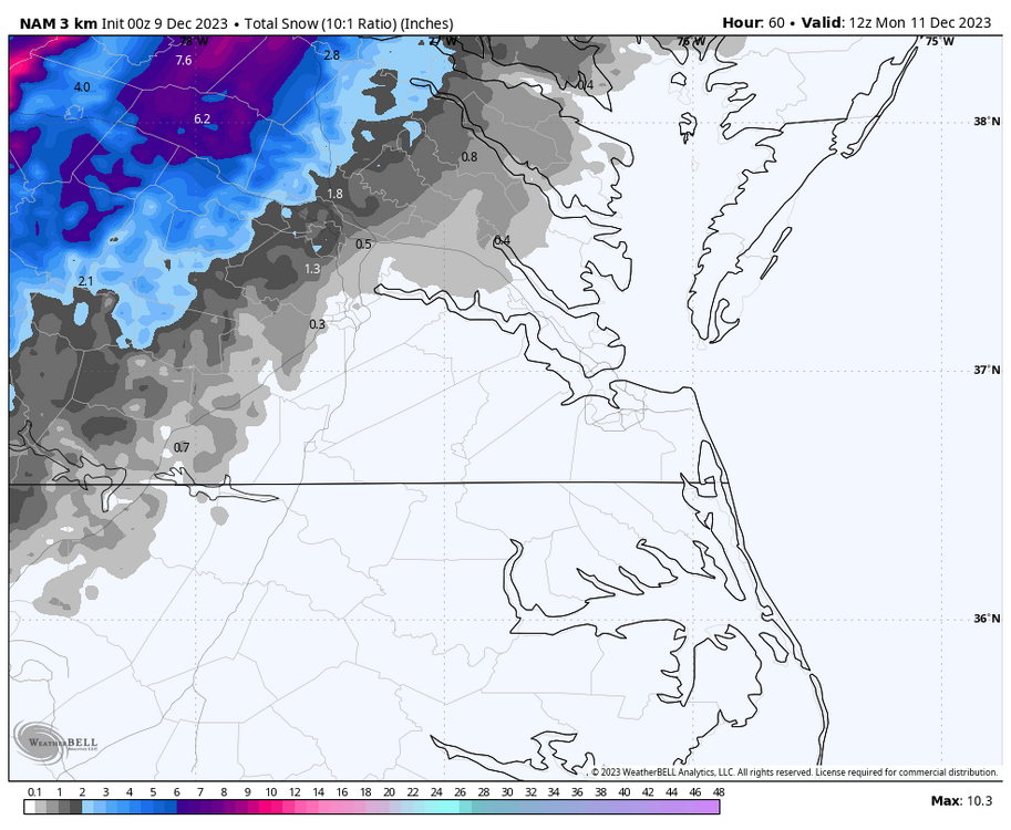
The 3k NAM has snow reaching I-95 around Richmond.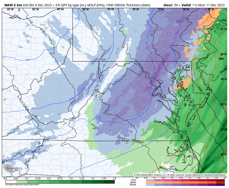
-
Richmond Metro/Hampton Roads Area Discussion
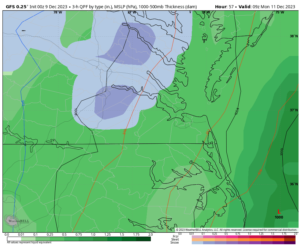
RIC Airport replied to RIC Airport's topic in Mid Atlantic
00z NAM was still pretty aggressive with snow falling east of the mountains Sunday night once the front passes. Best chances are north and west.
-
Richmond Metro/Hampton Roads Area Discussion
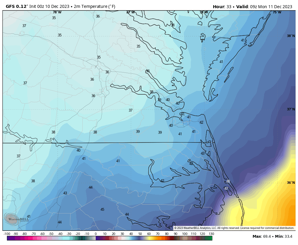
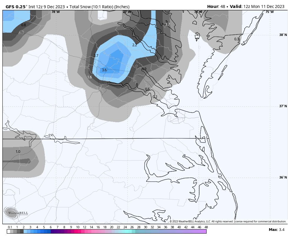
RIC Airport replied to RIC Airport's topic in Mid Atlantic
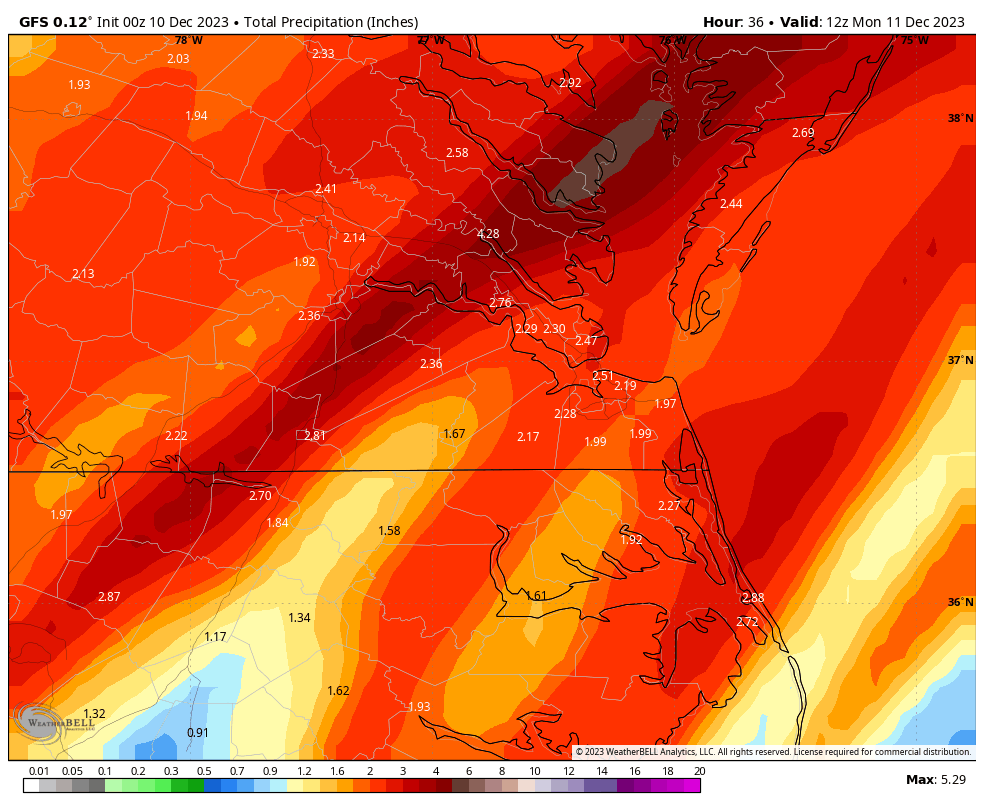
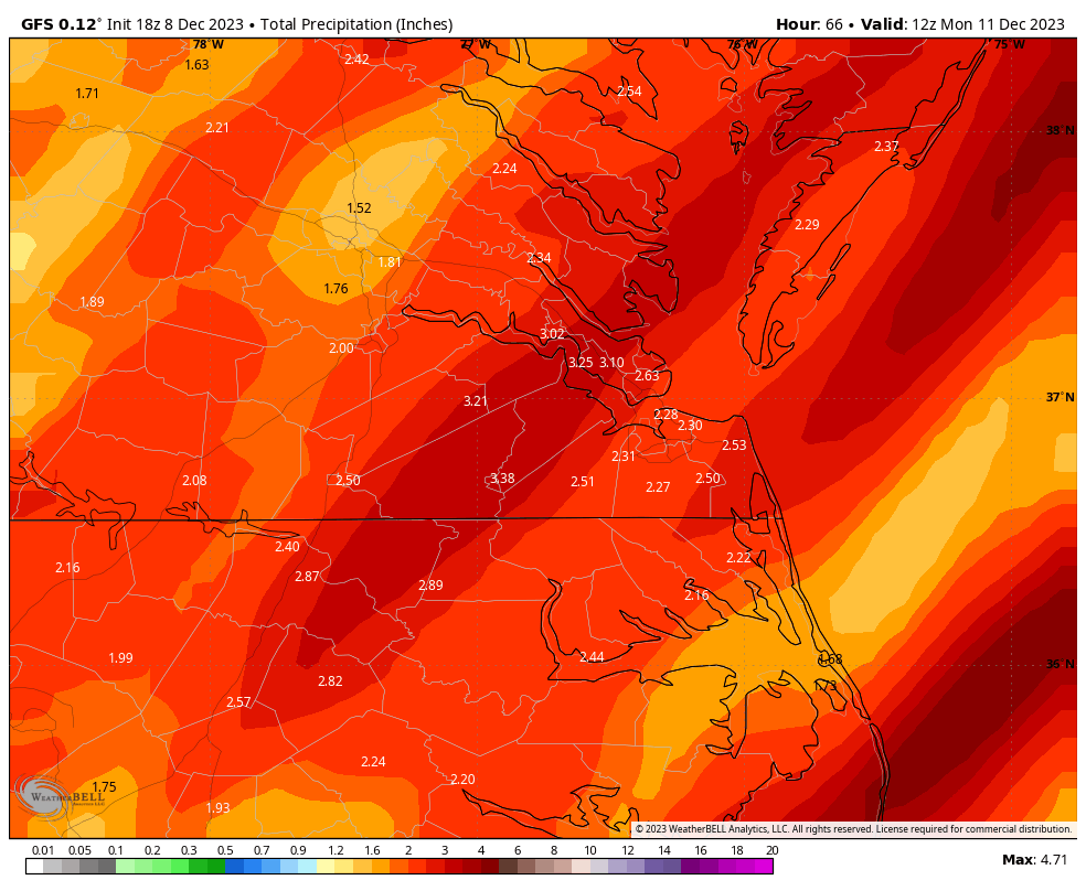
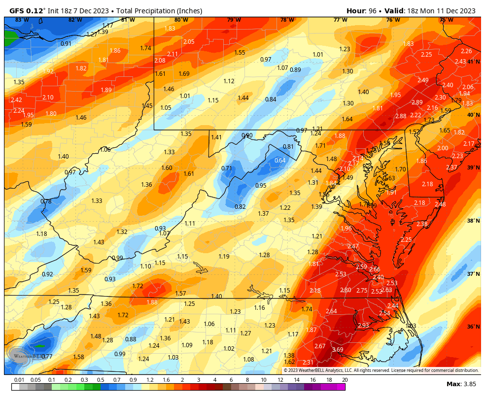
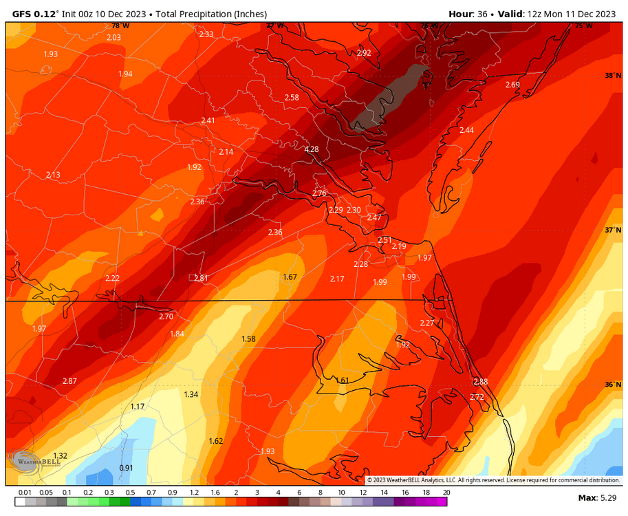
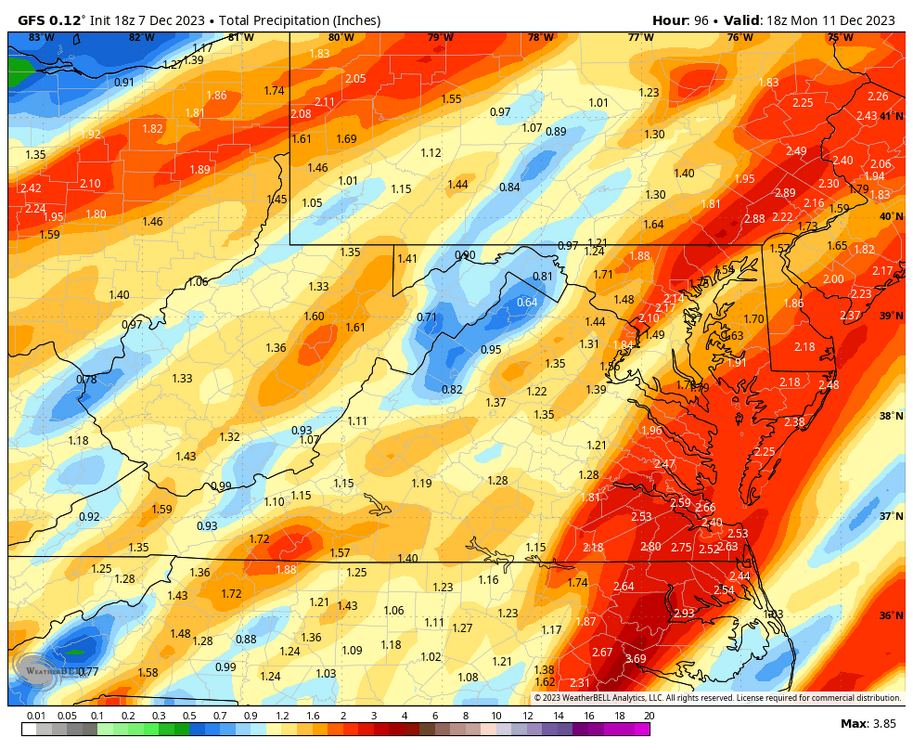
Impressive rainfall totals exceeding 3" in some spots through 7am Monday morning, according to the 18Z GFS. The daily rainfall record for Sunday at Richmond is 1.53" set in 1969 and 1.75" at Norfolk set in 1882. The 18Z GFS has 1.56" and 1.63" respectively, falling through 05z (midnight), so both station daily rainfall records are in jeopardy if the GFS is correct. Below are the 18z GFS totals thru 7am Monday.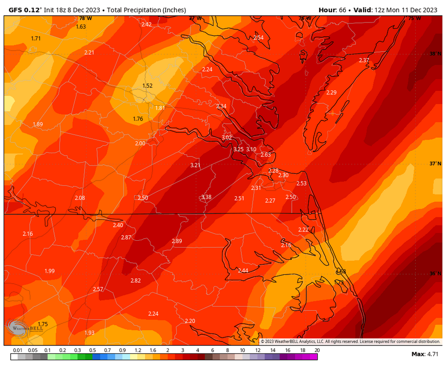
-
Richmond Metro/Hampton Roads Area Discussion
RIC Airport replied to RIC Airport's topic in Mid Atlantic
We will have the next frame tonight at 00z, but interesting that even the 3K NAM had snow this far east. I remain skeptical of the NAM, but something to watch.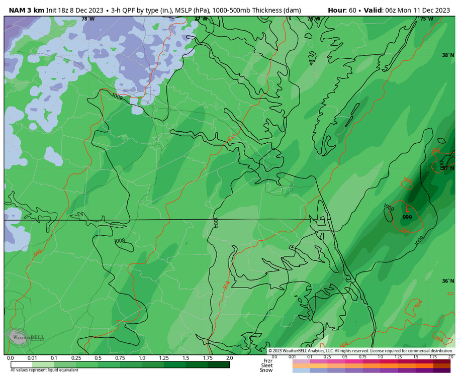
-
Richmond Metro/Hampton Roads Area Discussion
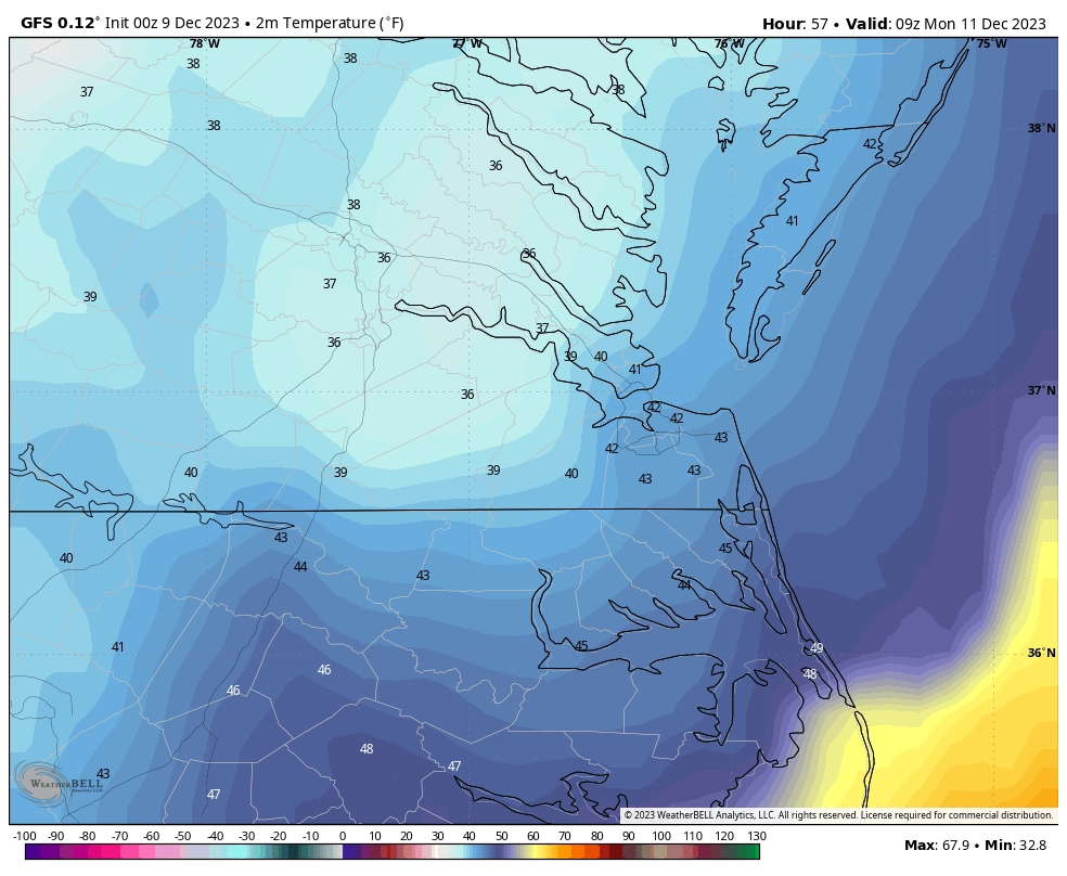
RIC Airport replied to RIC Airport's topic in Mid Atlantic
Also, today's 12Z GFS, however, paints a more believable solution, in my opinion. While there will be a sharp drop in temperatures immediately behind the front, I am unsure whether surface temperatures east of the mountains will get cold enough and fast enough for the accumulations the way the NAM depicts.
-
Richmond Metro/Hampton Roads Area Discussion
RIC Airport replied to RIC Airport's topic in Mid Atlantic
Definitely something to watch. Euro was aggressive with back end snow a couple days ago, then NAM got within range and was the same.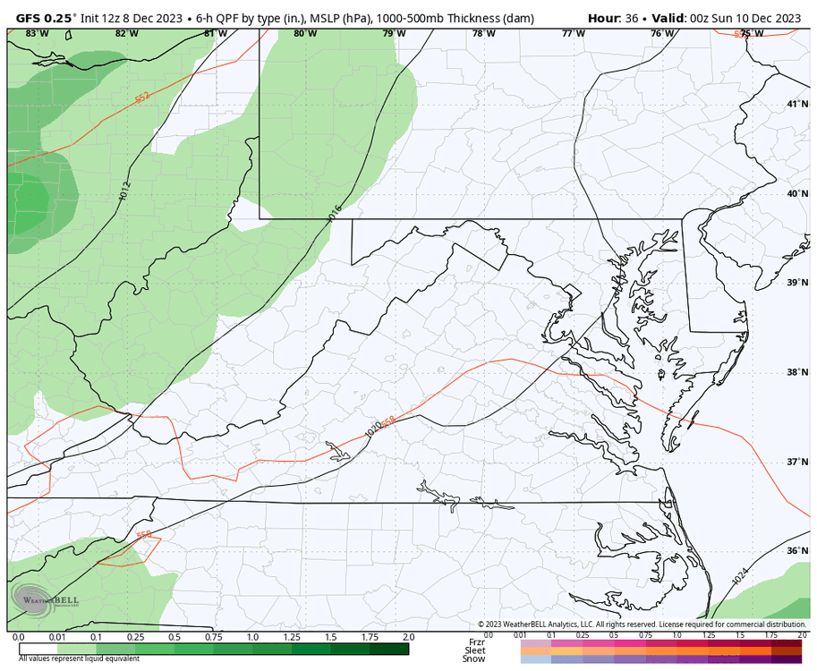

-
Richmond Metro/Hampton Roads Area Discussion
RIC Airport replied to RIC Airport's topic in Mid Atlantic
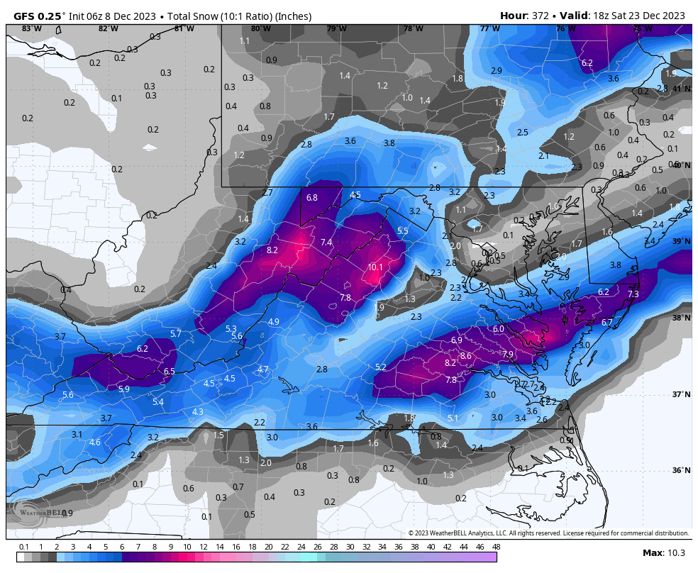
Too bad it's way out there, but would be a Christmas miracle this 06z GFS solution panned out. There have been off and on signals for a pre-Christmas storm somewhere on the east coast for almost a week now. Actually, there are numerous impulses in the flow so which one, if any, will be timed and placed properly to deliver snow for central and SE VA? There are still opportunities. Fun to look at though.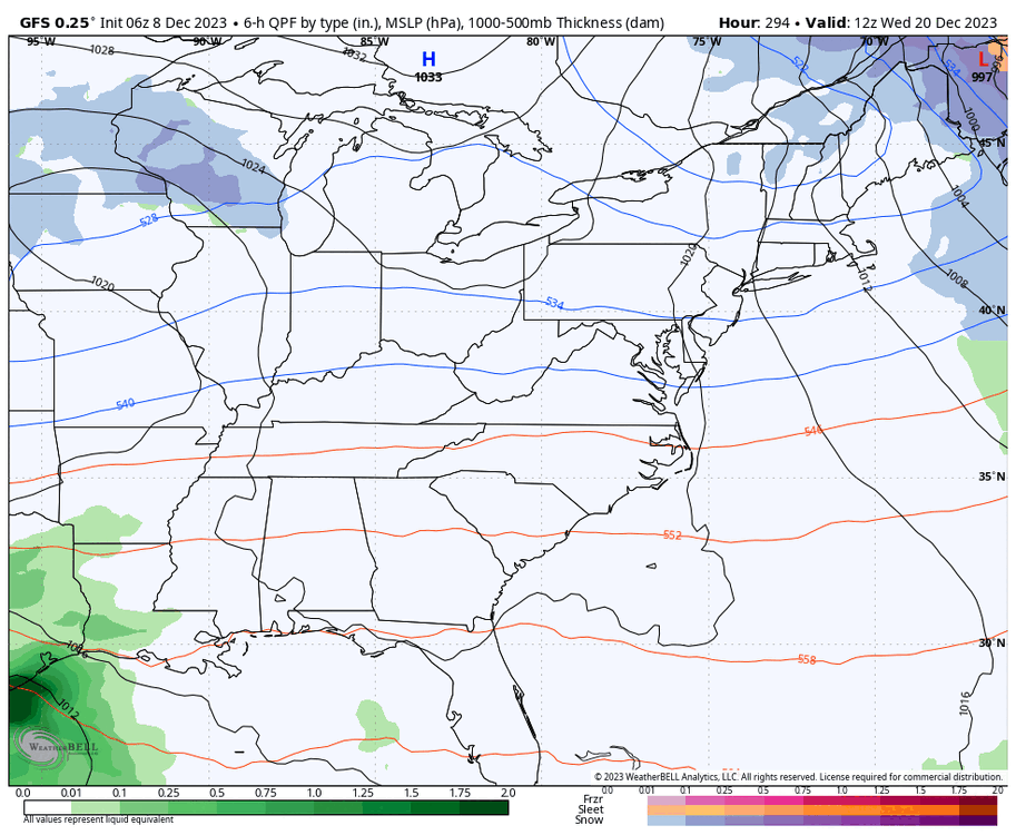
-
Richmond Metro/Hampton Roads Area Discussion
RIC Airport replied to RIC Airport's topic in Mid Atlantic
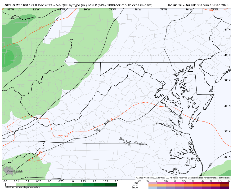
Sunday's front is looking similar to the one just before Thanksgiving with widespread 1-3" of rain across the region. The window for rain looks to start around 10am in the Richmond metro area and 3-4pm in Hampton Roads. The heaviest rain will arrive later in the evening after sunset, as indicated by today's 18Z GFS below. It's good to see we are finally getting Nino-induced moisture. We must get colder in our region and line it up with moisture. It's only December, and hopefully, we see signs of opportunity soon.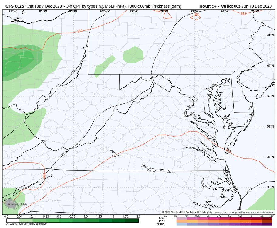
-
Richmond Metro/Hampton Roads Area Discussion
RIC Airport replied to RIC Airport's topic in Mid Atlantic
Yeah, I think most of the east coast is dealing with that, especially after last year as virtually everyone outside the lake effect snow regions got shut out. Its been particularly bad for us since the 2018-19 winter, hardly anything meaningful since. -
Richmond Metro/Hampton Roads Area Discussion
RIC Airport replied to RIC Airport's topic in Mid Atlantic
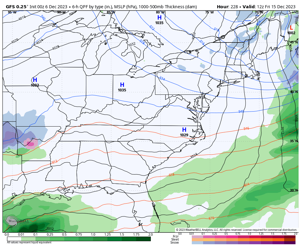
The 00z GFS decided to throw our area a bone. It's fun to look at, although I'm sure it'll change come 6z. But there have been signals of a storm for a couple of days around this time frame.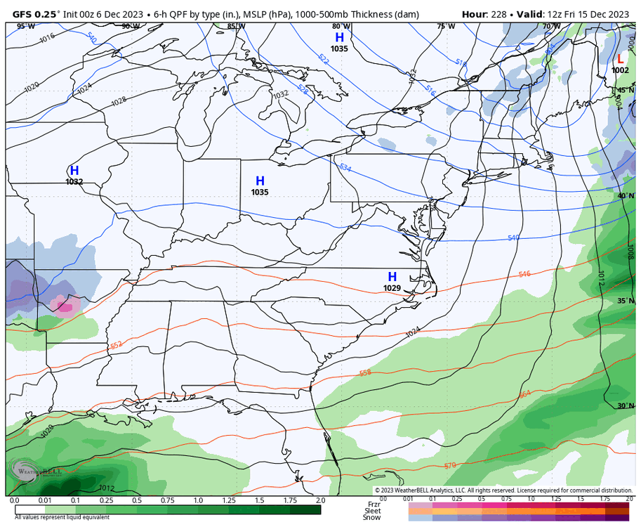
-
Richmond Metro/Hampton Roads Area Discussion
RIC Airport replied to RIC Airport's topic in Mid Atlantic
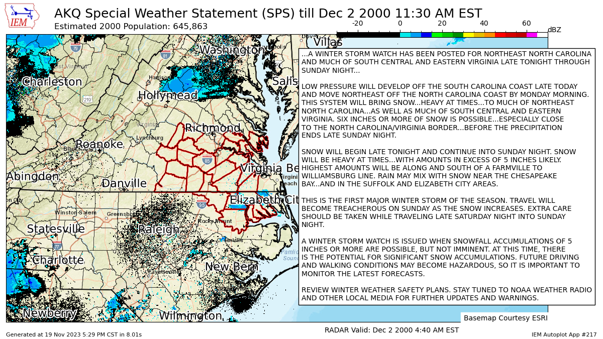
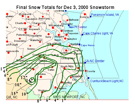
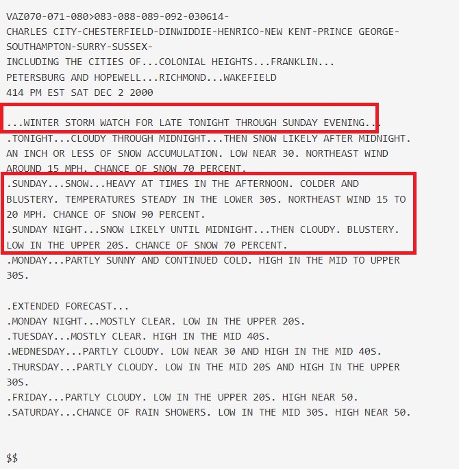
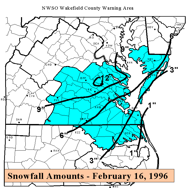
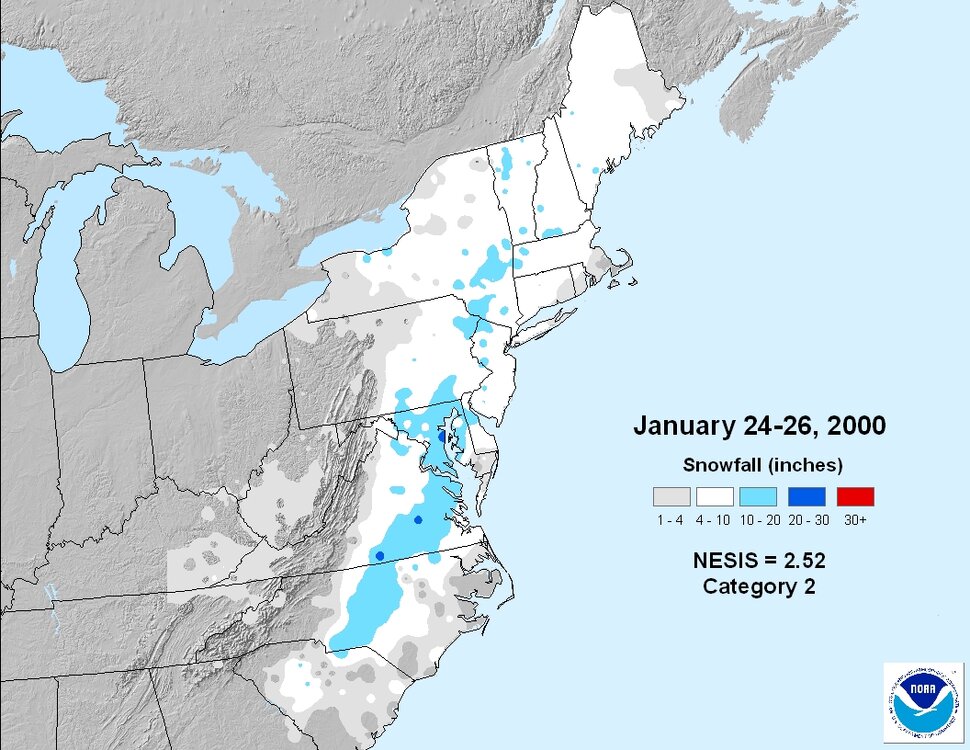
This weekend marks the anniversary of the 12/3-4/2000 storm, which was a major disappointment for most of our area. I guess unless you live in Franklin, Ahoskie, Currituck areas. Many areas in NE NC received 10-15" of snow. But, the storm was supposed to affect most of east central and SE VA. In fact, NWS Wakefield (as you can see below) even issued a winter storm watch as far N and W as the Richmond metro area. Unfortunately, in the final 24hours the models shifted the storm farther south. It could've been better region-wide, one of my worst memories being in Richmond at the time.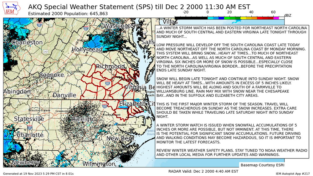
-
Richmond Metro/Hampton Roads Area Discussion
RIC Airport replied to RIC Airport's topic in Mid Atlantic
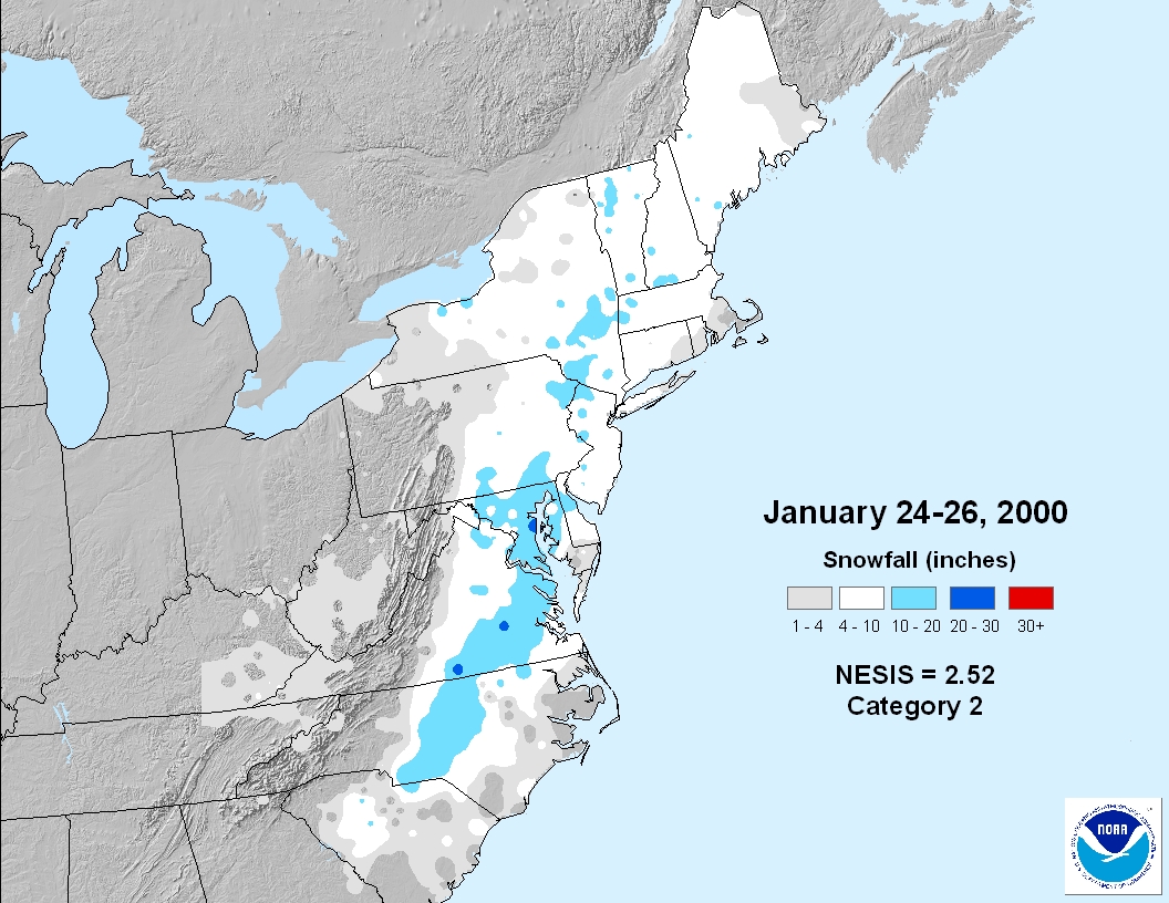
That IS our snowstorm track, though. It really doesn't get much better than that. We have also had storms form off the GA/SC coast and move north like 1/25/2000 and 2/16/1996 (see map below). 1/3/2018 and 12/26/2010 were some bit hits for SE areas. We also do well with a southern track coming from the west similar to 12/9/2018, 1/30/2010, 1/7/1988 and 2/16-17/2015.
-
Richmond Metro/Hampton Roads Area Discussion
RIC Airport replied to RIC Airport's topic in Mid Atlantic
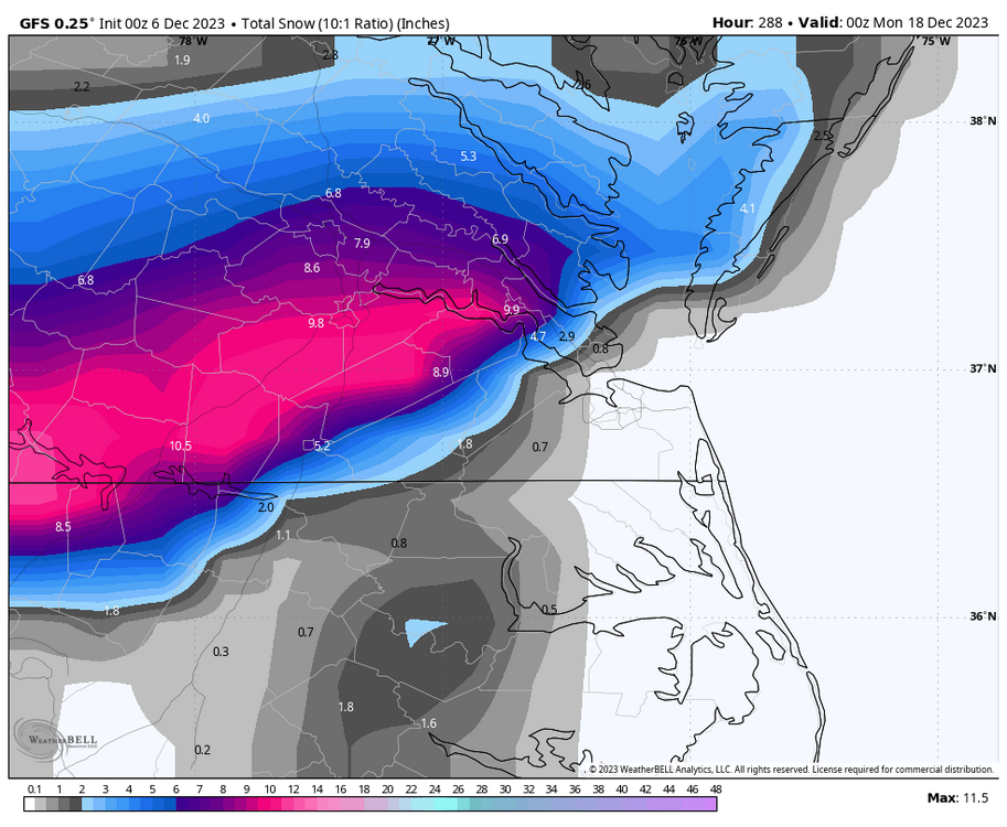
Today's 12z GFS had the perfect track, but unfortunately it doesn't line up with the cold. At least we are still seeing these "signals", eventually as we get deeper into winter, something will pan out, right?
-
Richmond Metro/Hampton Roads Area Discussion
RIC Airport replied to RIC Airport's topic in Mid Atlantic
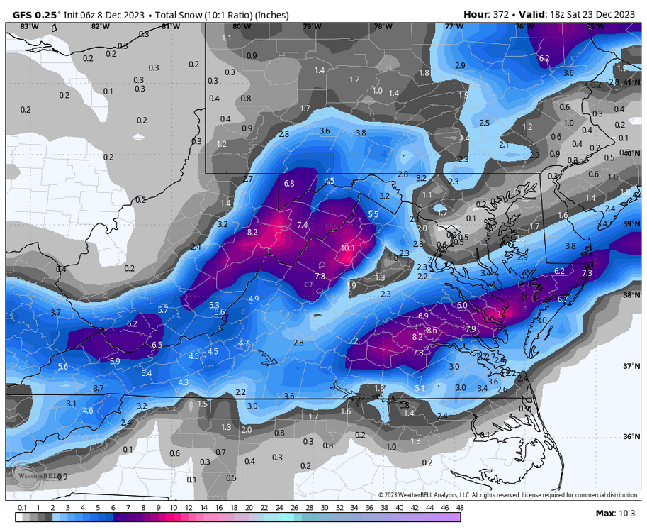
FWIW, today's 18z GFS snowstorm map was only good for northern and western areas. Also, it's at the end of the run, but something interesting to look at.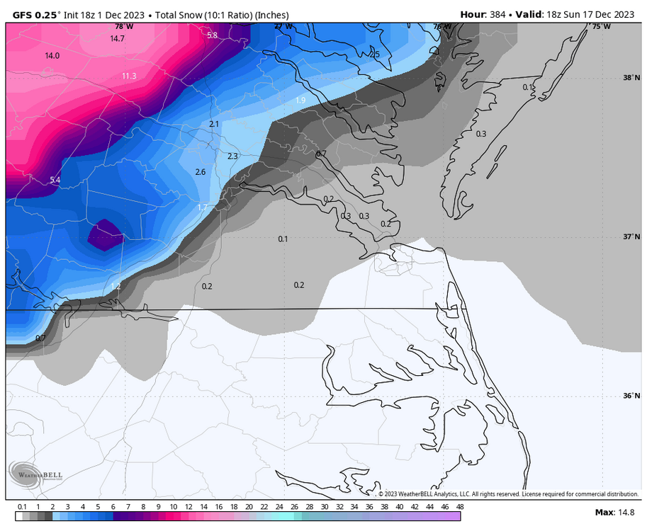
-
Richmond Metro/Hampton Roads Area Discussion
RIC Airport replied to RIC Airport's topic in Mid Atlantic
18Z GFS was a step back and similar to the 12z Euro solution. We knew this set up was (is) a long shot and isn't ideal for anything meaningful, but we are aiming to get our first flakes of the season to break the seal. -
Richmond Metro/Hampton Roads Area Discussion
RIC Airport replied to RIC Airport's topic in Mid Atlantic
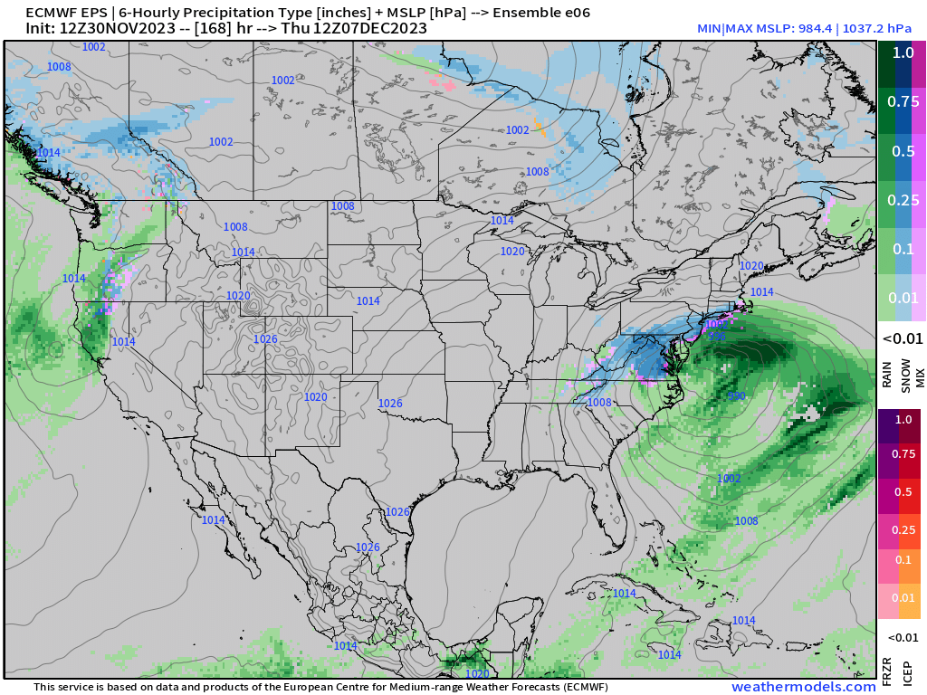
Here's a closer look at e06, the snowiest Euro ensemble member (out of 50) for most of our area. Dropping pretty good snows over central and eastern VA at hour 168 and up until about hour 180 as it exits off the coast. Obviously this will change, but showing it because it's the main the reason why we have an ensemble mean of 0.1 to 0.3" across the area.