RIC Airport
-
Posts
2,586 -
Joined
-
Last visited
Content Type
Profiles
Blogs
Forums
American Weather
Media Demo
Store
Gallery
Everything posted by RIC Airport
-
Richmond Metro/Hampton Roads Area Discussion
RIC Airport replied to RIC Airport's topic in Mid Atlantic
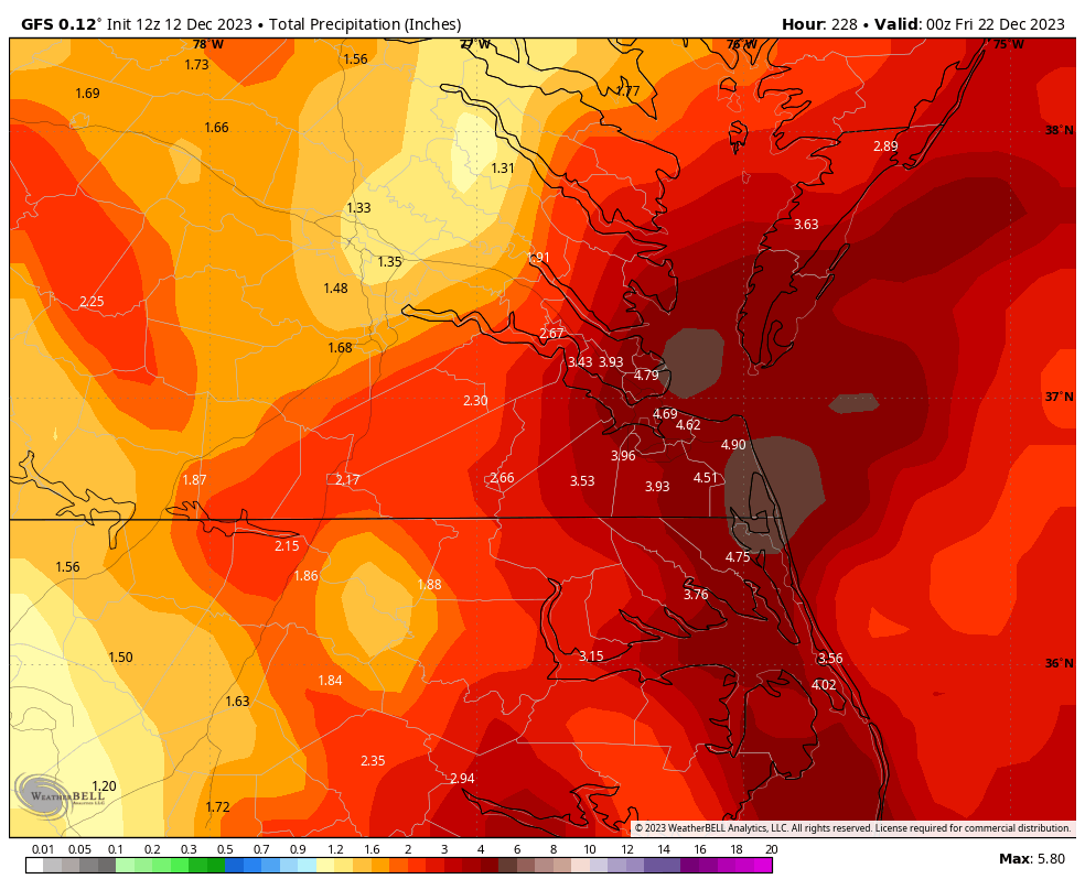
The 12Z Euro has the coastal slightly east of its last 1-2 runs. Widespread 1-3" of rain. It also has a 2nd low and tries to bring precip with it and perhaps it's cold enough for snow I-95 and west? It's something to watch in the coming days.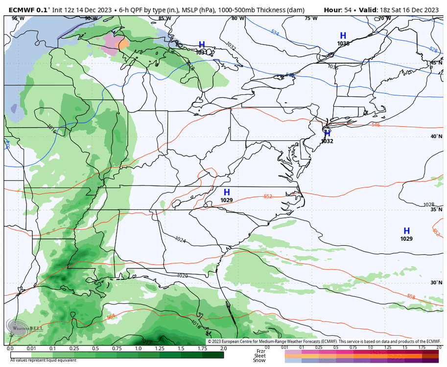


-
Richmond Metro/Hampton Roads Area Discussion
RIC Airport replied to RIC Airport's topic in Mid Atlantic
Starting to look like high temperatures on Christmas Day will be closer to normal. Obviously still subject to fluctuations, but encouraging if you're wanting a more wintry feeling and not the low-mid 70s we saw on Christmas in 2021 and 2015..thumb.png.1fc38ebdcee0efca1cdcbe4f1e9bfaaa.png)
.thumb.png.0c12744e2773b683653a49fe837c48b9.png)
-
Richmond Metro/Hampton Roads Area Discussion
RIC Airport replied to RIC Airport's topic in Mid Atlantic
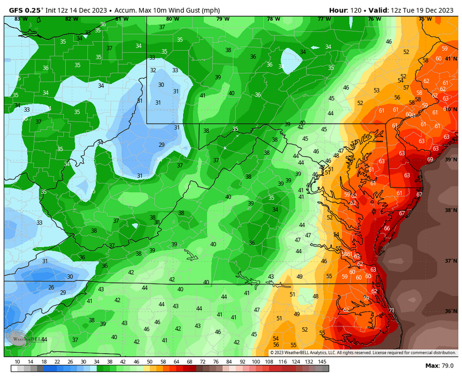
The 12Z GFS was farther east with the track of the coastal storm than the last 2 or 3 GFS runs. The strongest winds are along I-95 and east. The arrival of the rain is earlier Sunday morning with the heaviest in the afternoon and evening.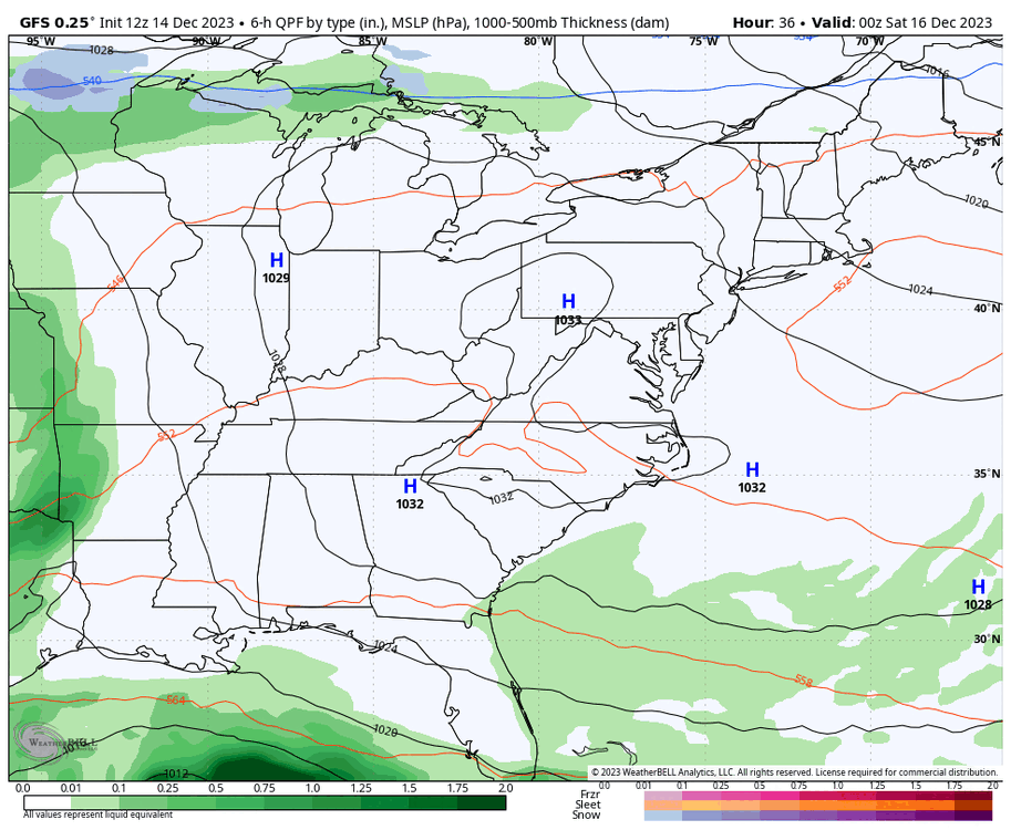
-
Richmond Metro/Hampton Roads Area Discussion
RIC Airport replied to RIC Airport's topic in Mid Atlantic
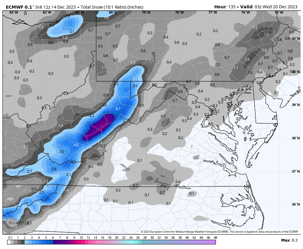
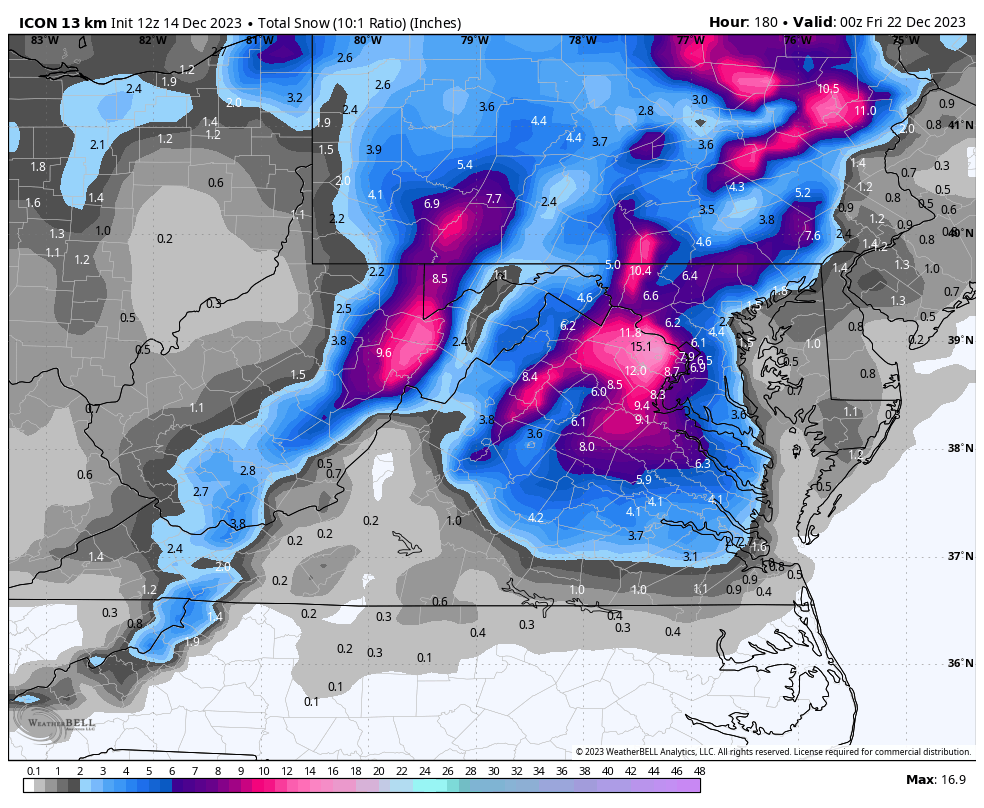
Interesting. I personally rarely look at the Icon. I guess it can be useful for some things, but it rarely leads the way on anything. But, would be cool if it panned out although the heaviest accumulations, as depicted, are north of our area.
-
Richmond Metro/Hampton Roads Area Discussion
RIC Airport replied to RIC Airport's topic in Mid Atlantic
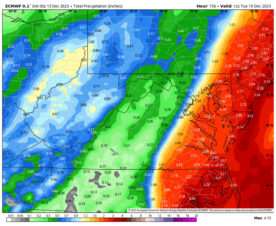
Euro caves to the GFS and is even farther west with the coastal storm and brings widespread 2-4" of rain. Pretty wound up, too, @JB Fins.
-
Richmond Metro/Hampton Roads Area Discussion
RIC Airport replied to RIC Airport's topic in Mid Atlantic
Not seeing any drastic changes on the 12Z GFS for the weekend coastal, precip totals were still 2-3" for many areas. Rain looks to start Sunday afternoon.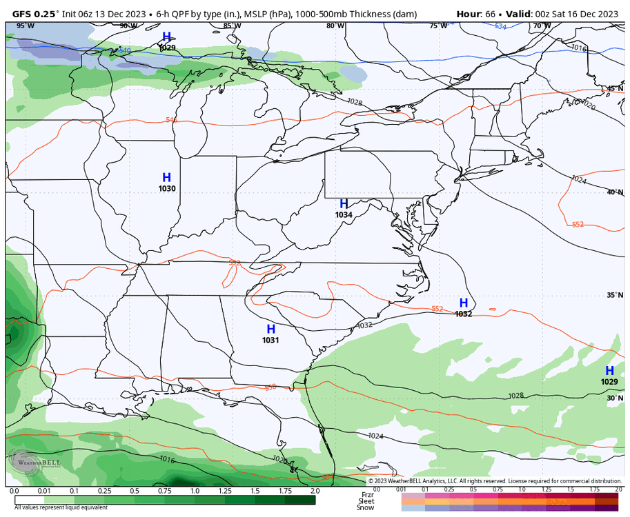

-
Richmond Metro/Hampton Roads Area Discussion
RIC Airport replied to RIC Airport's topic in Mid Atlantic
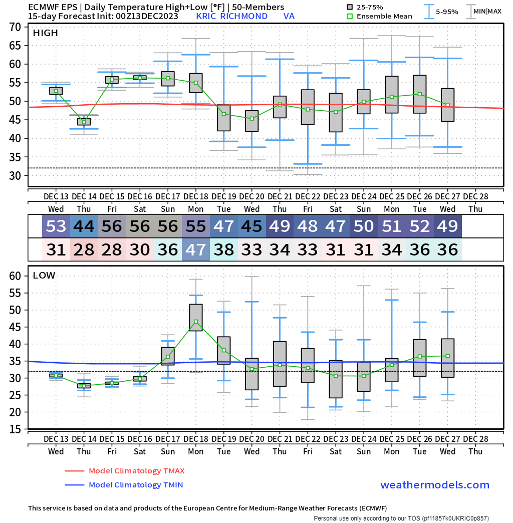
Still, no signs of a torch, if anything the Euro Ensembles trended cooler toward the end, but certainly the temps are nothing notable for December if you're looking for true cold. Below are the Euro Ensemble mean daily temps for Richmond and Norfolk the next 15 days.
.thumb.png.cfacbaaa9a0d0cb196fe5e79077c6e10.png)
-
Richmond Metro/Hampton Roads Area Discussion
RIC Airport replied to RIC Airport's topic in Mid Atlantic
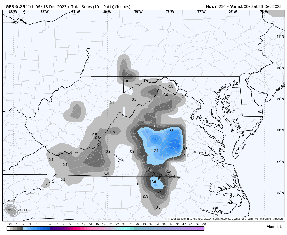
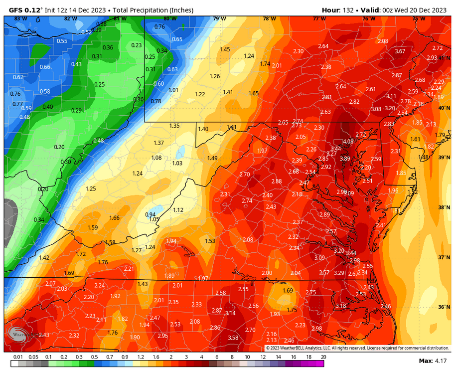
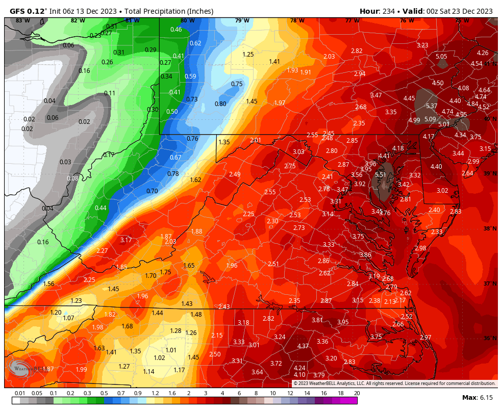
The GFS is still stubbornly further west. Below is today's 06Z where the coastal stalls and meanders off the coast for most of next week, then tries to end the precip as a mix and snow for parts of the state as colder air gets drawn in. Widespread 1-3" of rain for the region, with some places 3-4"+. The El Nino wet pattern that we were waiting for 3-4 months ago, is certainly here as of 3 weeks ago. Now we just need these coastals to get timed with cold. Time will tell.
-
Richmond Metro/Hampton Roads Area Discussion
RIC Airport replied to RIC Airport's topic in Mid Atlantic
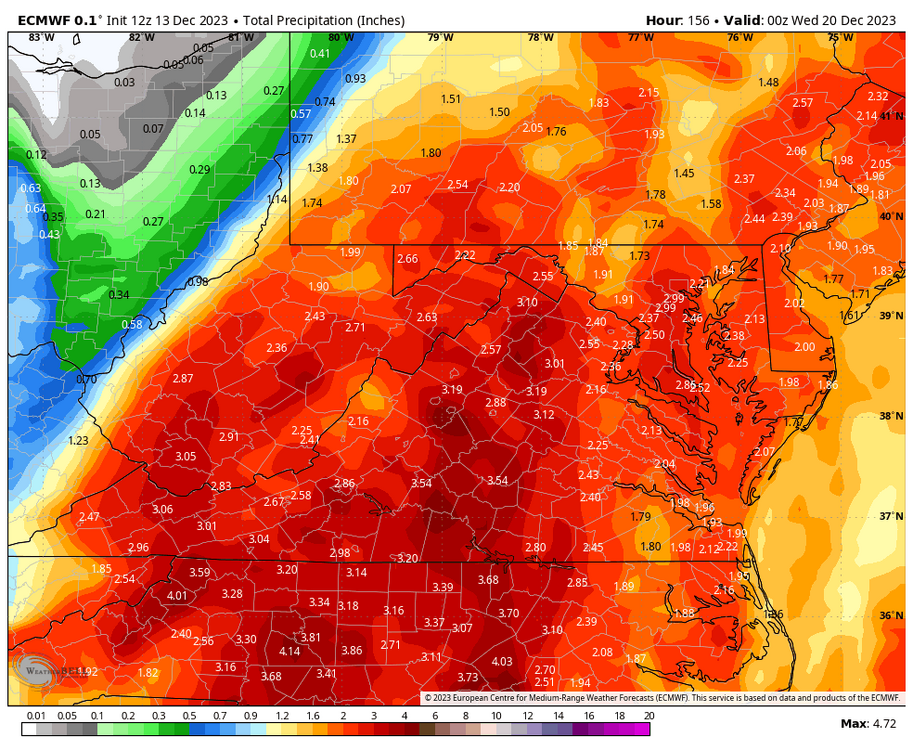
Euro was even further west at 00Z. The 0.25" line basically went from I-95 to US HWY 15.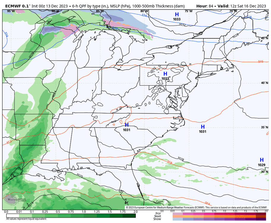
-
In the station notes, it says DCA was upgraded with a 40" stick back in December 2021. Why it took so long, I am not sure.
-
Richmond Metro/Hampton Roads Area Discussion
RIC Airport replied to RIC Airport's topic in Mid Atlantic
12z Euro is back east with the coastal, barely gets 0.25" up to RIC, but still has 1-2" of rain for Hampton Roads and most of NE NC. -
Richmond Metro/Hampton Roads Area Discussion
RIC Airport replied to RIC Airport's topic in Mid Atlantic
The 12Z GFS still has the coastal affecting the area and Hampton Roads, in particular, is clobbered with the worst rains and wind as the storm moves up the coast and meanders for several days.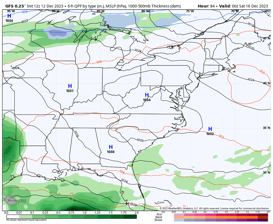

-
Richmond Metro/Hampton Roads Area Discussion
RIC Airport replied to RIC Airport's topic in Mid Atlantic
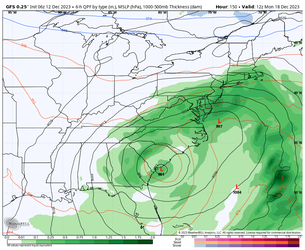
Yeah, looks like GFS went back west at 00z and the 06z run followed suit, @ldub23. Yay!.... I guess, if you want a winter time coastal that gives us rain and not snow. Also, GFS is still trying to push us into the 60s just in time for Christmas and the day after ahead of a storm that tracks through the Ohio Valley.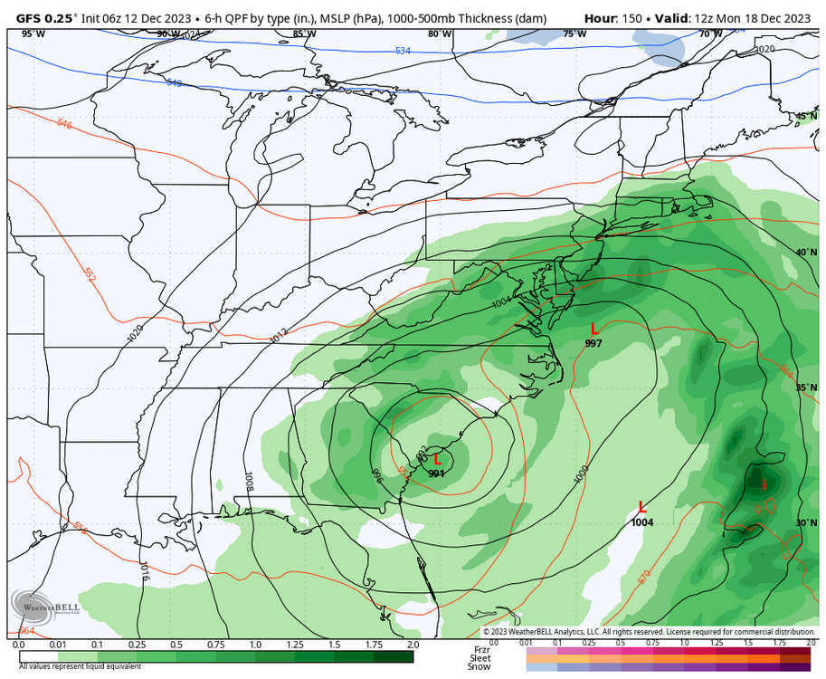
-
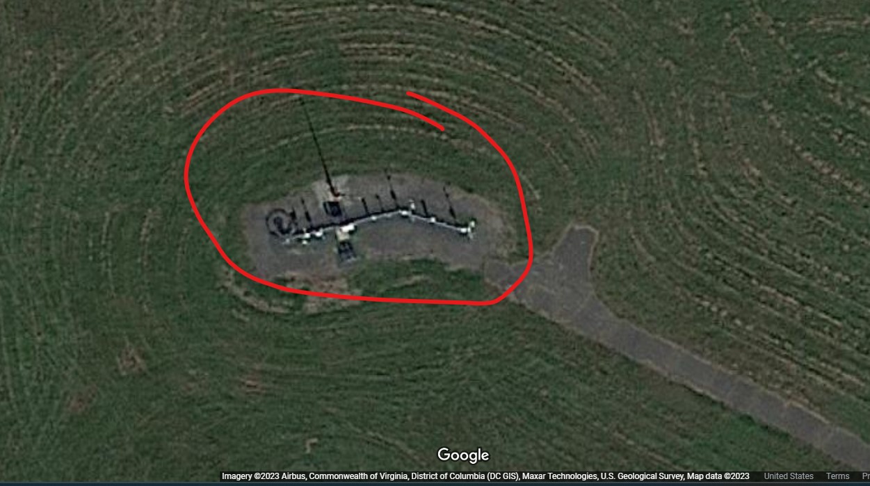
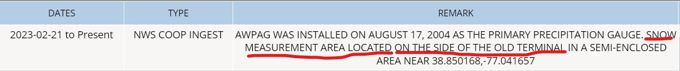
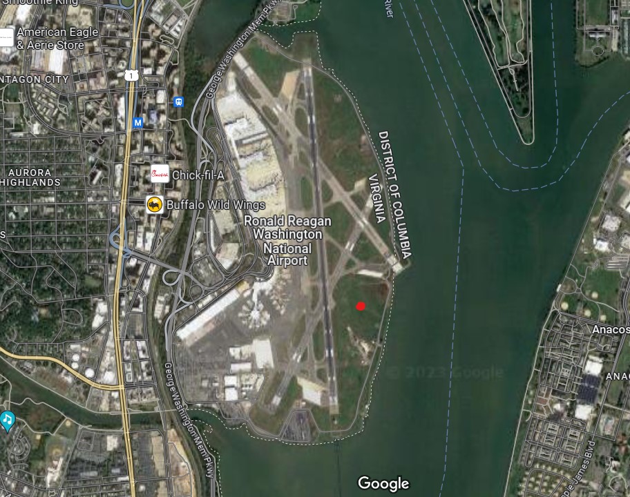
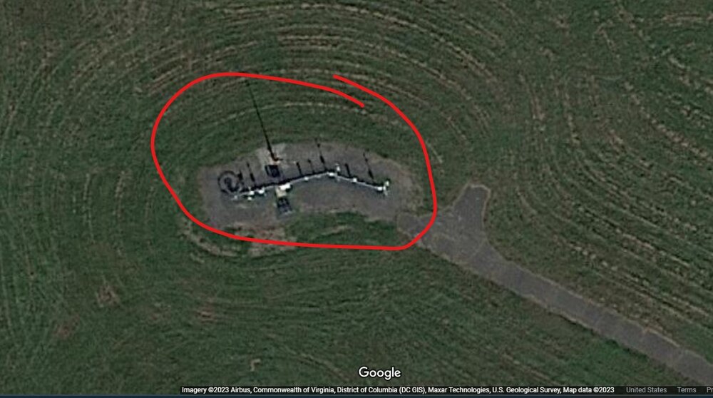
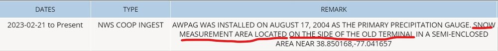
The ASOS is where the red dot is. Also, if you zoom in you can see it in the below photo. The below link takes you to the station information where you can scroll down read the recent station updates and other information. https://www.ncei.noaa.gov/access/homr/#ncdcstnid=20027254&tab=MISC You'll see where it says "Snow measurement area located on the side of the old terminal in a semi-enclosed area near 38.850168,-77.041657", which should be close to the southern end of the terminal/field.
-
Richmond Metro/Hampton Roads Area Discussion
RIC Airport replied to RIC Airport's topic in Mid Atlantic
12Z Euro and 18Z GFS takes the next storm out to sea. If true, we'll have a chance to dry out. -
Richmond Metro/Hampton Roads Area Discussion
RIC Airport replied to RIC Airport's topic in Mid Atlantic
-
LWX had 0.1" for DCA in their PNS statement.
-
RIC up to 0.2" after this morning's snow.
-
Mid-Atlantic Snow Totals Thread - Winter 2023-2024
RIC Airport replied to mattie g's topic in Mid Atlantic
Officially 0.2" this morning at RIC. -
Richmond Metro/Hampton Roads Area Discussion
RIC Airport replied to RIC Airport's topic in Mid Atlantic
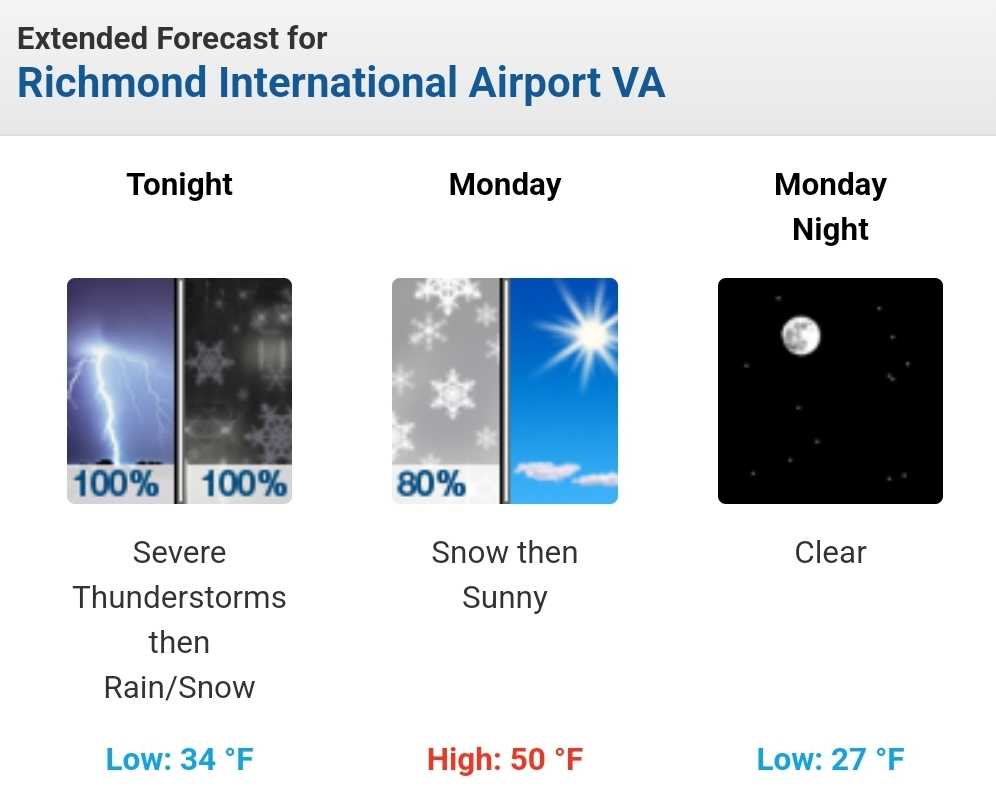
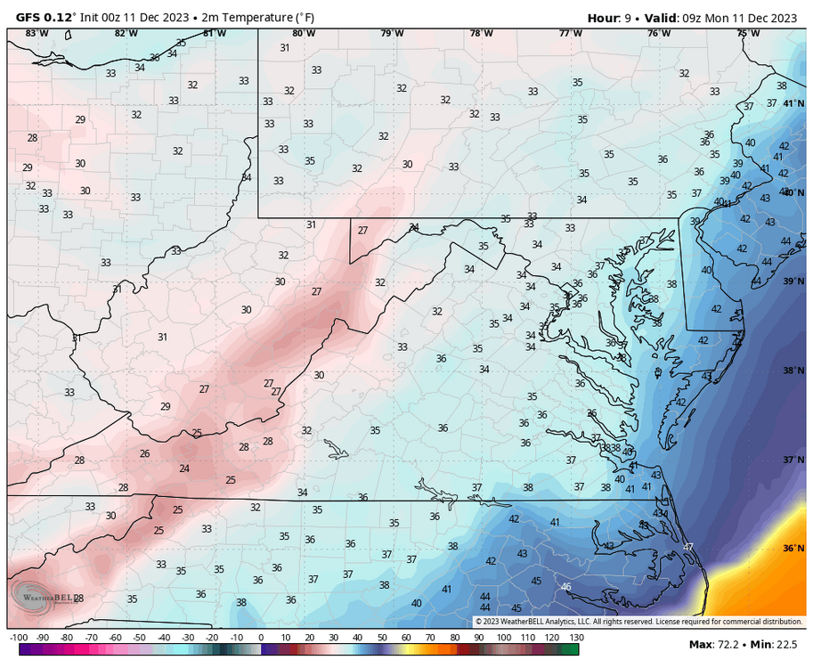
The seal is broken, will see what is reported when the CLI comes out this afternoon. There might've been 0.1", which of course, an improvement from last year. Wakefield sent out a statement earlier. Special Weather Statement National Weather Service Wakefield VA 330 AM EST Mon Dec 11 2023 VAZ048-062-064-069-075-076-083-509>522-111200- Fluvanna-Goochland-Caroline-Powhatan-Westmoreland-Richmond- New Kent-Western Louisa-Eastern Louisa-Western Hanover- Eastern Hanover-Western Chesterfield- Eastern Chesterfield (Including Col. Heights)- Western Henrico (Including the City of Richmond)-Eastern Henrico- Western King William-Eastern King William-Western King and Queen- Eastern King and Queen-Western Essex-Eastern Essex- Including the cities of Bybee, Central Plains, Cunningham, Lake Monticello, Nahor, Palmyra, Troy, Goochland, Corbin, Burruss Corner, Cedar Fork, Dawn, Fine Creek Mills, Flat Rock, Goodwins Store, Subletts, Worshams, Clayville, Genito, Sandy Point, Westmoreland, Colonial Beach, Leedstown, Oak Grove, Potomac Beach, Potomac Mills, Naylors Beach, Downing, Emmerton, Ethel, Farnham, Haynesville, Kennard, Bottoms Bridge, Browns Corner, Mountcastle, New Kent Airport, Orapax Farms, Quinton, Talleysville, Louisa, Mineral, Ashland, Mechanicsville, Bon Air, Midlothian, Chesterfield, Chester, Colonial Heights, Richmond, Sandston, Aylett, King William, West Point, Beazley, Biscoe, Henley Fork, Indian Neck, Newtown, Owenton, Saint Stephens Church, King And Queen Court House, Tappahannock, and Dunnsville 330 AM EST Mon Dec 11 2023 ...LIGHT SNOW ACCUMULATION THIS MORNING... Rain has changed over to snow across central and northeast Virginia early this morning. There may be localized heavy burst of snow. Temperatures are 32-34F, therefore, accumulation will be primarily on grassy and elevated surface. However, cannot rule out a slushy accumulation on roadways where there are localized higher snowfall rates. Snow and rain will end by 7 A.M. this morning.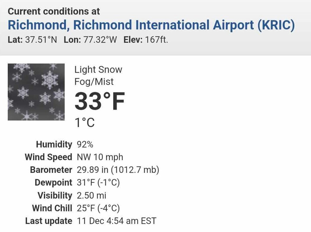
-
Richmond Metro/Hampton Roads Area Discussion
RIC Airport replied to RIC Airport's topic in Mid Atlantic
Fingers crossed for recording a trace!!! Too bad temps won't drop below the mid 30s.
-
Richmond Metro/Hampton Roads Area Discussion
RIC Airport replied to RIC Airport's topic in Mid Atlantic
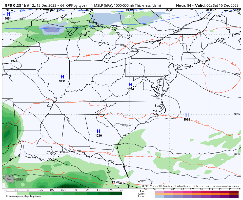
Cold front is moving through now. RIC went from 62°F at 10pm to the mid 40s some 30 minutes later. Wakefield sent a statement about 10 minutes ago for places east of Richmond about to get the cold front. Special Weather Statement National Weather Service Wakefield VA 1044 PM EST Sun Dec 10 2023 NCZ012-VAZ079>084-086>090-092-514-516-518-520-523-110515- Northampton-Surry-Dinwiddie-Southampton-Eastern Henrico-Eastern King and Queen-York-James City-Gloucester-Greensville-Charles City-Mathews-New Kent-Prince George-Sussex-Eastern King William-Brunswick-Eastern Chesterfield (Including Col. Heights)- 1044 PM EST Sun Dec 10 2023 ...A LINE OF SHOWERS WILL AFFECT NORTHAMPTON...GREENSVILLE... SOUTHAMPTON...NORTHWESTERN YORK...SUSSEX...DINWIDDIE...JAMES CITY... SOUTHEASTERN CHESTERFIELD...GLOUCESTER...SOUTHEASTERN KING AND QUEEN...CHARLES CITY...PRINCE GEORGE...NEW KENT...SOUTHEASTERN HENRICO...SOUTHEASTERN KING WILLIAM...SURRY AND EASTERN BRUNSWICK COUNTIES...THE CITY OF COLONIAL HEIGHTS...THE CITY OF HOPEWELL...THE CITY OF PETERSBURG...THE CITY OF EMPORIA AND THE CITY OF WILLIAMSBURG... At 1040 PM EST, a cold front with winds in excess of 40 mph was from Shacklefords to 7 miles northwest of Dinwiddie to 12 miles south of Littleton. Movement was southeast at 30 mph. Winds in excess of 40 mph are possible as the front moves southeast through midnight. Locations impacted include... Newport News, Petersburg, Dinwiddie, Hopewell, New Kent, Colonial Heights, Roanoke Rapids, Williamsburg, Charles City, Emporia, Gloucester Courthouse, West Point, Waverly, Lawrenceville, Courtland, Garysburg, Rich Square, Wakefield, Boykins, and McKenney. If outdoors, consider seeking shelter inside a building. -
Richmond Metro/Hampton Roads Area Discussion
RIC Airport replied to RIC Airport's topic in Mid Atlantic
RIC is up to 1.93" thru 10pm, with 2 more hours to go, @Rhino16. The daily record was only 1.53" set in 1969. -
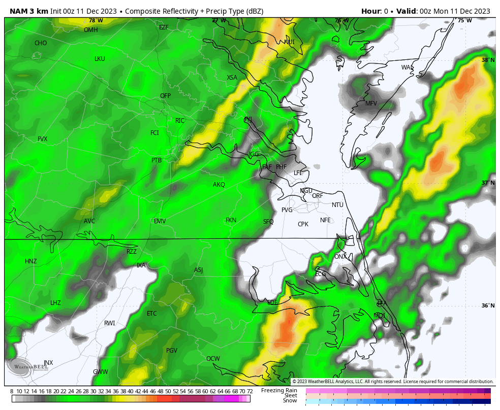
Richmond Metro/Hampton Roads Area Discussion
RIC Airport replied to RIC Airport's topic in Mid Atlantic
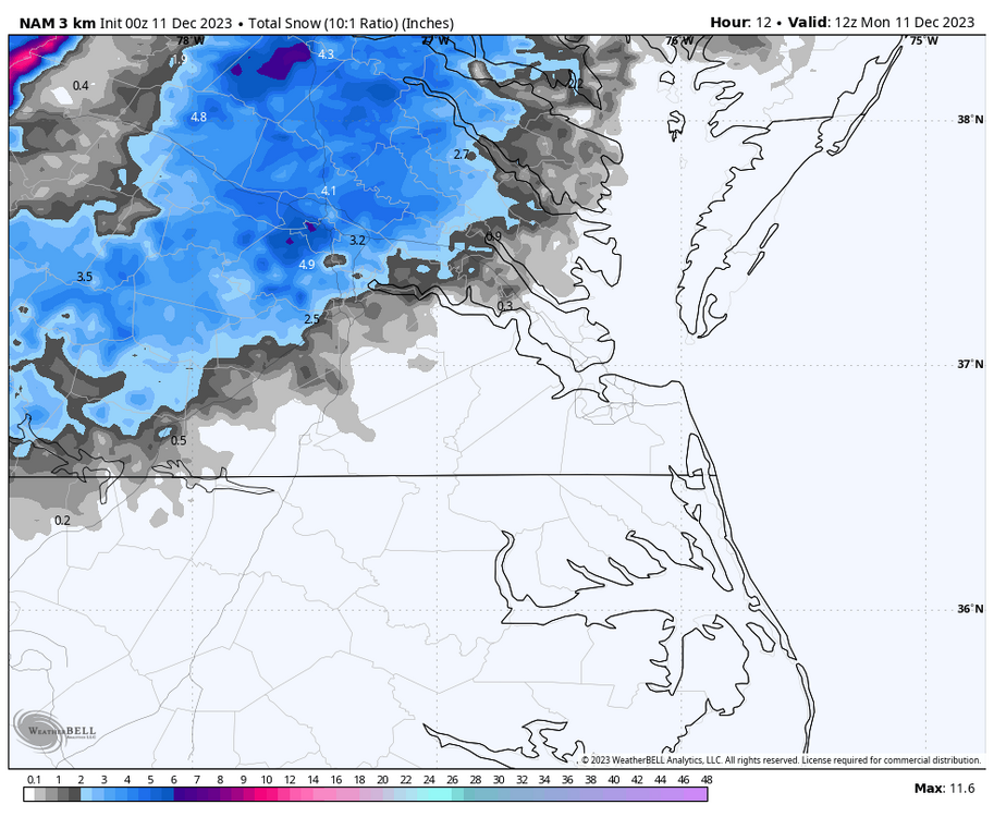
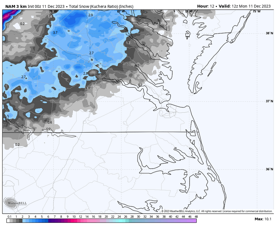
00Z NAM still shows that transition from rain to snow from about 3am to 7am along I-95 and as far east as Williamsburg up to the Northern Neck. NWS Wakefield has snow in the grids for many areas tomorrow morning.

-
Richmond Metro/Hampton Roads Area Discussion
RIC Airport replied to RIC Airport's topic in Mid Atlantic
RIC is up to 1.43” thru 9pm with another batch of heavy rains about to swing through. I think you may have a shot, @Rhino16.
.png.ca0bac61dbebd8a29982bbfc73cabcbe.png)
.png.7a1125349c201e992dcac53869b63011.png)


.png.511764212bcb7398019f9d995836691d.png)