RIC Airport
-
Posts
2,586 -
Joined
-
Last visited
Content Type
Profiles
Blogs
Forums
American Weather
Media Demo
Store
Gallery
Everything posted by RIC Airport
-
Richmond Metro/Hampton Roads Area Discussion
RIC Airport replied to RIC Airport's topic in Mid Atlantic
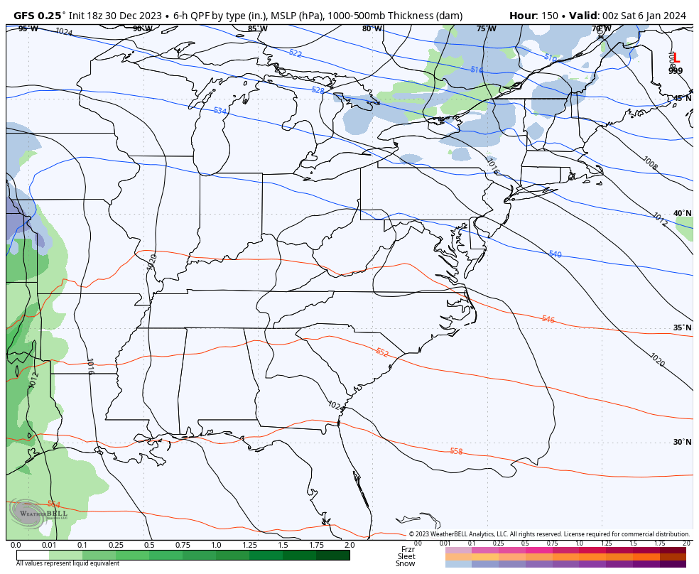
6z GFS is on board and was better than the 00z GFS. Precip arrives Saturday afternoon. Let's see if things trend better at 12z.

-
Richmond Metro/Hampton Roads Area Discussion
RIC Airport replied to RIC Airport's topic in Mid Atlantic
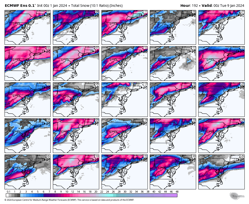
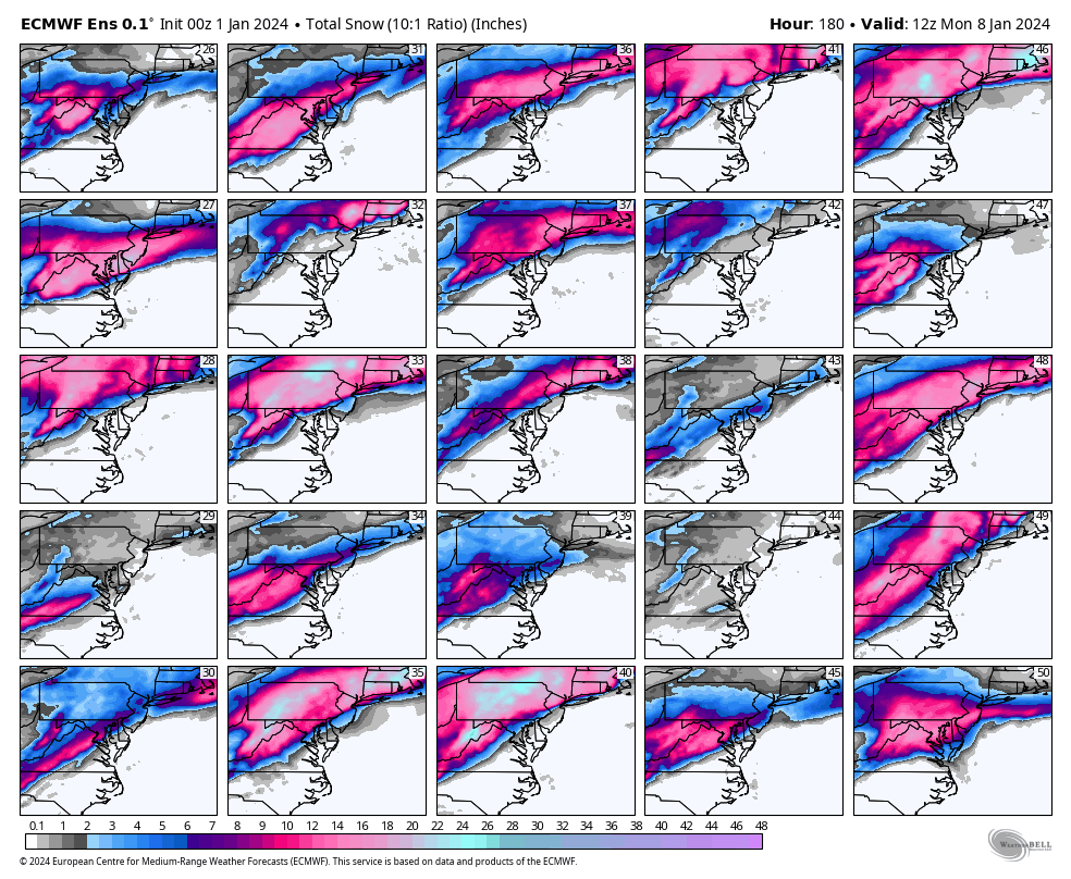
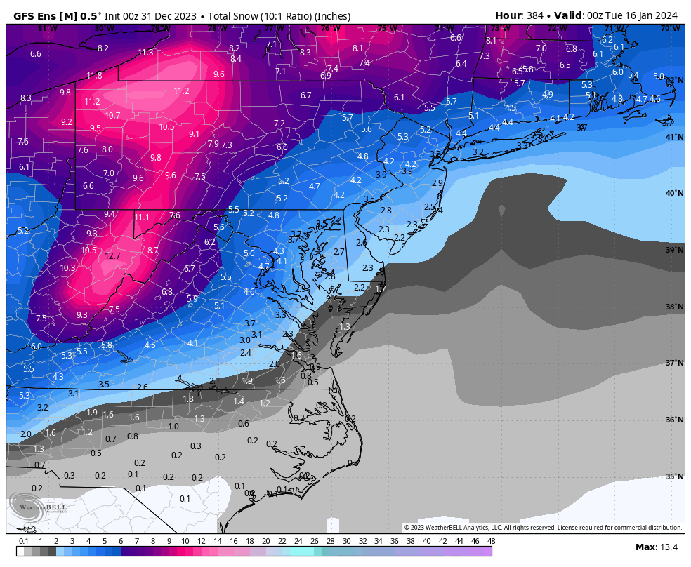
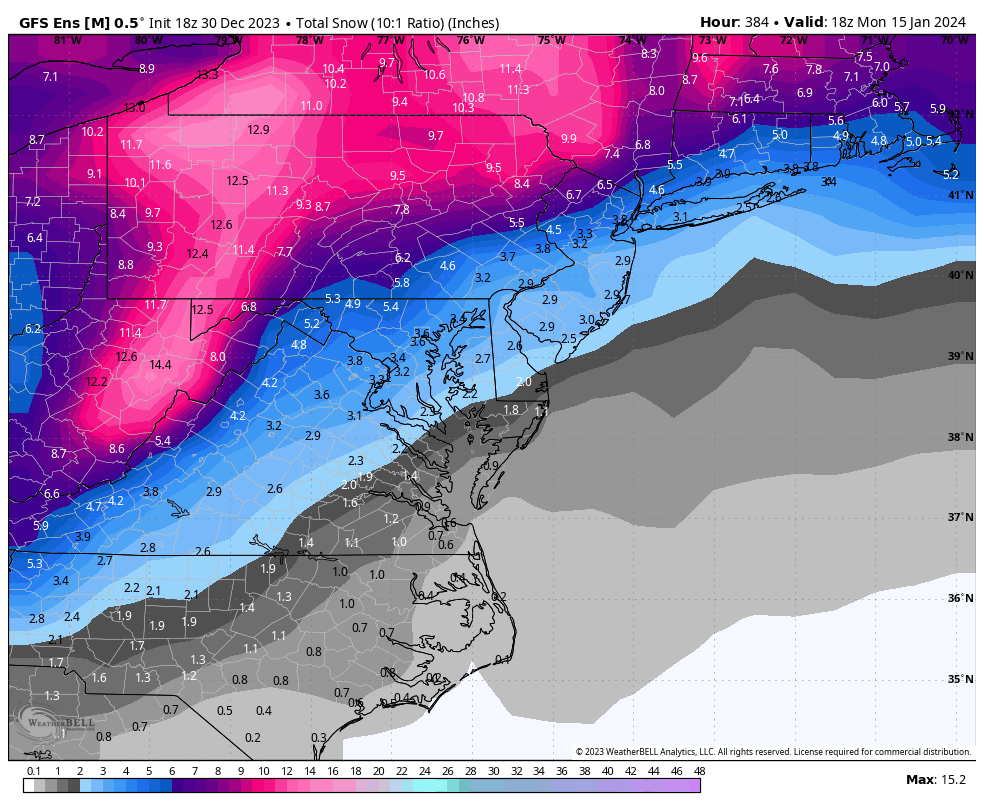
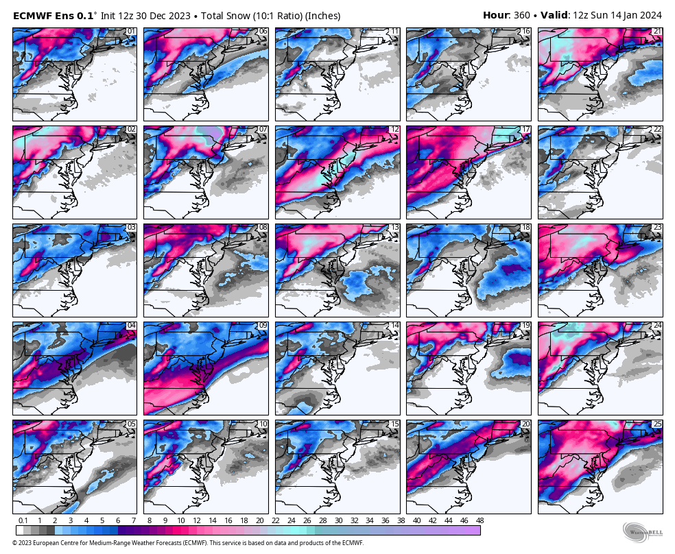
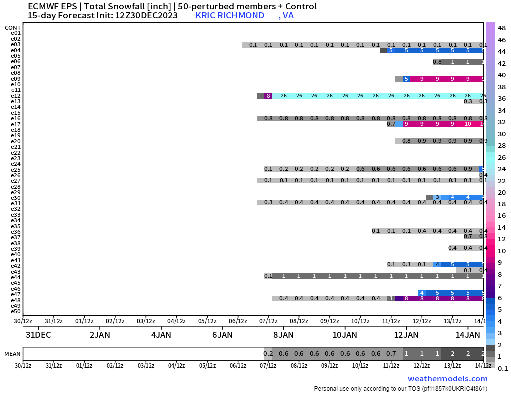
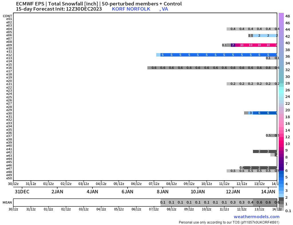
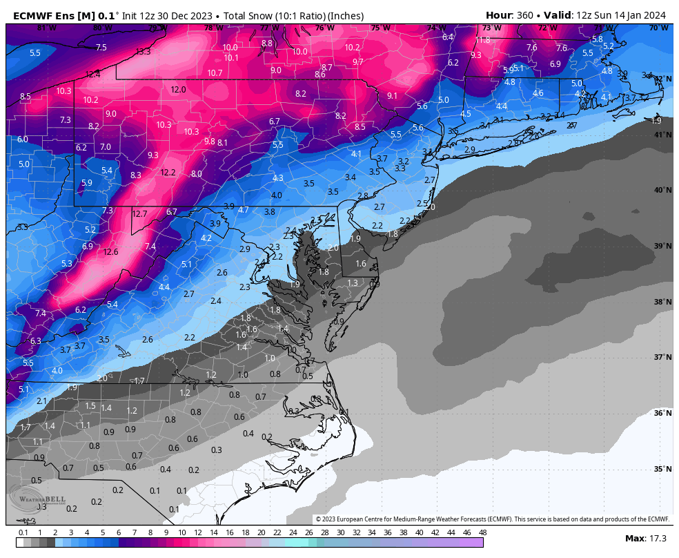
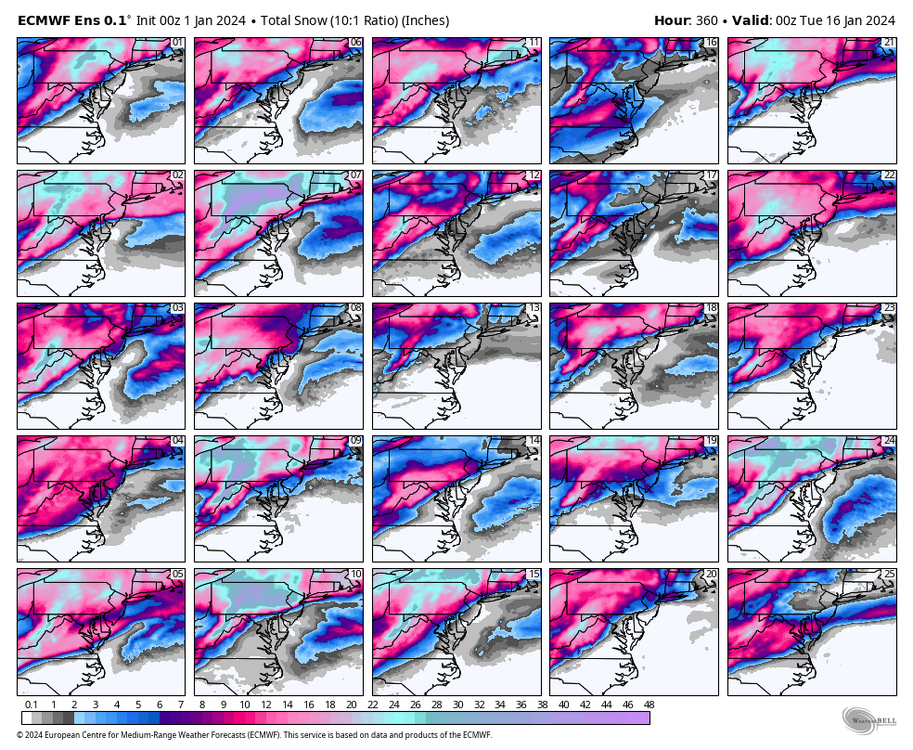
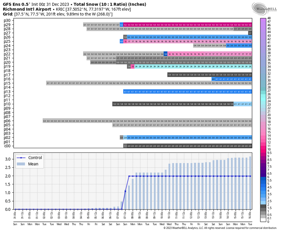
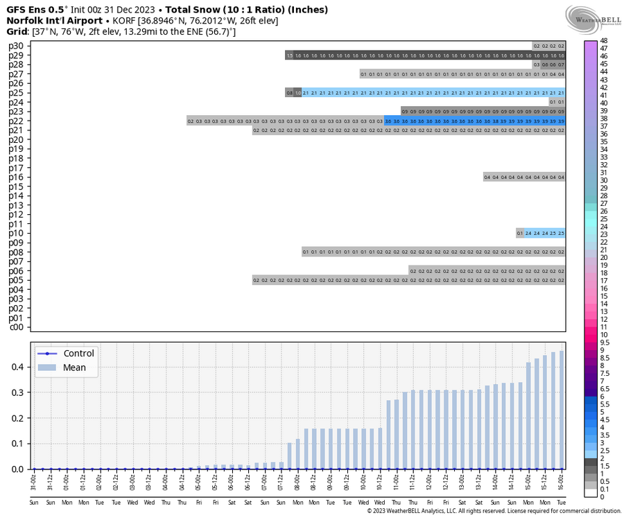
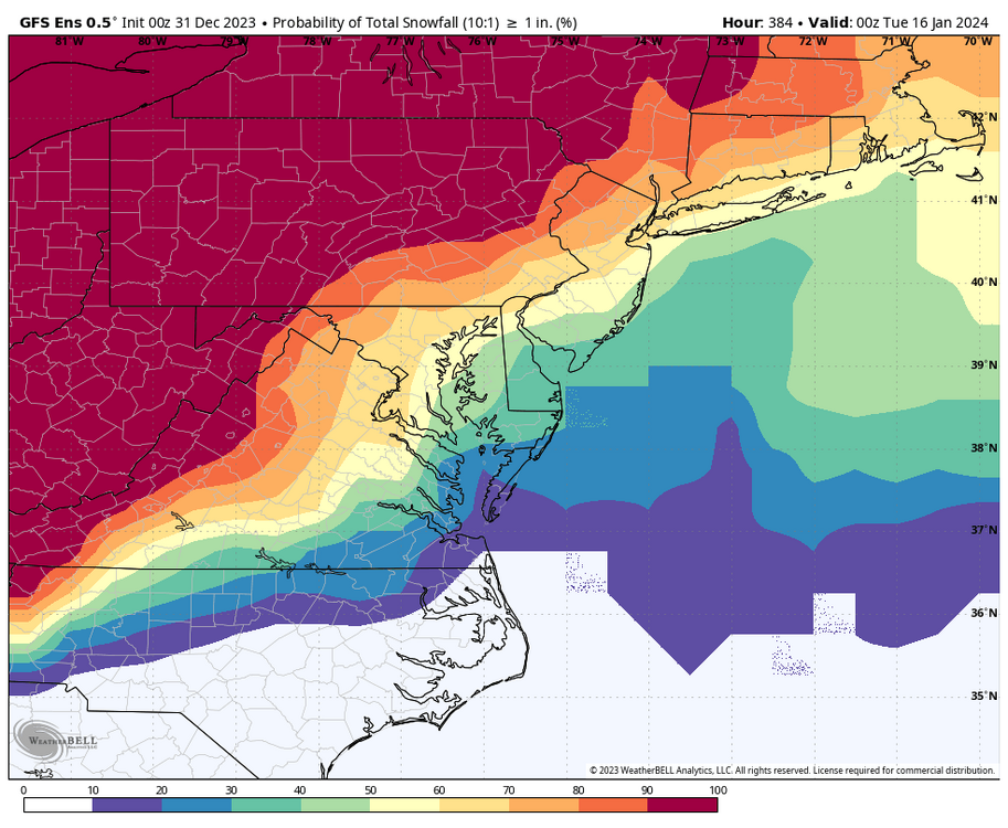
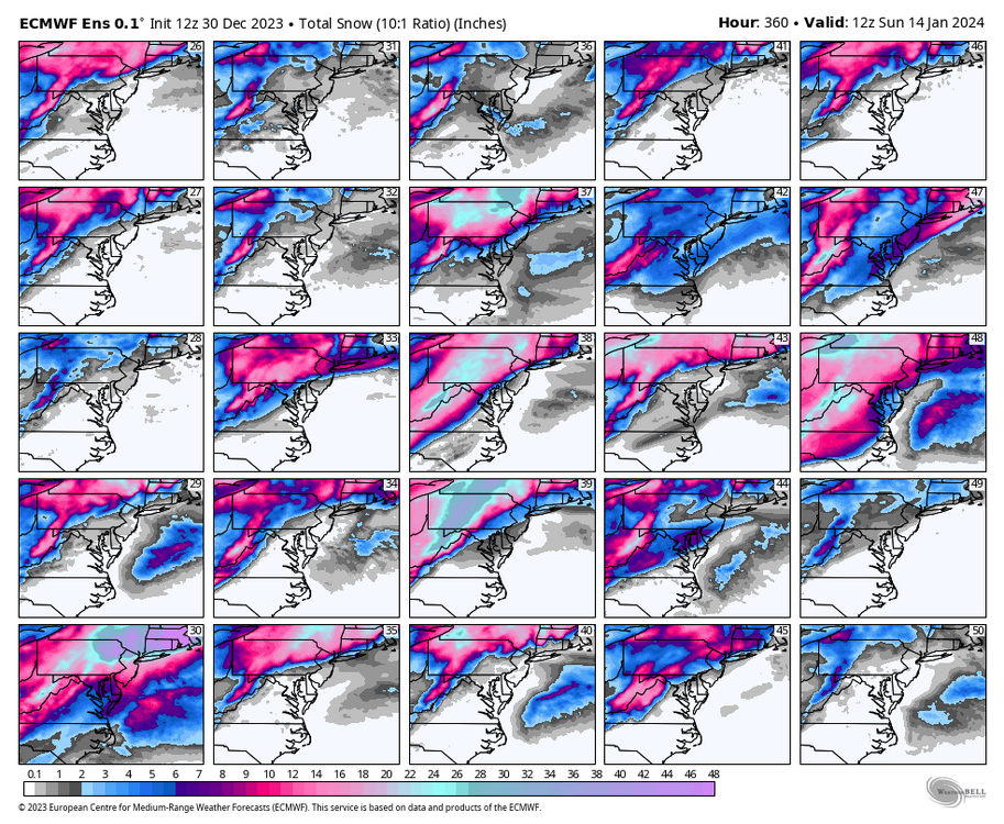
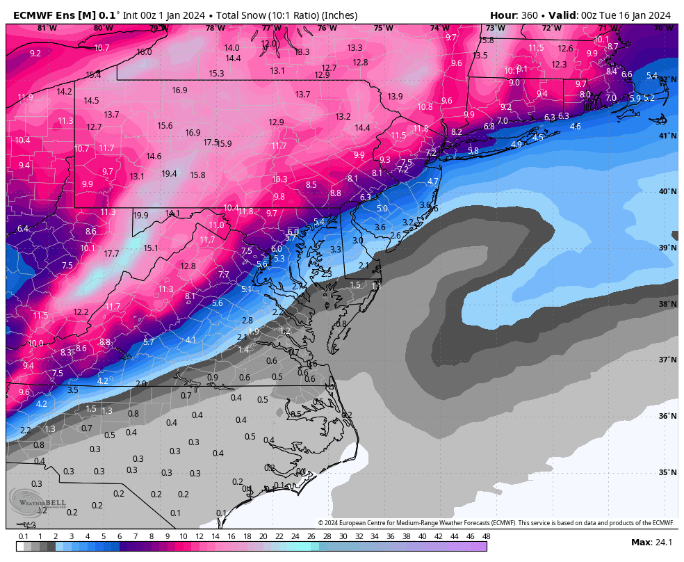
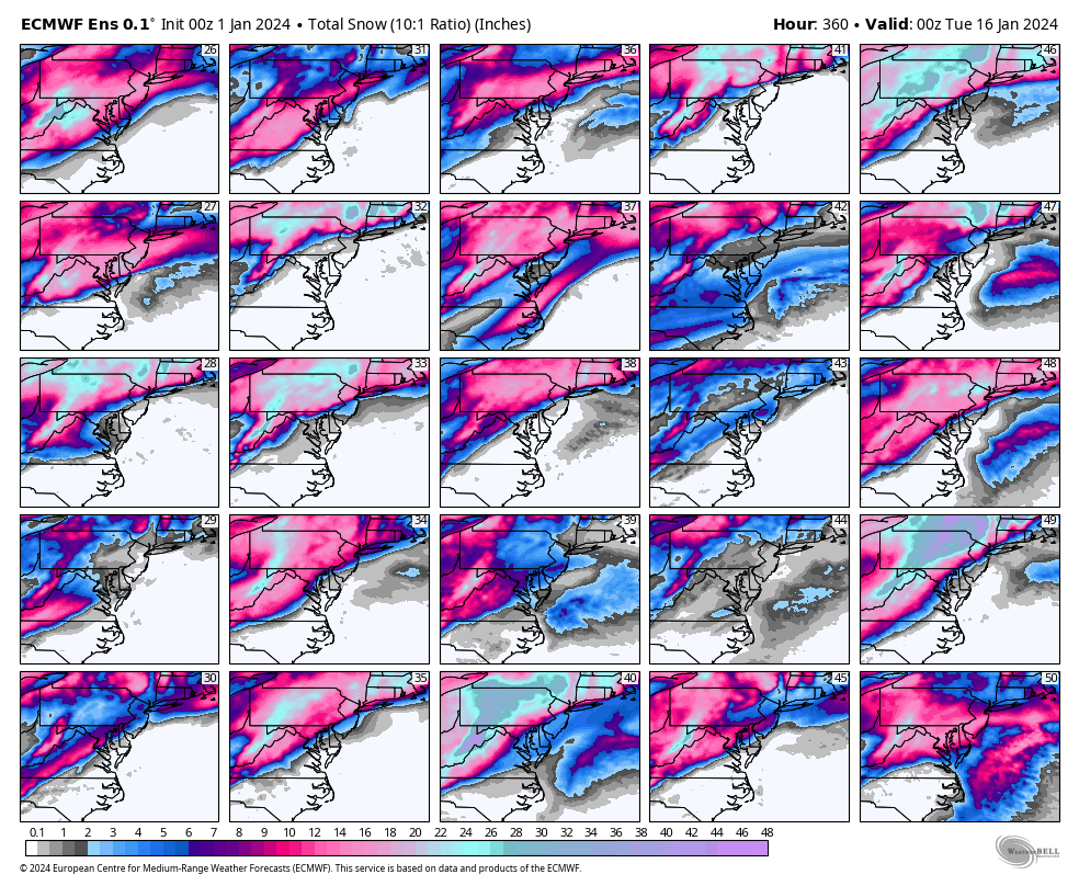
Here is the snowfall mean for all euro ensemble members for the entire 00z run though hour 360 and the updated totals map for the 50 individual members Also, the specific Richmond and Norfolk snowfall outputs from each member thru hour 360. Yes, the ensmebles indicate another opportunity for snow around the 12-14th of January.

.thumb.png.e0828956db840484475609949ff895c9.png)
.thumb.png.2fb4f17b7ba6e3afc5ee3998a9b242d7.png)
-
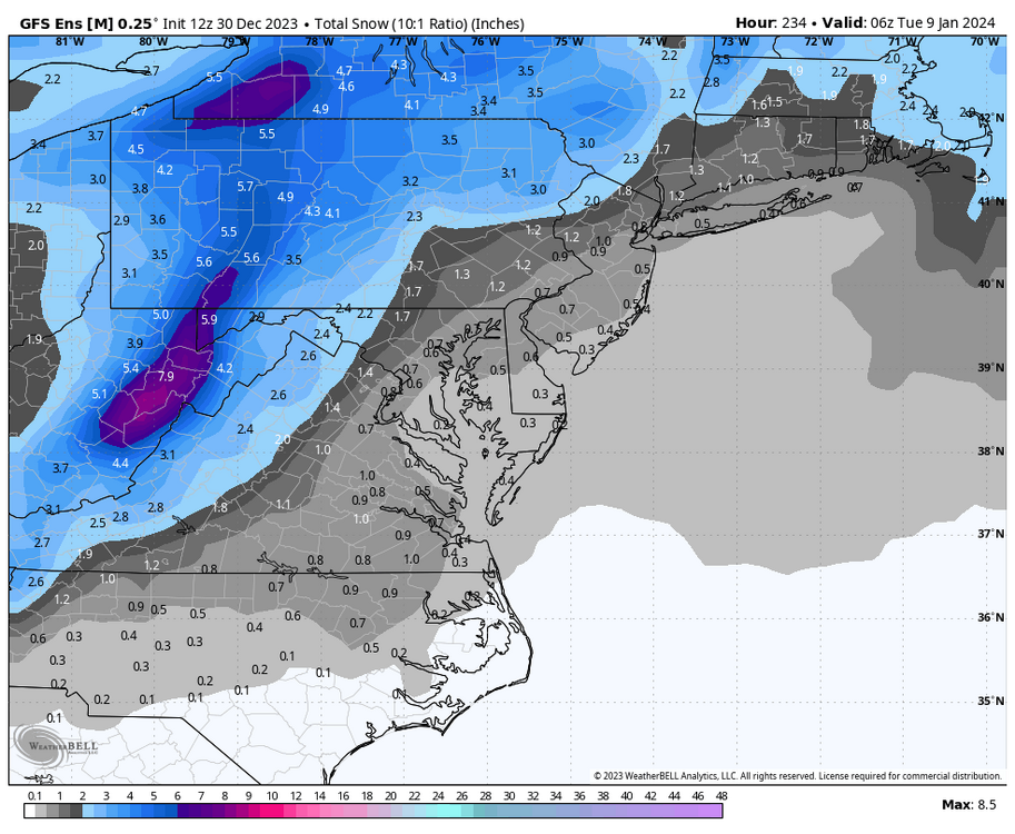
Richmond Metro/Hampton Roads Area Discussion
RIC Airport replied to RIC Airport's topic in Mid Atlantic
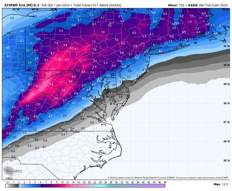
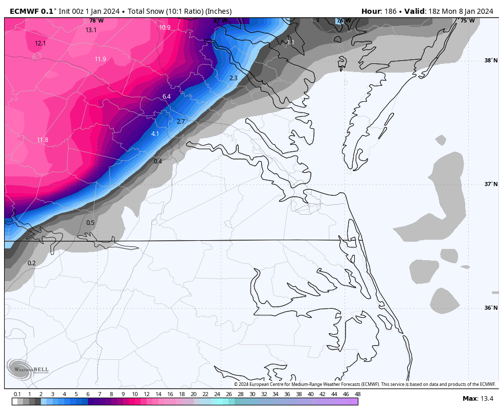
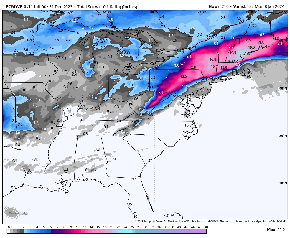
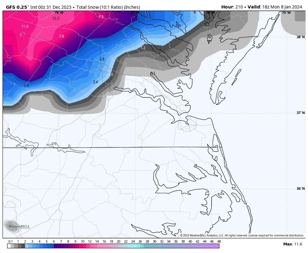
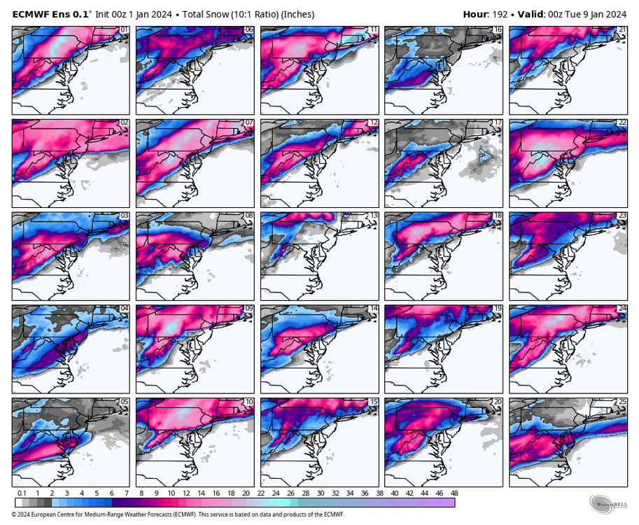
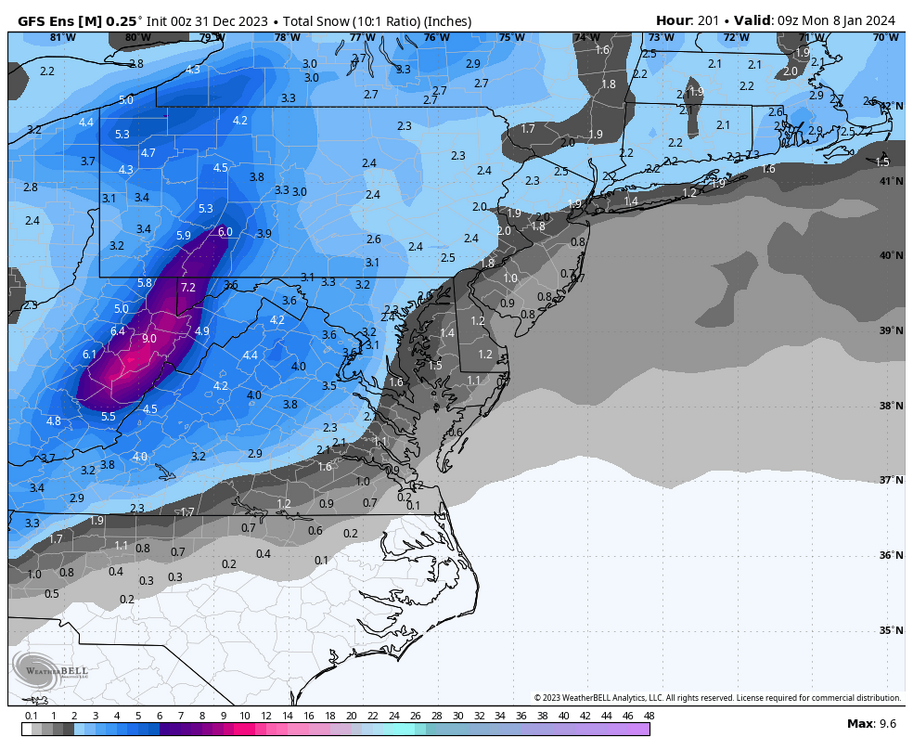
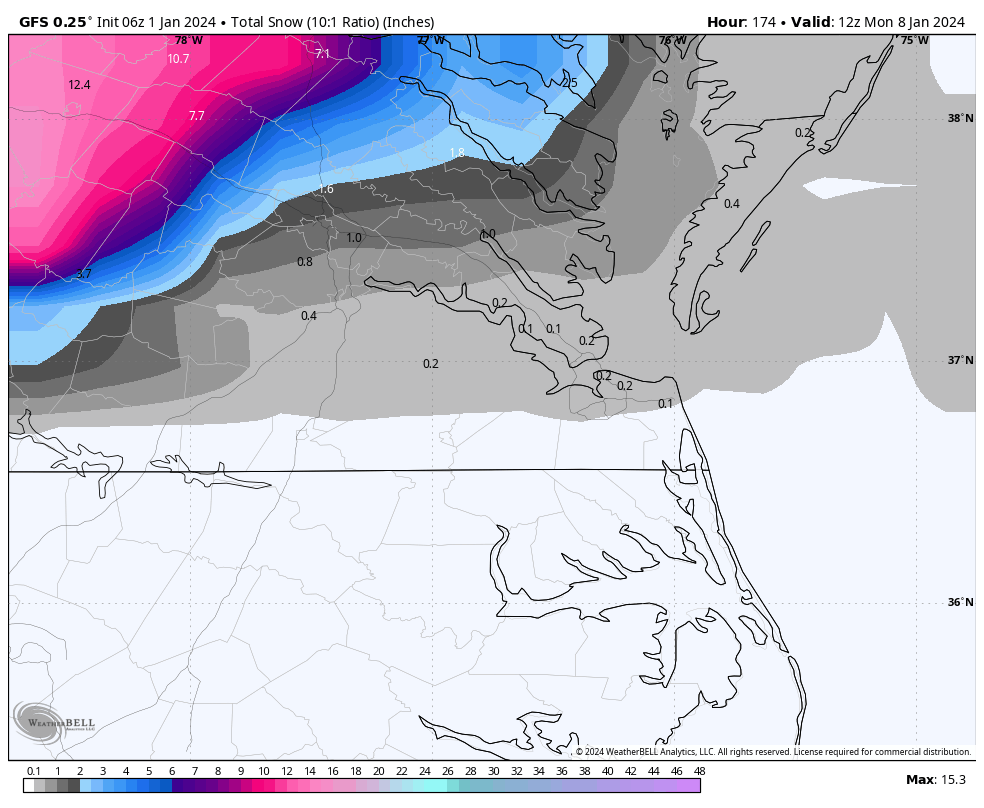
Here is the snowfall from the 00Z Euro Ensembles through 7am on the morning of January 9th. Of course, this is a 10:1 ratio, but the mean from all the members is 1.2" at RIC. That is mainly from 6 or 7 of the 50 members as the vast majority of them, as you can see, are hits in northern and western VA, particularly from US Hwy 15 and westward.

-
Richmond Metro/Hampton Roads Area Discussion
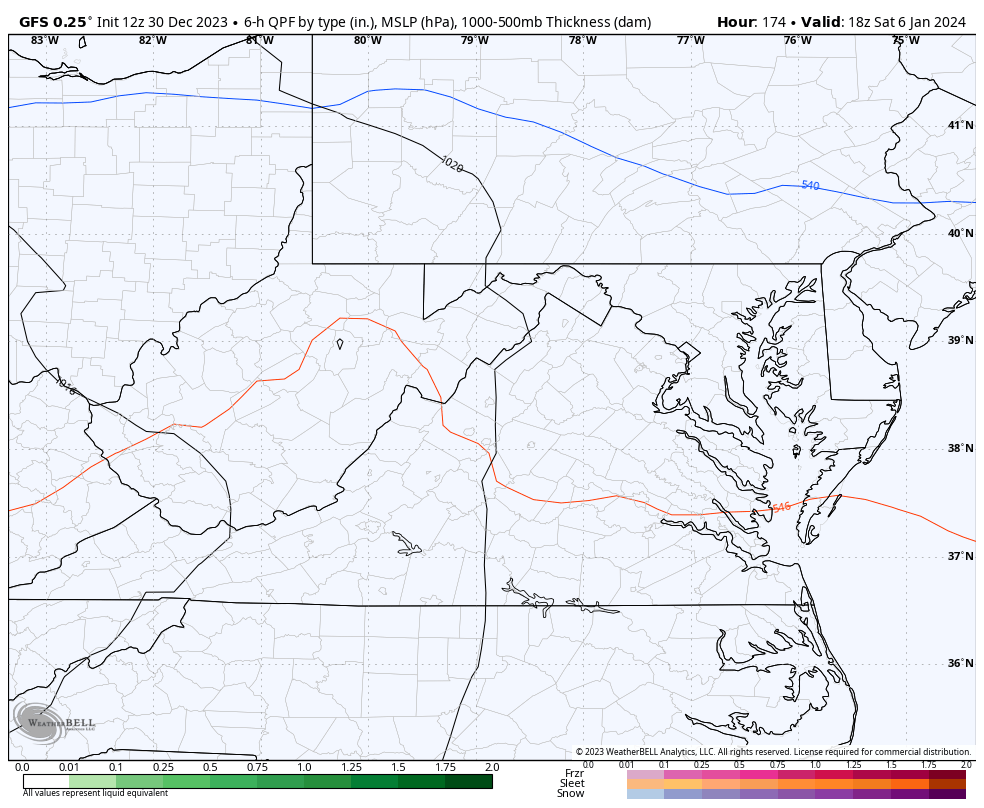
RIC Airport replied to RIC Airport's topic in Mid Atlantic
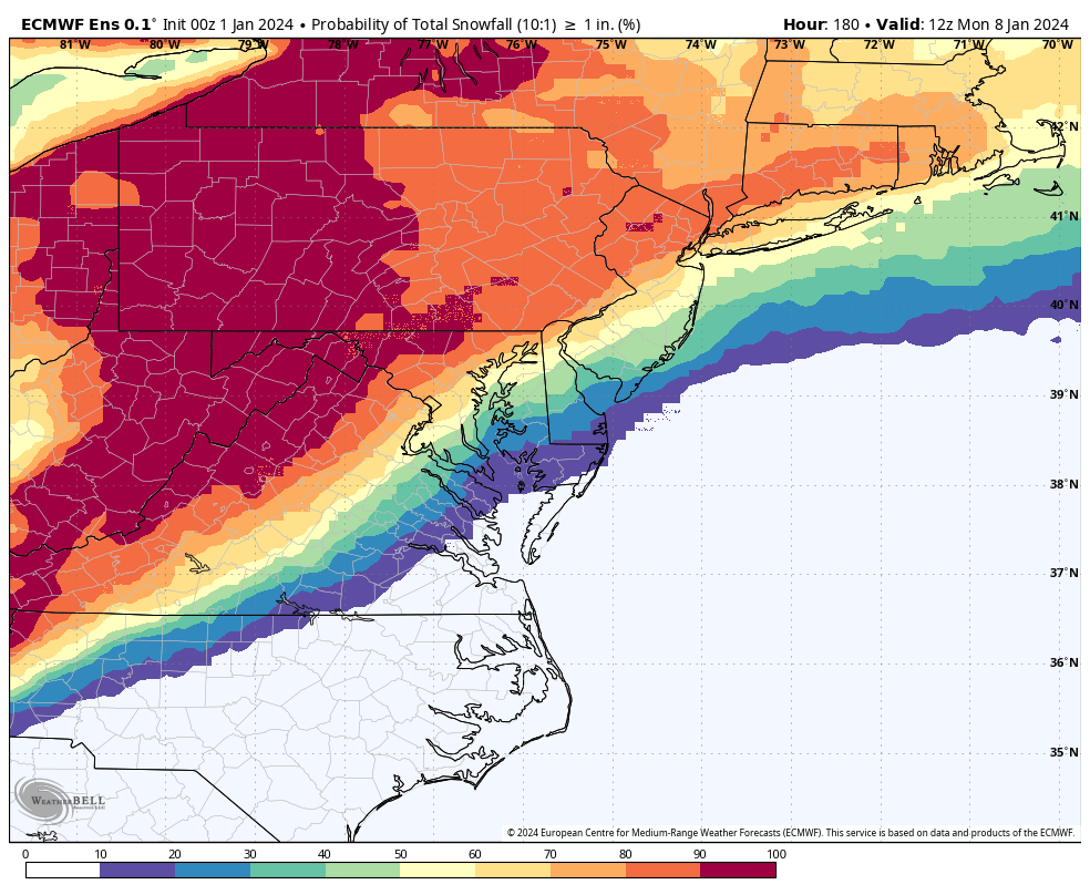
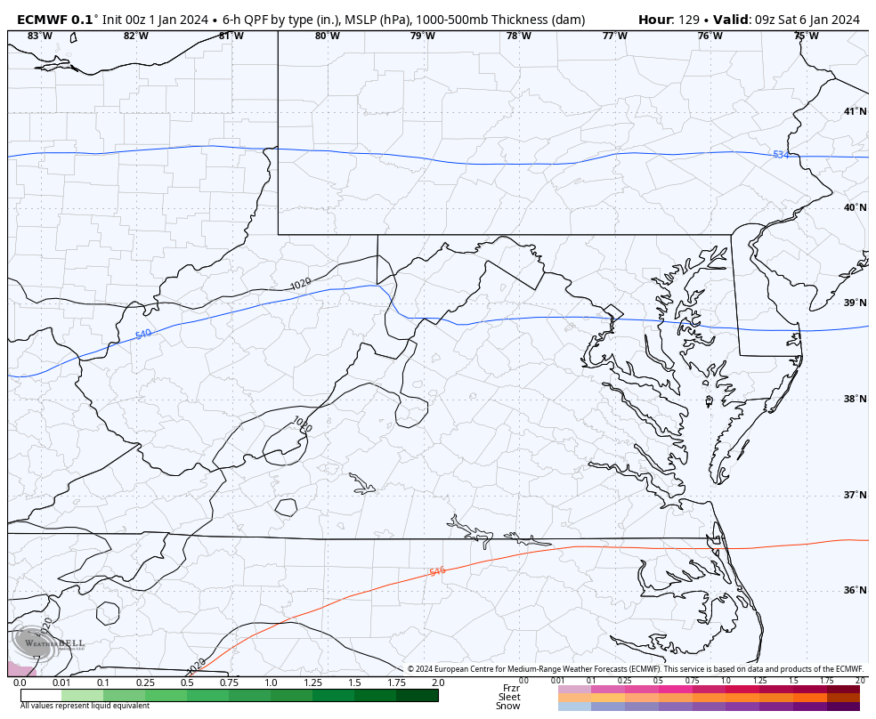
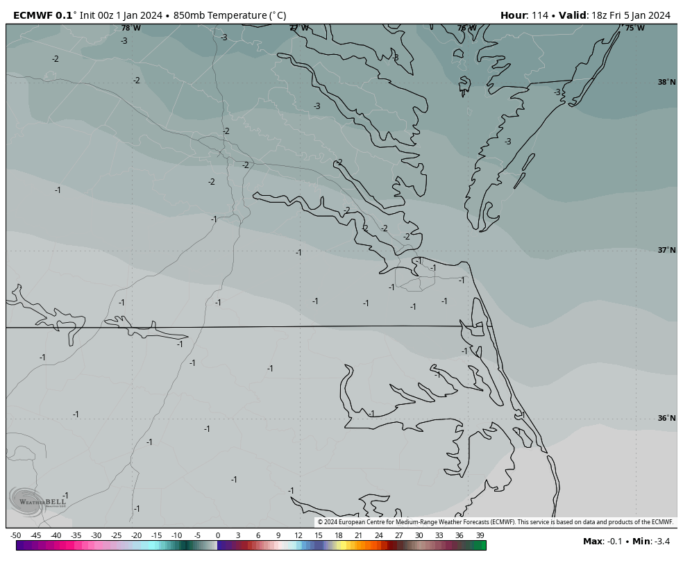
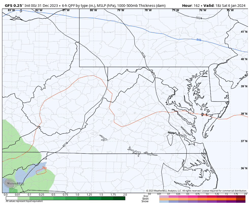
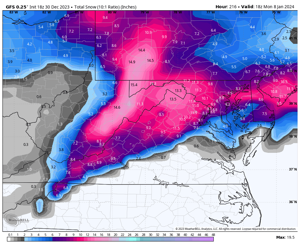
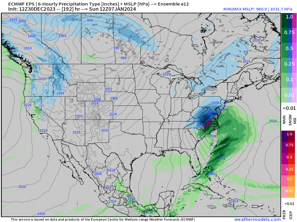
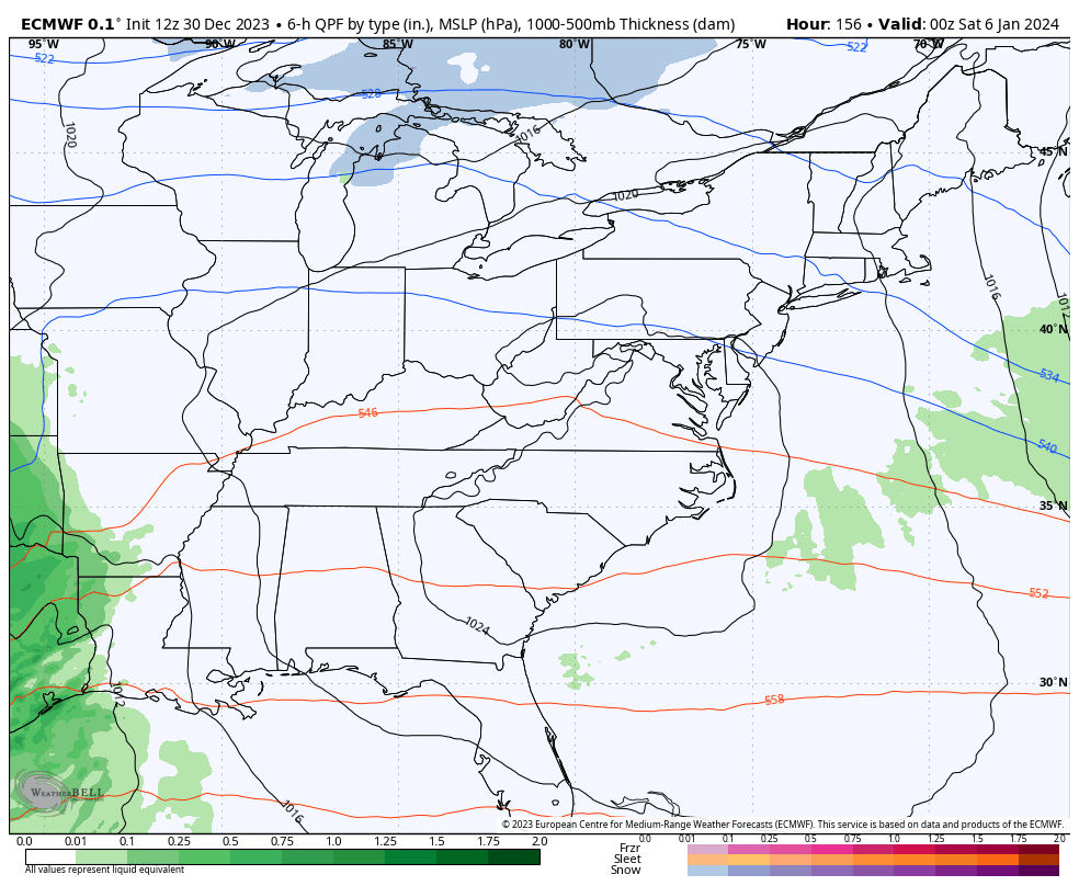
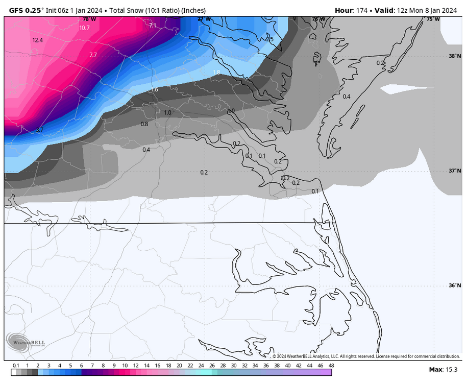
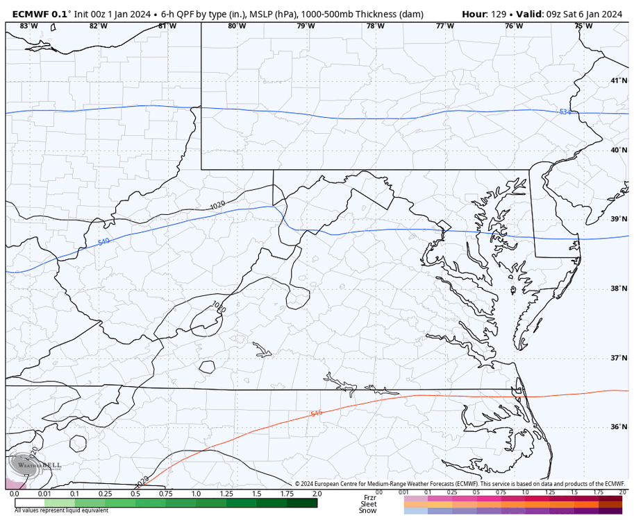
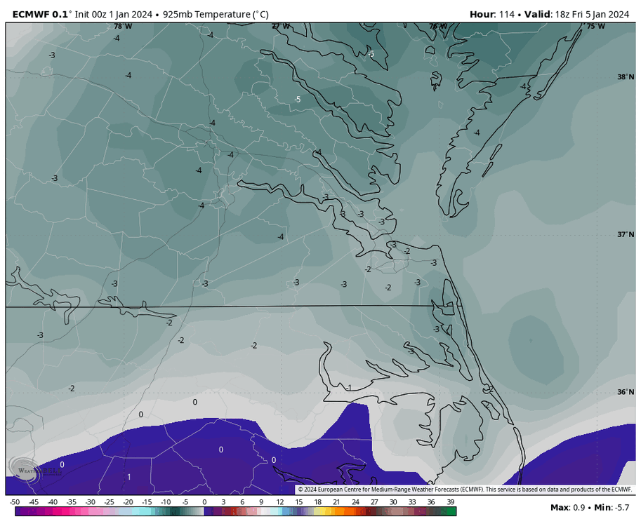
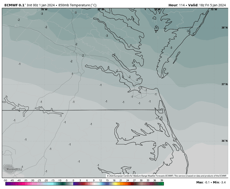
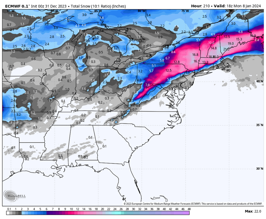
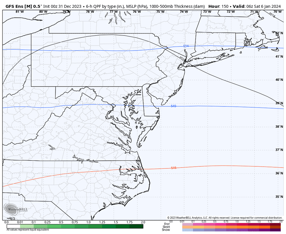
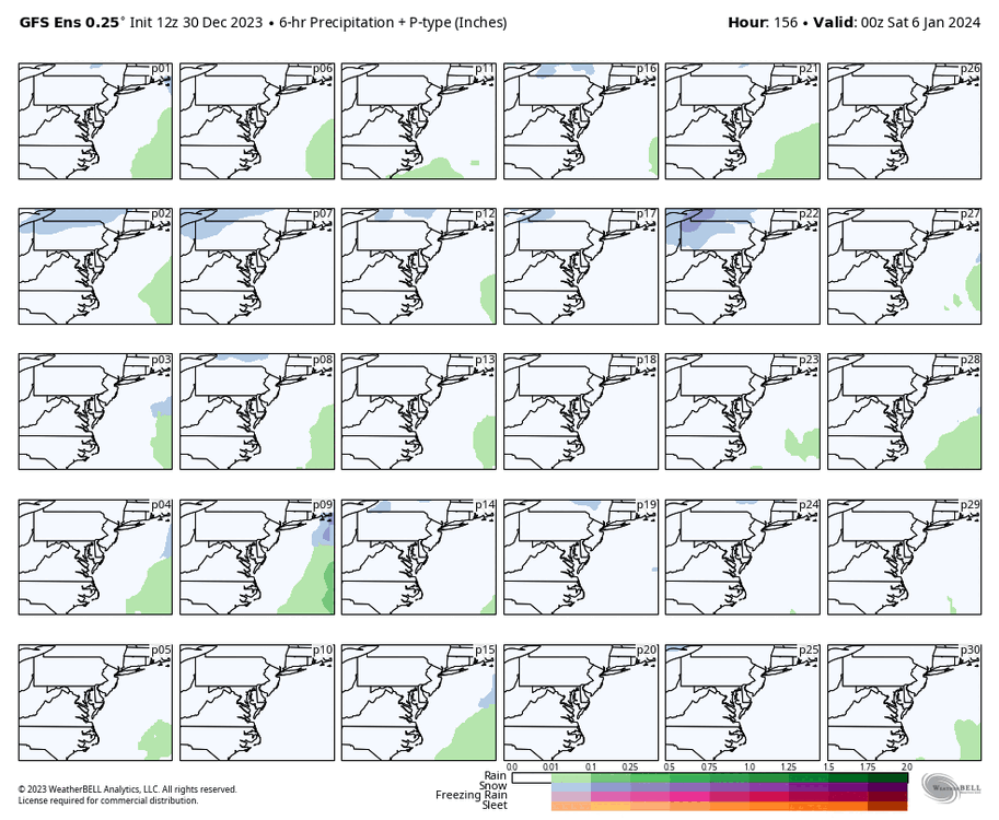
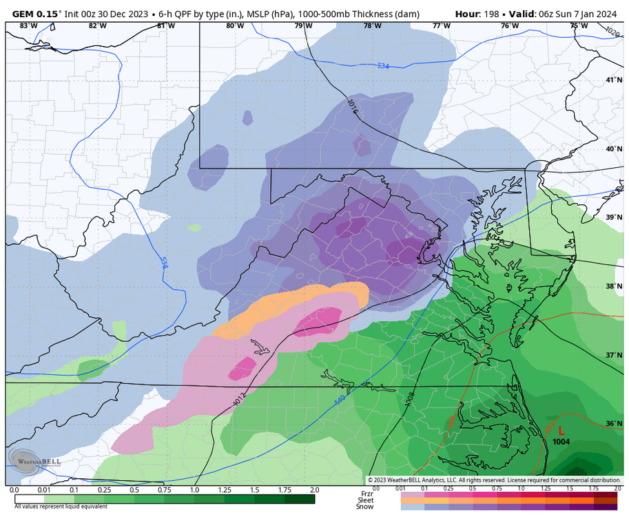
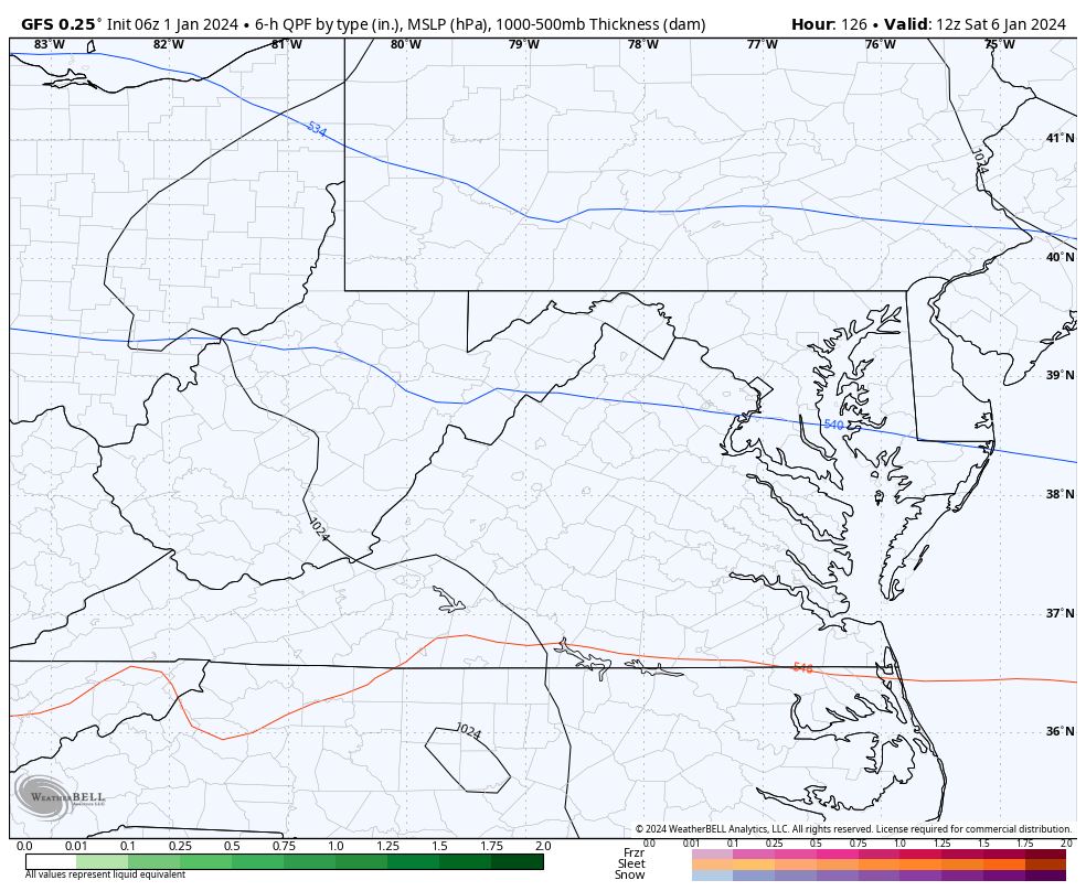
The 00Z Euro came back south and east. Verbatim, it's better if you're north and west of Richmond, but it still drops, accumulating snow even in Richmond this run. However, there is a sharp cut-off once you get south and east of Richmond. Precip actually arrives in the afternoon and evening of Saturday January 6th. There are some 850mb and surface temp concerns for RIC metro specifically (which I've looped below), but too early to get into the details as the model is subject to change. But, this is an encouraging development.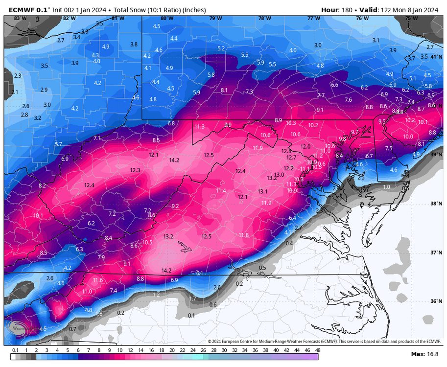

-
Richmond Metro/Hampton Roads Area Discussion
RIC Airport replied to RIC Airport's topic in Mid Atlantic
We needed the Euro to get on board, and it didn't last night. Also, GFS has caved to the Euro, so that threat seems less likely today. There is still some uncertainty with how the rest of the month goes, and I'm not too fond of the troughing tendency in the middle and western CONUS. But there is plenty of time to monitor, and everything could change at the drop of a dime, and we get a sneaky event. -
Richmond Metro/Hampton Roads Area Discussion
RIC Airport replied to RIC Airport's topic in Mid Atlantic
Meanwhile, the 00z Euro was not our friend tonight. The ensembles might reveal hope for the 1/7 event, but I will check later in the morning.
-
Richmond Metro/Hampton Roads Area Discussion
RIC Airport replied to RIC Airport's topic in Mid Atlantic
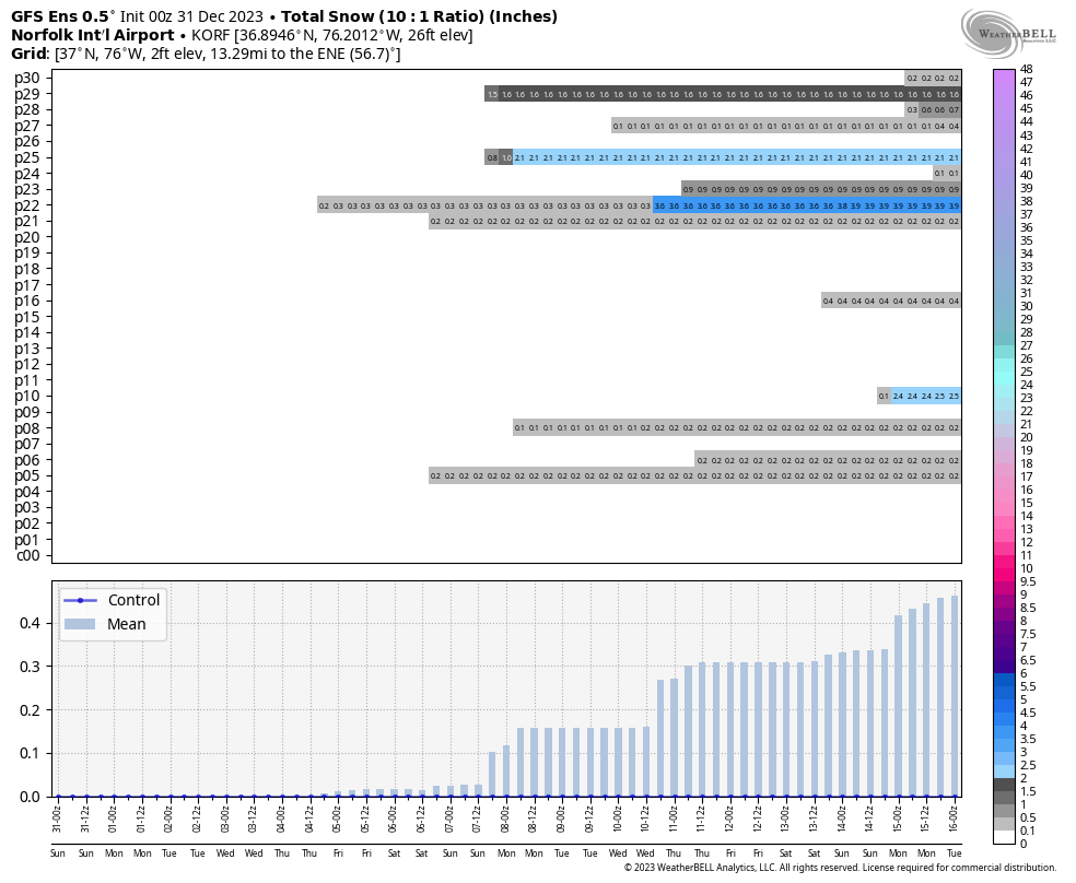
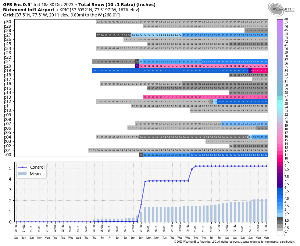
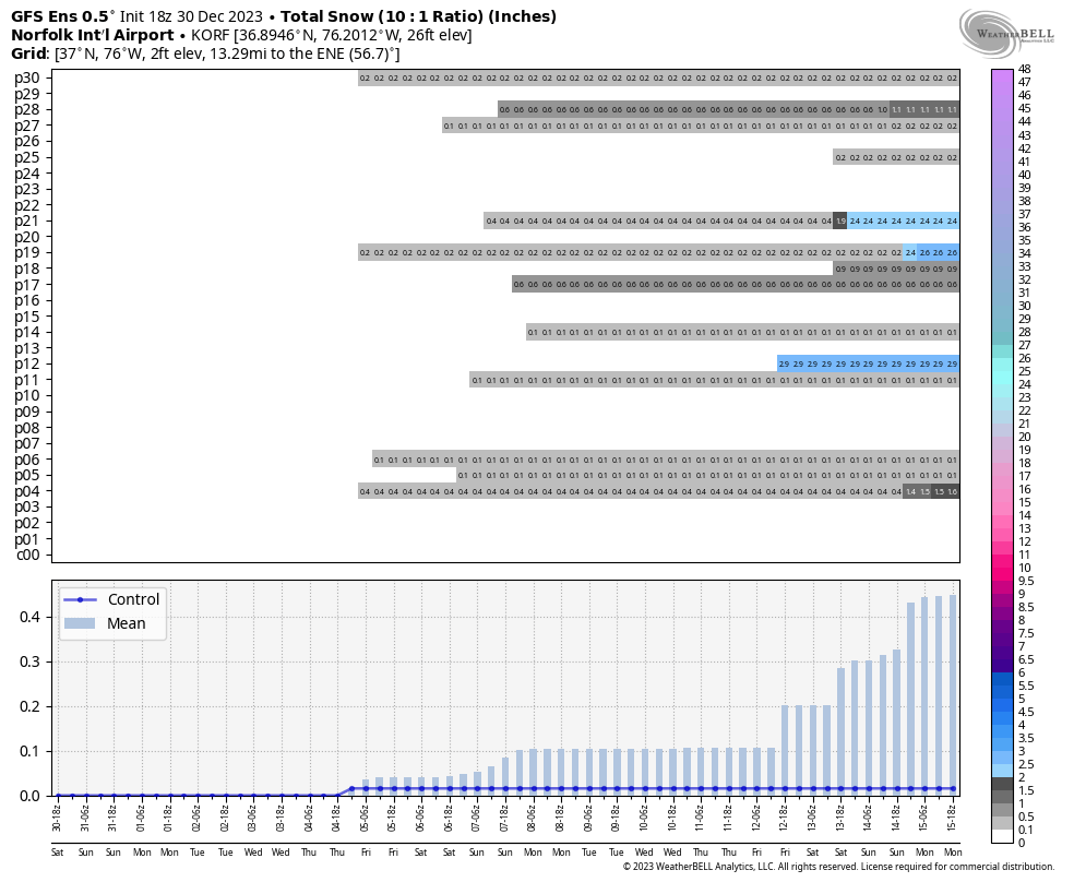
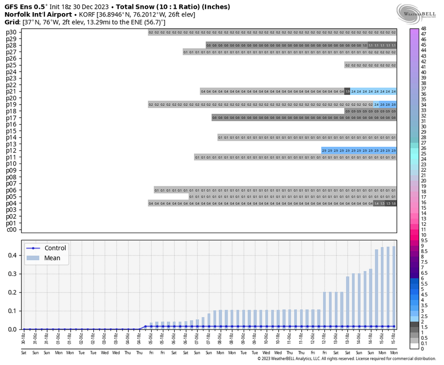
Here are the 00z GFS ensemble member snowfall outputs for Richmond and Norfolk. You can see there are opportunities between January 7th and 15th. I also included a map of the regional mean from the entire run.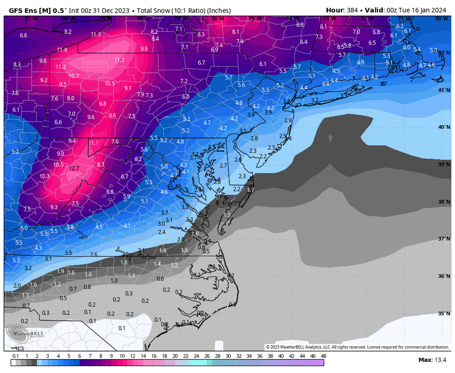
-
Richmond Metro/Hampton Roads Area Discussion
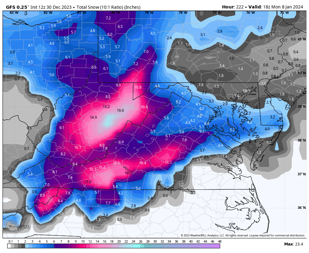
RIC Airport replied to RIC Airport's topic in Mid Atlantic
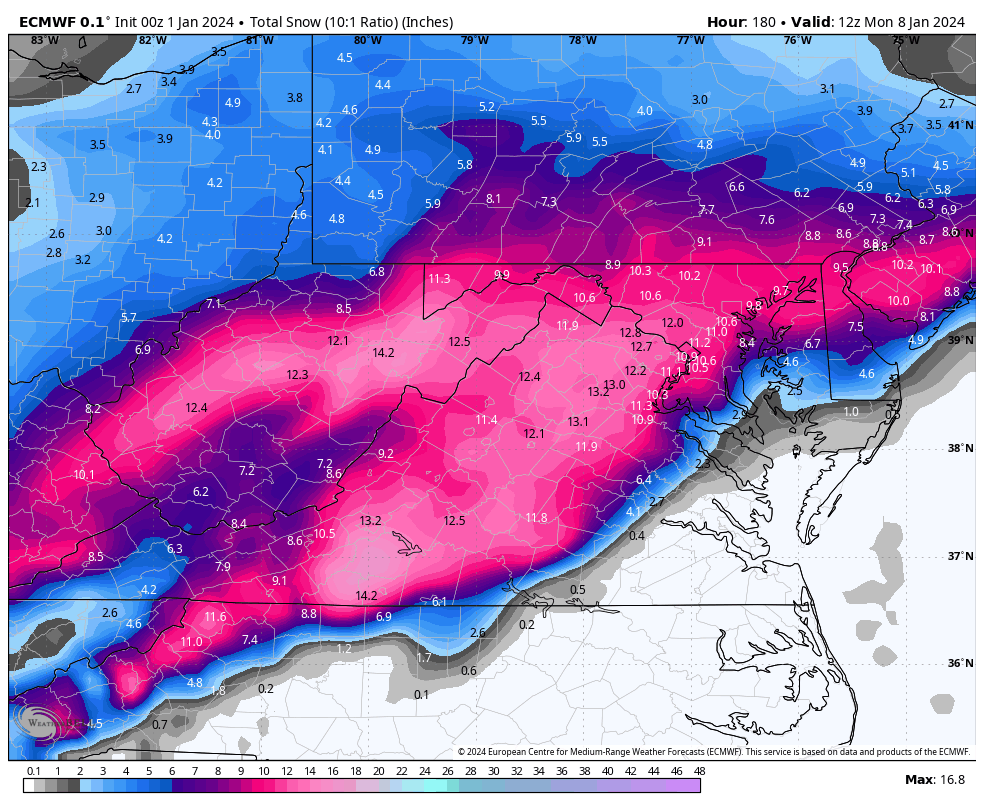
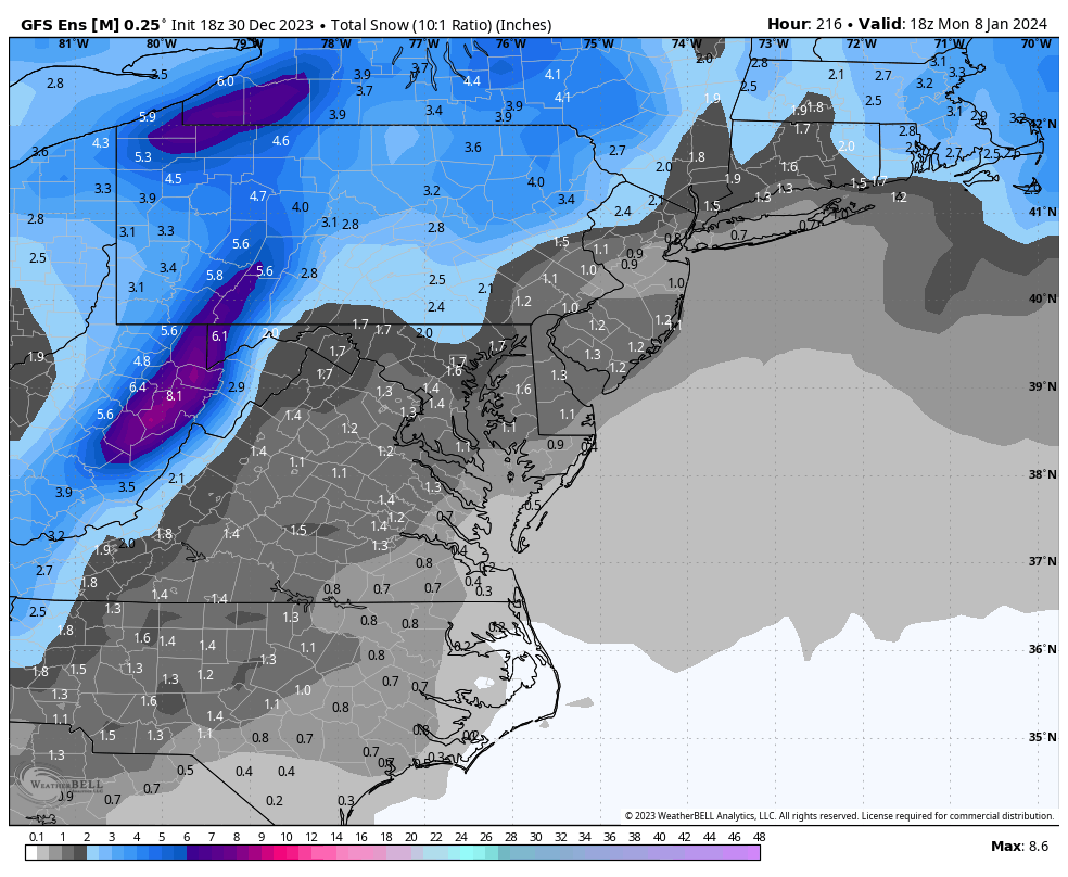
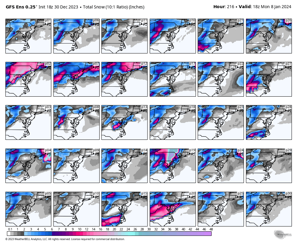
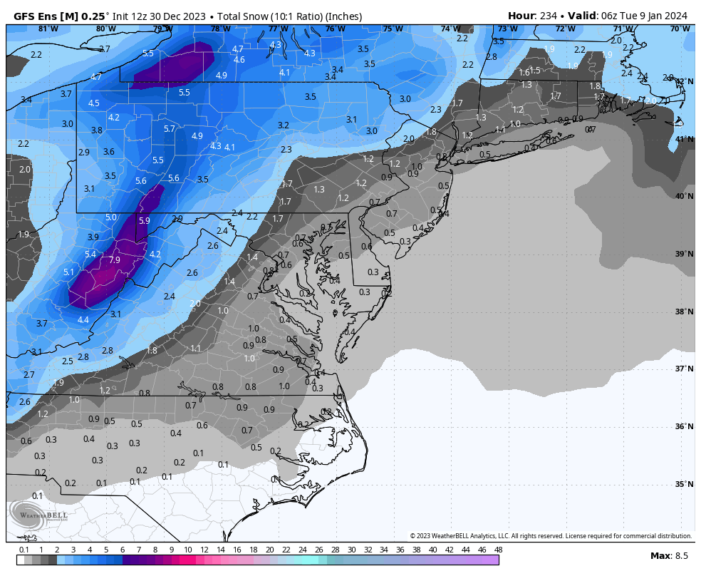
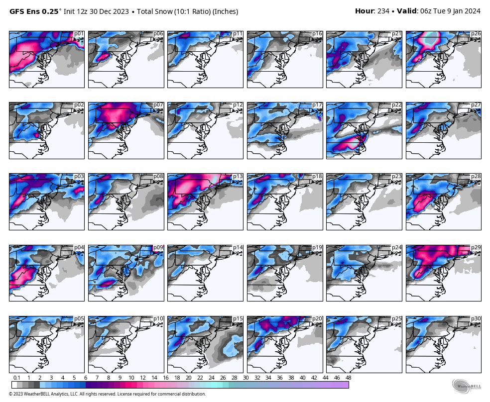
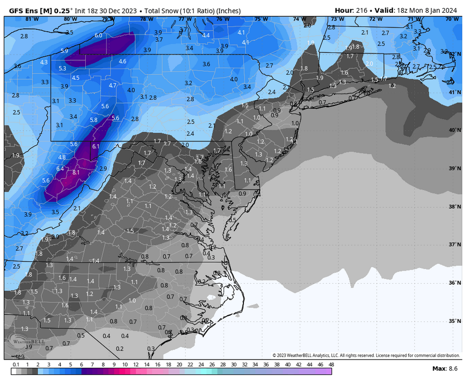
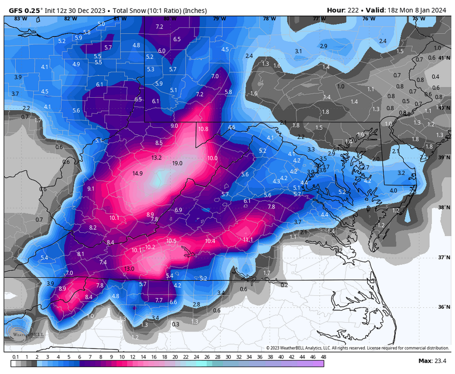
The 00Z GFS ensembles continue to signal a storm threat for January 7th. The snowfall mean at RIC increased once again. The 1st map is a loop of the ensemble mean. The 2nd is a slowed-down loop so you can see how each of the 30 members handles this event. So watch closely! There were several good hits for Richmond. The final two maps are the snowfall totals for each ensemble member and a regional map of the snowfall mean for the period ending early Monday morning, January 8th.
-
Richmond Metro/Hampton Roads Area Discussion
RIC Airport replied to RIC Airport's topic in Mid Atlantic
The 00z Canadian had a more favorable solution for Richmond. But, I think it might be too cold with the antecedent airmass, has widespread low-mid teens the morning of Saturday the 6th.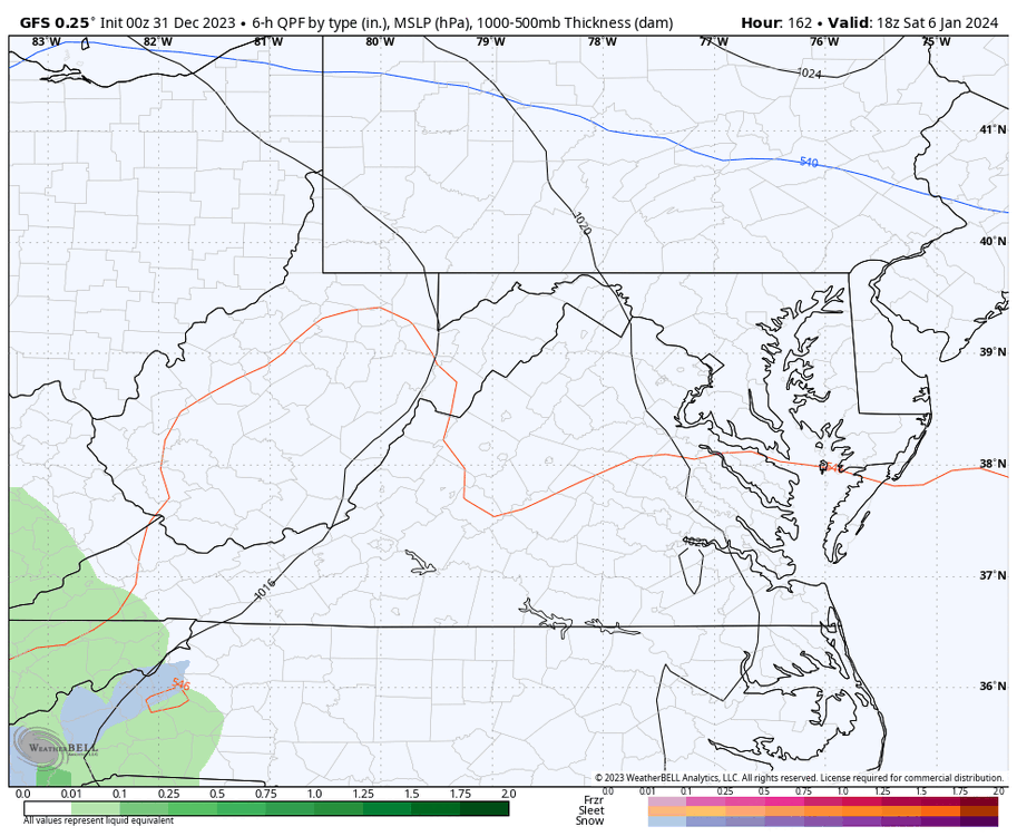


-
Richmond Metro/Hampton Roads Area Discussion
RIC Airport replied to RIC Airport's topic in Mid Atlantic
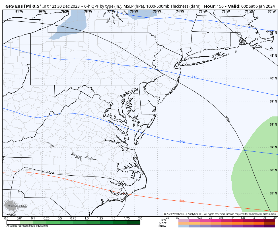
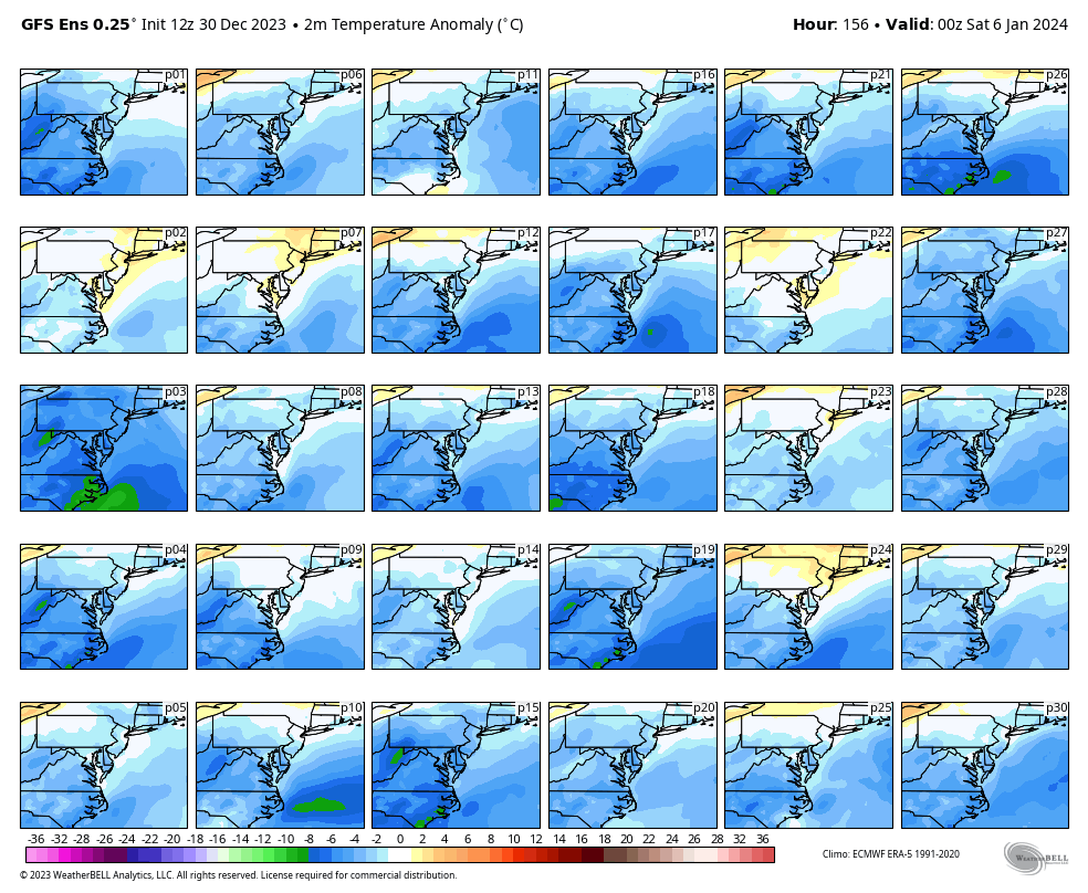
I like that look. However, the 00Z GFS maintains the snow mostly north and west. Maybe the low deepens farther SE? There is a surge of warm air over SE VA and up to RIC as the low approaches. Plenty of time to change for the better on the GFS, but not much different from today's earlier GFS runs.
-
Richmond Metro/Hampton Roads Area Discussion
RIC Airport replied to RIC Airport's topic in Mid Atlantic
Here is the regional mean for the entire run.
-
Richmond Metro/Hampton Roads Area Discussion
RIC Airport replied to RIC Airport's topic in Mid Atlantic
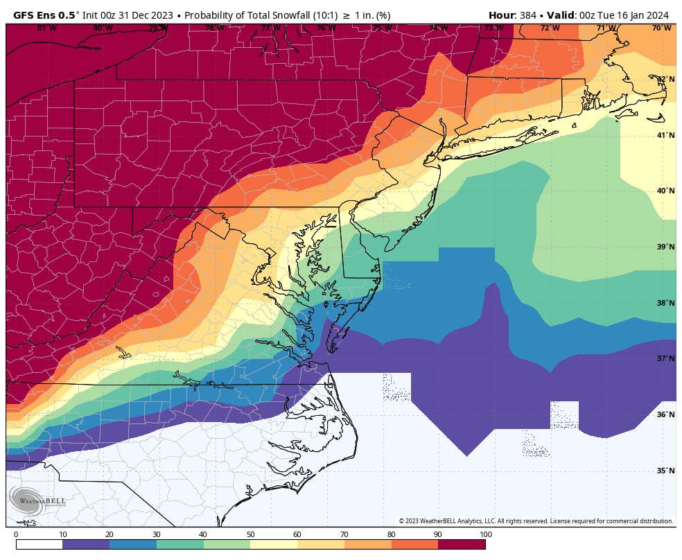
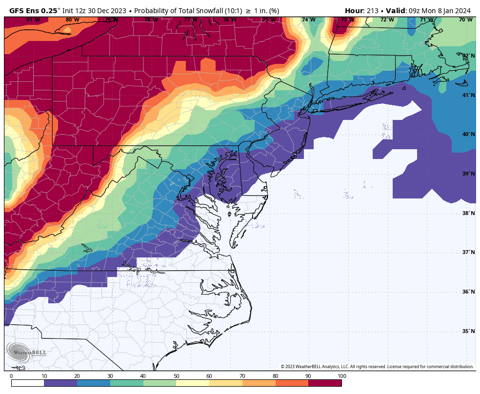
Below are the snowfall outputs from each 18Z GFS ensemble member for RIC and ORF, with threats mainly around January 7th and then again from the 12-14th.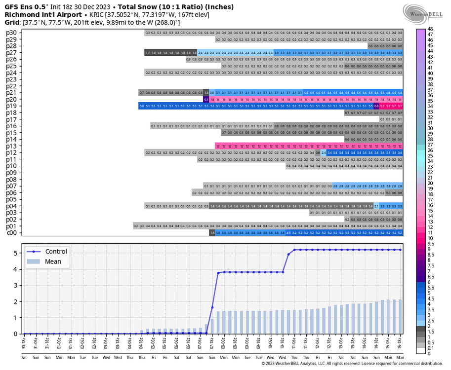
-
Richmond Metro/Hampton Roads Area Discussion
RIC Airport replied to RIC Airport's topic in Mid Atlantic
Here are the 18z GFS ensemble members for around January 7th. I slowed them down so you can see how each member handles this event. Below, the snow mean through 18z January 8th increased from the 12Z GFS ens I posted earlier. RIC, specifically, went from 0.8" to 1.2".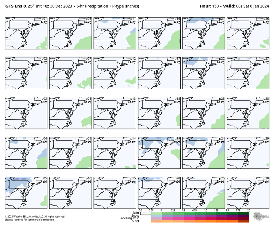


-
Richmond Metro/Hampton Roads Area Discussion
RIC Airport replied to RIC Airport's topic in Mid Atlantic
The 18Z GFS has a similar outcome as the 12z where it puts out snow north and west of Richmond on January 7th. Still plenty of time for things to turn more favorable and for other models such as the Euro and Canadian to agree with a colder scenario.

-
Richmond Metro/Hampton Roads Area Discussion
RIC Airport replied to RIC Airport's topic in Mid Atlantic
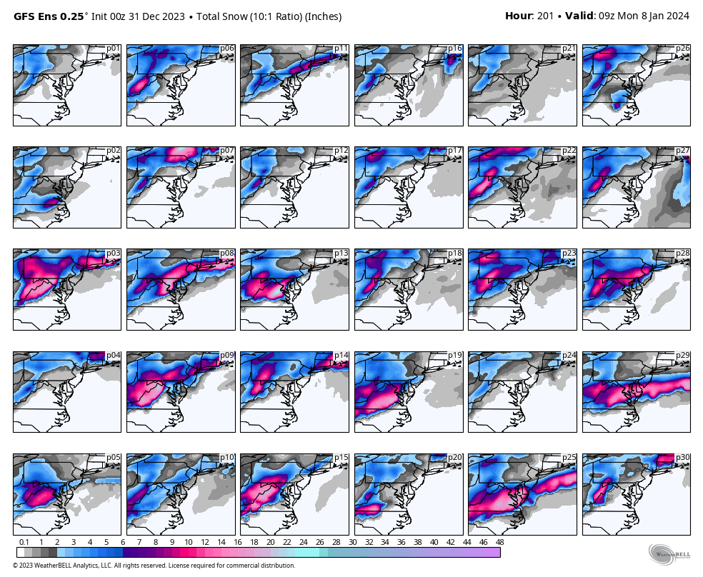
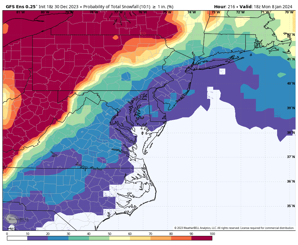
Below are the snowfall outputs for each ensemble member for both Richmond and Norfolk from the 12z EPS run. You can also see they indicate a snowstorm threat between January 12th and January 14th, which looks better than the January 7th threat as more members have something for that timeframe. Ensemble Member 12 ^^ obliterates RIC and drops 26" of snow for January 7th. I'm only posting it for fun. It's extreme and obviously should not be taken literally.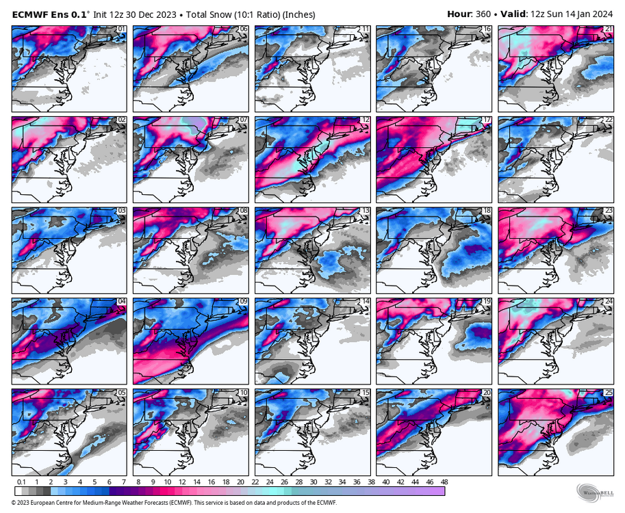


-
Richmond Metro/Hampton Roads Area Discussion
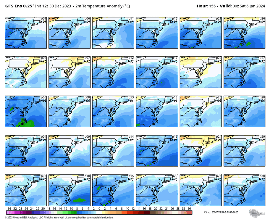
RIC Airport replied to RIC Airport's topic in Mid Atlantic
Some of the European ensemble members show an opportunity for snow around January 7th and then again between the 12-14th of January. This EPS run was very encouraging for the overarching pattern. Really hope the GEFS trends this way. Rather than dropping the core of the cold out west, the EPS was faster in its delivery and farther east with the orientation of the cold. Also, the -NAO builds west toward Baffin Island, and the SE Ridge is kept at bay the whole run. Keep your hopes alive!!!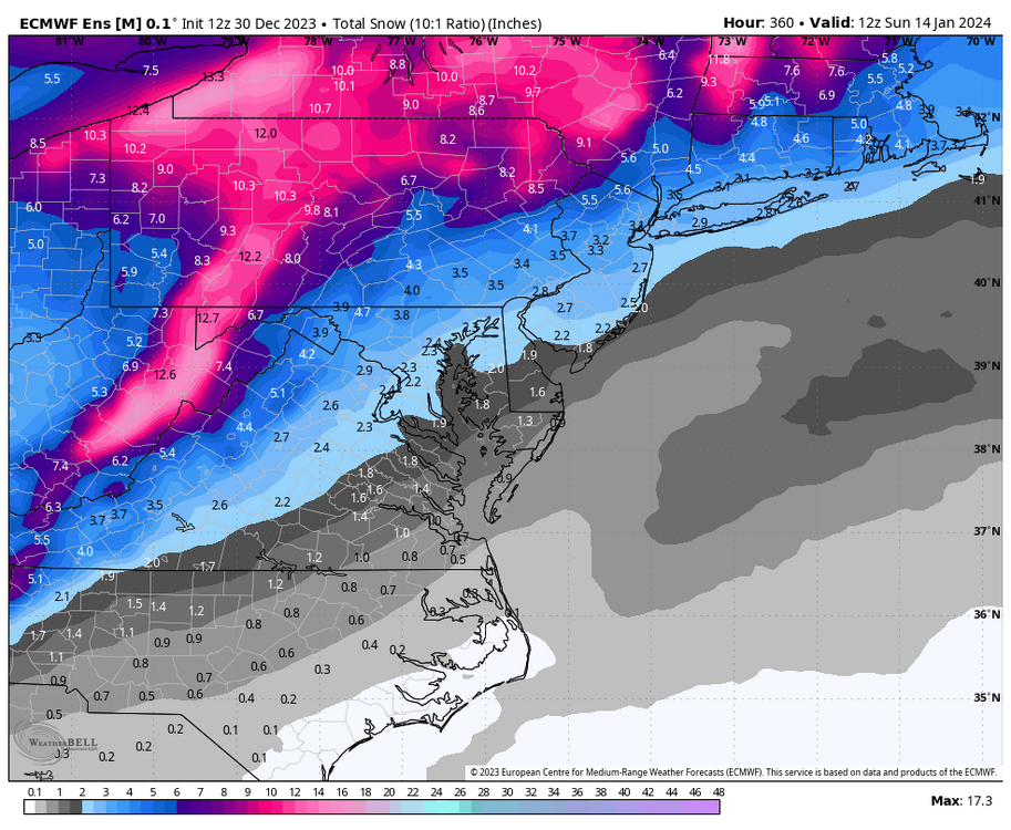
-
Richmond Metro/Hampton Roads Area Discussion
RIC Airport replied to RIC Airport's topic in Mid Atlantic
The 12z Euro has the storm, @tigersaint11 but similar to the 0z run region, we are too warm region-wide. There could be some snow/ice for some parts of the mountains.
-
Richmond Metro/Hampton Roads Area Discussion
RIC Airport replied to RIC Airport's topic in Mid Atlantic
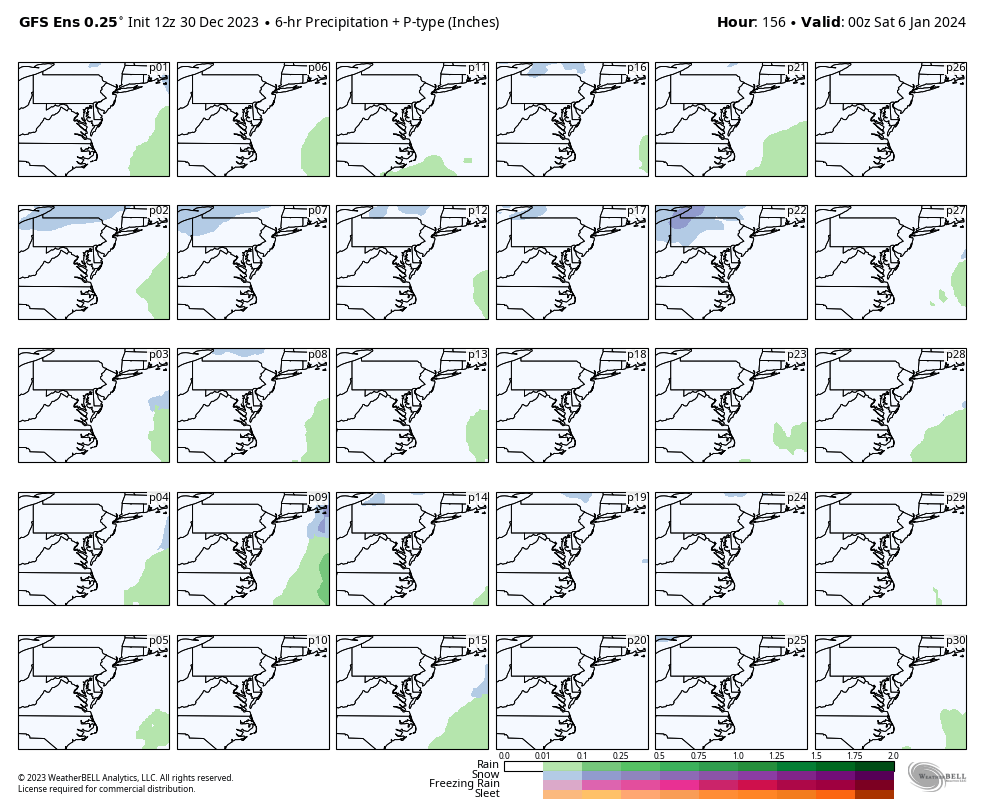
Some of the 12Z GFS ensembles have it, but many of them look warm or are complete shutouts. The snow mean from the 30 members for this event is around 1" of snow at RIC. Watch closely as I slowed them down so you can see how each member handles this event.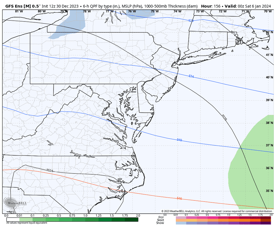


-
Richmond Metro/Hampton Roads Area Discussion
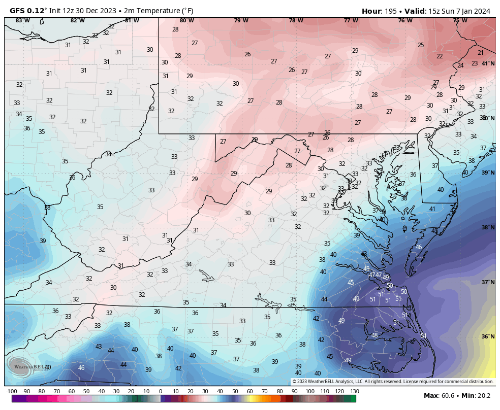
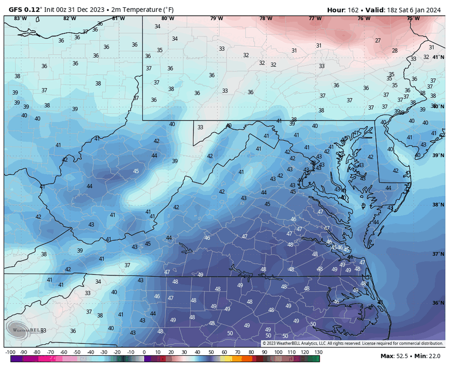
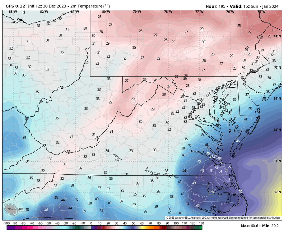
RIC Airport replied to RIC Airport's topic in Mid Atlantic
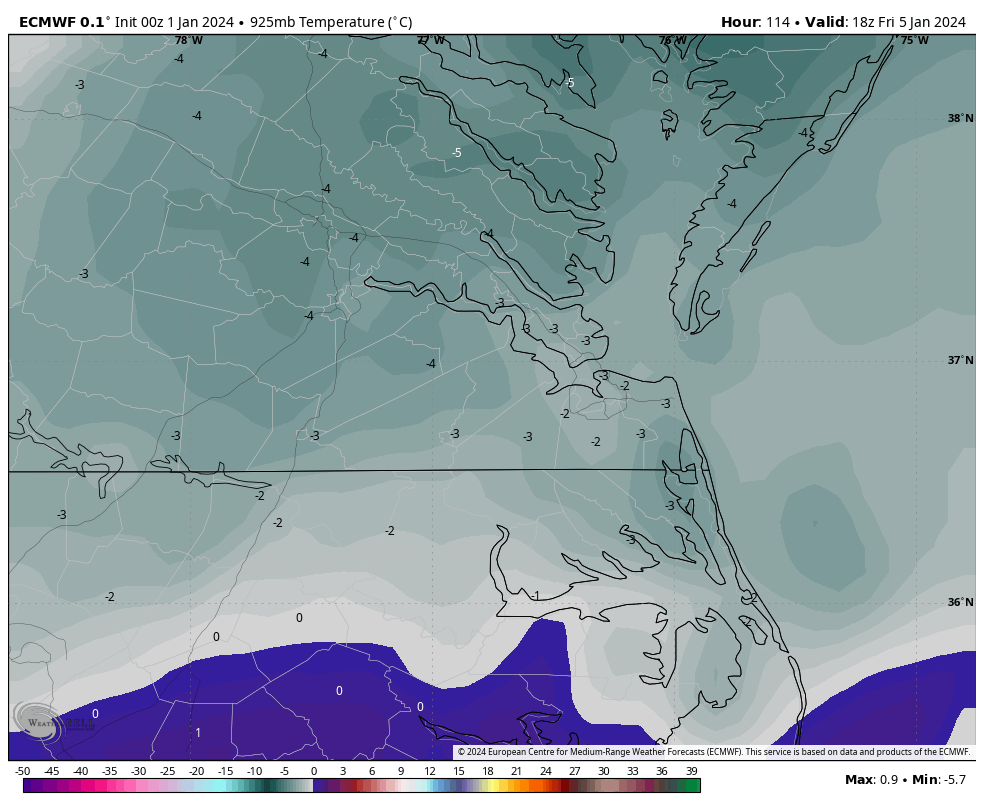
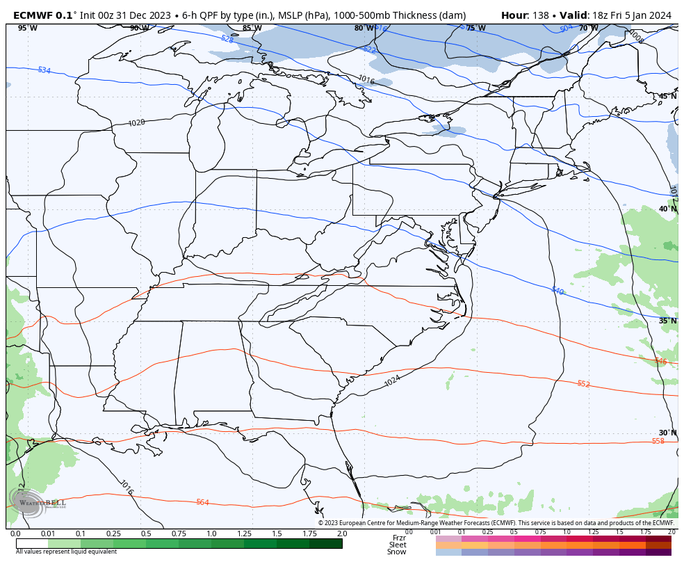
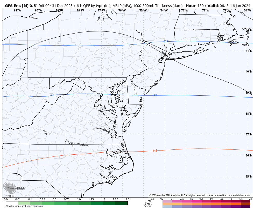
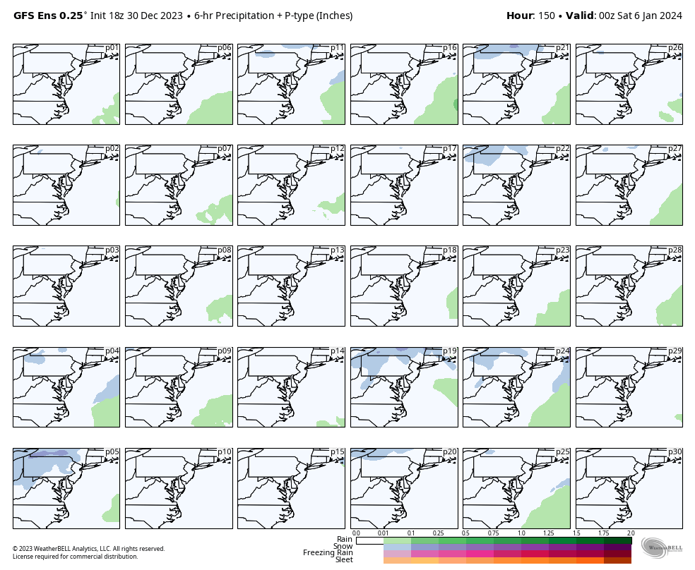
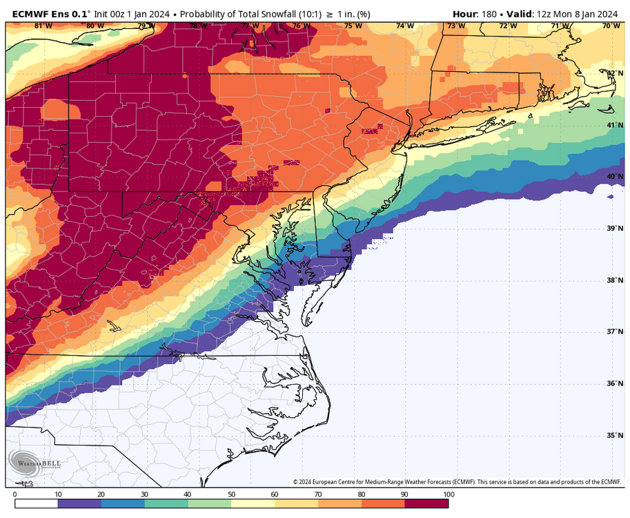
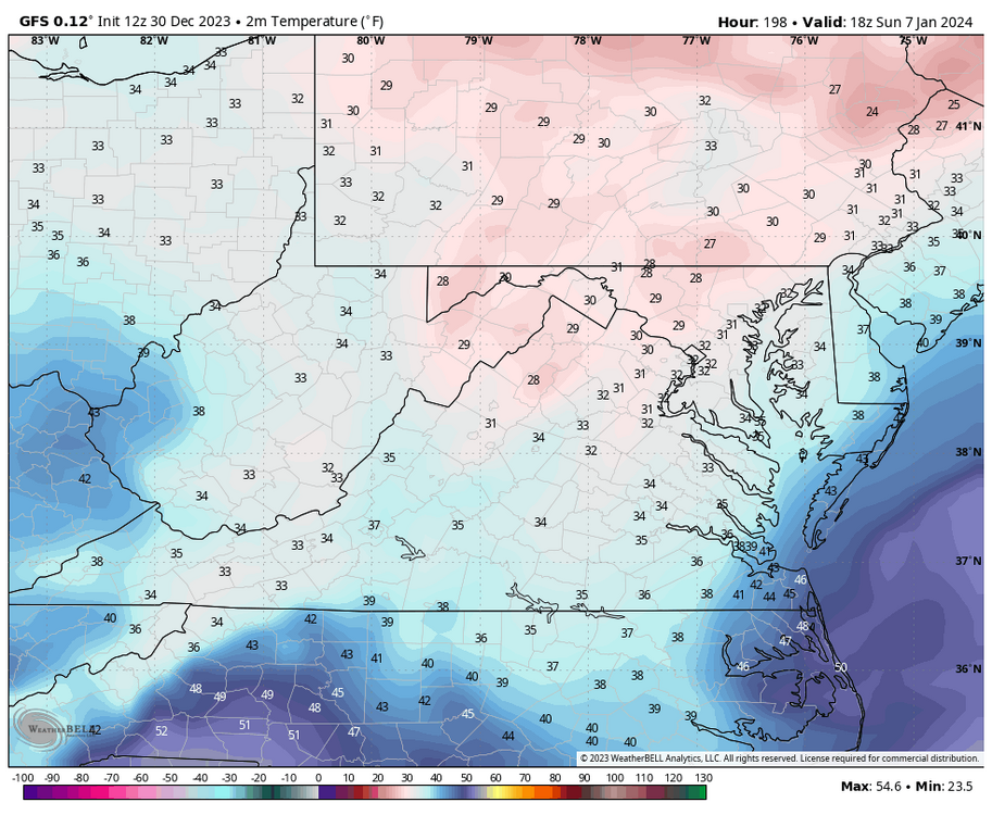
Fortunately, it is. However, there looks to be surface temp issues for Richmond metro and points southeast. Verbatim precip starts moving between 1am and 4am, and RIC is in the mid-30s to around 40 when the precip moves in, but temps DO drop to just above freezing by 1pm as the low passes and before the precip ends the evening of the 7th.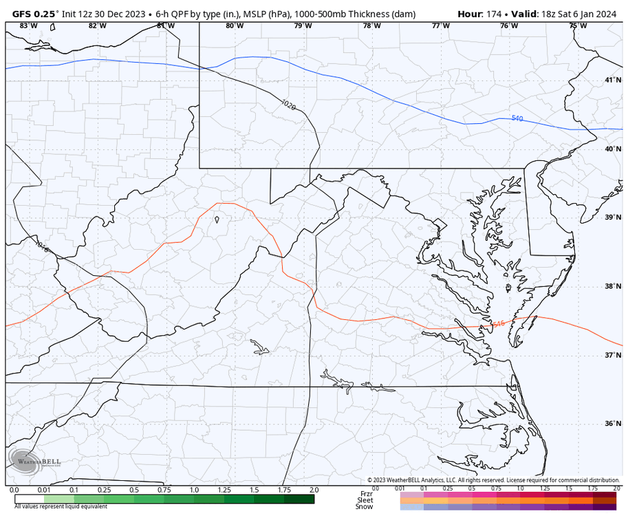
-
Richmond Metro/Hampton Roads Area Discussion
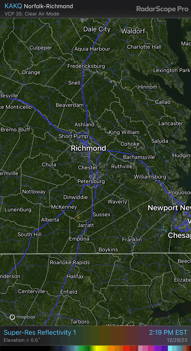
RIC Airport replied to RIC Airport's topic in Mid Atlantic
Some thunder and lightning around and a few sleet pellets thrown in in spots with this upper level low. Anyone see any?
-
Richmond Metro/Hampton Roads Area Discussion
RIC Airport replied to RIC Airport's topic in Mid Atlantic
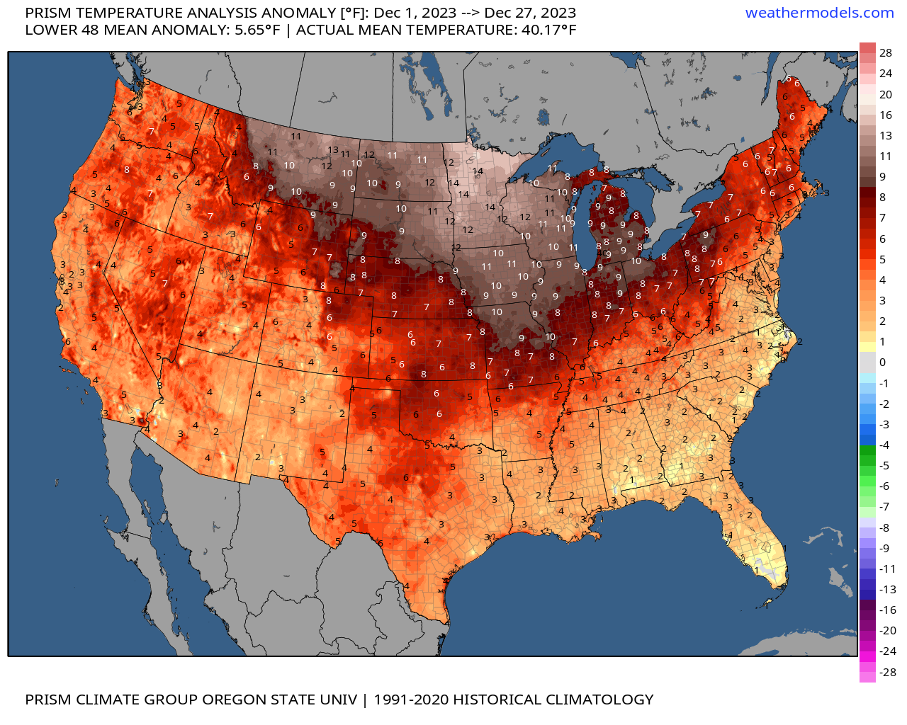
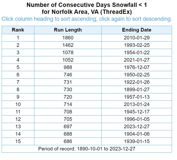
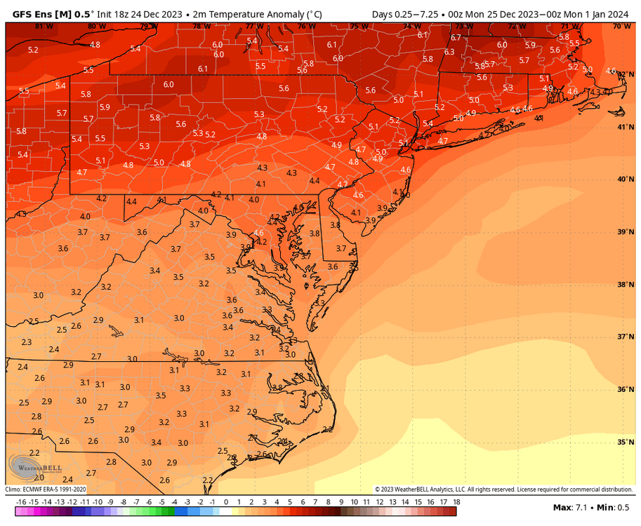
And RIC is at +3.6. In fact, yesterday and the day before were +16 and +12, respectively, from their daily average. To put yesterday's +16 into perspective, the last time Richmond had a daily departure of -16 or lower was on Christmas Eve 2022, when the low temperature was 8°F, and the high was only 24°F, which was a -24 departure from average. We don't seem to get those negative departures as often anymore. So yes, It's been a warm month, although our part of the CONUS looks to have been spared the worst. Also, through yesterday, Norfolk had received 6.34" of rain, which makes December 2023 the second wettest December on record. The wettest, December 2009, had 7.57" and appears safe as the latest models only have up to about 0.10 to 0.25" at best at ORF through the end of the year. Also, Norfolk is moving toward its top 10 stretches of days with less than 1 inch of snow.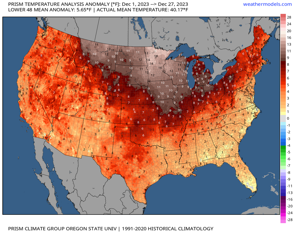
-
Jan Medium/Long Range Disco: Winter is coming
RIC Airport replied to stormtracker's topic in Mid Atlantic
-
Richmond Metro/Hampton Roads Area Discussion
RIC Airport replied to RIC Airport's topic in Mid Atlantic
Nice! Too bad we only got 0.2" of snow out of it. Yup, getting tired of talking about this "pattern change" from a theoretical perspective, impatiently waiting to see things fall in place. But there is still plenty of time left. All we need is 3 weeks of an excellent pattern to score, and even if it takes another 3-4 weeks to get there, we are still in the heart of winter. Looking at you February 2015 and others. @ldub23, GFS did have a SE VA snowstorm last night at 00Z in case you missed it. Fantasy land, of course. And of course, 12Z has a Midwest cutter at the end. The model flip flipping continues.
-
Richmond Metro/Hampton Roads Area Discussion
RIC Airport replied to RIC Airport's topic in Mid Atlantic
Might be in luck if today's 12Z GFS has a clue. Merry Christmas!
-
Richmond Metro/Hampton Roads Area Discussion
RIC Airport replied to RIC Airport's topic in Mid Atlantic
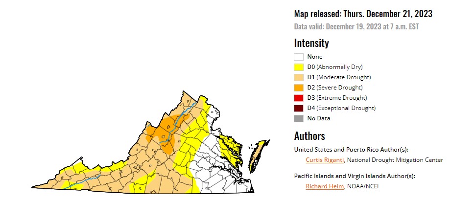
I continue to be encouraged, but I don't need to update about the long-range because the models are just flip-flopping more than usual, and there is no clear emerging trend except I am not seeing signs of us torching. We started 2023 with highs in the upper 60s and low 70s in the first week of January, so I'm so thankful we aren't seeing that this time. But, if you want an update on rain , the 18Z GFS likes the northern and western parts of the state Tuesday and Wednesday. Honestly, those are the places that need it the most based on the latest drought monitor. The below also includes precip from a disturbance that swings through on Friday. Its strength and exact track have fluctuated, so it's subject to change. RIC needs another 1.09" for December 2023 to become the wettest December on record. Also, the next 7 days will be mild, with the upper 50s to even some low 60s in spots through Thursday before it turns colder from Friday through Sunday (upper 40s/low 50s).


.png.a041b48e263d64da882d7e15094705b2.png)
.png.c93297c1bed5df0ba76c8ad4bc54cb0a.png)