RIC Airport
-
Posts
2,586 -
Joined
-
Last visited
Content Type
Profiles
Blogs
Forums
American Weather
Media Demo
Store
Gallery
Everything posted by RIC Airport
-
Richmond Metro/Hampton Roads Area Discussion
RIC Airport replied to RIC Airport's topic in Mid Atlantic
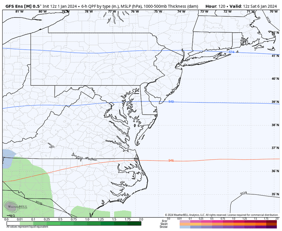
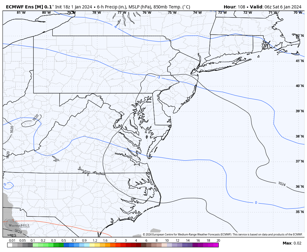
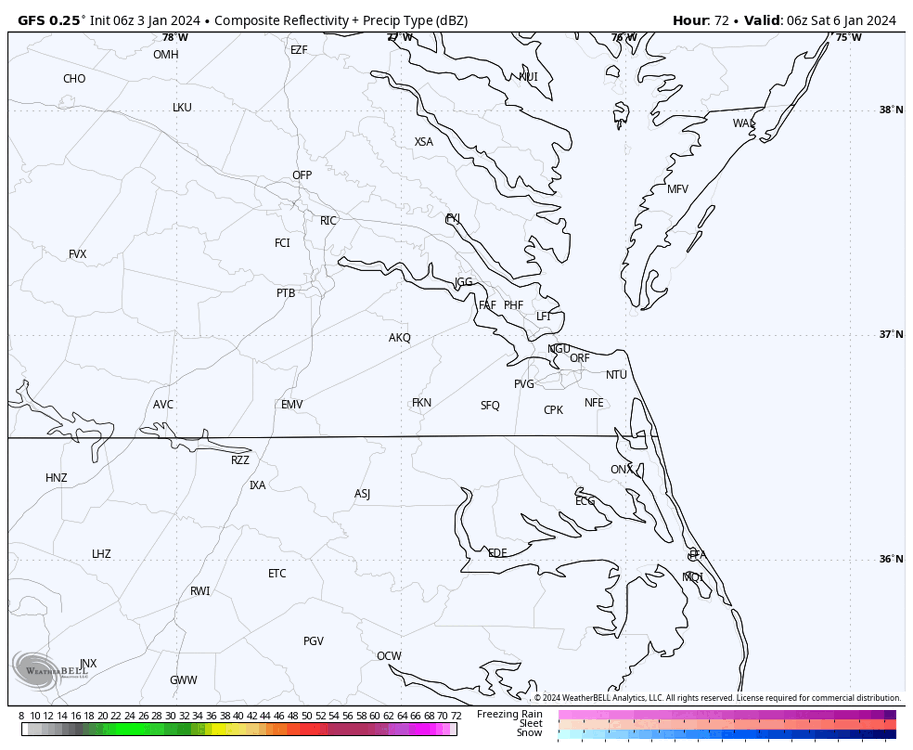
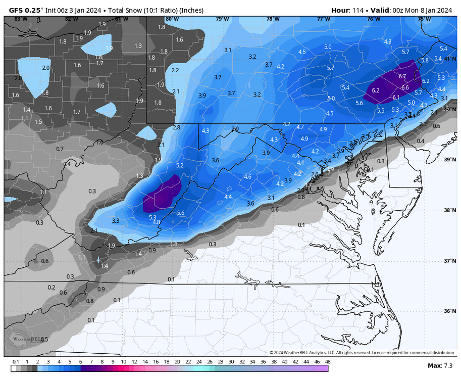
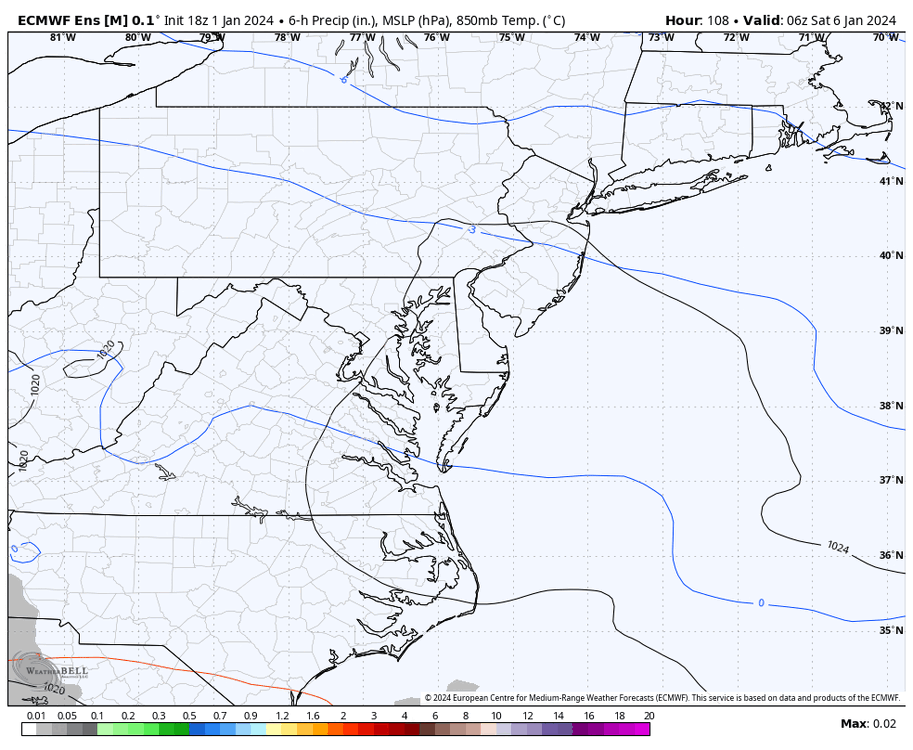
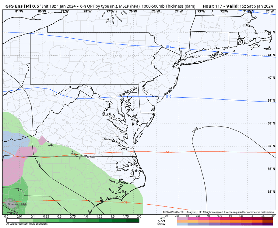
The NAM is starting to come within range, and eventually the HRRR, so timing could change. But based on the 6z GFS, this is only looking like a Saturday event. Precip arrives around 7am and ends around 7pm. GFS dropped 1 to 1.5" of rain.
-
Richmond Metro/Hampton Roads Area Discussion
RIC Airport replied to RIC Airport's topic in Mid Atlantic
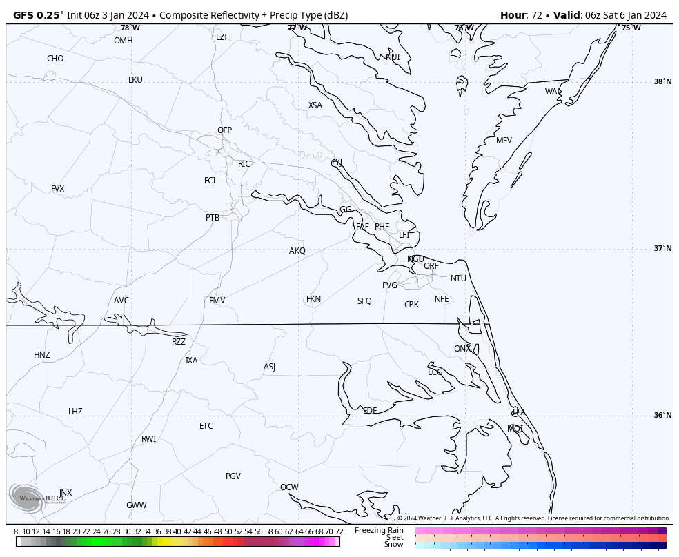
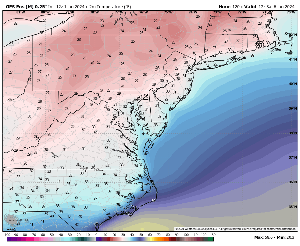
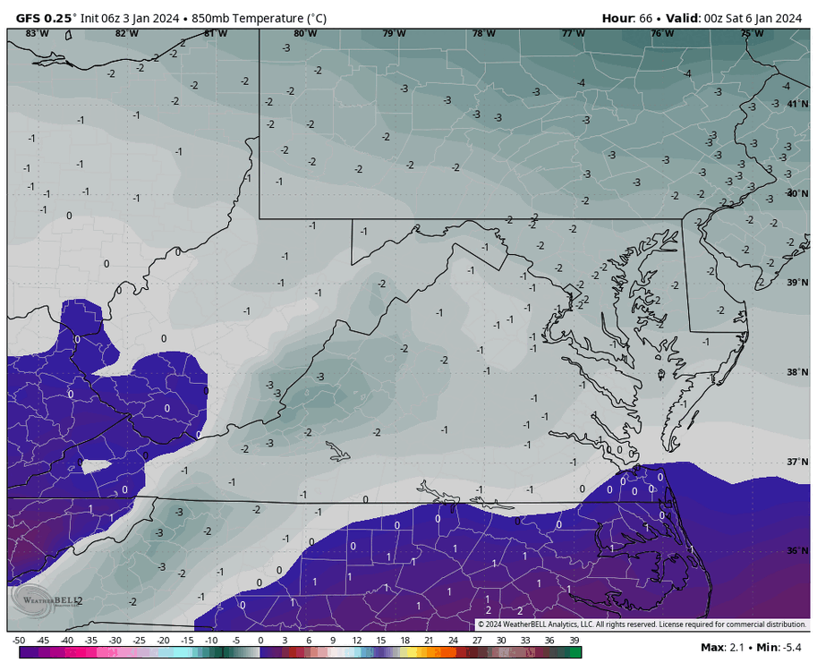
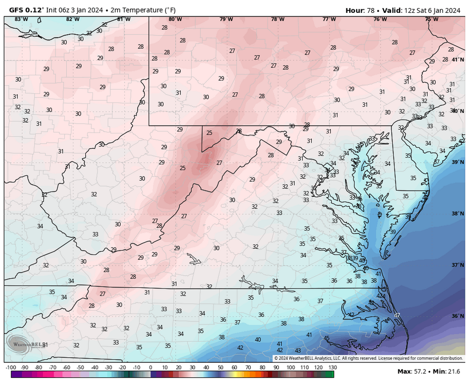
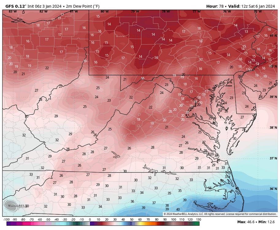
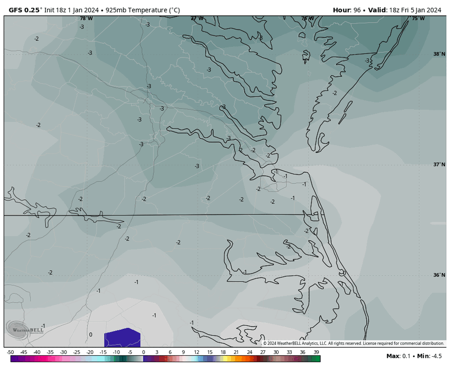
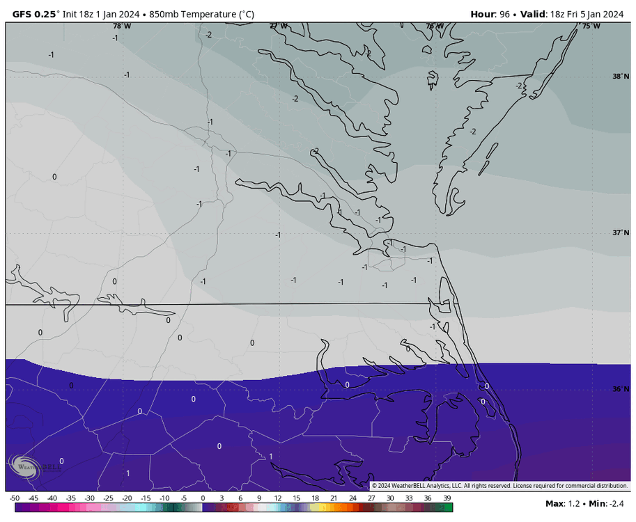
6Z was a step back, even for CHO and DCA. Those mid-level thermals remain an issue. Look at how warm it gets at 850mb as the low approaches from the south. GFS also has the fastest arrival of the precip with surface temperatures just above freezing (35°F) as the precip arrives, but the dewpoint will be 26°F at the time. GFS has the dewpoint below freezing at RIC for 3 hours (7am-10am) so that 35°F surface temp will drop below freezing when the precip starts. So even in Richmond the precip will probably be frozen (snow or mix) for 2-3 hours before we flip over to rain.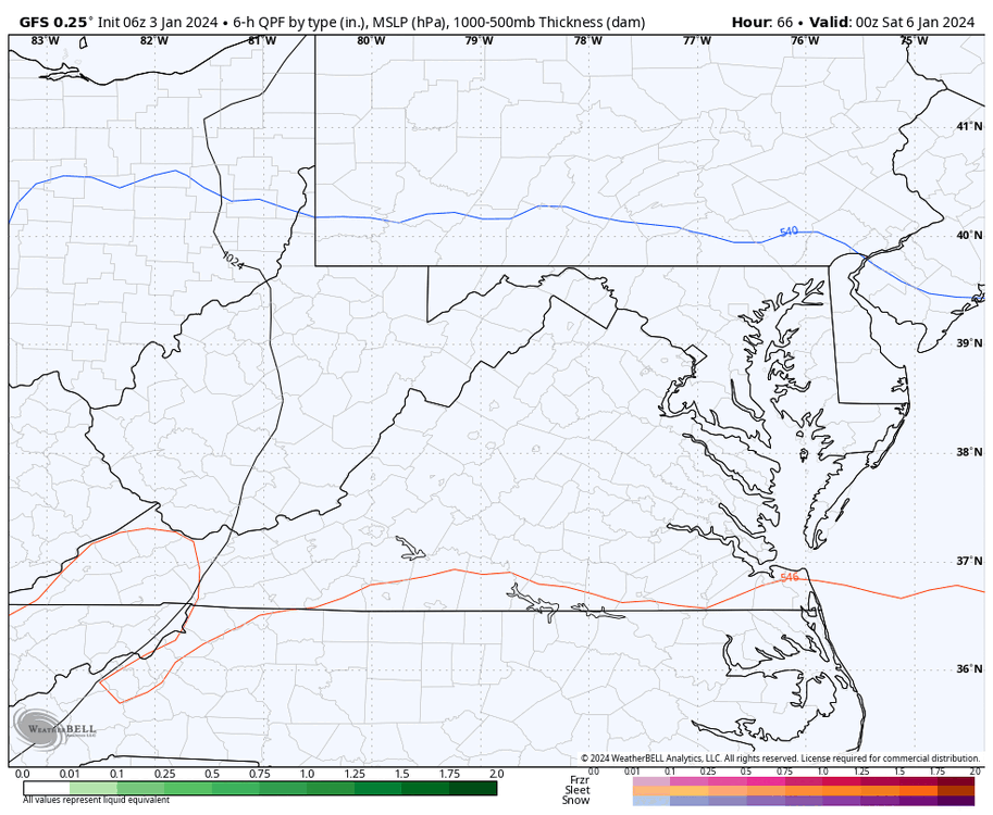

-
Richmond Metro/Hampton Roads Area Discussion
RIC Airport replied to RIC Airport's topic in Mid Atlantic
The 00Z GFS was a little colder this run, more favorable for CHO up to DCA.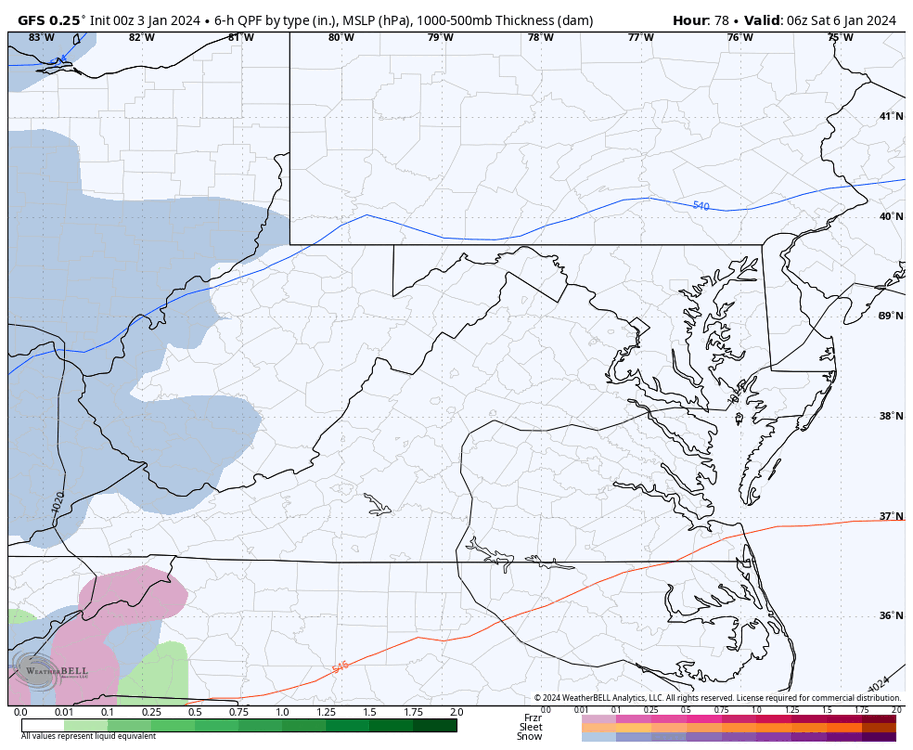

-
Richmond Metro/Hampton Roads Area Discussion
RIC Airport replied to RIC Airport's topic in Mid Atlantic
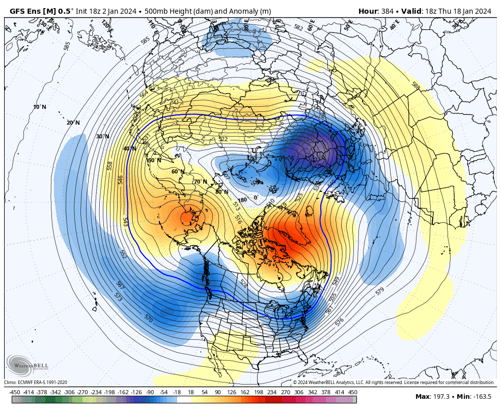
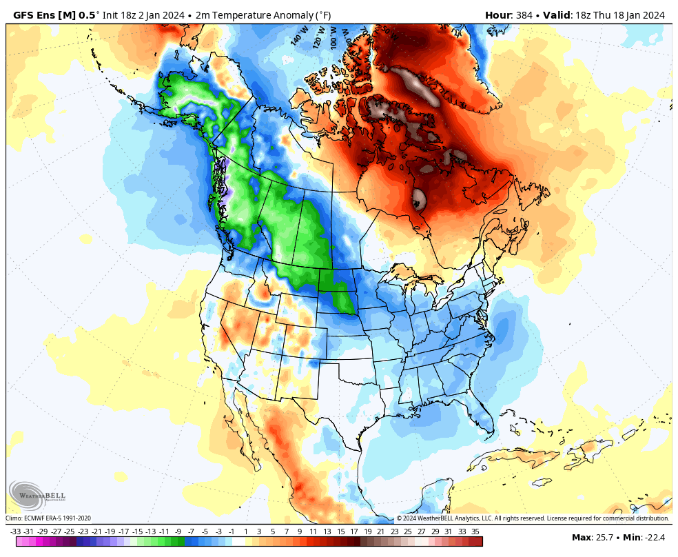
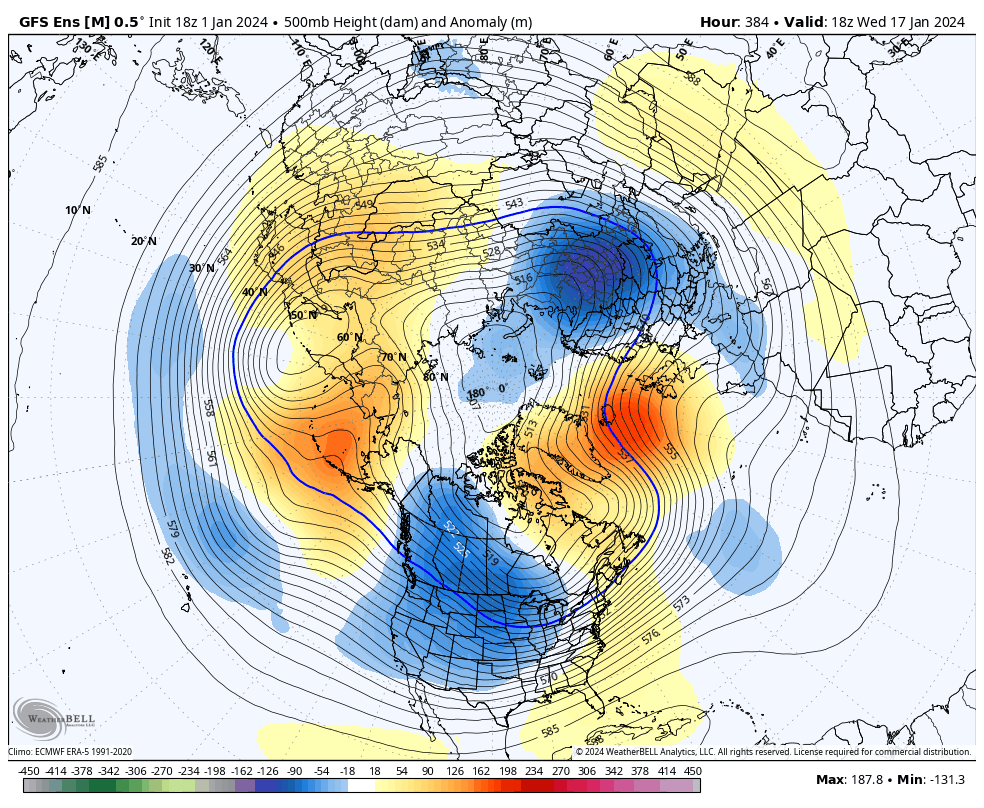
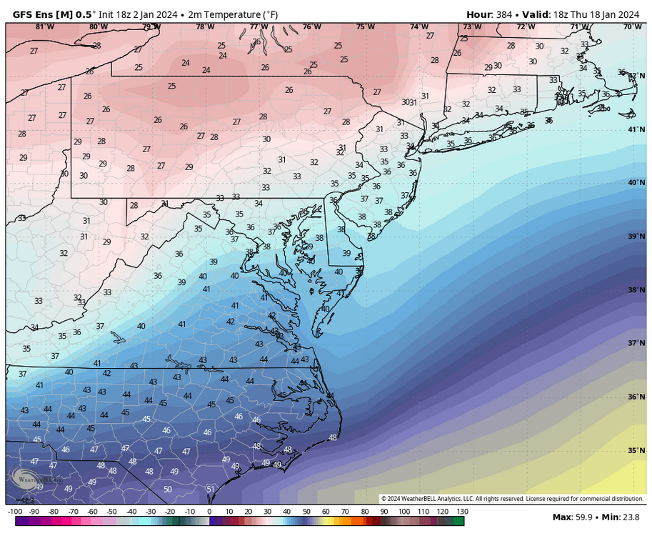
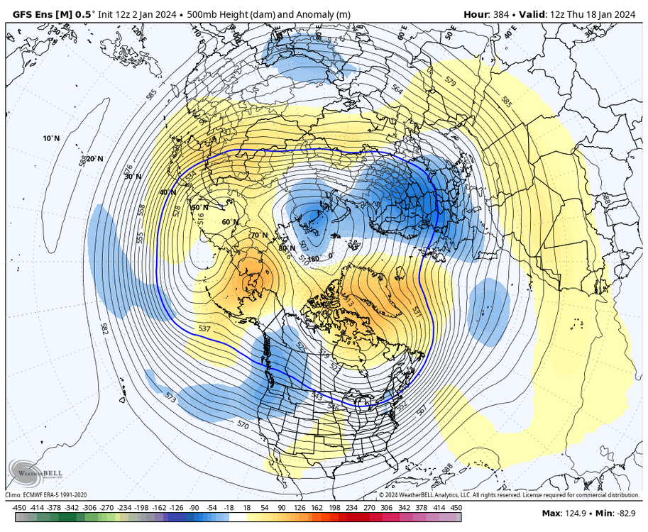
I understand that, and I just tried to explain why we are seeing the cutters, why it’s been tough getting cold in our part of the country, and what needs to change as we monitor the models. Plus, so much can change beyond about 200 hours. For instance, the below 00Z GFS run from Christmas Day was torching us with highs around 70°F this Saturday when, recently, we have been tracking the potential for a snowstorm. We now know we won’t be anywhere near 70°F this Saturday. In the future, you should use the ensembles, not the operational ones at that range, and then try to identify trends. Ensembles are still subject to fluctuations, but using them for analysis is better. As you can see below, unlike the 12Z GEFS, the 18Z GEFS looks closer to the end of the 12Z EPS. I like the higher heights showing up in the southwest, and temperatures, while not extremely cold, are still slightly below average in the East. Hour 384 below could indicate things transitioning to a better pattern later on. Again, if we change the overall flow and increase ridging in the west, it'll be better for snow opportunities here and less likely to see cutter after cutter. However, I agree that the low to mid-40s aren’t cold in January, but once we get into the heart of winter, things could work out if it's just "cold enough."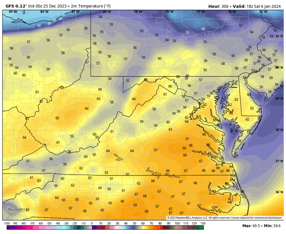


-
Richmond Metro/Hampton Roads Area Discussion
RIC Airport replied to RIC Airport's topic in Mid Atlantic
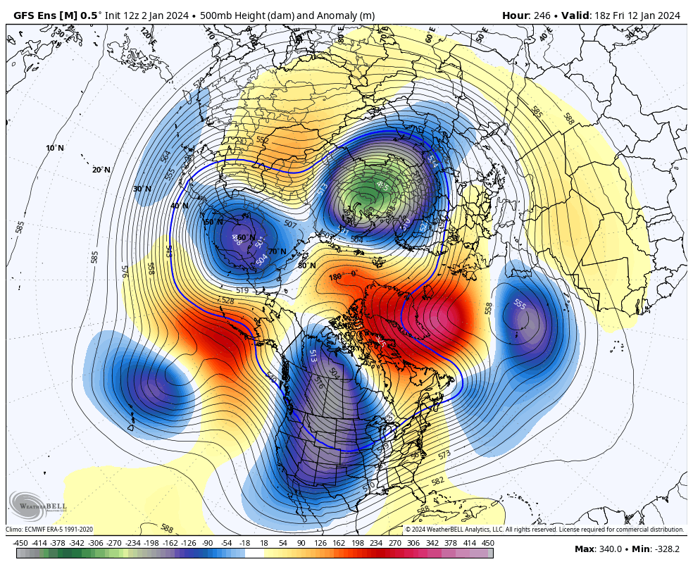
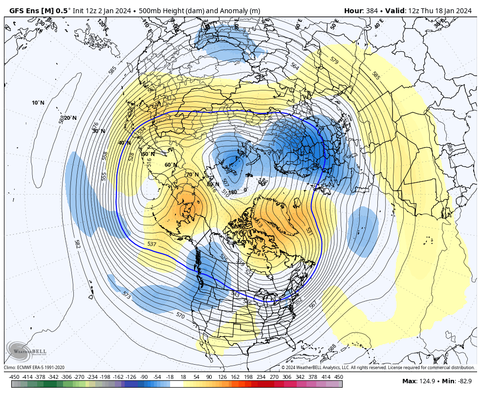
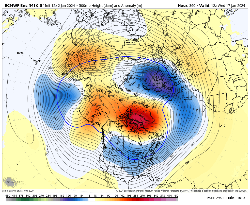
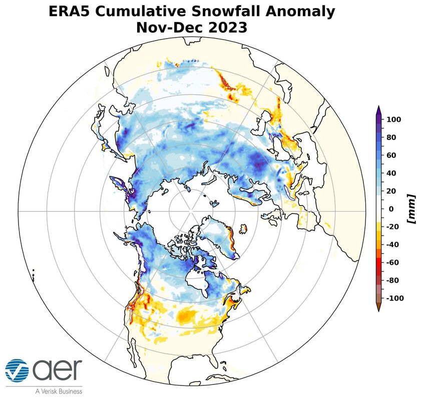
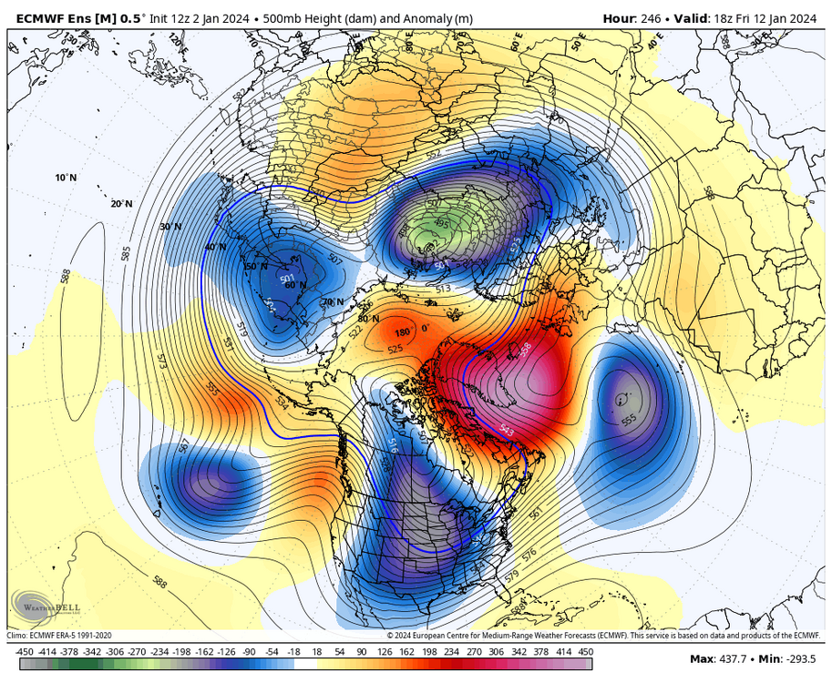
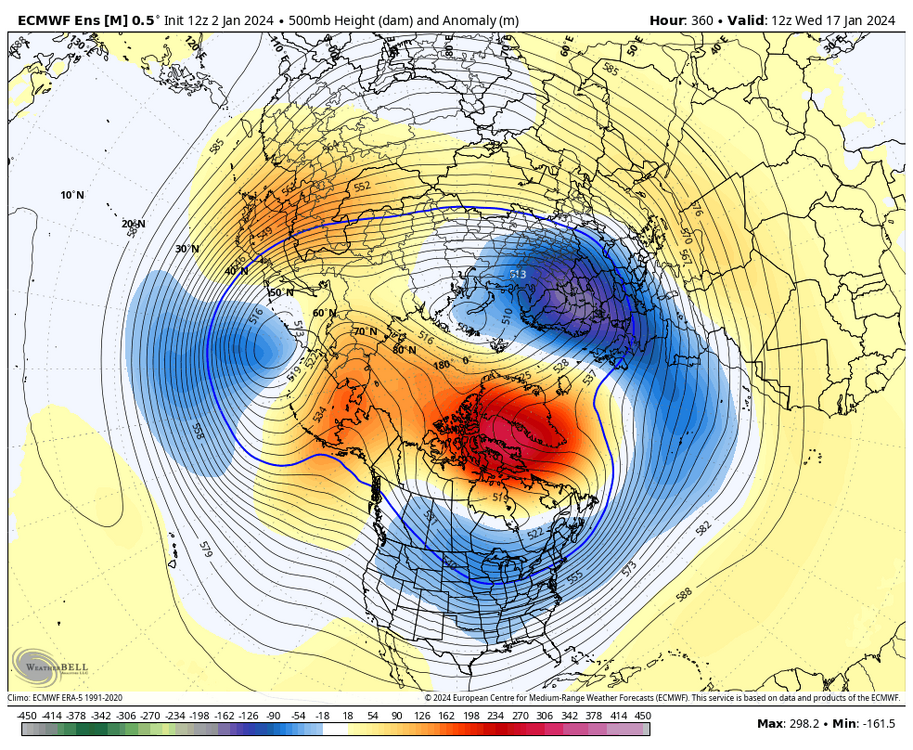
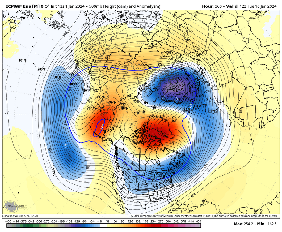
Below are two maps from the GEFS and EPS. I like the -NAO consistency. The last time we saw that was years ago. The -NAO is probably preventing us from torching like we did much of last winter. When you flip through the run, you can tell that pesky SE Ridge is just lurking down below Cuba. We also have an active southern stream, another component absent in recent winters. We need to get rid of the troughing tendency in the West and a better mechanism to deliver cold in the east. Storms tend to cut to the Midwest and Ohio Valley with that orientation. Or indeed, farther north and west than is ideal for I-95. The end of the EPS was better than the GEFS, but certainly no amplified western ridge. We can still get a sneaky event with the right timing and placement of other features, but it complicates things. There is still plenty of time left, and remember, March IS a snow month, too. GEFS EPS It also doesn't help that the CONUS has not had much snow this winter, which doesn't help build and sustain cold like we've seen in Russia.

-
Richmond Metro/Hampton Roads Area Discussion
RIC Airport replied to RIC Airport's topic in Mid Atlantic
00Z GEFS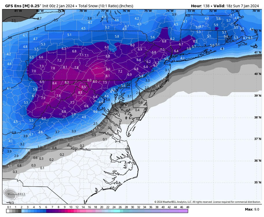
-
Richmond Metro/Hampton Roads Area Discussion
RIC Airport replied to RIC Airport's topic in Mid Atlantic
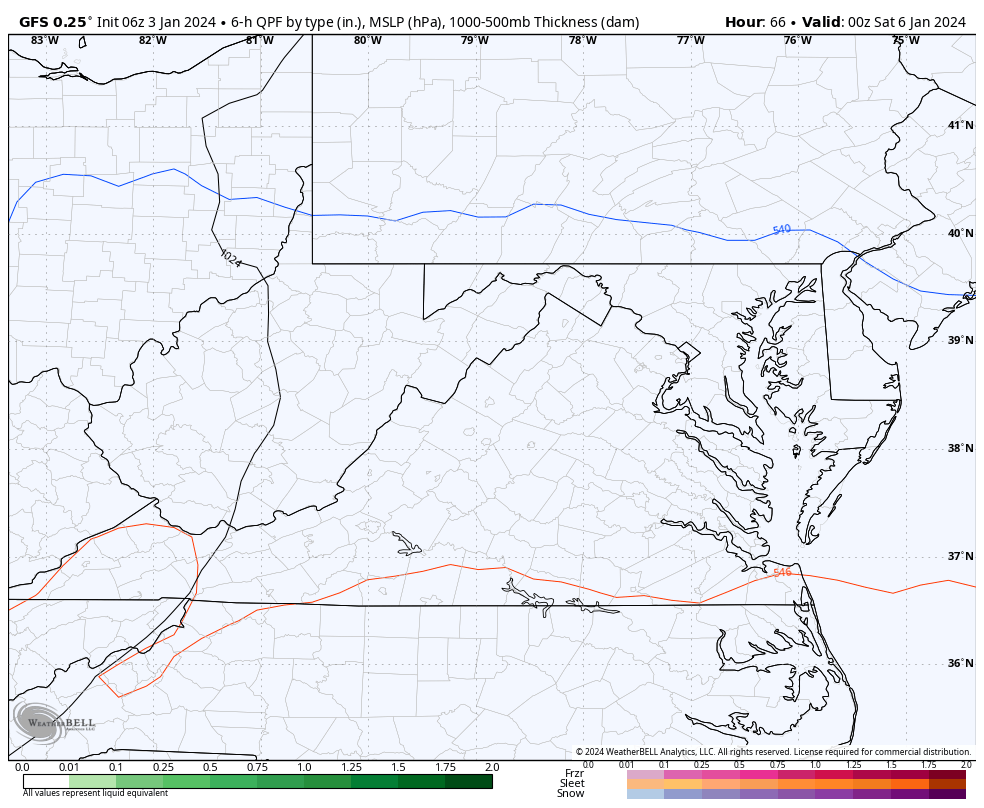
Meanwhile, the 00z GFS was awful. Like I said in an earlier post today, we'll have these fluctuations with the rain/snow line and track of the low.
-
Richmond Metro/Hampton Roads Area Discussion
RIC Airport replied to RIC Airport's topic in Mid Atlantic
Nice, definitely an accomplishment!!! -
Richmond Metro/Hampton Roads Area Discussion
RIC Airport replied to RIC Airport's topic in Mid Atlantic
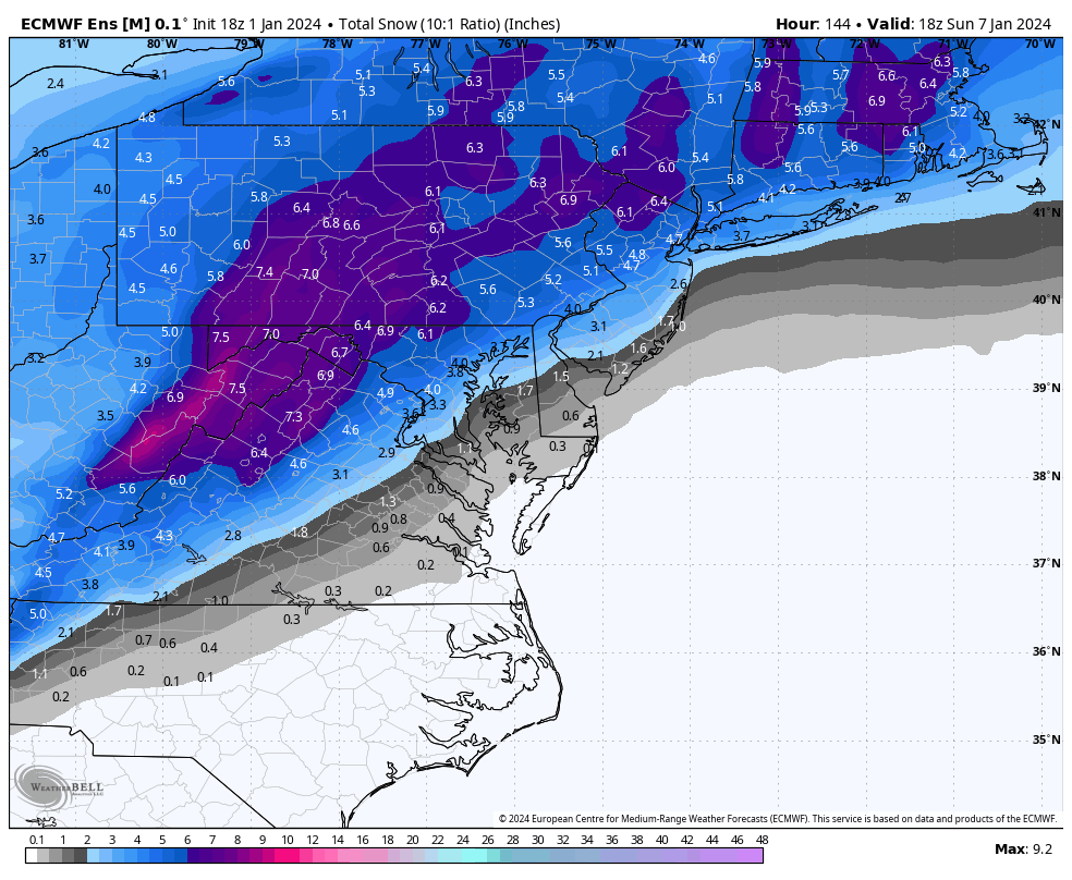
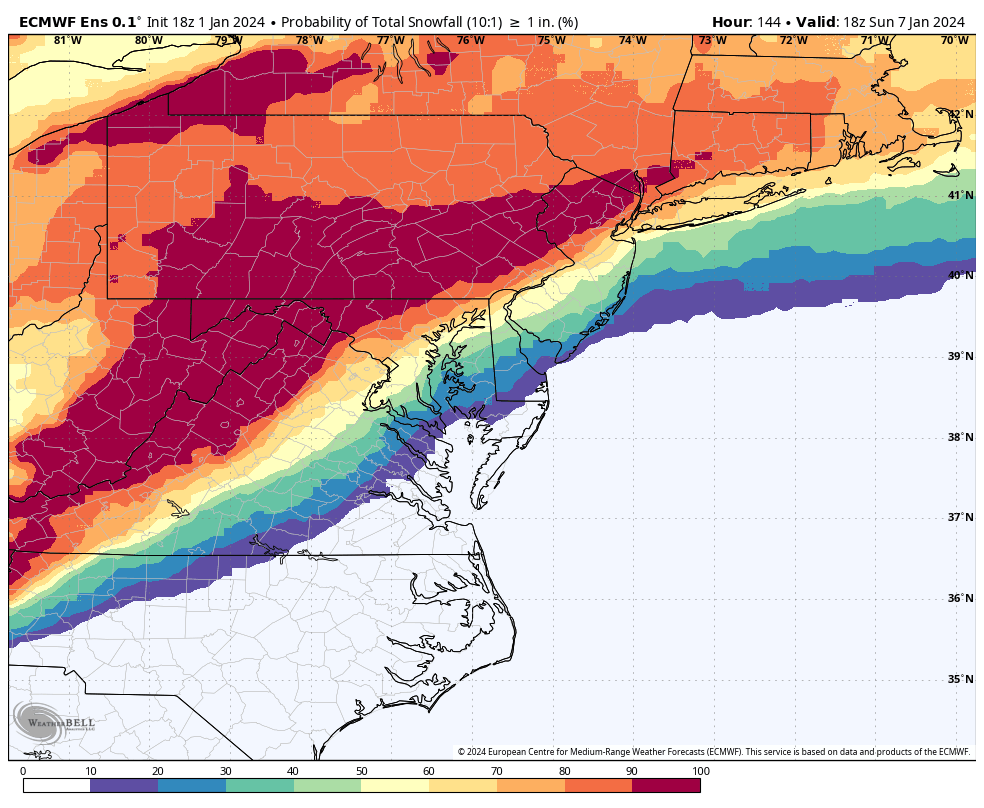
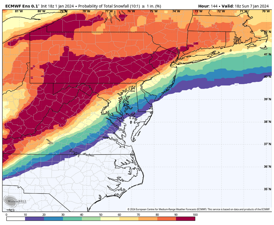
The 18z Euro Ensembles only goes out to hour 144 (Sunday at 1pm). Some encouraging signs, but still way too many misses, @Conway7305, @wasnow215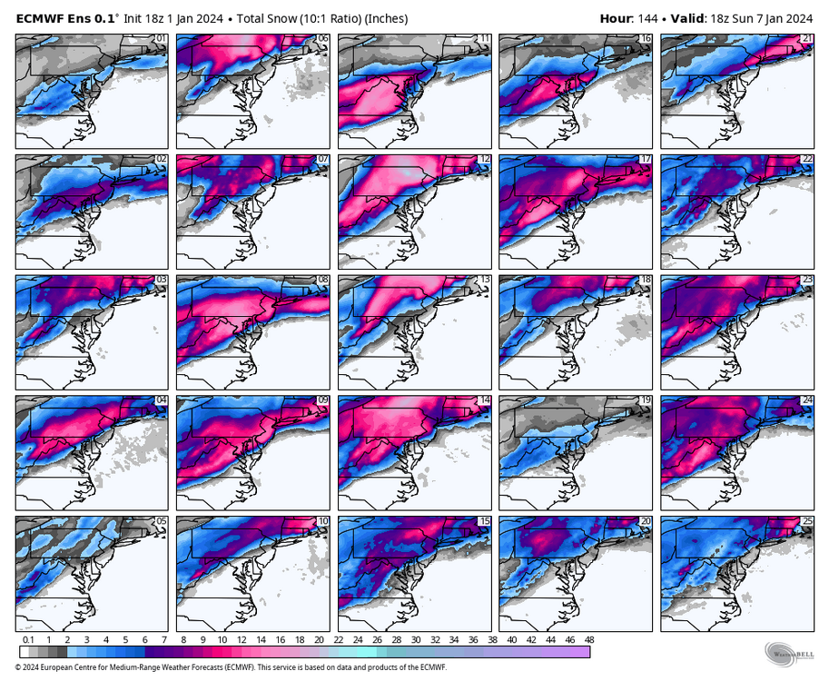
-
Richmond Metro/Hampton Roads Area Discussion
RIC Airport replied to RIC Airport's topic in Mid Atlantic
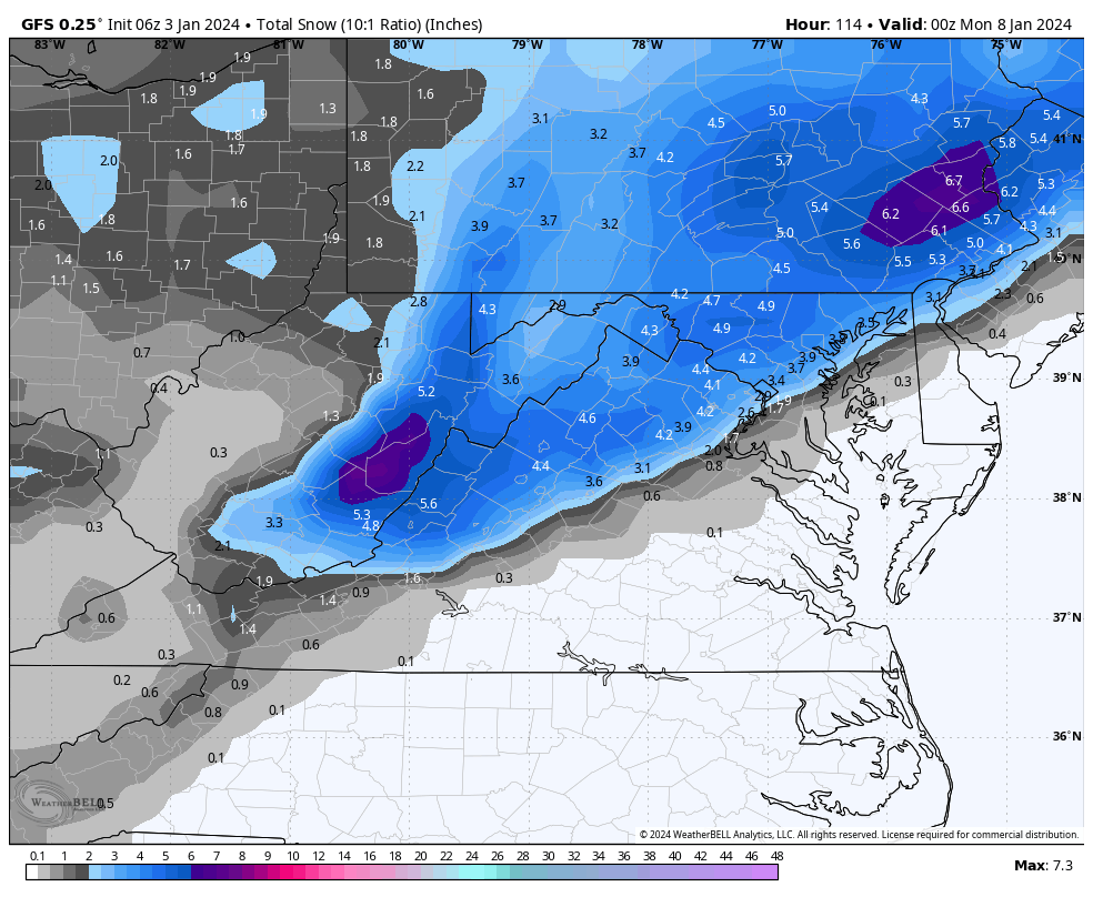
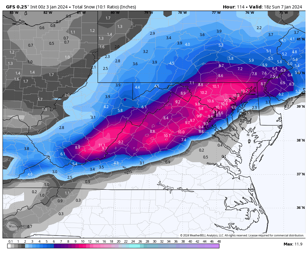
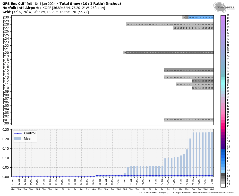
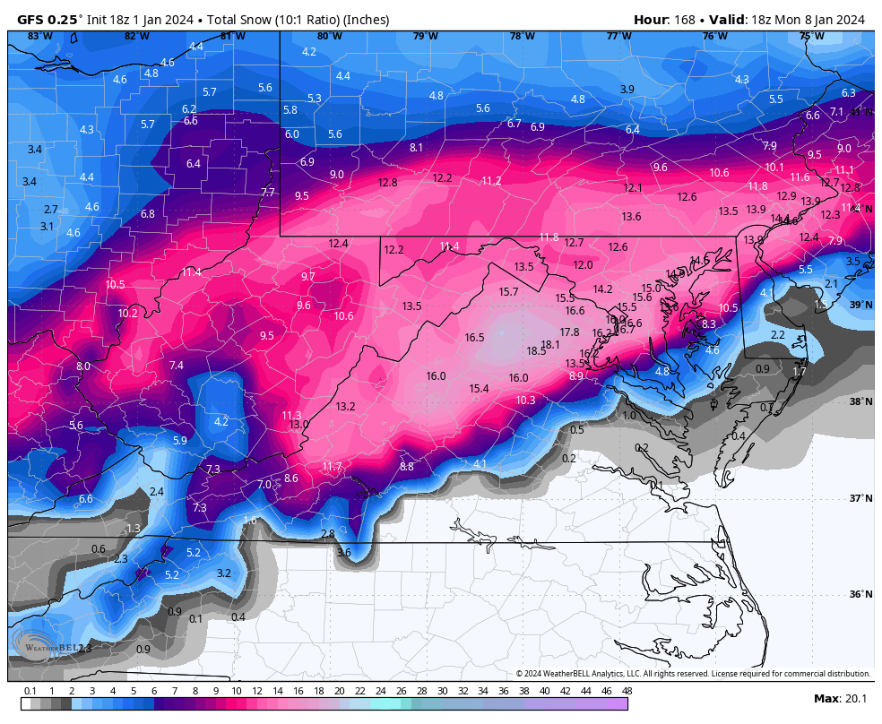
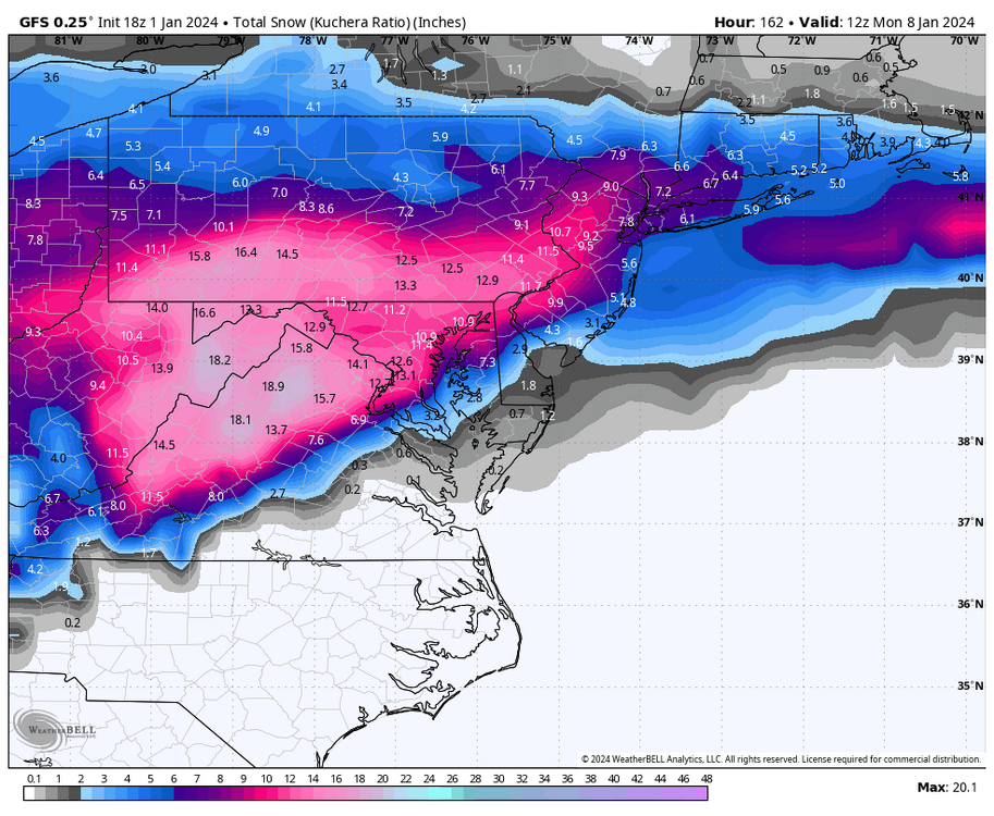
Here are the charts from the 18Z GEFS for RIC and ORF. Although there are signals around the 14th, the 1/6 to 1/7 event is the best snow opportunity. At hour 384, this troughing tendency is still out west, so the bulk of the cold only occasionally glances eastward. There are ways to work with this and we can still get chances, just makes things harder. But, can certainly change though. The EPS, on the other hand, was a much better look at the end of the run.

-
Richmond Metro/Hampton Roads Area Discussion
RIC Airport replied to RIC Airport's topic in Mid Atlantic
-
Jan Medium/Long Range Disco: Winter is coming
RIC Airport replied to stormtracker's topic in Mid Atlantic
-
Richmond Metro/Hampton Roads Area Discussion
RIC Airport replied to RIC Airport's topic in Mid Atlantic
The models may need to get some upper air features, such as the position/strength of the high, the wave that moves to our S and E on the 4th, which eventually sets up as a 50/50 low. These need to be timed correctly and could be misplaced incorrectly in this run, so the rain/snow line fluctuates back and forth with each model run. We need to wait until the shortwaves get better sampling. But, right now, I urge caution against getting too excited. Another concern are the warm SSTs, we had a warm year and a mild fall. Perhaps in another 3-4 weeks, we wouldn't have this problem with this surge of warmth coming from our SE when ocean temperatures are a bit colder....hopefully. -
Richmond Metro/Hampton Roads Area Discussion
RIC Airport replied to RIC Airport's topic in Mid Atlantic
It also doesnt help that the surface low is practically tracking over SE VA and into the mouth of the Chesapeake Bay. -
Richmond Metro/Hampton Roads Area Discussion
RIC Airport replied to RIC Airport's topic in Mid Atlantic
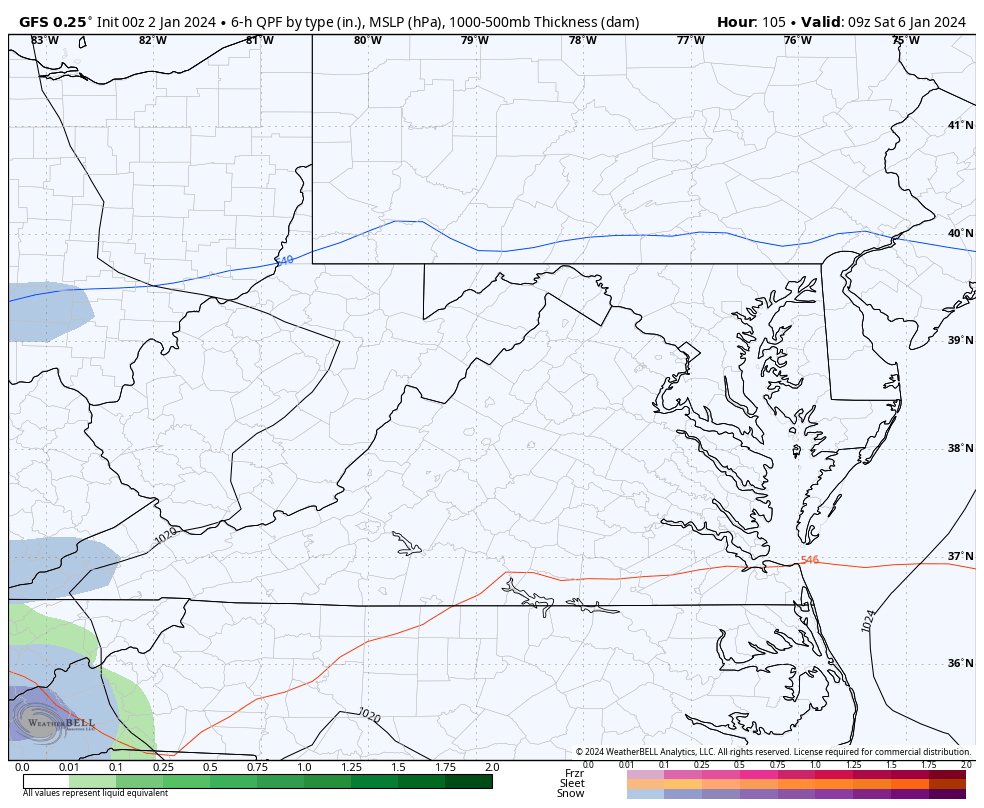
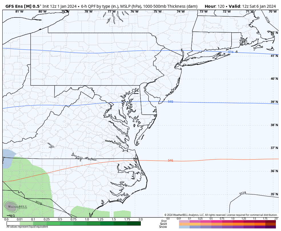
The 18Z GFS still shows the major concerns I addressed earlier. There is this huge surge of warm air advection as the low approaches our area. The antecedent airmass was also not very cold.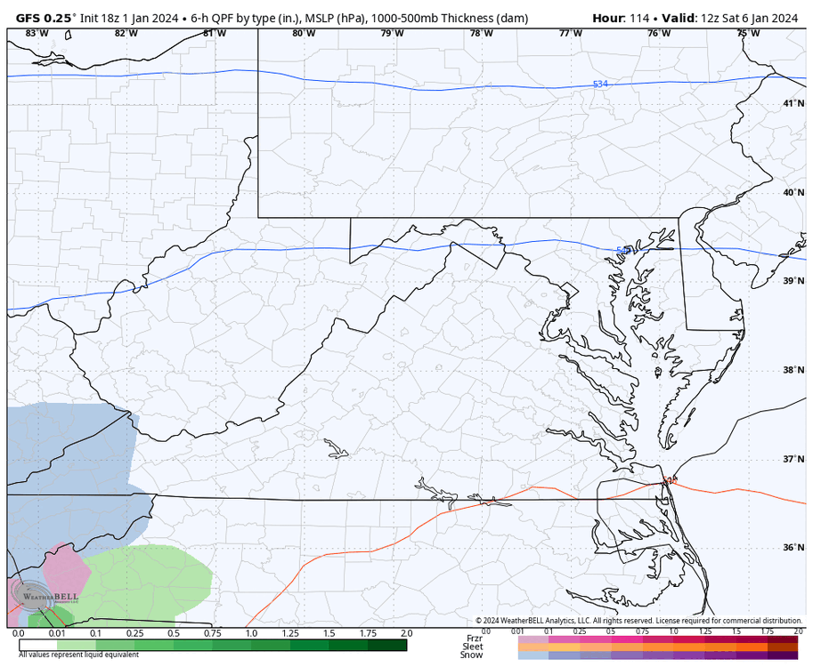

-
Richmond Metro/Hampton Roads Area Discussion
RIC Airport replied to RIC Airport's topic in Mid Atlantic
That was only a snap shot in time. The cold pushes east there after.
-
Richmond Metro/Hampton Roads Area Discussion
RIC Airport replied to RIC Airport's topic in Mid Atlantic
Meanwhile, Wakefield just sent the 2023 climate summary. Warm and snowless. -
Richmond Metro/Hampton Roads Area Discussion
RIC Airport replied to RIC Airport's topic in Mid Atlantic
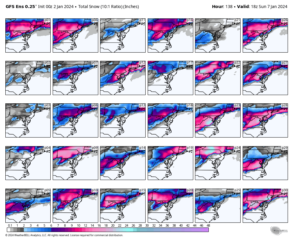
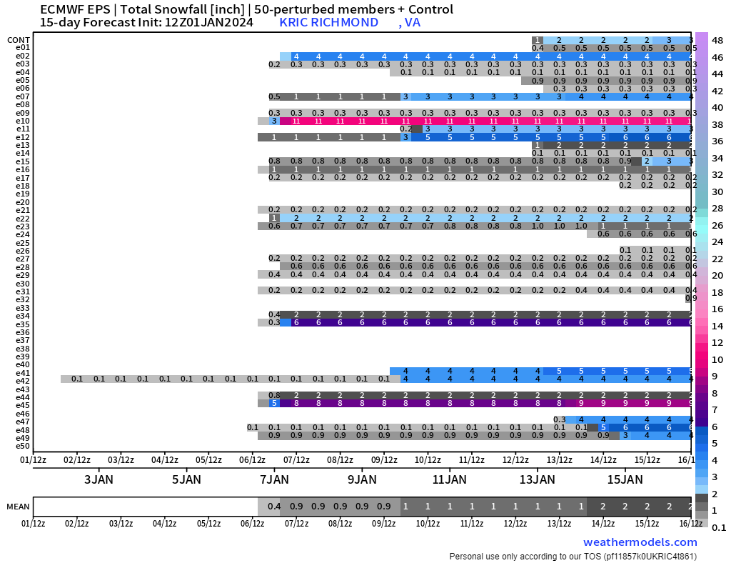
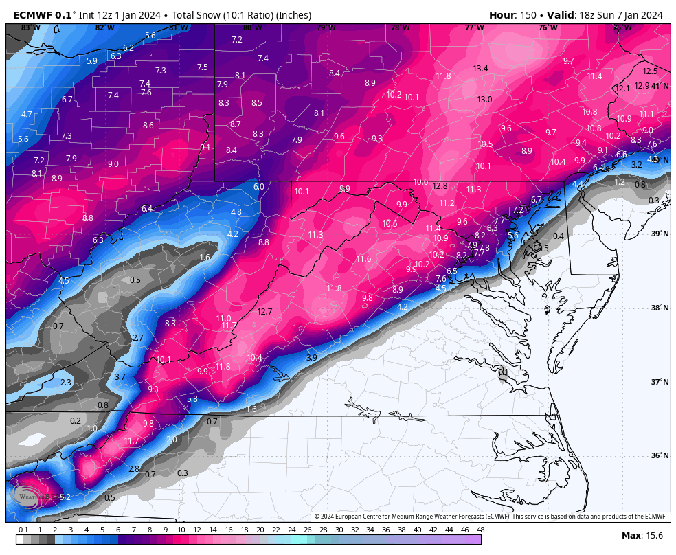
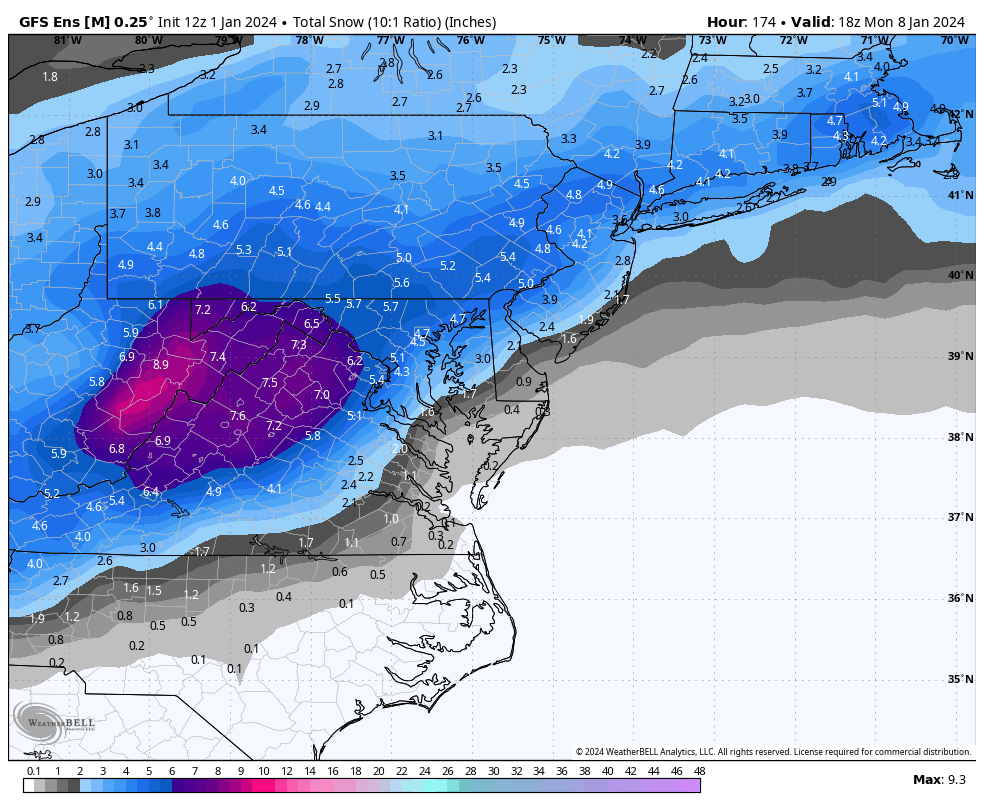
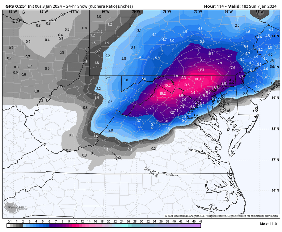
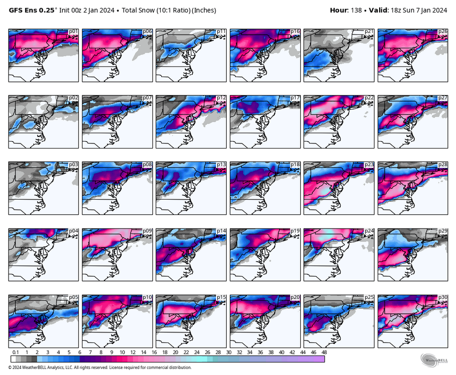
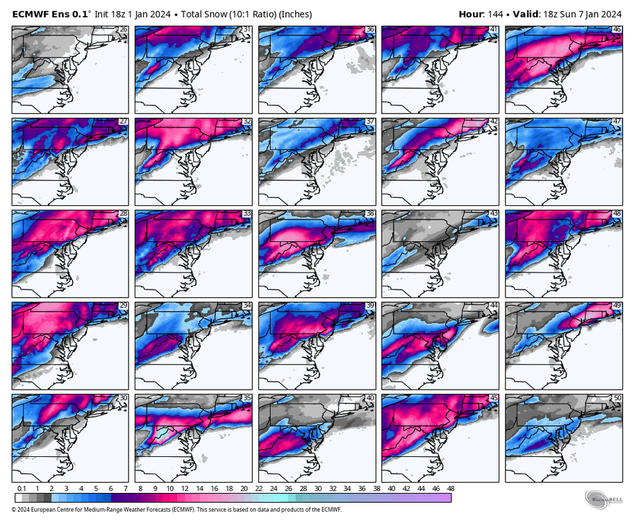
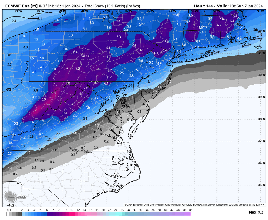
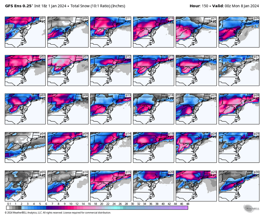
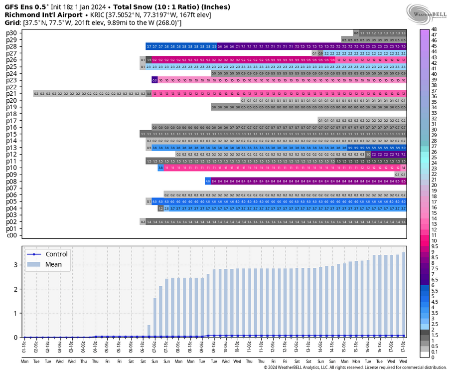
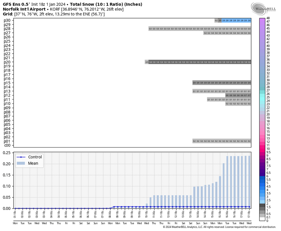
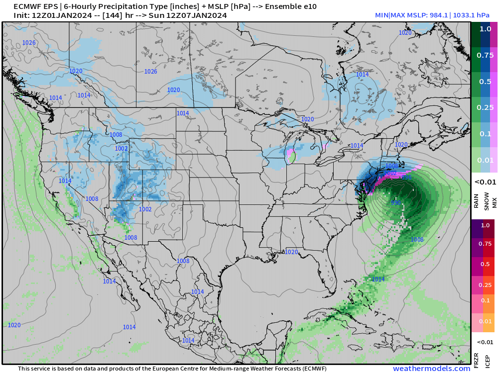
Here is the EPS snowfall output from each of the 50 members for Richmond, @Rhino16, @wasnow215, @tigersaint11, @Conway7305, @SoCoWx. And for fun, since E-10 was the snowiest dropping 11" at RIC, I pulled it to see how it came to its solution. And even that member suggests RIC will go from rain and only to heavy snow once the low passes to our east and temperatures drop. Hopefully it's THE member that will be correct.
-
Richmond Metro/Hampton Roads Area Discussion
RIC Airport replied to RIC Airport's topic in Mid Atlantic
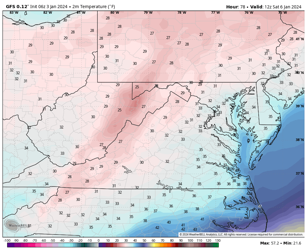
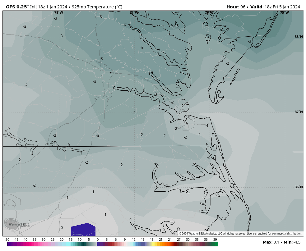
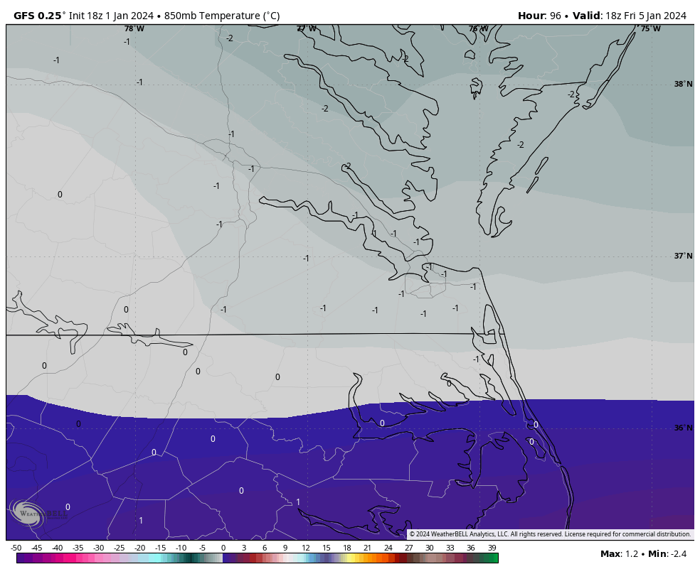
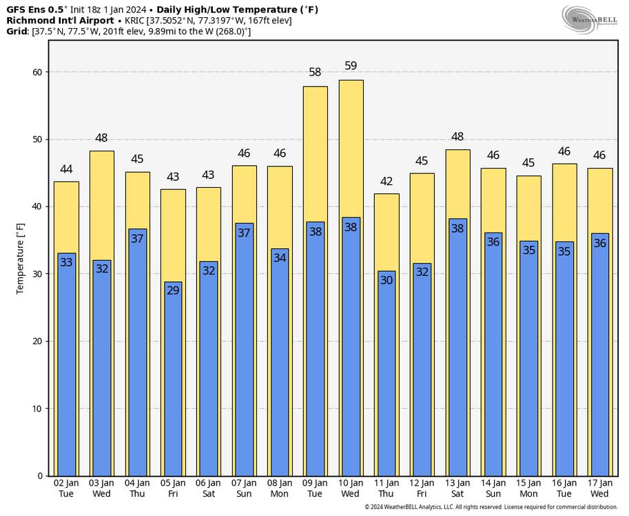
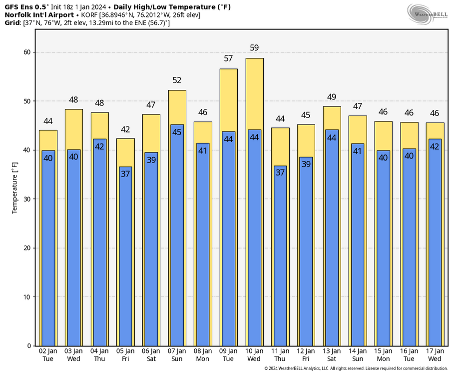
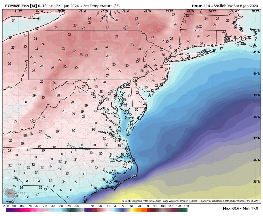
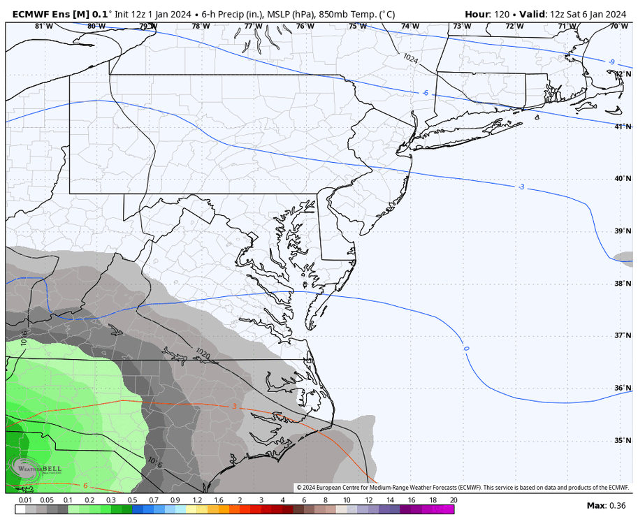
I looked closer at the EPS, and similar to the GEFS, major 850mb and surface temperature concerns remain. This is the mean of all members. The Euro ensemble mean 850 MB temperature at RIC go from 0°C at 7am Saturday to 2°C by 1pm and rise to 4°C by 7pm. Even as late as 1am Sunday, the 850mb temp only drops to 2°C before finally falling to -1°C by 7am. Meanwhile, surface temps are 31°F at 7am Saturday as the precip approaches, then rise to 40°F by 1pm and peak at 42°F by 7pm. Surface temps drop to 35°F by 7am; by then, 850s are back below 0°C. So, any remaining precip should be frozen. The problem is most of the precip will be gone by then.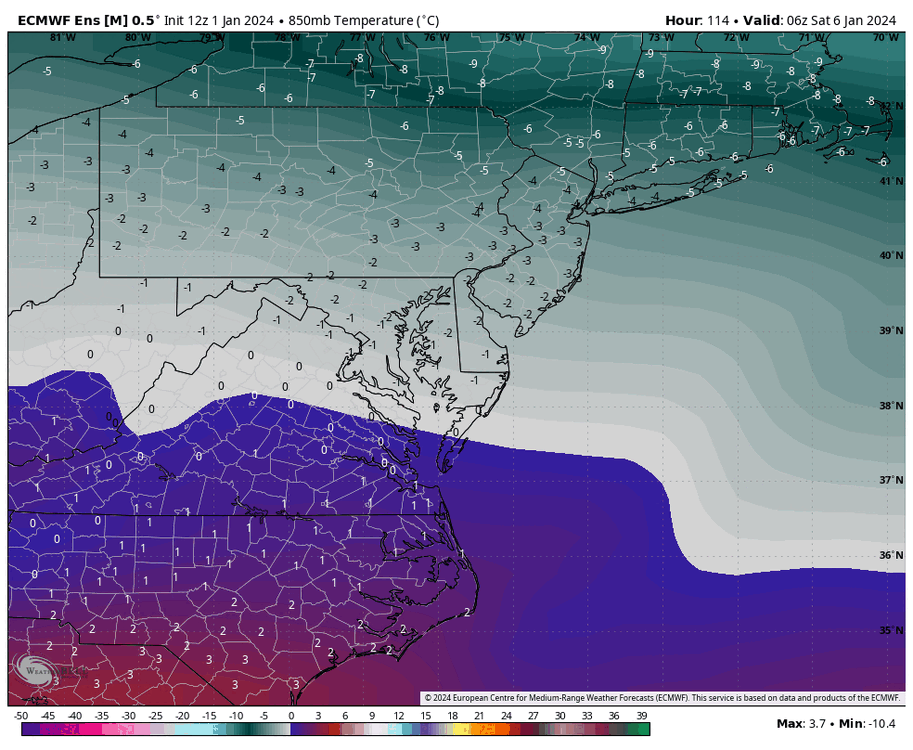
-
Richmond Metro/Hampton Roads Area Discussion
RIC Airport replied to RIC Airport's topic in Mid Atlantic
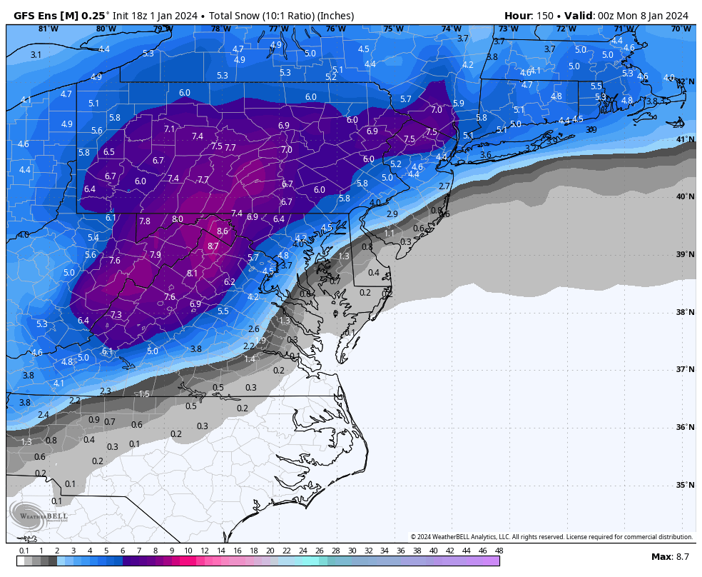
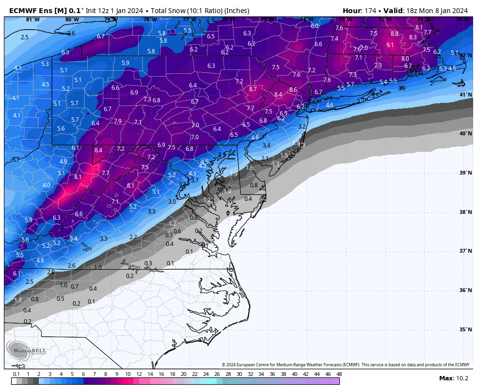
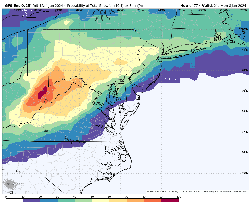
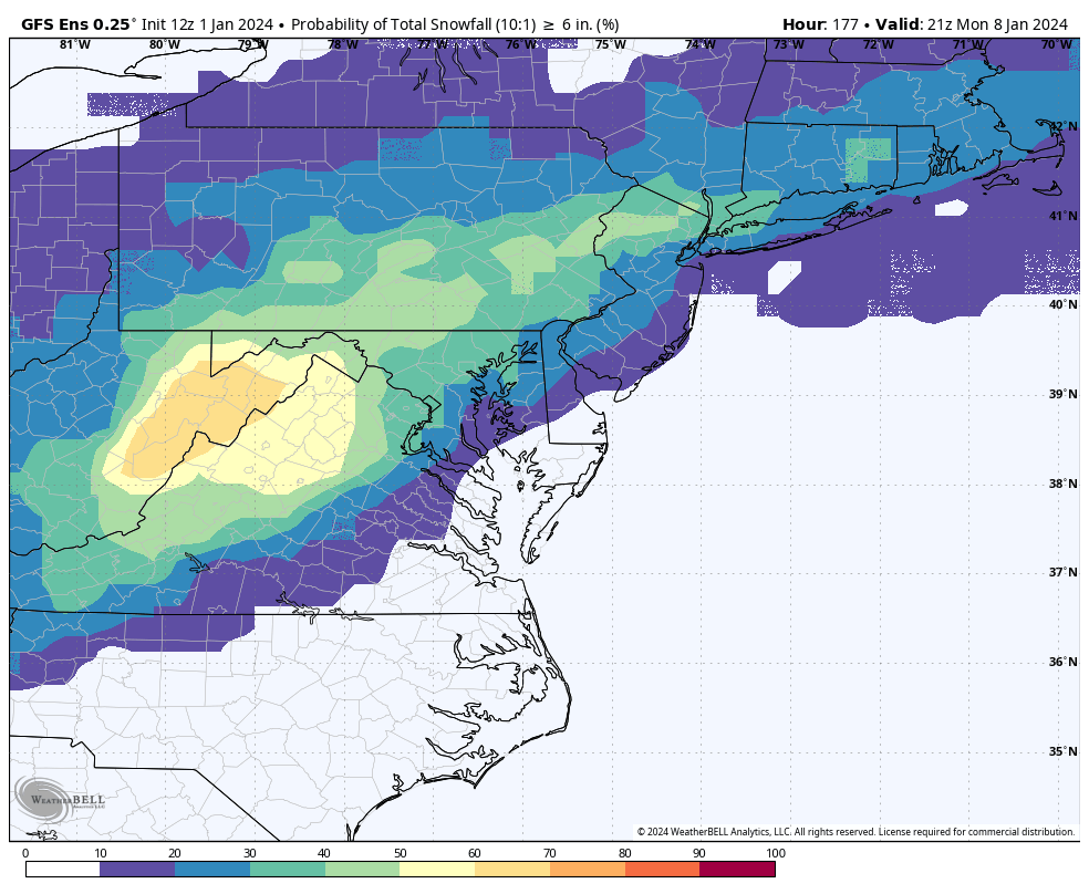
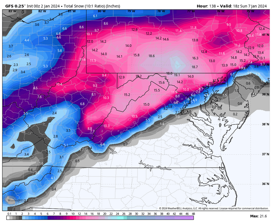
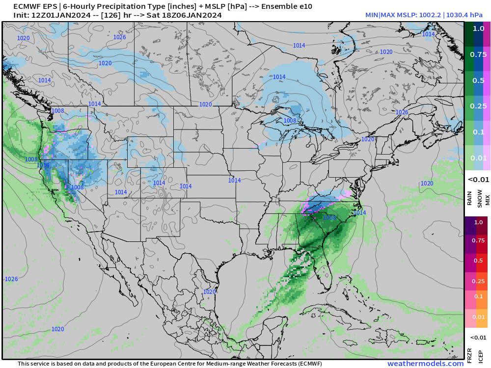
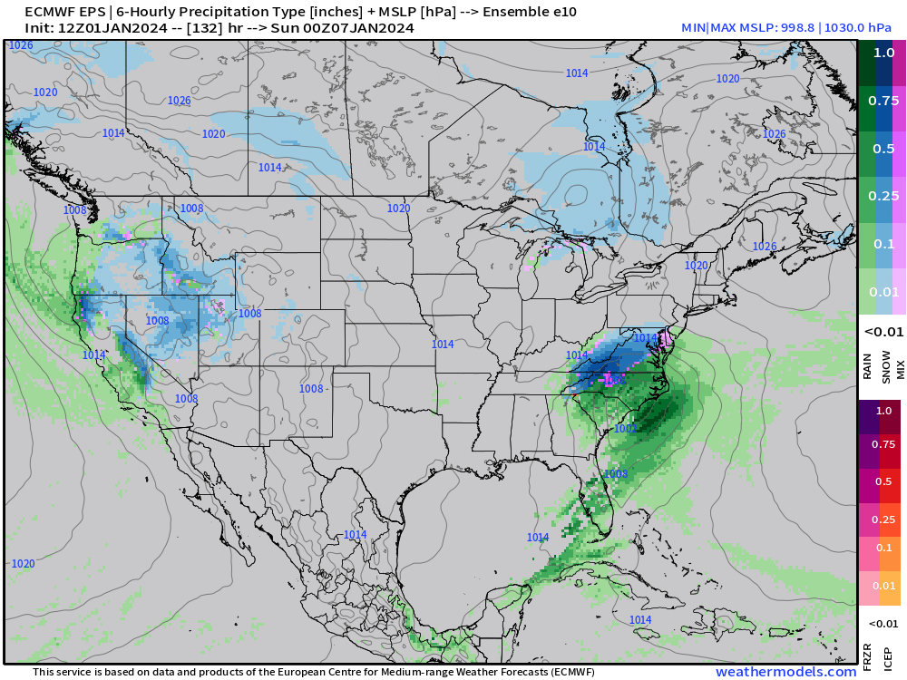
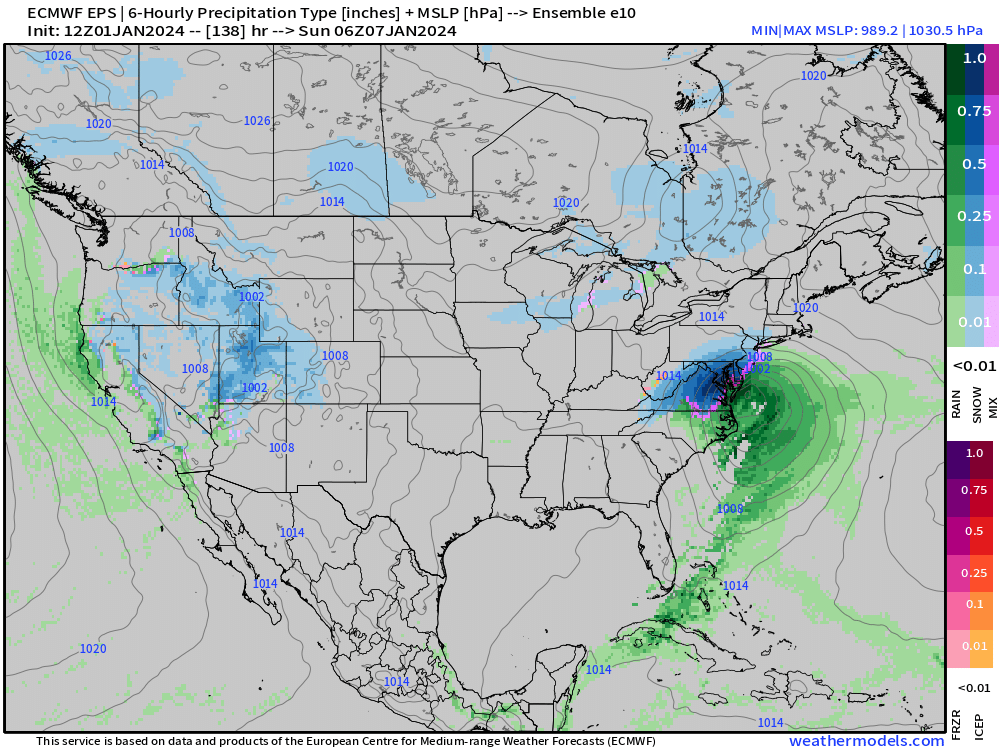
Here is the EPS mean and 50 members thru 18z January 8th. I'll post the charts once the entire run is complete.

-
Richmond Metro/Hampton Roads Area Discussion
RIC Airport replied to RIC Airport's topic in Mid Atlantic
Well, the 12Z Euro just erased a lot of hope.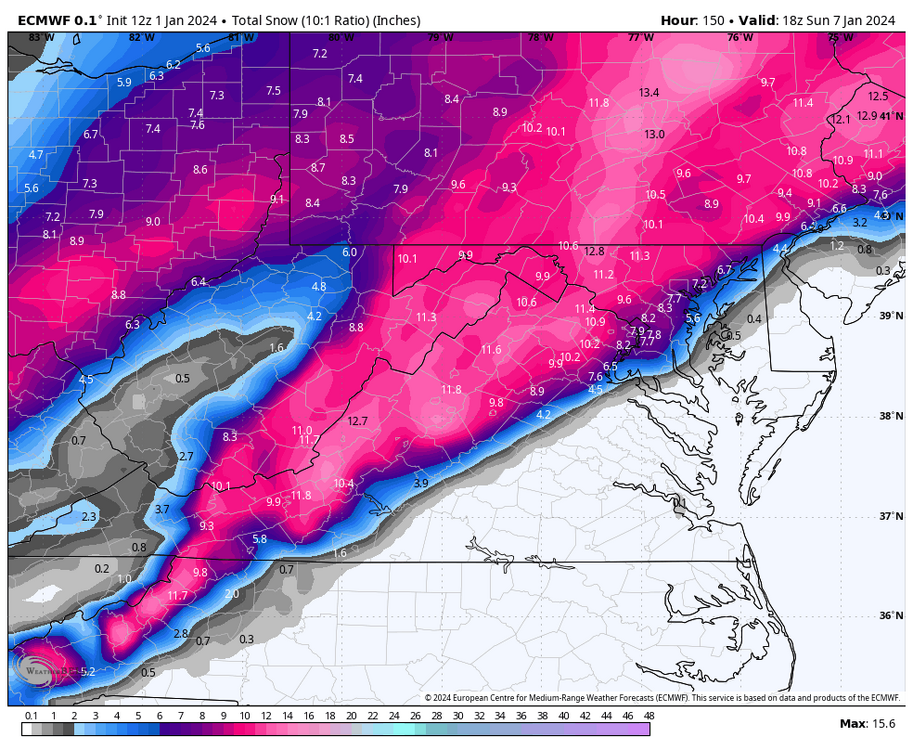

-
Richmond Metro/Hampton Roads Area Discussion
RIC Airport replied to RIC Airport's topic in Mid Atlantic
While we await the Euro, major 850mb and surface temperature concerns remain if you are south and east a line from Caroline to Lousia to Buckingham. The ensemble mean would suggest 850s MB temperatures at RIC goes from 0°C at 10am Saturday to 1°C by 1pm and stays there until about 4am Sunday when it goes back to 0°C before finally reaching -1°C by 10am. Surface temperatures around Richmond are in the upper 30s to around 40°F the whole time. This is a mean, so obviously, there are colder members. We need to trend both of these colder. From my glean of the 12z GFS ensembles, the best chance for snow in Richmond is after the low passes and gets to our east on the back side. Whether it sticks is the big question.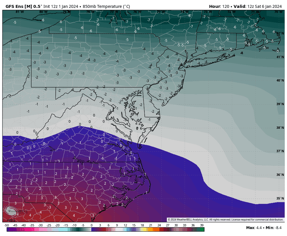

-
Richmond Metro/Hampton Roads Area Discussion
RIC Airport replied to RIC Airport's topic in Mid Atlantic
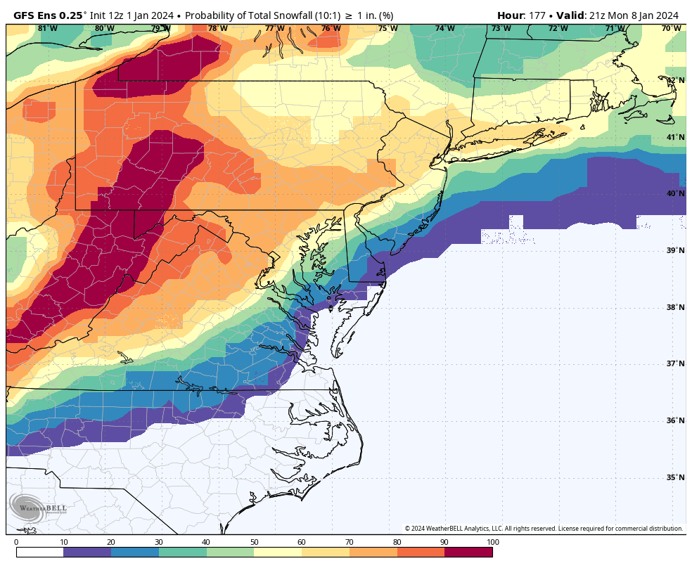
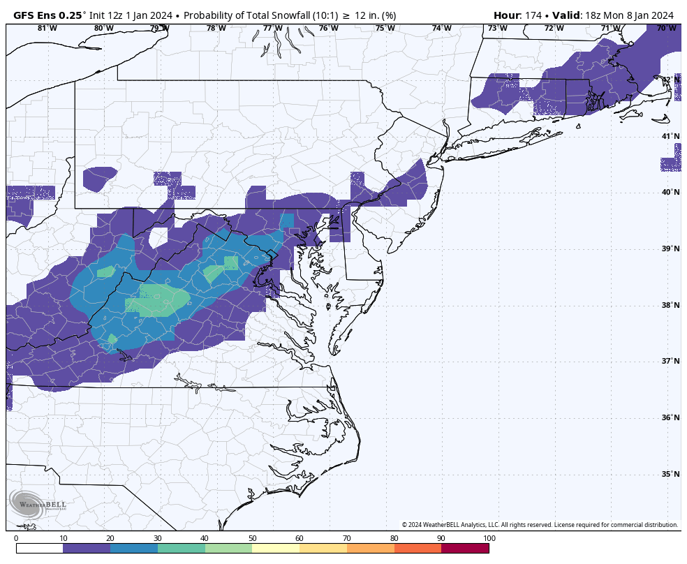
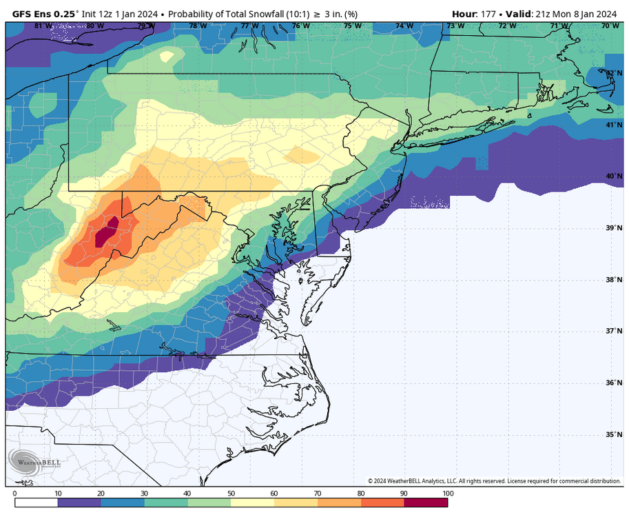
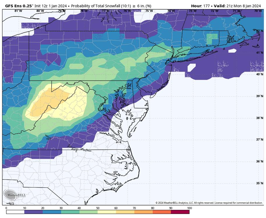
Chances for at least one inch of snow around Richmond keeps going up, now at around 40%. Hopefully this trend continues.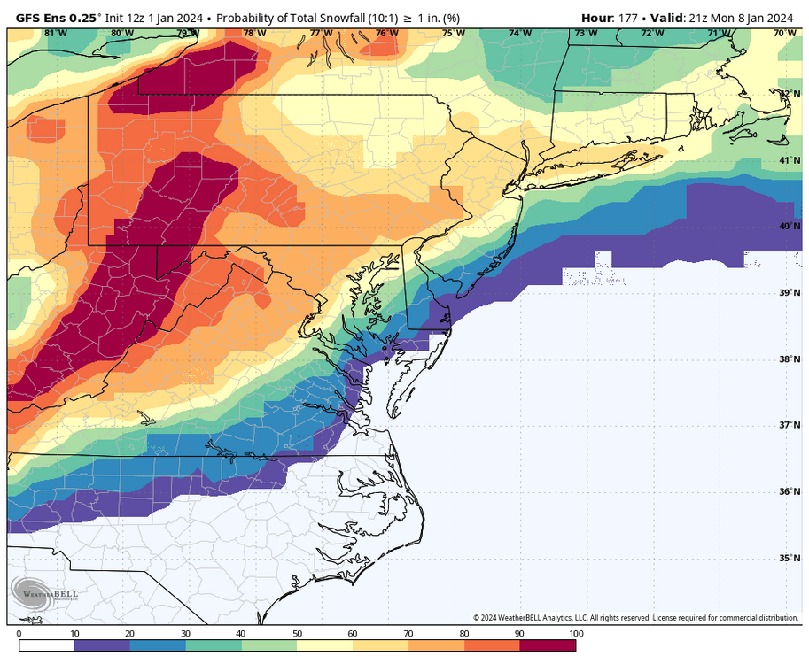

-
Richmond Metro/Hampton Roads Area Discussion
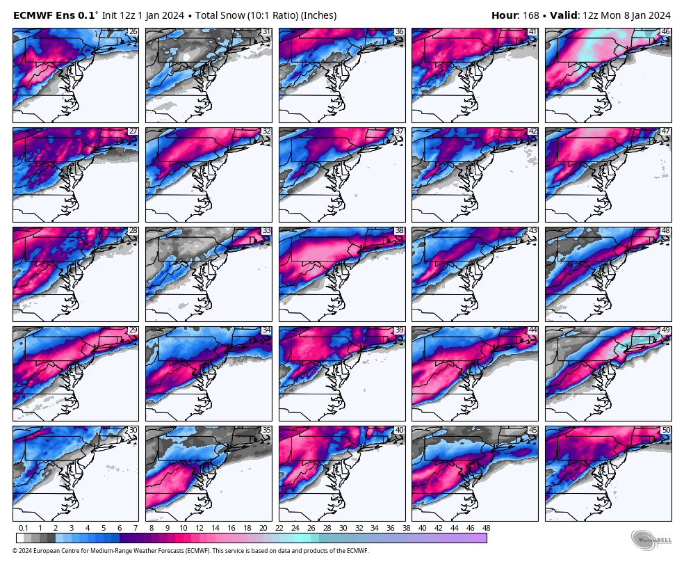
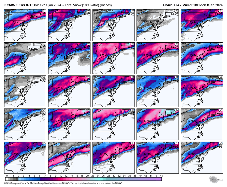
RIC Airport replied to RIC Airport's topic in Mid Atlantic
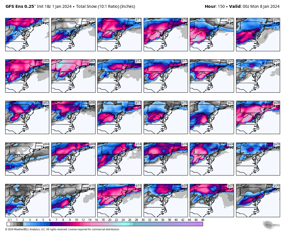
Here are the individuals thru 18z Monday, @Conway7305.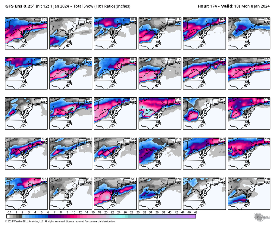
-
Richmond Metro/Hampton Roads Area Discussion
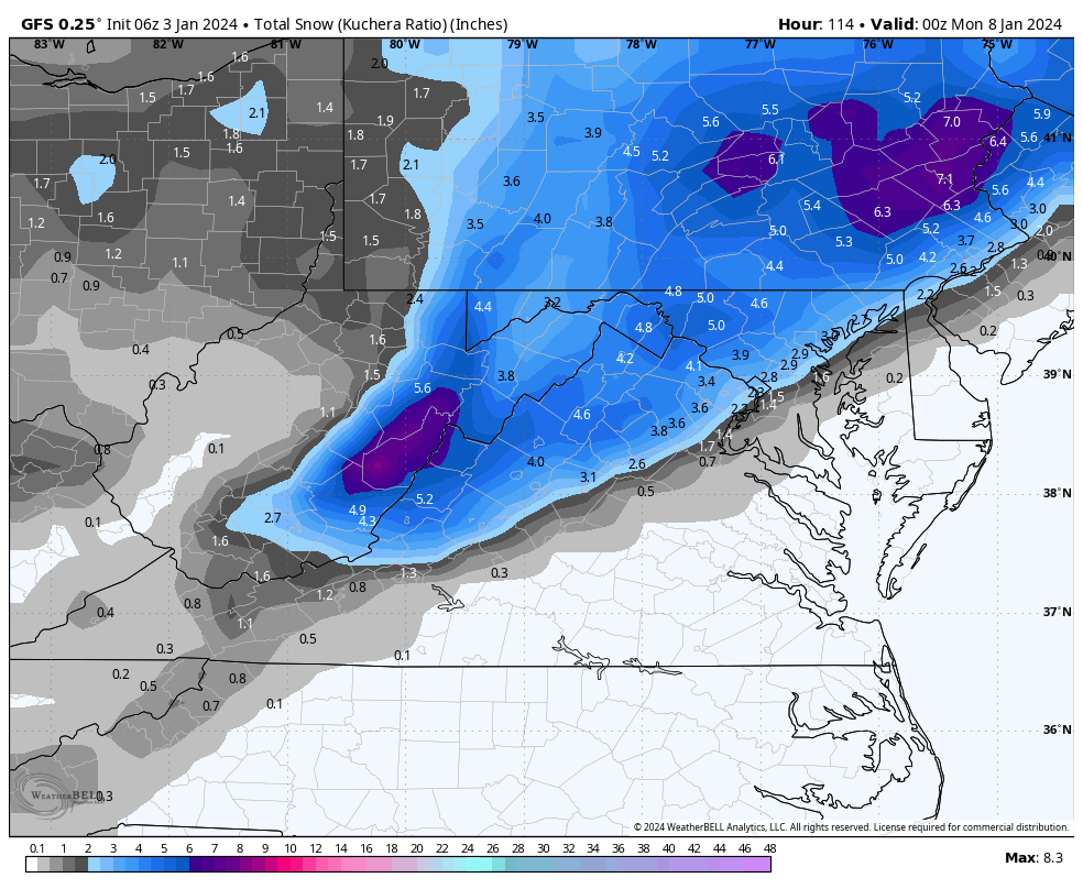
RIC Airport replied to RIC Airport's topic in Mid Atlantic
The dark blue has made it as far SE as RIC. I'll post them momentarily when they finish.