RIC Airport
-
Posts
2,586 -
Joined
-
Last visited
Content Type
Profiles
Blogs
Forums
American Weather
Media Demo
Store
Gallery
Everything posted by RIC Airport
-
Richmond Metro/Hampton Roads Area Discussion
RIC Airport replied to RIC Airport's topic in Mid Atlantic
It looks like a couple of different pieces of energy, and any of them could be the one that becomes the storm. I suspect GFS will probably hone in on different ones, so the timing will be different, especially this far out. That's ok as long as we maintain the active southern stream. We just need the correct one timed with cold. Also, if the PV relax just enough so they don't go too far south. -
Richmond Metro/Hampton Roads Area Discussion
RIC Airport replied to RIC Airport's topic in Mid Atlantic
You're right, I mentioned that. -
Richmond Metro/Hampton Roads Area Discussion
RIC Airport replied to RIC Airport's topic in Mid Atlantic
I edited my post see above and explained why it went north. -
Richmond Metro/Hampton Roads Area Discussion
RIC Airport replied to RIC Airport's topic in Mid Atlantic
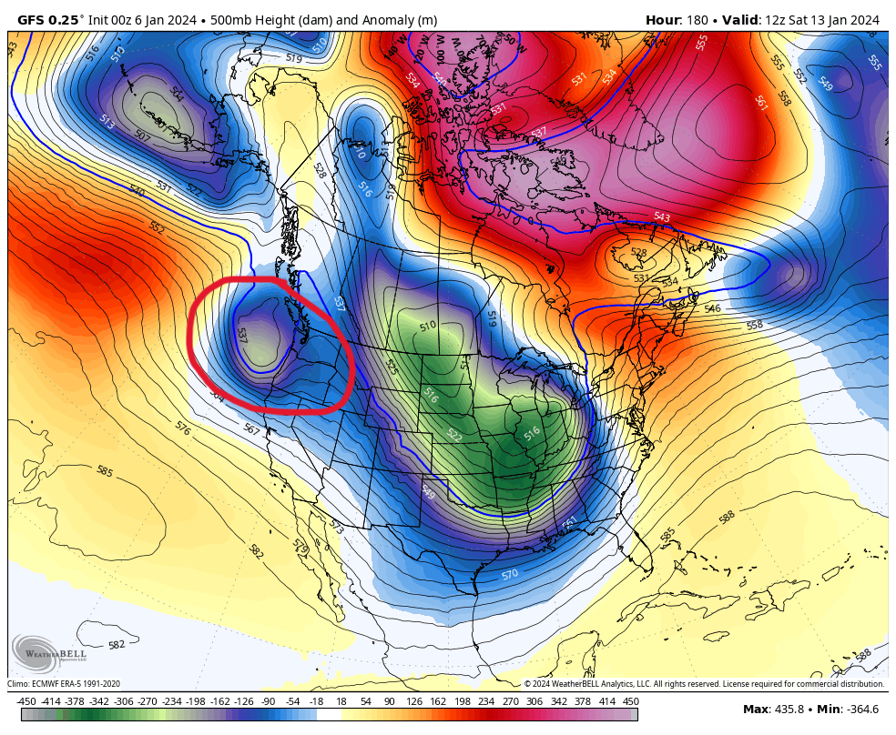
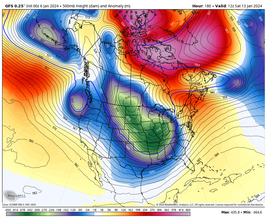
00Z GFS also had a snowstorm, but it was a few days earlier and was primarily a hit north and west of Richmond. The reason why that wave went north was because the PV lobe was weaker. You can see the energy enter the PAC NW and then get quashed SE on the heels of the PV, but since the PV lobe weakens and lifts farther north into Canada, it allows the energy to take a farther north track. Don't need to post the maps since we know it'll change. But at least it's consistently showing something again. I personally prefer they stay south of us at this range.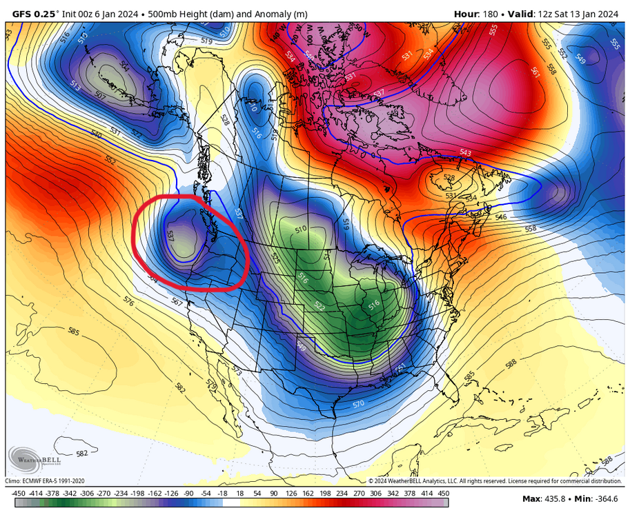
-
Richmond Metro/Hampton Roads Area Discussion
RIC Airport replied to RIC Airport's topic in Mid Atlantic
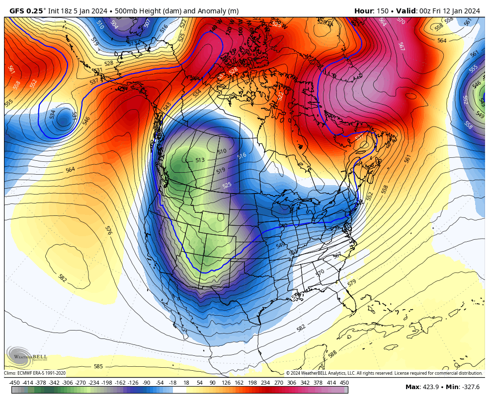
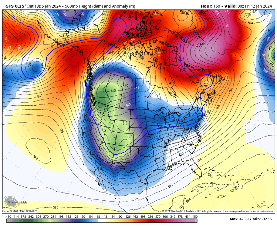
18Z GFS was encouraging, @Conway7305, @wasnow215, @ldub23, @Stormpc, @mikeeng92, @Rhino16. The PV lobe drops into the CONUS and delivers cold and forces the storm track south, just hopefully it's not too far south. But, we have some wiggle room.

-
Richmond Metro/Hampton Roads Area Discussion
RIC Airport replied to RIC Airport's topic in Mid Atlantic
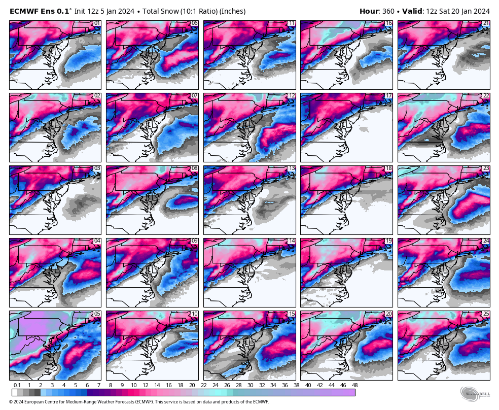
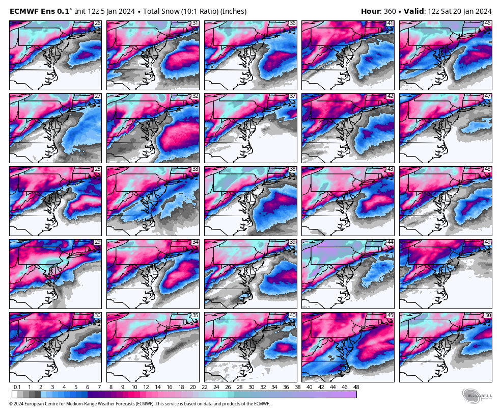
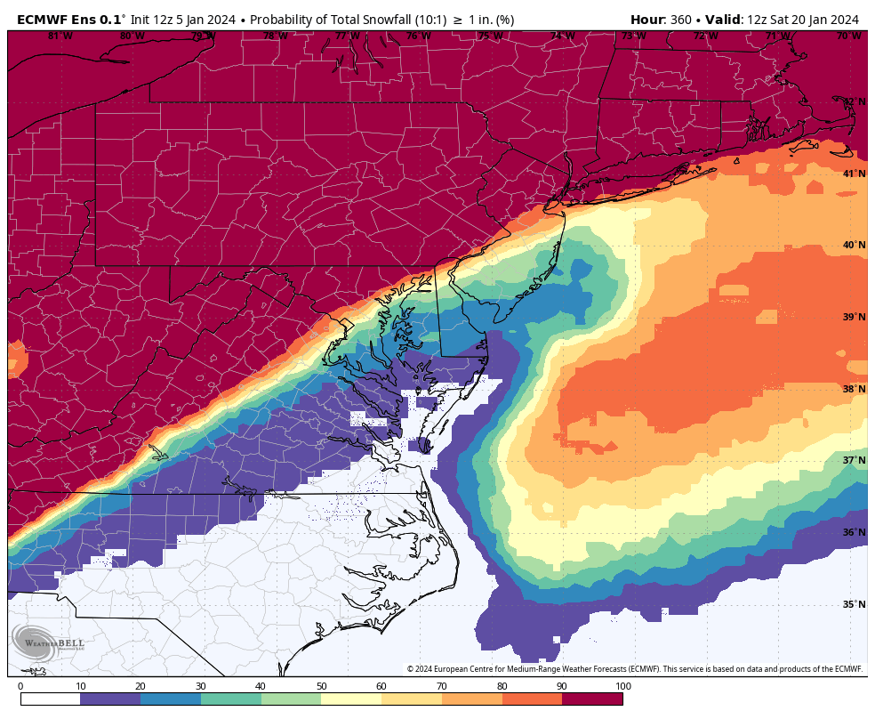
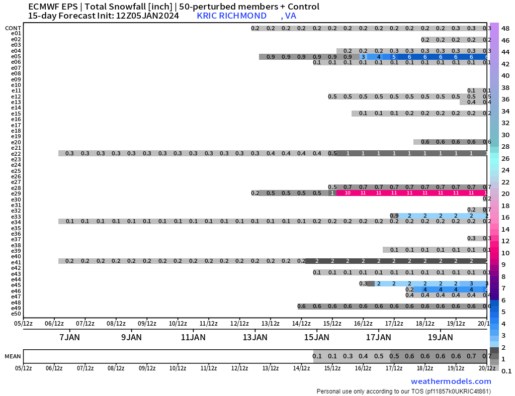
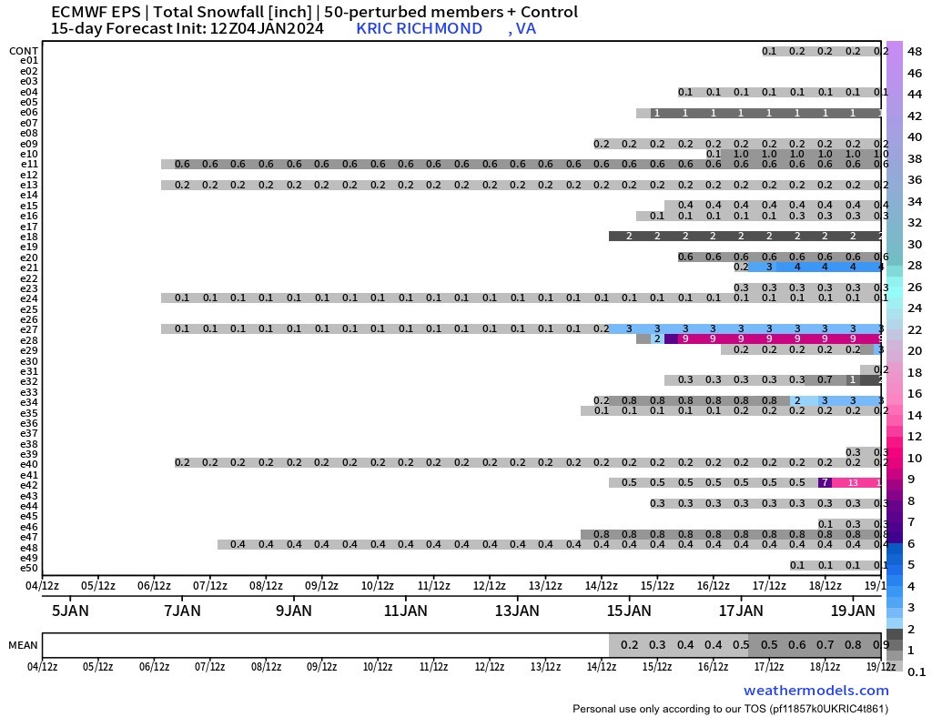
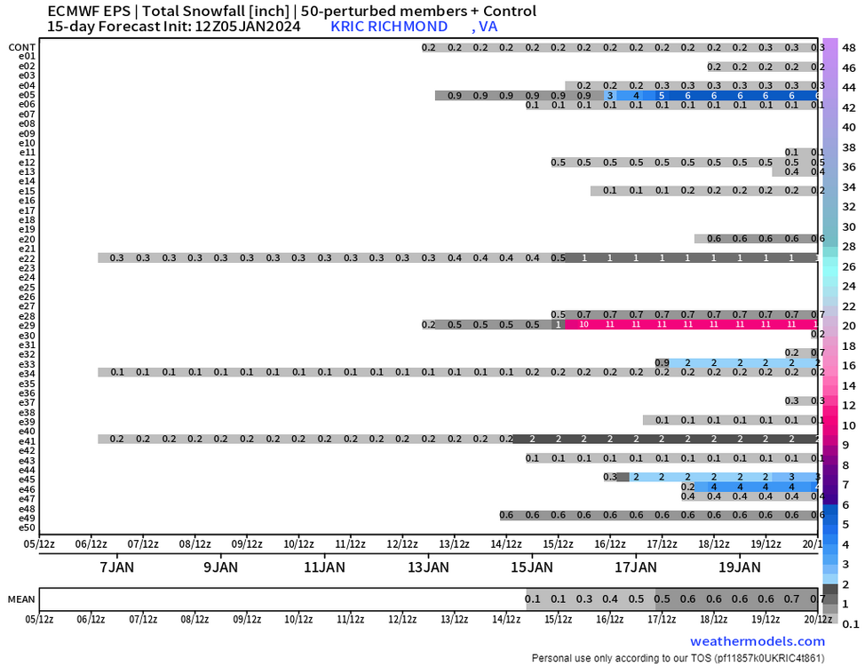
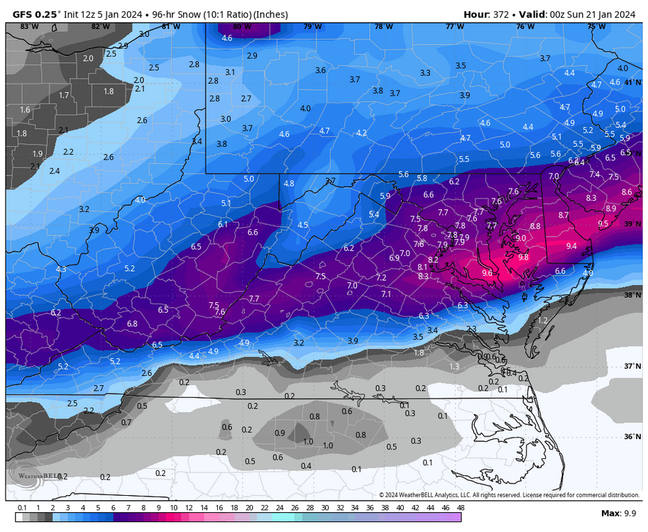
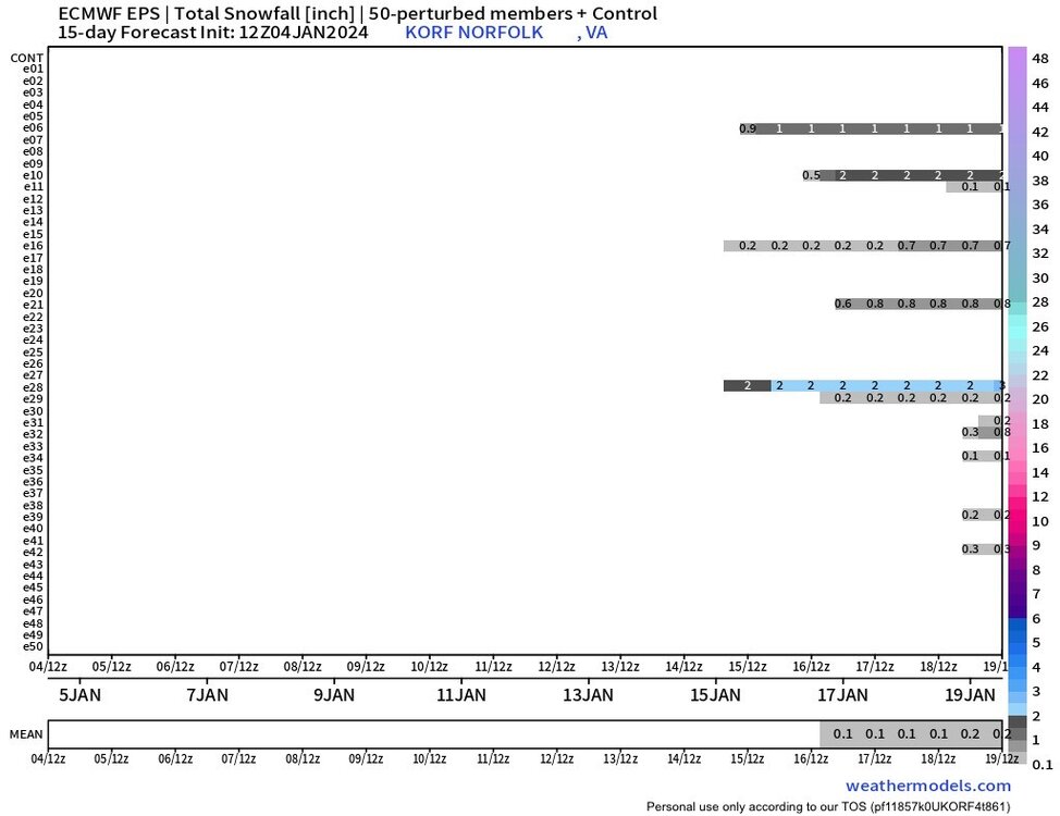
Member #29 gave RIC 11" on Day 10. I just looked at it, and that storm jumped from STL to RDU and then turned up the coast. We never get snow in that evolution. So, you have an improbable scenario skewing the mean. Meanwhile, member #34 had a 68°F 7am temp at RIC that day, which is equally unlikely. EPS Members 26-50 (see #34)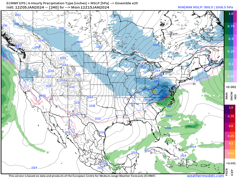
-
Richmond Metro/Hampton Roads Area Discussion
RIC Airport replied to RIC Airport's topic in Mid Atlantic
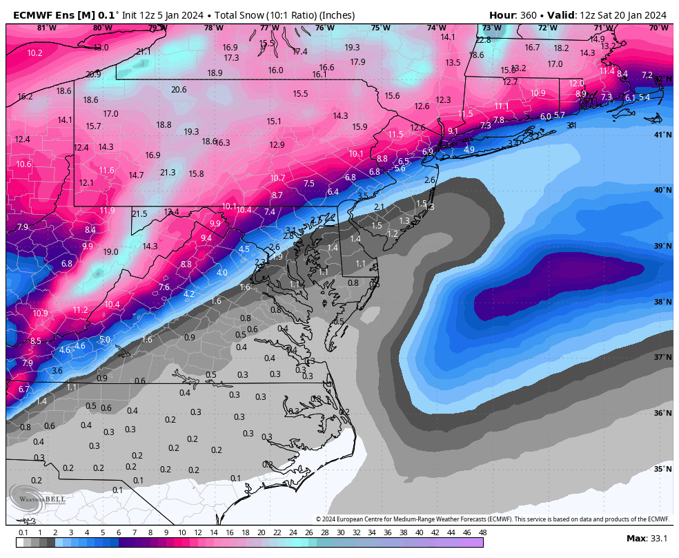
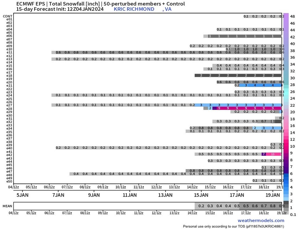
Although there is still potential based on the evolving pattern, the 12Z EPS snowfall mean was not that encouraging east of the mountains. One member did give RIC 11" of snow so hopefully it has a clue.


-
Richmond Metro/Hampton Roads Area Discussion
RIC Airport replied to RIC Airport's topic in Mid Atlantic
@ldub23, case in point. And there is plenty of time to improve this. But, the opportunity is there once we get the cold.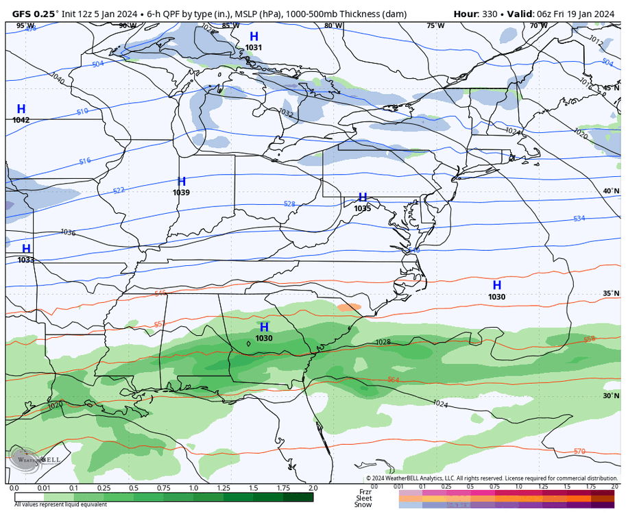
-
Richmond Metro/Hampton Roads Area Discussion
RIC Airport replied to RIC Airport's topic in Mid Atlantic
Just let the pattern evolve. It's been doing this for several days now. We know the cold will initially dump west. It's the period beyond that with the best potential for us. -
Richmond Metro/Hampton Roads Area Discussion
RIC Airport replied to RIC Airport's topic in Mid Atlantic
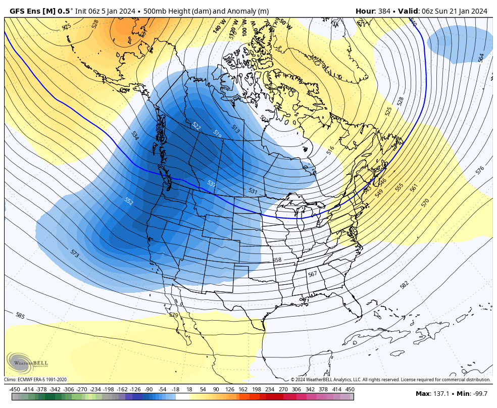
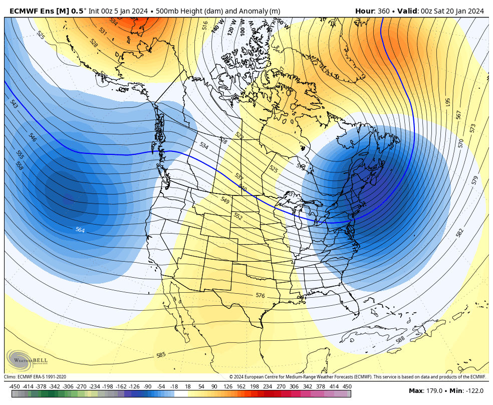
The end of the 00z run delivered a snow/ice storm for Richmond and West. It will continue to flip/flop. Remember when the Christmas Day GFS had us around 70°F for tomorrow? The models have periodically tried to torch us, and although we've been skewed warm, thankfully, the warmest outcomes have not yet materialized. But I see what you're saying. You're tired of seeing the same troughiness in the west and cutter after cutter. I am, too! Thankfully, the ensemble mean wasn't too torchy and a few members were frigid. But similar challenges remain until we get a bonafide ridge out west. The end of last night's EPS had a different look in the east, which I've also posted below. 06Z GEFS 00Z EPS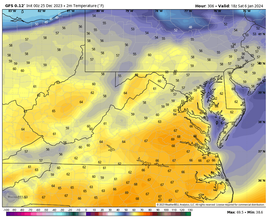


-
Richmond Metro/Hampton Roads Area Discussion
RIC Airport replied to RIC Airport's topic in Mid Atlantic
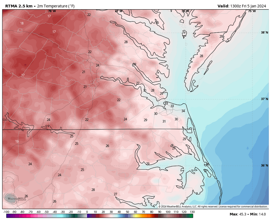
This morning was one of the colder mornings we've seen this winter, particularly for inland areas. Wakefield issued a Winter Weather Advisory for areas just west of Richmond until 10am tomorrow. URGENT - WINTER WEATHER MESSAGE National Weather Service Wakefield VA 409 AM EST Fri Jan 5 2024 VAZ061-062-069-510-051715- /O.NEW.KAKQ.WW.Y.0001.240106T0600Z-240106T1700Z/ Cumberland-Goochland-Powhatan-Eastern Louisa- Including the cities of Angola, Guinea Mills, Hawk, Raines Tavern, Reeds, Stoddert, Goochland, Fine Creek Mills, Flat Rock, Goodwins Store, Subletts, Worshams, Clayville, Genito, and Mineral 409 AM EST Fri Jan 5 2024 ...WINTER WEATHER ADVISORY IN EFFECT FROM 1 AM TO NOON EST SATURDAY... * WHAT...Mixed precipitation expected. Total sleet accumulations of less than one inch and ice accumulations of a light glaze. * WHERE...Cumberland, Goochland, Powhatan and Eastern Louisa Counties. * WHEN...From 1 AM to noon EST Saturday. * IMPACTS...Plan on slippery road conditions.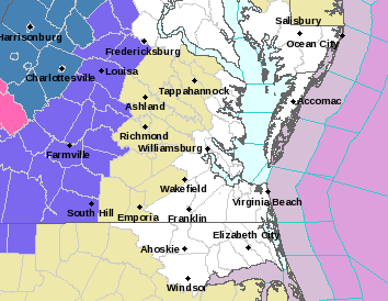
-
Richmond Metro/Hampton Roads Area Discussion
RIC Airport replied to RIC Airport's topic in Mid Atlantic
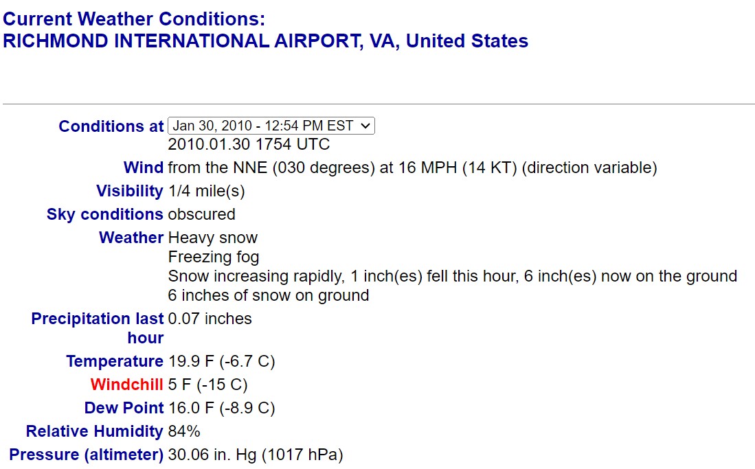
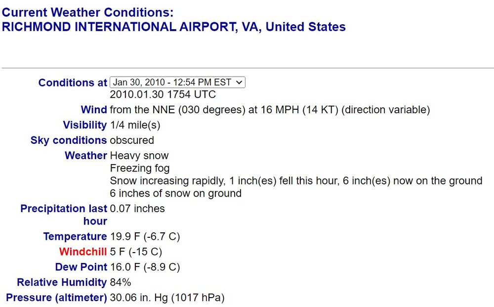
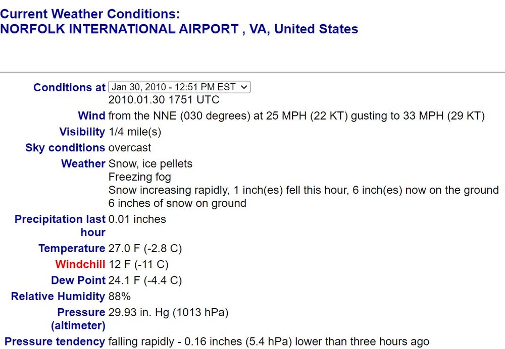
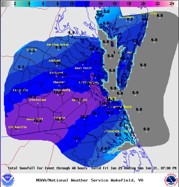
The January 30, 2010, storm was a southern slider that occurred with a very cold airmass in place. Richmond recorded 10.0" of snow with 1-2 inches per hour rates and was only around 20°F during the height of the event, one of the coldest storms we had seen in a while.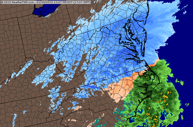
-
Richmond Metro/Hampton Roads Area Discussion
RIC Airport replied to RIC Airport's topic in Mid Atlantic
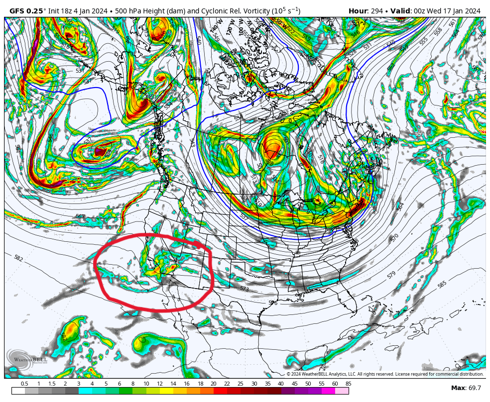
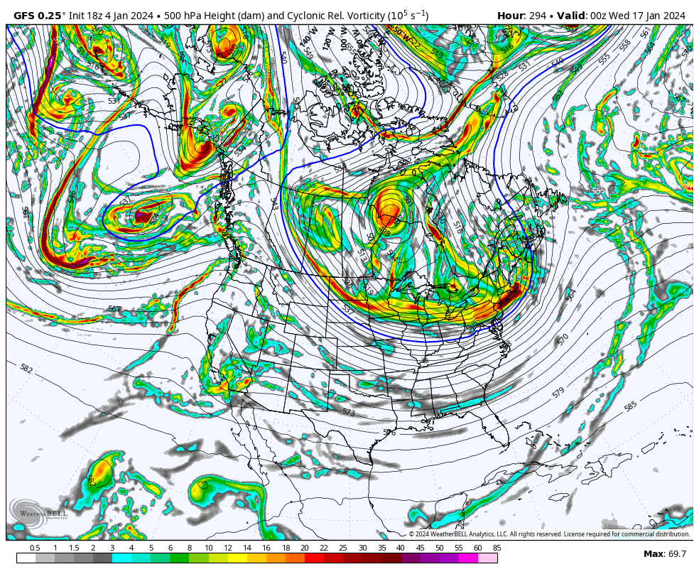
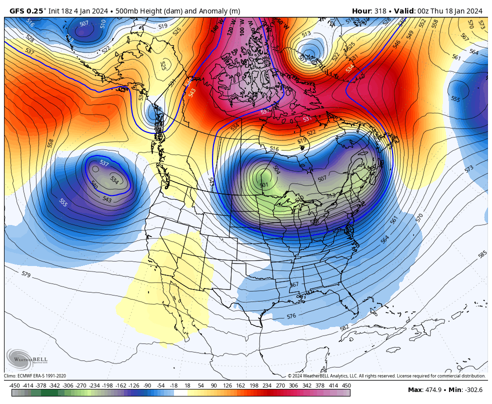
I was looking at the 18z GFS, and of course, this is an OP run way out there, but hopefully, it's indicative of opportunities later in the month. At 294, you can see the energy moving into CONUS in the SW, but then it gets squashed after it gets to about AR/LA. You can watch the PV lobe squash it. If that PV is weaker and that -NAO block relaxes more and is a bit farther north than is depicted here, perhaps that wave can develop and swing south of us, and moisture override with temps in the 20s here, and we get like a 1/30/2010, which came about in a similar way. Wishful thinking and using an 18z OP past 300 hours for analysis...so. But, wanted to be positive for the likes of others like @ldub23, @eaglesin2011, @Conway7305, @SoCoWx, @Stormpc.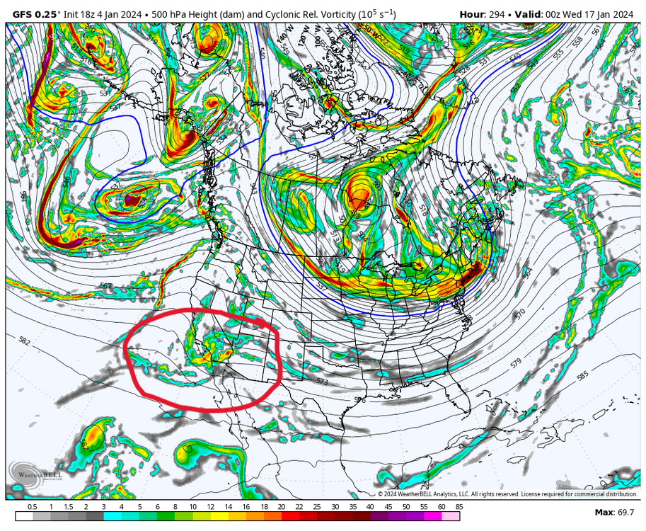

-
Richmond Metro/Hampton Roads Area Discussion
RIC Airport replied to RIC Airport's topic in Mid Atlantic
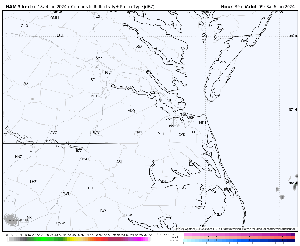
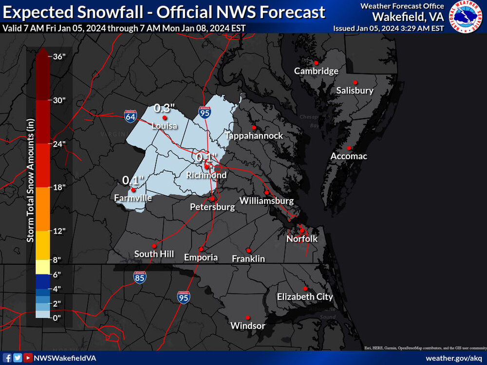
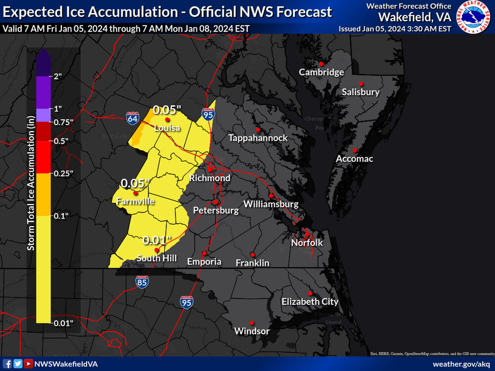
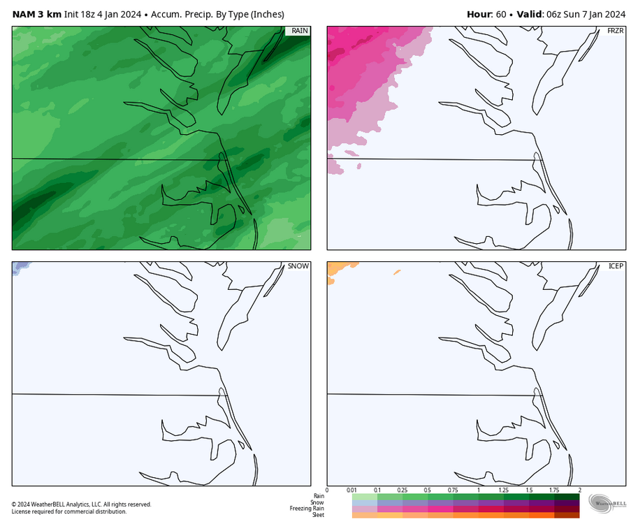
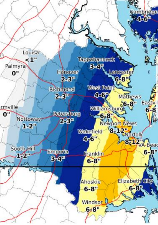
The 18Z 3K NAM has precip arriving into the Richmond metro between 6am and 8am on Saturday. That is the window where freezing rain could fall before changing to rain and tapering off Saturday evening after sunset. However, the western portions of Powhatan and Goochland and areas north of about Fredericksburg could take until noon before changing over. Precip totals look to exceed an inch in most places.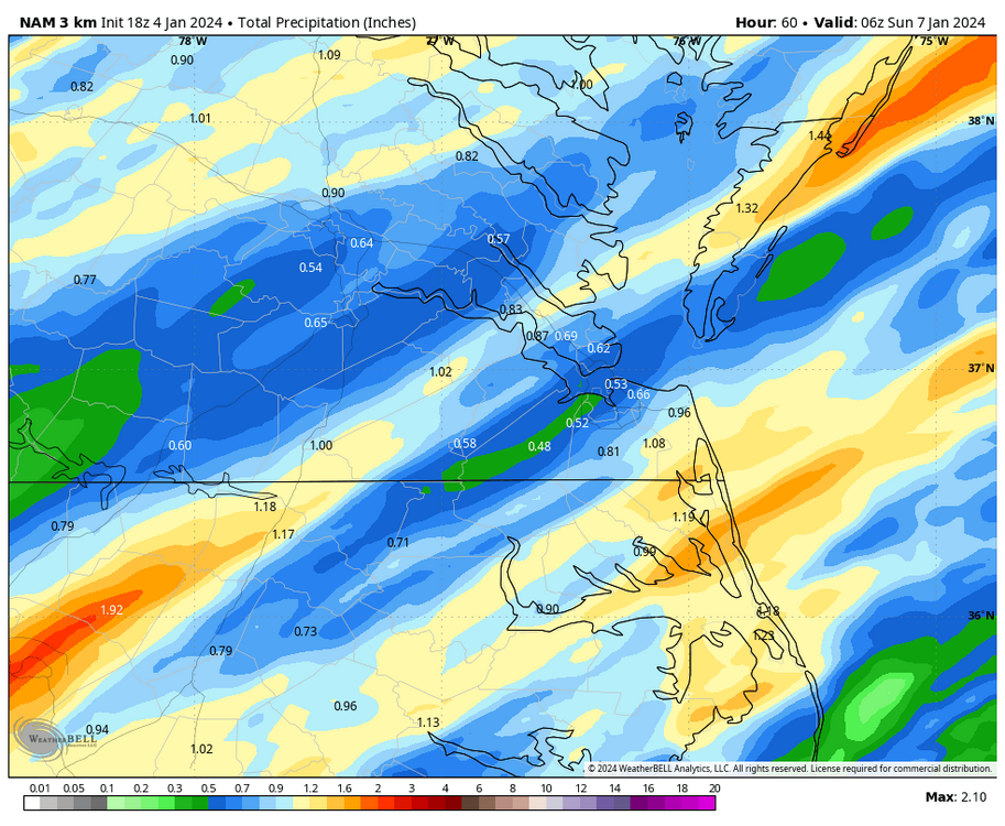
-
Richmond Metro/Hampton Roads Area Discussion
RIC Airport replied to RIC Airport's topic in Mid Atlantic
I found these, too for your area. When I have time at some point, I'll look for more.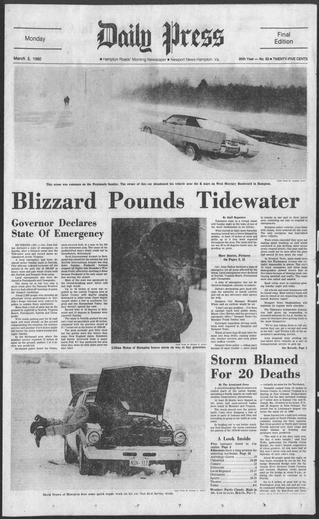
-
Richmond Metro/Hampton Roads Area Discussion
RIC Airport replied to RIC Airport's topic in Mid Atlantic
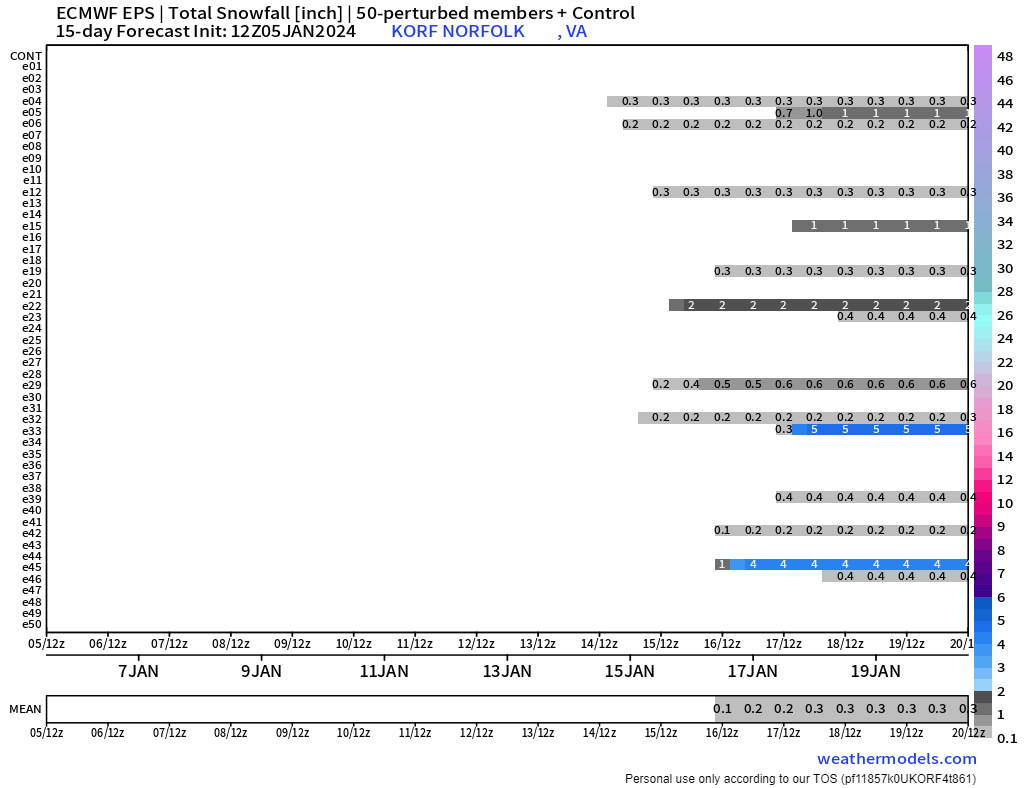
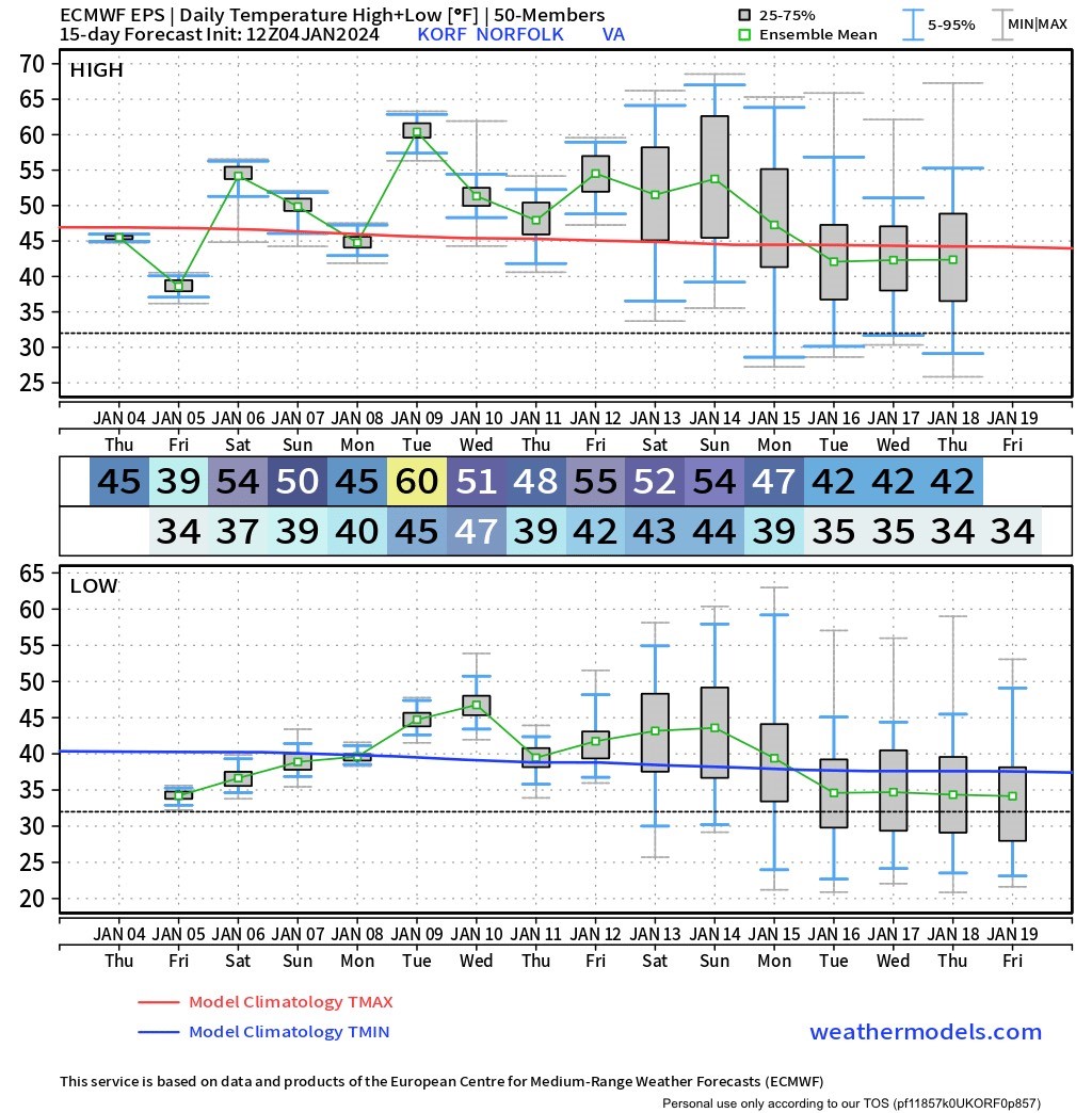
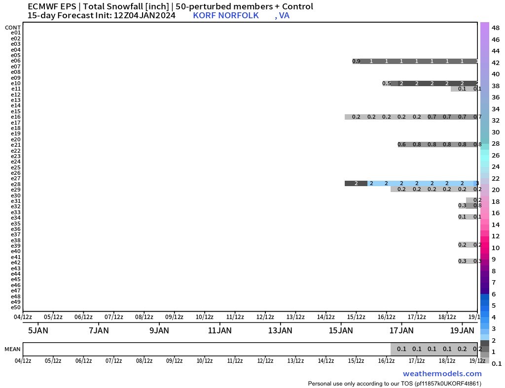
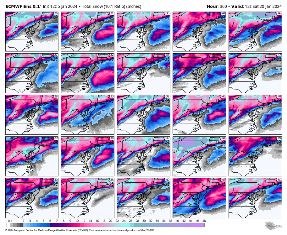
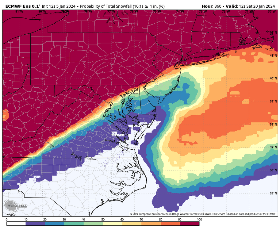
Definitely a signal on the EPS for that time. EPS says we can expect a temporary rise in temperatures ahead of the cutters next week, followed by a subsequent downward trend. While there may be some snow opportunities, they remain more limited for Hampton Roads. The snowfall mean was one of the more depressing maps I've seen this winter. And that's even skewed by the few members that still give us accumulations this weekend.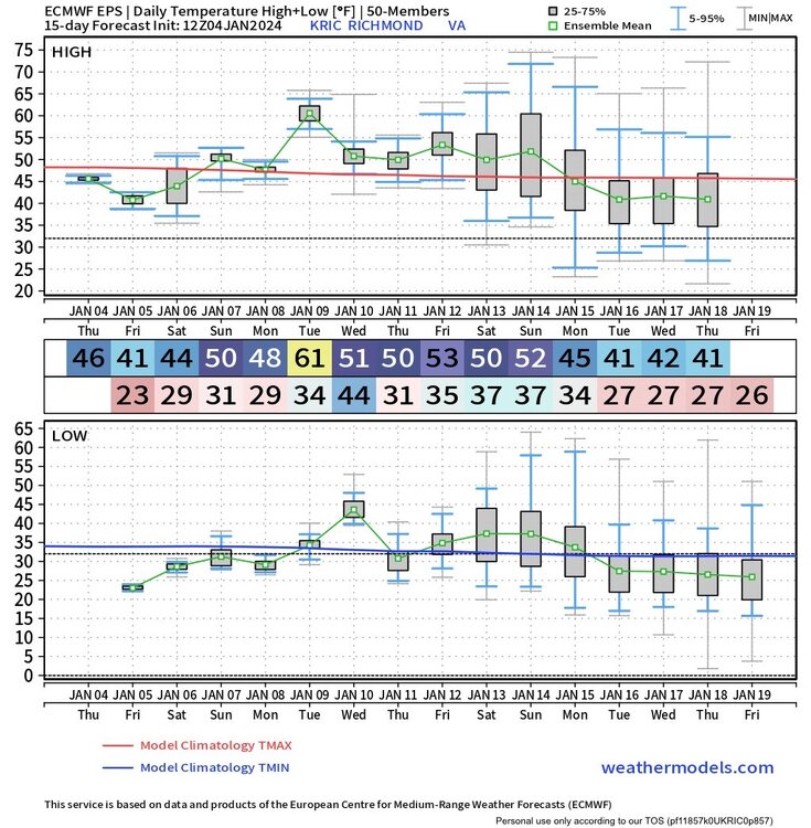

-
Richmond Metro/Hampton Roads Area Discussion
RIC Airport replied to RIC Airport's topic in Mid Atlantic
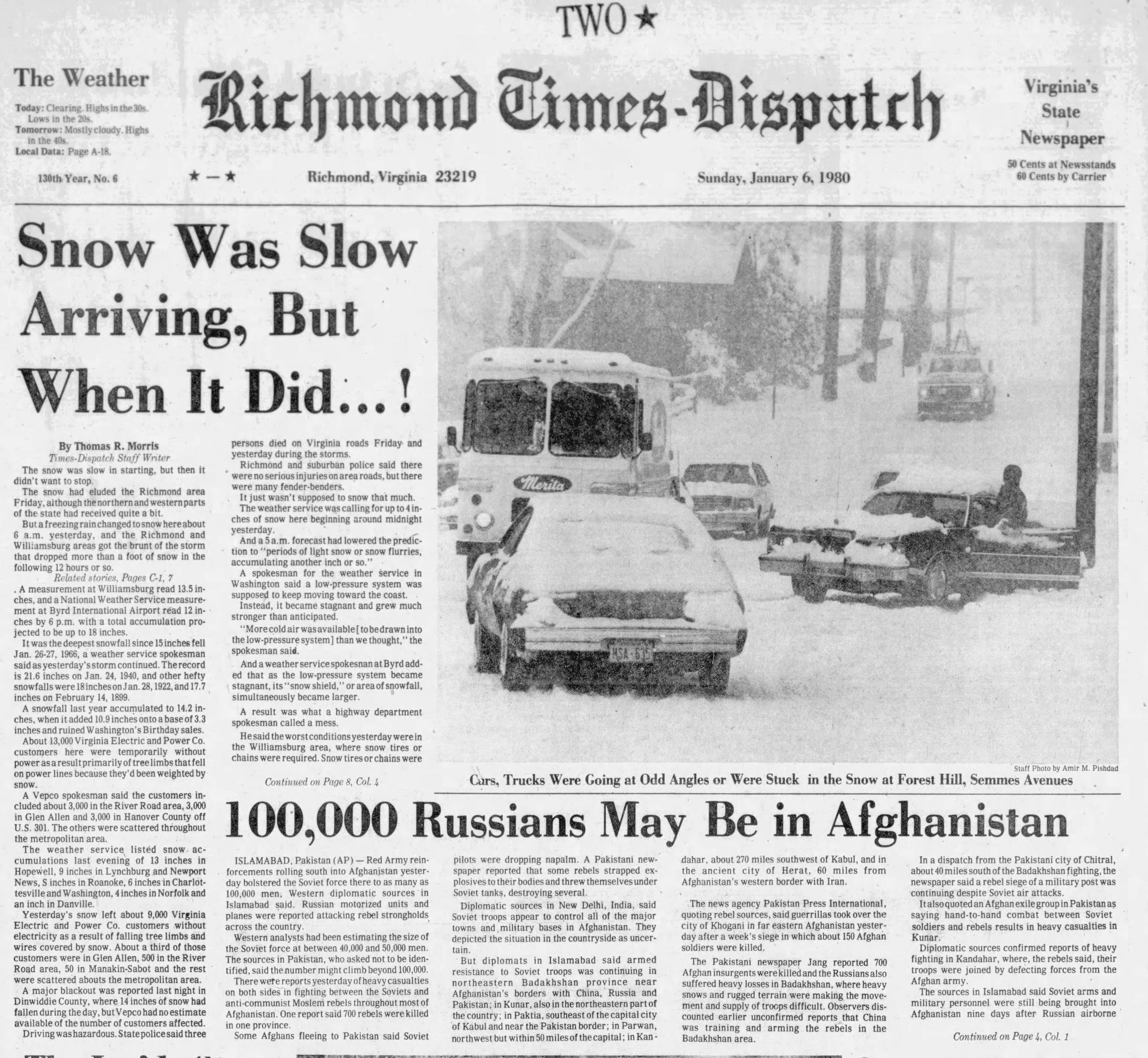
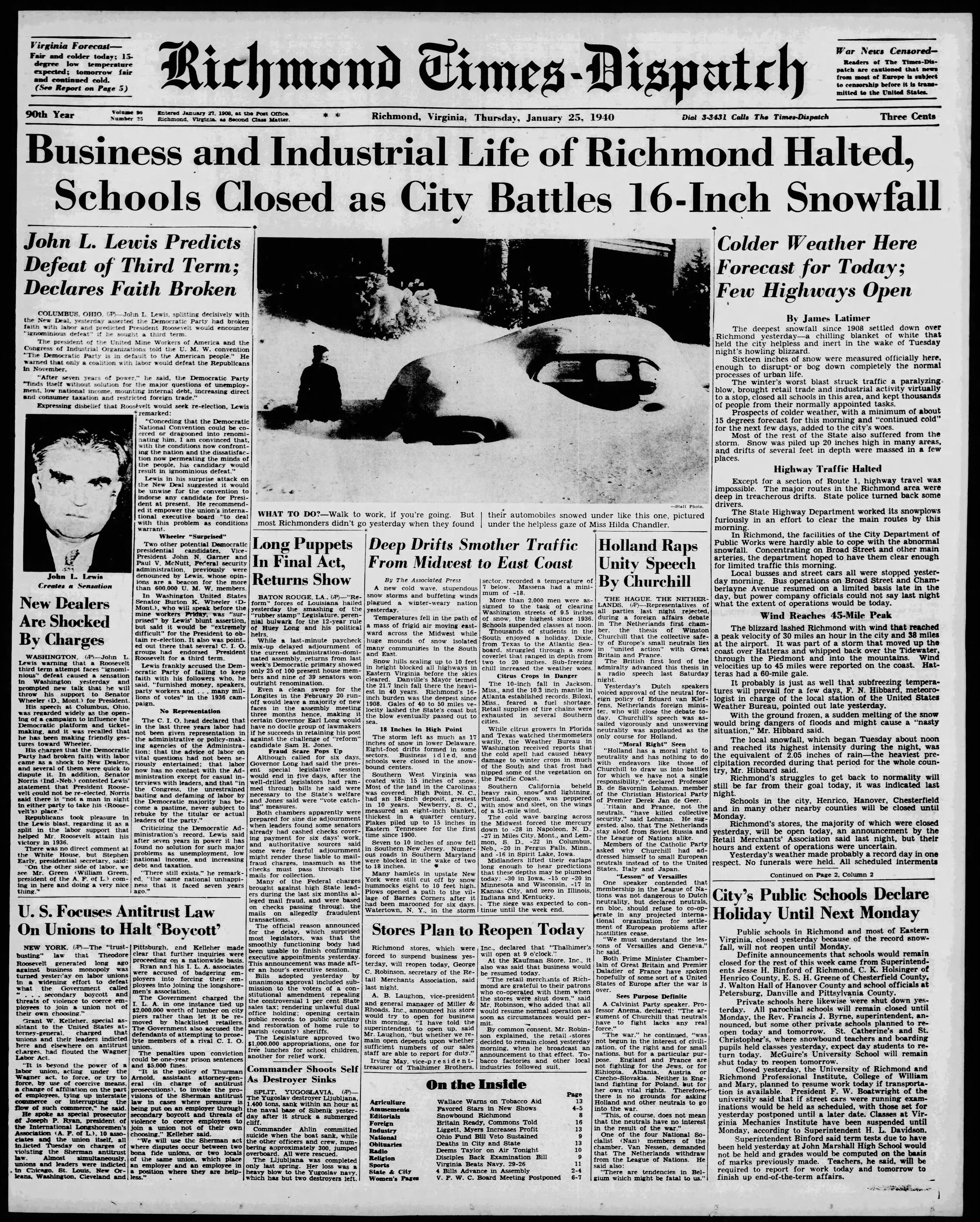
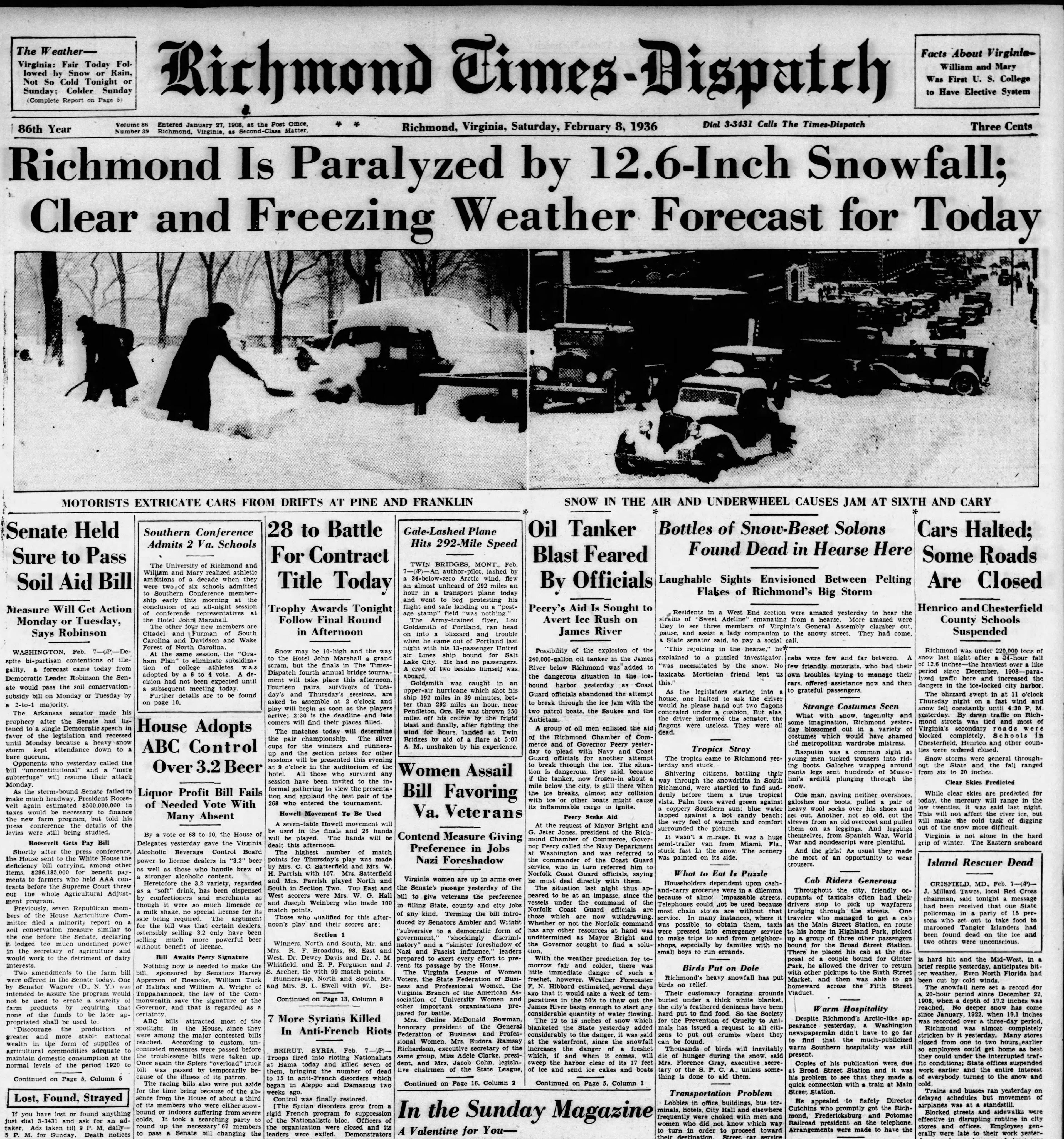
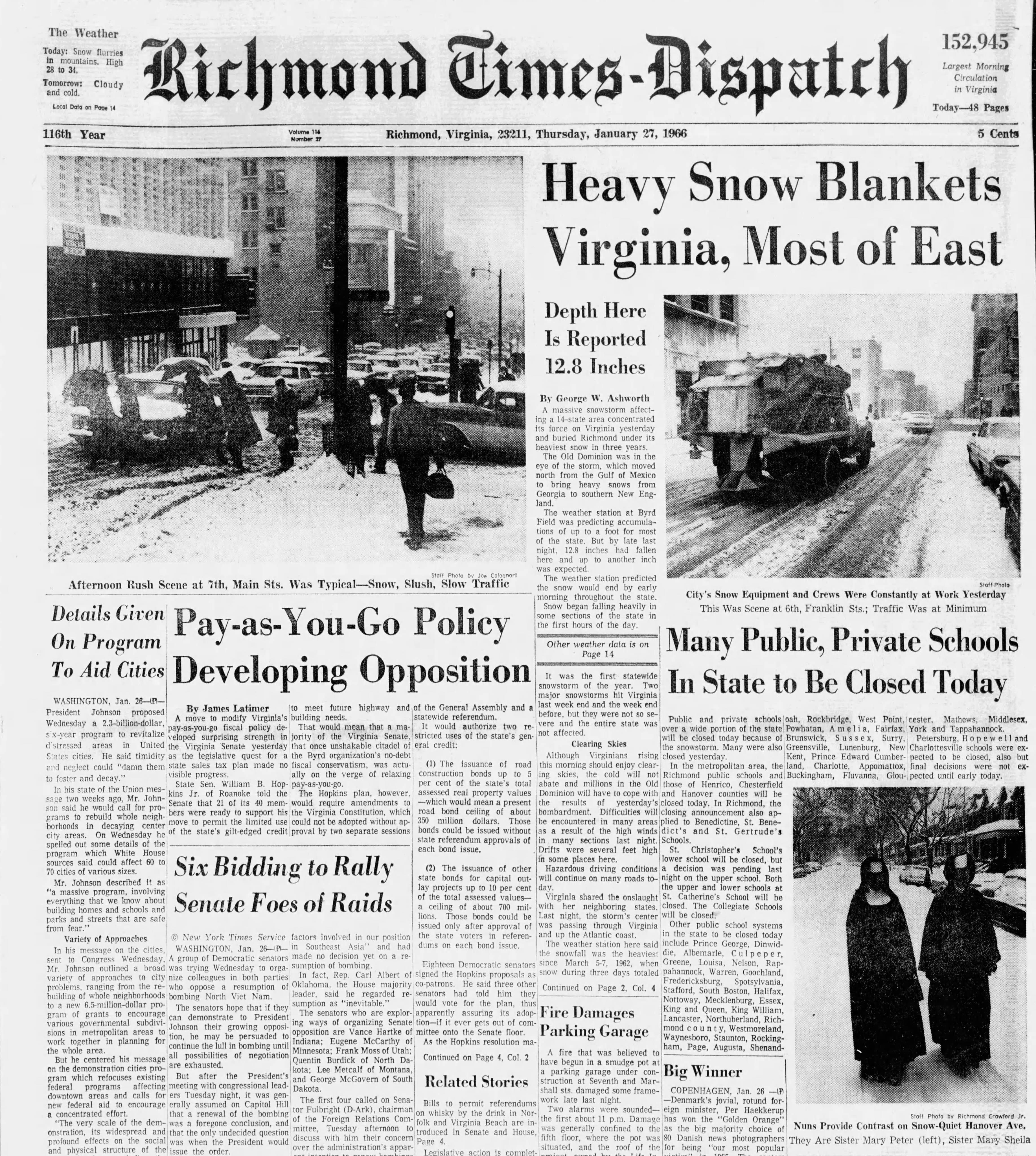
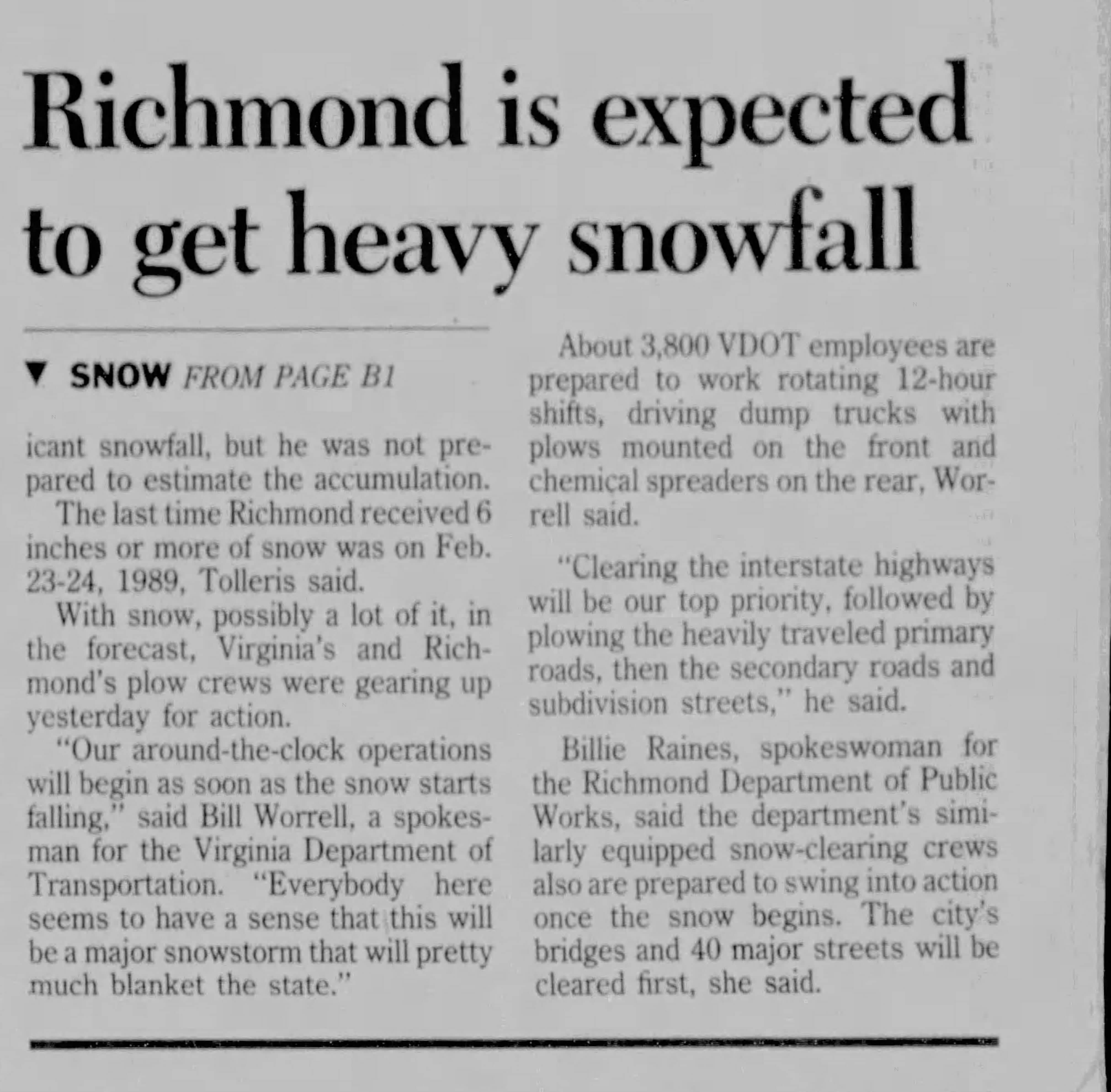
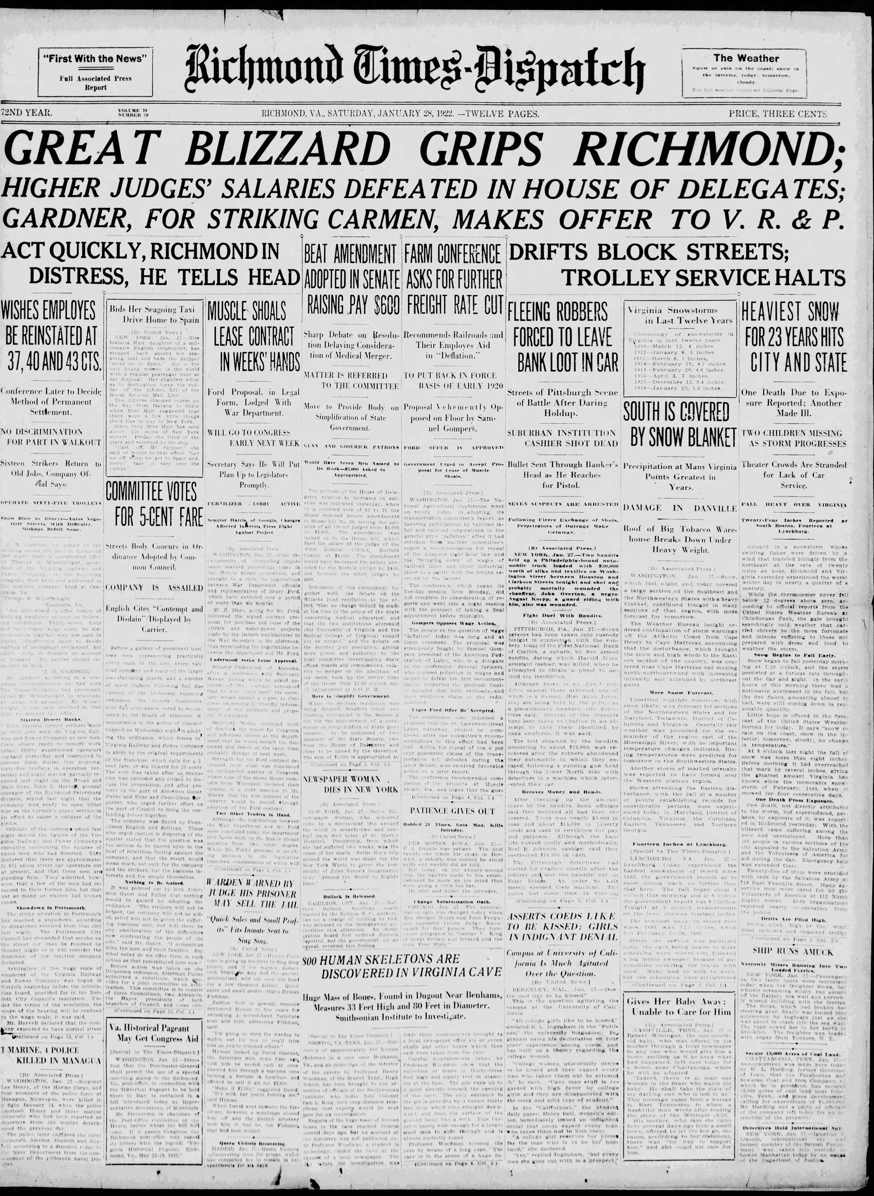
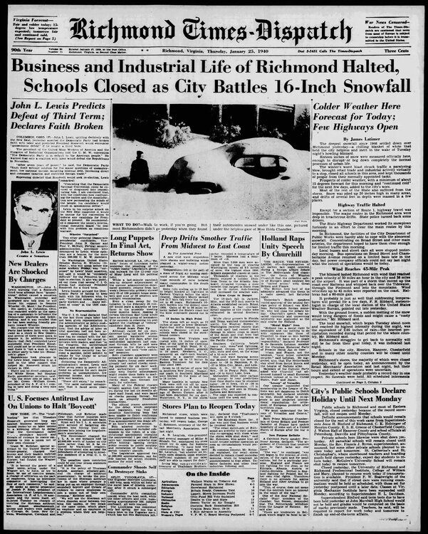
There no question, we used to be a legit snow town. Can you imagine some of these headlines today?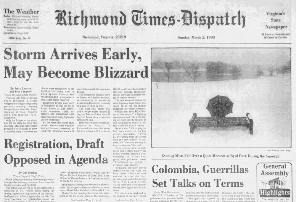


-
Richmond Metro/Hampton Roads Area Discussion
RIC Airport replied to RIC Airport's topic in Mid Atlantic
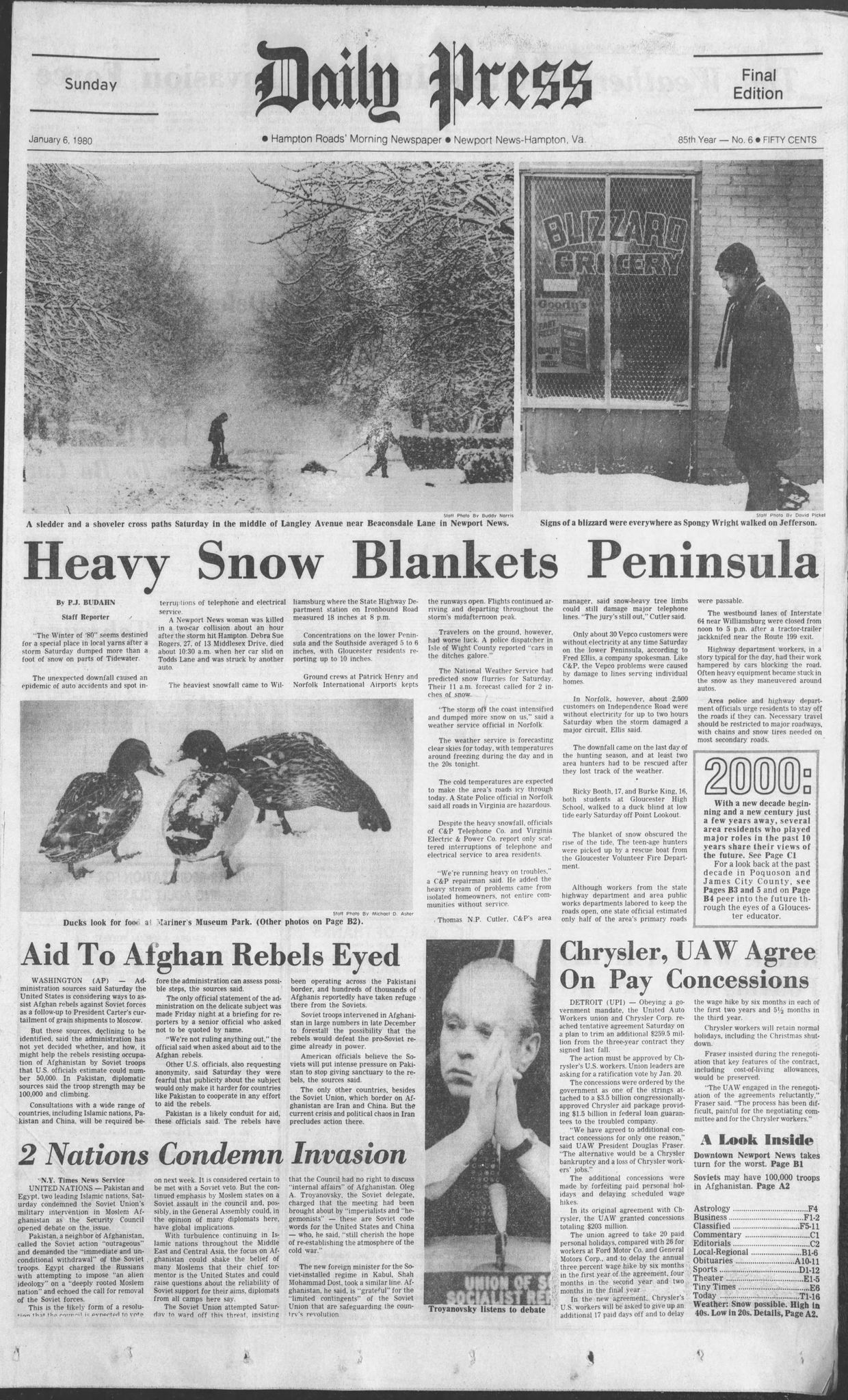
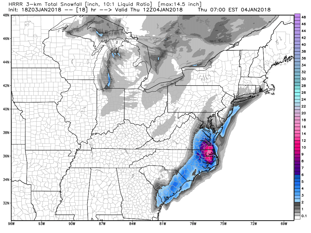
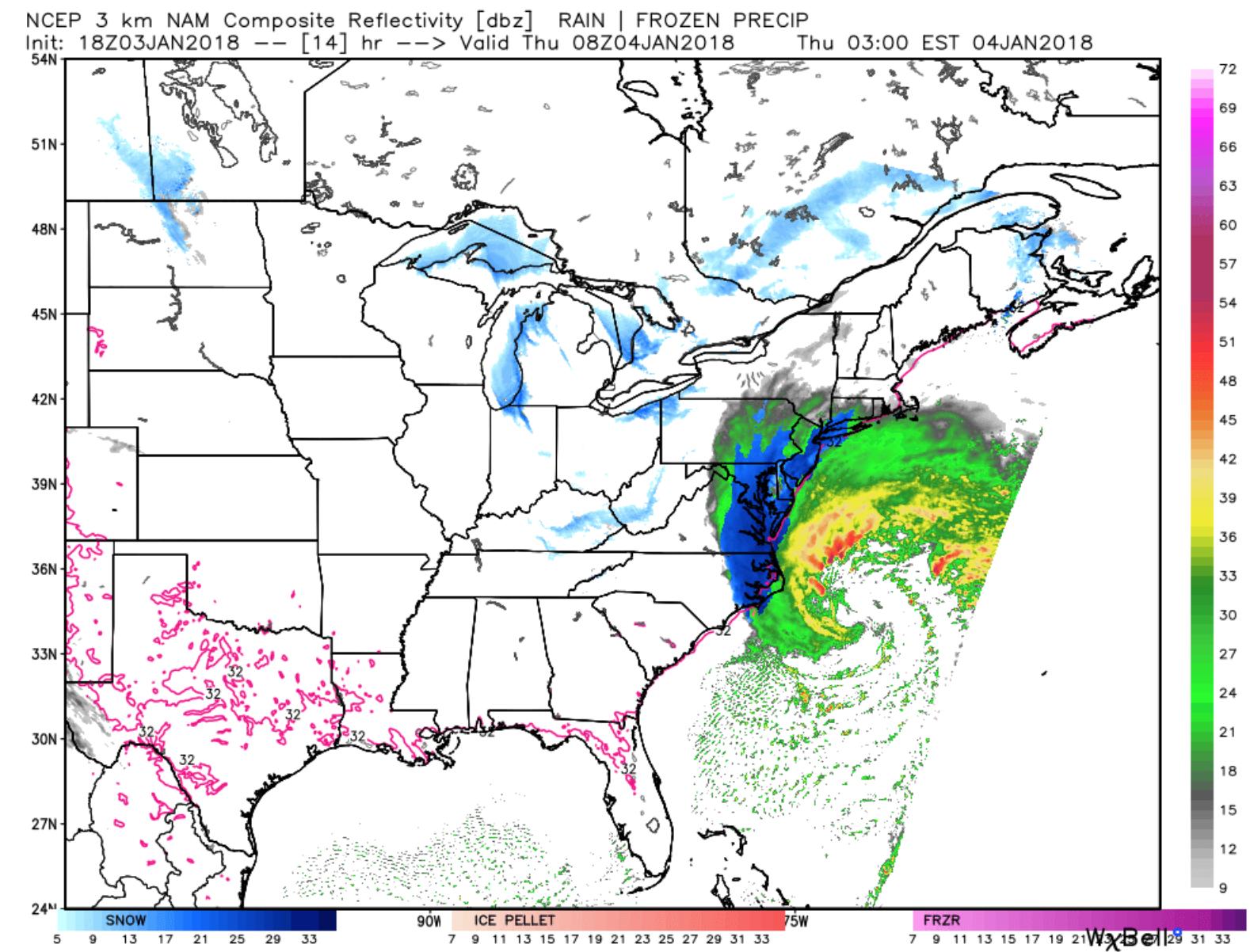
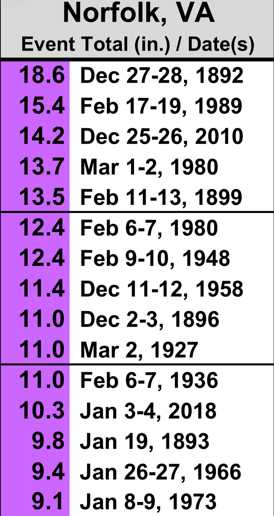
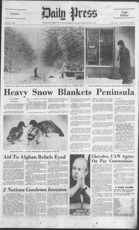
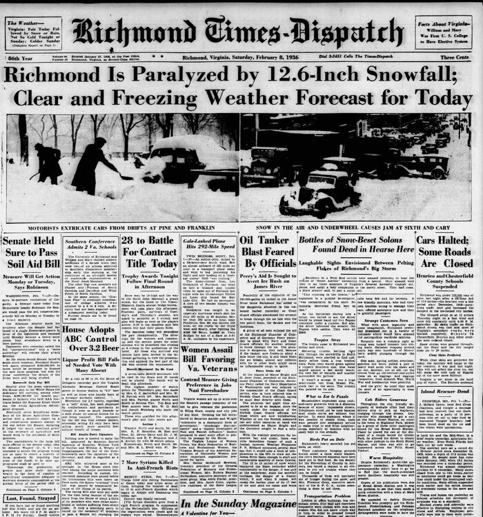
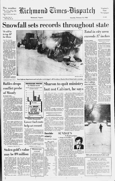
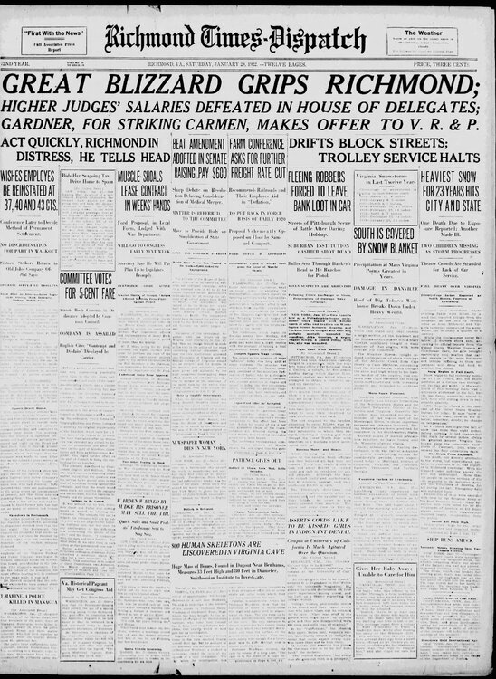
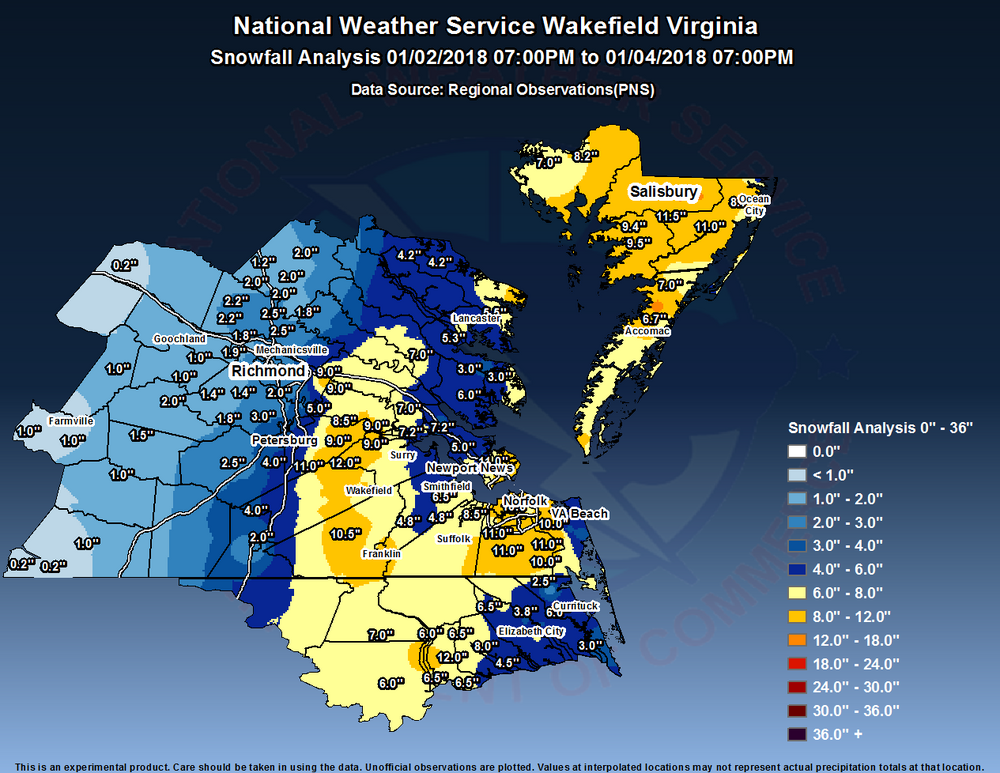
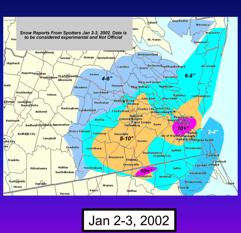
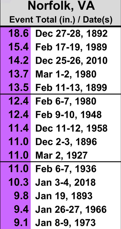
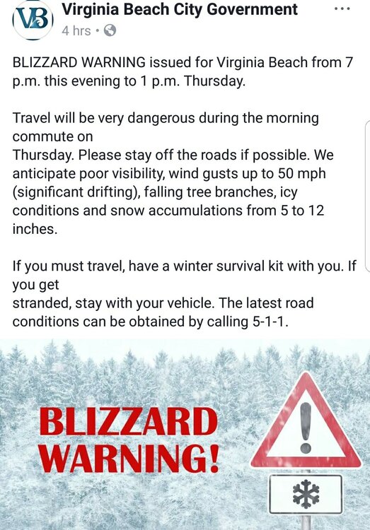
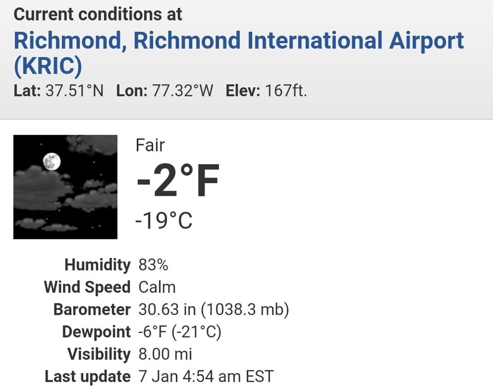
To cheer everyone up, today marks the sixth anniversary of the blizzard that struck E NC and VA, which was the second blizzard to hit Hampton Roads in less than a year. The storm, which was verified as a blizzard at ORF recorded 10.3” of snow. However, due to the storm's track, Richmond only recorded 3.0”. This event was the eleventh biggest snowstorm on record at ORF since snowfall records began in 1891. This period featured one of the coldest stretches we have experienced since the winter of 1995-96. On January 7, 2018, the temperature in RIC dropped to -3°F, the first time it had dropped below 0°F since the year 2000. Richmond remained below freezing for four consecutive days, but it would have been eight days in a row had it not been for hitting 34°F one day in the middle. It is worth noting that the most consecutive days below freezing at RIC was twelve days back in the winter of 1935-36. Here are some images I saved. Additionally, yesterday marked the anniversary of the January 3, 2002, snowstorm that affected our area. Richmond and Norfolk both experienced a decent snowstorm with 7.7 inches and 7.2 inches of snowfall, respectively. It is noteworthy that this storm occurred during an otherwise mild winter season throughout the east..png.049bc23842577578ba721c6c8079b9c4.png)

-
Richmond Metro/Hampton Roads Area Discussion
RIC Airport replied to RIC Airport's topic in Mid Atlantic
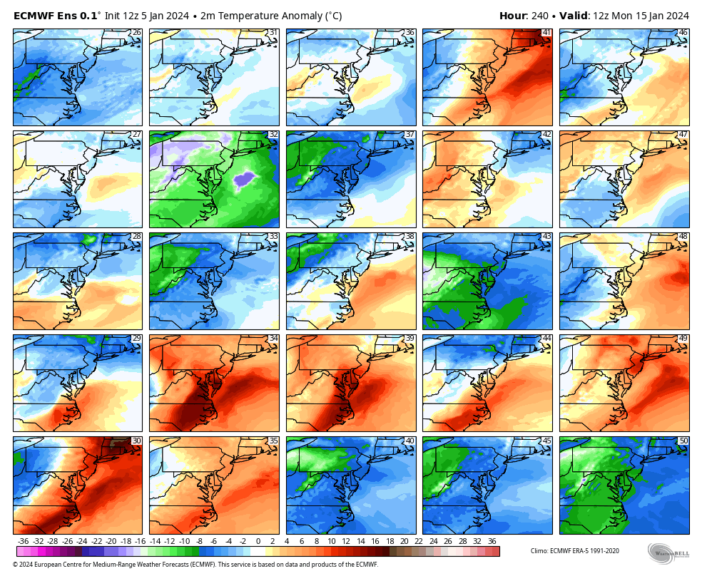
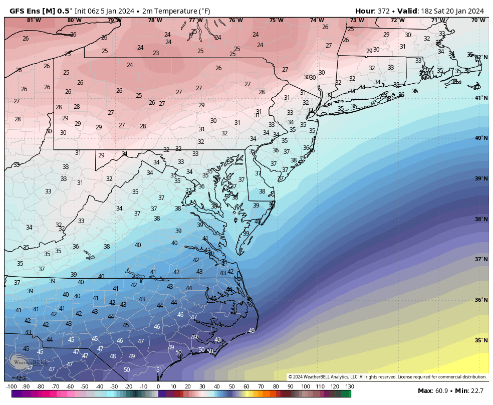
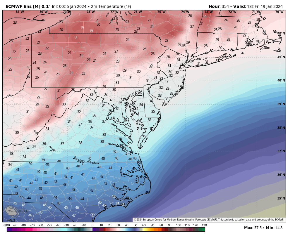
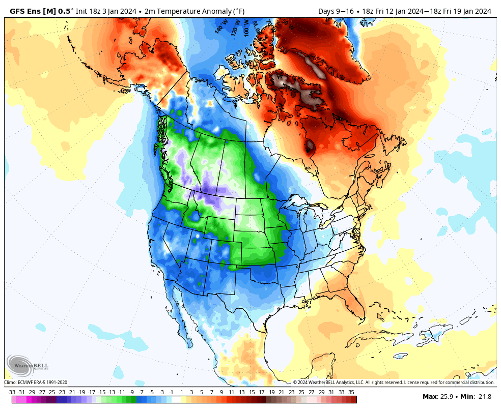
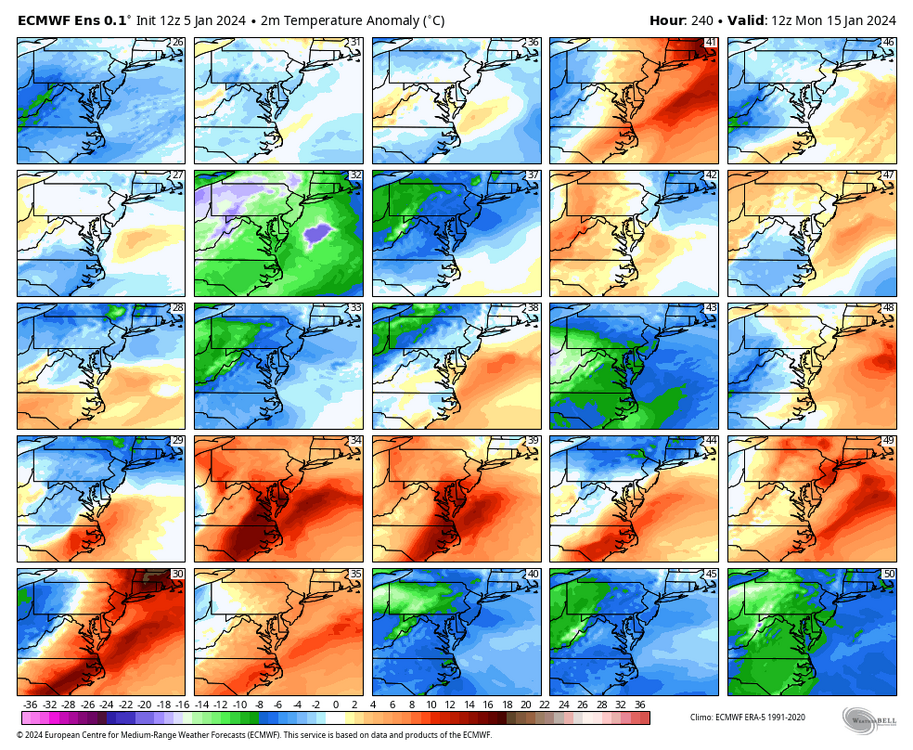
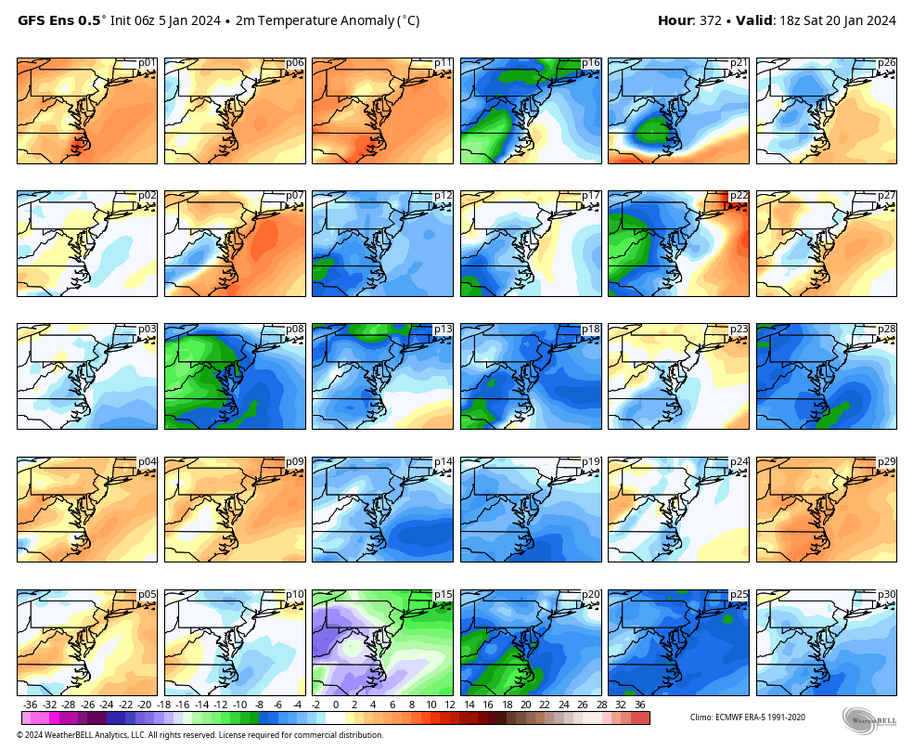
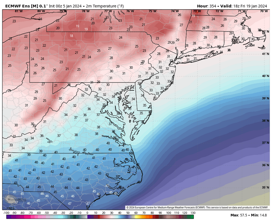
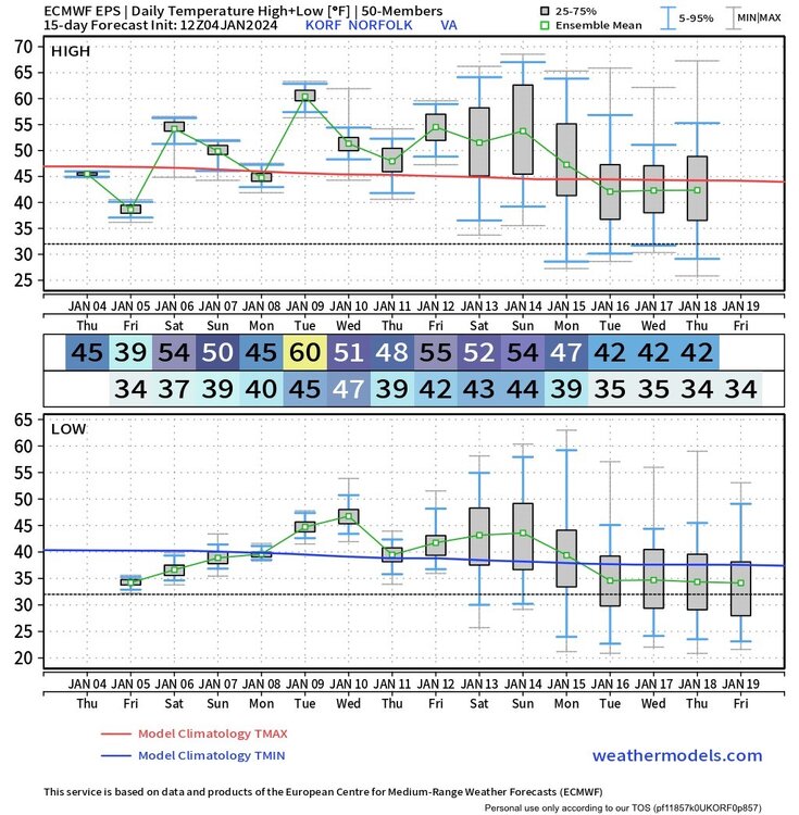
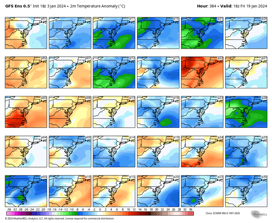
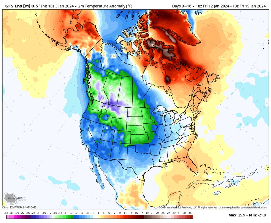
The ensemble mean was in the low-mid 40s for that day. But, you can see a handful of members are torching us, which is probably skewing the mean too warm. Also, you can see on the last map that we are still warm in the east for that period, but it's clear that the warm departures are being erased by then.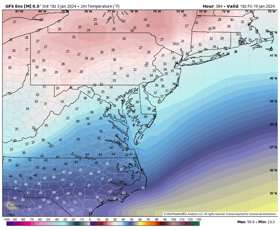
-
Richmond Metro/Hampton Roads Area Discussion
RIC Airport replied to RIC Airport's topic in Mid Atlantic
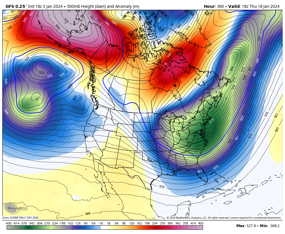
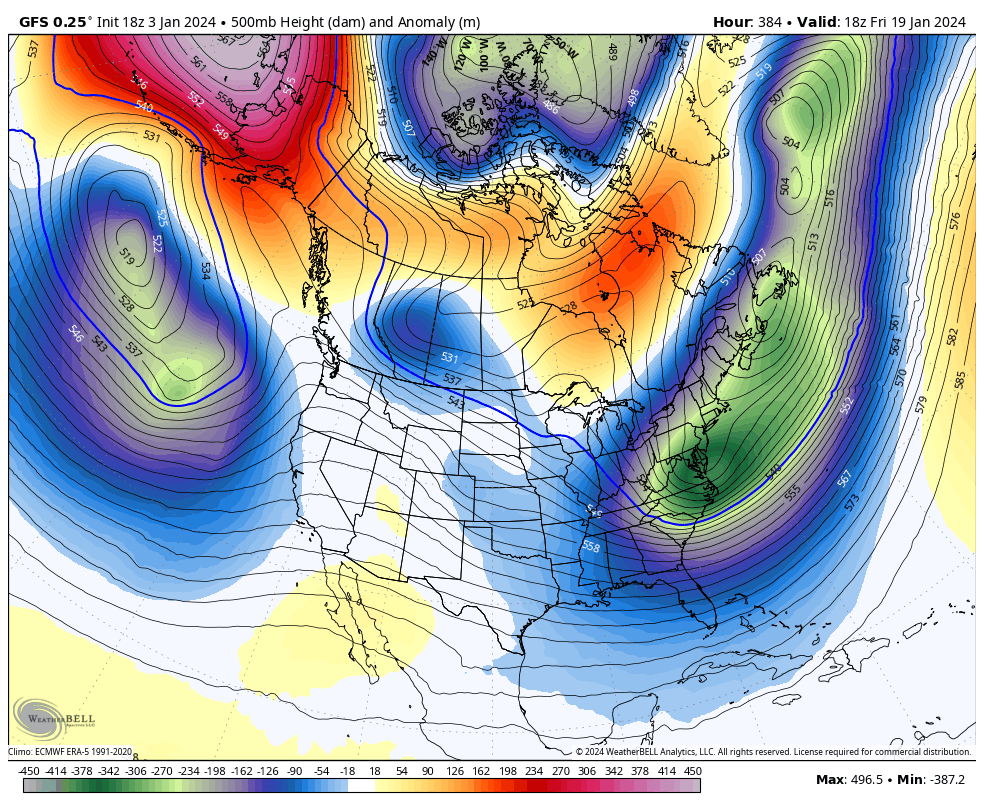
The PV drops out of Canada and into the plains and the cold eventually moves east. Hopefully there after there is moisture headed our way. Not giving up on the winter, @Conway7305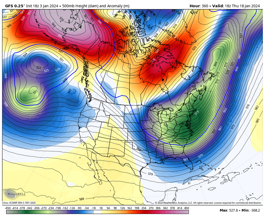

-
Richmond Metro/Hampton Roads Area Discussion
RIC Airport replied to RIC Airport's topic in Mid Atlantic
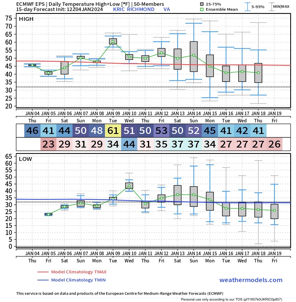
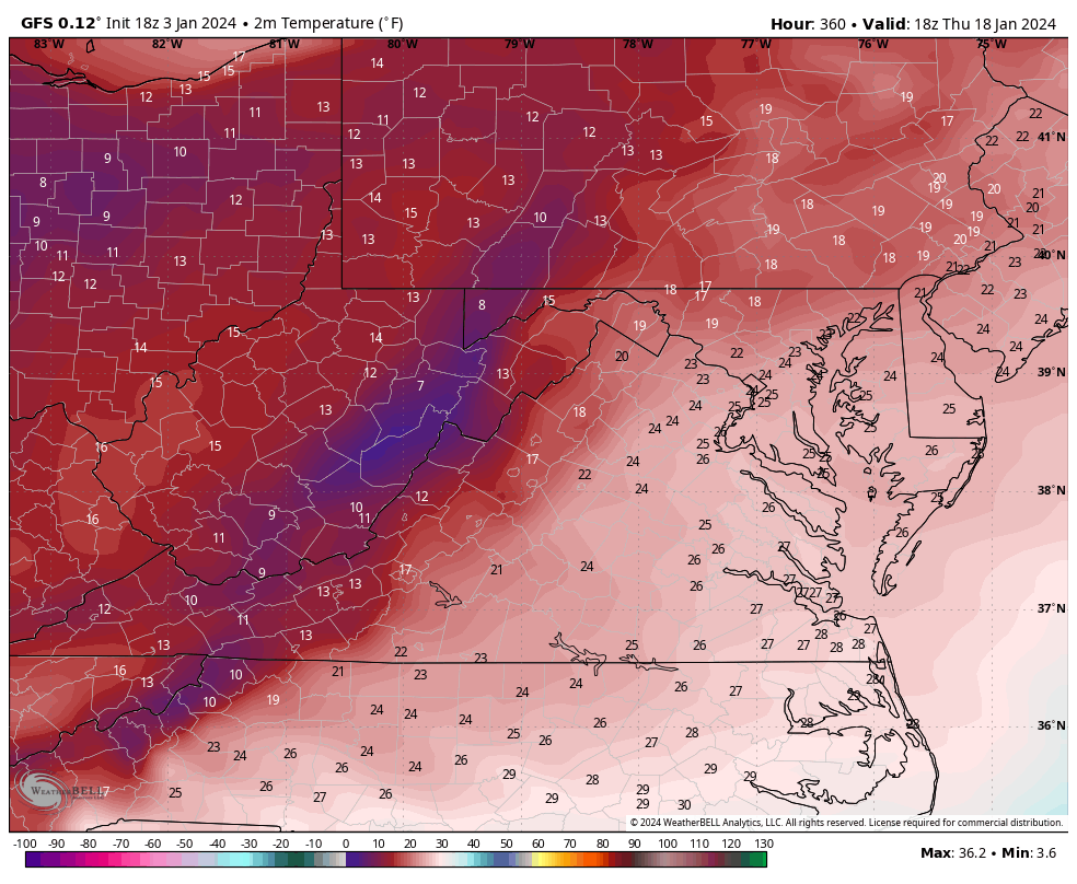
Yup, I was just looking at that. I'll take a look at the ensembles as they come in. But, the end of the GFS had highs in the low-mid 20s two days in a row.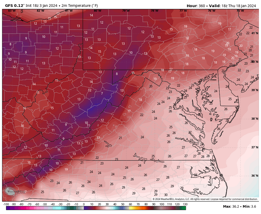
-
Richmond Metro/Hampton Roads Area Discussion
RIC Airport replied to RIC Airport's topic in Mid Atlantic
I looked at the 12Z EPS, and while it's moving in the right direction, it's still not close to where we need it to be. However, anything is better than nothing. If we can get a ridge with the correct orientation, timed with a shortwave, it could potentially push the storm track further south and east, while also bringing in colder air. This would make us less prone to experiencing mid-level torching with the incoming storms from the south.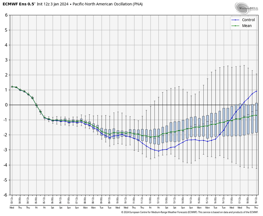
-
Richmond Metro/Hampton Roads Area Discussion
RIC Airport replied to RIC Airport's topic in Mid Atlantic
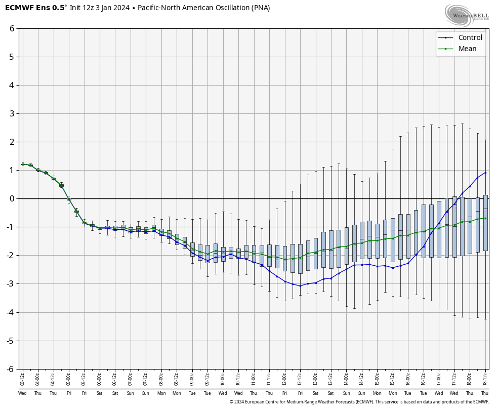
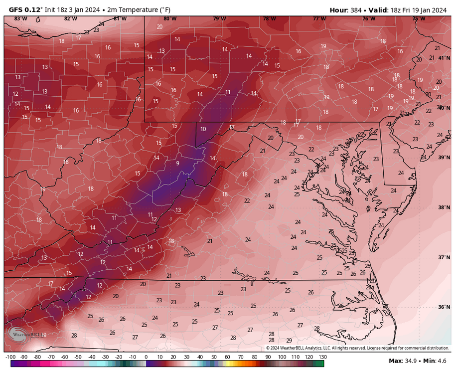
I agree, tried to explain that yesterday in an earlier post, in case you missed it. That western trough (-PNA) has been a big issue. -
Richmond Metro/Hampton Roads Area Discussion
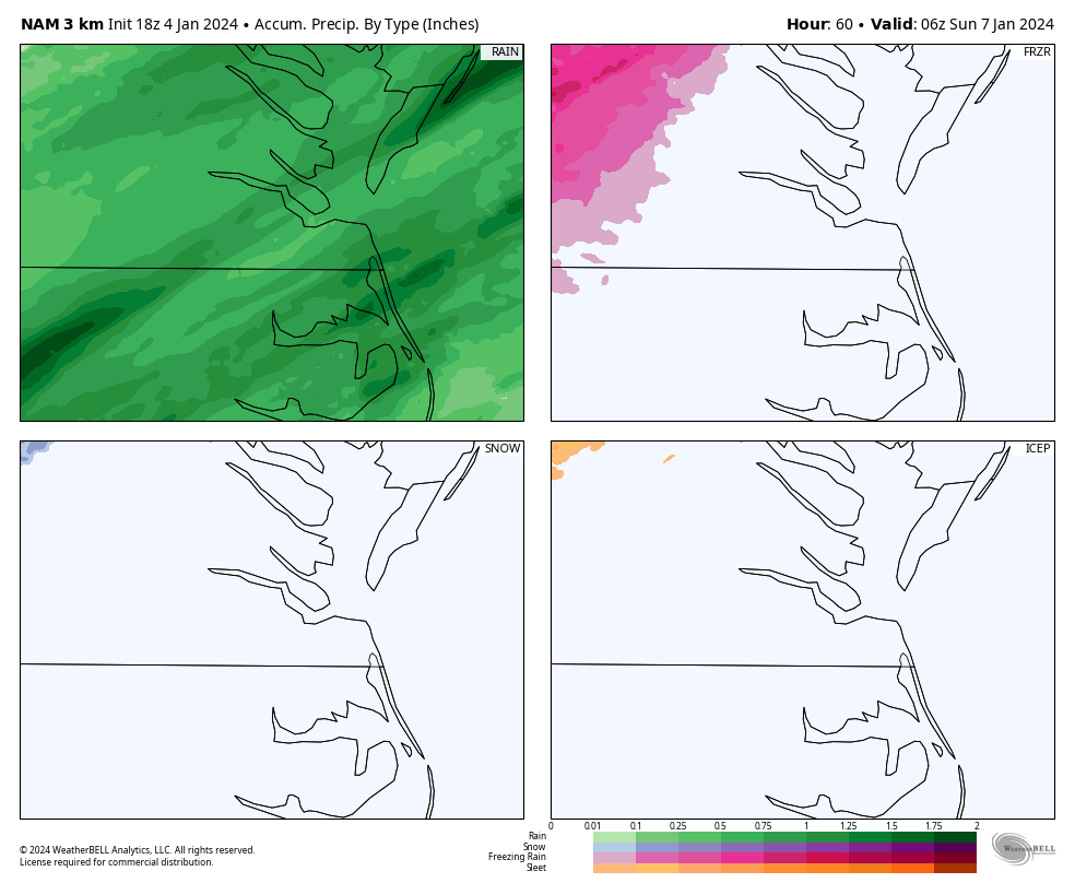
RIC Airport replied to RIC Airport's topic in Mid Atlantic
The mid week storm is trending colder. There could be another round of frozen precip, especially on the west side of RIC, before flipping over to rain. Will need to monitor the trends.
-
Richmond Metro/Hampton Roads Area Discussion
RIC Airport replied to RIC Airport's topic in Mid Atlantic
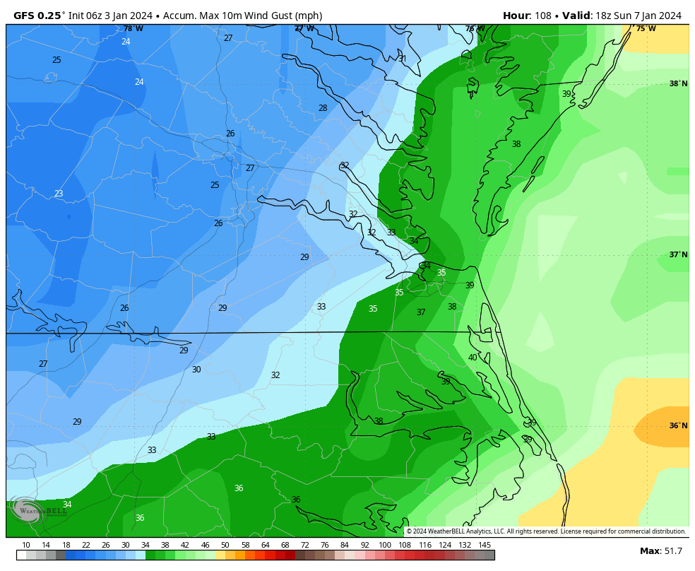
I am seeing wind gusts 20-30mph for C VA on Sunday, @wasnow215