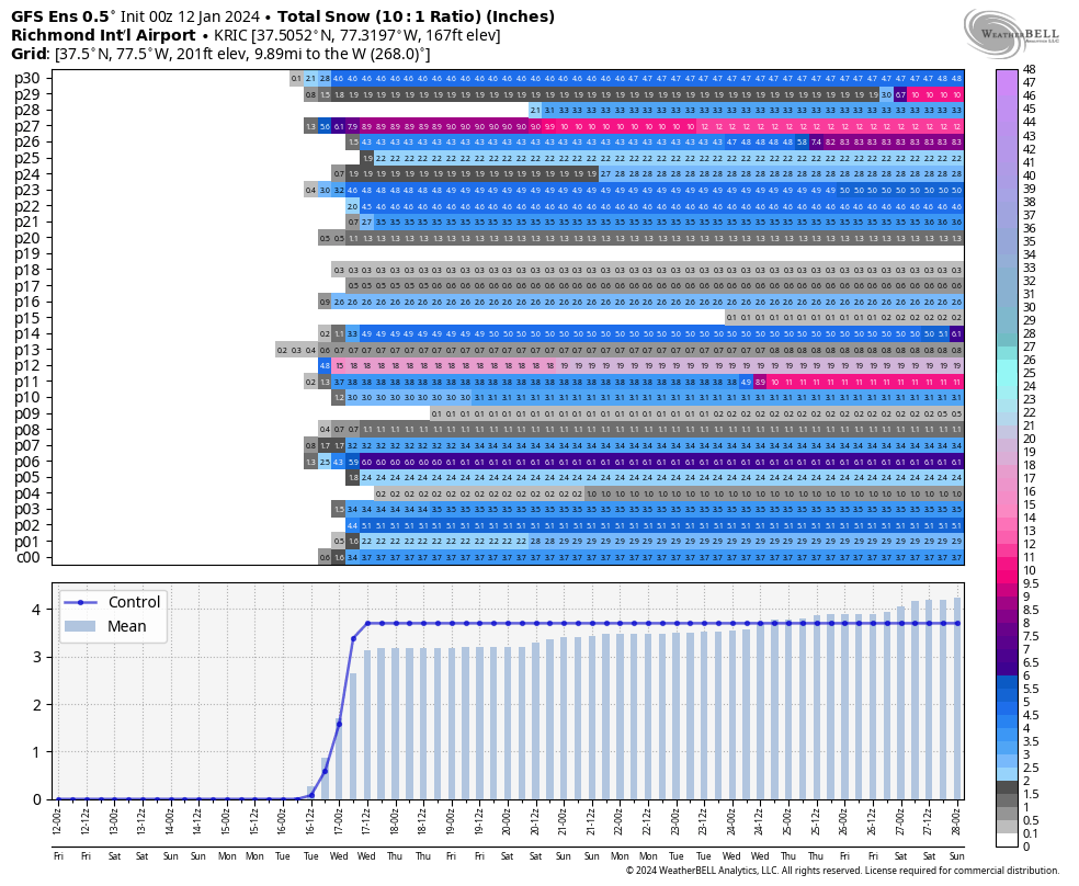
RIC Airport
-
Posts
2,586 -
Joined
-
Last visited
Content Type
Profiles
Blogs
Forums
American Weather
Media Demo
Store
Gallery
Everything posted by RIC Airport
-
Richmond Metro/Hampton Roads Area Discussion
RIC Airport replied to RIC Airport's topic in Mid Atlantic
The 12 GEFS continue to indicate we are still in the game, but the snowfall mean for the Tuesday-Wednesday period did drop some.
-
Richmond Metro/Hampton Roads Area Discussion
RIC Airport replied to RIC Airport's topic in Mid Atlantic
I've pointed that out a few times over the last few weeks. I believe I now know why @ldub23 has a weenie tag on his account. And I am beginning to think that willy-nilly posting the 384-hour GFS in the Mid Atlantic long range thread, where many admins and moderators hang out, with no analysis or proper context had much to do with it. -
Richmond Metro/Hampton Roads Area Discussion
RIC Airport replied to RIC Airport's topic in Mid Atlantic
Yeah, it's never good when one of the major global models doesn't come on board, and others tend to cave in that direction. But, as I've seen, strange things can happen within 72 hours. I just wanted to explain what this GFS run did in our region. Not that we should take it verbatim. I don't believe the 12Z GFS solution is correct, just how it evolved and suddenly threw a bunch of precip back at the last minute. -
Richmond Metro/Hampton Roads Area Discussion
RIC Airport replied to RIC Airport's topic in Mid Atlantic
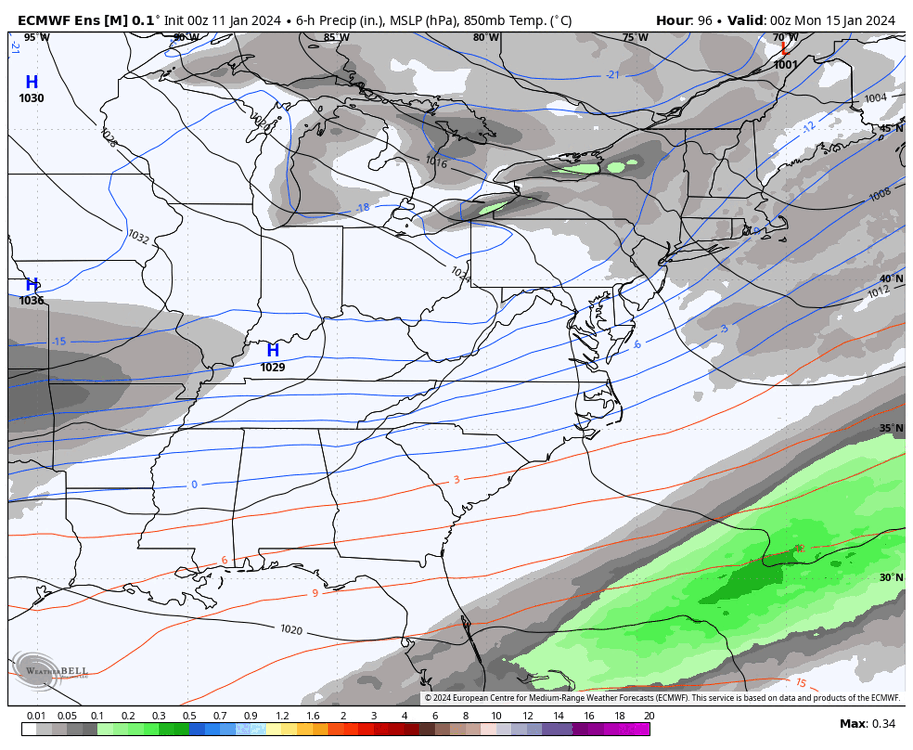
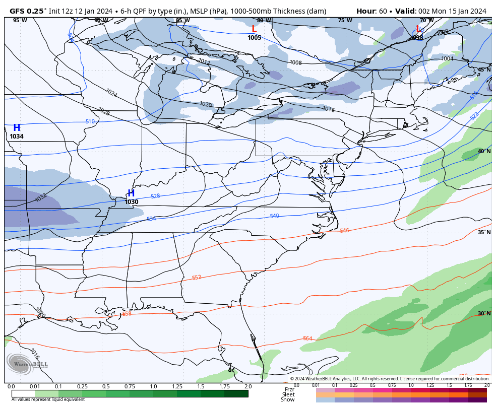
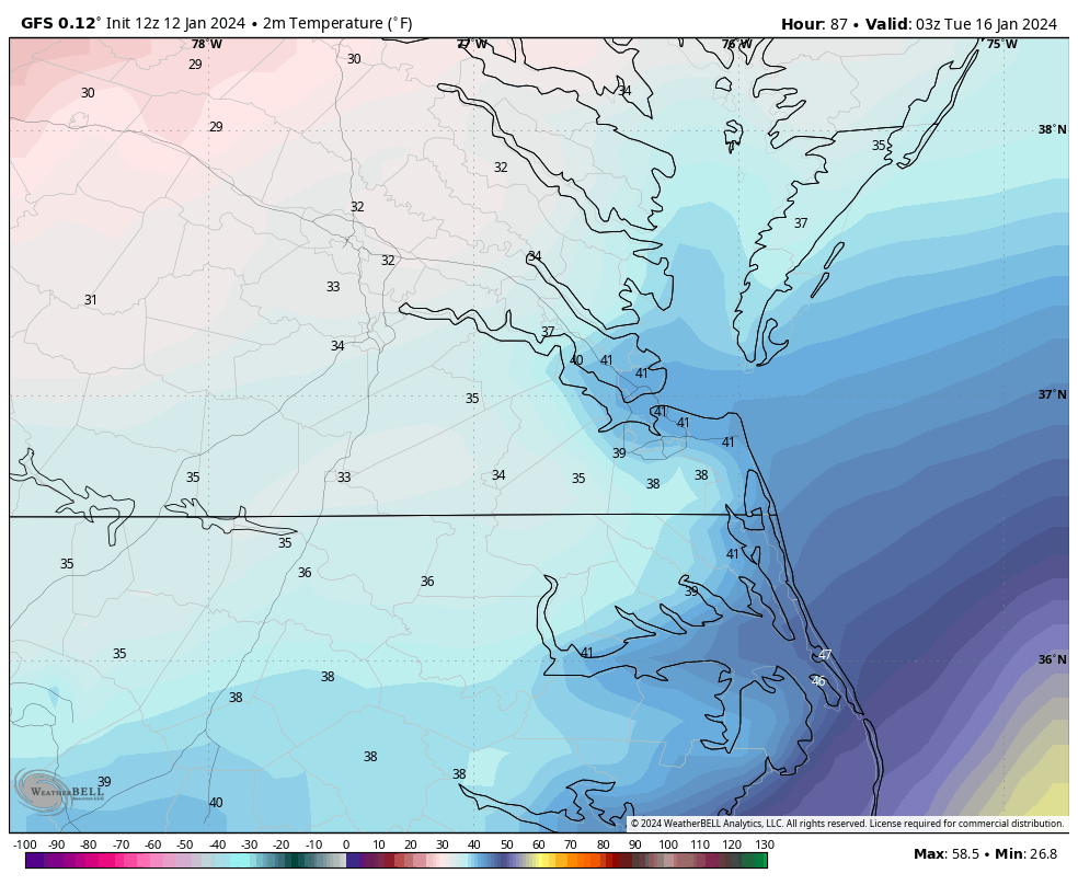
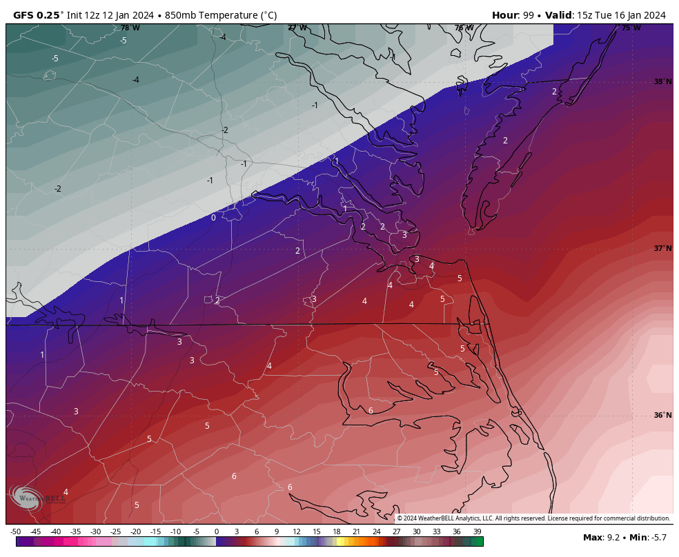
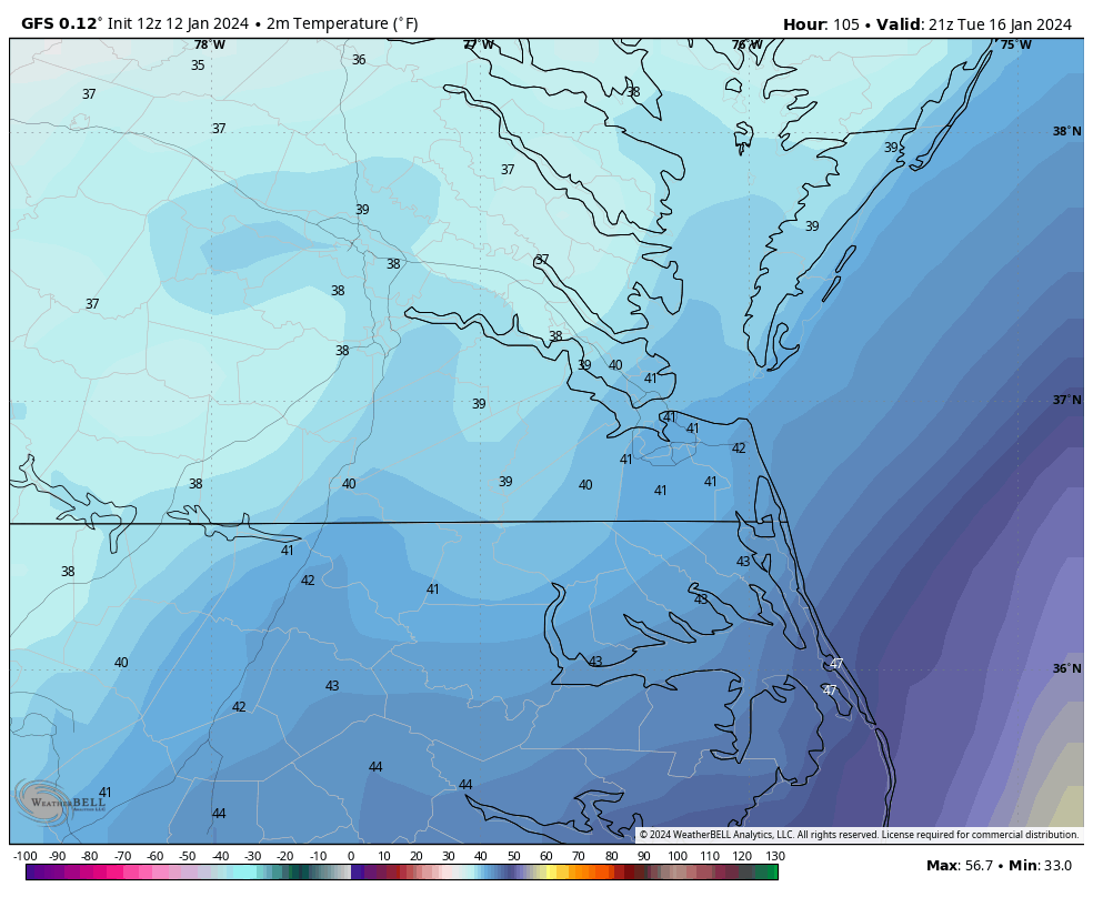
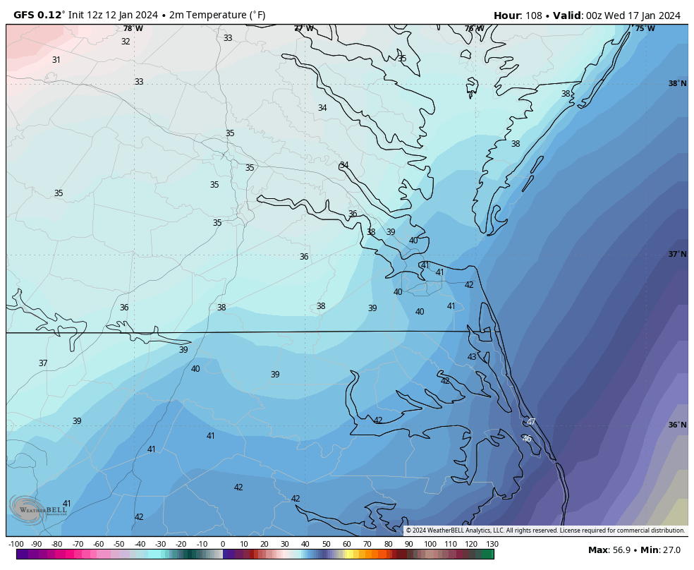
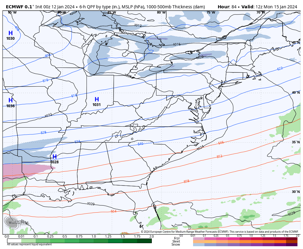
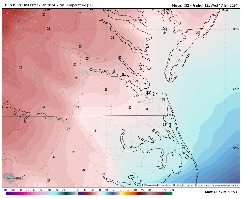
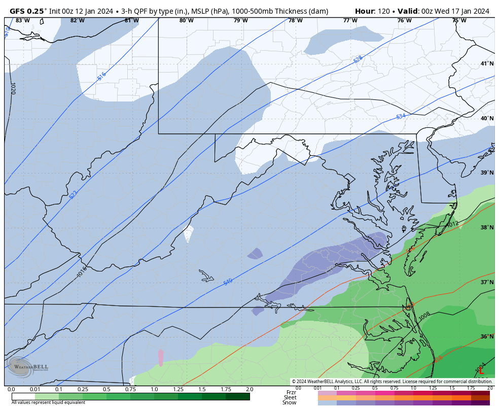
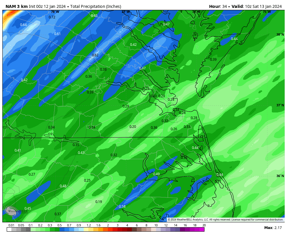
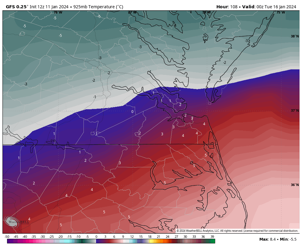
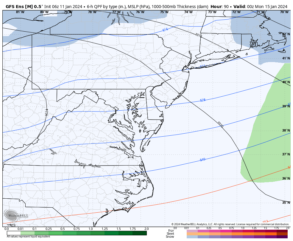
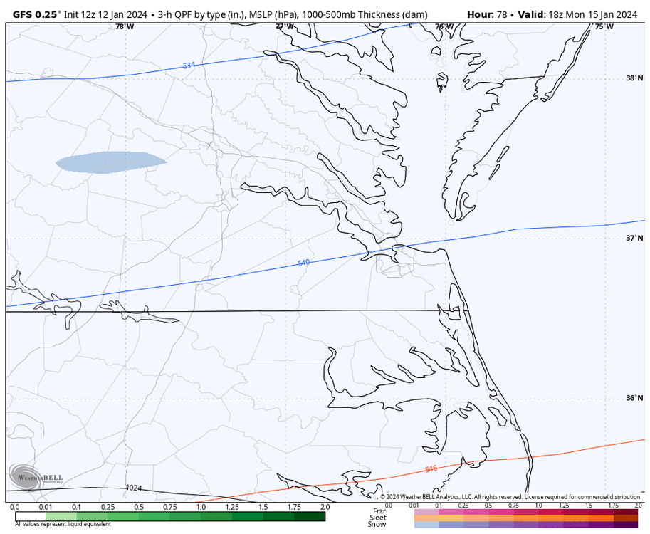
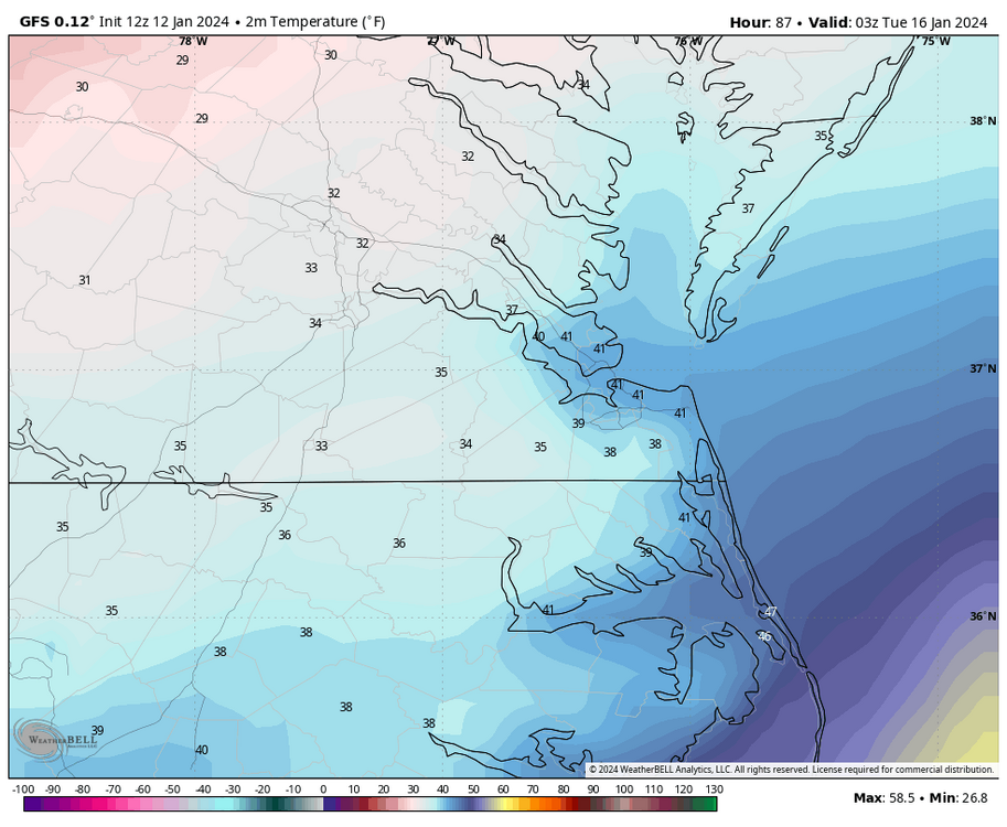
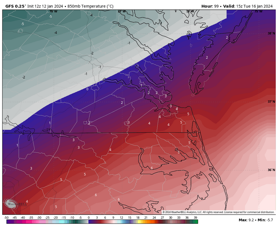
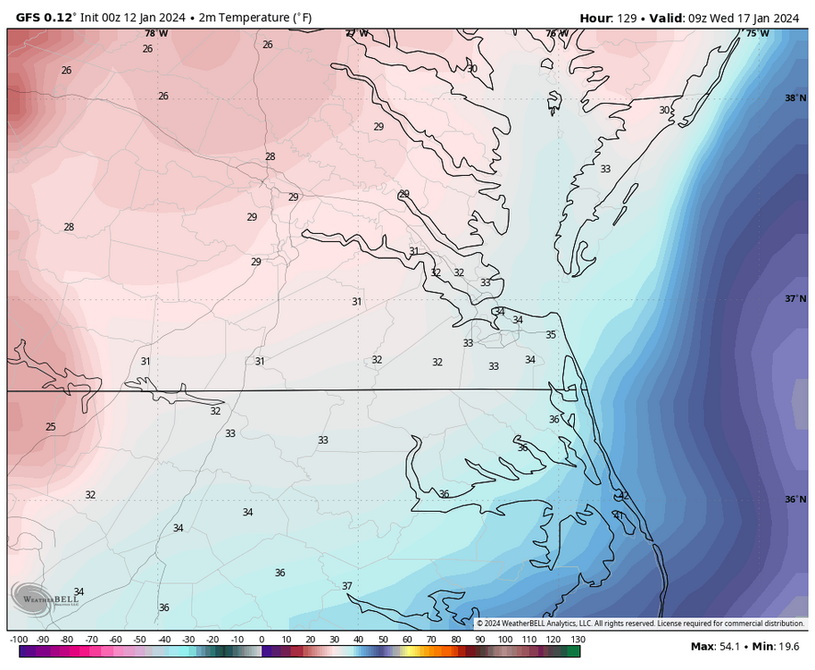
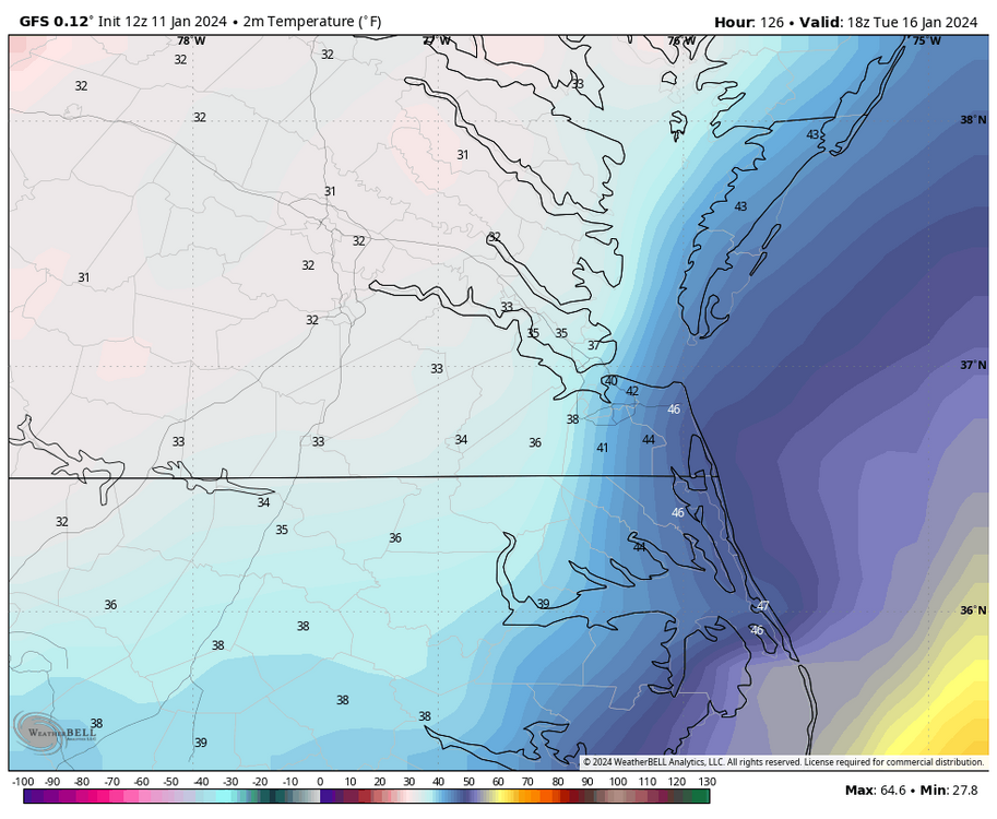
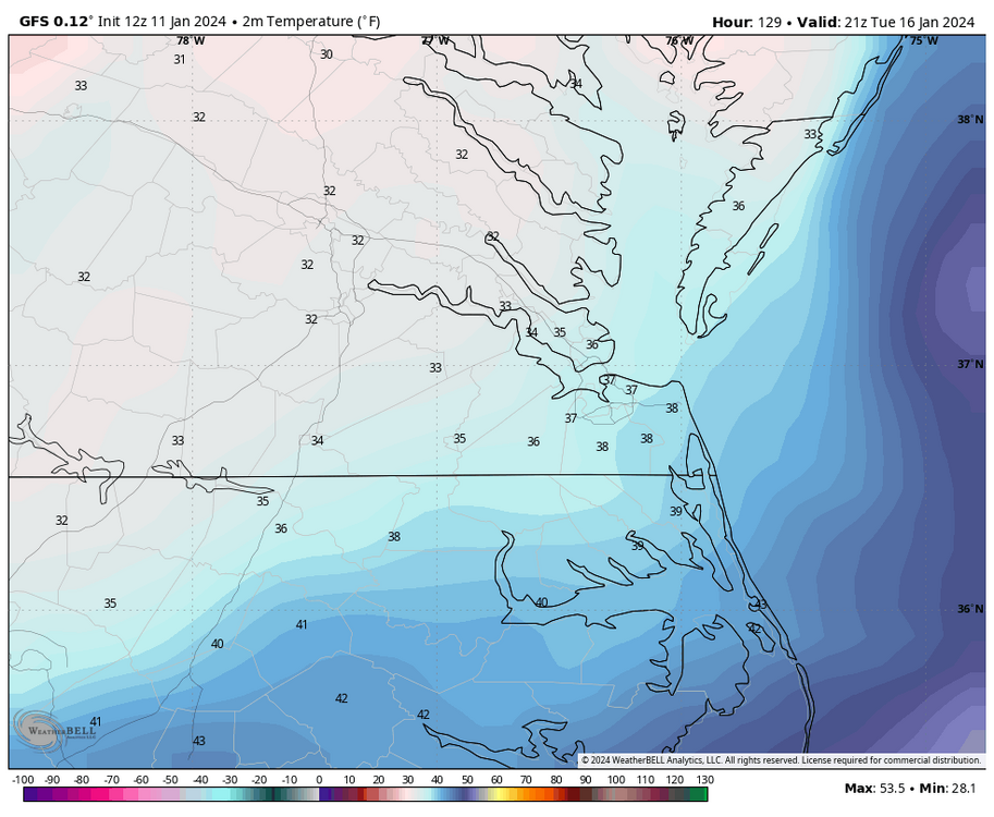
So, looking at the 12Z GFS, some precip begins moving into the state between 10pm Monday and 1am Tuesday, but this precip area (snow) primarily stays north and west of Richmond. Surface temps around RIC are around freezing but start to increase as the low approaches. More precip (rain) enters NE NC and southside Hampton Roads between 4am and 7am, while RIC and most of C VA remain dry slotted between the two areas of precip. By 10am Tuesday, RIC had risen to 37°F, and ORF was at 43°F as the low approached our latitude. There is an area of light rain from the Eastern Shore down into Eastern NC. By 4pm, RIC is at 38°F as more precip begins to develop south and east of RIC. By 7pm, the low is well east of Virginia but somehow moisture begins to blossom well to the west, and that is when snow begins to break out around RIC, and the temps begin to drop toward freezing. Light snow continues to fall in the Richmond area from about 7pm Tuesday and then becomes moderate to heavy between 1am and 4am Wednesday as temps continue to fall. As temps continue to fall behind the departing low, the temperatures even in SE VA lower, and the heavier snow band moves SE and over all of Hampton Roads between 4am and 7am Wednesday before taping off shortly after that. The farthest north and west the 850°C line gets is at hour 99 (10am Tuesday). It stays south and east of RIC from just south of Petersburg and toward West Point. This suggests that it may be too warm only at the surface, at least initially, to snow should there is precip around in the RVA metro. But it's during this time most of C VA is in the dry slot anyway.


-
Richmond Metro/Hampton Roads Area Discussion
RIC Airport replied to RIC Airport's topic in Mid Atlantic
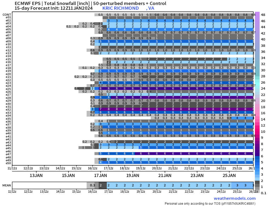
The good news is the 00Z GEFS and was still on par with the 18Z GEFS. Here is the entire run. For, @Stormpc


-
Richmond Metro/Hampton Roads Area Discussion
RIC Airport replied to RIC Airport's topic in Mid Atlantic
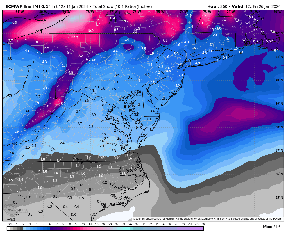
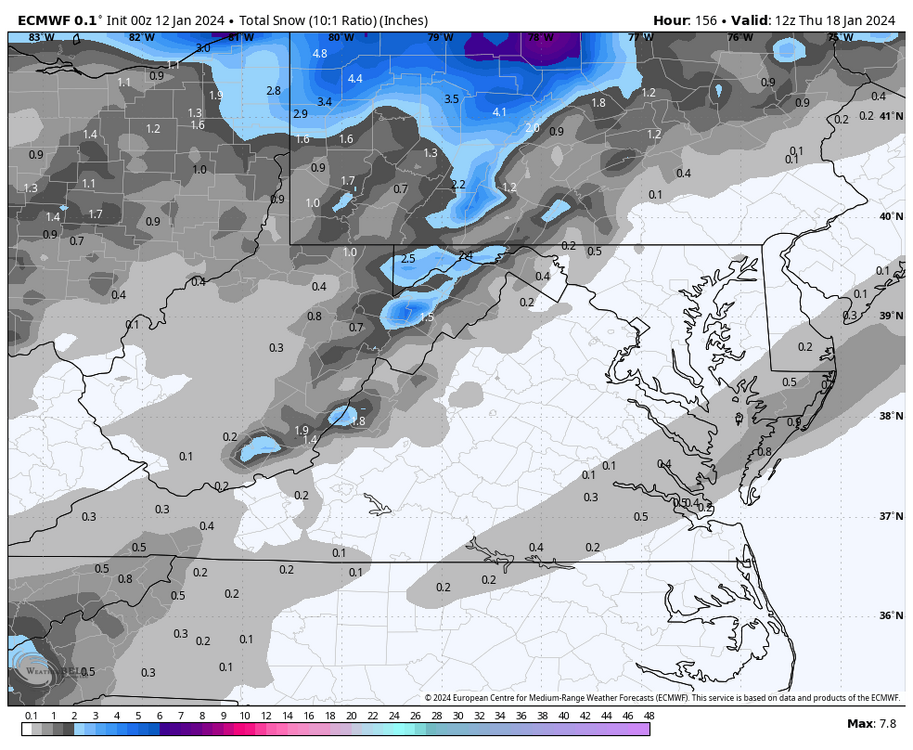
The Euro tried but did not come around for us at 00Z. Although it did try to drop some snow between Richmond and the Hampton Roads area. Hopefully, the EPS saves us after this, however I will not be staying up for them. Still a ways to go, so much can still change.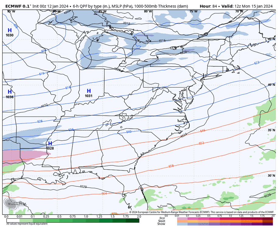
-
Richmond Metro/Hampton Roads Area Discussion
RIC Airport replied to RIC Airport's topic in Mid Atlantic
@Conway7305, they still look good to me.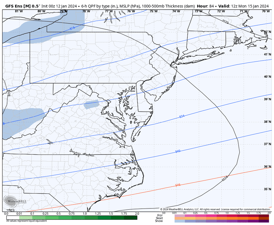


-
Richmond Metro/Hampton Roads Area Discussion
RIC Airport replied to RIC Airport's topic in Mid Atlantic
GFS looks to have RIC remaining below freezing for 4, possibly 5 days in a row. The last time that happened was back in January of 2018. We also need to watch the 21st. @Stormpc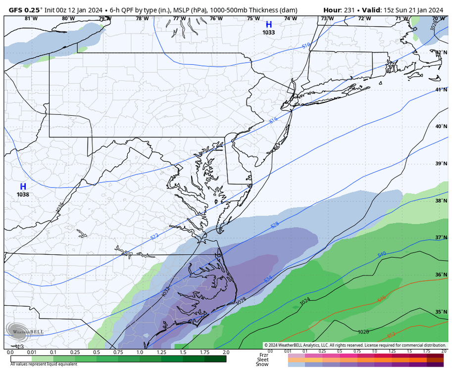
-
Richmond Metro/Hampton Roads Area Discussion
RIC Airport replied to RIC Airport's topic in Mid Atlantic
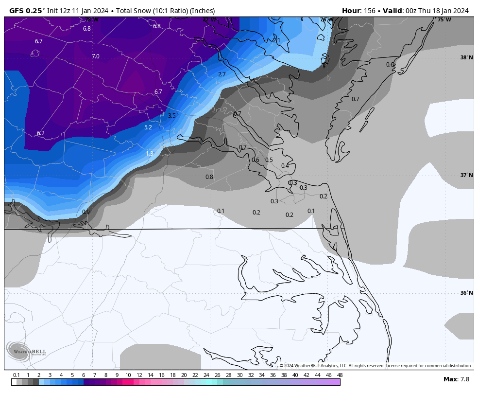
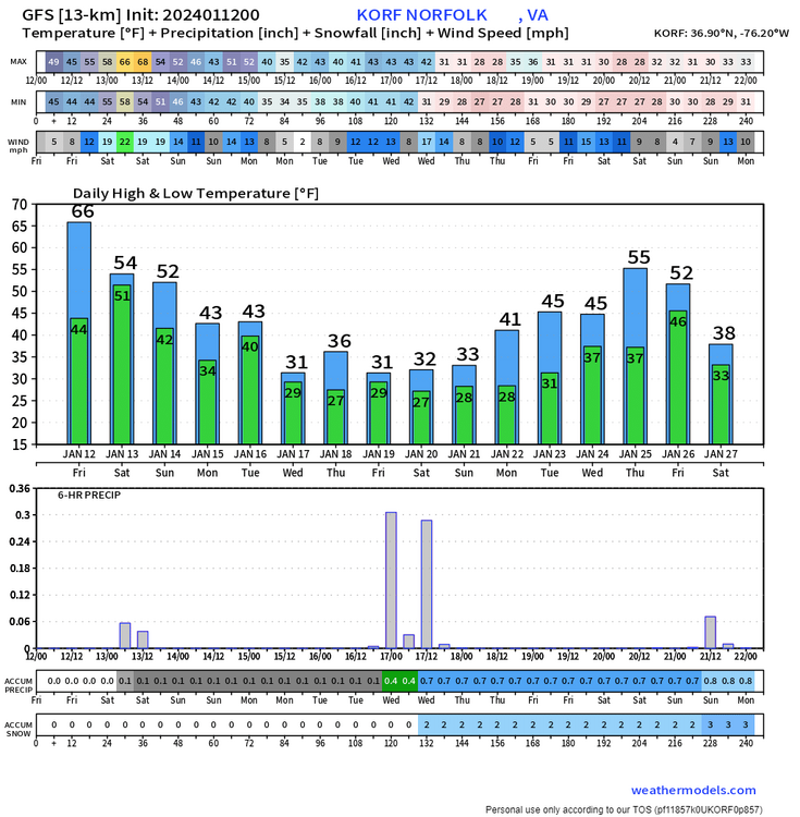
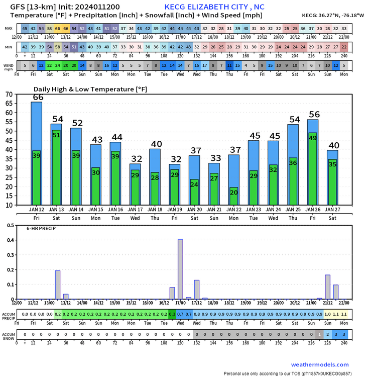
The GFS has a changeover to snow SE of Williamsburg between 1am and 4am Wednesday as the low pulls away. Looks to be a window of heavy snow, too, for all of Hampton Roads and down to about ECG. I think you'll definitely see flakes.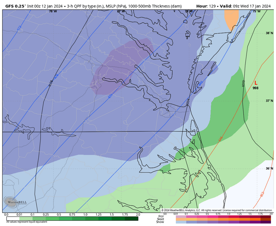
-
Richmond Metro/Hampton Roads Area Discussion
RIC Airport replied to RIC Airport's topic in Mid Atlantic
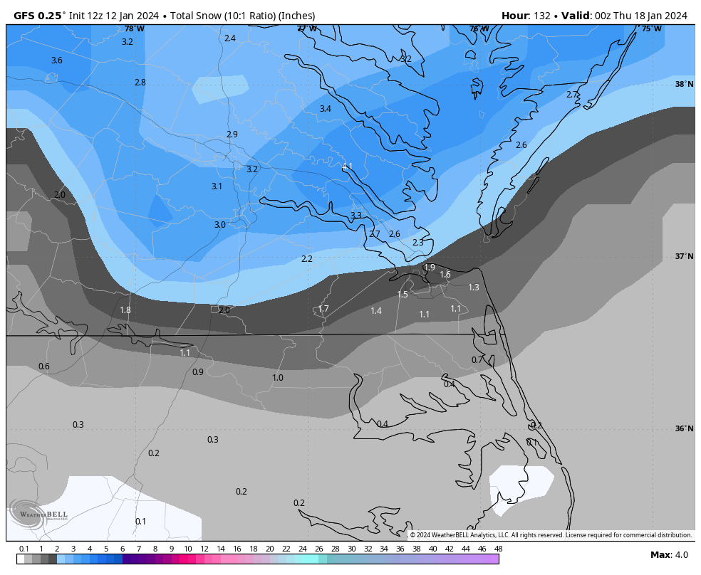
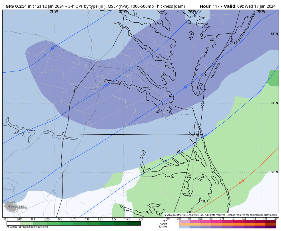
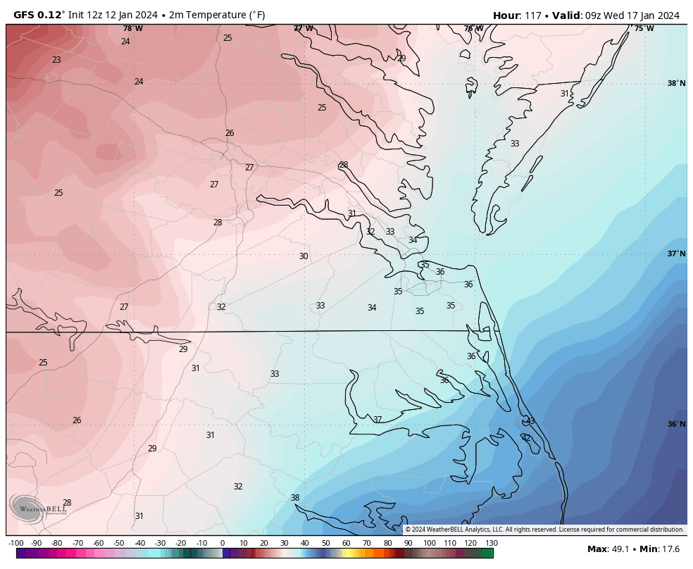
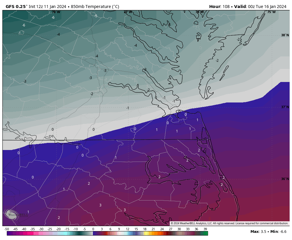
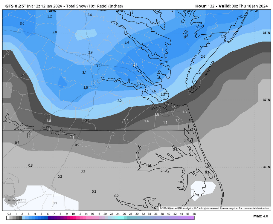
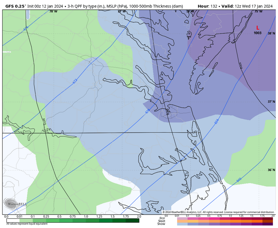
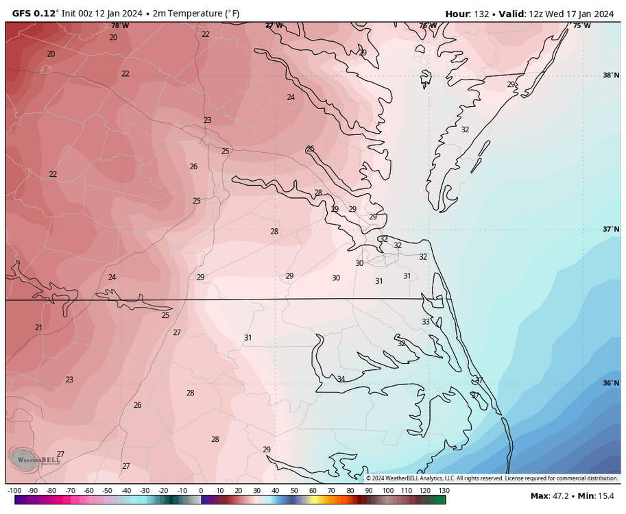
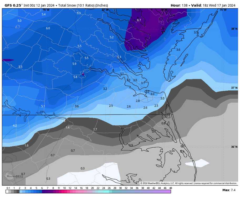
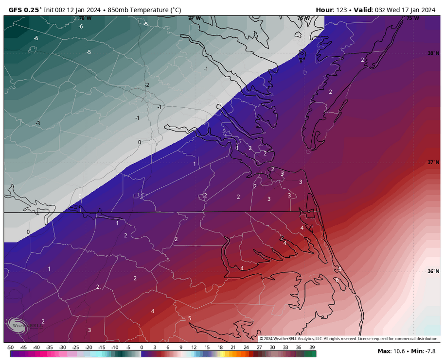
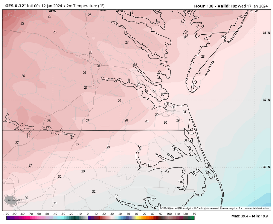
Looks like the 850 0°C line stays south of Petersburg and east of Richmond around West Point this run, so this is an all-snow event. Surface temperatures are around freezing at the start but drop into the 20s during the height of the event. The event's timing is also later, starting later in the day Tuesday.
-
Richmond Metro/Hampton Roads Area Discussion
RIC Airport replied to RIC Airport's topic in Mid Atlantic
00Z GFS was a great hit! Let's just hope it holds and Euro reverses its course from 12Z.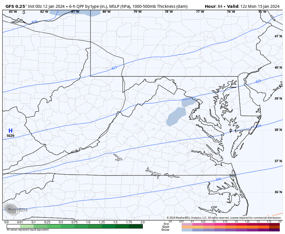


-
Richmond Metro/Hampton Roads Area Discussion
RIC Airport replied to RIC Airport's topic in Mid Atlantic
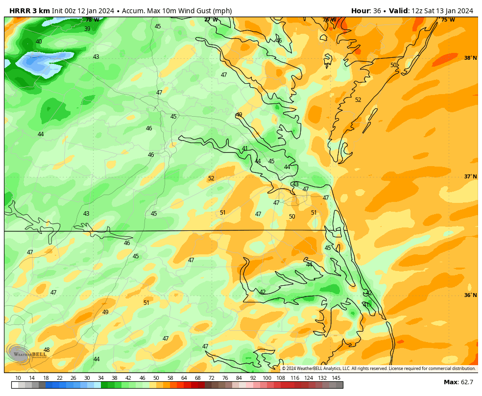
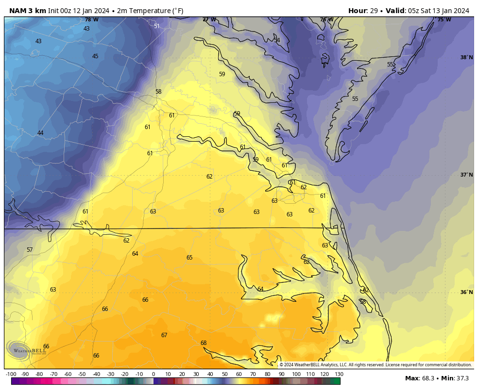
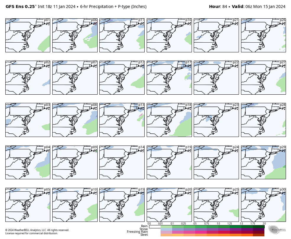
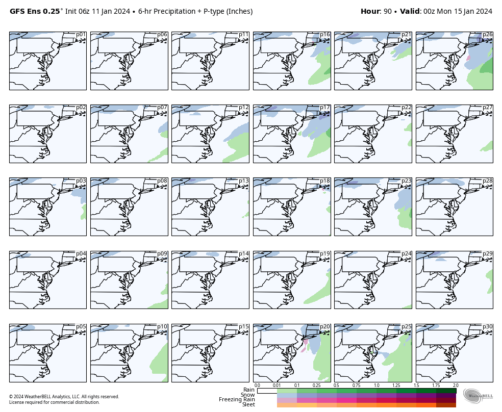
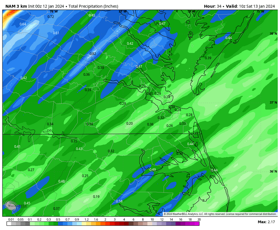
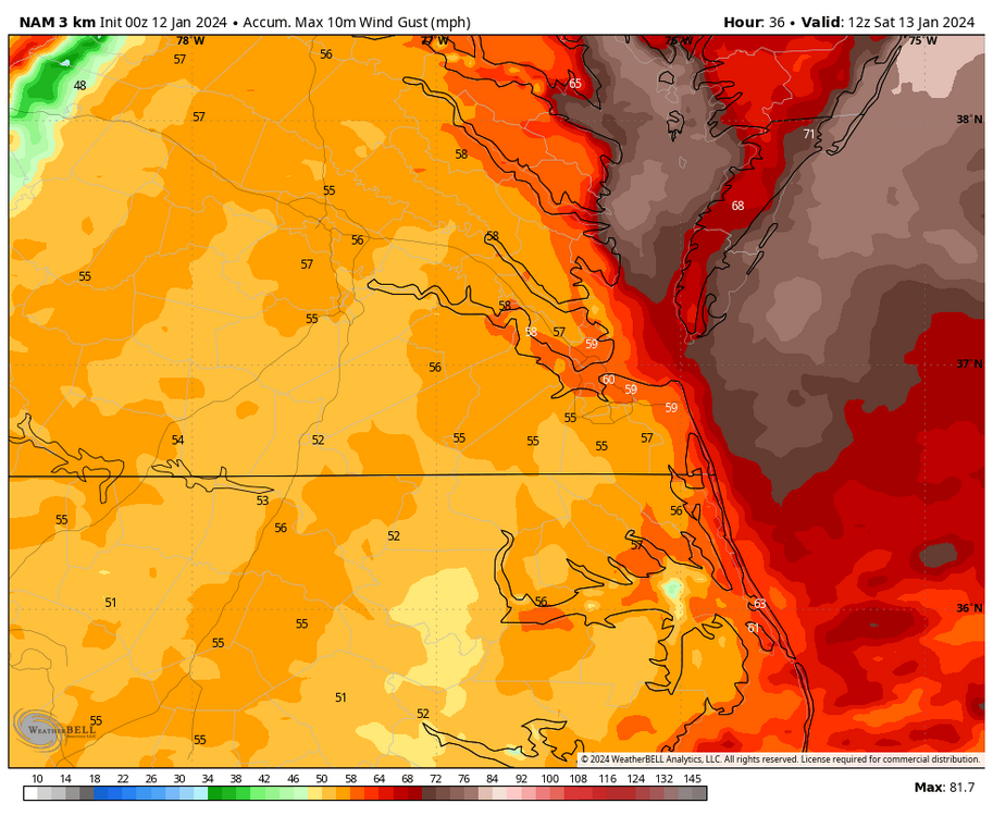
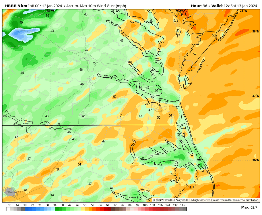
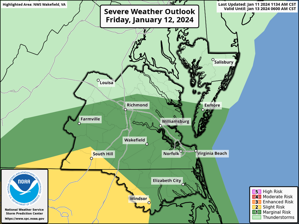
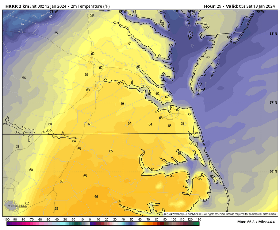
Depending on your location, the 00Z 3K NAM and HRRR have tomorrow’s rain entering our region between 4pm and 7pm. Although not as intense as Tuesday night's, both models have a squall line approaching Richmond between 11pm and midnight, then Hampton Roads and NE NC between 1am-and 3am before exiting off the coast. Rainfall totals are generally 0.25” to 0.50”, but higher amounts up to an inch in storm cells are possible. Flood watches are in the north and western parts of the state because there looks to be widespread 1-2" totals. For wind, the 3K NAM has the worst winds, arriving between 7pm and 1am in most areas. Verbatim, it has widespread 50-60mph gusts, with higher gusts along the immediate coastline. HRRR was not as aggressive with the winds as it generally had 40-45mph and 50-55mph only along the immediate coast, where AKQ has issued a wind advisory. SPC also has our area at a marginal risk for severe due to the potential for destructive winds. Interestingly, all models have surface temperatures starting in the low-mid 30s inland and upper 30s to low 40s toward the coast but will peak into the low-mid 60s toward midnight/1am before finally cooling down before sunrise Saturday morning.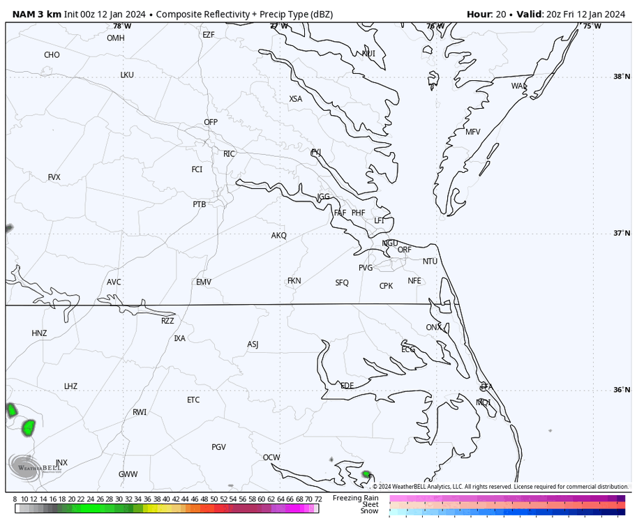

-
Richmond Metro/Hampton Roads Area Discussion
RIC Airport replied to RIC Airport's topic in Mid Atlantic
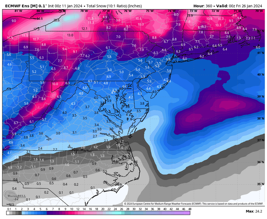
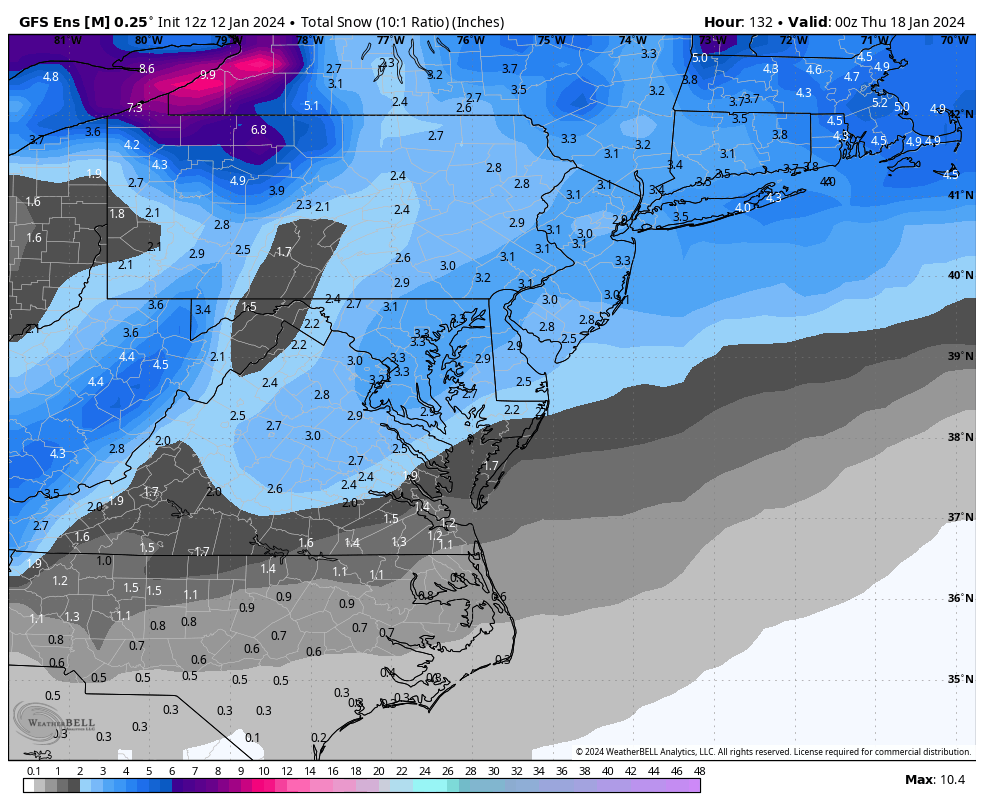
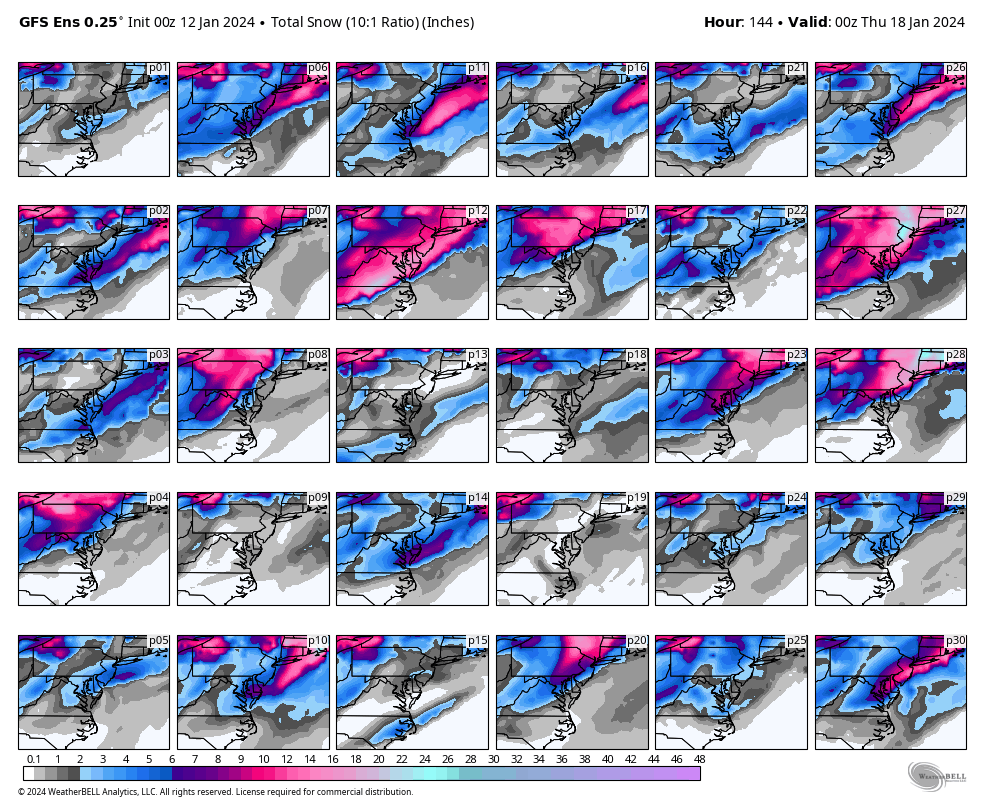
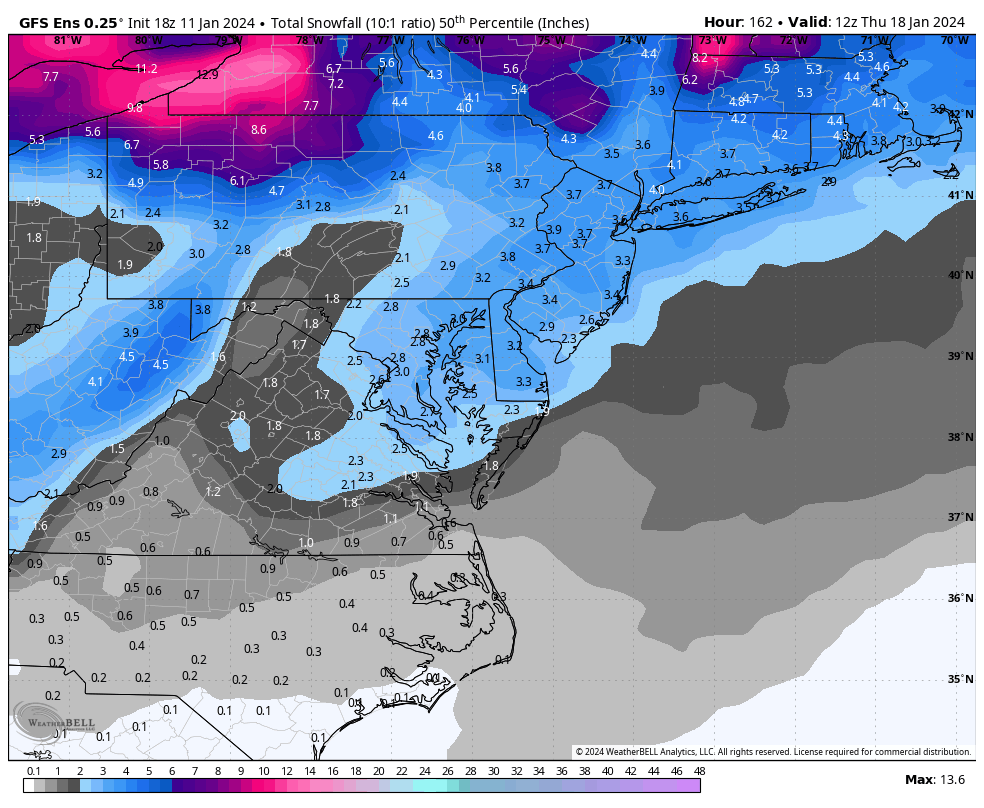
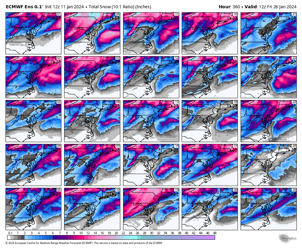
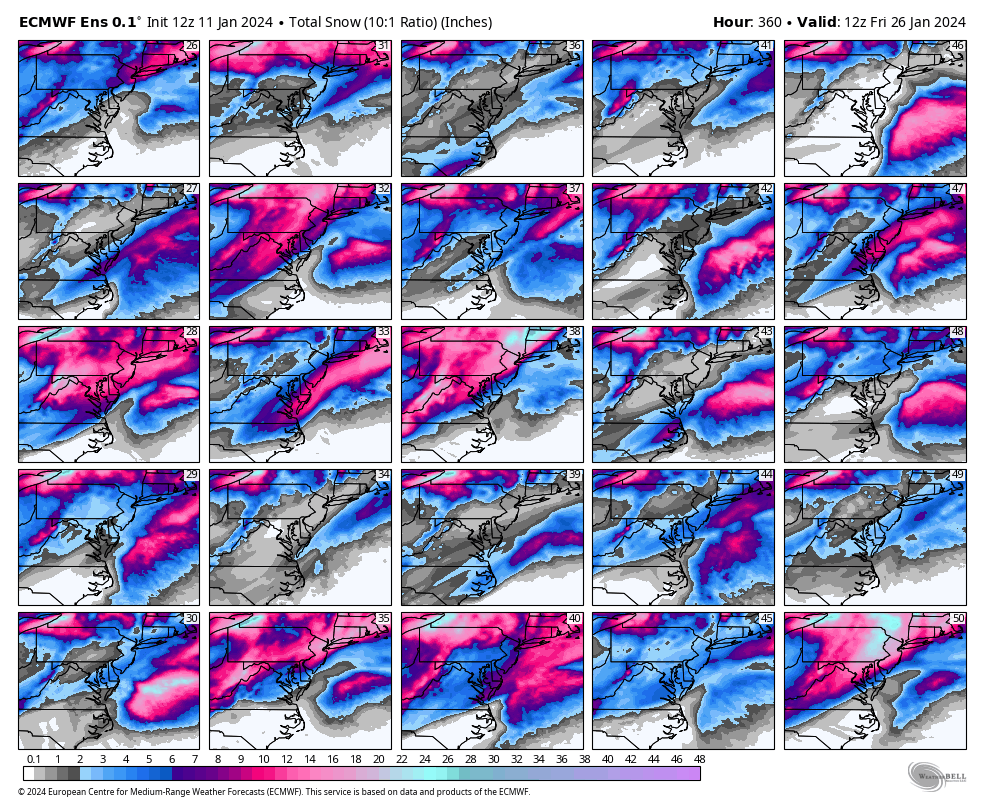
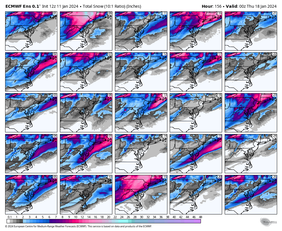
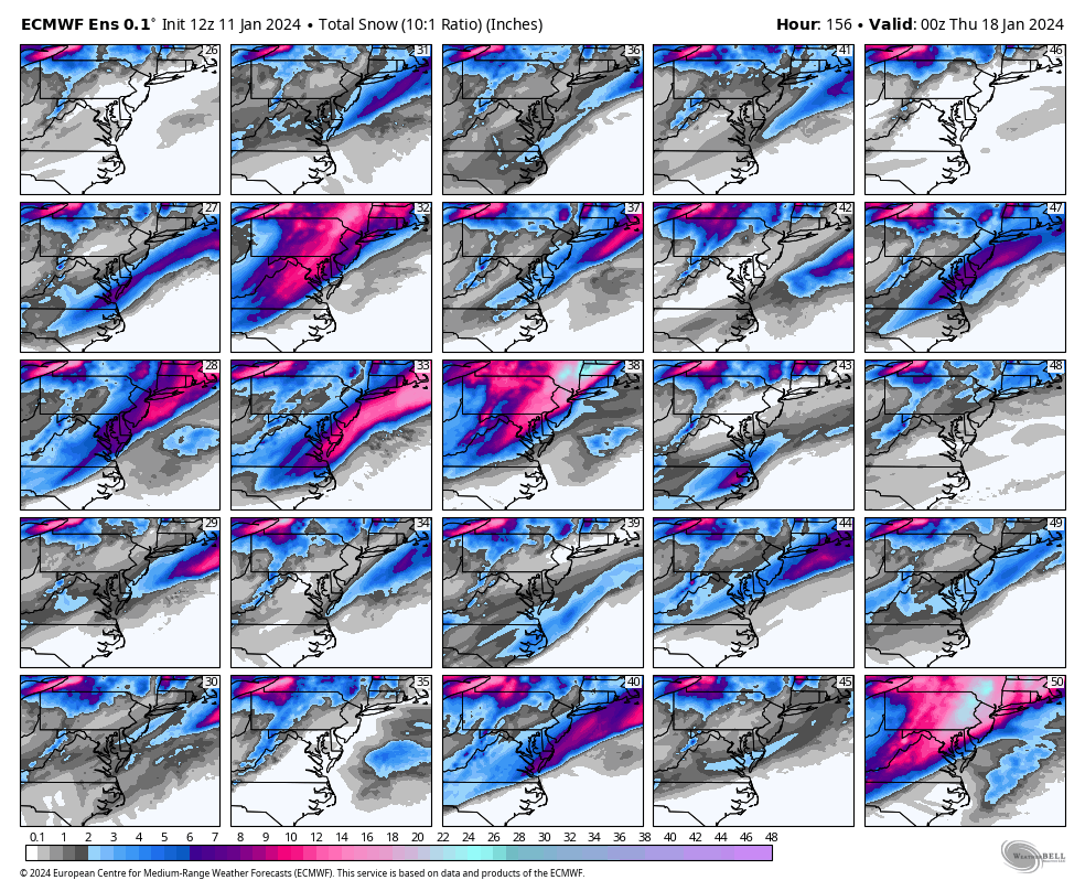
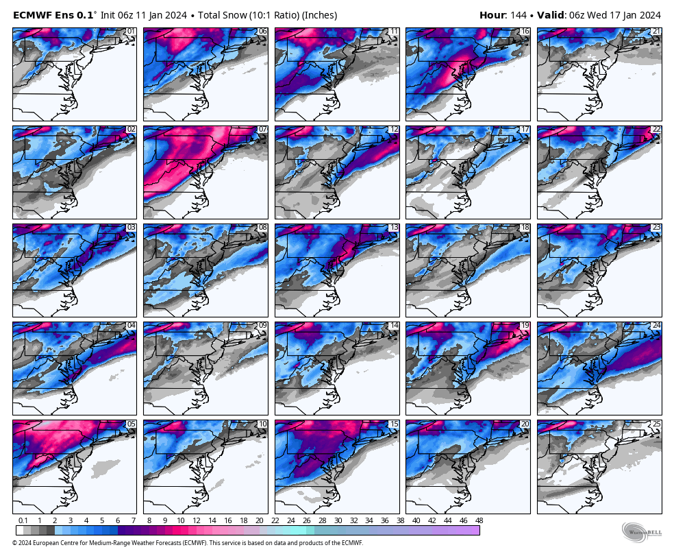
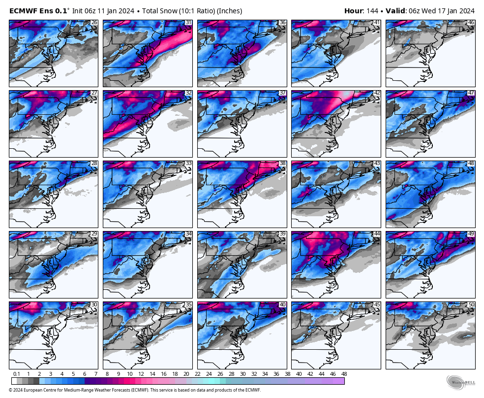
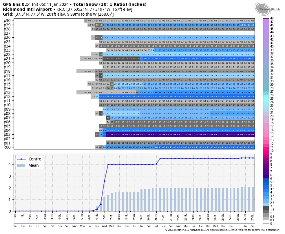
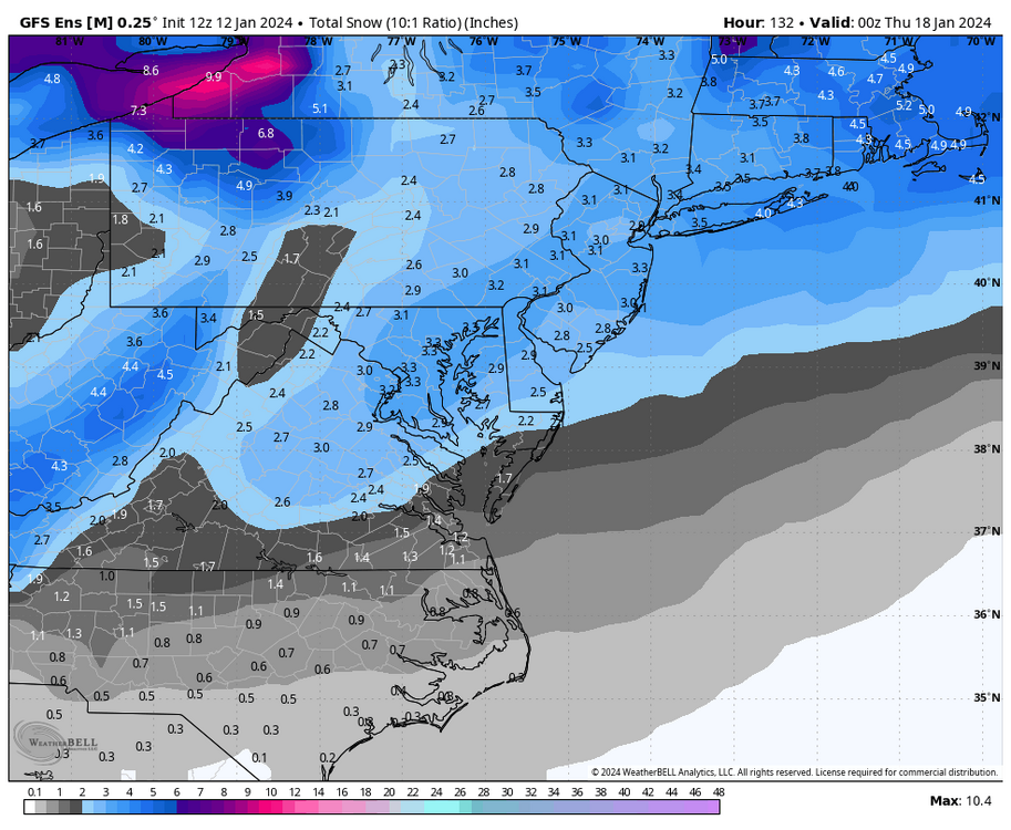
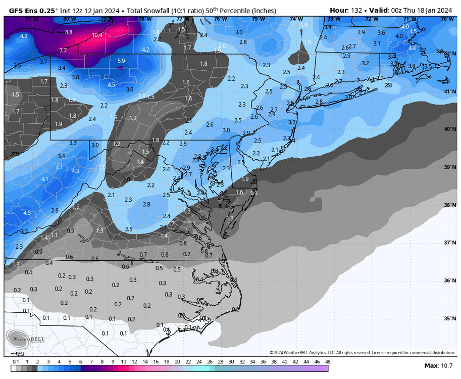
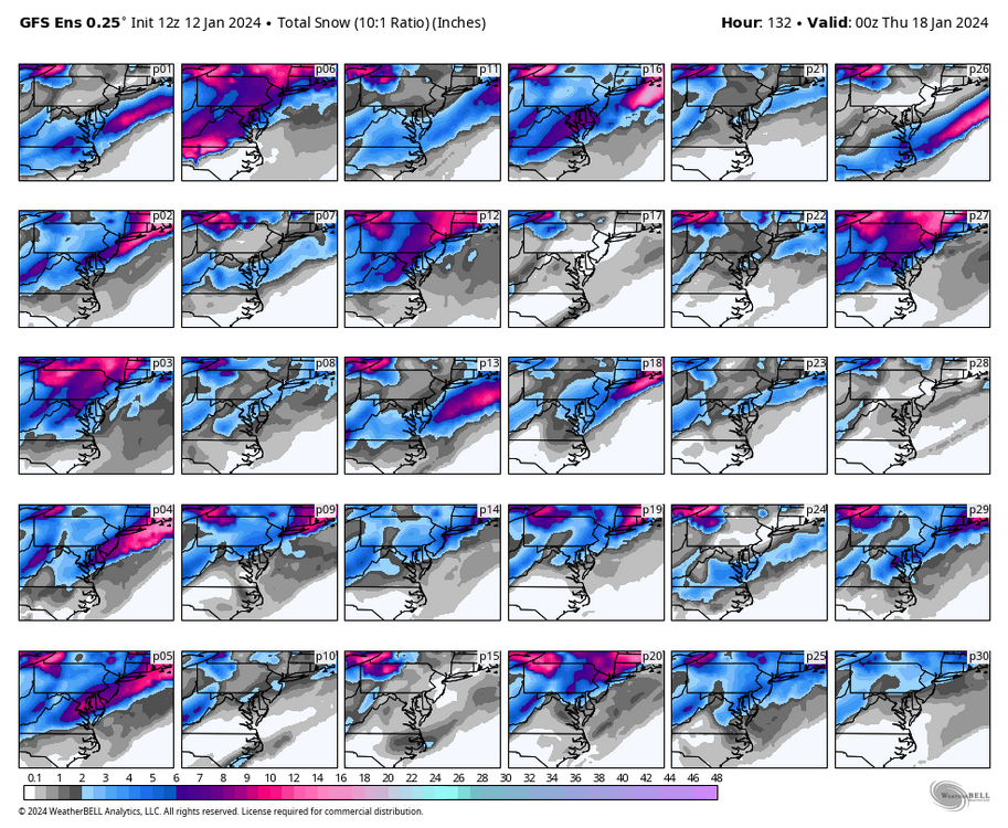
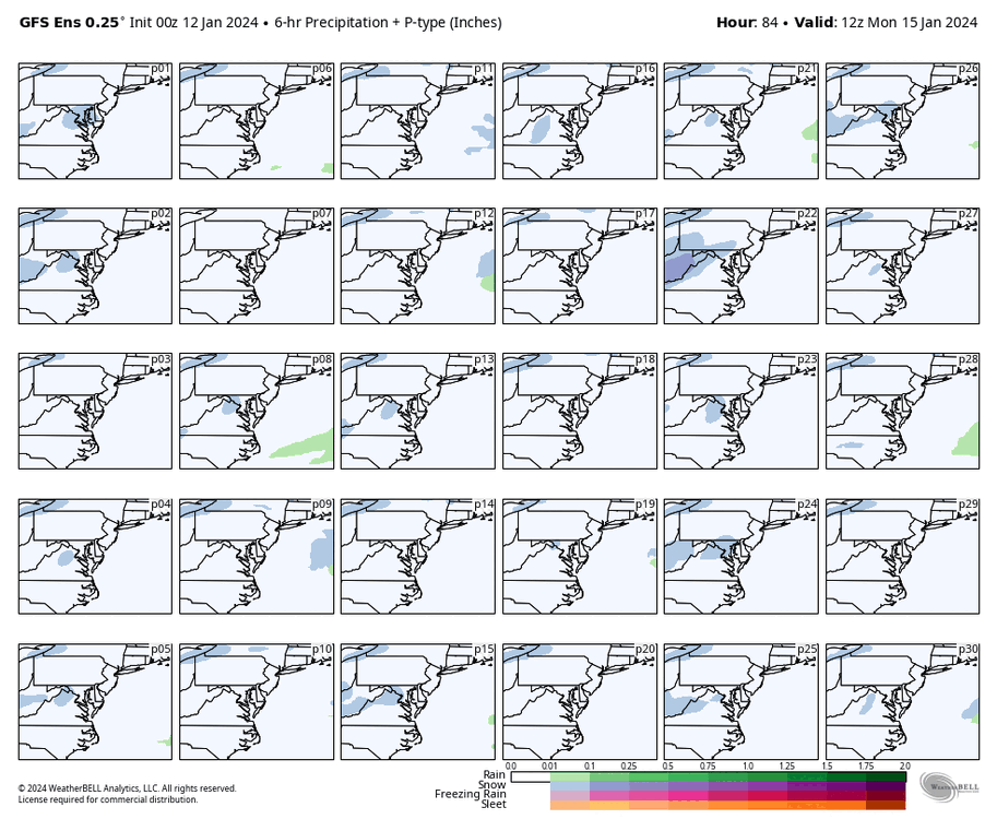
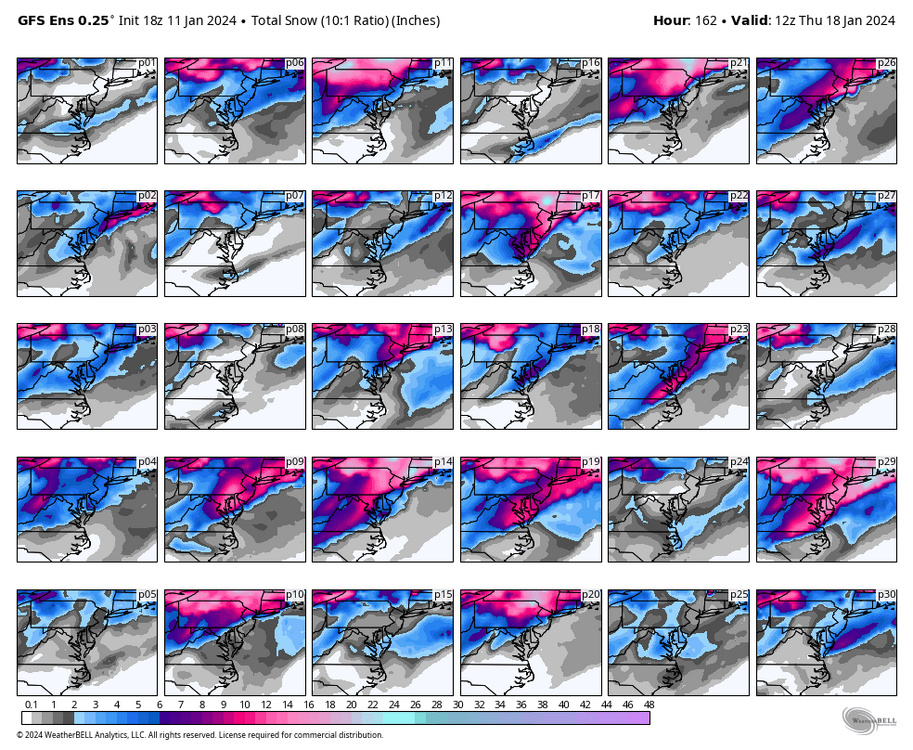
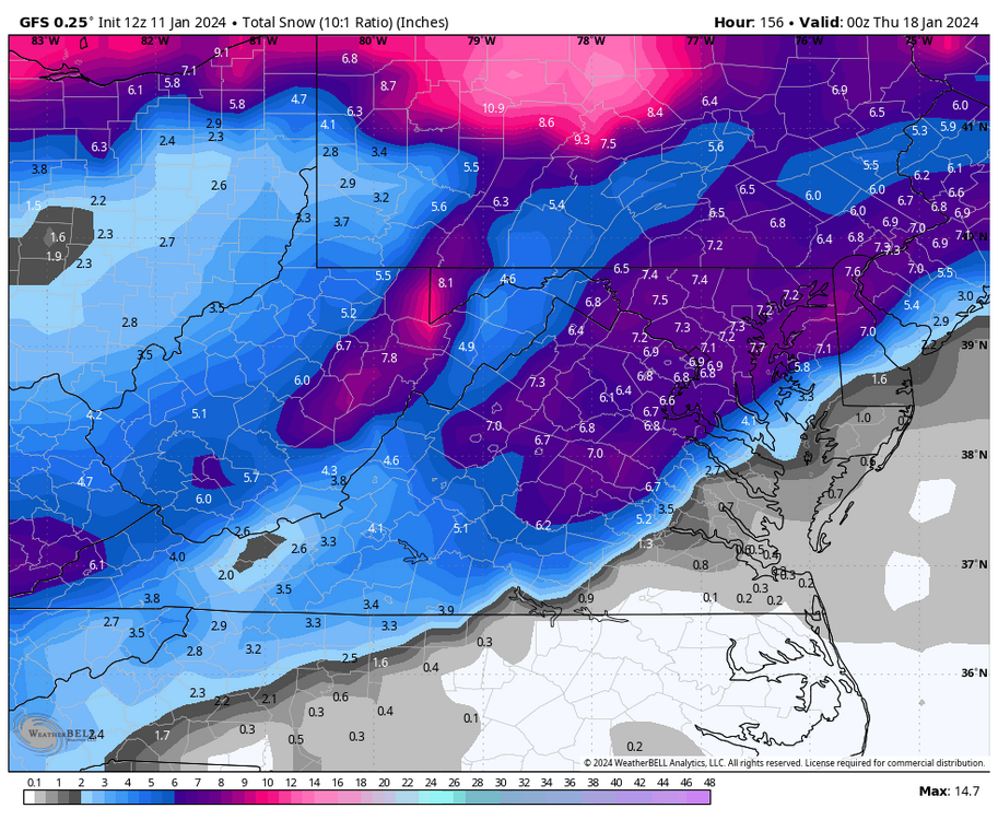
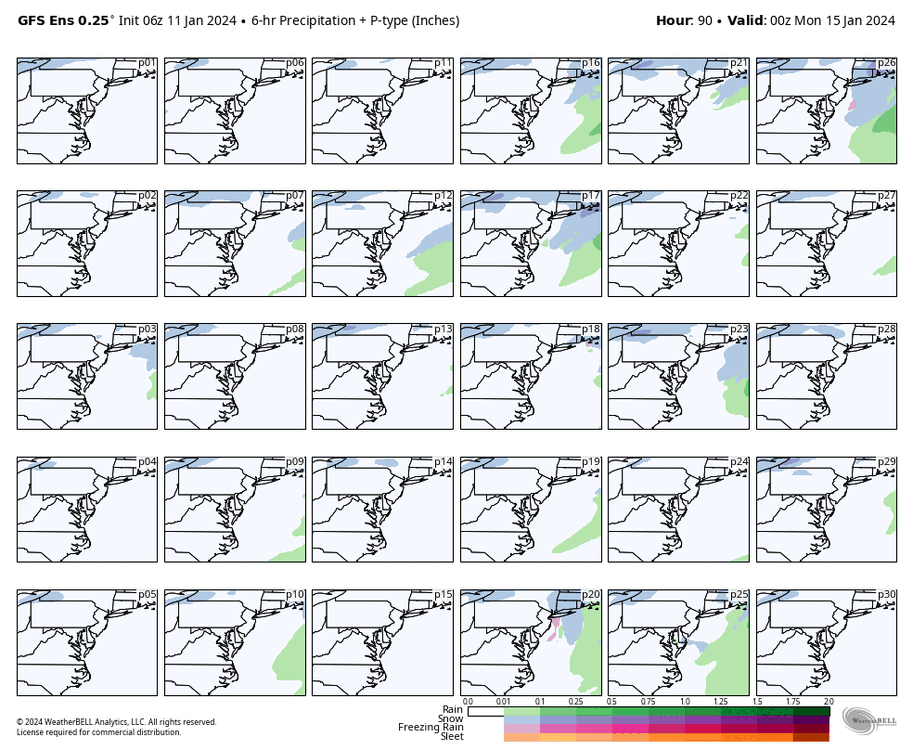
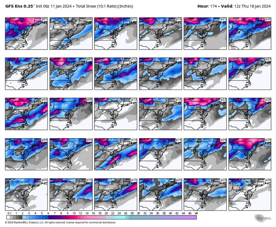
These are for the entire run. Today's 18Z GEFS was the best GEFS run this winter. If this isn't a snow signal, then I don't know what is.

-
Richmond Metro/Hampton Roads Area Discussion
RIC Airport replied to RIC Airport's topic in Mid Atlantic
p29? I just looked at them, and they've increased my confidence. Hopefully, the 12Z Euro run was a blip. I slowed down the individual members. I don't know about you, but I don't see many with pink. Btw, these are only through 12Z Thursday.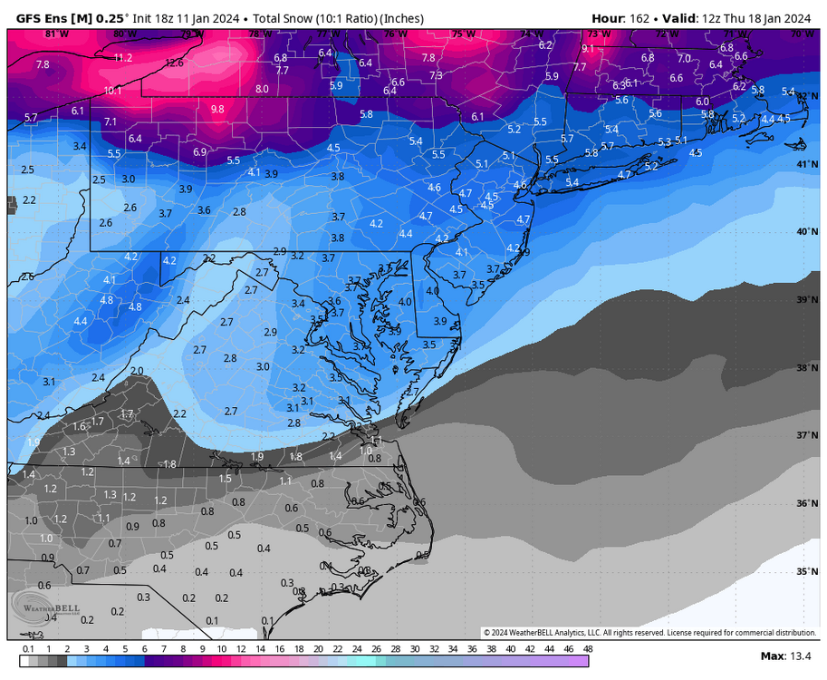


-
Richmond Metro/Hampton Roads Area Discussion
RIC Airport replied to RIC Airport's topic in Mid Atlantic
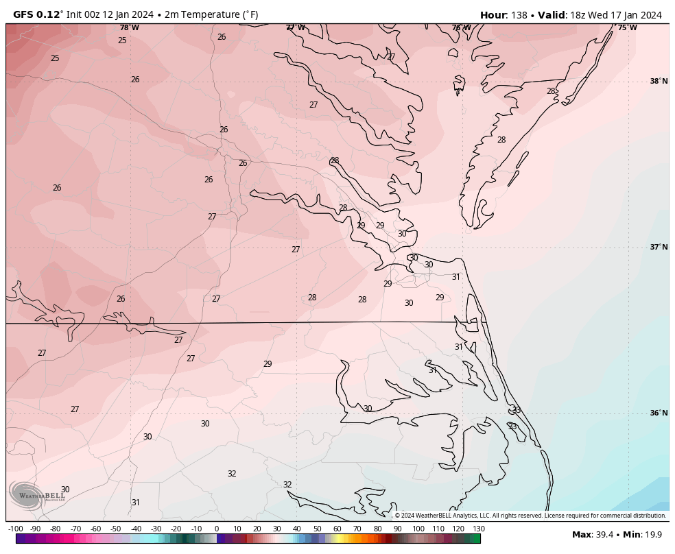
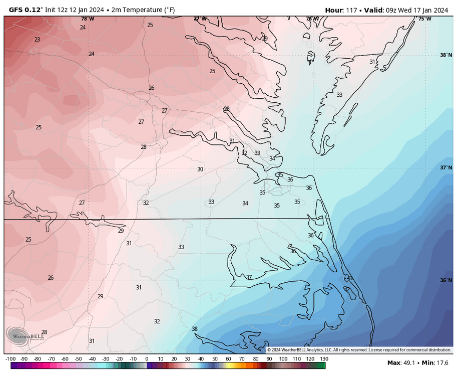
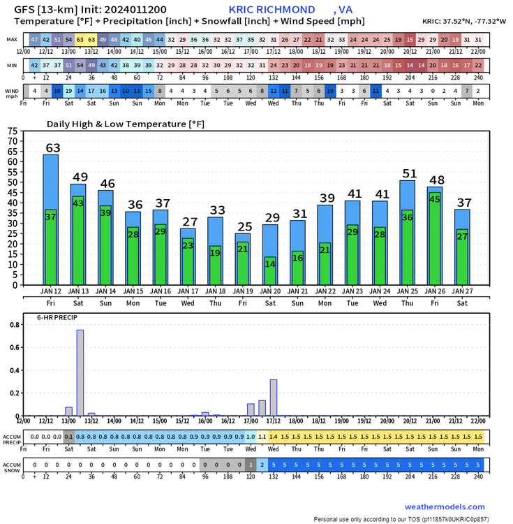
12z GFS had RIC hitting 10°F and the 18Z GFS has 13°F Wednesday morning. We have a pretty cold airmass coming, but I think the GFS was picking up on snow cover, so it probably was a few degrees too cold. With the way this winter has gone, I would be skeptical of it getting that cold, but it is possible if we get a solid snow cover. RIC reached 8°F on 12/24/2022. That was the first single-digit low temperature recorded at Richmond since January 2018, when it hit -3°F. -
Richmond Metro/Hampton Roads Area Discussion
RIC Airport replied to RIC Airport's topic in Mid Atlantic
RIC has a COOP station in Varina that serves as a back up for the FAA contract observers. This is where the December 2018 measurement was taken. It happens all the time. For those that've been here long enough, even the many years before Easternuswx abruptly shut down in 2010, this is the reason why we have our own thread. I'm grateful for the participation in this thread, I knew once the first bona fide chance for snow, people were going to return. We are the "Deep South" to them. For the sake of conversation to snow, I'm afraid I have to disagree with others that we are the south. At least from a historical perspective, RIC's snow climate is more aligned with DCA than RDU. The data and past snowstorms do show an RDU correlation with ORF. Again, this is from a historical perspective, looking at the data. Who knows where we are today with warmer oceans and a warmer climate. And to be frank, DC has been no better than we've been lately. -
Richmond Metro/Hampton Roads Area Discussion
RIC Airport replied to RIC Airport's topic in Mid Atlantic
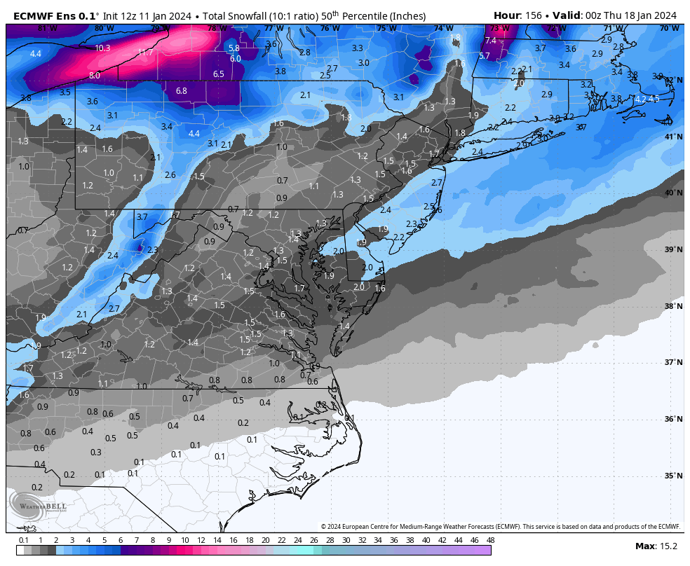
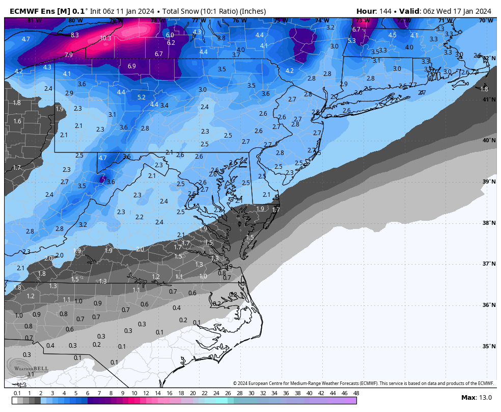
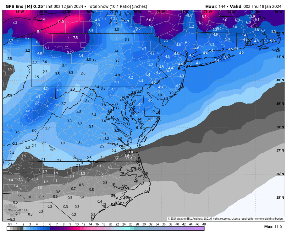
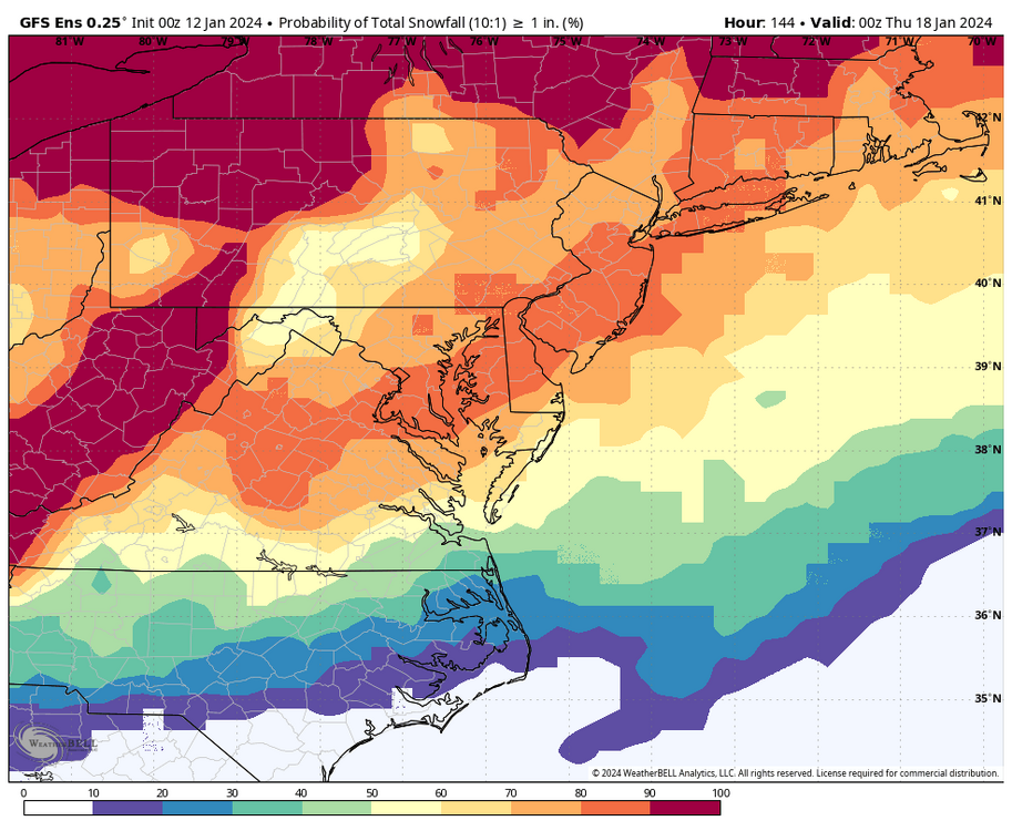
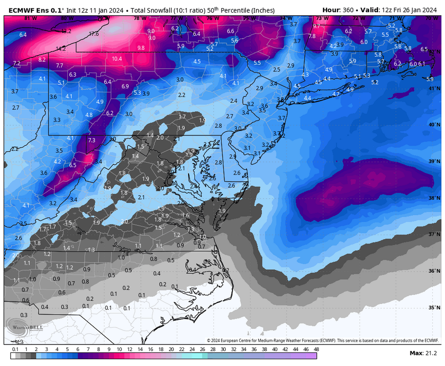
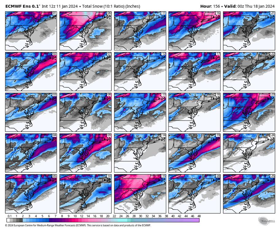
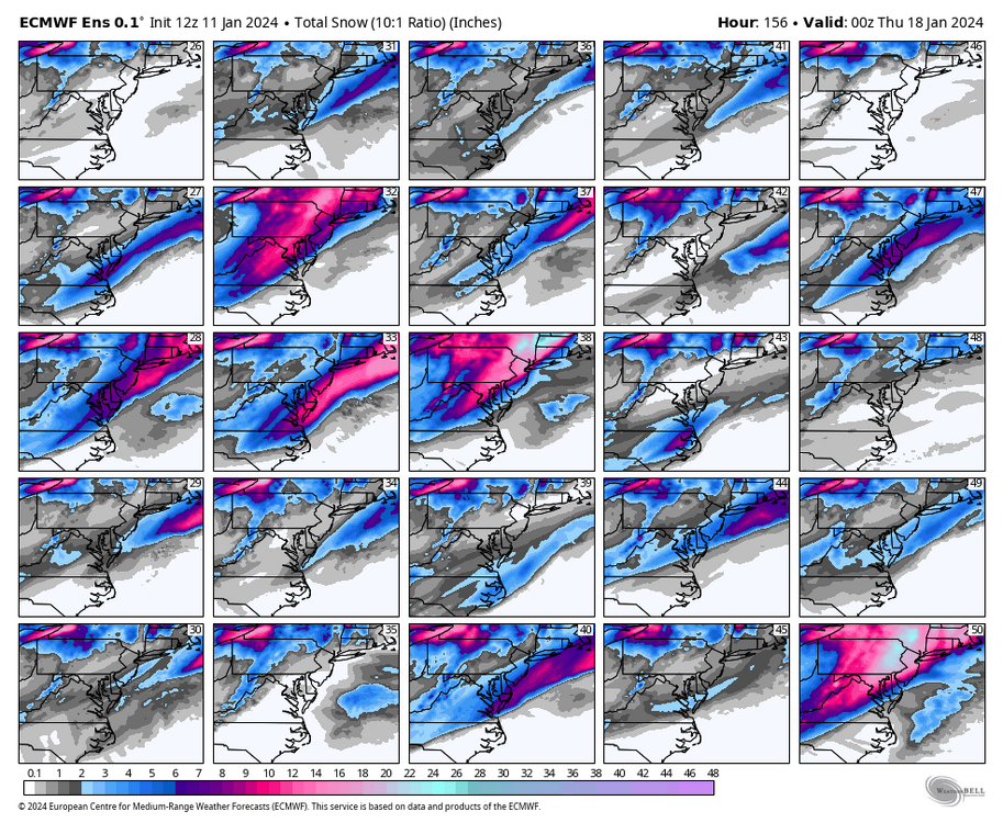
The below is for the entire 12z EPS run, which is the best we've seen all winter. If this is any indication of the next couple of weeks, we'll be busy tracking snow.


-
Richmond Metro/Hampton Roads Area Discussion
RIC Airport replied to RIC Airport's topic in Mid Atlantic
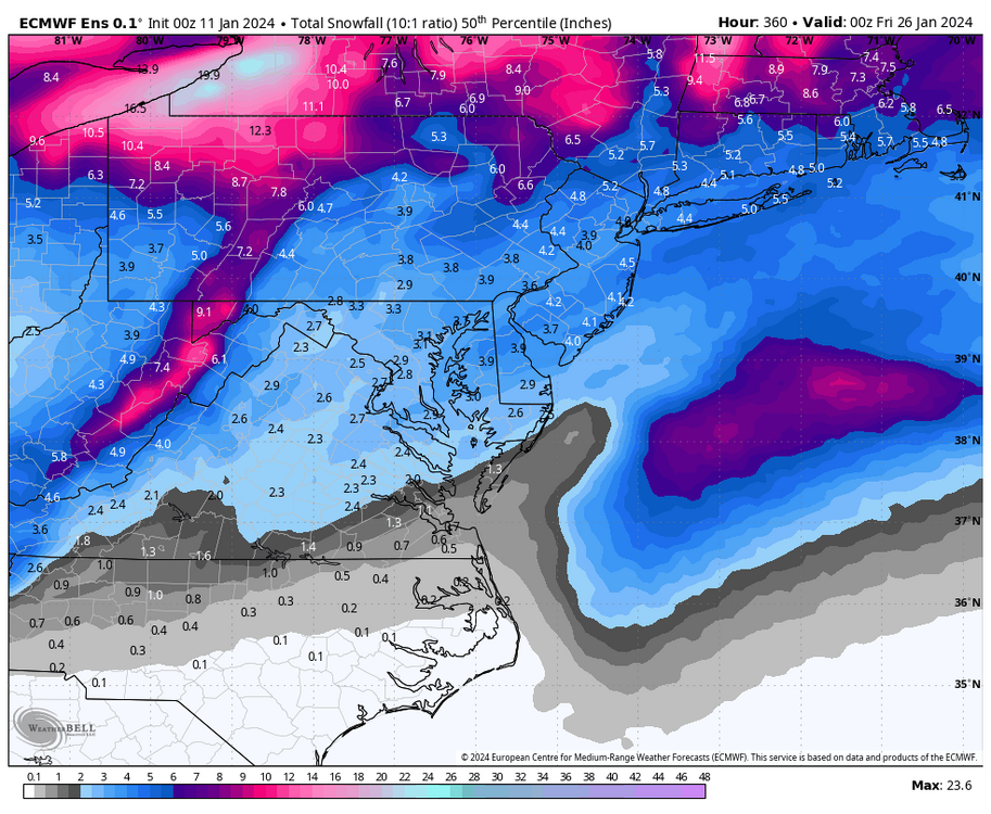
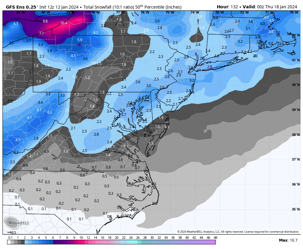
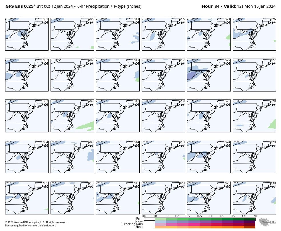
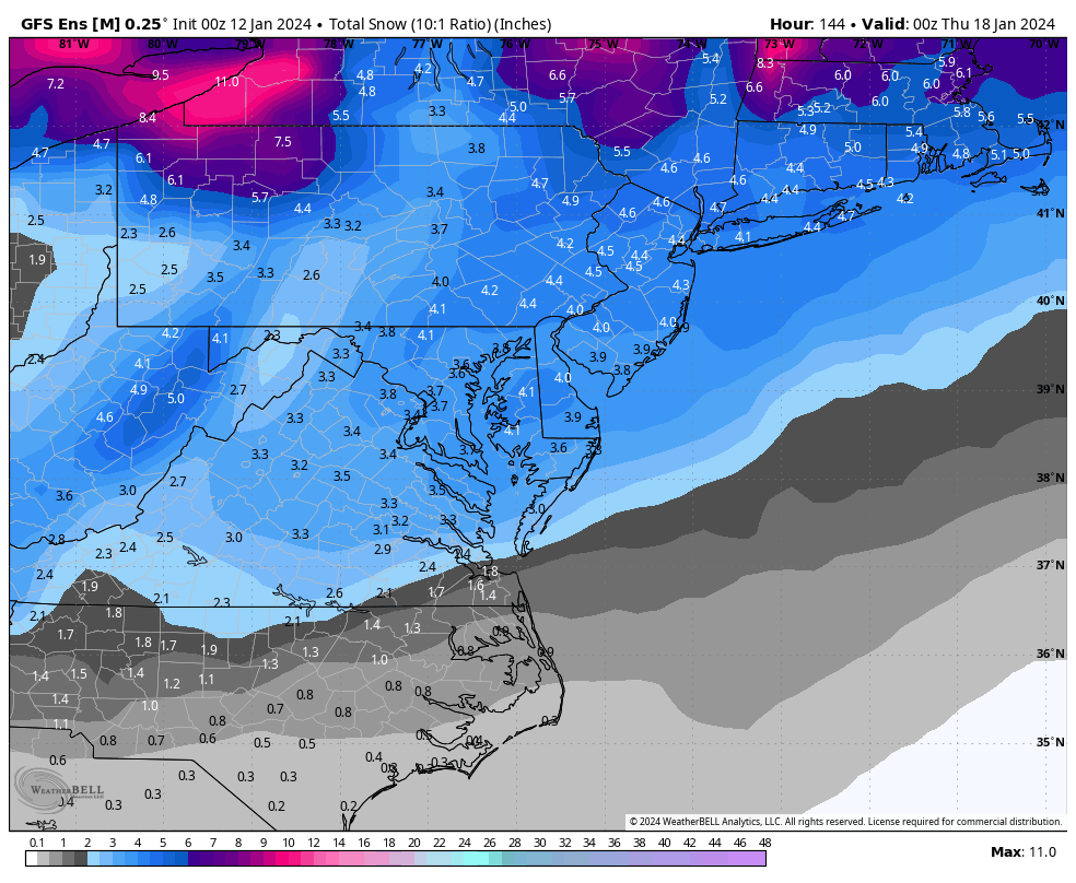
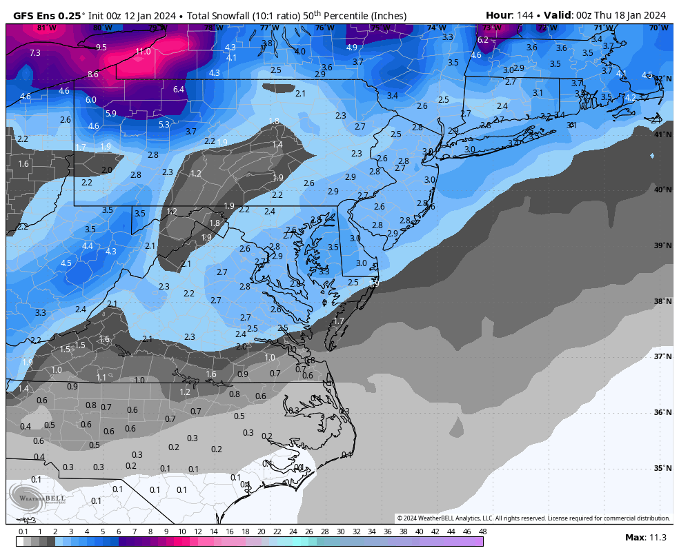
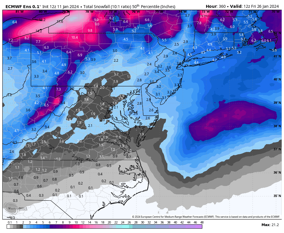
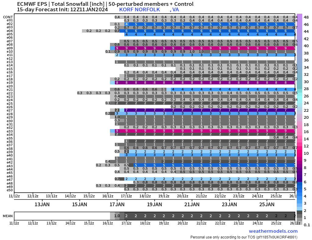
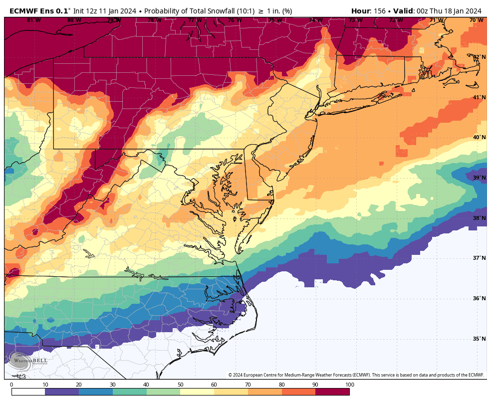
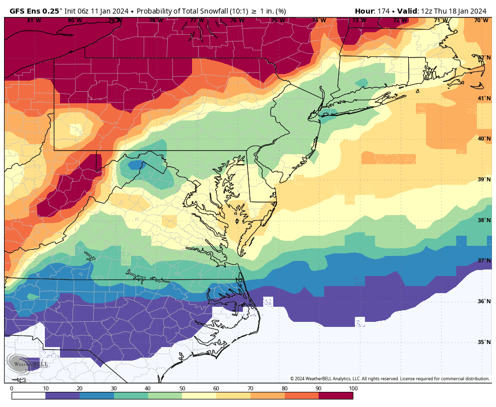
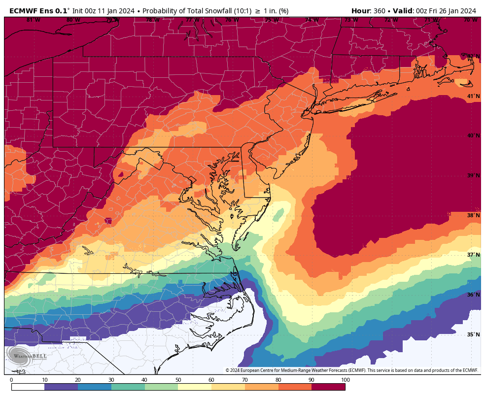
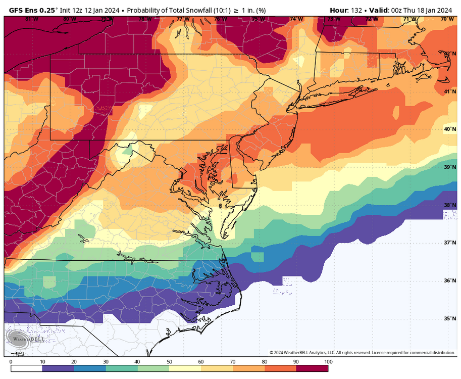
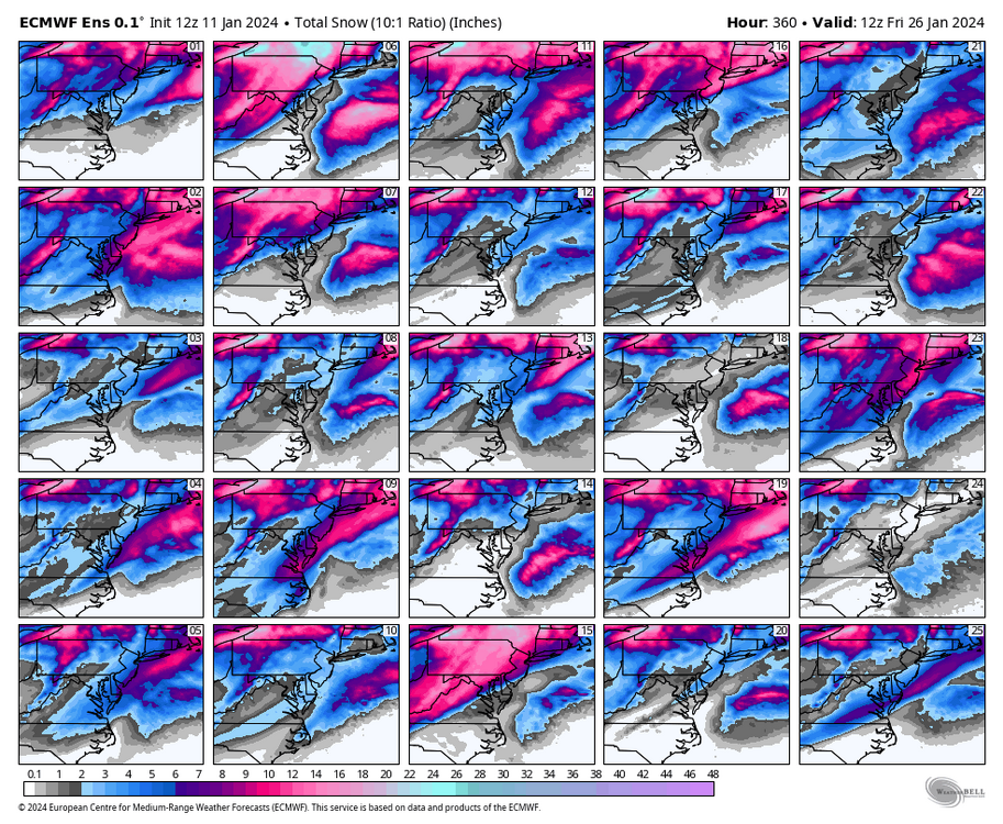
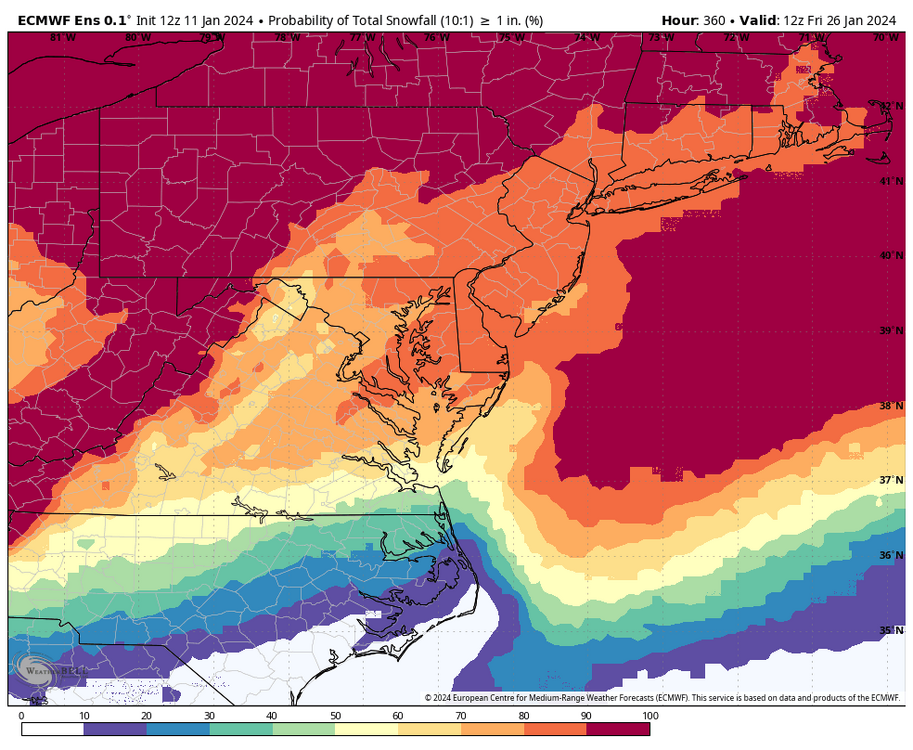
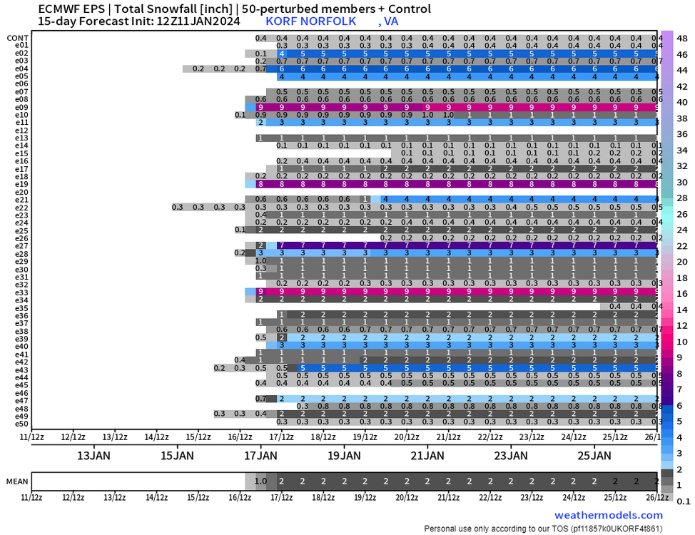
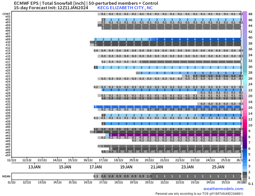
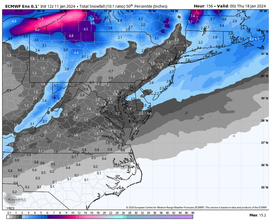
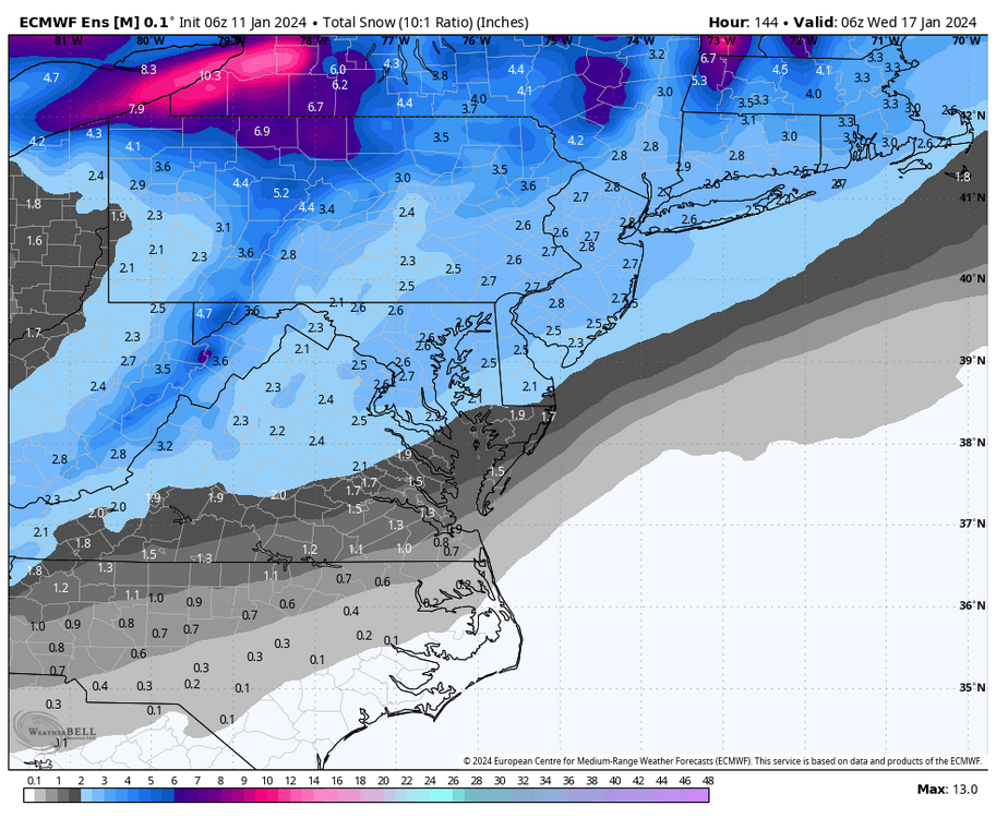
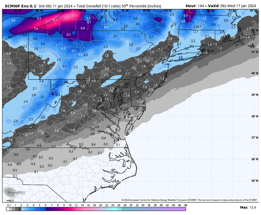
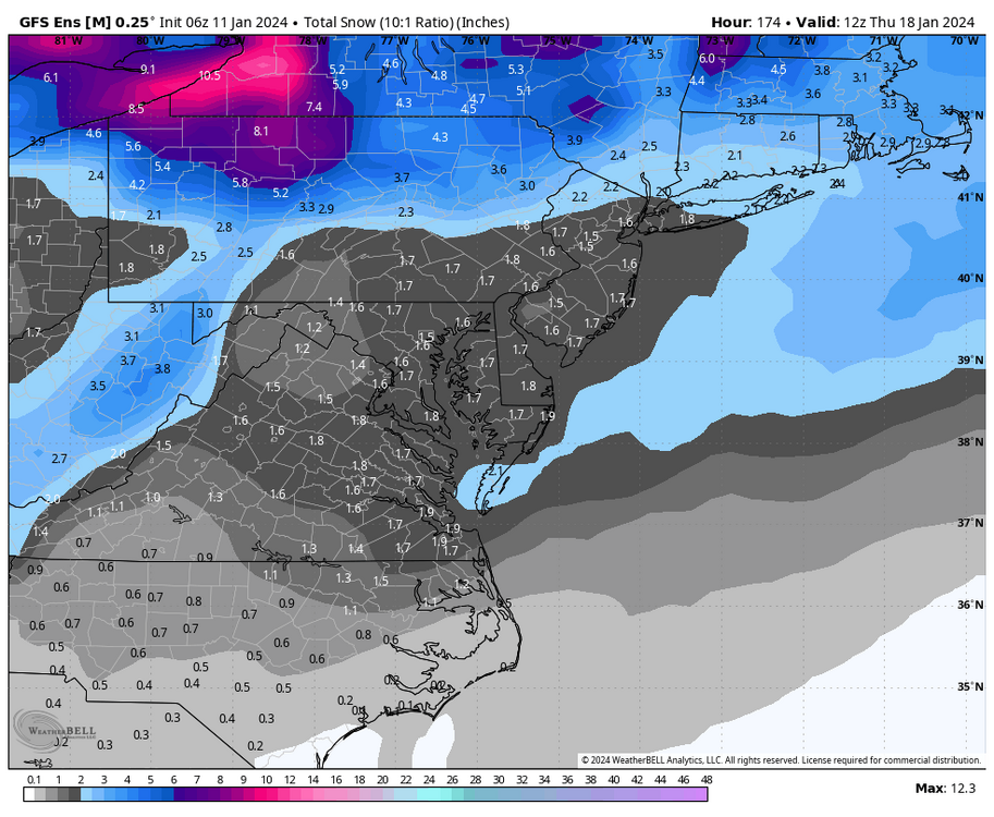
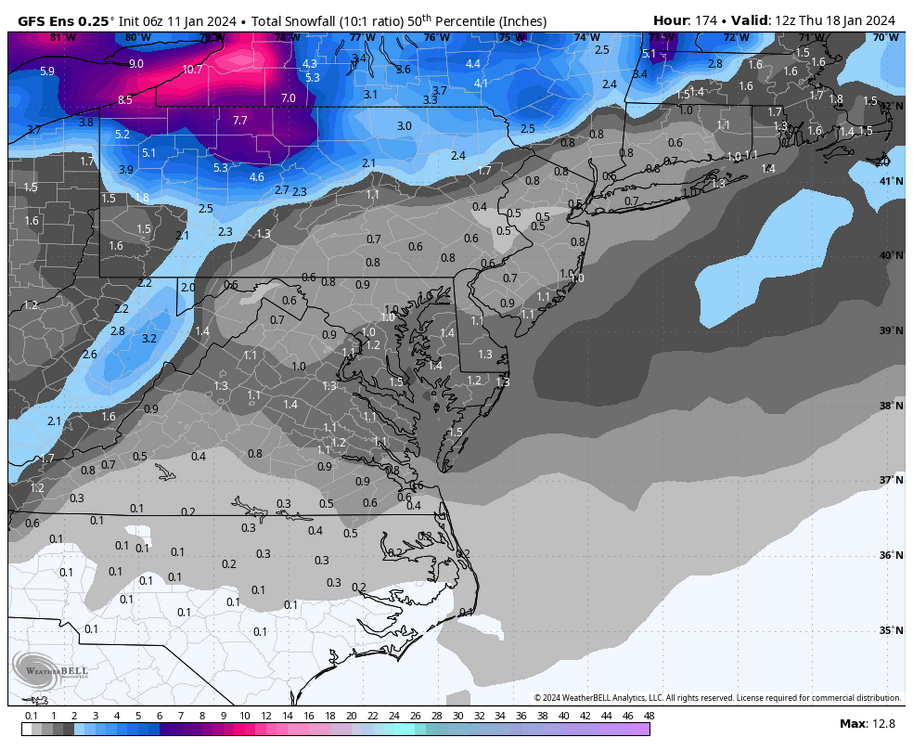
Just returned after being away all afternoon. I was surprised to see how dry the op Euro was, but at least the ensembles kept us in fair play, even with the 12Z GFS being a farther north and warmer solution. I’m sure you have already seen these in the other threads, but posting them for our thread since I was unavailable earlier. These maps go through 00z Thursday (7pm Wednesday evening), so they only capture the time frame for the 16th to 17th snow threat. There were 28 of 50 ensembles with at least 2” of snow for RIC. But, there are fewer 4” + members than in the last couple of EPS runs. I'd say a 1-3" event is still within reason, which is a HUGE accomplishment for us. EPS has a 60% probability of 1" of snow at RIC, which means it's more likely than not. EPS puts Norfolk at a 40" chance. Obviously, we hope to score higher, which is still on the table, given the spread of the members.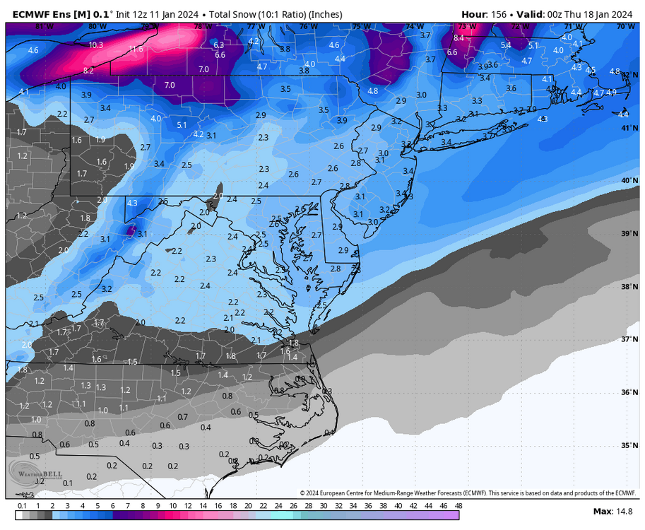

-
Richmond Metro/Hampton Roads Area Discussion
RIC Airport replied to RIC Airport's topic in Mid Atlantic
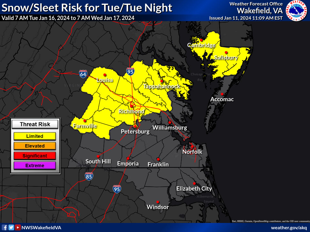
AKQ is beginning to message about the threat.
-
Richmond Metro/Hampton Roads Area Discussion
RIC Airport replied to RIC Airport's topic in Mid Atlantic
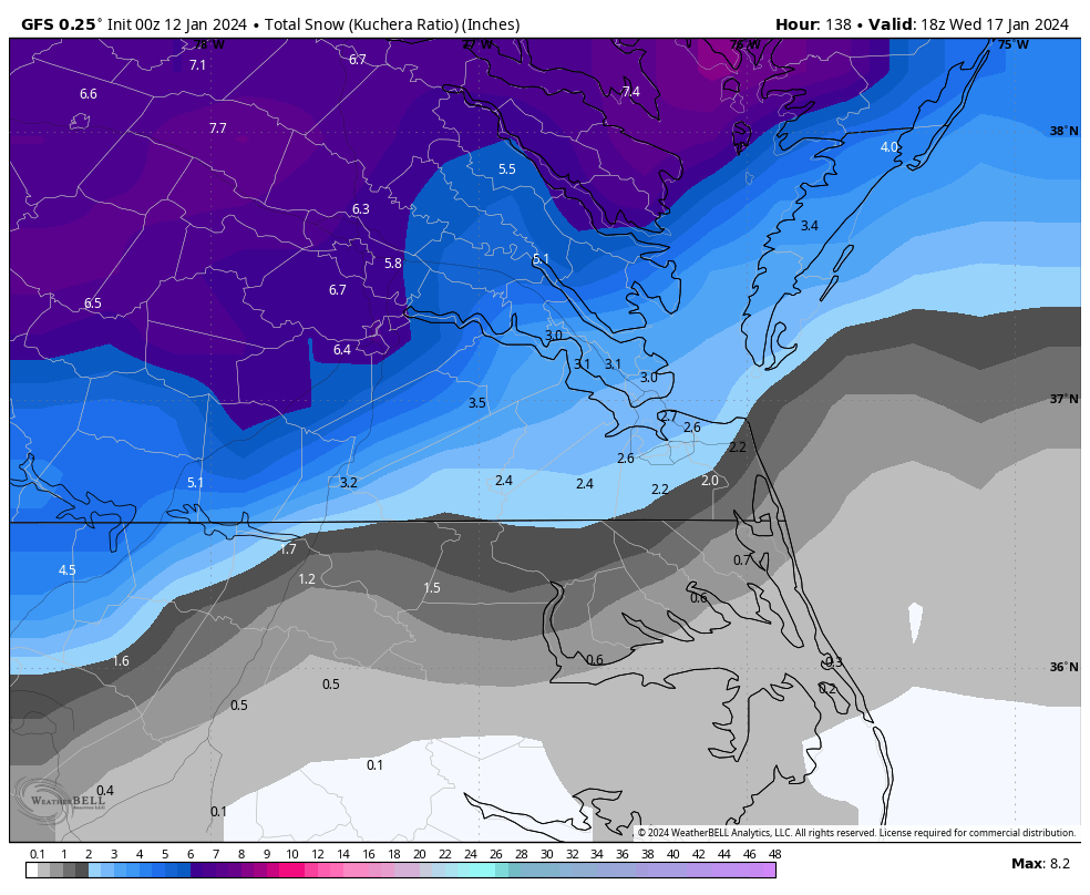
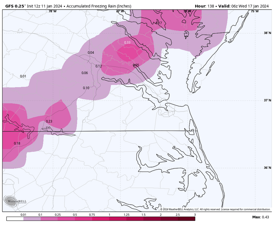
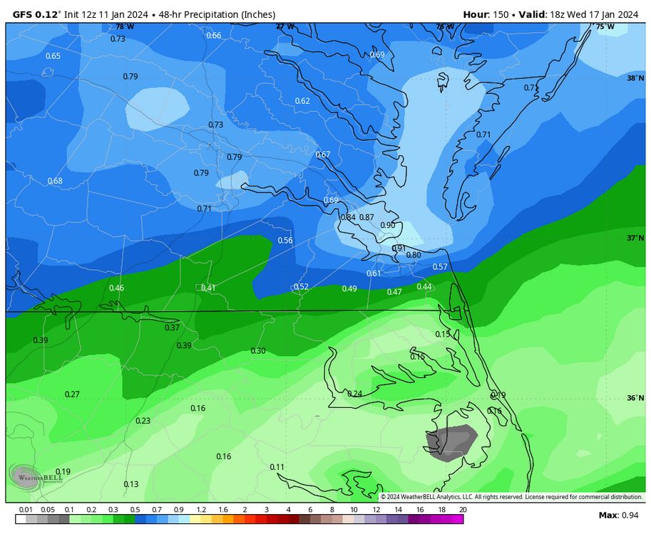
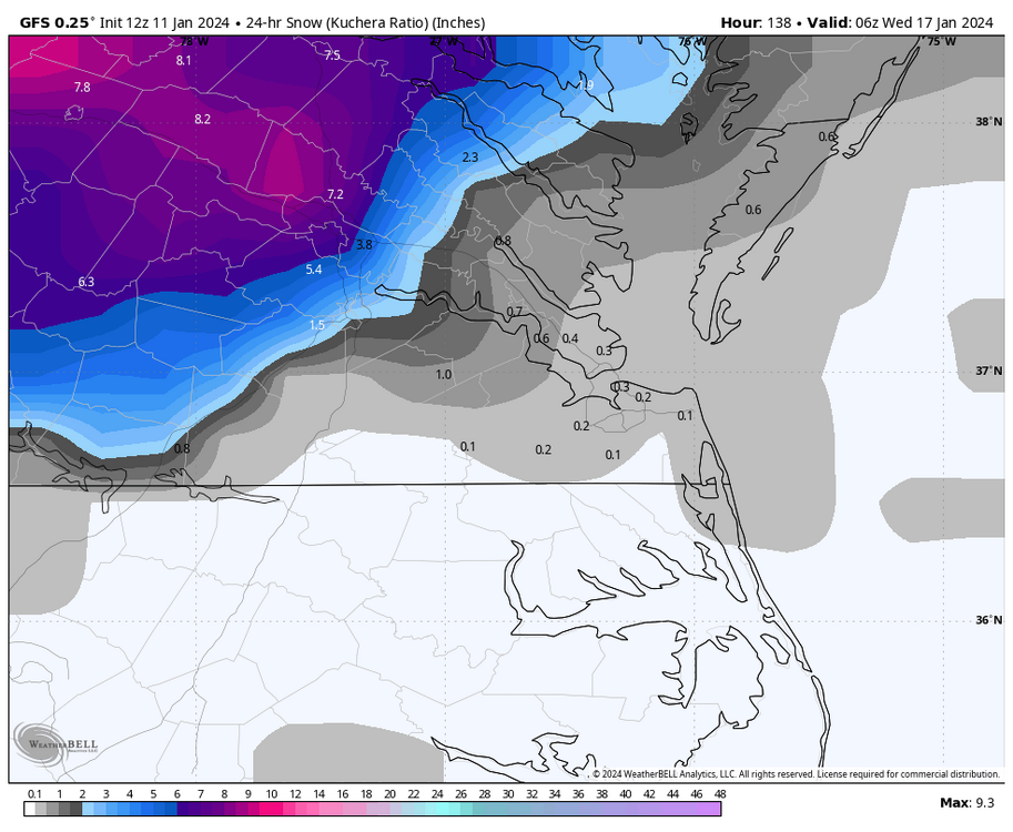
Yup, not giving up hope since the Euro has been more consistent and colder for us! I added the total QPF and the Kuchera map to my above post. Unfortunately, I'll be away from my computer most of the afternoon and won't be active when the Euro runs. I'll try to peak at my phone at least when I can, but later this evening, I'll be fully available to comment for our region, which you won't see in the forum long-range thread. (aka the DC only ). -
Richmond Metro/Hampton Roads Area Discussion
RIC Airport replied to RIC Airport's topic in Mid Atlantic
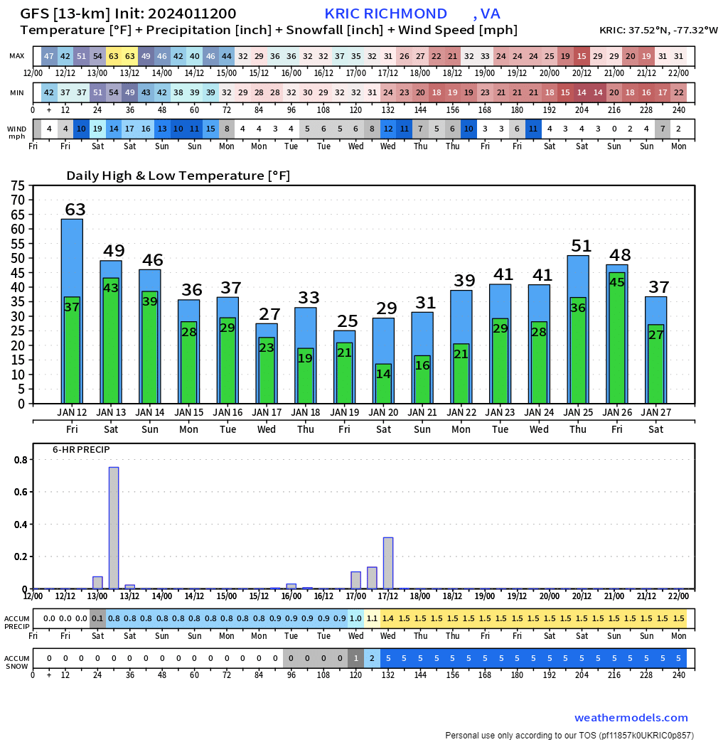
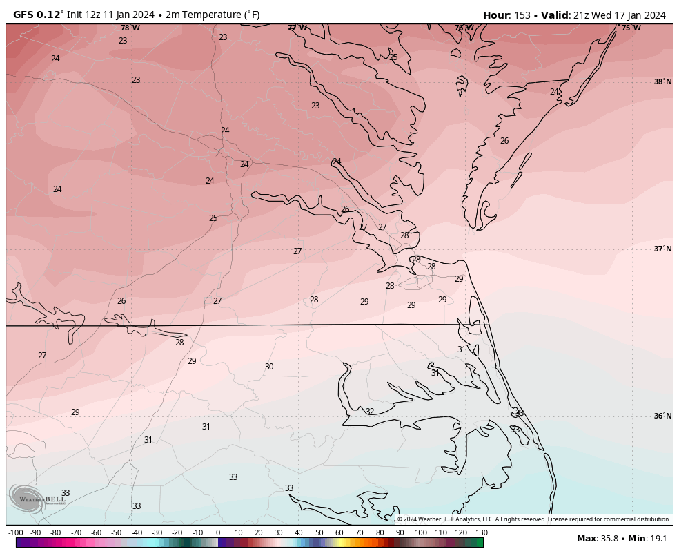
Interestingly, the GFS gets us very cold following the storm. GFS has widespread single digits and low teens inland, with RIC hitting 10°F Wednesday morning and only 24°F for a high. If it's true that RIC only reaches 24°F, it would be the coldest high temperature since 12/23/22. I went back to 2010, and below are the coldest high temperatures since then. Threshold Exceedance Summary Station: RICHMOND BYRD AP State: VA ID: 447201 Latitude: 37.51 degrees Longitude: -77.32 degrees Elevation: 166 feet Station period of record: 01/01/1897-01/10/2024 CLIMOD product: Thresholds Creation time: 01/11/2024 11:54 EST Element: Maximum Temperature Units: degree F Threshold: <=23.00 Years: 2010 - 2023 Season: November - March Column delimiter: tab Date Value 01/07/2014 22 01/22/2014 23 02/16/2015 22 02/19/2015 23 02/20/2015 21 01/06/2018 23 01/07/2018 23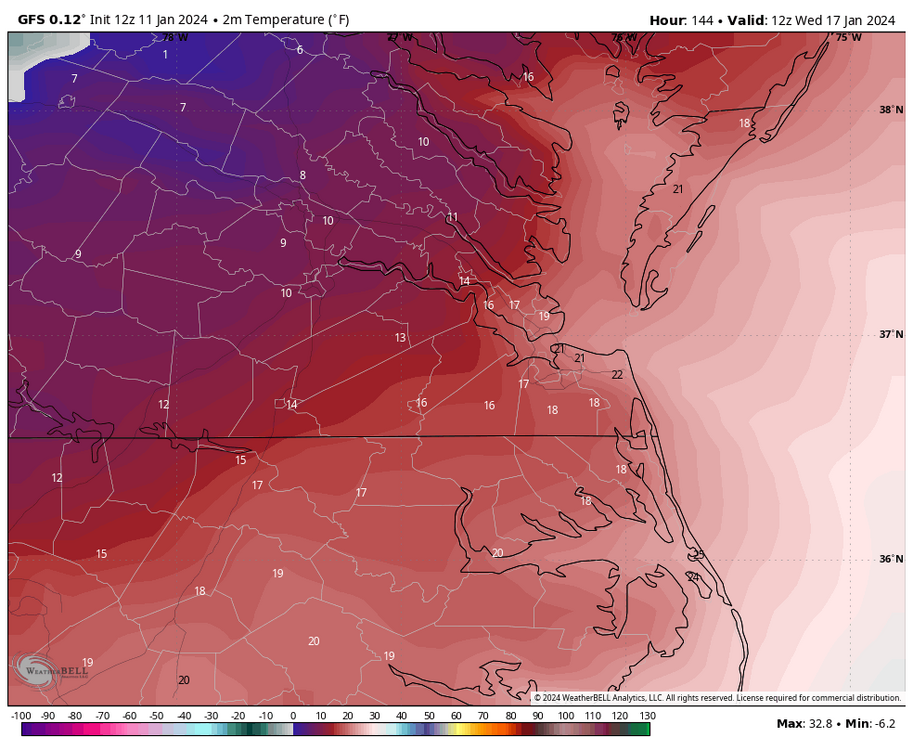

-
Richmond Metro/Hampton Roads Area Discussion
RIC Airport replied to RIC Airport's topic in Mid Atlantic
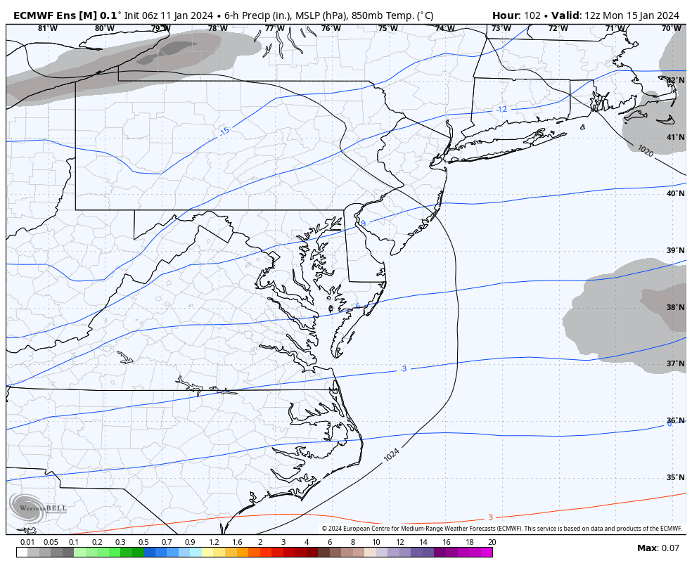
12Z GFS is still a snow event, particularly for the Richmond area, but as usual, the devil is in the details. GFS depicts some mid-level warm concerns for a portion of the storm. Although surface temps are around freezing when the precip starts, the 850 MB temp starts around +1°C at 15Z Tuesday and drops to 0°C by 18Z and -2°C by 21Z. It’s during this time the bulk of the precip is falling, and so that’s why things are complicated along, south and east of about US Hwy 360. So, its hard to say exactly how much this cuts down totals. But, I think RIC should see its first inch. Not as confident about Hampton Roads, although even the southside could see falling snow as the storm pulls away.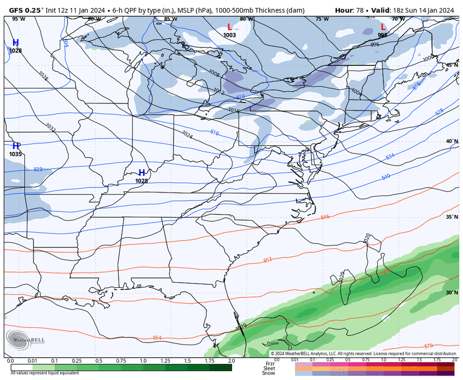


-
Richmond Metro/Hampton Roads Area Discussion
RIC Airport replied to RIC Airport's topic in Mid Atlantic
FWIW, the 6Z EPS only goes out to hour 144 so the event is not quite over. I do not see anything alarming. I think this indicates that 12Z EPS will probably be decent.


-
Richmond Metro/Hampton Roads Area Discussion
RIC Airport replied to RIC Airport's topic in Mid Atlantic
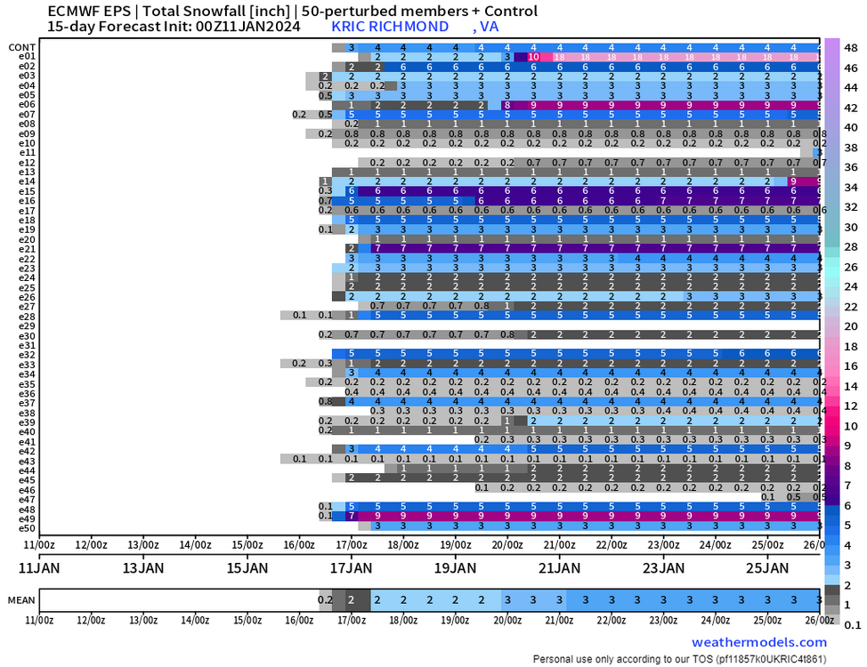
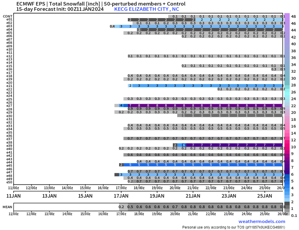
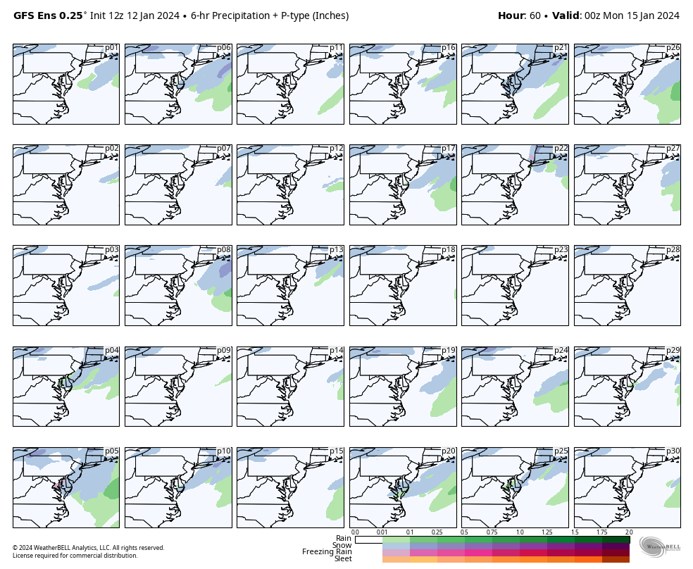
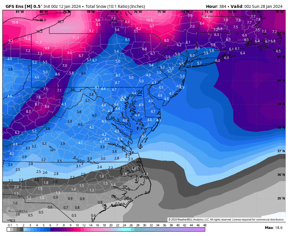
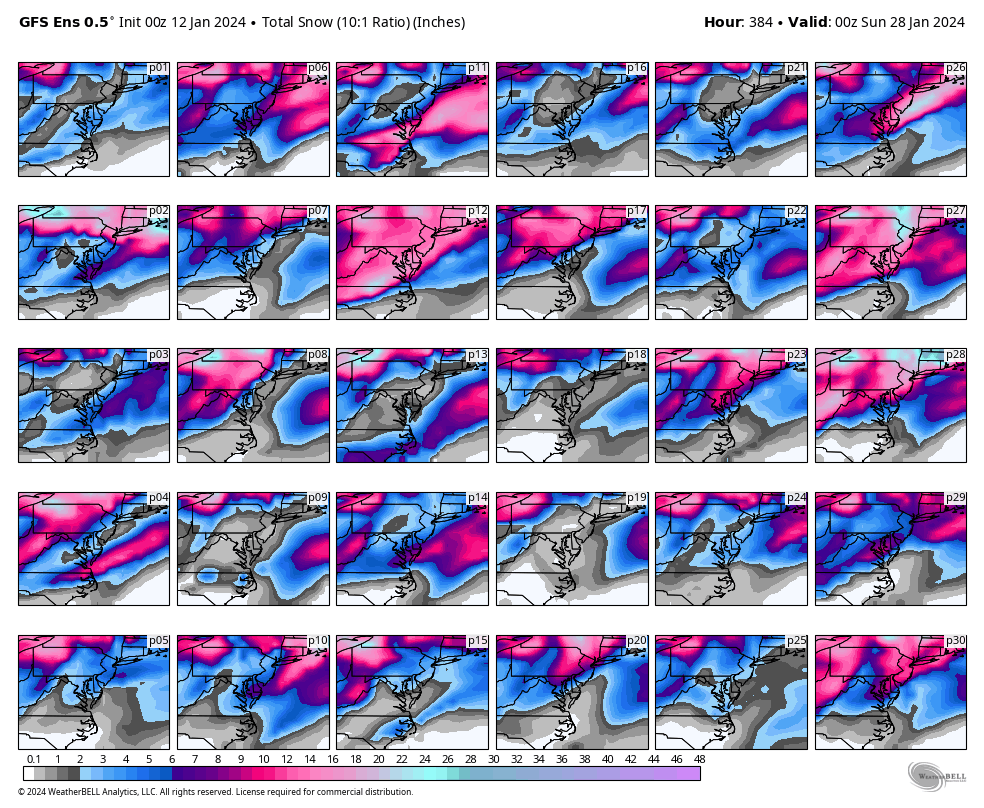
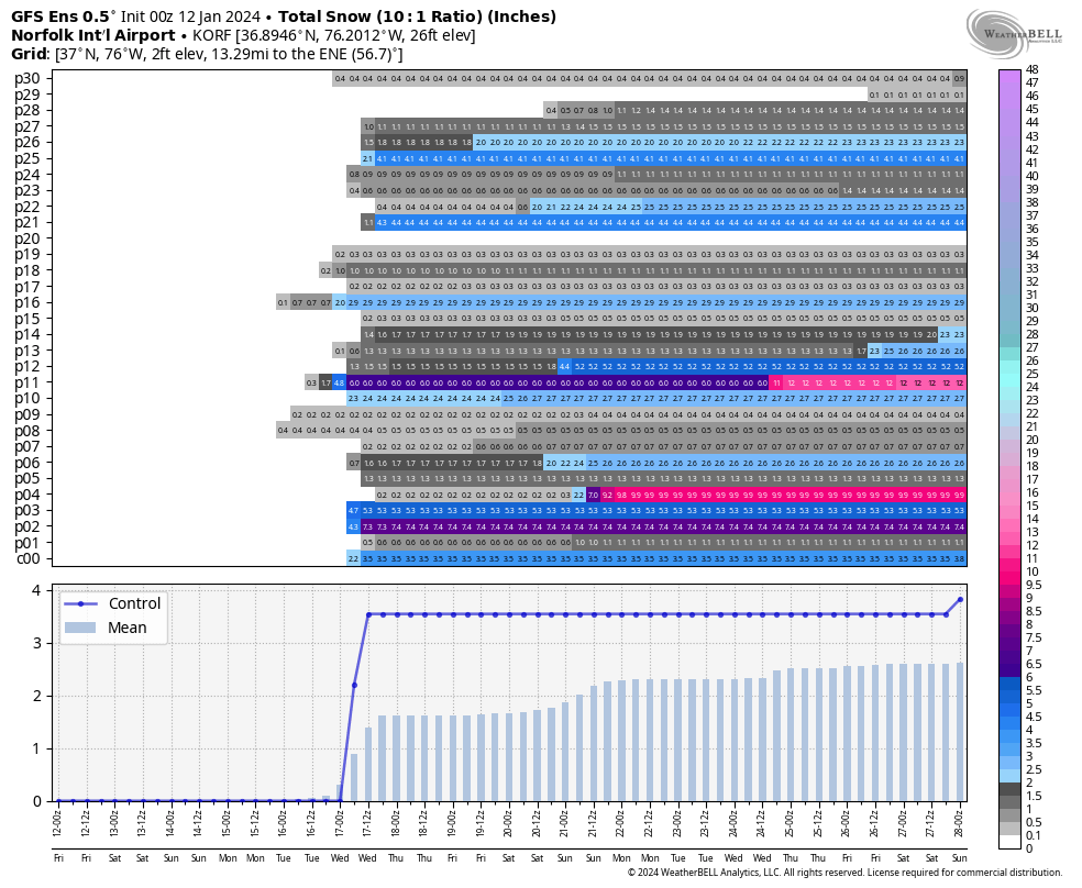
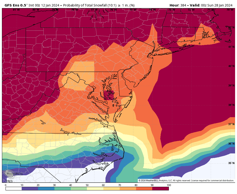
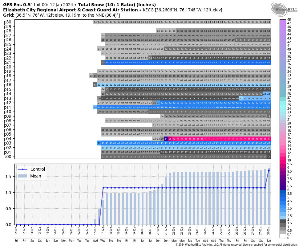
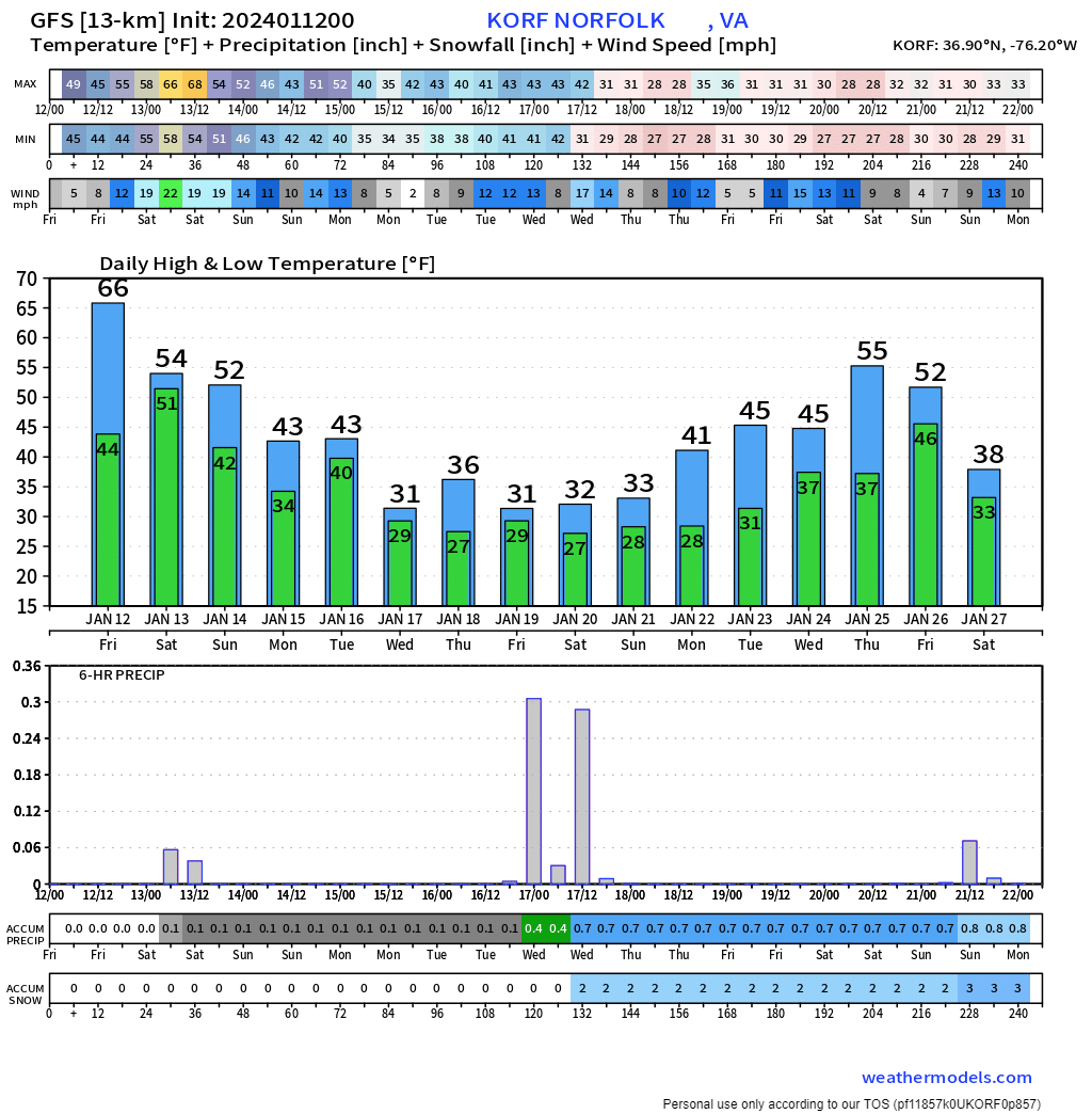
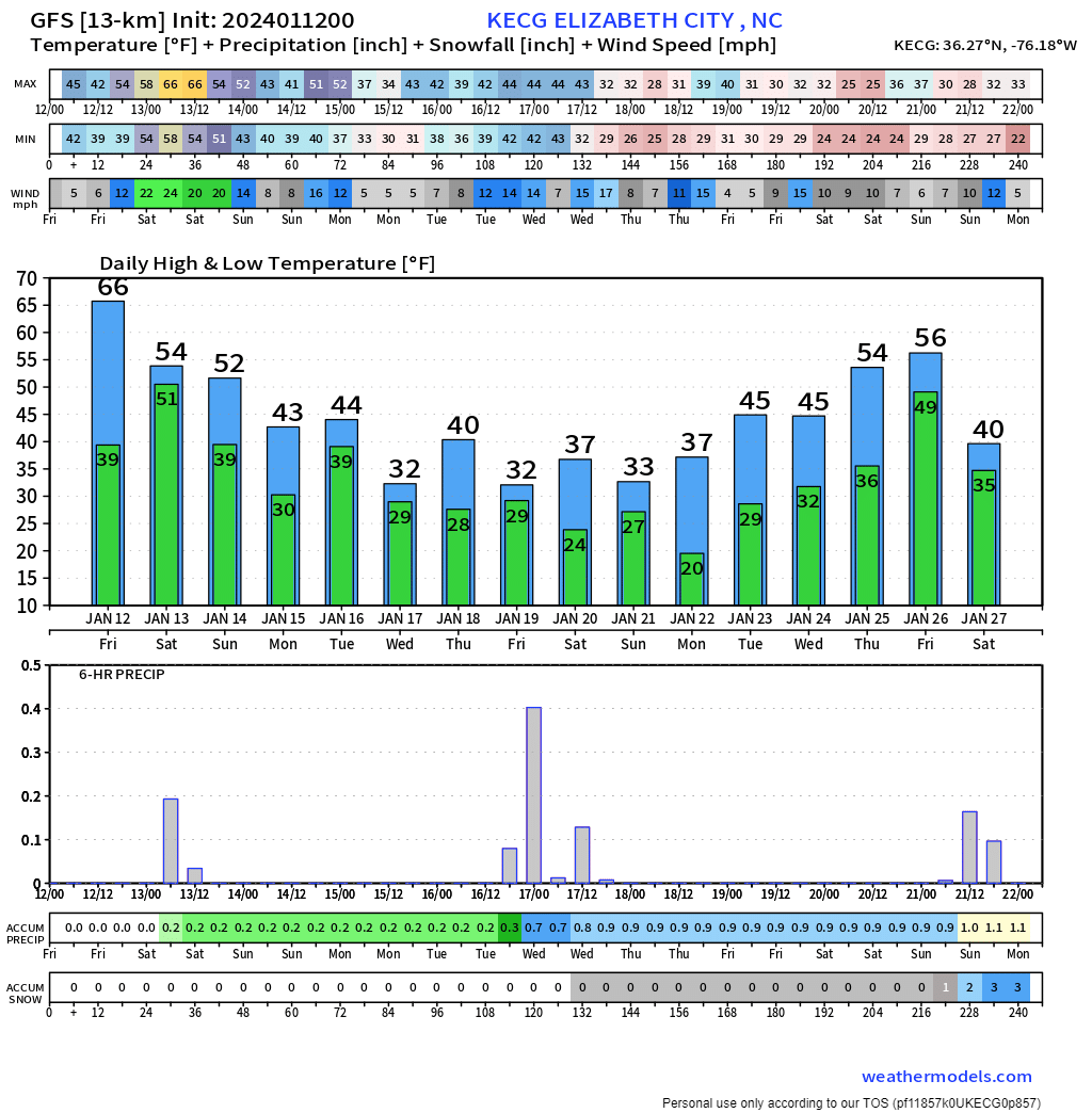
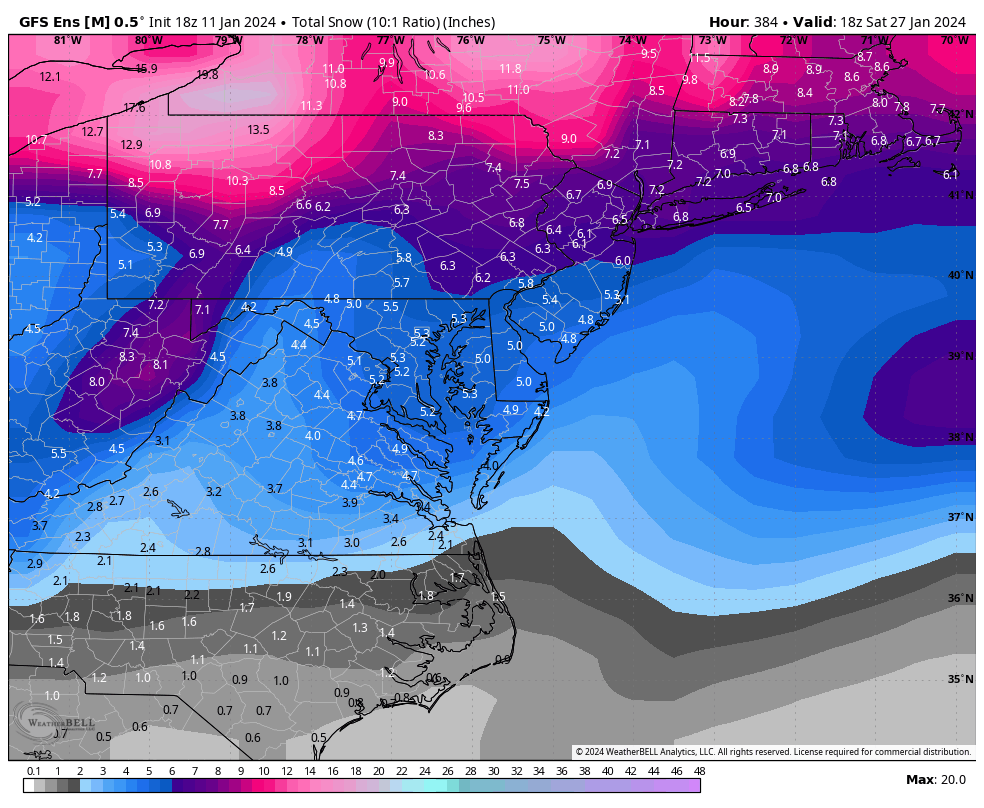
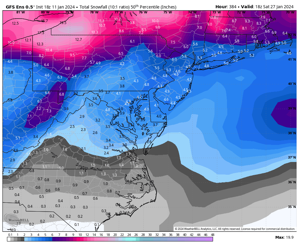
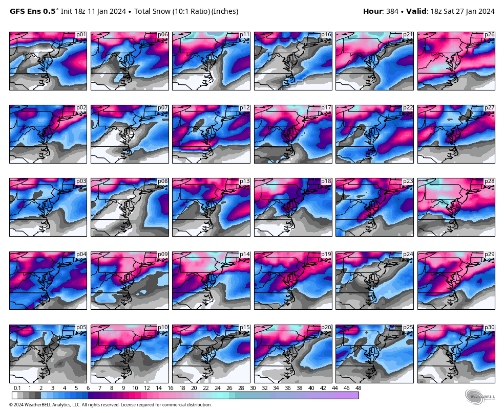
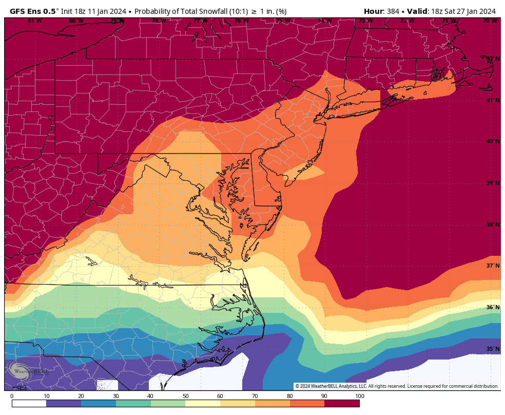
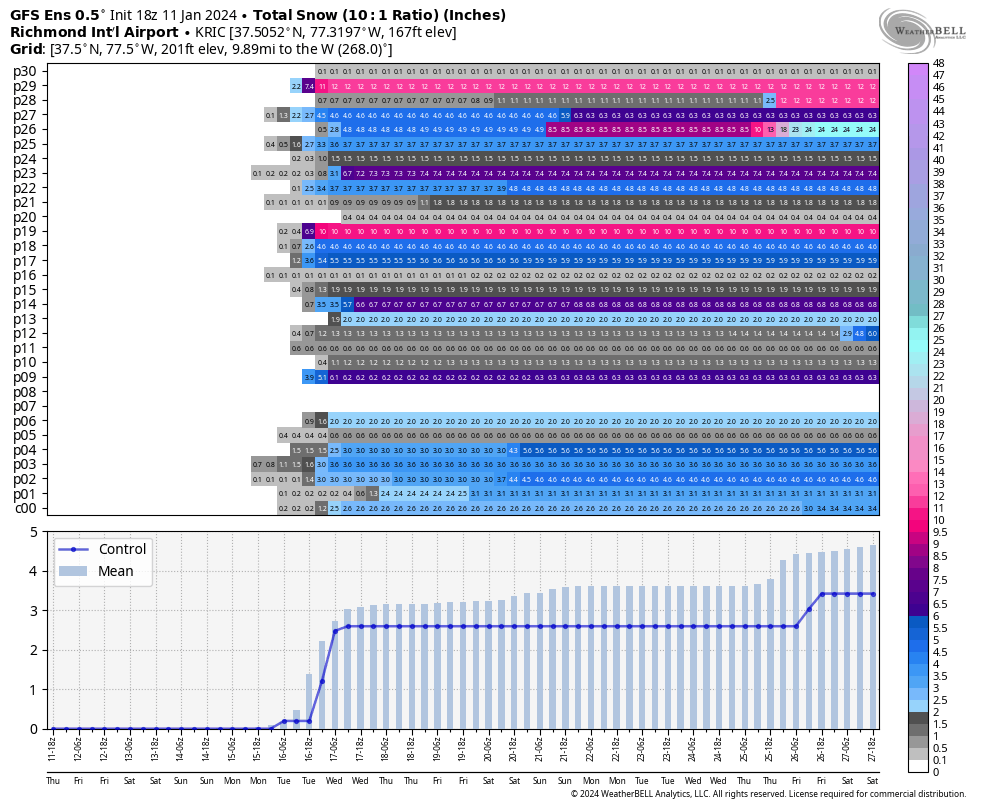
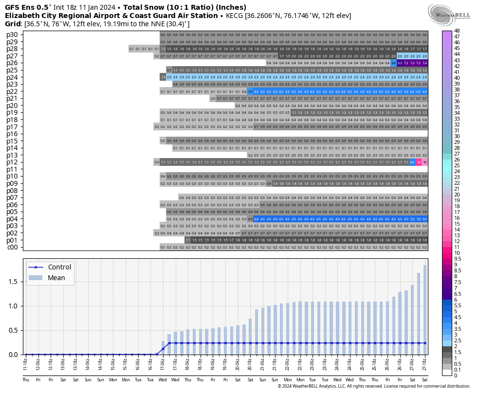
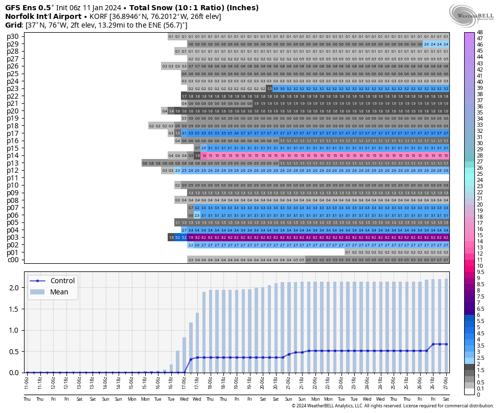
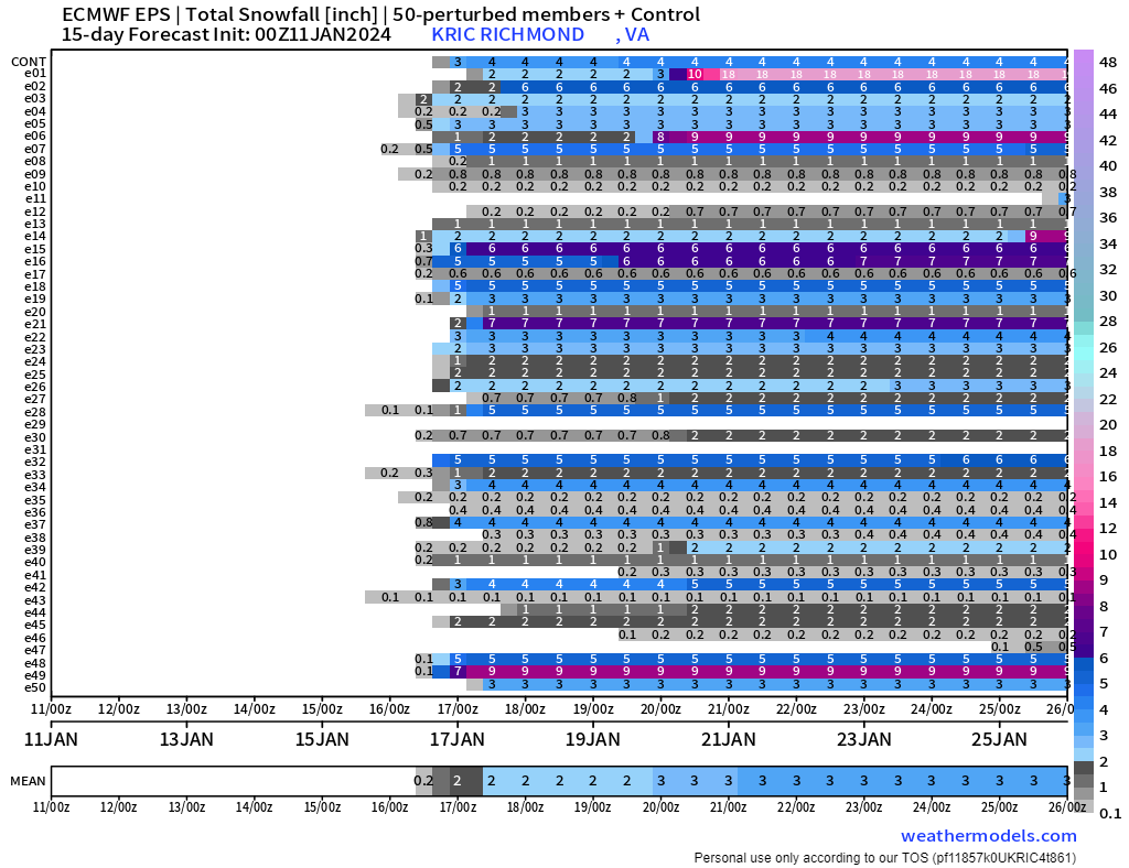
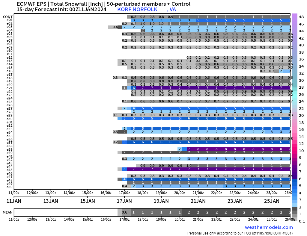
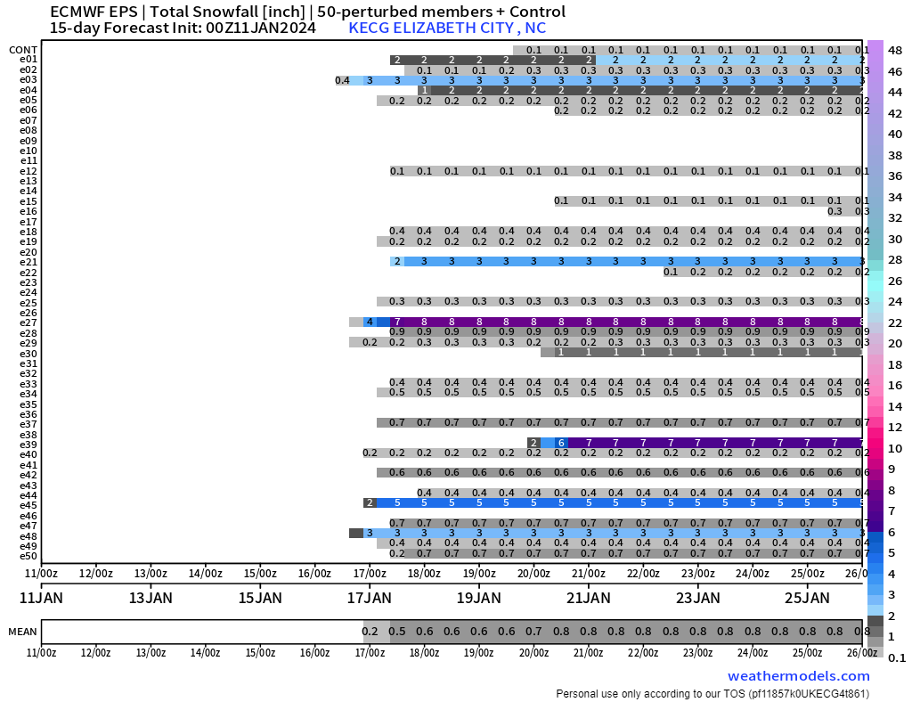
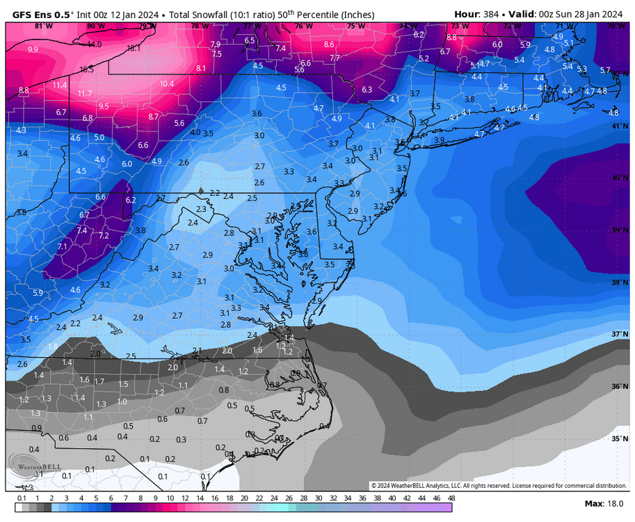
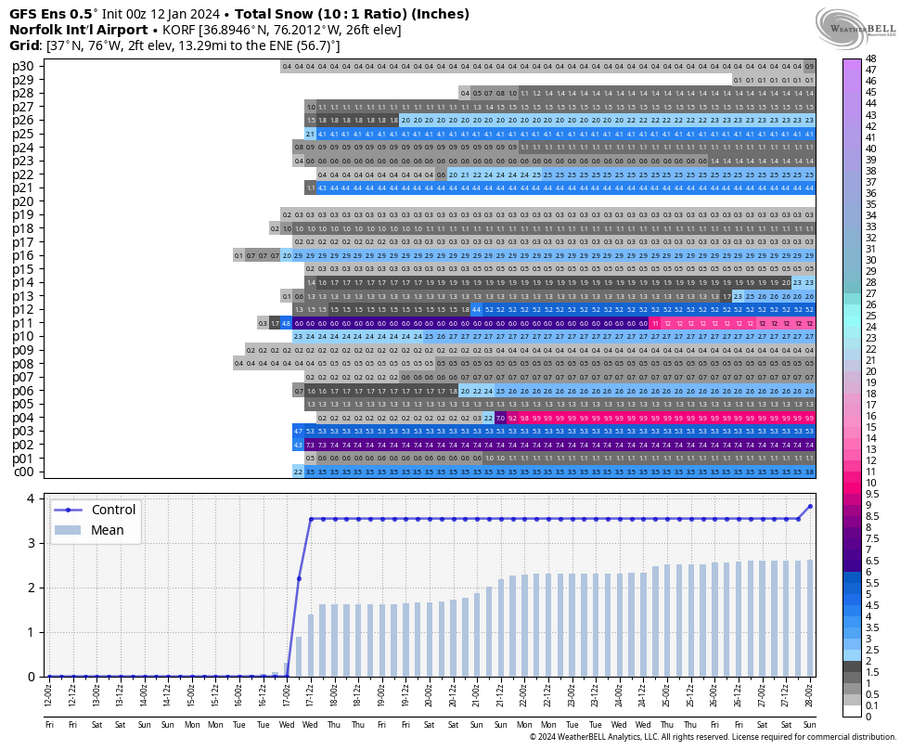
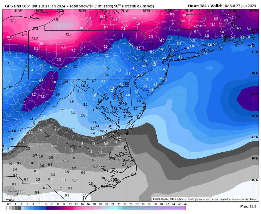
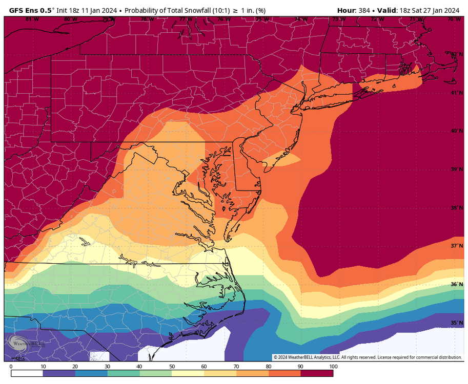
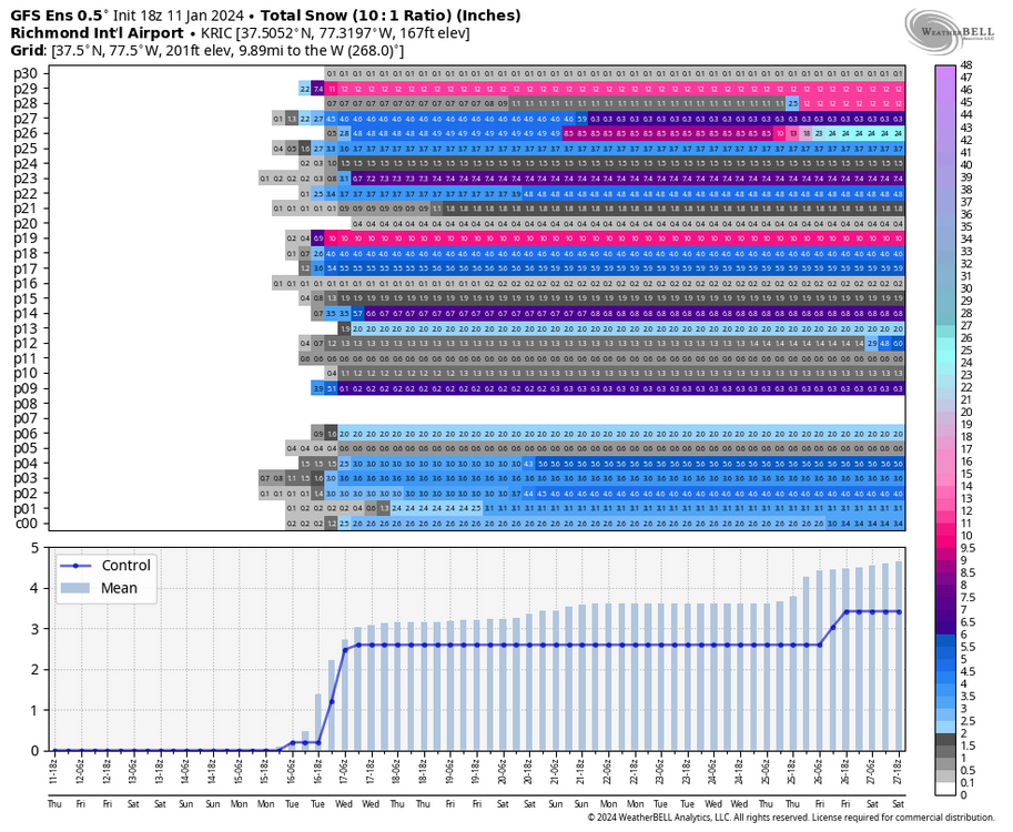
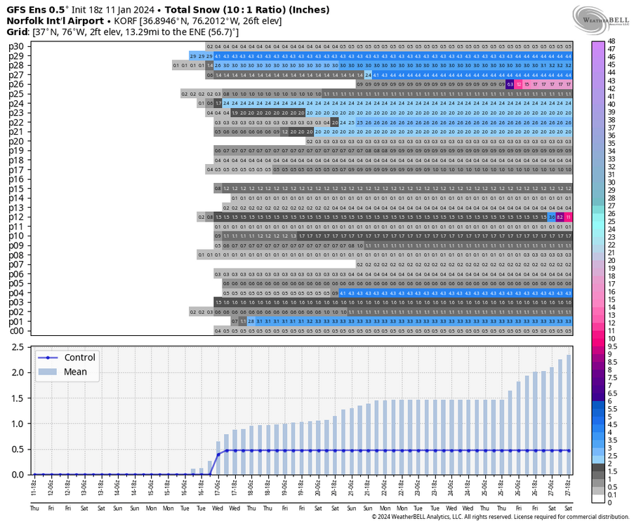
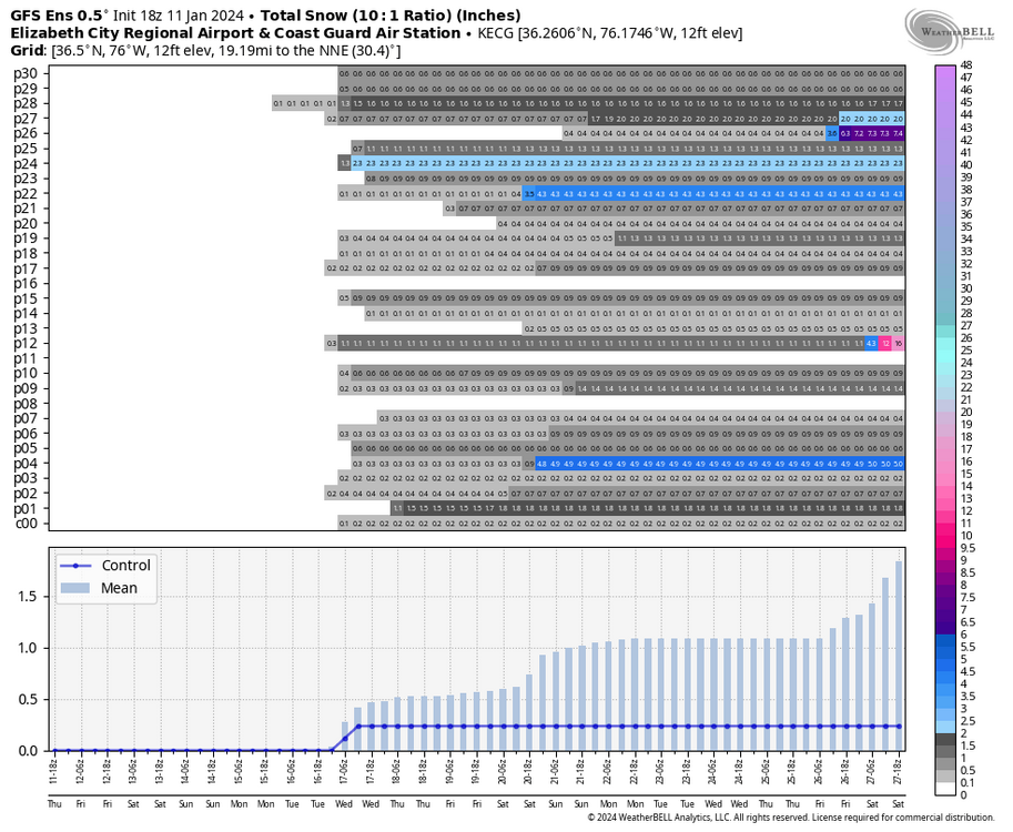
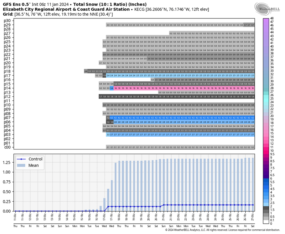
Definitely gonna be interesting. Hopefully, this doesn't slip away from us. The 6Z GFS was a step back but produced snow on the backside. Here is the 6Z GEFS, though. Most hits are centered around 1/16 to 1/17, which the below maps focus on. Looking at the charts, snow threats beyond early next week were weak, @ldub23. Today's 12Z could very well have a SE ridge at 384. I also added ECG for you, @Stormpc.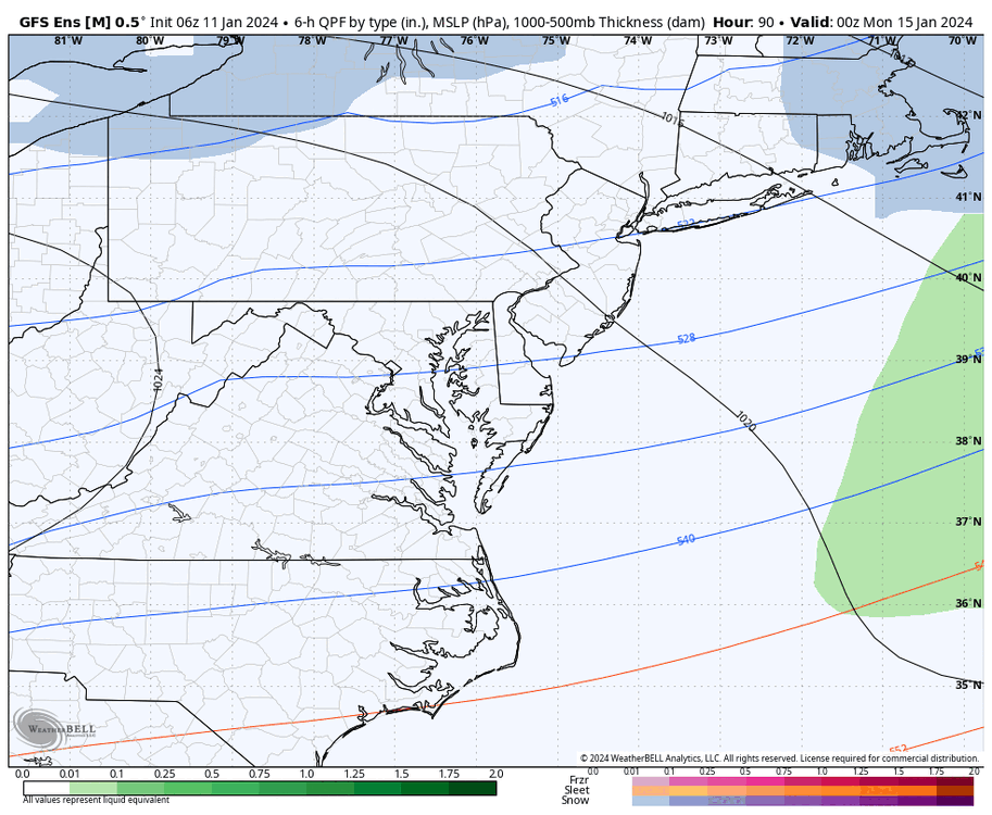


-
Richmond Metro/Hampton Roads Area Discussion
RIC Airport replied to RIC Airport's topic in Mid Atlantic
EPS