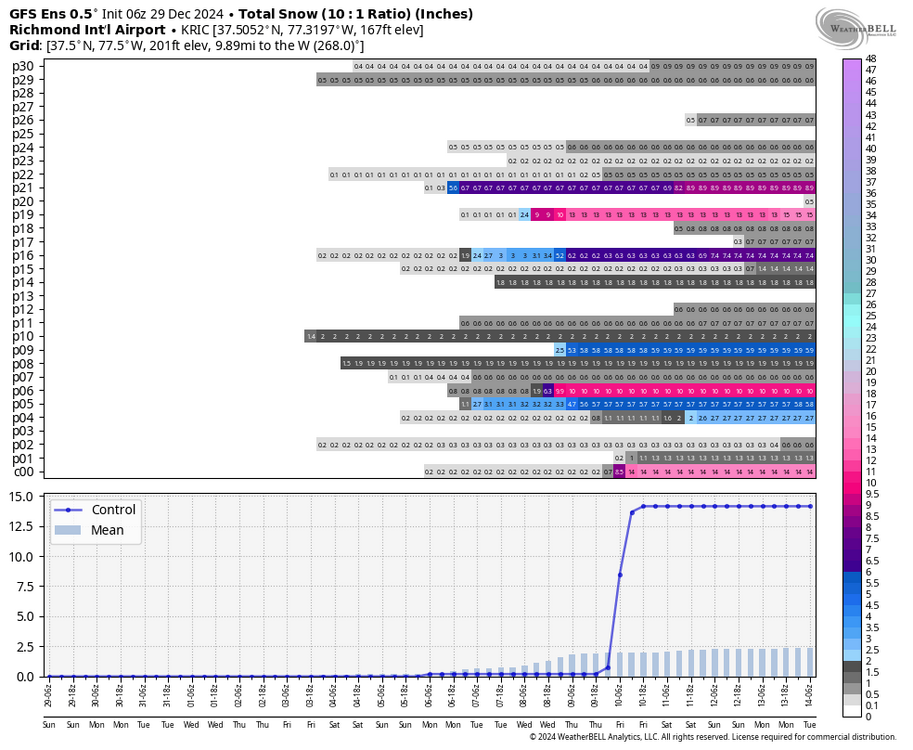
RIC Airport
-
Posts
2,586 -
Joined
-
Last visited
Content Type
Profiles
Blogs
Forums
American Weather
Media Demo
Store
Gallery
Everything posted by RIC Airport
-
Richmond Metro/Hampton Roads Area Discussion
RIC Airport replied to RIC Airport's topic in Mid Atlantic
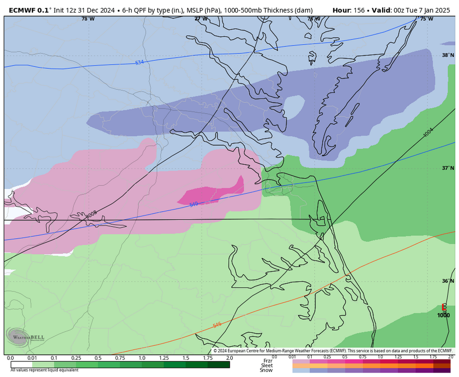
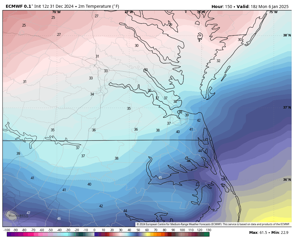
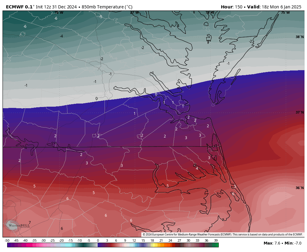
This Euro run suggests there will be a period of IP and ZR before a **possible** turnover to rain. Possible, because this is the warmest panel I see, it's a close call for Richmond. Surface temps are around 31-33 at hour 150, but the 925mb, 850mb and 700mb level appeared to remain below 0°C throughout the event. The last image actually has a changeover back to snow as colder air filters in as the coastal redevelops off the coast. Notice the 540 line moves SE of RIC at hour 156.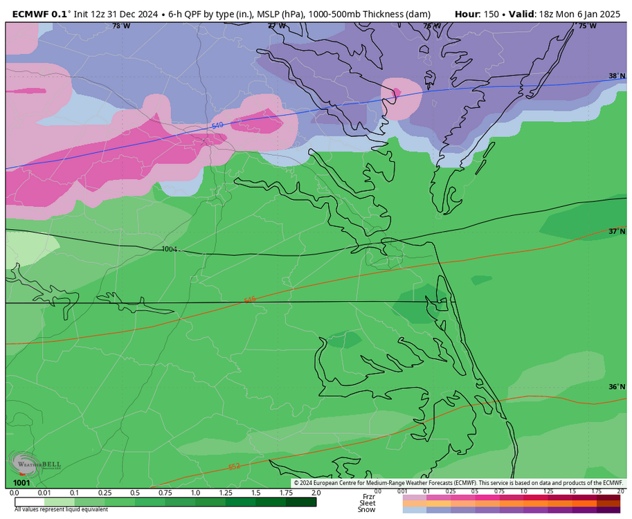


-
Richmond Metro/Hampton Roads Area Discussion
RIC Airport replied to RIC Airport's topic in Mid Atlantic
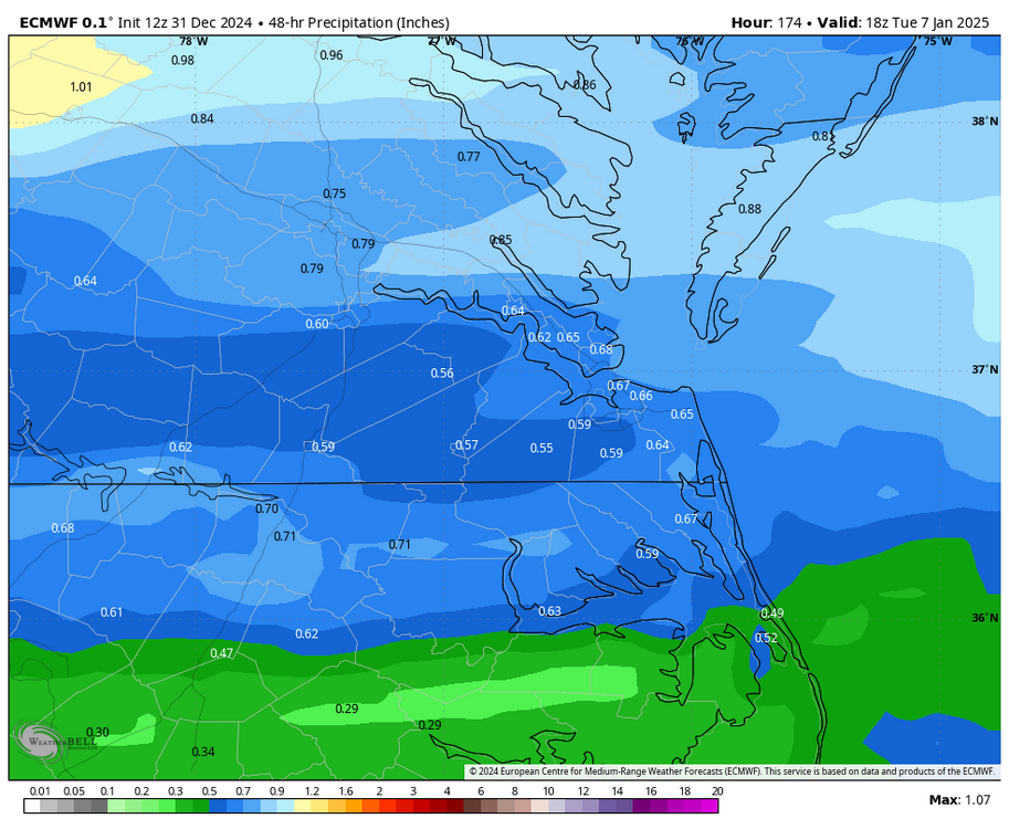
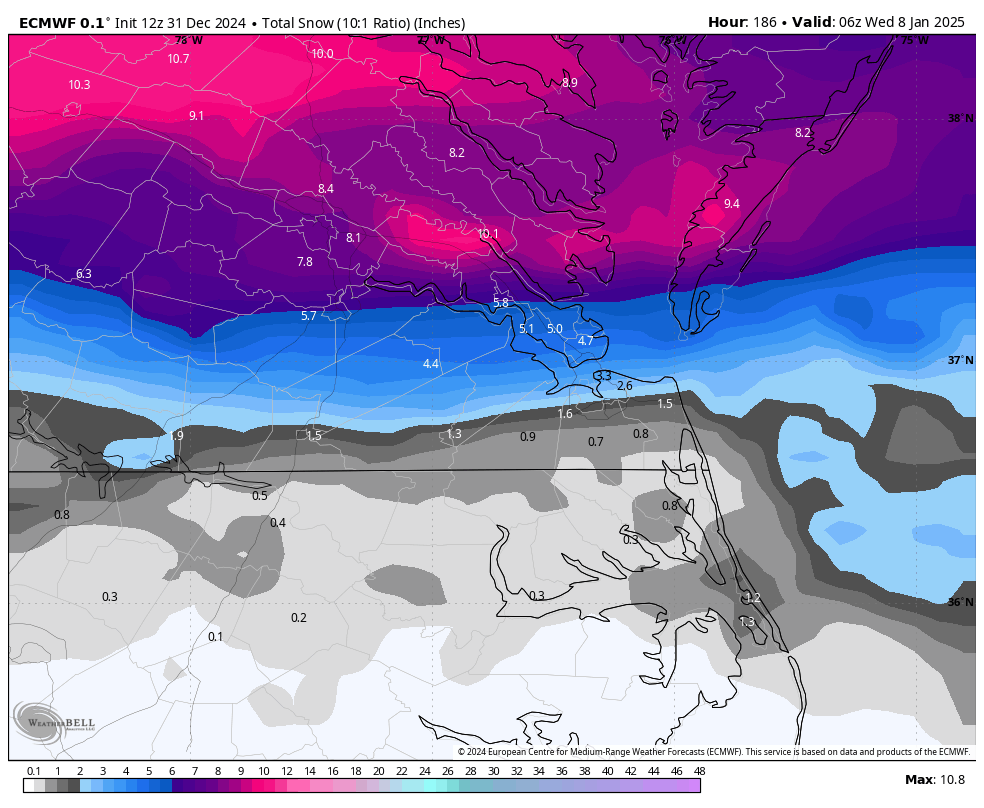
Euro came south with wave #1 with 4-8" common across metro RIC. But, of course, this assumes a 10:1 ratio. Not sure if it's a trend, but it's encouraging to see a colder solution. The model has about 0.80" of total QPF for the event.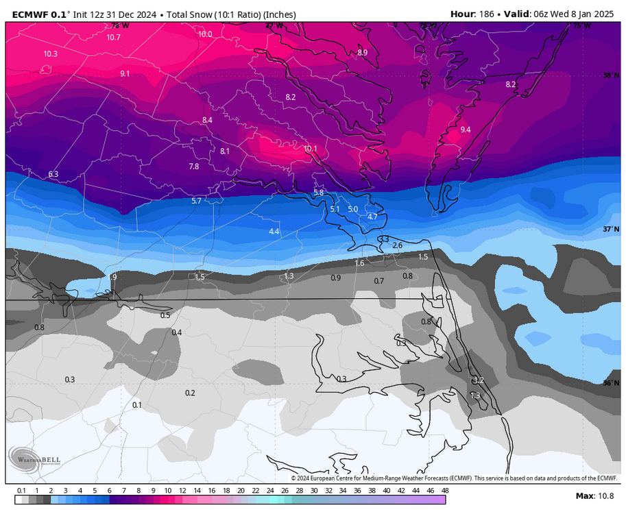

-
Richmond Metro/Hampton Roads Area Discussion
RIC Airport replied to RIC Airport's topic in Mid Atlantic
The 6Z GFS op renewed hope for wave 2, and the GEFS run was healthy, with about 8-10 good hits out of the 30 ensembles. If we're lucky, even wave one can provide a coating to an inch. But that might be asking for too much at this juncture. I hope the 12z suite turns things around for us, particularly the Euro.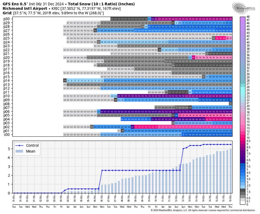

-
Richmond Metro/Hampton Roads Area Discussion
RIC Airport replied to RIC Airport's topic in Mid Atlantic
The earlier runs also factored in snow cover when the coldest of the air moved into the region. The op runs haven't been as snowy for us so single digits or even below 0°F readings are harder to do without snow cover around here. Also, it's starting to become apparent that supression will be an issue for us. There is still time, but I'm not liking the trends so far for wave #2. -
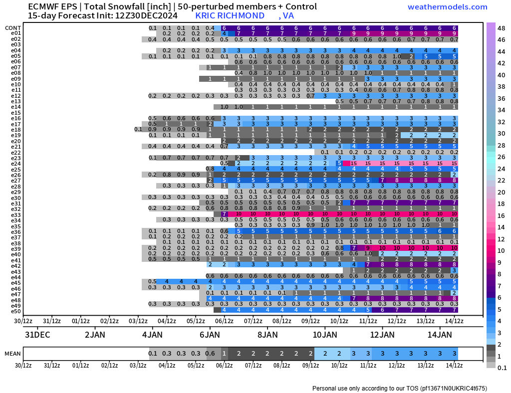
Richmond Metro/Hampton Roads Area Discussion
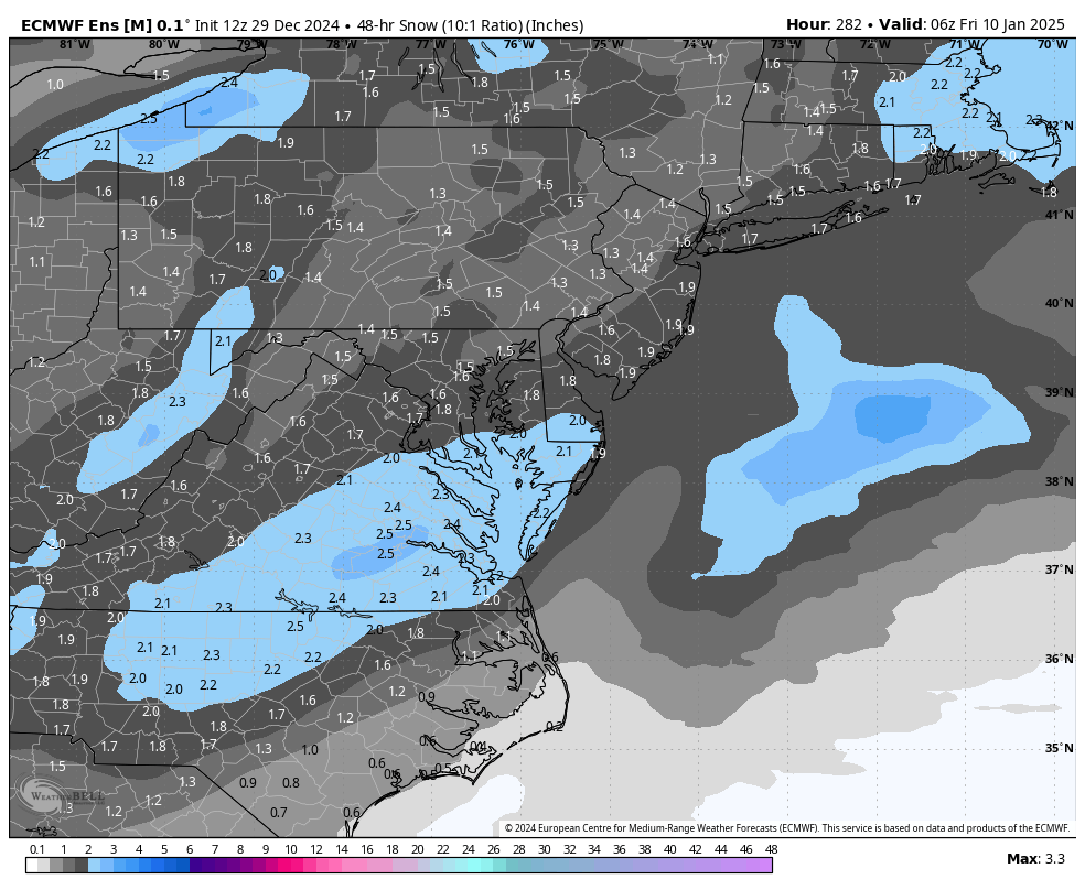
RIC Airport replied to RIC Airport's topic in Mid Atlantic
If you look at the chart below, most of the potential is from later next week.
-
Richmond Metro/Hampton Roads Area Discussion
RIC Airport replied to RIC Airport's topic in Mid Atlantic
AKQ has introduced chance of snow Sunday night for most zones. Latest Disco below. .LONG TERM /THURSDAY NIGHT THROUGH MONDAY/... As of 300 PM EST Tuesday... Key Messages: - A disturbance brings a chance for light rain/snow Friday afternoon and evening across northern and eastern portions of the area. - Temperatures trend much colder for the weekend. - Continuing to keep an eye on the Sunday night-Monday timeframe. Chances for some sort of winter weather has increased, but confidence on the details remains low at this point. Cold temperatures and mainly dry conditions are expected through most of the extended period as transient high pressure initially settles over the area. Aloft, brisk zonal/quasi-zonal flow is expected late Thursday/early Friday, before heights fall in advance of a digging trough Friday afternoon/evening. This evolution is likely to lead to sfc low development offshore of the area as strong cold advection pushes in behind a cold front. Highs Friday warm into the mid-upper 40s. However, the aforementioned upper disturbance should spark off increased cloudiness and perhaps some light precip across northern portions of the area Friday afternoon, transitioning eastward toward the coast Friday evening and early overnight. While deep-layer moisture is lacking, forecast soundings support light snow or a rain/snow mix with temps well below freezing just above the sfc (sfc temps quickly fall into the 30s by the evening). For now, only have slight chc PoPs for the Northern Neck, Eastern Shore, and coastal SE VA/NE NC. Quickly clearing out for Saturday and most of Sunday as cold Canadian high pressure builds down from the Midwest. Highs both days struggle to reach 40 F, with mid-upper 30s expected across the N/NW. Overnight lows also trend cold and lows Friday and Saturday night in the teens and 20s are expected... "mildest" at the immediate coast. Uncertainty then builds Sunday night into Monday as a potent shortwave ejects out of Desert Southwest and Plains. Some sort of precip, some potentially of the wintry variety, is looking increasingly probable by early Monday as sfc low pressure slides into the Great Lakes region. Most of the uncertainty is present only because this event remains ~7 days away and perfect agreement among the model guidance is just not possible at this lead time. For example, while the deterministic GFS and ECMWF suggest somewhat similar sfc evolutions and potential winter wx from precip overrunning a cold low-level airmass, several of their ensembles and the deterministic Canadian depict quite different solutions. Will continue to show a chance of snow for most of our area late Sunday night during precip onset, transitioning to rain/snow around sunrise Monday, and then rain Monday. Additionally, there are many unknowns about p-type as soundings show slight differences in the warm nose magnitude and precip intensity. Thus, will continue to keep p-types limited to rain and snow and introduce freezing rain and sleet as confidence increases (if necessary). Either way, the best chance of winter wx is inland and especially across our northern counties. Probabilities from the ECMWF ensemble for >1" and >3" snow increased with this cycle, with ~50% and ~20% respectively...roughly from the RIC metro and points N and E. Probs from the GEFS and CMC ensemble are lower so mainly just something to monitor at this point. Regardless of any wintry wx, there is high confidence in below average temperatures through most of next week -
Richmond Metro/Hampton Roads Area Discussion
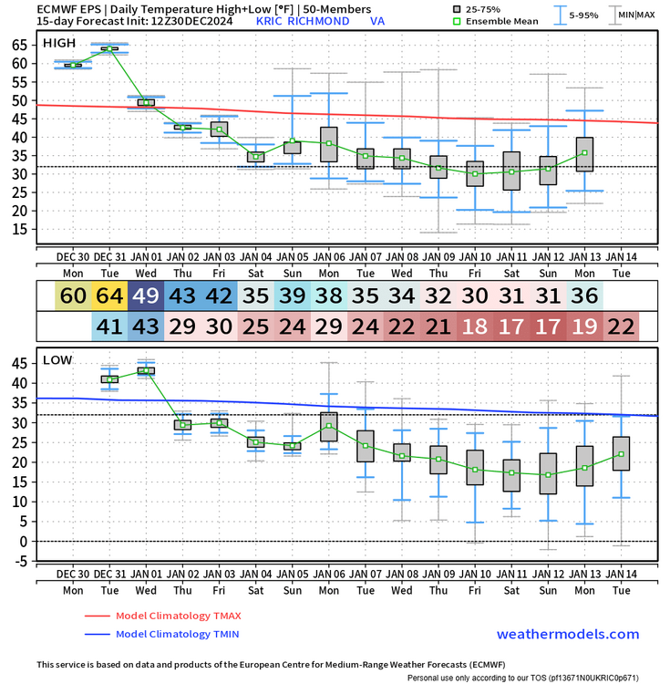
RIC Airport replied to RIC Airport's topic in Mid Atlantic
EPS mean was still decent, although certainly can be better for January. Hopefully things rebound in the coming days. If RIC stays below freezing for more than two days in a row, it will be the longest stretch of cold since January 2018 when there were 4 days remaining below freezing. There would've been a 7 day stretch had it not been for the lone high of 34°F in the middle.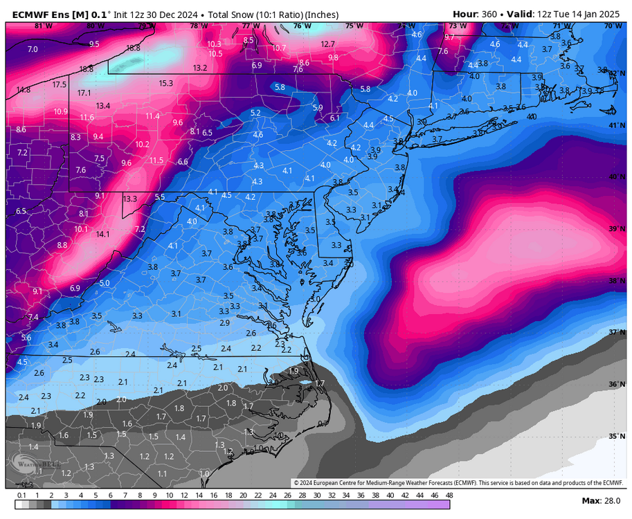

-
Richmond Metro/Hampton Roads Area Discussion
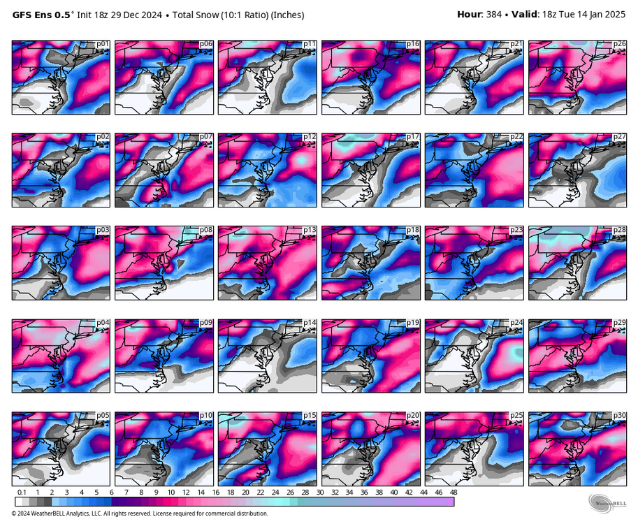
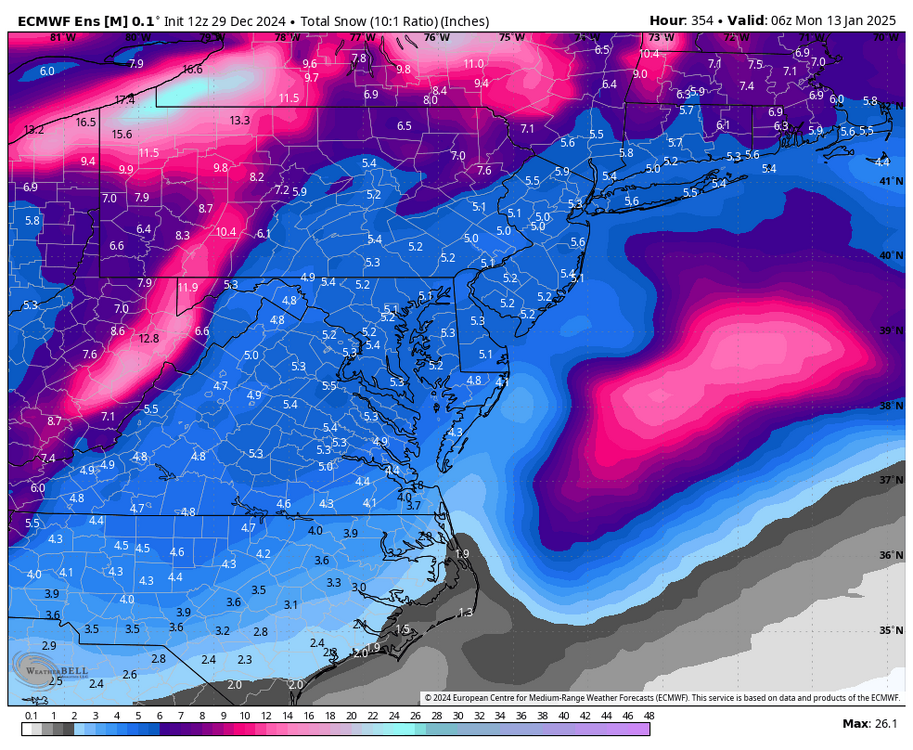
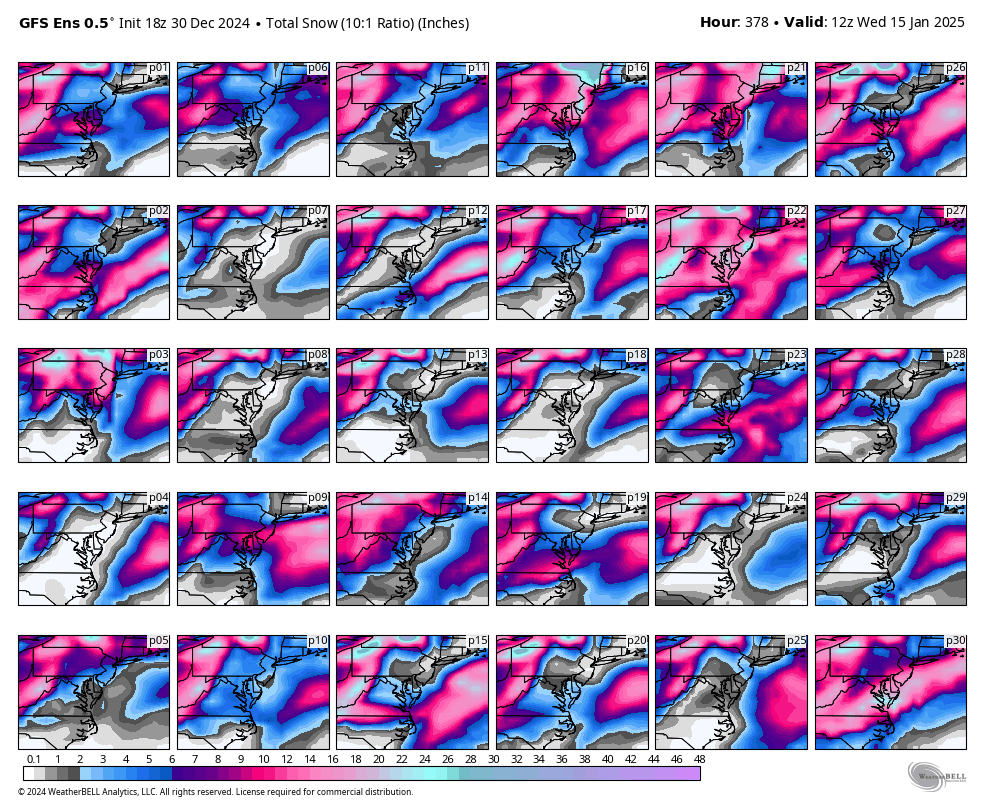
RIC Airport replied to RIC Airport's topic in Mid Atlantic
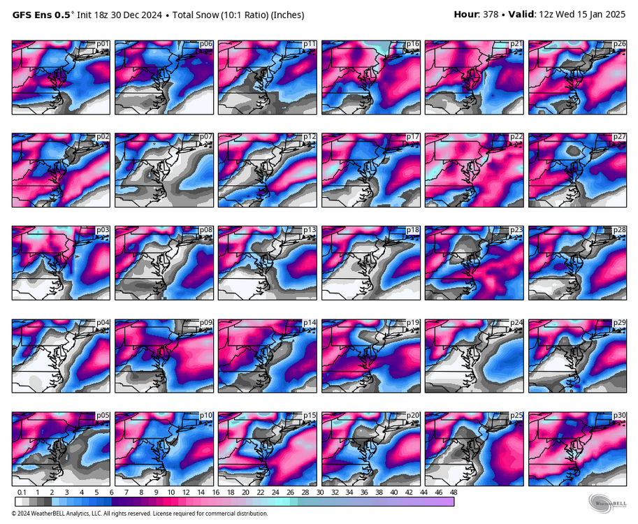
Final GEFS run
-
Richmond Metro/Hampton Roads Area Discussion
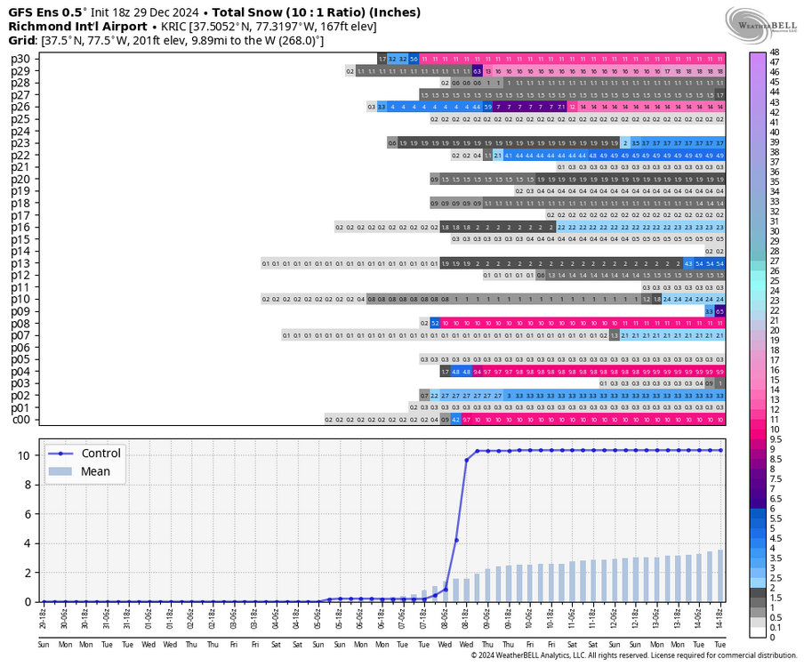
RIC Airport replied to RIC Airport's topic in Mid Atlantic
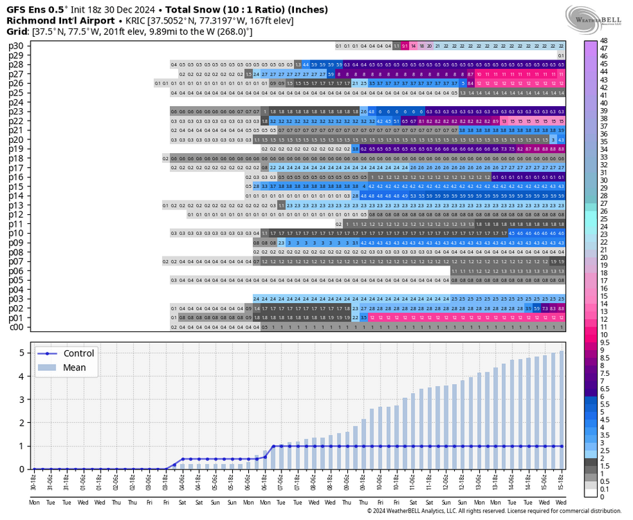
Yes, I had to step a way for a bit, but will post the GEFS. Things are still looking RIPE for cold and snow and every run will offer a different solution as expected, but what a close call with this one, looks like it tries to phase too late. This may be the best January we've had since 2014 with all the opportunities combined with good cold.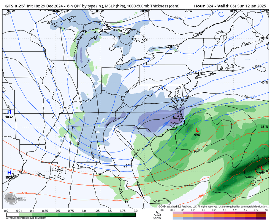
-
Richmond Metro/Hampton Roads Area Discussion
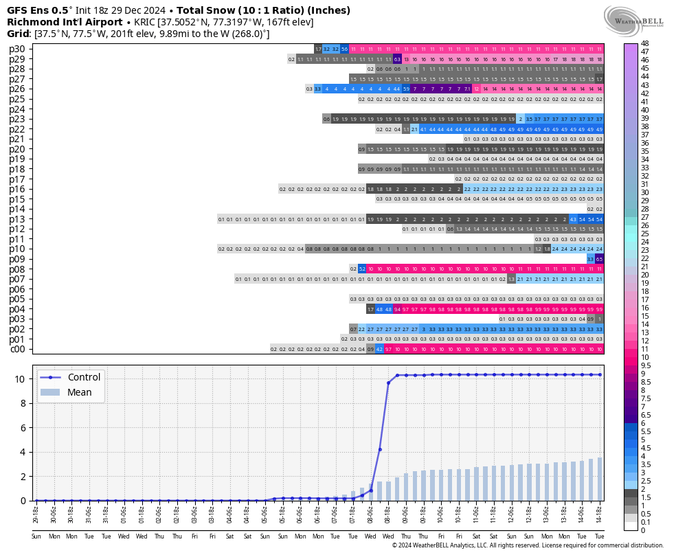
RIC Airport replied to RIC Airport's topic in Mid Atlantic
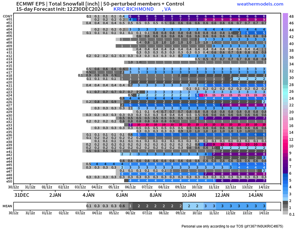
32"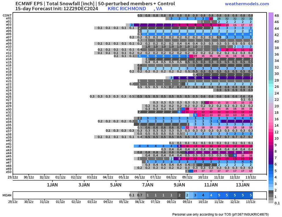
-
Richmond Metro/Hampton Roads Area Discussion
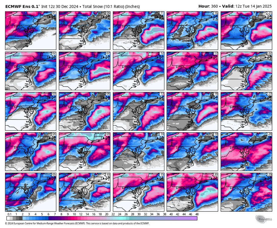
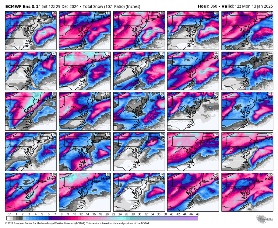
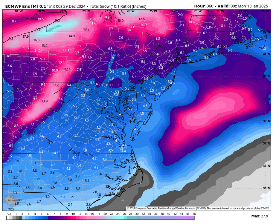
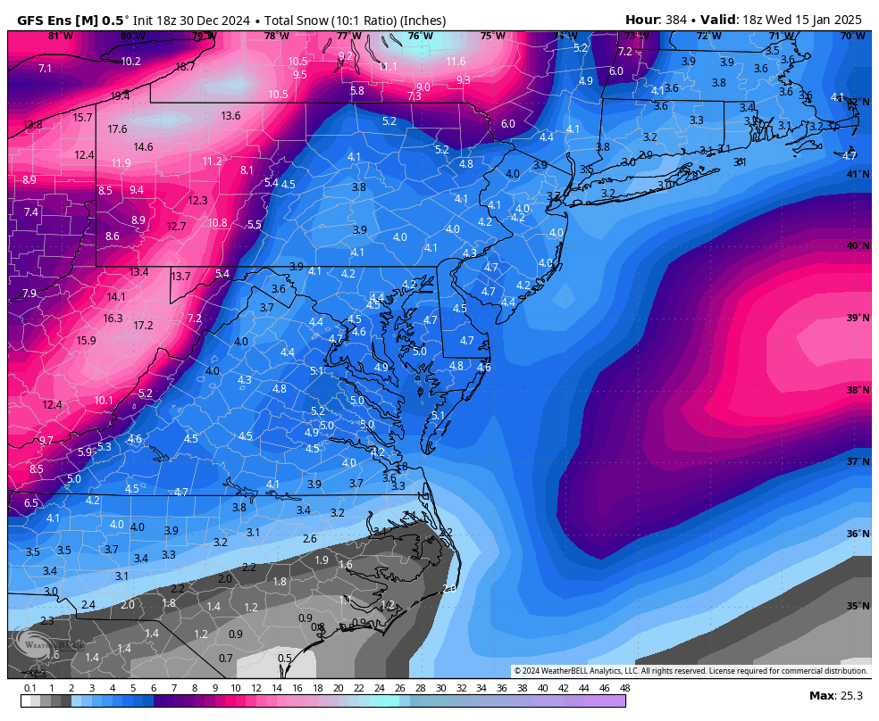
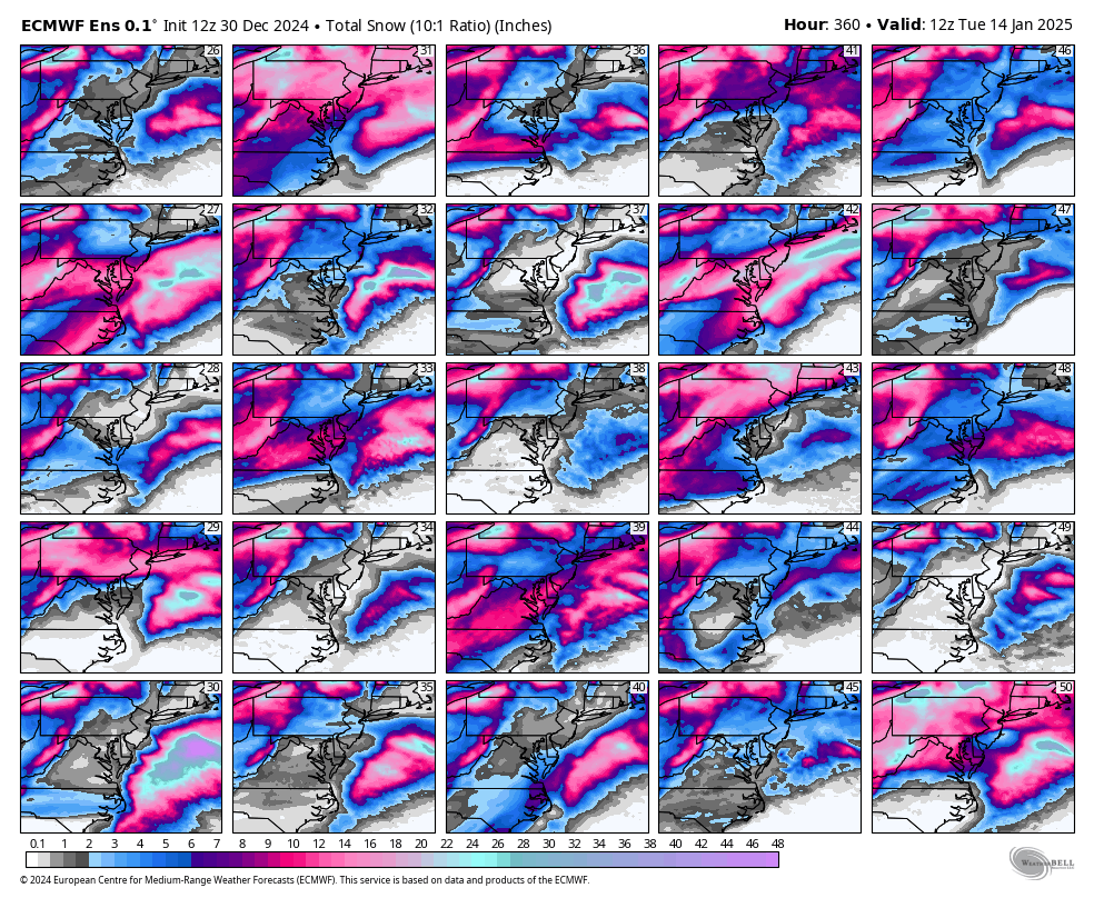
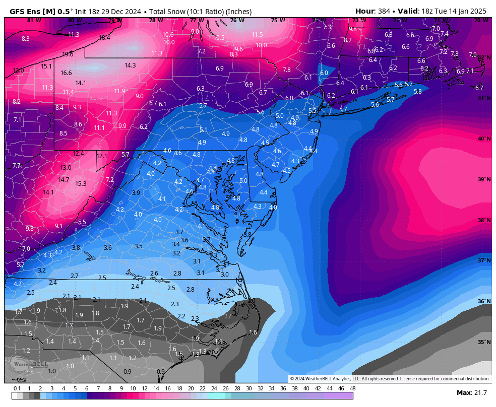
RIC Airport replied to RIC Airport's topic in Mid Atlantic
I usually prefer to wait until the run is completely finish. Here is thru hr 360.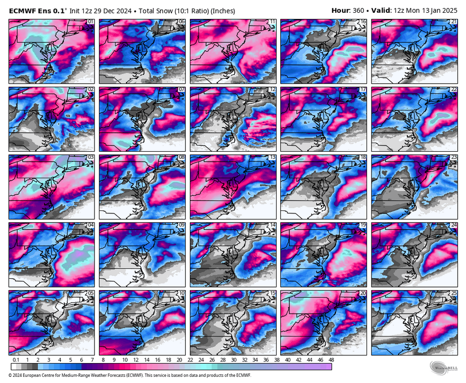
-
Richmond Metro/Hampton Roads Area Discussion
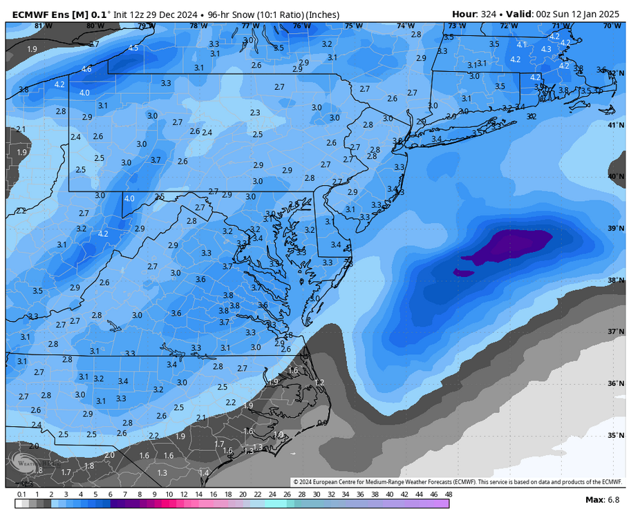
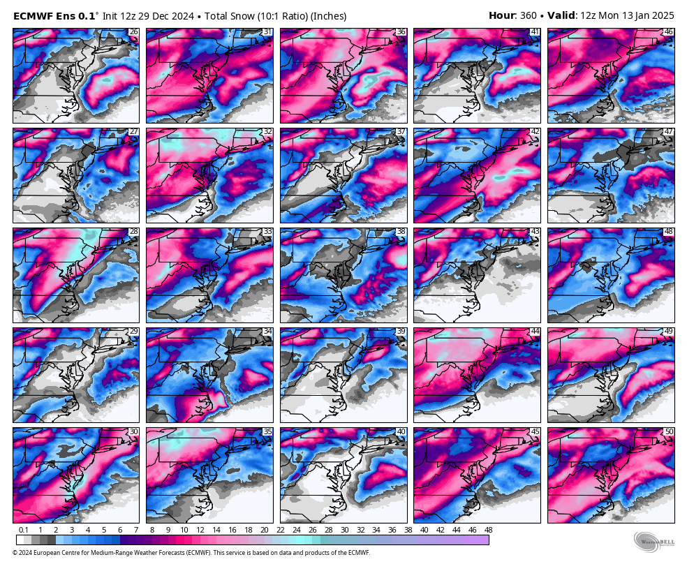
RIC Airport replied to RIC Airport's topic in Mid Atlantic
Highest 2 and 4 day mean maps.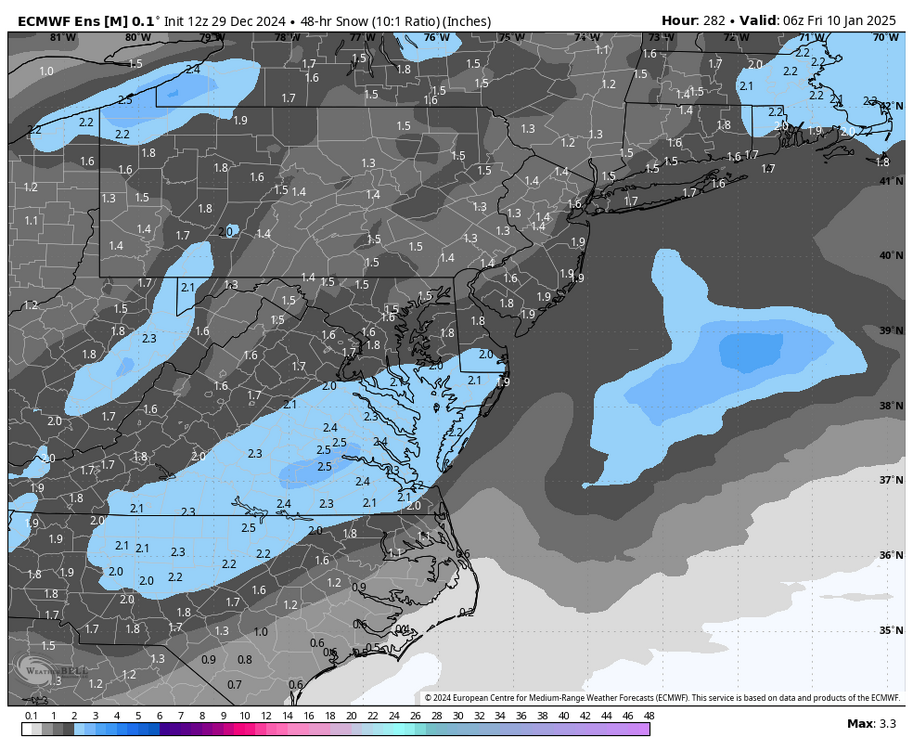
-
Richmond Metro/Hampton Roads Area Discussion
RIC Airport replied to RIC Airport's topic in Mid Atlantic
-
Richmond Metro/Hampton Roads Area Discussion
RIC Airport replied to RIC Airport's topic in Mid Atlantic
EPS coming in STRONG!! -
Richmond Metro/Hampton Roads Area Discussion
RIC Airport replied to RIC Airport's topic in Mid Atlantic
That RDU to ORF signal is strong on the GEFS. Plenty of examples where Richmond did well despite the heaviest snows to the S and E. 1/7/2017 is a recent example.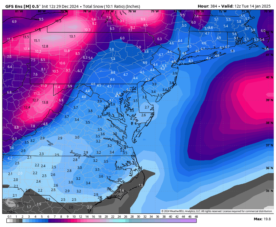
-
Richmond Metro/Hampton Roads Area Discussion
RIC Airport replied to RIC Airport's topic in Mid Atlantic
I'll post the finals when they are done, but the numbers are still ticking up. -
Richmond Metro/Hampton Roads Area Discussion
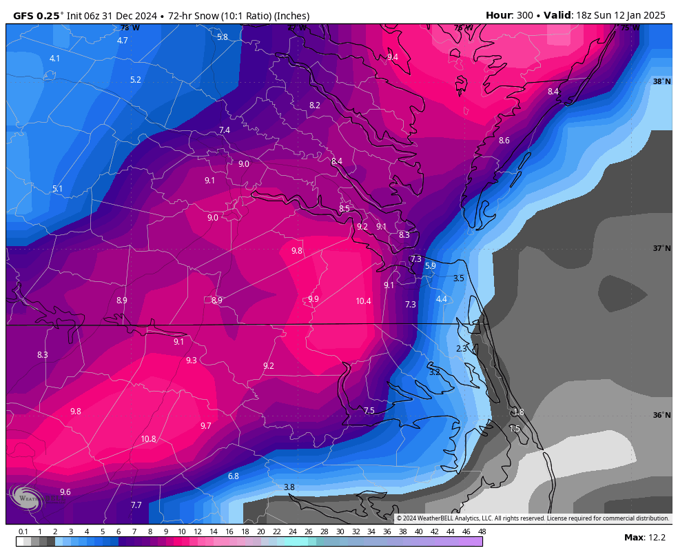
RIC Airport replied to RIC Airport's topic in Mid Atlantic
This only through hour 294, but certainly a RDU to ORF snowstorm signal.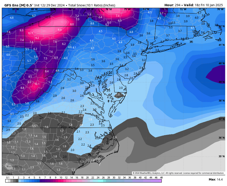
-
Richmond Metro/Hampton Roads Area Discussion
RIC Airport replied to RIC Airport's topic in Mid Atlantic
They're still running. Euro has a different solution for the storm on the 6th.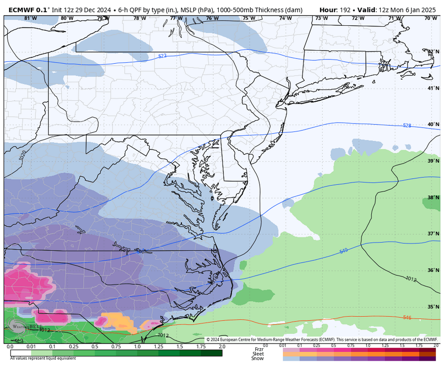

-
Richmond Metro/Hampton Roads Area Discussion
RIC Airport replied to RIC Airport's topic in Mid Atlantic
The CMC has the 2nd wave farther north delivering mostly for Hampton Roads.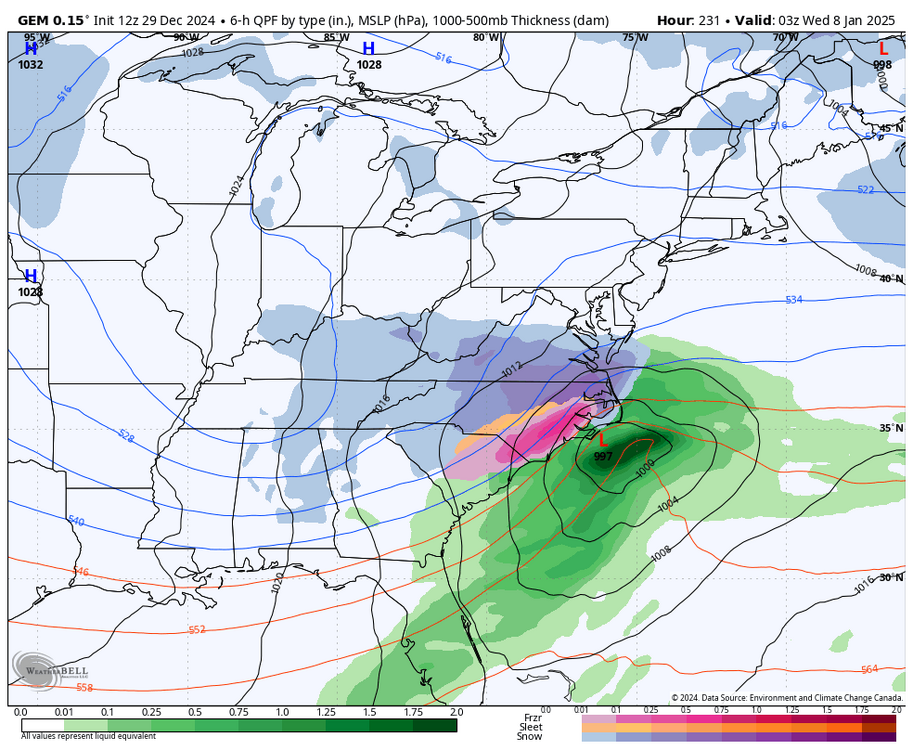
-
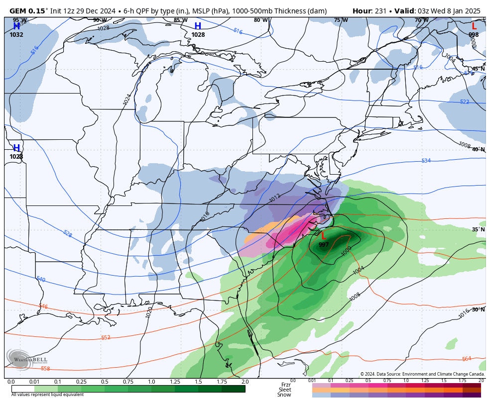
Richmond Metro/Hampton Roads Area Discussion
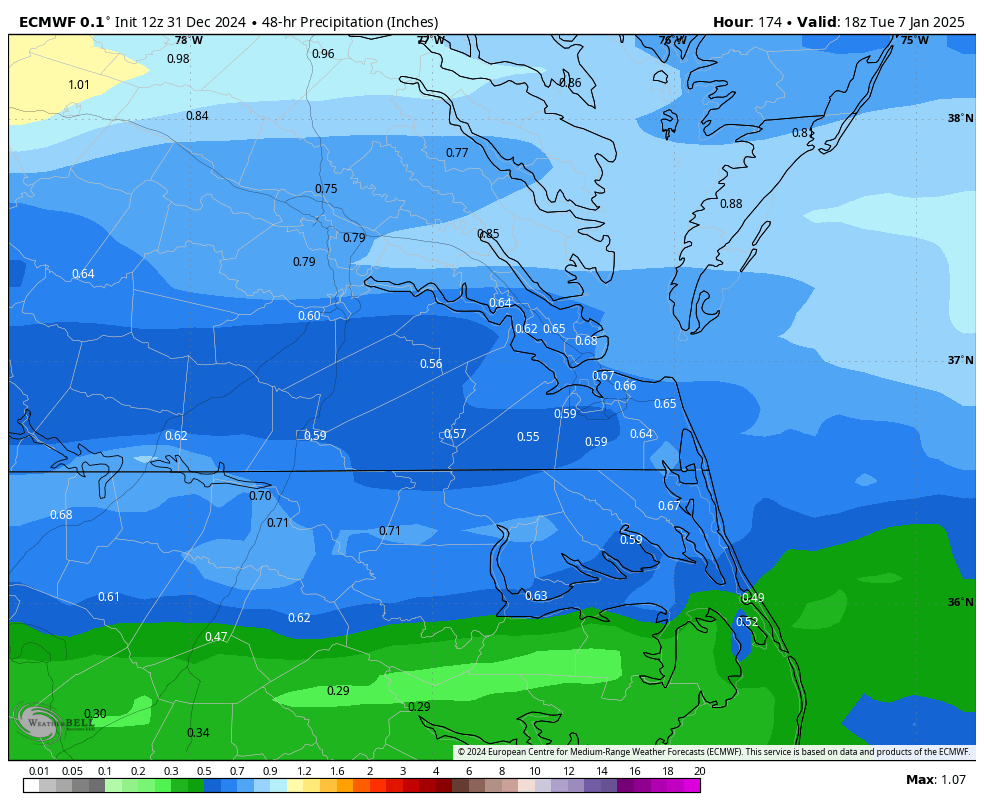
RIC Airport replied to RIC Airport's topic in Mid Atlantic
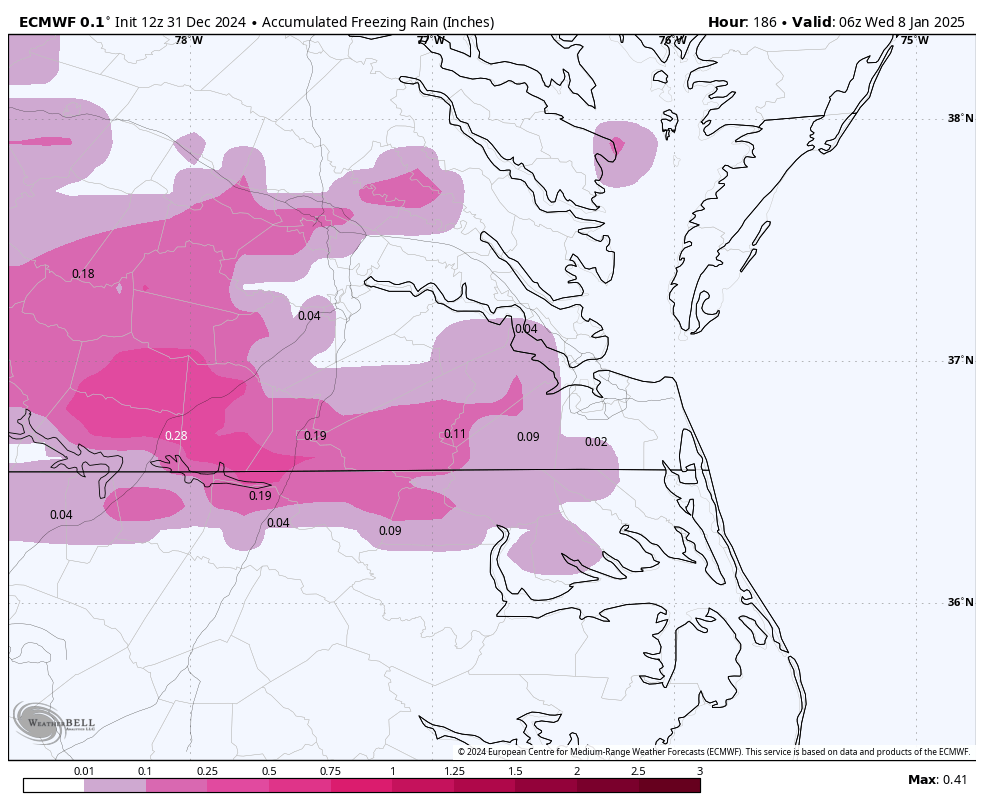
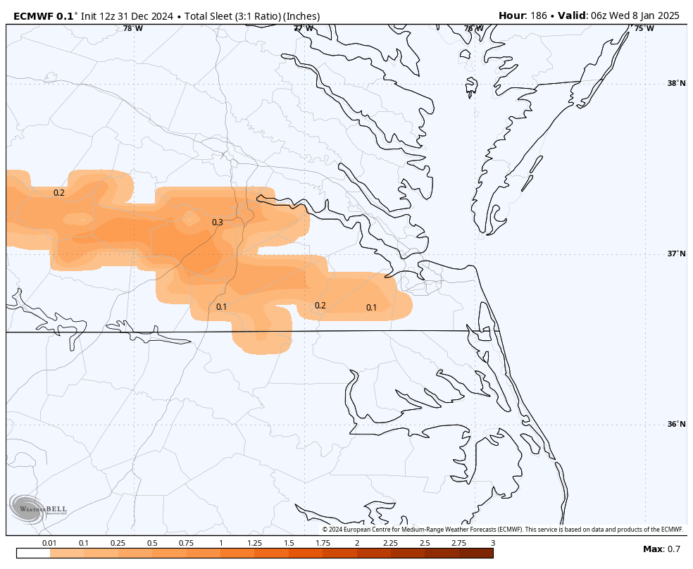
12Z GFS has the initial wave for 1/6 to 1/7 cutting west of the mountains, but we start as snow and then change to IP/ZR. As depicted, there could actually be a significant amount of ice in spots before changing over to rain. The next wave is suppressed to our south, but it is certainly not a bad spot at this range, as things do trend north over time. -
Richmond Metro/Hampton Roads Area Discussion
RIC Airport replied to RIC Airport's topic in Mid Atlantic
Certainly a step back from 00Z, but still a signal. Let's hope 12Z is a bump back in the right direction. Here is the 00Z run map for reference.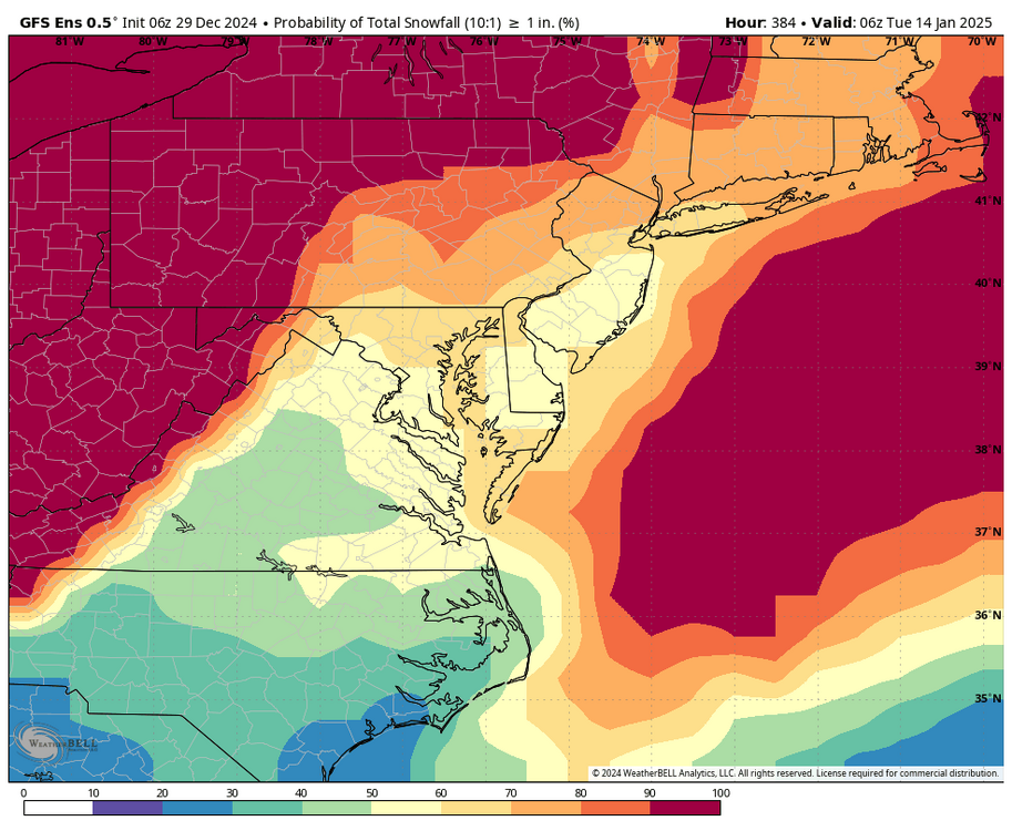

-
Richmond Metro/Hampton Roads Area Discussion
RIC Airport replied to RIC Airport's topic in Mid Atlantic
.thumb.png.926e18a24cfd91cac7a02f2df28ea14f.png)
.thumb.png.1cddcd2bc0f600c37c7b5a329ae8279d.png)
-
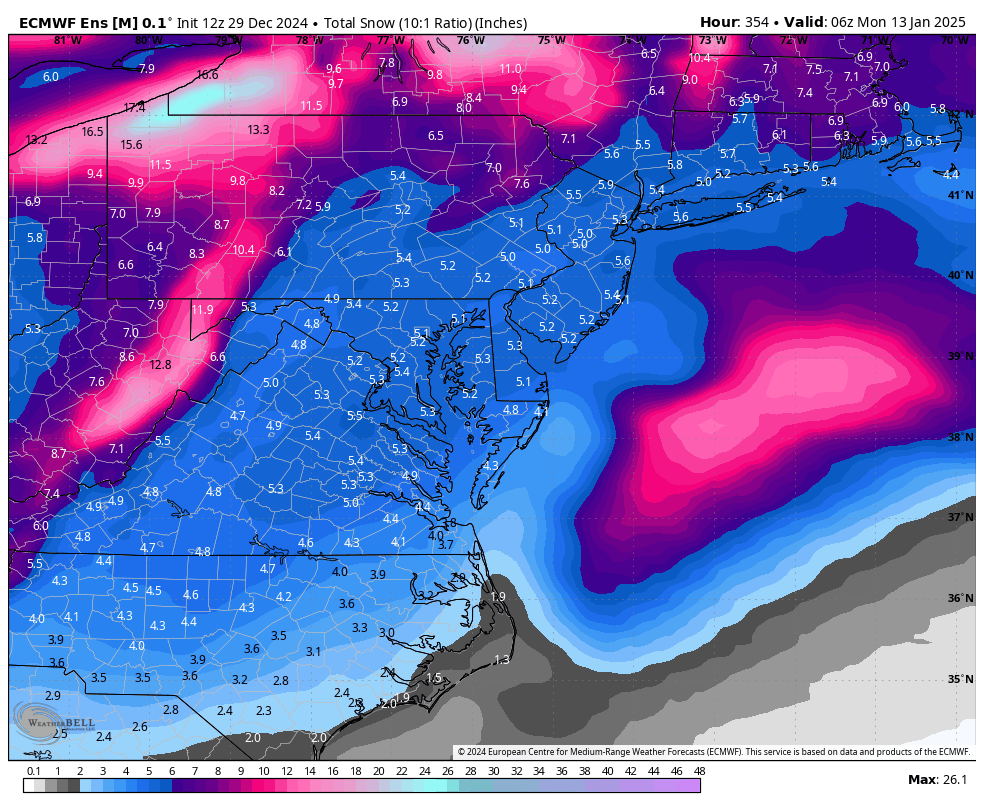
Richmond Metro/Hampton Roads Area Discussion
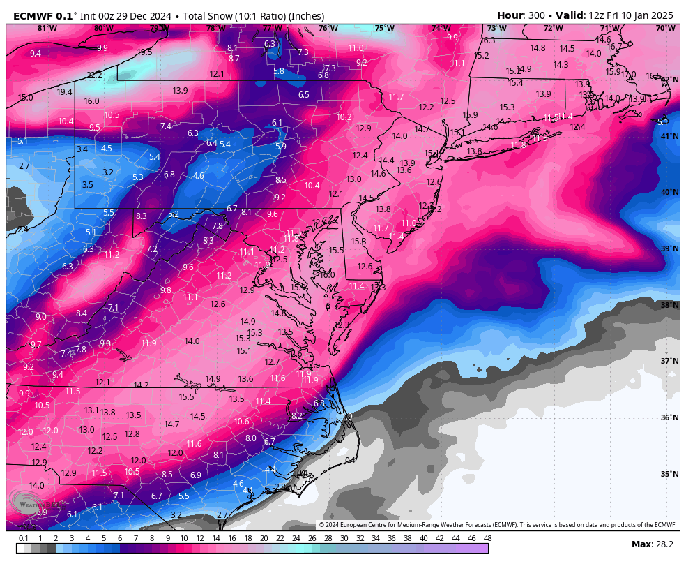
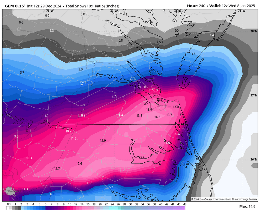
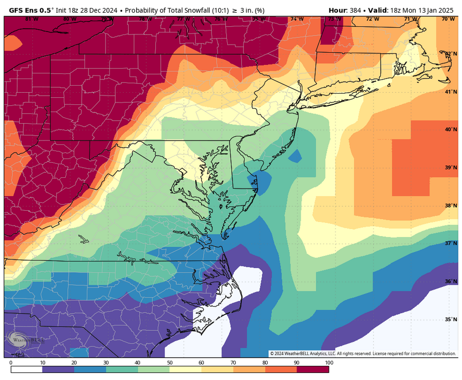
RIC Airport replied to RIC Airport's topic in Mid Atlantic
00z Euro has a HECS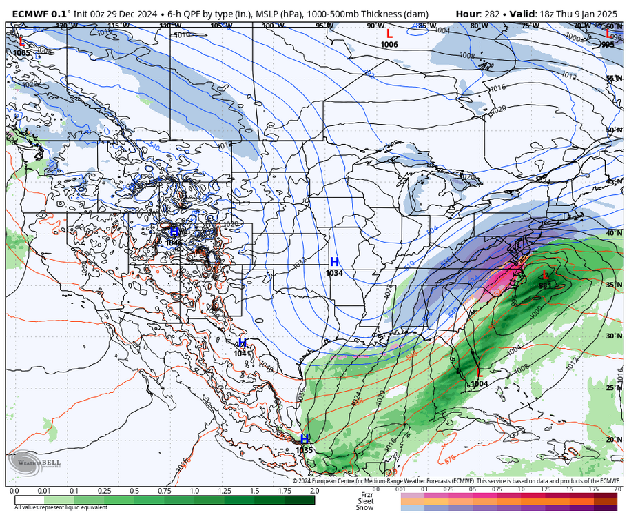

-
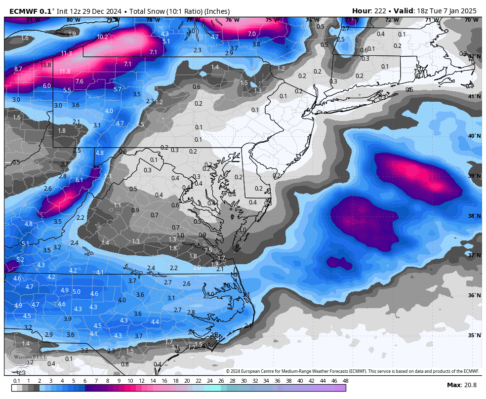
Richmond Metro/Hampton Roads Area Discussion
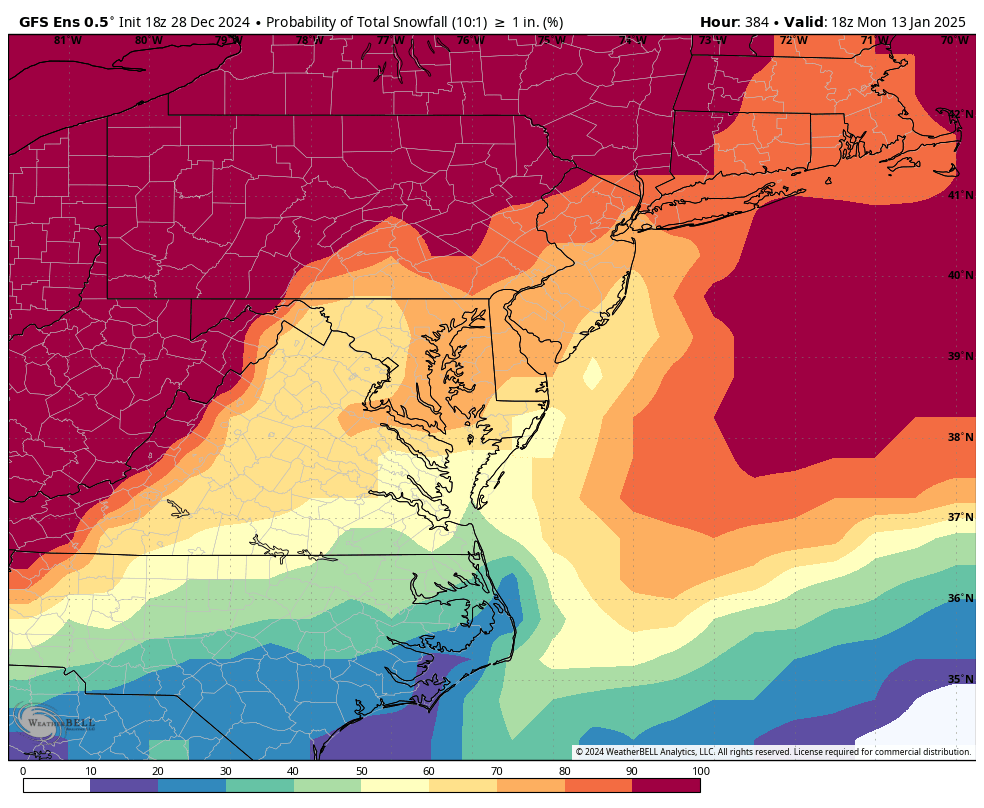
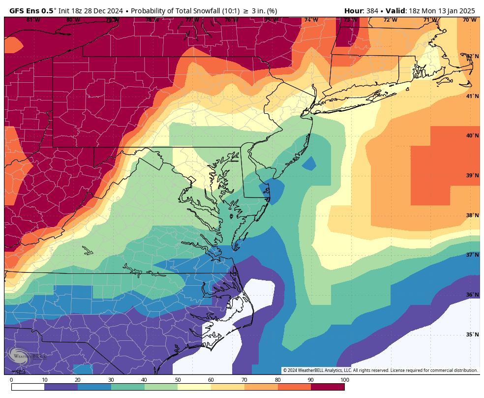
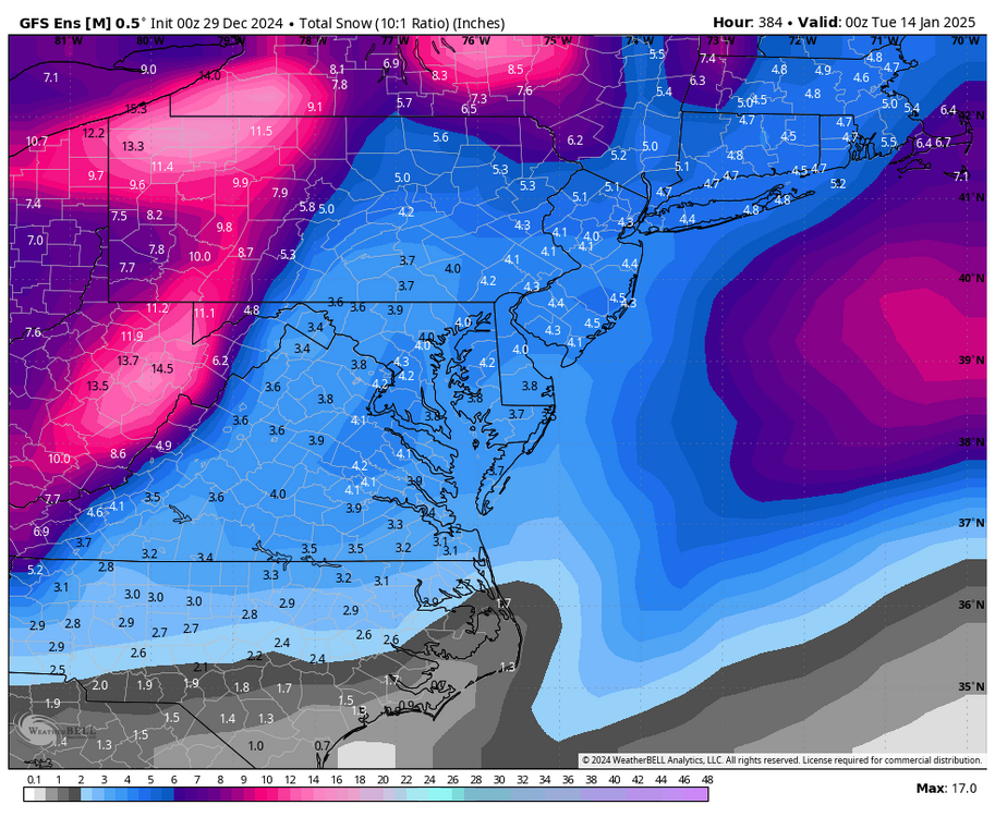
RIC Airport replied to RIC Airport's topic in Mid Atlantic
00z GFS has provided another snow event for the 7-8th. Still a long ways to go unfortunately.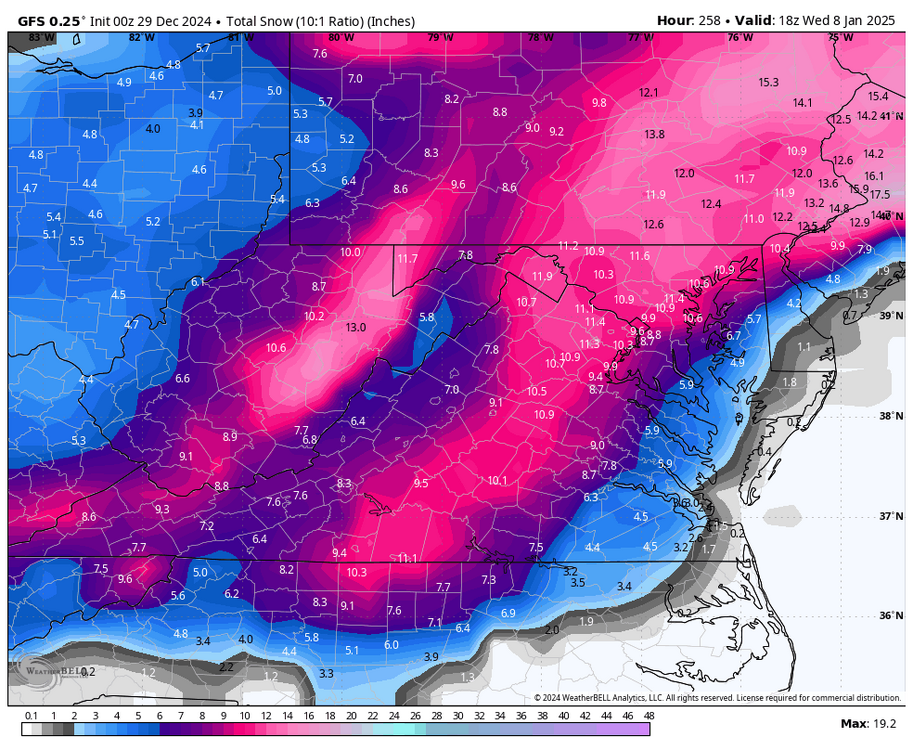
-
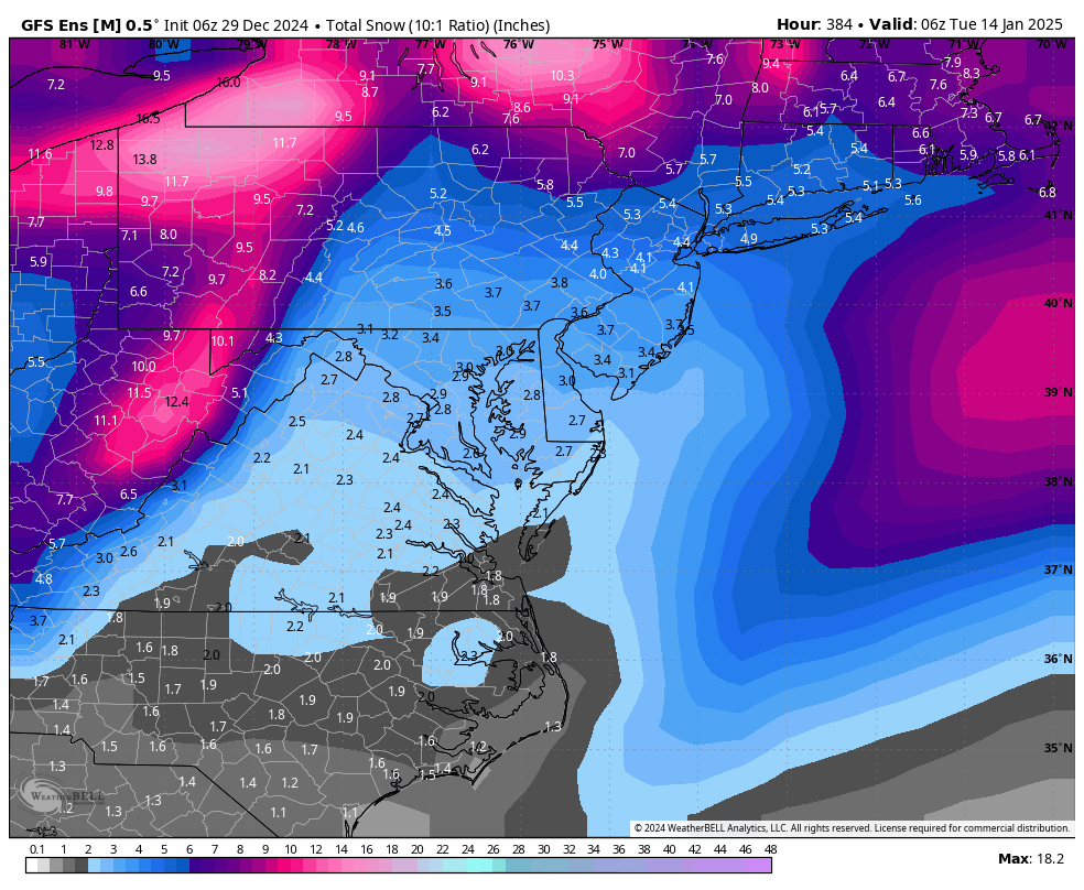
Richmond Metro/Hampton Roads Area Discussion
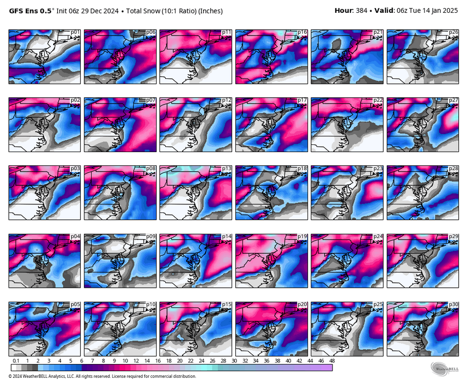
RIC Airport replied to RIC Airport's topic in Mid Atlantic
Better than 12z GEFS, but not as good as the 6Z run. Obviously, even with ensembles there will be some fluctuations.


.png.fdc7f4d9626a85a4128114e1736b70cb.png)
.png.60d5986a99e2fec52c9697f856068b8d.png)