

RIC Airport
-
Posts
2,586 -
Joined
-
Last visited
Content Type
Profiles
Blogs
Forums
American Weather
Media Demo
Store
Gallery
Everything posted by RIC Airport
-
Richmond Metro/Hampton Roads Area Discussion
RIC Airport replied to RIC Airport's topic in Mid Atlantic
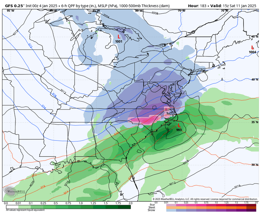
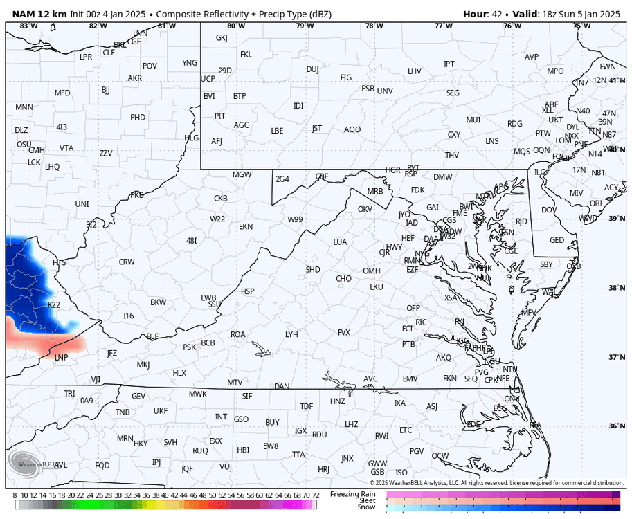
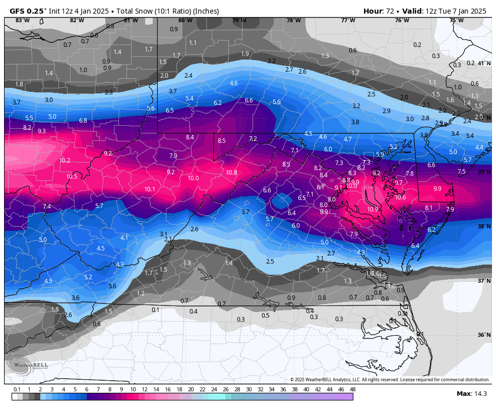
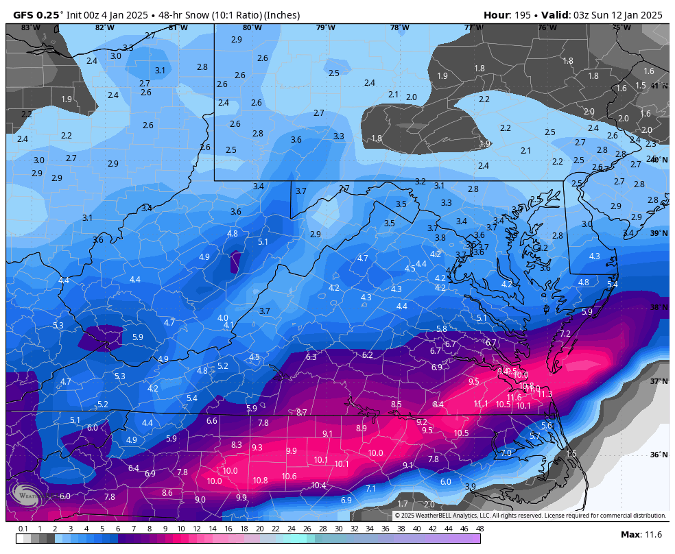
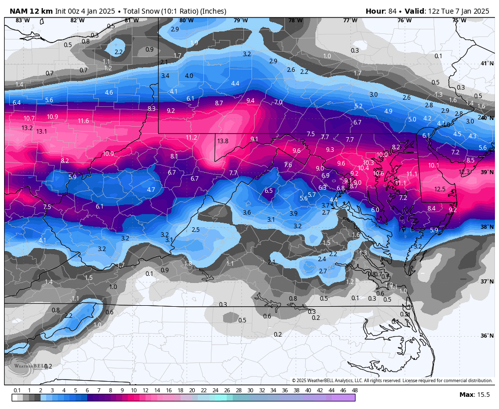
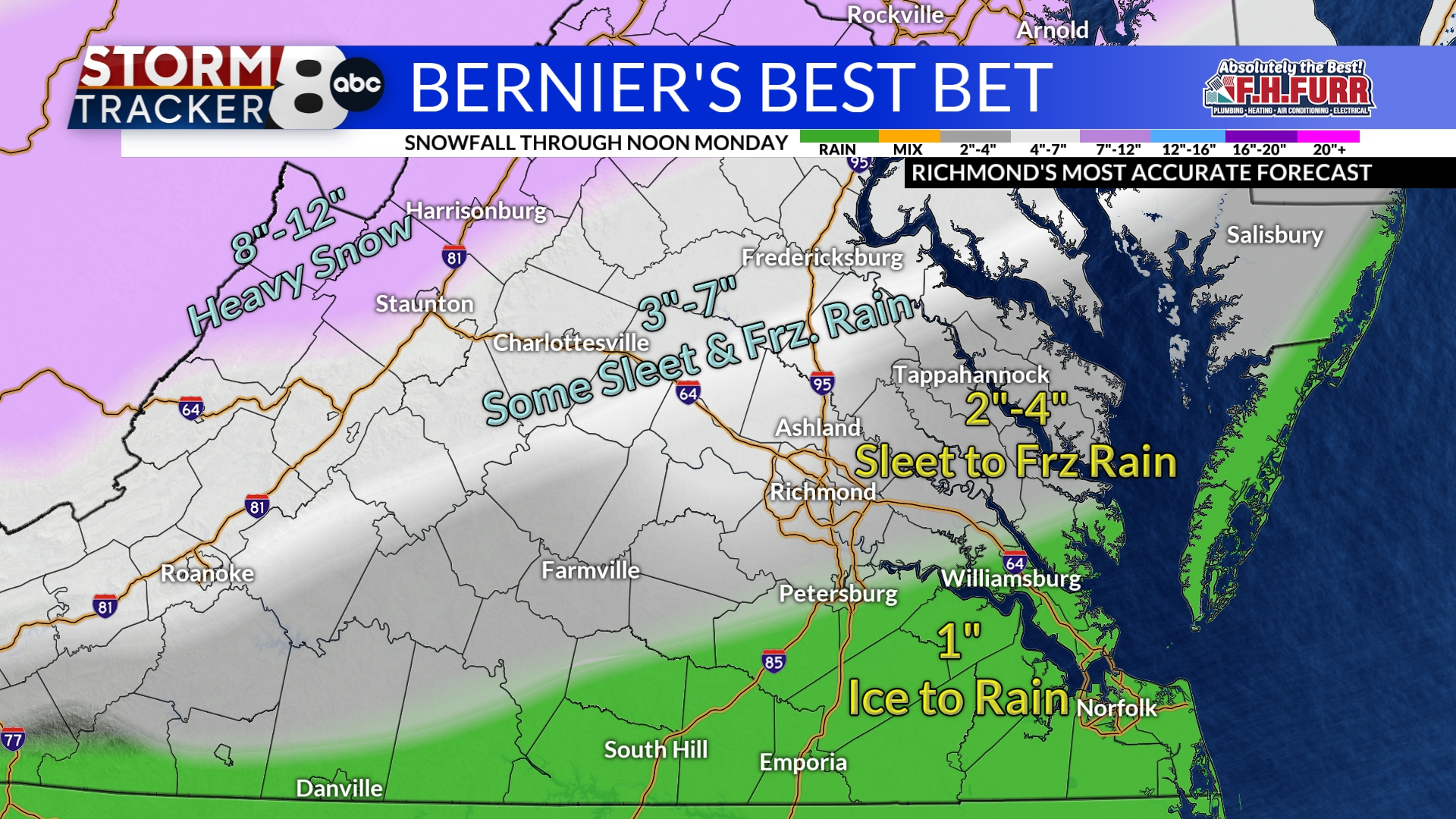
We are in a tough spot this go around, and no, I don't like what I see. The airport getting an inch is possible, but it's not 100%. Hopefully, the next storm will come through for our region. The back end snow offers the most hope, but the band's location differs from run to run. -
Richmond Metro/Hampton Roads Area Discussion
RIC Airport replied to RIC Airport's topic in Mid Atlantic
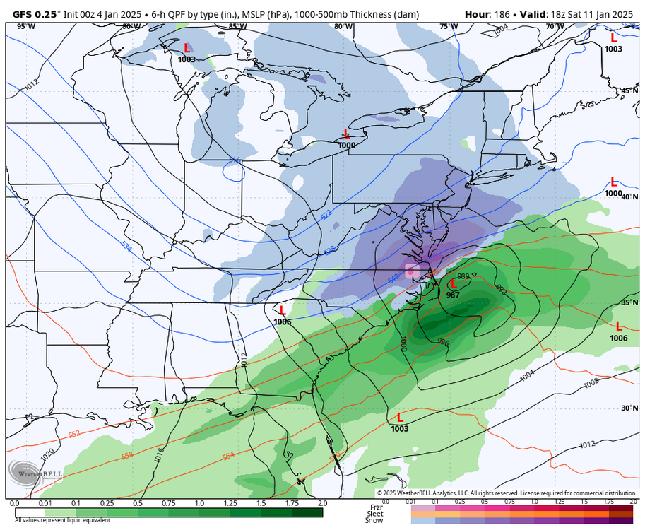
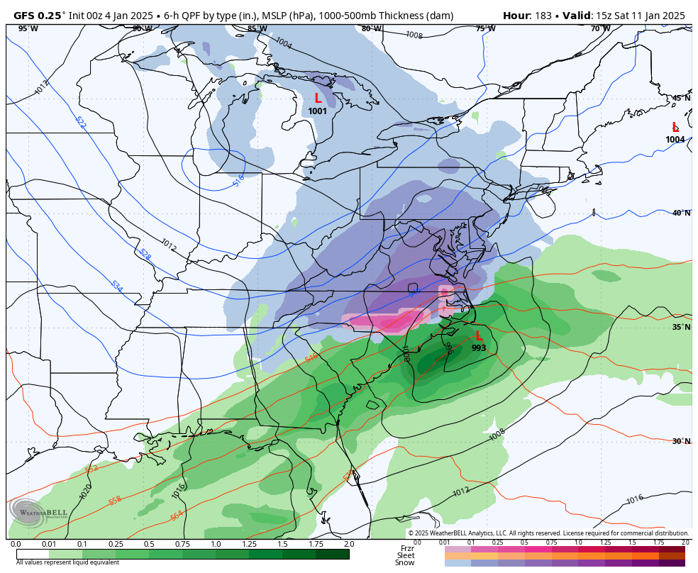
The latest GFS, fwiw. Still shows a band of snow on the backside.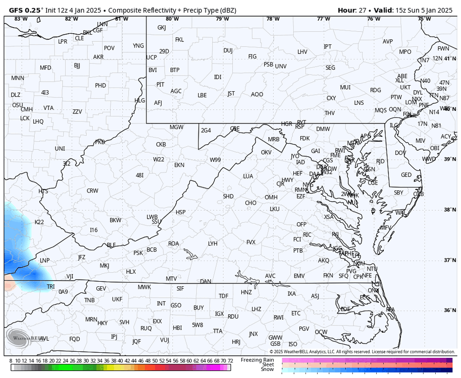

-
Richmond Metro/Hampton Roads Area Discussion
RIC Airport replied to RIC Airport's topic in Mid Atlantic

-
Richmond Metro/Hampton Roads Area Discussion
RIC Airport replied to RIC Airport's topic in Mid Atlantic
-
Richmond Metro/Hampton Roads Area Discussion
RIC Airport replied to RIC Airport's topic in Mid Atlantic
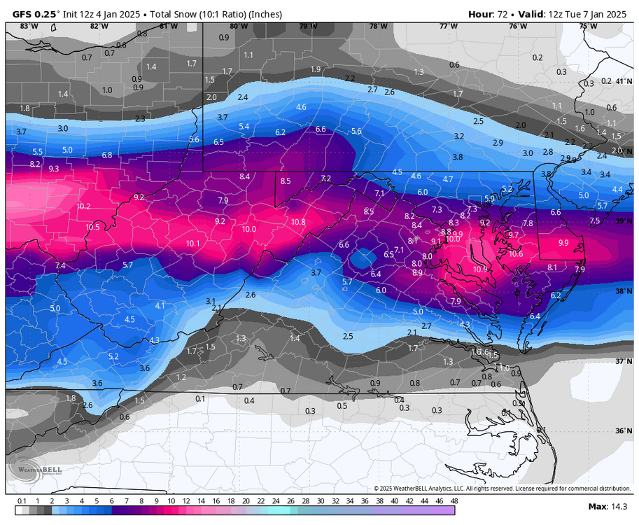
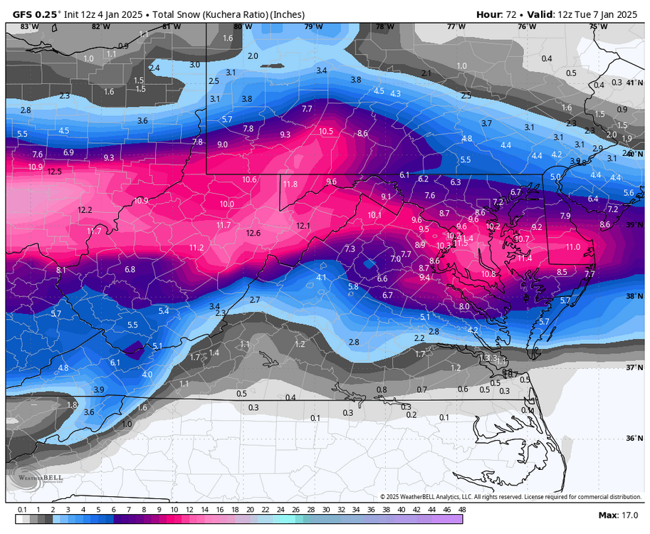
Storm #2 next weekend coming in strong on the GFS. -
Richmond Metro/Hampton Roads Area Discussion
RIC Airport replied to RIC Airport's topic in Mid Atlantic


-
Richmond Metro/Hampton Roads Area Discussion
RIC Airport replied to RIC Airport's topic in Mid Atlantic
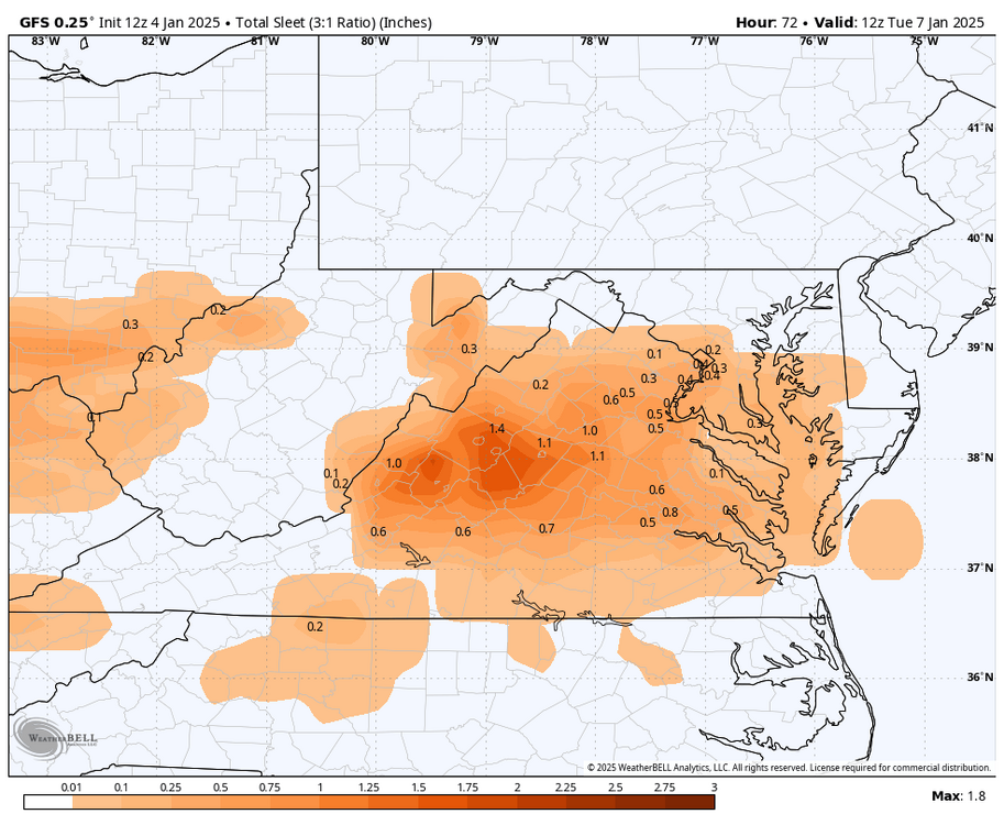
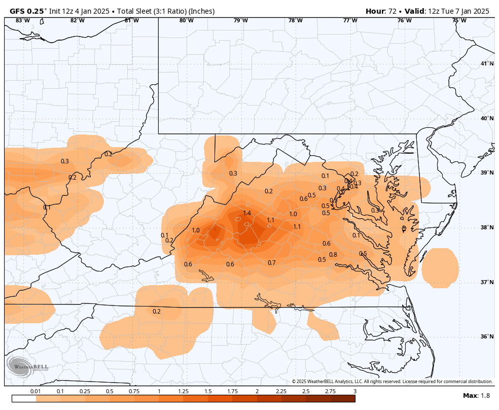
Still gets ugly with mixing and even a changeover to rain, but there is a nice deformation band swinging through Virginia on the back side.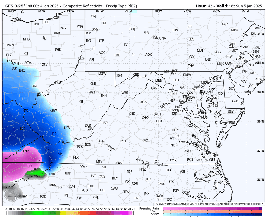
-
Richmond Metro/Hampton Roads Area Discussion
RIC Airport replied to RIC Airport's topic in Mid Atlantic
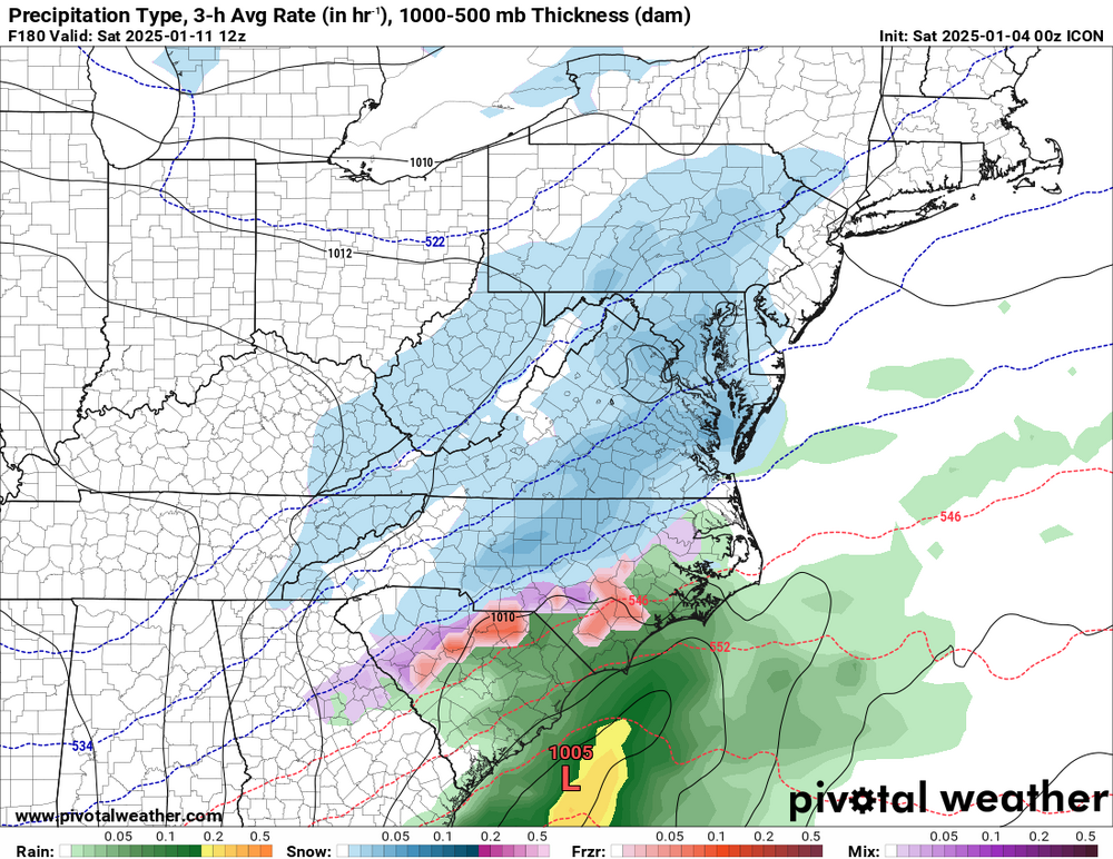
End of the ICON with the second storm.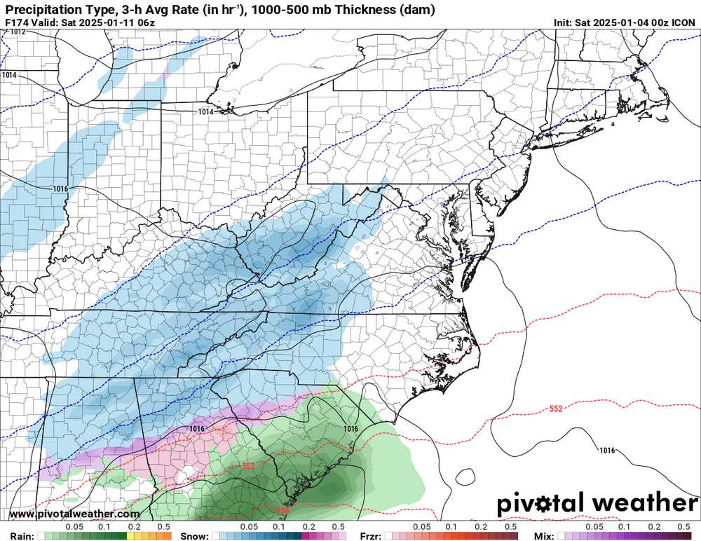
-
Richmond Metro/Hampton Roads Area Discussion
RIC Airport replied to RIC Airport's topic in Mid Atlantic
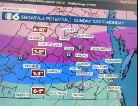
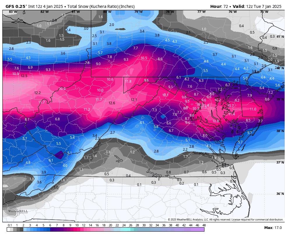
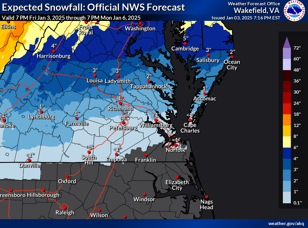
Yeah, I just realized he posted the snow map. Seems low to me as well. -
Richmond Metro/Hampton Roads Area Discussion
RIC Airport replied to RIC Airport's topic in Mid Atlantic
Mike Thomas from Fox 5 DC posted the GRAF model. Looked on the colder side, also picks up on the ULL. https://x.com/MikeTFox5/status/1875382706227286149 -
Richmond Metro/Hampton Roads Area Discussion
RIC Airport replied to RIC Airport's topic in Mid Atlantic
Yes! Here was the 18z run.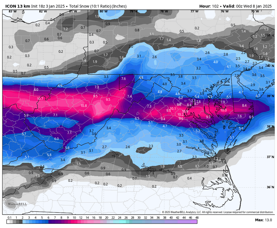
-
Richmond Metro/Hampton Roads Area Discussion
RIC Airport replied to RIC Airport's topic in Mid Atlantic
Latest ICON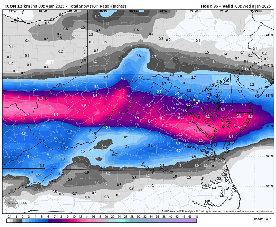
-
Richmond Metro/Hampton Roads Area Discussion
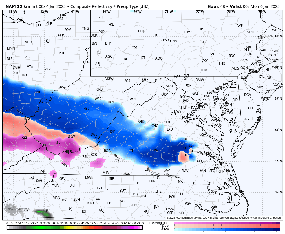
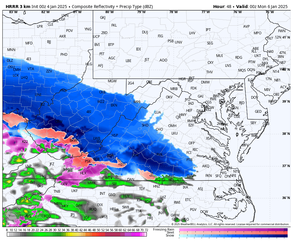
RIC Airport replied to RIC Airport's topic in Mid Atlantic
That was the last HRRR frame at hour 48. I'd post the 3K NAM out to hour 60 and really don't want to. -
Richmond Metro/Hampton Roads Area Discussion
RIC Airport replied to RIC Airport's topic in Mid Atlantic
-
Richmond Metro/Hampton Roads Area Discussion
RIC Airport replied to RIC Airport's topic in Mid Atlantic

-
Richmond Metro/Hampton Roads Area Discussion
RIC Airport replied to RIC Airport's topic in Mid Atlantic
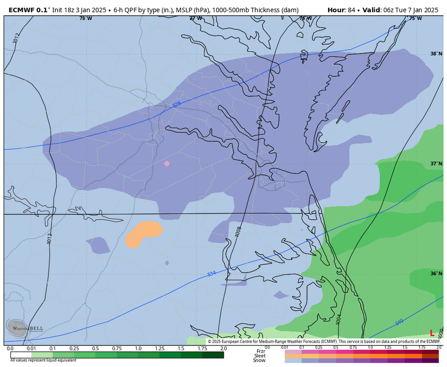
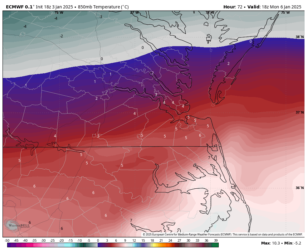
Then we fall back below freezing for the back end snow.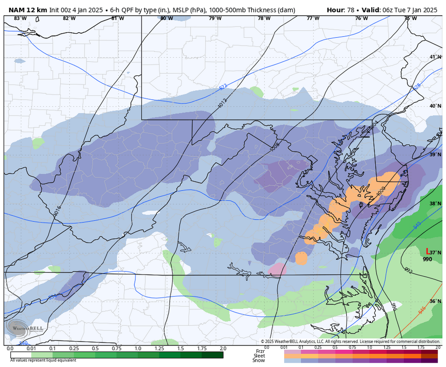
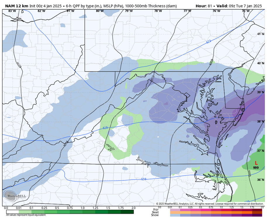
-
Richmond Metro/Hampton Roads Area Discussion
RIC Airport replied to RIC Airport's topic in Mid Atlantic
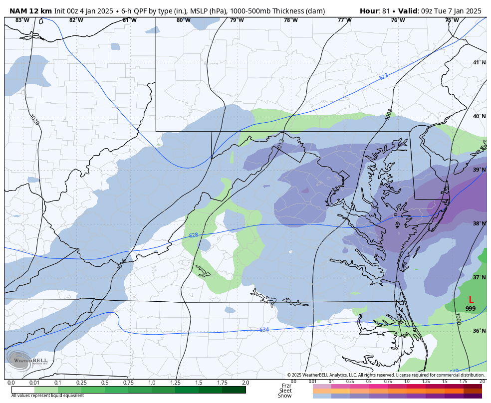
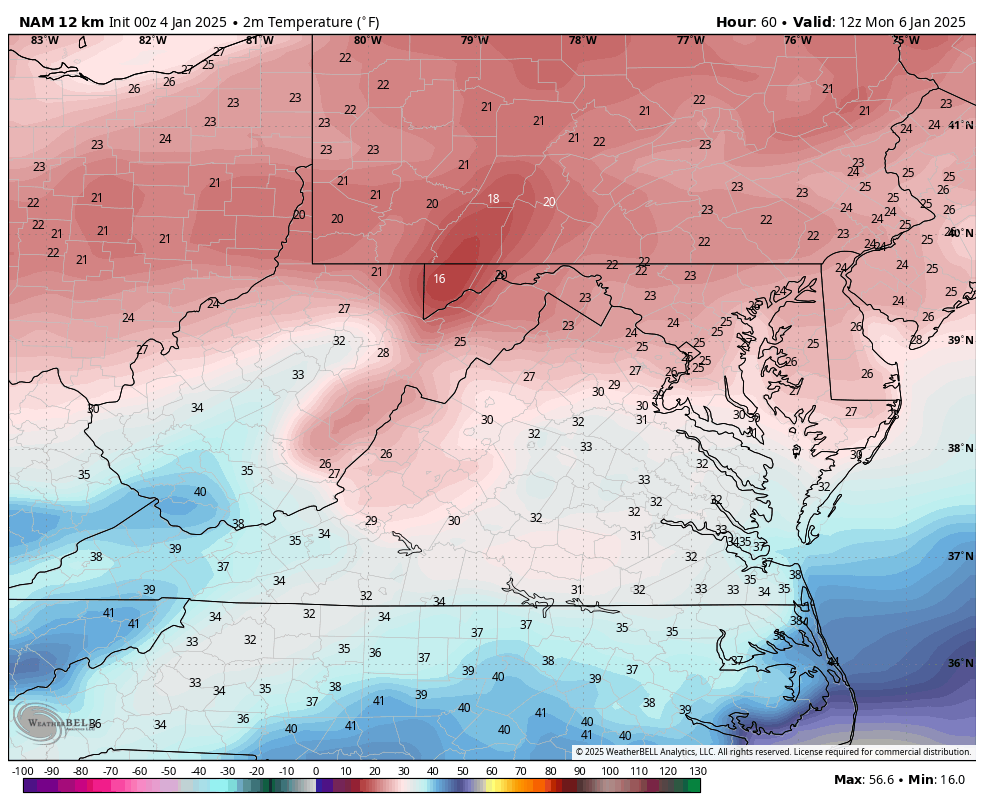
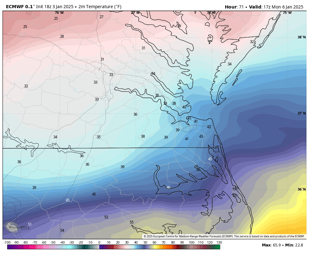
RIC gets above freezing between hr 63 and 72. -
Richmond Metro/Hampton Roads Area Discussion
RIC Airport replied to RIC Airport's topic in Mid Atlantic

-
Richmond Metro/Hampton Roads Area Discussion
RIC Airport replied to RIC Airport's topic in Mid Atlantic
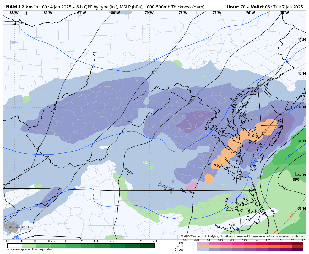
Here is the 00z NAM at that same time. Lets see how it does in later panels.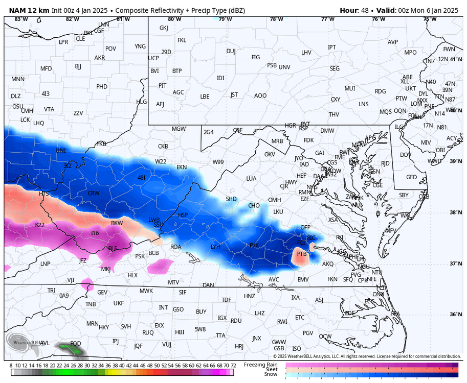
-
Richmond Metro/Hampton Roads Area Discussion
RIC Airport replied to RIC Airport's topic in Mid Atlantic
Yes, I know this is way out in time for the HRRR, but it has the snow at hour 48 (7pm Sunday), moving into the area.
-
Richmond Metro/Hampton Roads Area Discussion
RIC Airport replied to RIC Airport's topic in Mid Atlantic
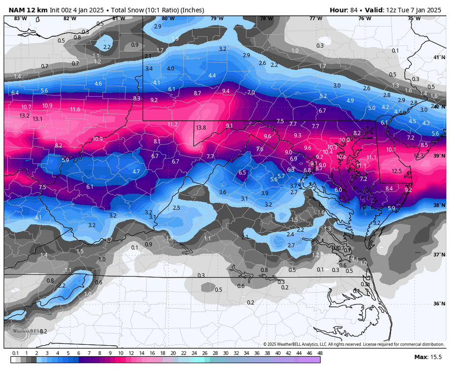
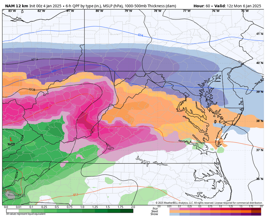
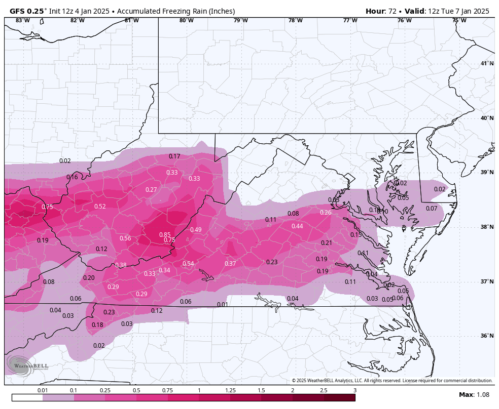
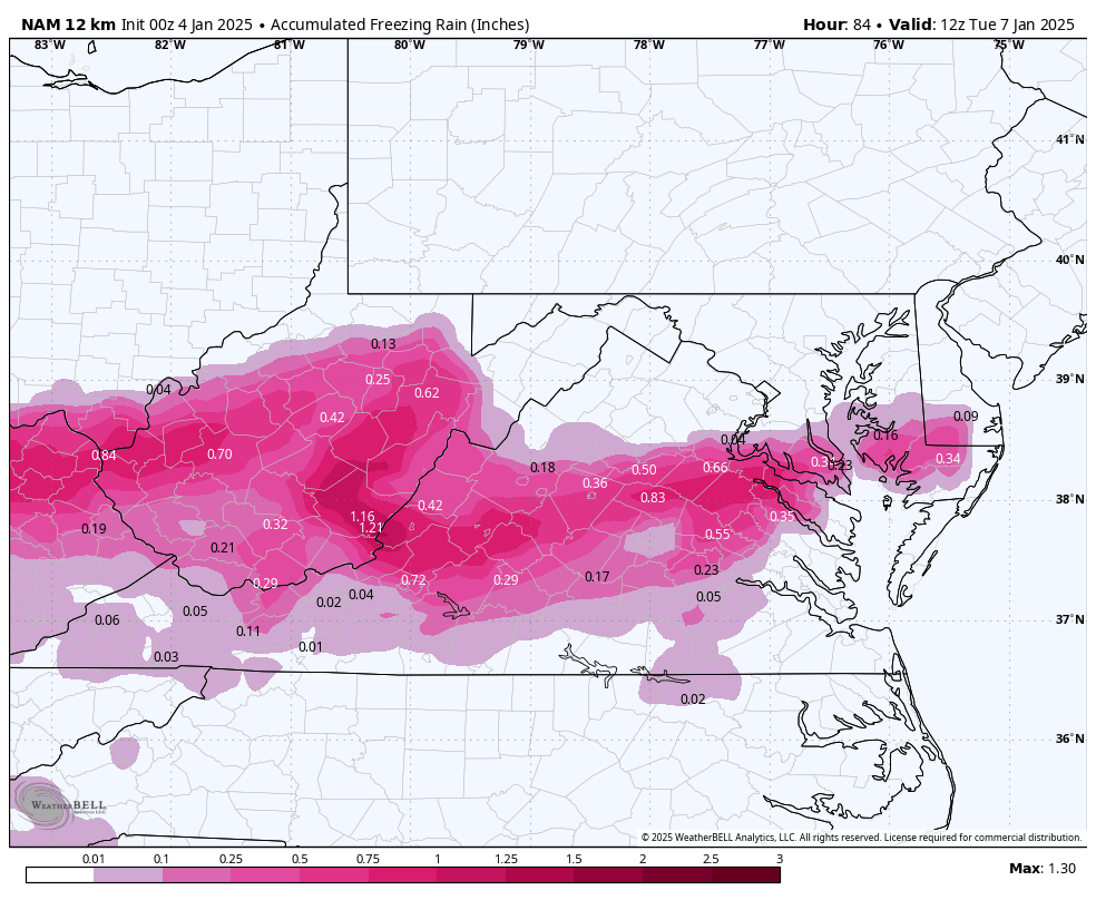
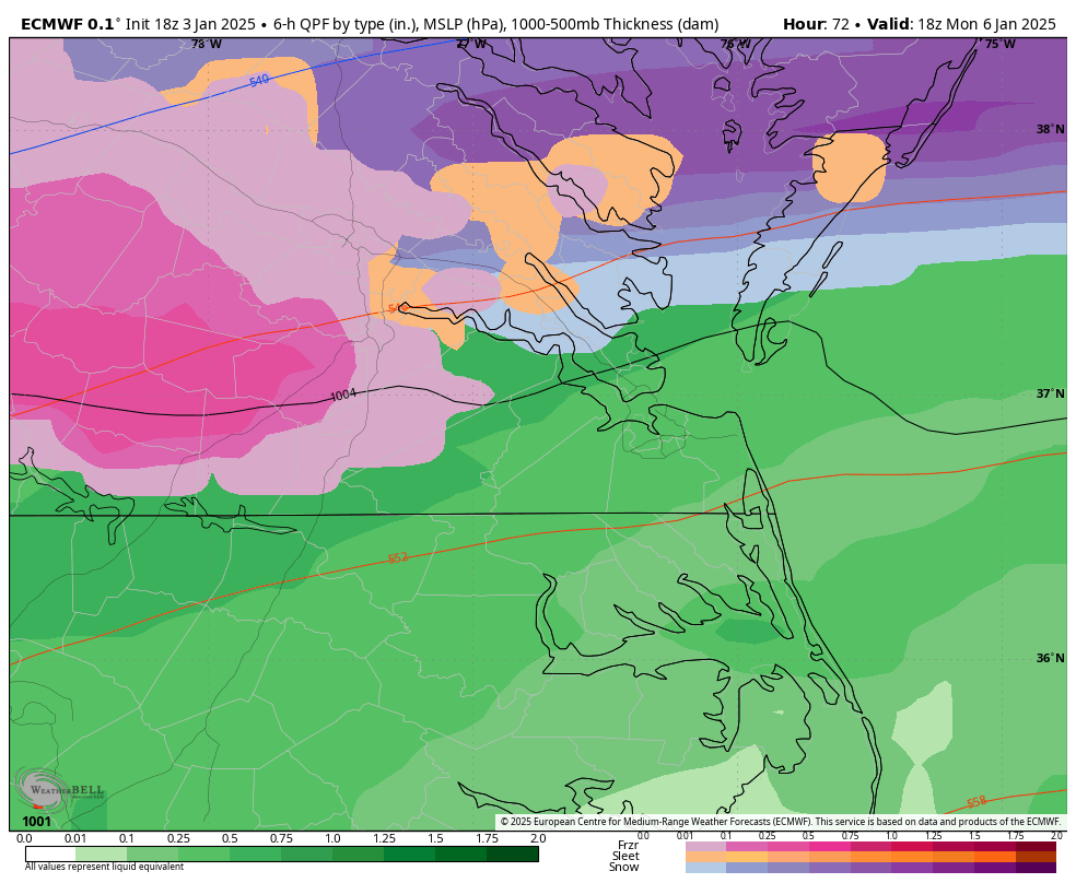
I should mention that the surface temperature only reached 33°F for about a 2-hour window before dropping below freezing after the storm passed. This was also when the 18z Euro indicated the potential for a deformation band to move through the area. The GFS also hinted at this possibility, but the location of the band has varied with each run.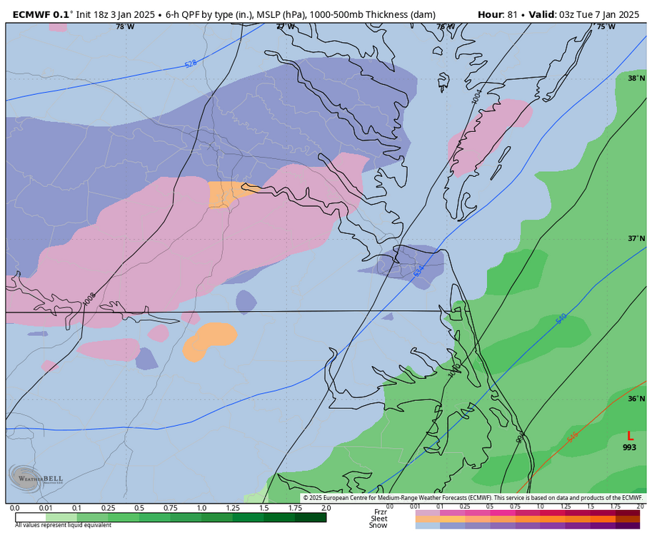
-
Richmond Metro/Hampton Roads Area Discussion
RIC Airport replied to RIC Airport's topic in Mid Atlantic
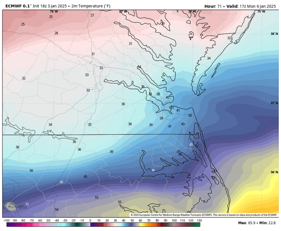
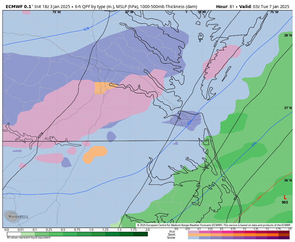
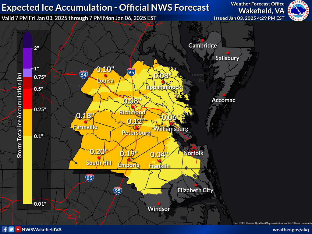
I agree, but it's typical of our office to be conservative. The same was done before the 12/9/2018 storm; we remember how that unfolded. LWX sometimes has the opposite problem. Another thing to note is that even the 18z Euro got RIC above freezing at the surface around noon-1 pm Monday. And to get the best snow, we want to be north of the 540 thickness line, and that pretty much camps out from about Harrisonburg to Fredericksburg for most of the event.

-
Richmond Metro/Hampton Roads Area Discussion
RIC Airport replied to RIC Airport's topic in Mid Atlantic
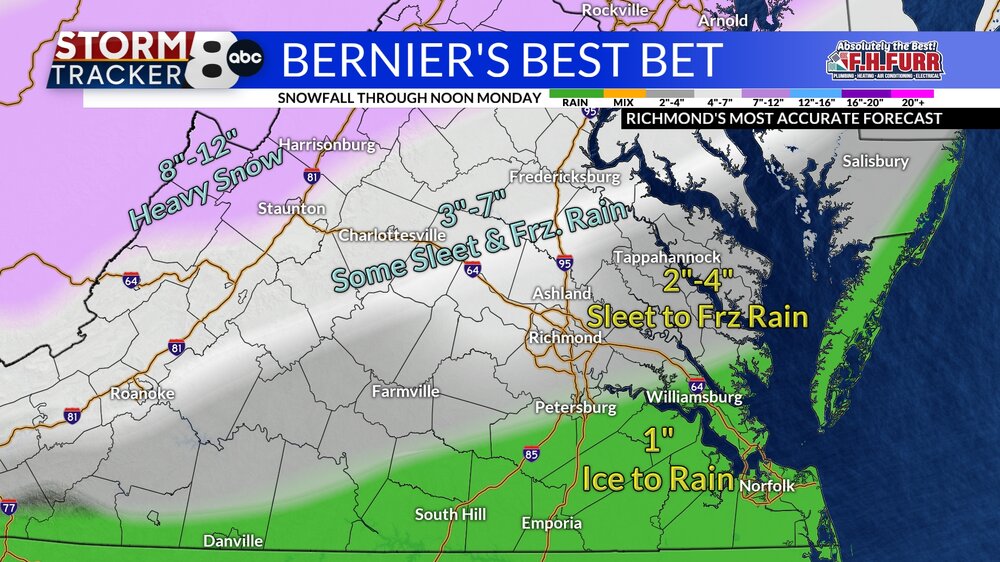
The local TV stations are not as conservative.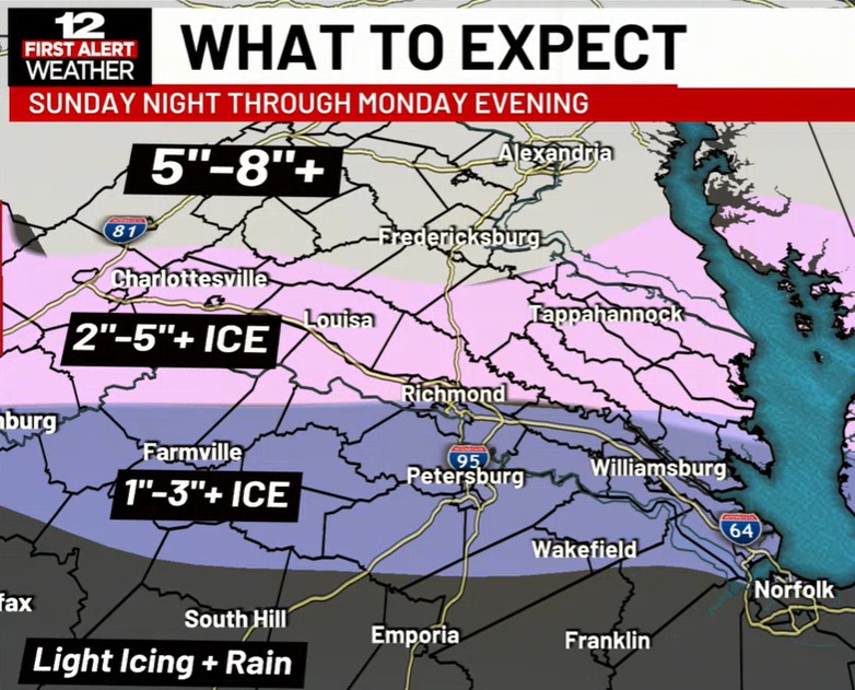
-
Richmond Metro/Hampton Roads Area Discussion
RIC Airport replied to RIC Airport's topic in Mid Atlantic
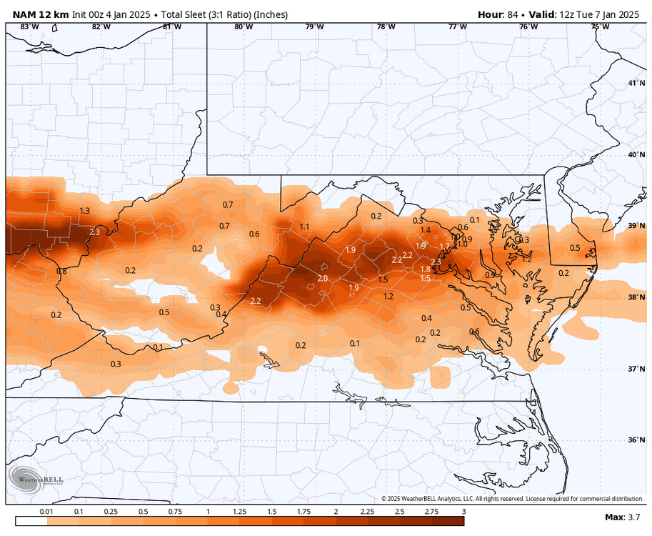
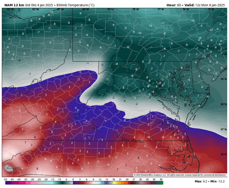
There will be mixing, unfortunately, and there are many times (not always) when the mixing gets pretty far north. As I mentioned before, we are dealing with antecedent cold vs a strong high in a place in upstate NY, and given the orientation of this storm, we are prone to mixing. Gotta use those Euro maps with caution.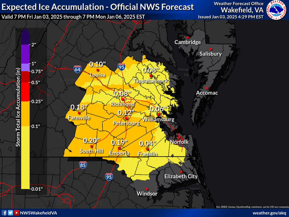
-
Richmond Metro/Hampton Roads Area Discussion
RIC Airport replied to RIC Airport's topic in Mid Atlantic
Wakefield is pretty conservative, but pretty typical for them. Mixing will be an issue, too bad we will be south of the 540 line.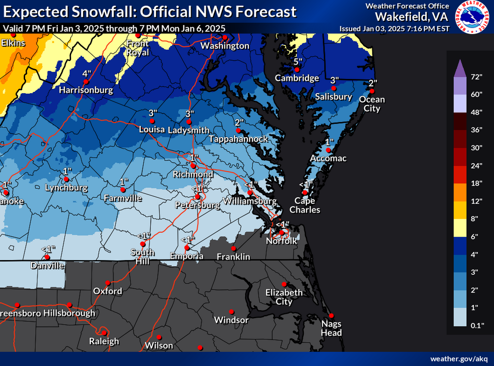
.thumb.png.2e5a91a79bcf959346e3efd0efd2dc46.png)


.png.56e32d939e36a6e172a0dae5971493ea.png)
