RIC Airport
-
Posts
2,586 -
Joined
-
Last visited
Content Type
Profiles
Blogs
Forums
American Weather
Media Demo
Store
Gallery
Everything posted by RIC Airport
-
Richmond Metro/Hampton Roads Area Discussion
RIC Airport replied to RIC Airport's topic in Mid Atlantic
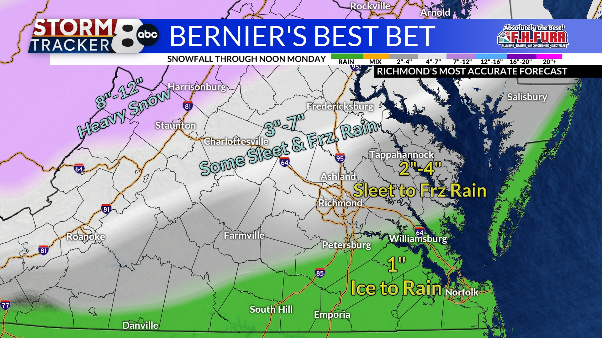
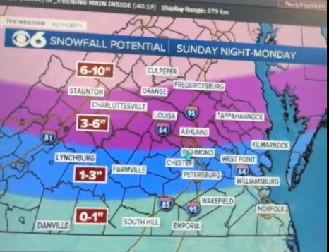
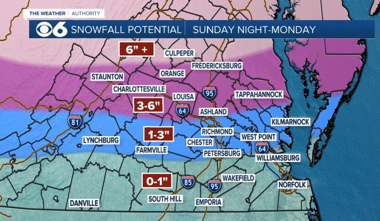
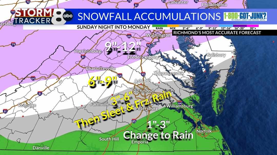
CBS 6's latest map
-
Richmond Metro/Hampton Roads Area Discussion
RIC Airport replied to RIC Airport's topic in Mid Atlantic
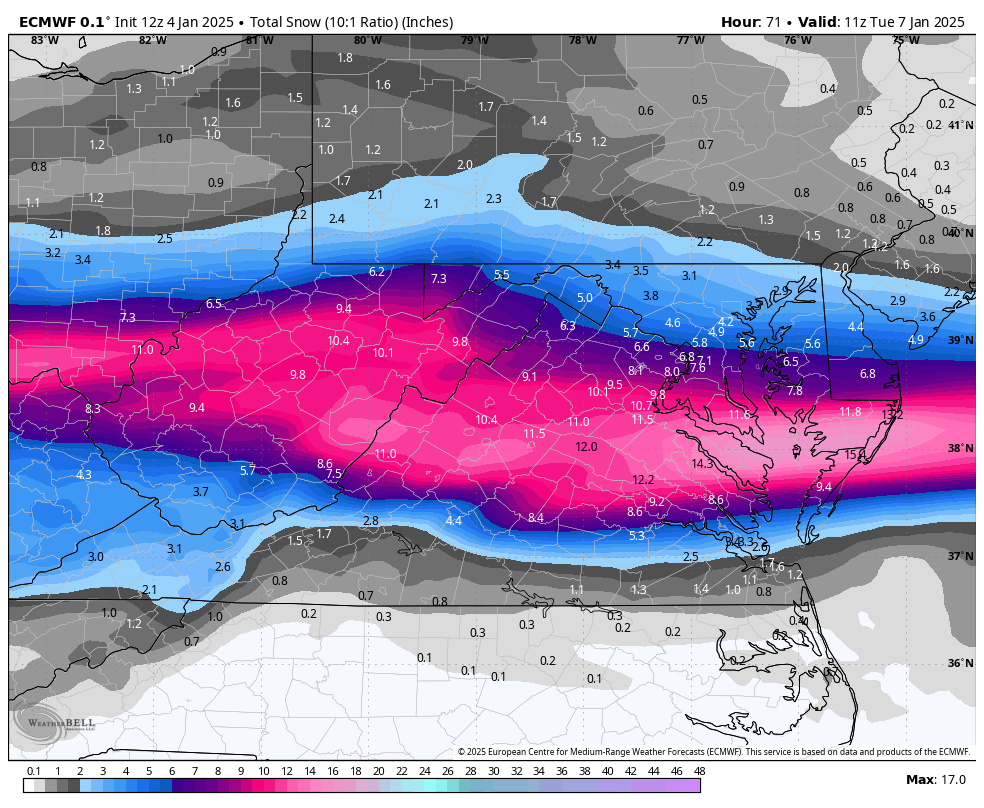
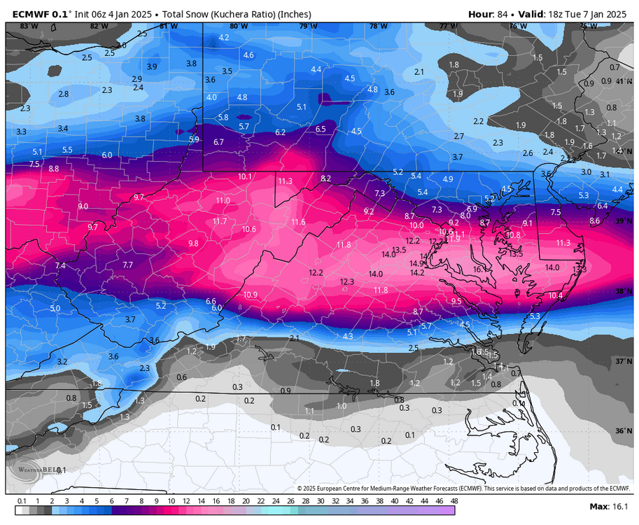
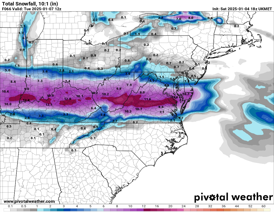
18z vs 12z

-
Richmond Metro/Hampton Roads Area Discussion
RIC Airport replied to RIC Airport's topic in Mid Atlantic
On my phone at the moment, but here are 18z vs 12z.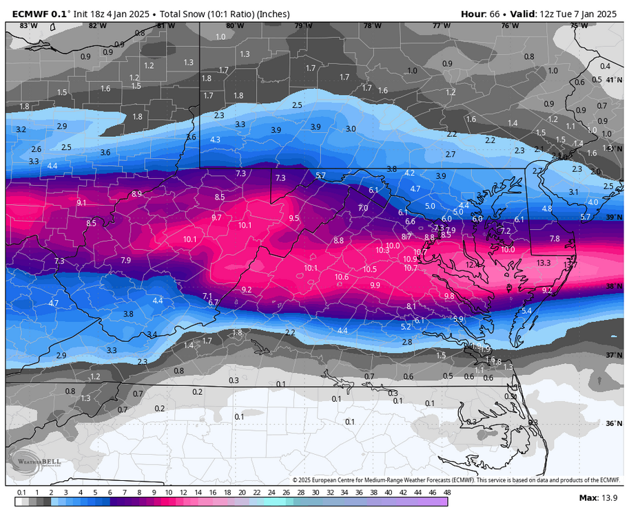

-
Richmond Metro/Hampton Roads Area Discussion
RIC Airport replied to RIC Airport's topic in Mid Atlantic
No significant changes on the 18z Euro. RIC does rise above freezing between 11am and 4pm Monday before falling below freezing ahead of the back end snow. EDIT: There was a small shift northward with the snowfall axis compared to 12z. -
Richmond Metro/Hampton Roads Area Discussion
RIC Airport replied to RIC Airport's topic in Mid Atlantic
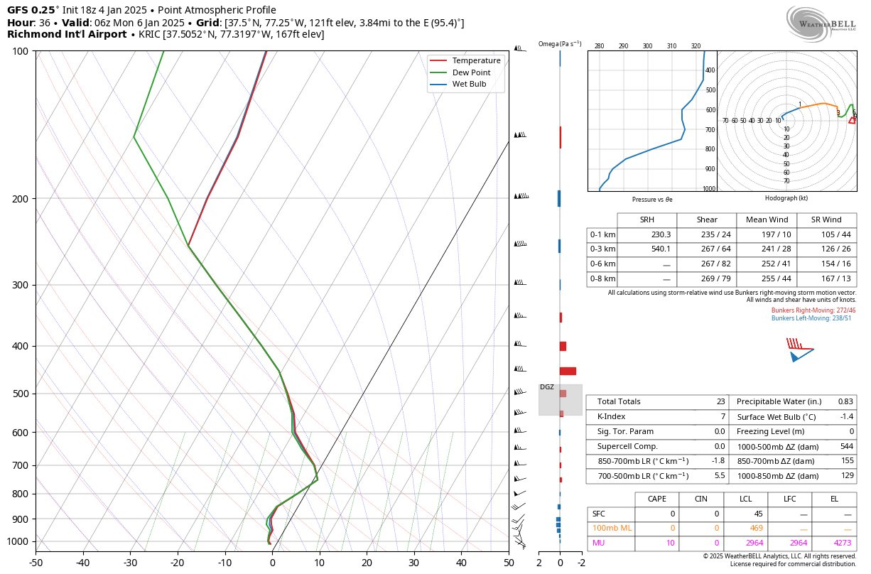
Seems that way. It will be colder for longer up your way before any mixing. RIC starts to have a warm layer creeping in at 850mb around hour 36, 1 am Monday.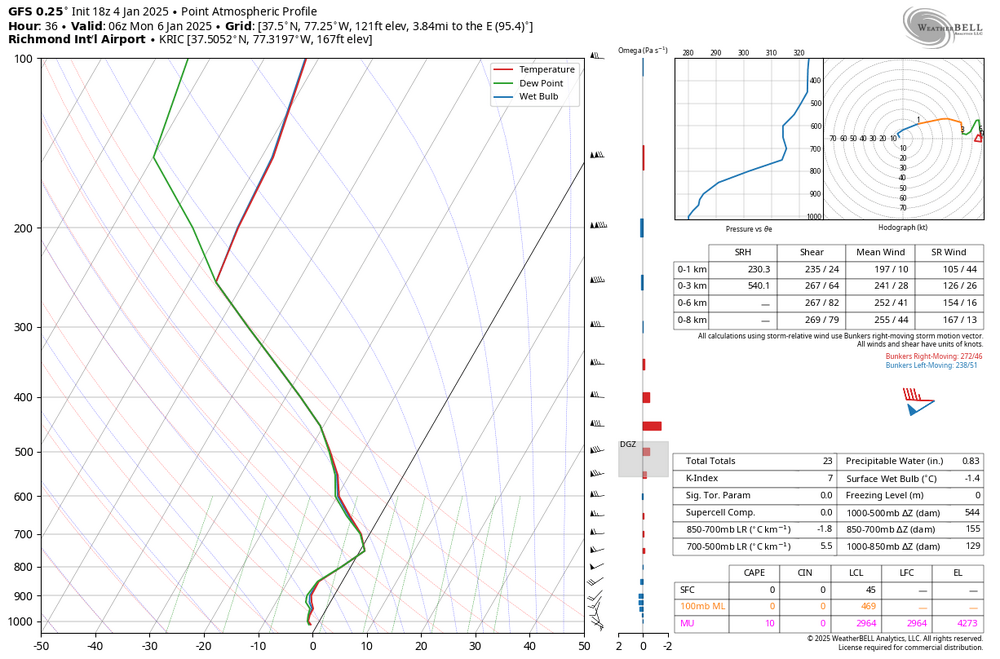
-
Richmond Metro/Hampton Roads Area Discussion
RIC Airport replied to RIC Airport's topic in Mid Atlantic
Yup, posted on the previous page a while ago. -
Richmond Metro/Hampton Roads Area Discussion
RIC Airport replied to RIC Airport's topic in Mid Atlantic
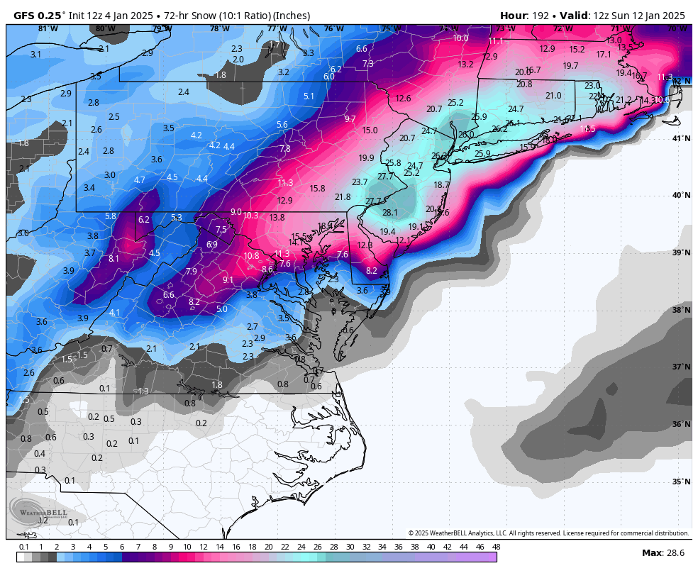
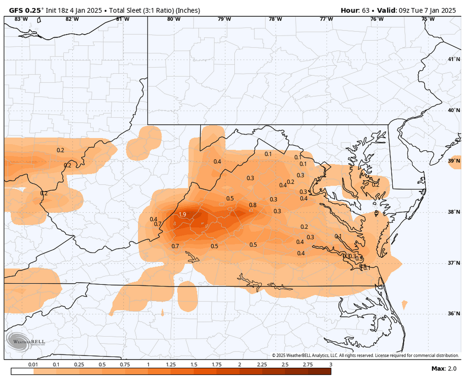
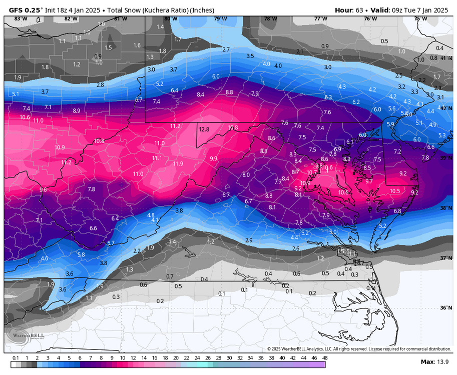
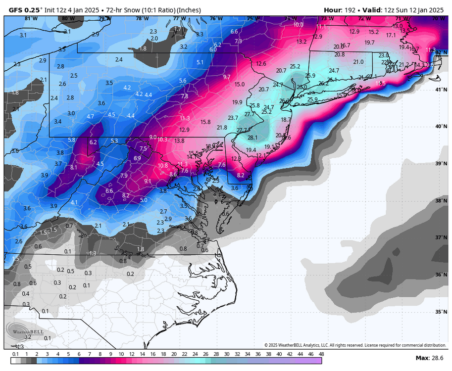
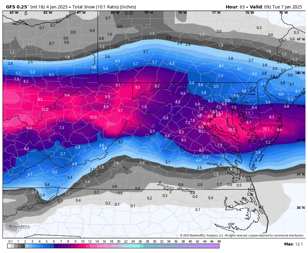
A nice uptick with snowfall on the 18z GFS.

-
Richmond Metro/Hampton Roads Area Discussion
RIC Airport replied to RIC Airport's topic in Mid Atlantic
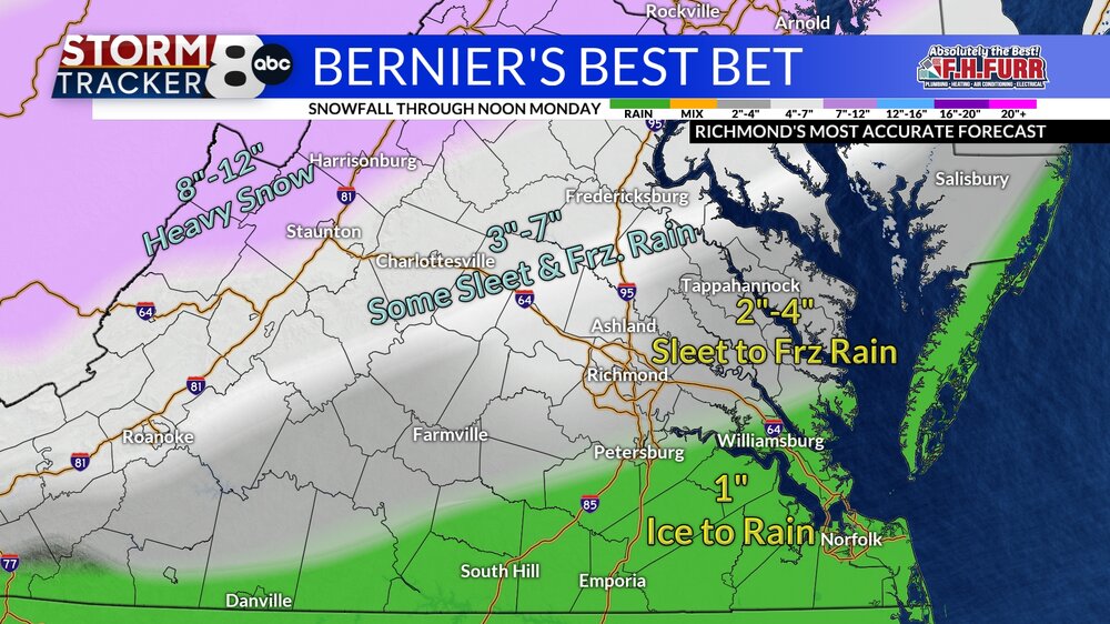
ABC 8 just increased their totals as well.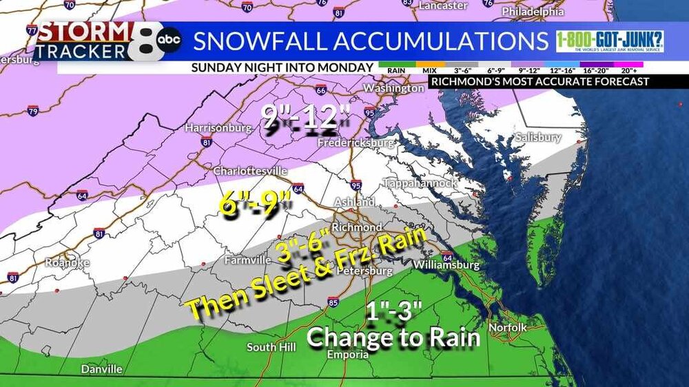
-
Richmond Metro/Hampton Roads Area Discussion
RIC Airport replied to RIC Airport's topic in Mid Atlantic
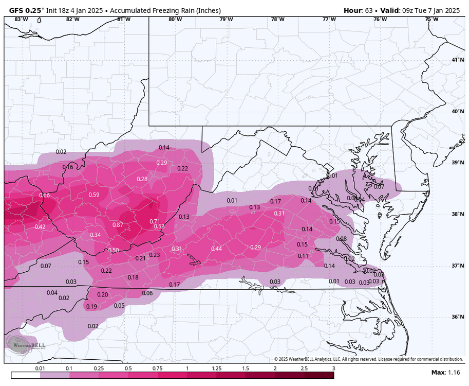
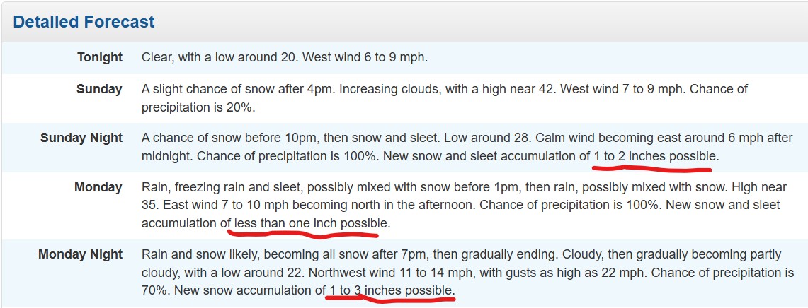
URGENT - WINTER WEATHER MESSAGE National Weather Service Wakefield VA 401 PM EST Sat Jan 4 2025 VAZ048-062-064-075>078-083-085-509>512-515>522-050515- /O.UPG.KAKQ.WS.A.0001.250105T2100Z-250107T1200Z/ /O.NEW.KAKQ.WS.W.0001.250105T2100Z-250106T1200Z/ Fluvanna-Goochland-Caroline-Westmoreland-Richmond-Northumberland- Lancaster-New Kent-Middlesex-Western Louisa-Eastern Louisa- Western Hanover-Eastern Hanover-Western Henrico (Including the City of Richmond)-Eastern Henrico-Western King William-Eastern King William-Western King and Queen-Eastern King and Queen- Western Essex-Eastern Essex- 401 PM EST Sat Jan 4 2025 ...WINTER STORM WARNING IN EFFECT FROM 4 PM SUNDAY TO 7 AM EST MONDAY... * WHAT...Heavy mixed precipitation expected. Total snow and sleet accumulations between 4 and 6 inches and ice accumulations of between one and two tenths of an inch. Locally higher totals are possible. * WHERE...Portions of central, east central, eastern, and north central Virginia. * WHEN...From 4 PM Sunday to 7 AM EST Monday. * IMPACTS...Plan on slippery road conditions. The hazardous conditions could impact the Monday morning and evening commutes. PRECAUTIONARY/PREPAREDNESS ACTIONS... If you must travel, keep an extra flashlight, food, and water in your vehicle in case of an emergency. Call 511 for road information. && $$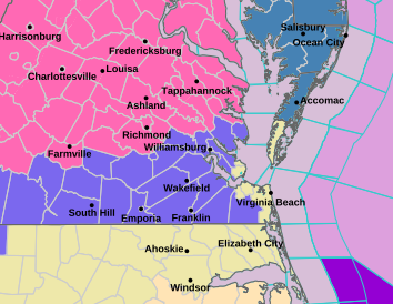
-
Richmond Metro/Hampton Roads Area Discussion
RIC Airport replied to RIC Airport's topic in Mid Atlantic
Warning just issued and advisories for interior SE VA.
-
Richmond Metro/Hampton Roads Area Discussion
RIC Airport replied to RIC Airport's topic in Mid Atlantic
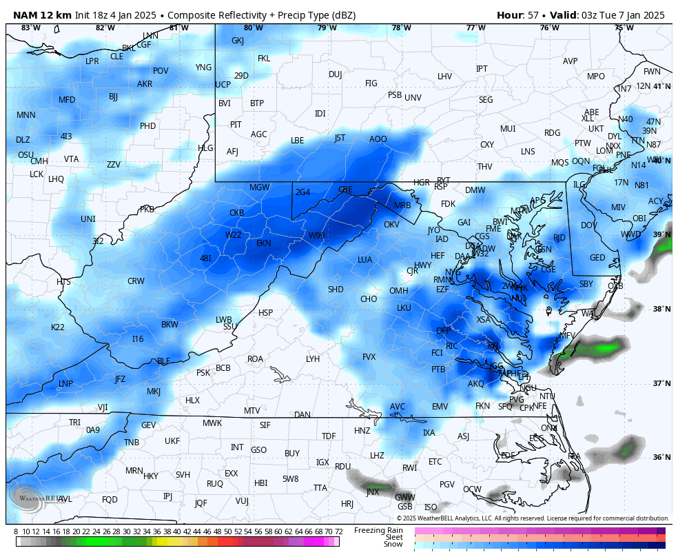
AKQ has more snow for the back end.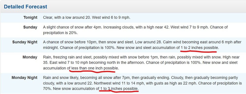
-
Richmond Metro/Hampton Roads Area Discussion
RIC Airport replied to RIC Airport's topic in Mid Atlantic
We do get back end snow around hour 54, heaviest at 57.
-
Richmond Metro/Hampton Roads Area Discussion
RIC Airport replied to RIC Airport's topic in Mid Atlantic
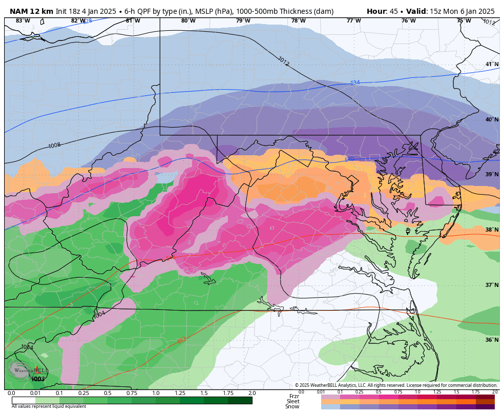
DCA is a sleet fest while RIC is dry slotted.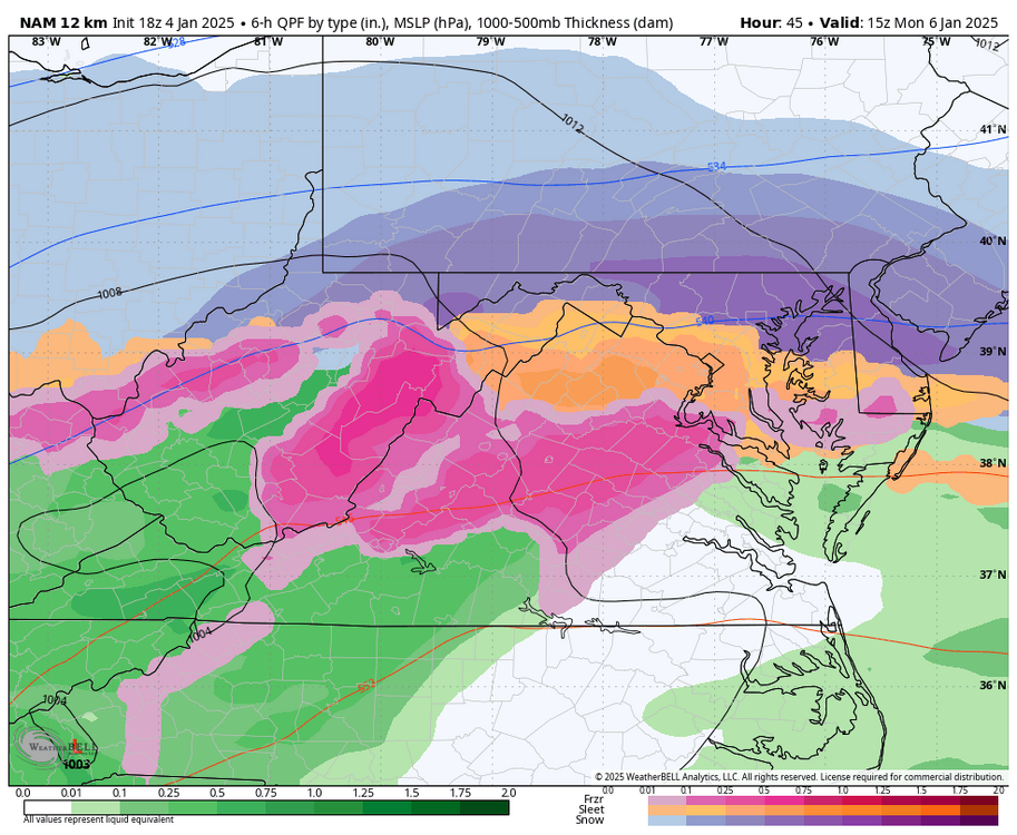
-
Richmond Metro/Hampton Roads Area Discussion
RIC Airport replied to RIC Airport's topic in Mid Atlantic
18z HRRR showed a nice slug up front.
-
Richmond Metro/Hampton Roads Area Discussion
RIC Airport replied to RIC Airport's topic in Mid Atlantic
Looks awful to me so far. -
Richmond Metro/Hampton Roads Area Discussion
RIC Airport replied to RIC Airport's topic in Mid Atlantic
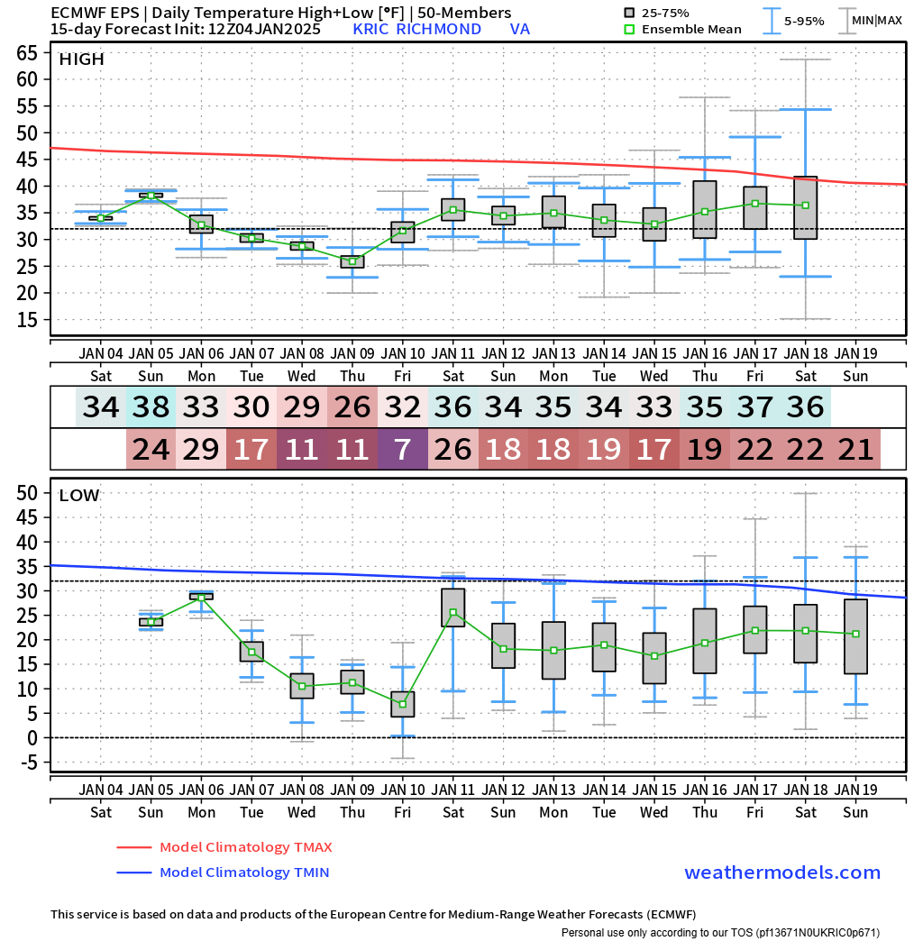
EPS suggests it could reach the single digits soon.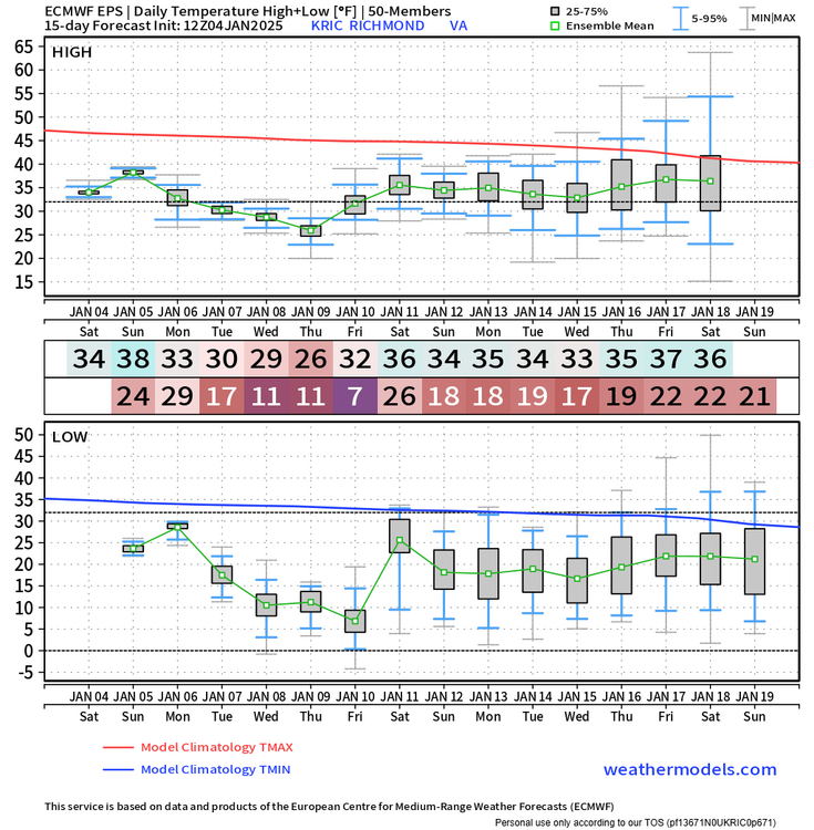
.thumb.png.22b8417e2a27f74f994b958dc505283f.png)
-
Richmond Metro/Hampton Roads Area Discussion
RIC Airport replied to RIC Airport's topic in Mid Atlantic
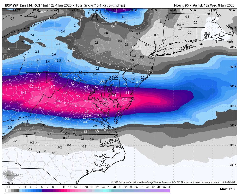
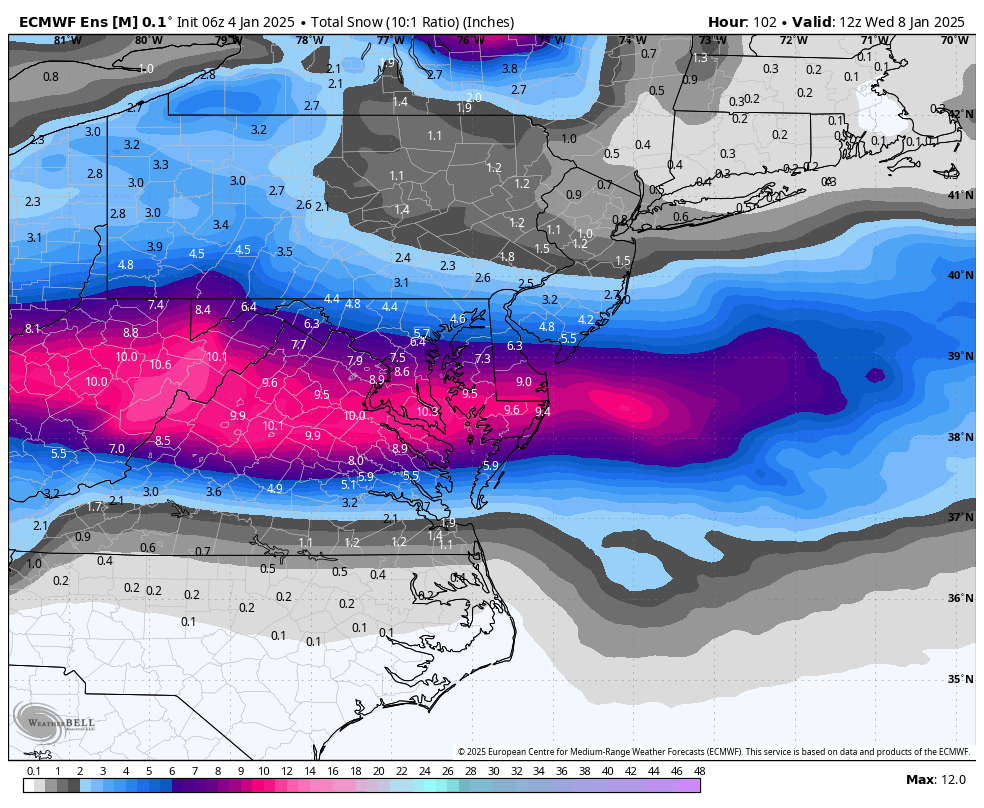
EPS 12z vs 6z, numbers inched up farther south.

-
Richmond Metro/Hampton Roads Area Discussion
RIC Airport replied to RIC Airport's topic in Mid Atlantic
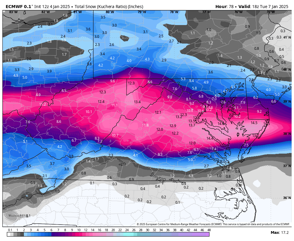
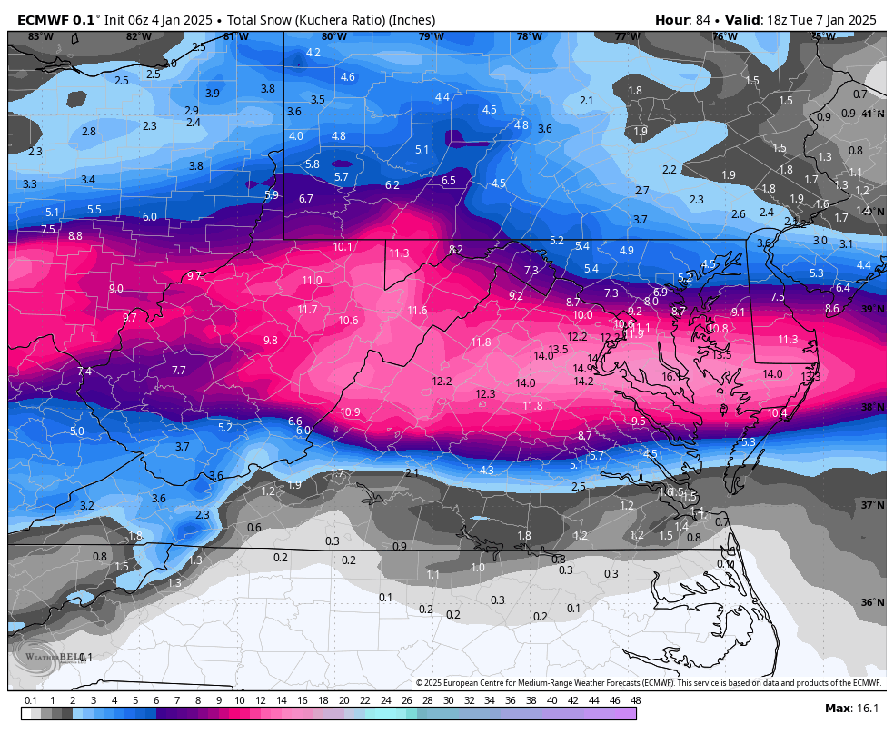
12z Kuchera vs 6z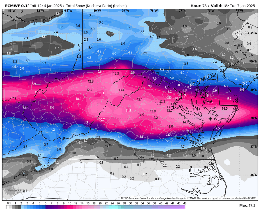
-
Richmond Metro/Hampton Roads Area Discussion
RIC Airport replied to RIC Airport's topic in Mid Atlantic
Euro held strong.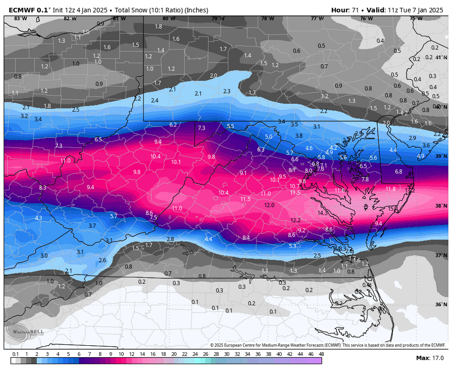
-
Richmond Metro/Hampton Roads Area Discussion
RIC Airport replied to RIC Airport's topic in Mid Atlantic
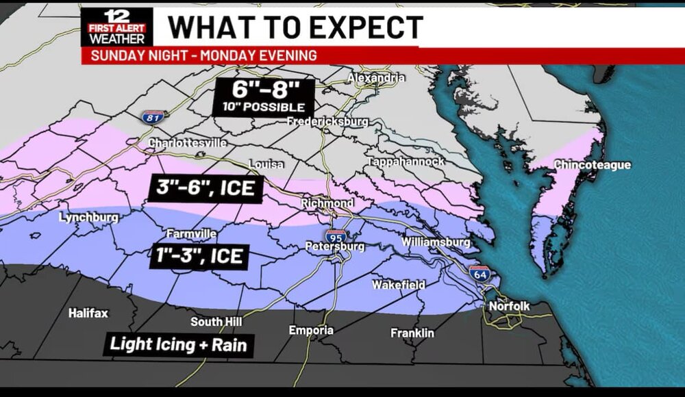
NBC 12 increased their totals, @wasnow215.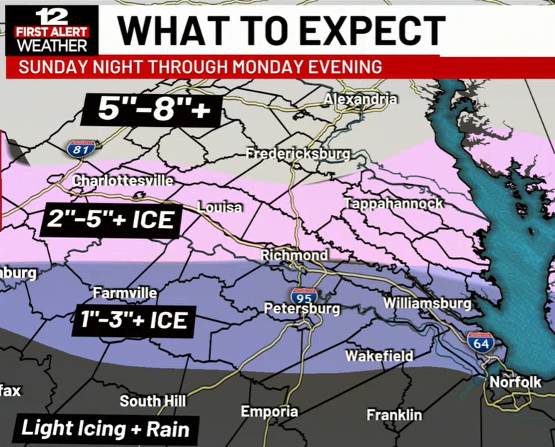
-
Richmond Metro/Hampton Roads Area Discussion
RIC Airport replied to RIC Airport's topic in Mid Atlantic
On the colder side of things, also had a nice band on the back end.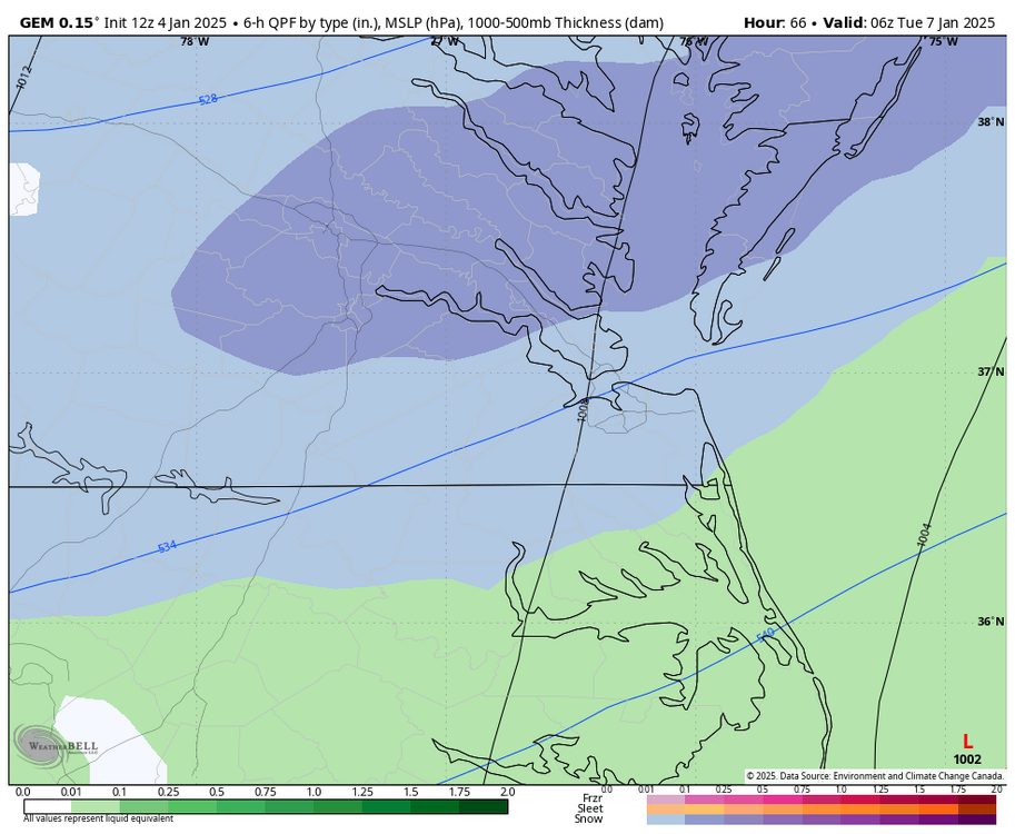
-
Richmond Metro/Hampton Roads Area Discussion
RIC Airport replied to RIC Airport's topic in Mid Atlantic
Just another possibility and why @wasnow215 is keeping us on our heels.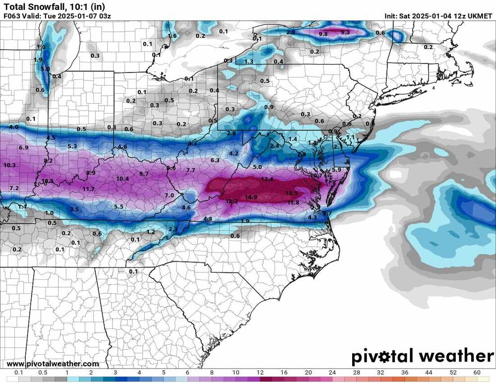
-
Richmond Metro/Hampton Roads Area Discussion
RIC Airport replied to RIC Airport's topic in Mid Atlantic
I think this is a high end possibility and would hope for that as well. -
Richmond Metro/Hampton Roads Area Discussion
RIC Airport replied to RIC Airport's topic in Mid Atlantic
I wasn't impressed with this GFS run for next weekend, it heavily impacts the Northeast while we remain on the southern fringe. At least the storm is still present, so maybe the Euro will produce a more favorable outcome.
-
Richmond Metro/Hampton Roads Area Discussion
RIC Airport replied to RIC Airport's topic in Mid Atlantic
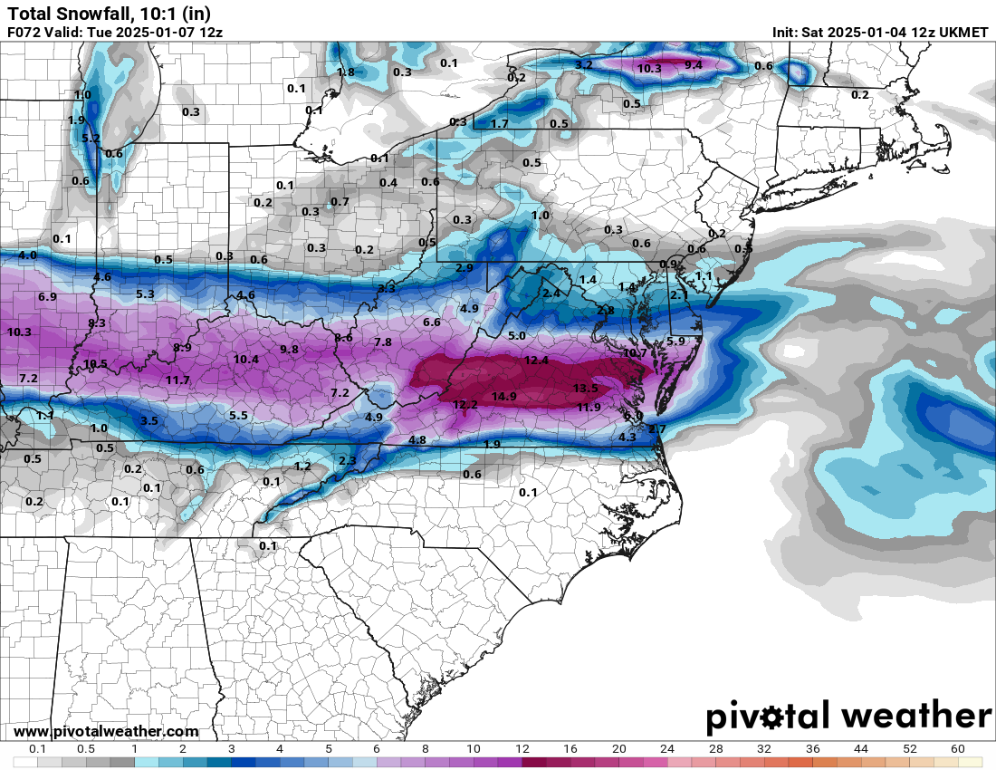
The clown maps are underdoing the mixing. Each site has a slightly different algorithm, but they are based on a 10:1 ratio. Sites like TT even tell you that their snow map numbers include sleet. For Metro Richmond, 1-4" is a good forecast but has high bust potential. Also, recent runs (including the Euro) have us turning over to rain for a time. That was not the case until about 24 hours or so ago.


.png.f16915a29b3bf8480b6081a235f3829b.png)