RIC Airport
-
Posts
2,586 -
Joined
-
Last visited
Content Type
Profiles
Blogs
Forums
American Weather
Media Demo
Store
Gallery
Everything posted by RIC Airport
-
Richmond Metro/Hampton Roads Area Discussion
RIC Airport replied to RIC Airport's topic in Mid Atlantic
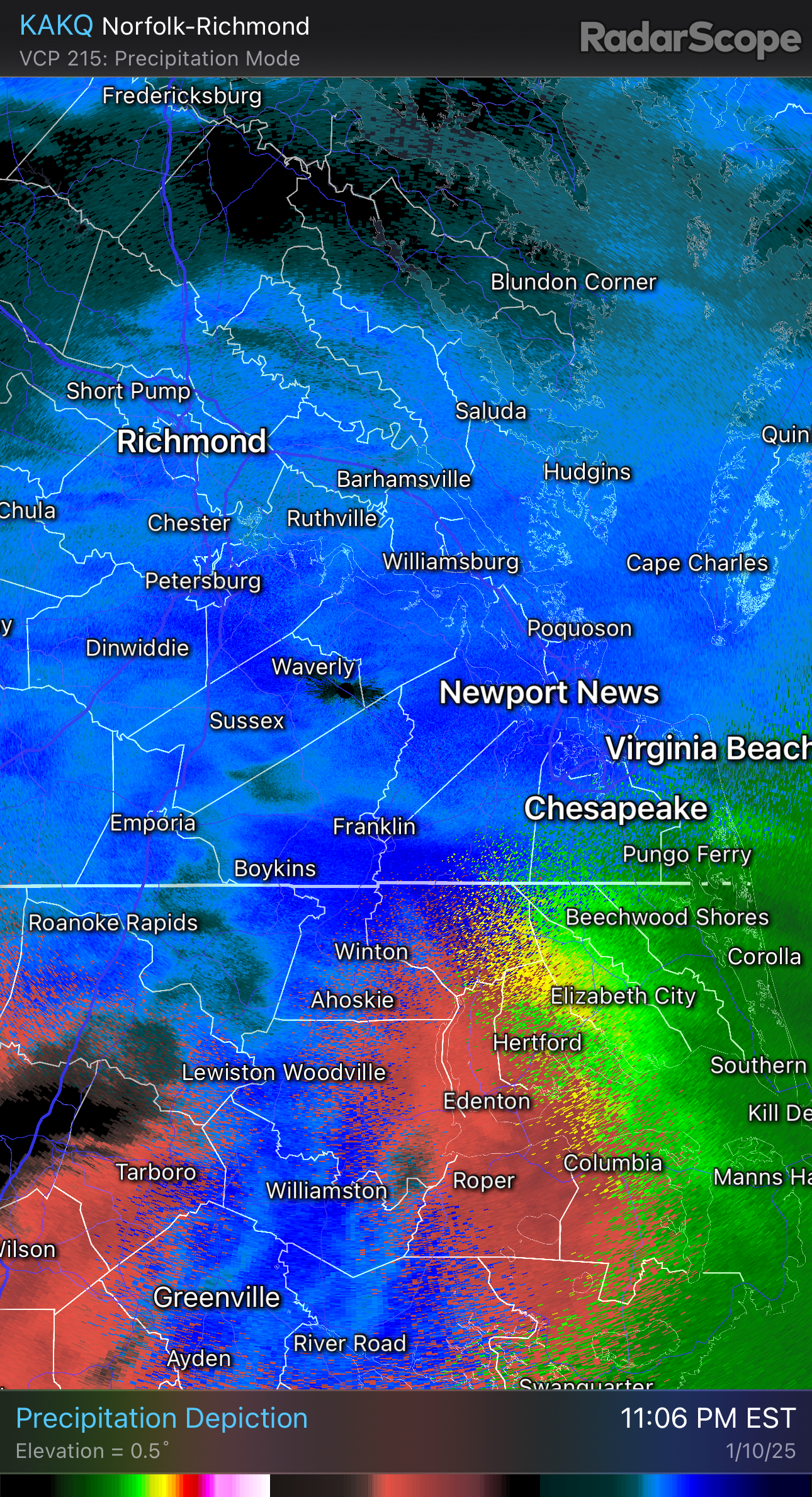
Seems like the area between Petersburg, Williamsburg and Newport News is where the best banding is setting up. We’ll see.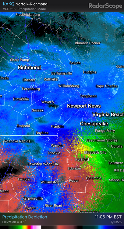
-
Richmond Metro/Hampton Roads Area Discussion
RIC Airport replied to RIC Airport's topic in Mid Atlantic
Roads are completely covered 2mi SW of the W&M campus. I haven't measured yet, but had to put something outside to remember where the snowboard was. -
Richmond Metro/Hampton Roads Area Discussion
RIC Airport replied to RIC Airport's topic in Mid Atlantic
Plenty of moisture moving east out of SW VA.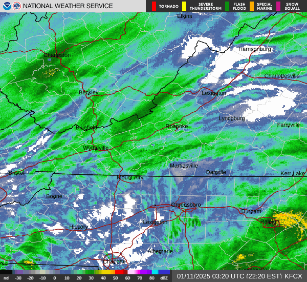
-
Richmond Metro/Hampton Roads Area Discussion
RIC Airport replied to RIC Airport's topic in Mid Atlantic
Welcome! -
Richmond Metro/Hampton Roads Area Discussion
RIC Airport replied to RIC Airport's topic in Mid Atlantic
Snow has picked up, small flake size though. Sticking is already happening and its become breezy. -
Richmond Metro/Hampton Roads Area Discussion
RIC Airport replied to RIC Airport's topic in Mid Atlantic
There is a reason why there are smaller regional threads in the forum. That's all I will say, but won't discourage others from double tapping if they choose to. -
Richmond Metro/Hampton Roads Area Discussion
RIC Airport replied to RIC Airport's topic in Mid Atlantic
I am in Williamsburg tonight about 2 mi SW of W&M campus and have flurries. -
Richmond Metro/Hampton Roads Area Discussion
RIC Airport replied to RIC Airport's topic in Mid Atlantic
Latest GRAF model I am able to find, @chris624wx, @VARTV. https://x.com/MikeTFox5/status/1877847739980993011 -
Richmond Metro/Hampton Roads Area Discussion
RIC Airport replied to RIC Airport's topic in Mid Atlantic
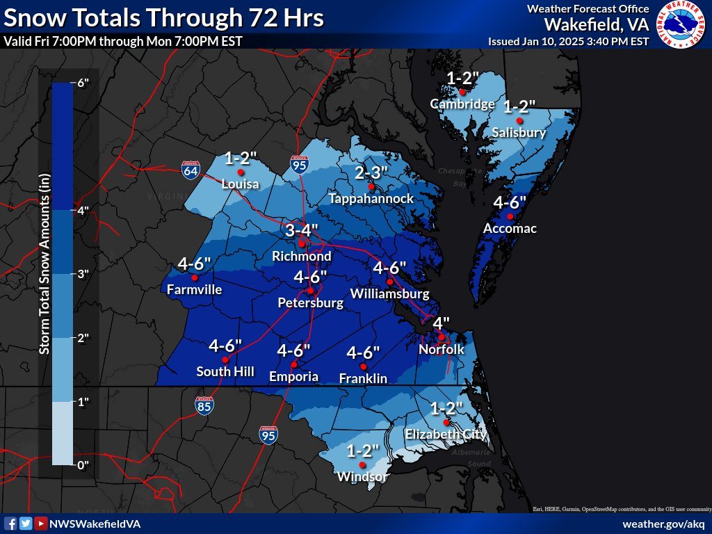
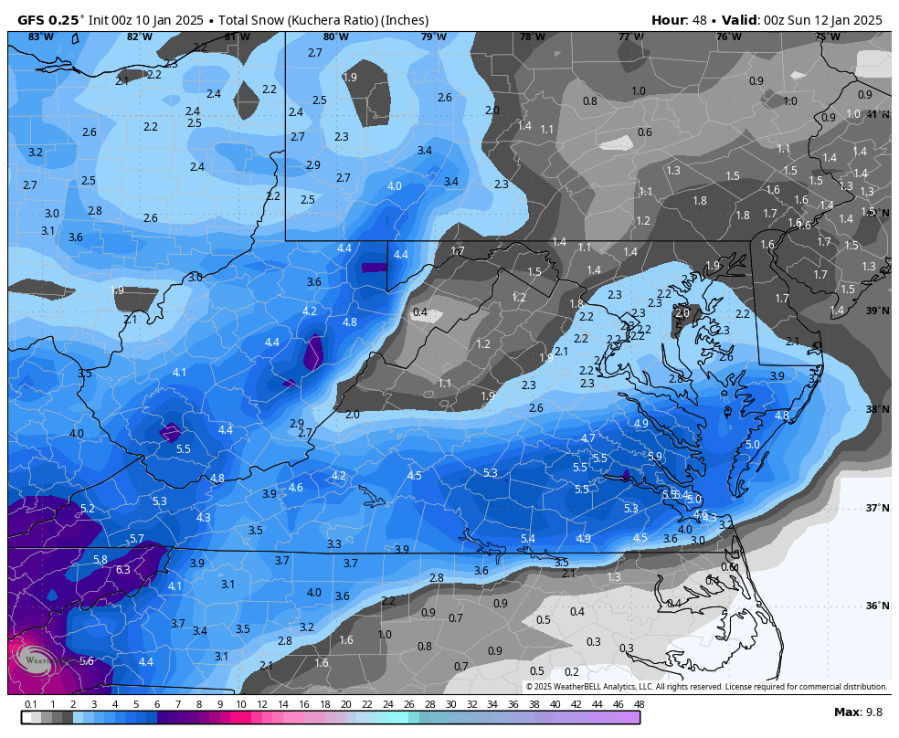
AKQ put out an updated map, a pretty large area where UP to 6" of snow could fall tonight.
-
Richmond Metro/Hampton Roads Area Discussion
RIC Airport replied to RIC Airport's topic in Mid Atlantic
Closer view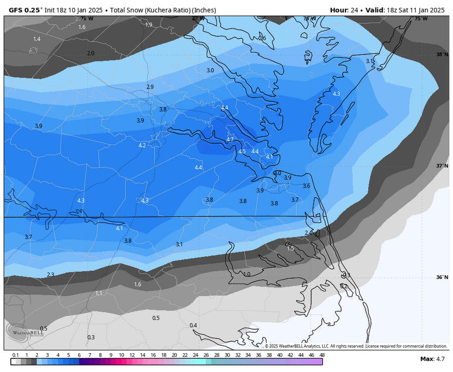
-
Richmond Metro/Hampton Roads Area Discussion
RIC Airport replied to RIC Airport's topic in Mid Atlantic
Thanks, Bob. Appreciate your insights. -
Richmond Metro/Hampton Roads Area Discussion
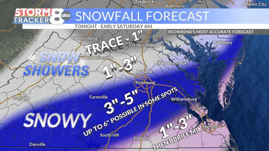
RIC Airport replied to RIC Airport's topic in Mid Atlantic
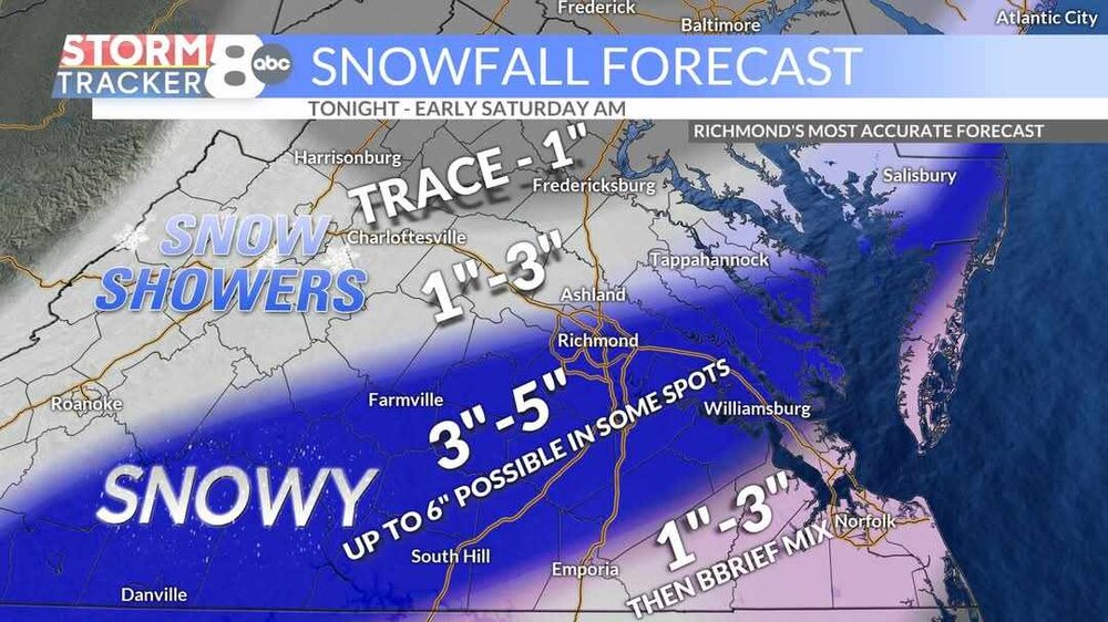
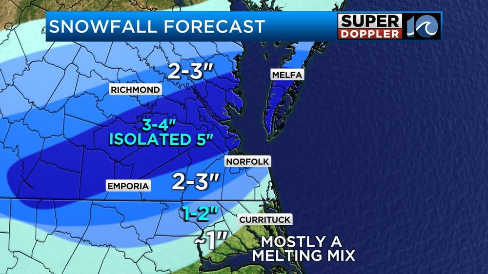
Hampton Roads Market TV stations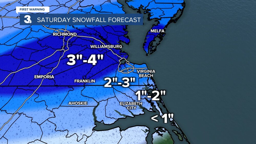

-
Richmond Metro/Hampton Roads Area Discussion
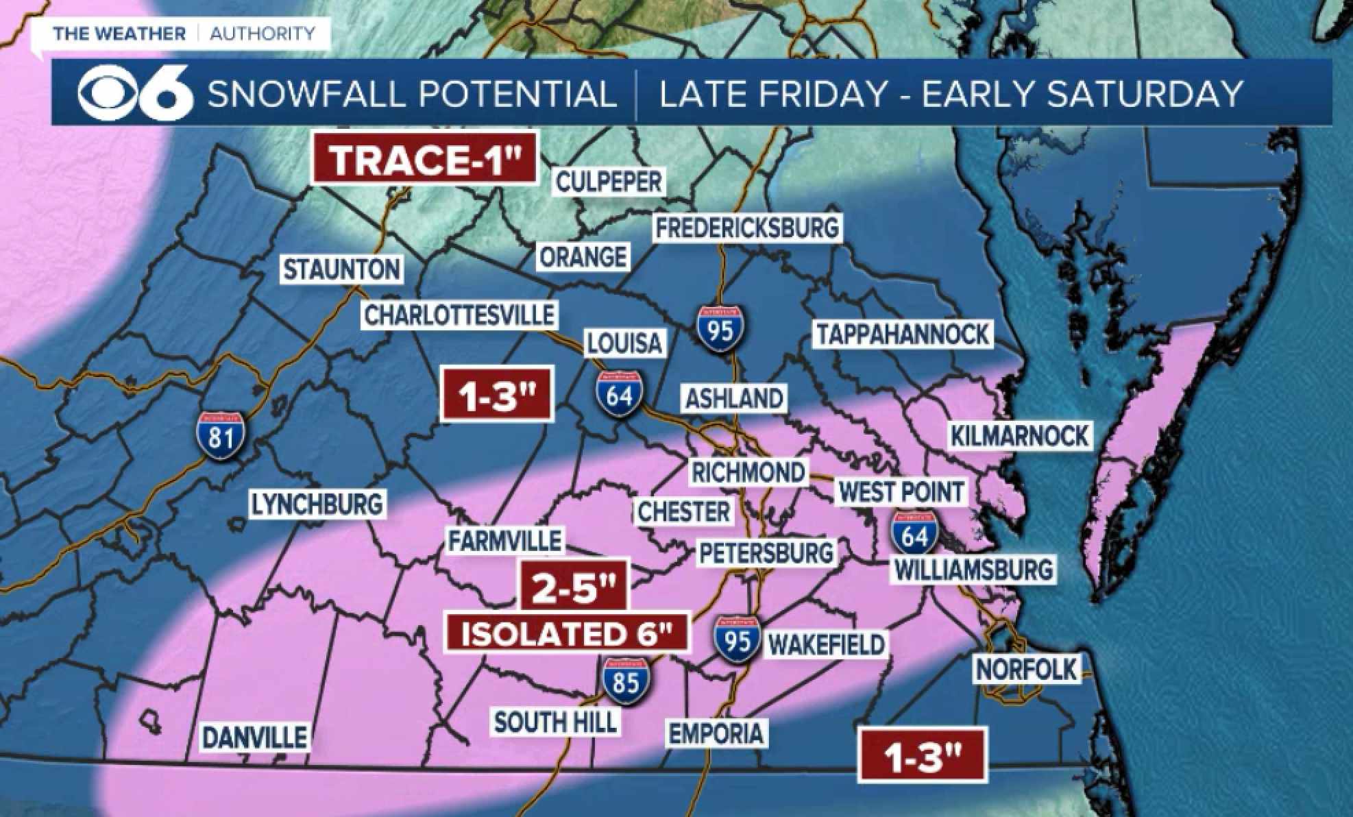
RIC Airport replied to RIC Airport's topic in Mid Atlantic
Richmond market TV station maps.
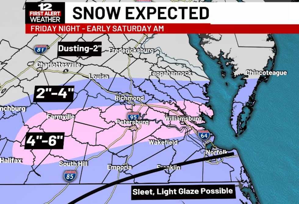
-
Richmond Metro/Hampton Roads Area Discussion
RIC Airport replied to RIC Airport's topic in Mid Atlantic
https://x.com/Daniel_Bonds/status/1877698909721526734?t=Lj-QSKqb4sElkDV9Or4h5A&s=19 -
Richmond Metro/Hampton Roads Area Discussion
RIC Airport replied to RIC Airport's topic in Mid Atlantic
That pesky dry air up this way is what they are picking up on. Hopefully it's a bit overdone. From the looks of the radar, you'd think we'd be getting a foot.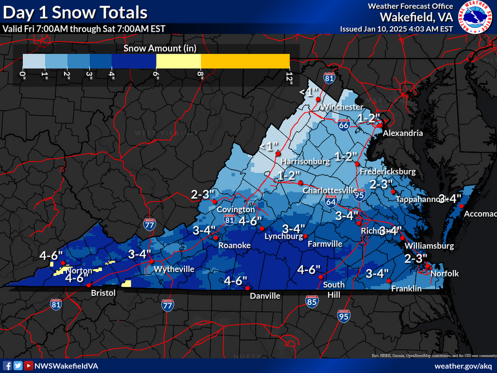
-
Richmond Metro/Hampton Roads Area Discussion
RIC Airport replied to RIC Airport's topic in Mid Atlantic
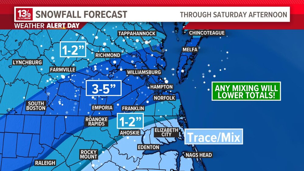
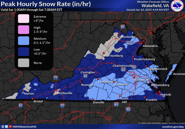
They believe mixing could cut down on totals there but still believe up to 2" is possible. Saw the below graphics on WAVY, first explains why southside Hampton Roads is tricky.
-
Richmond Metro/Hampton Roads Area Discussion
RIC Airport replied to RIC Airport's topic in Mid Atlantic
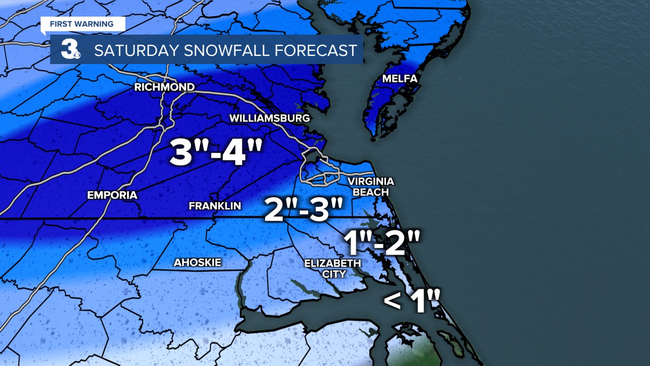
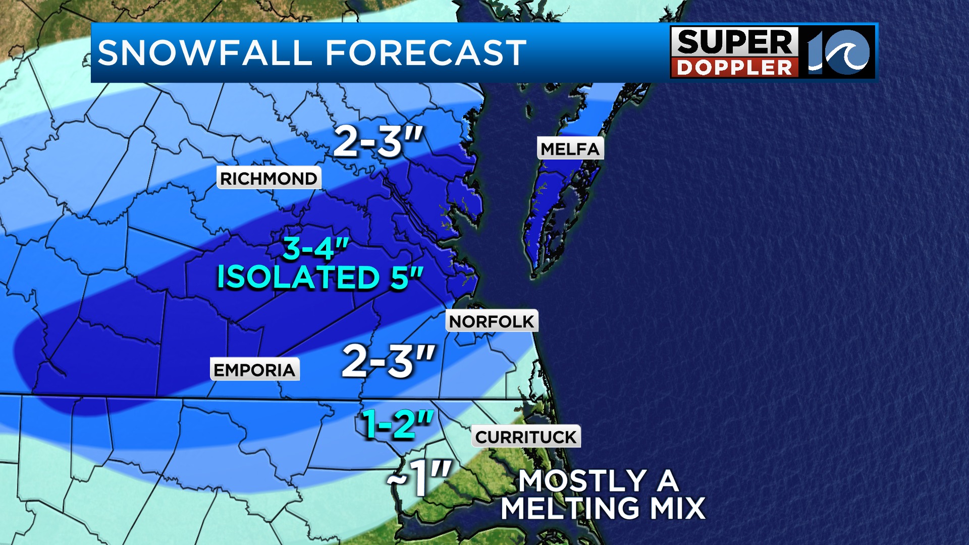
Updated map, somewhere between RIC and PHF could hit 6 inches..png.3e58816008a76a98d665e7cc5b54475e.png)
-
Richmond Metro/Hampton Roads Area Discussion
RIC Airport replied to RIC Airport's topic in Mid Atlantic
Wakefield is saying watches that remained in place around Richmond will likely need to be upgraded to a warning. .SHORT TERM /FRIDAY NIGHT THROUGH SATURDAY NIGHT/... 945 PM EST Thursday Update... General trend among the 00z model suite, including among the hi-res output, has been a continued upward trend in QPF/snowfall amounts with a slightly more amplified system. There is also better agreement on the potential placement of a narrow band of higher totals in the 4-6" range, generally across the northern tier of the current Winter Storm Warning per the 00z HRRR and NAM. While we will defer the final decision on headline upgrades to the overnight shift, it is looking quite likely that the winter storm watches for wrn Chesterfield, the city of Richmond, and points W will need to be upgraded to a warning for 3-5" of snow. Additionally, at least advisories will almost certainly be needed for a tier or two of counties N of the current watches/warnings, including on the MD Eastern Shore. Higher uncertainty remains over the SE due to mixing/p-type concerns, but will also need at least advisories here as well. -
Richmond Metro/Hampton Roads Area Discussion
RIC Airport replied to RIC Airport's topic in Mid Atlantic
Exactly, it's just an extra tool. ICON hasn't been around long enough to have a reputation and "SEEing" things over the legacy models. -
Richmond Metro/Hampton Roads Area Discussion
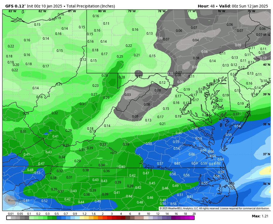
RIC Airport replied to RIC Airport's topic in Mid Atlantic
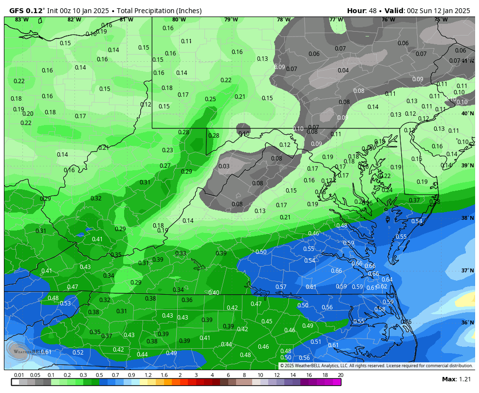
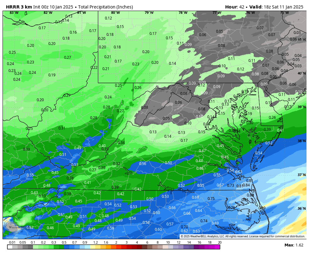
00z GFS was about .10" less in QPF on average for most from the 18z run.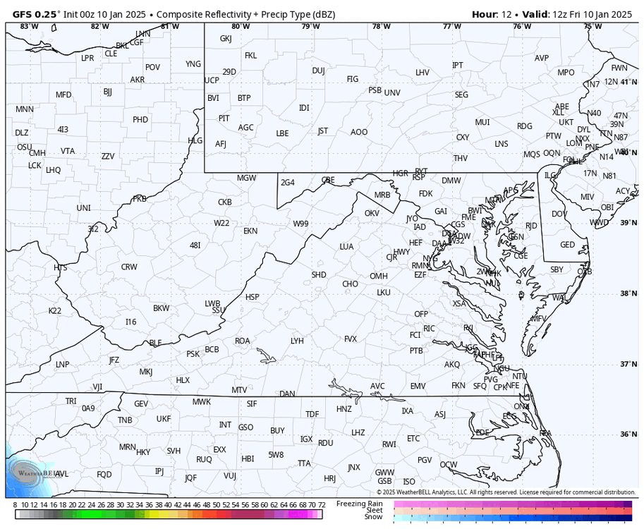

-
Richmond Metro/Hampton Roads Area Discussion
RIC Airport replied to RIC Airport's topic in Mid Atlantic
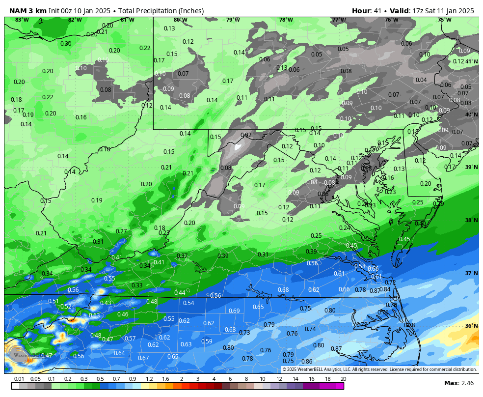
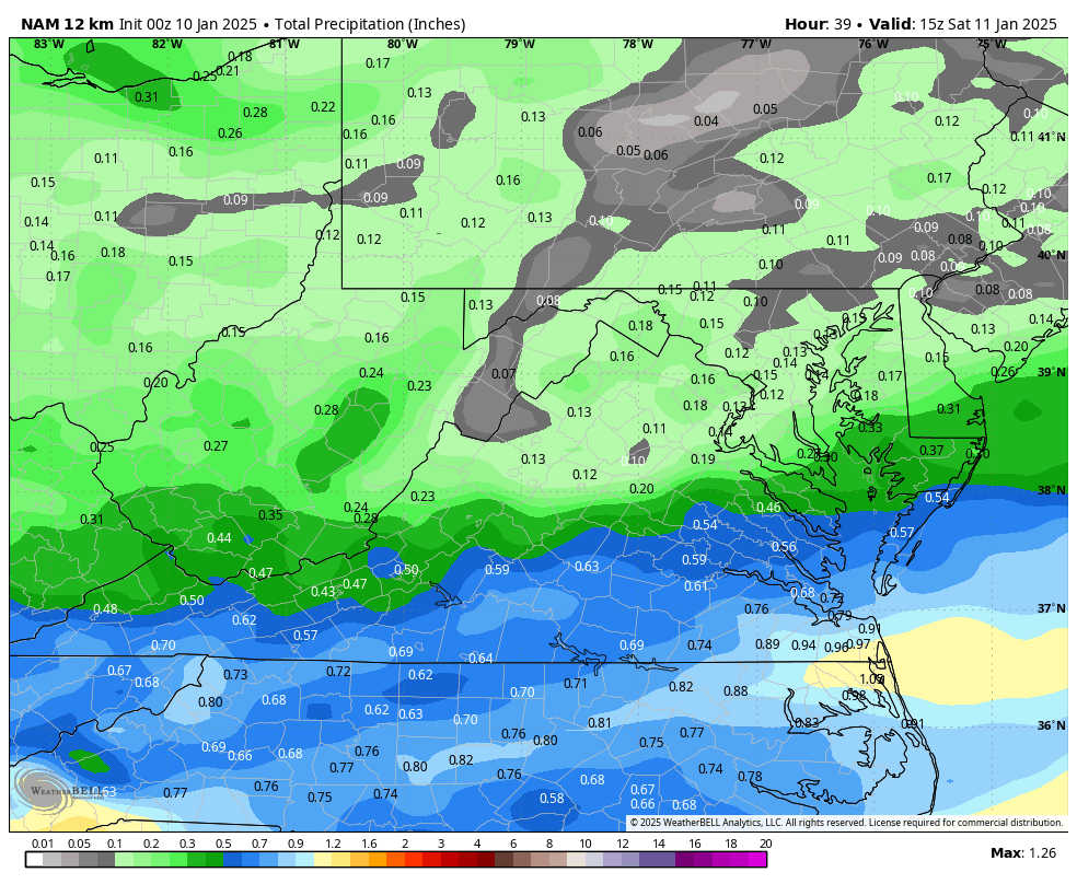
3K NAM was drier overall.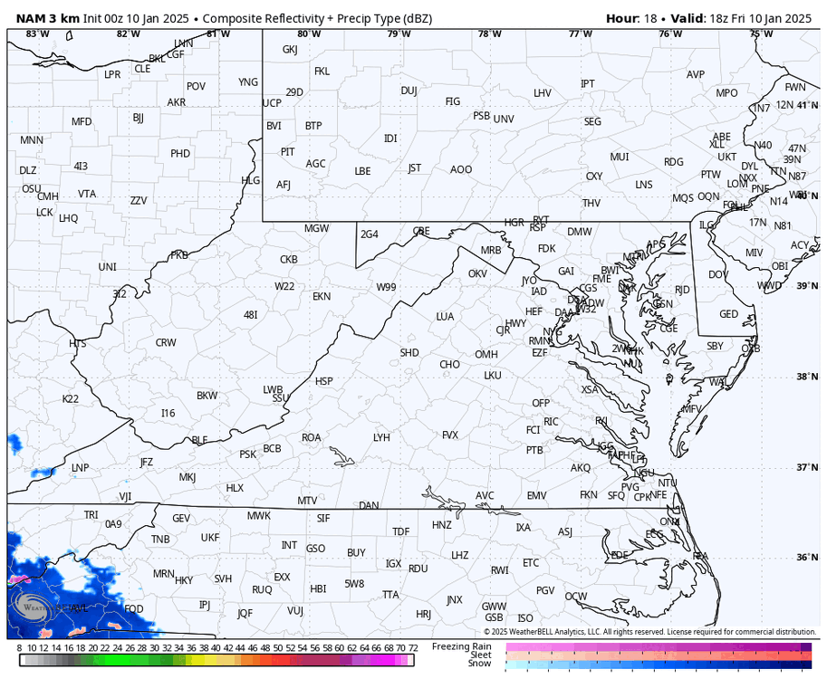
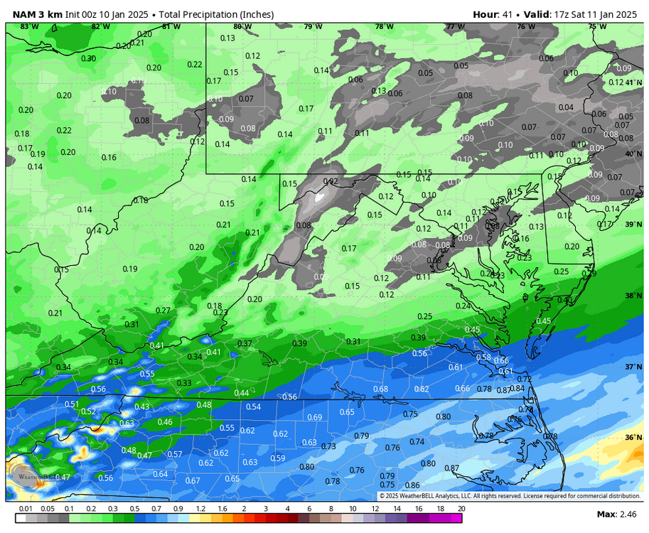
-
Richmond Metro/Hampton Roads Area Discussion
RIC Airport replied to RIC Airport's topic in Mid Atlantic

-
Richmond Metro/Hampton Roads Area Discussion
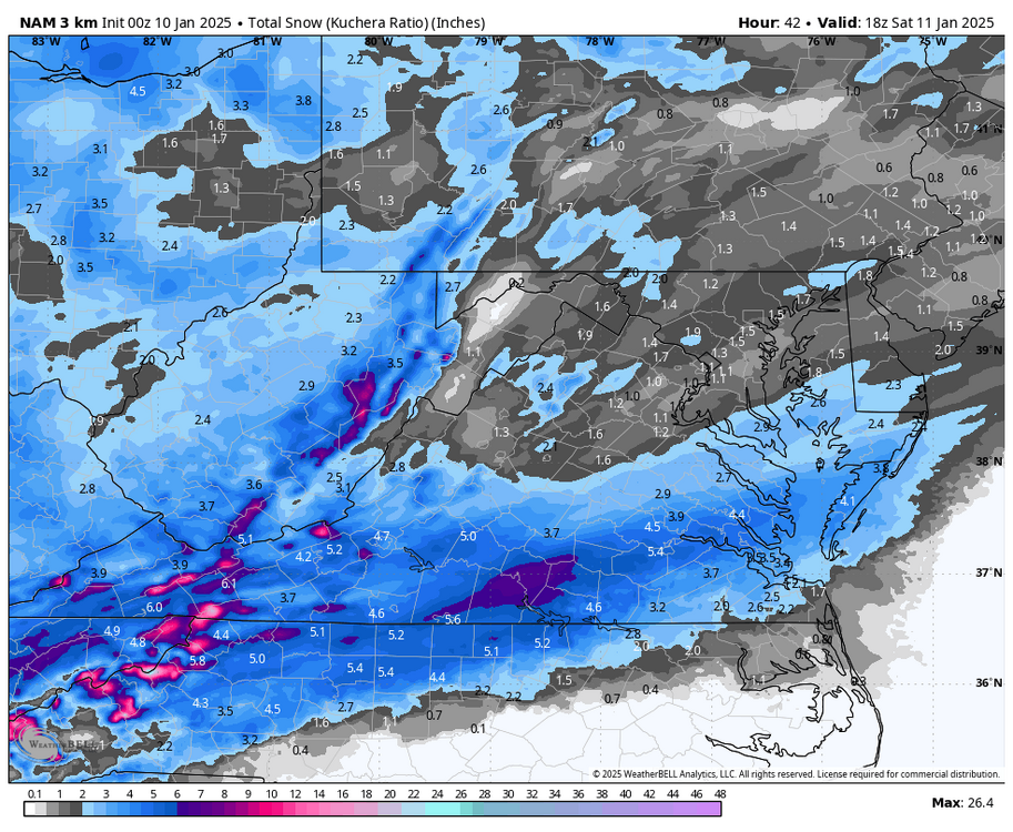
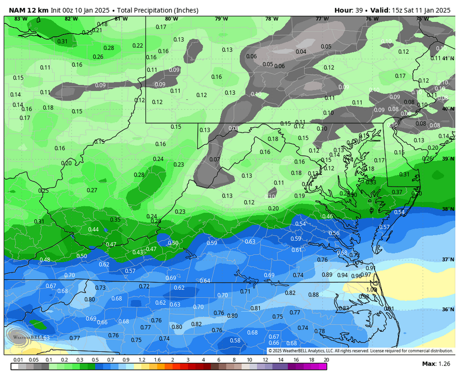
RIC Airport replied to RIC Airport's topic in Mid Atlantic
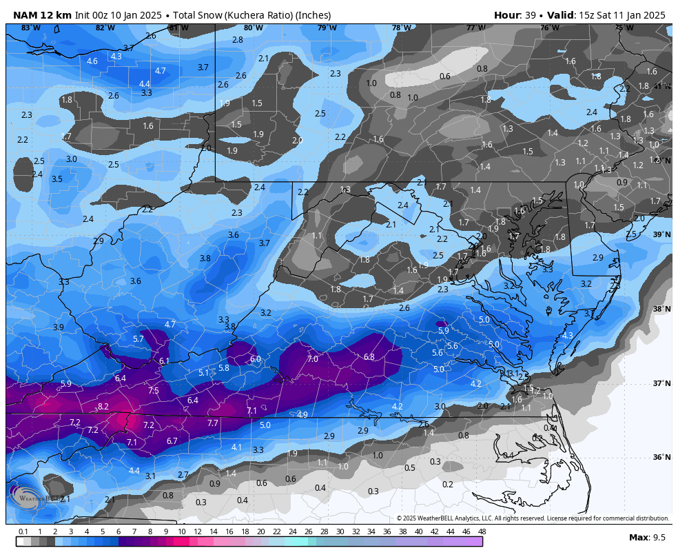
The NAM is also looking great!!! -
Richmond Metro/Hampton Roads Area Discussion
RIC Airport replied to RIC Airport's topic in Mid Atlantic
HRRR seems to be slighty faster as well.
-
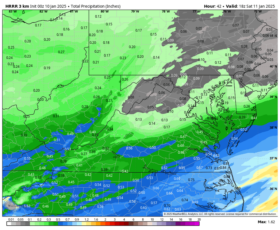
Richmond Metro/Hampton Roads Area Discussion
RIC Airport replied to RIC Airport's topic in Mid Atlantic
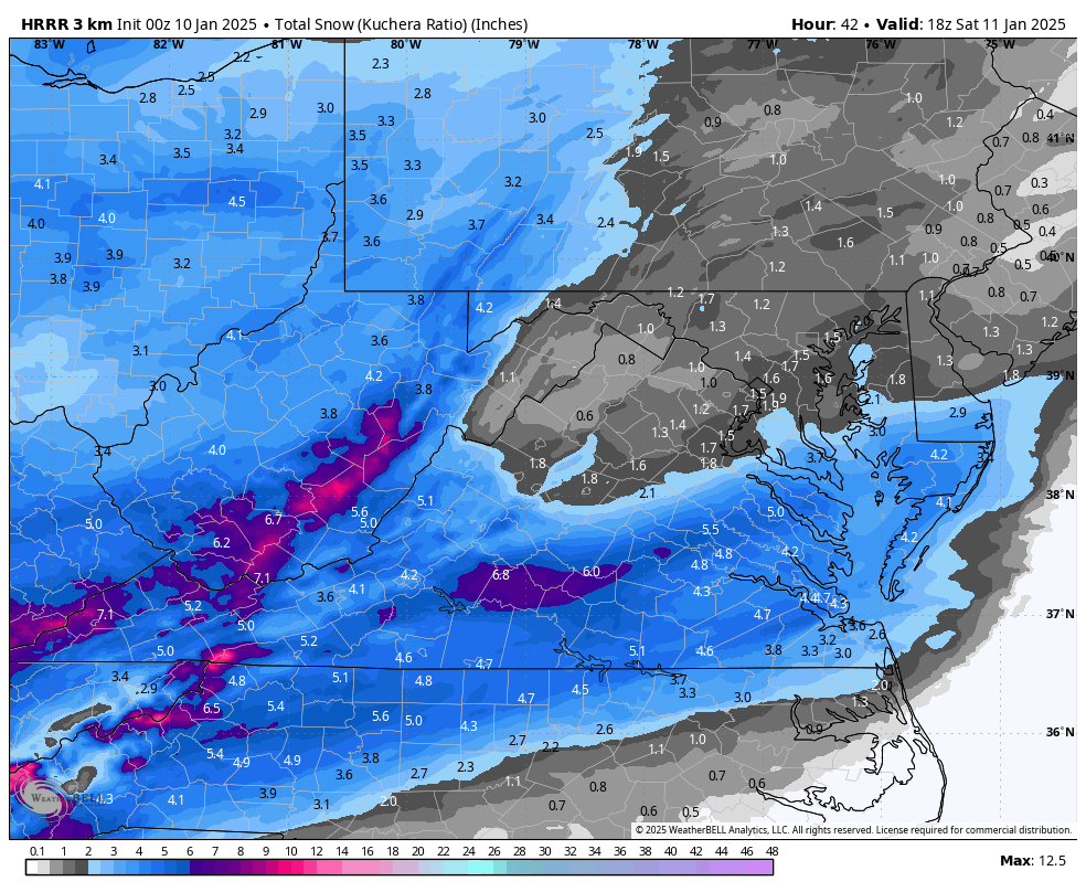
Meanwhile, 00Z HRRR is coming in strong.