RIC Airport
-
Posts
2,586 -
Joined
-
Last visited
Content Type
Profiles
Blogs
Forums
American Weather
Media Demo
Store
Gallery
Everything posted by RIC Airport
-
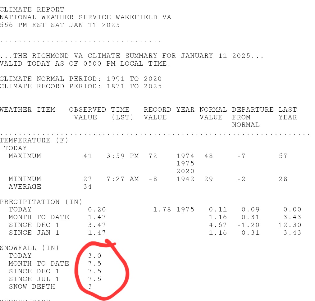
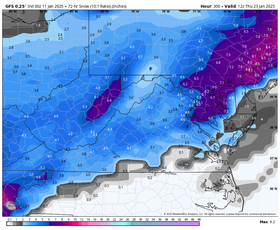
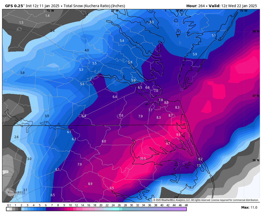
@RodneyS looks like RIC's storm total was 4.0" so season total is now 7.5" per latest CLI. I'd wait until it's reflected on tonight's CF6 update before considering it final.

-
Richmond Metro/Hampton Roads Area Discussion
RIC Airport replied to RIC Airport's topic in Mid Atlantic
Definitely see the signals. ORF actually has more hits.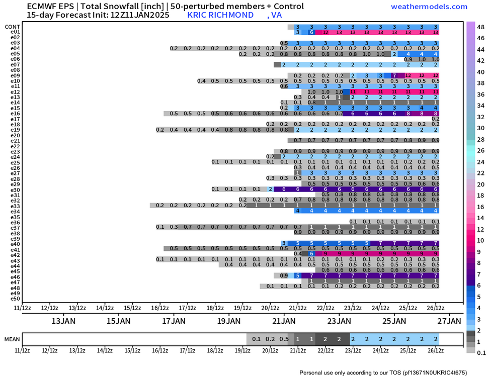

-
Richmond Metro/Hampton Roads Area Discussion
RIC Airport replied to RIC Airport's topic in Mid Atlantic
Sorry, I had to catch some Zs, these overnight storms are the worst. Real weenies don't sleep when it snows, you push through. @Conway7305, @wasnow215, we are NOT done. Maybe RIC has the potential to hit 20" this season. We are due. I'm also sorry for Hampton Roads, but rooting for a better event next time, @SnowBeach, @EverythingisEverything, @VARTV, @chris624wx, @Stormpc, et.al.
-
RIC recorded 1.0" before midnight, reflected on the CF6. The preliminary number for today is 2.0" for a storm total of 3.0" and bringing RIC's season total to 6.5". The next CLI should be sent around 5:30pm.
-
Richmond Metro/Hampton Roads Area Discussion
RIC Airport replied to RIC Airport's topic in Mid Atlantic
0.29" of QPF at RIC through 4 a.m. at 28°F is easily 3 to 3.5" of snow from this event. Maybe it'll come in a PNS statement later this morning; otherwise, we will have to wait until the CLI is sent around 5:30 p.m. to know the storm total. -
Richmond Metro/Hampton Roads Area Discussion
RIC Airport replied to RIC Airport's topic in Mid Atlantic
Just shy of 3.5" measured as of 4am. -
Richmond Metro/Hampton Roads Area Discussion
RIC Airport replied to RIC Airport's topic in Mid Atlantic
Glad you switched back to snow, there is still time before things end so hopefully you can finish with 3-4" at least. -
Richmond Metro/Hampton Roads Area Discussion
RIC Airport replied to RIC Airport's topic in Mid Atlantic
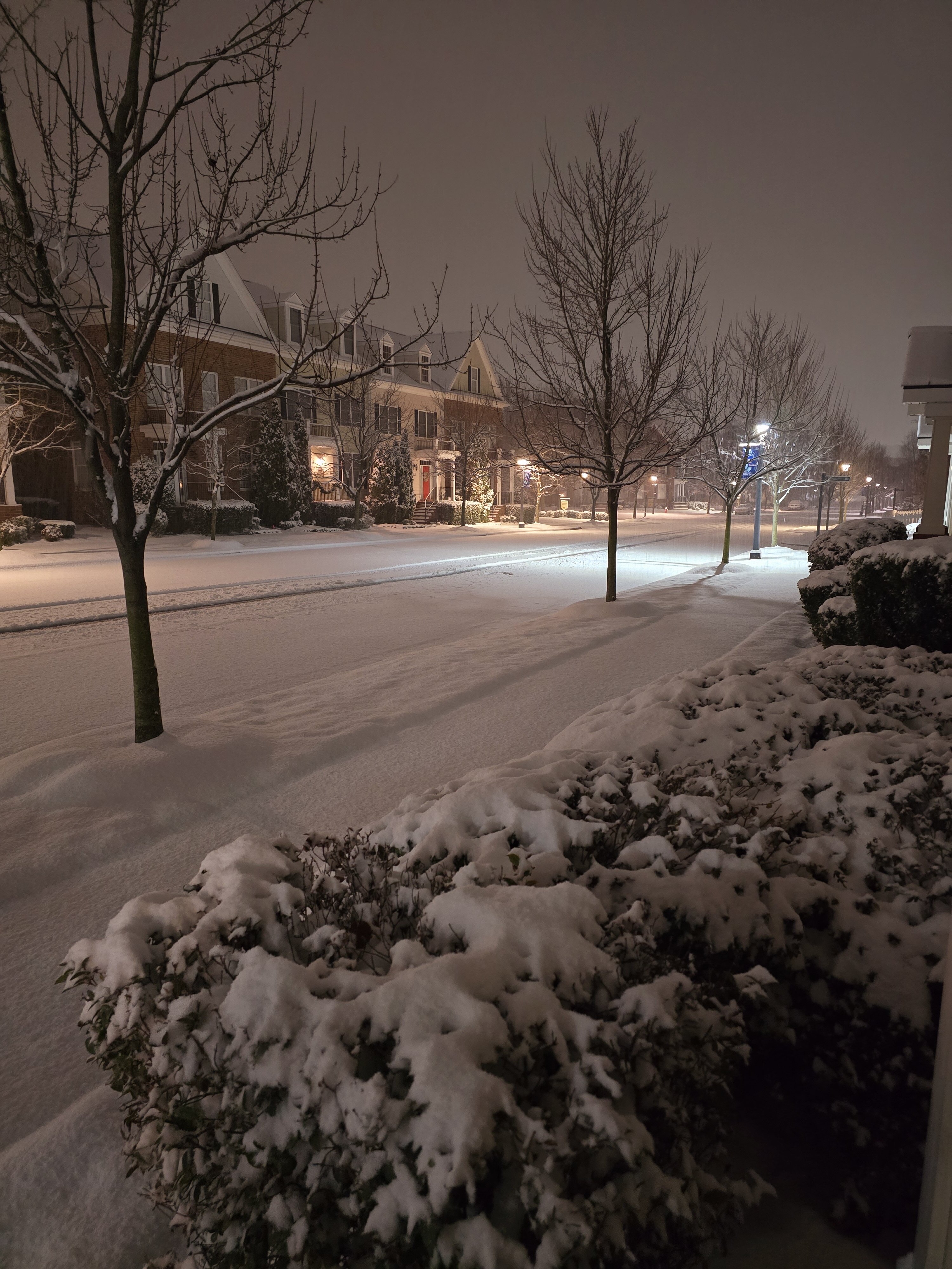
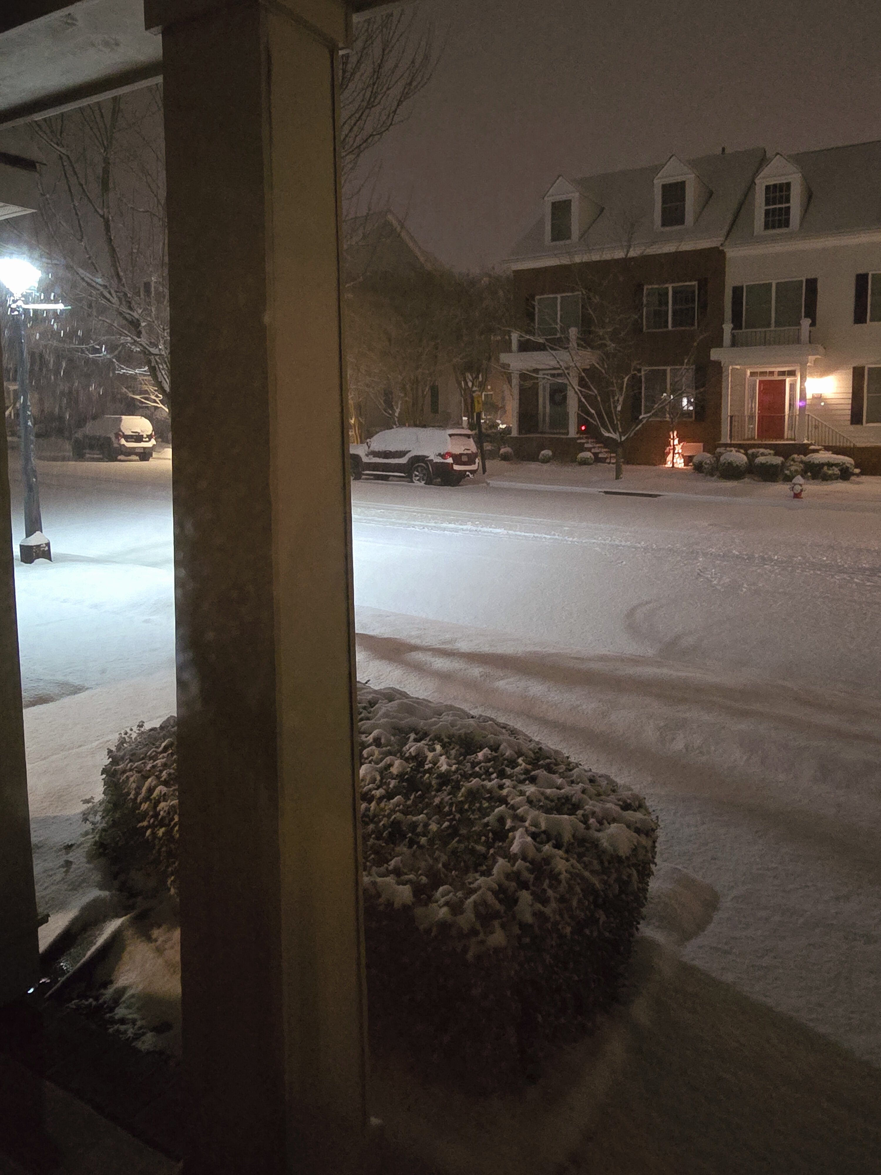
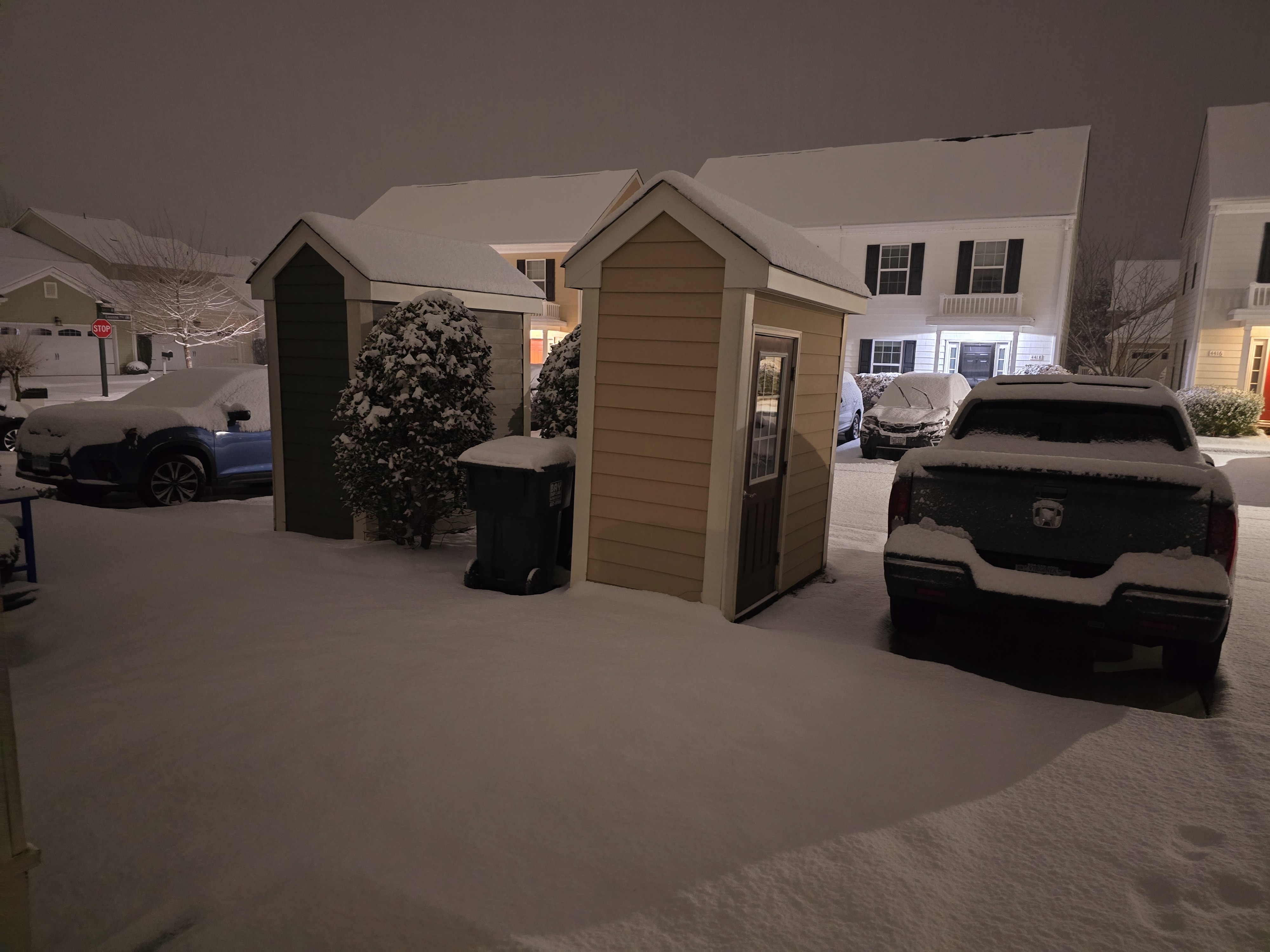
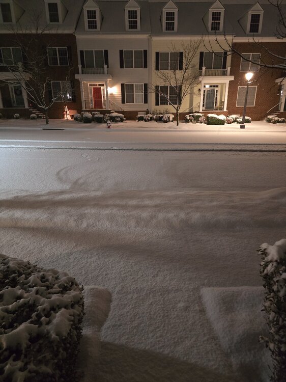
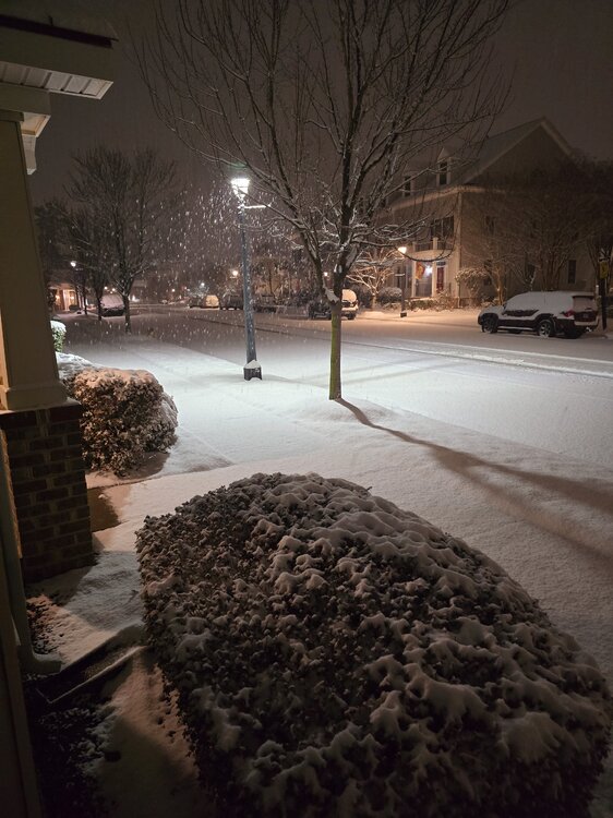
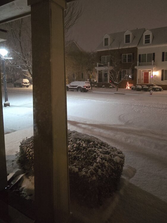
A few pics taken in the last 10 mins. This is the Newtown area of Williamsburg, 2 miles SW of W&M campus. Looking at the radar, I'm guessing 4" is probably within reason before this is over.
-
Richmond Metro/Hampton Roads Area Discussion
RIC Airport replied to RIC Airport's topic in Mid Atlantic
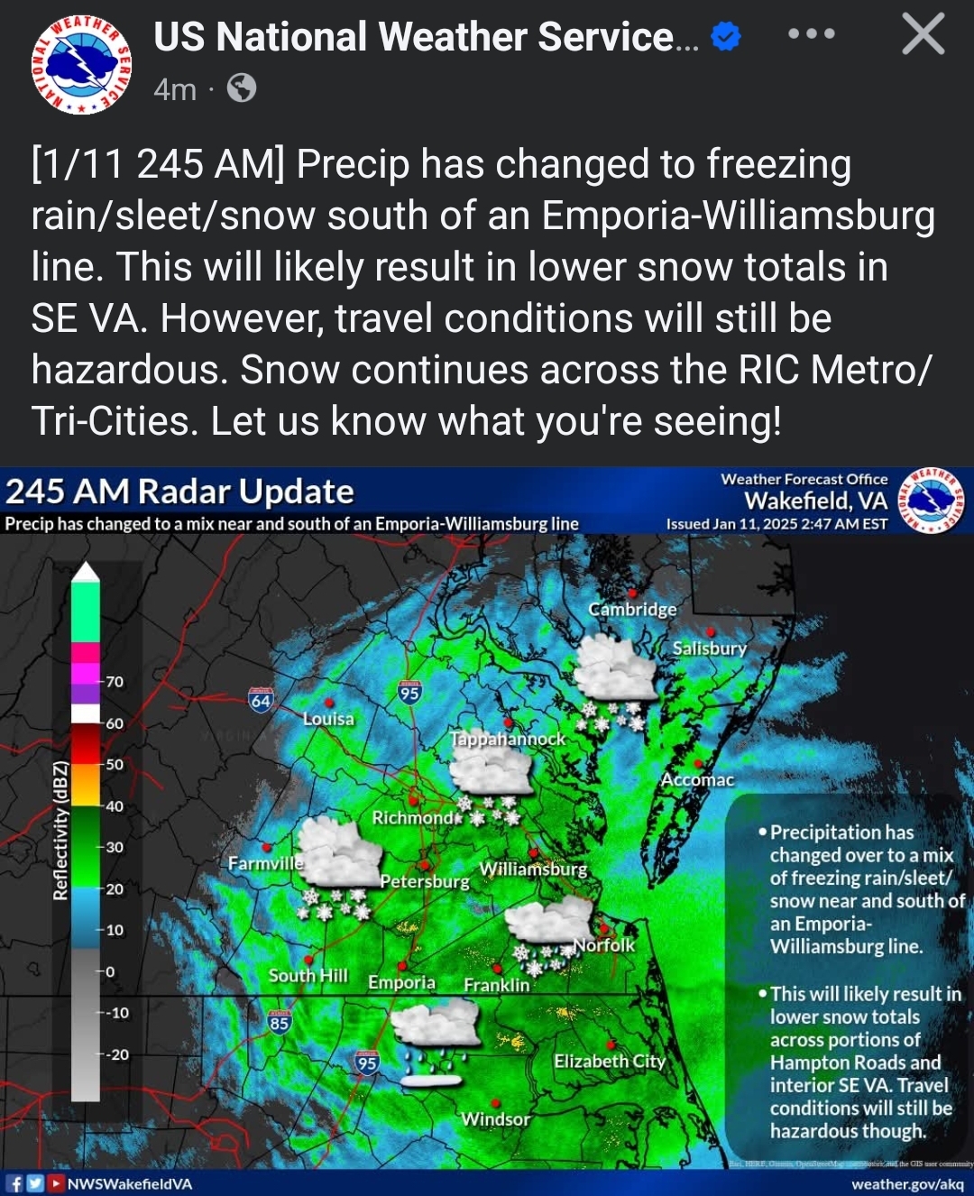
AKQ is acknowledging this will lead to reduced totals.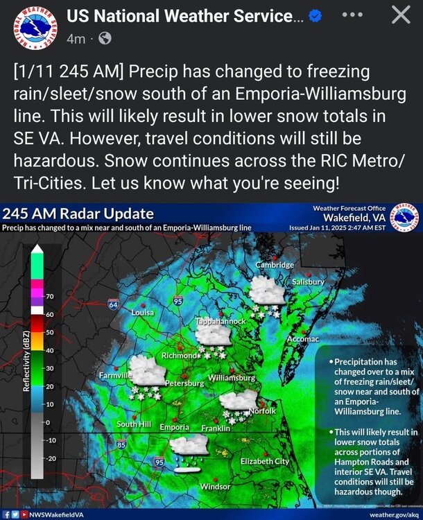
-
Richmond Metro/Hampton Roads Area Discussion
RIC Airport replied to RIC Airport's topic in Mid Atlantic
But you're still below freezing so freezing rain? I had about a 45 min period of sleet, but back to snow and up to 2.2" now. -
Richmond Metro/Hampton Roads Area Discussion
RIC Airport replied to RIC Airport's topic in Mid Atlantic
Back to all snow, fattest flakes of the night. Should really pile up now. -
Richmond Metro/Hampton Roads Area Discussion
RIC Airport replied to RIC Airport's topic in Mid Atlantic
Interesting, there is layer of warm air that moved over Williamsburg so changed to sleet.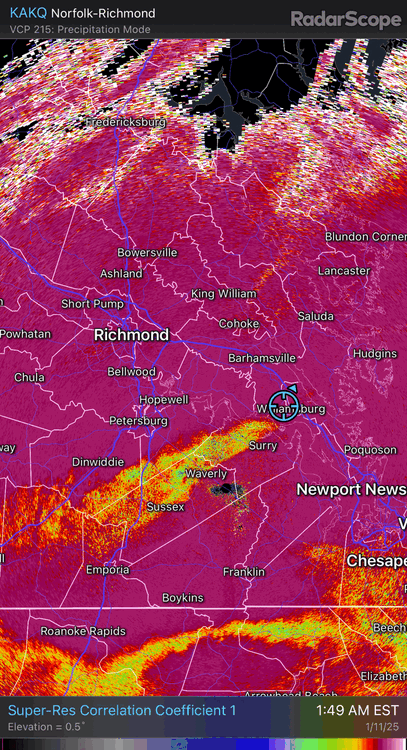
-
Richmond Metro/Hampton Roads Area Discussion
RIC Airport replied to RIC Airport's topic in Mid Atlantic
RIC recorded 1.0" through midnight. The heaviest rates of the night started after that so I think reaching 2.5-3" is certainly possible before things begin to wind down.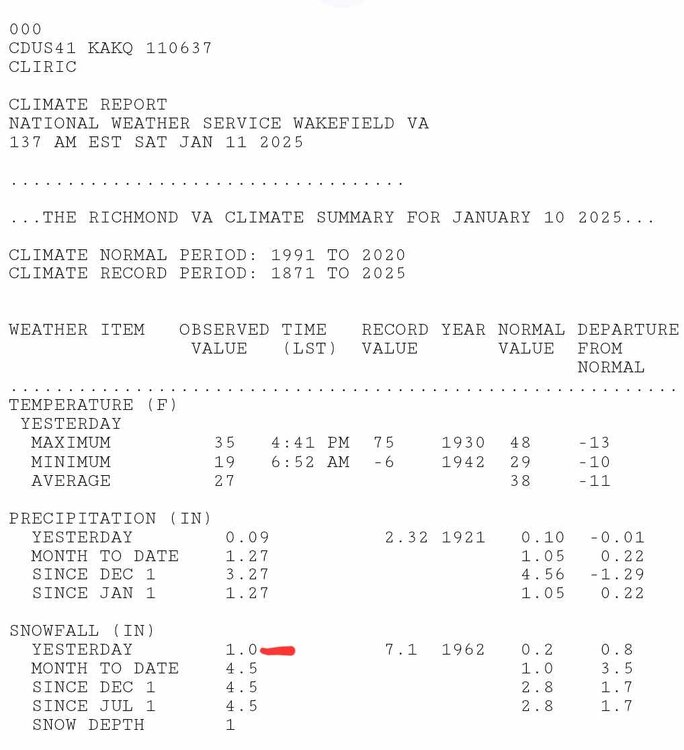
-
Richmond Metro/Hampton Roads Area Discussion
RIC Airport replied to RIC Airport's topic in Mid Atlantic
Excellent! I think things are about to get better, getting into the heart of the event now. -
Richmond Metro/Hampton Roads Area Discussion
RIC Airport replied to RIC Airport's topic in Mid Atlantic
Had a lull, but picking up again, finally up to an inch. -
Richmond Metro/Hampton Roads Area Discussion
RIC Airport replied to RIC Airport's topic in Mid Atlantic
It also could be rate dependent so could change back to all snow. -
Richmond Metro/Hampton Roads Area Discussion
RIC Airport replied to RIC Airport's topic in Mid Atlantic
Unfortunately you can see it on radar, models had this possibility for the south side, but surprised it’s happening this early.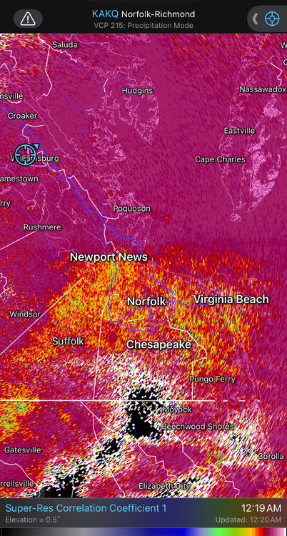
-
Richmond Metro/Hampton Roads Area Discussion
RIC Airport replied to RIC Airport's topic in Mid Atlantic
This area should do well in the coming couple of hours. 473545843_8887579137962843_7091287187062167741_n.mp4 -
Richmond Metro/Hampton Roads Area Discussion
RIC Airport replied to RIC Airport's topic in Mid Atlantic
@EverythingisEverything, are you mixing or all snow? -
Richmond Metro/Hampton Roads Area Discussion
RIC Airport replied to RIC Airport's topic in Mid Atlantic
0.09" of QPF at RIC at mostly 28°F so one of the recent model runs already busted. I'm pretty sure I saw a 0.08" one something earlier today. -
Richmond Metro/Hampton Roads Area Discussion
RIC Airport replied to RIC Airport's topic in Mid Atlantic
It's good to see the threats pop up. I'm impressed with this month so far, with all the cold and snow chances. Especially the cold, it just seems so persistent, which has been rare for so many years.
-
Richmond Metro/Hampton Roads Area Discussion
RIC Airport replied to RIC Airport's topic in Mid Atlantic
I think it'll set up north of the last band so you should do well in SP. -
Richmond Metro/Hampton Roads Area Discussion
RIC Airport replied to RIC Airport's topic in Mid Atlantic
0.8" here so far. -
Richmond Metro/Hampton Roads Area Discussion
RIC Airport replied to RIC Airport's topic in Mid Atlantic
Glad you're starting off with snow. Raleigh to the SW seem to have struggled with mostly IP/ZR right out of the gate. -
Richmond Metro/Hampton Roads Area Discussion
RIC Airport replied to RIC Airport's topic in Mid Atlantic
The heaviest returns that will likely affect Richmond metro are just entering between Lynchburg and Farmville.