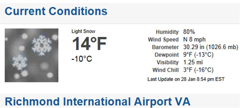
RIC Airport
-
Posts
2,586 -
Joined
-
Last visited
Content Type
Profiles
Blogs
Forums
American Weather
Media Demo
Store
Gallery
Everything posted by RIC Airport
-
Richmond Metro/Hampton Roads Area Discussion
RIC Airport replied to RIC Airport's topic in Mid Atlantic
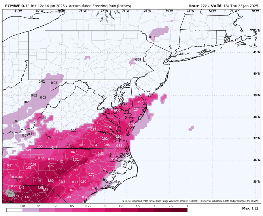
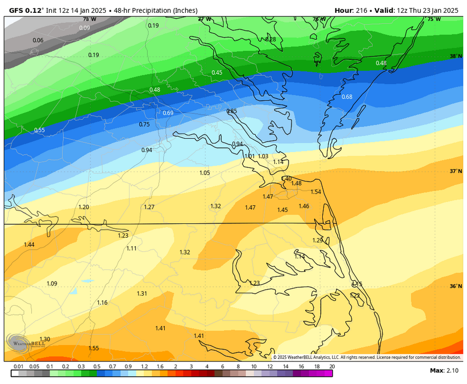
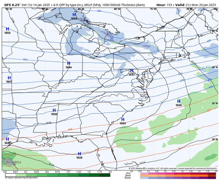
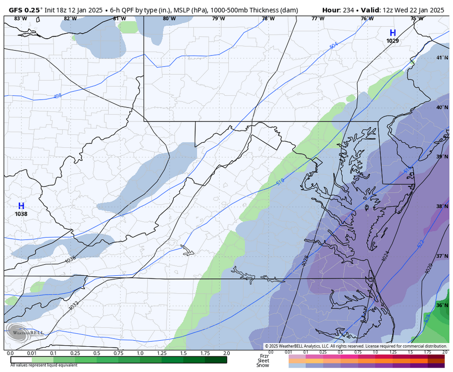
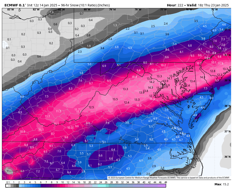
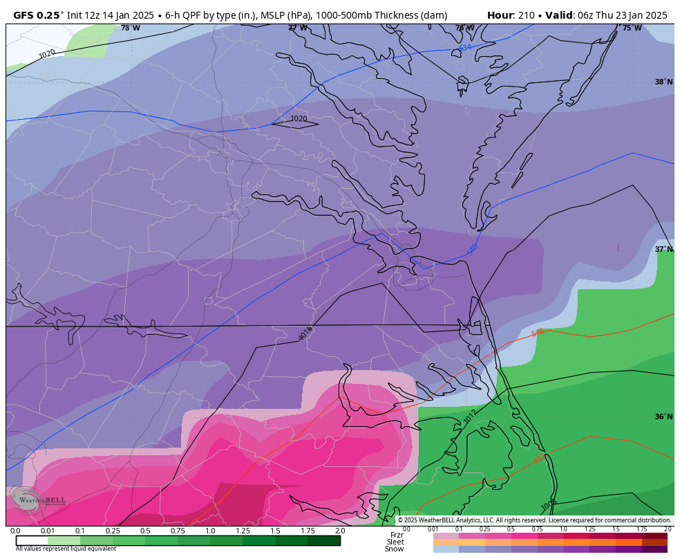
Euro had the storm, but wasn't as kind for our area, not sure I believe the ZR with a track like this.

-
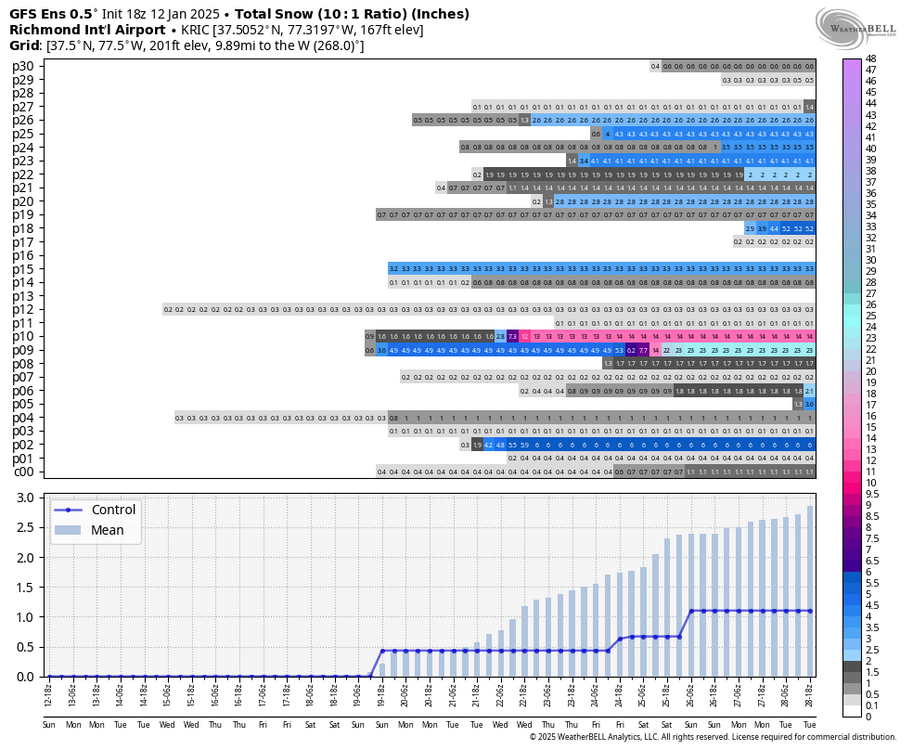
Richmond Metro/Hampton Roads Area Discussion
RIC Airport replied to RIC Airport's topic in Mid Atlantic
Looks like good GEFS support for that time-frame.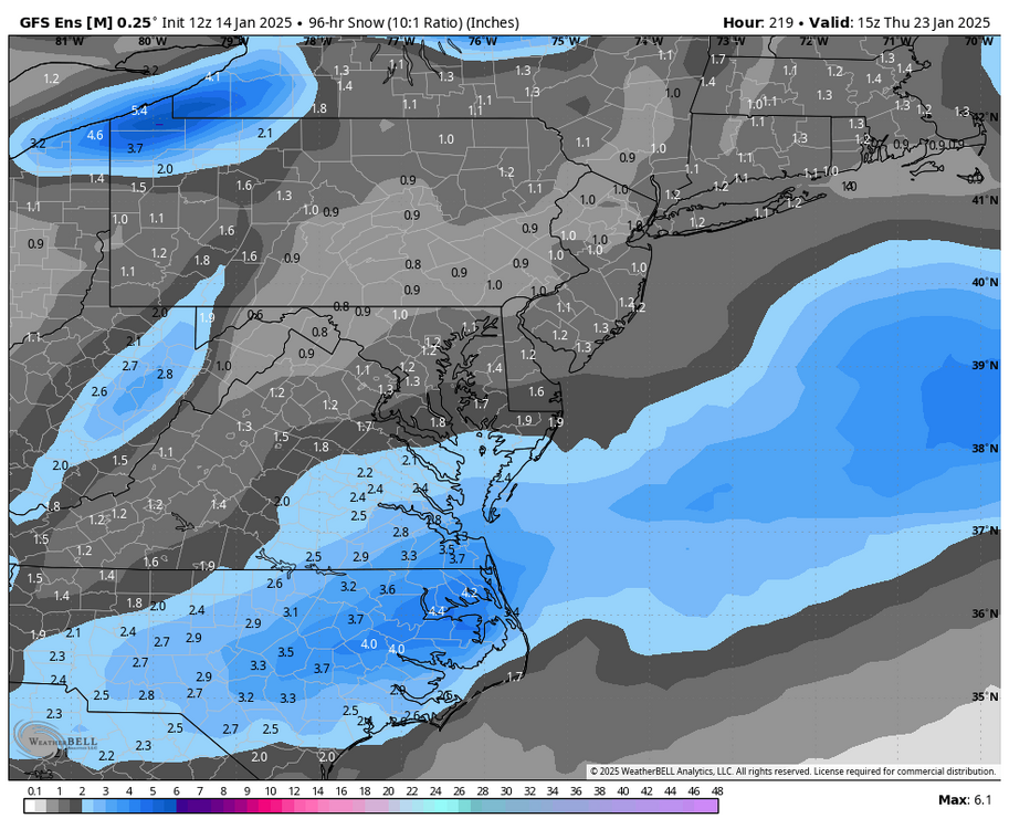
-
Richmond Metro/Hampton Roads Area Discussion
RIC Airport replied to RIC Airport's topic in Mid Atlantic
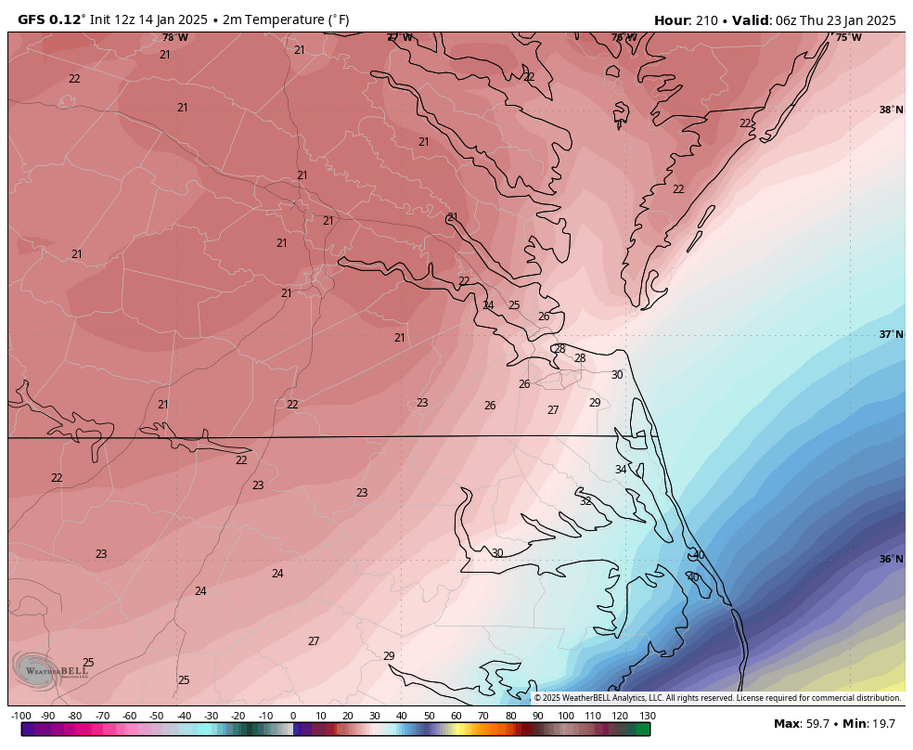
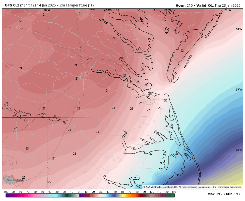
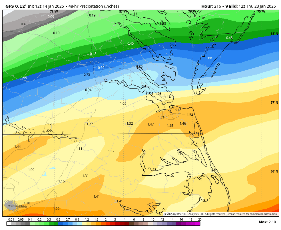
Also, @chris624wxtemperatures are frigid during this event. You tap 0.50" to 1.50" into cold air with temperatures 20-25 degrees should offer good ratios.
-
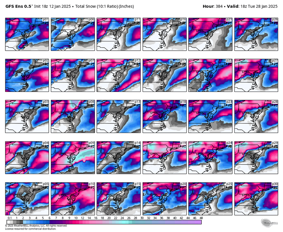
Richmond Metro/Hampton Roads Area Discussion
RIC Airport replied to RIC Airport's topic in Mid Atlantic
Hopefully the Euro catches on and we get better support on the GEFS. -
Richmond Metro/Hampton Roads Area Discussion
RIC Airport replied to RIC Airport's topic in Mid Atlantic
-
Richmond Metro/Hampton Roads Area Discussion
RIC Airport replied to RIC Airport's topic in Mid Atlantic
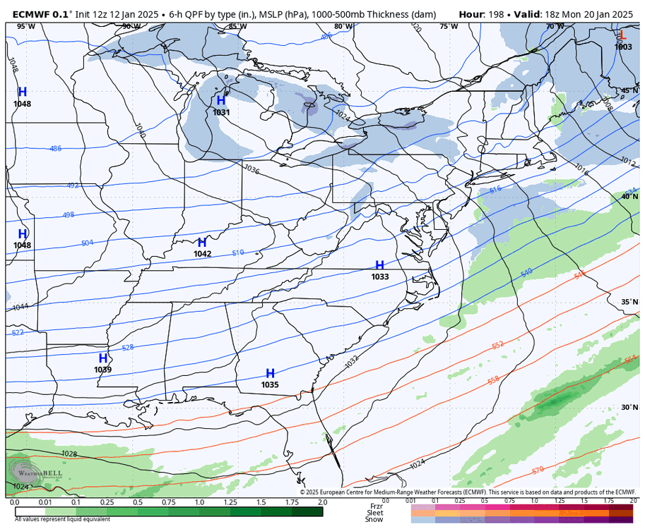
12z GFS is coming in strong! -
Richmond Metro/Hampton Roads Area Discussion
RIC Airport replied to RIC Airport's topic in Mid Atlantic
GFS is still aggressive with that 2nd wave forming after passage of the cold front.

-
Richmond Metro/Hampton Roads Area Discussion
RIC Airport replied to RIC Airport's topic in Mid Atlantic
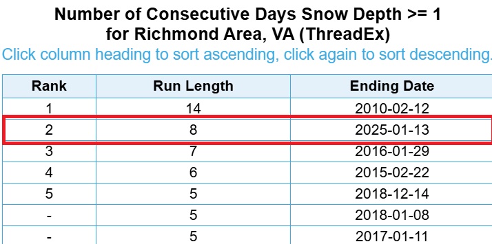
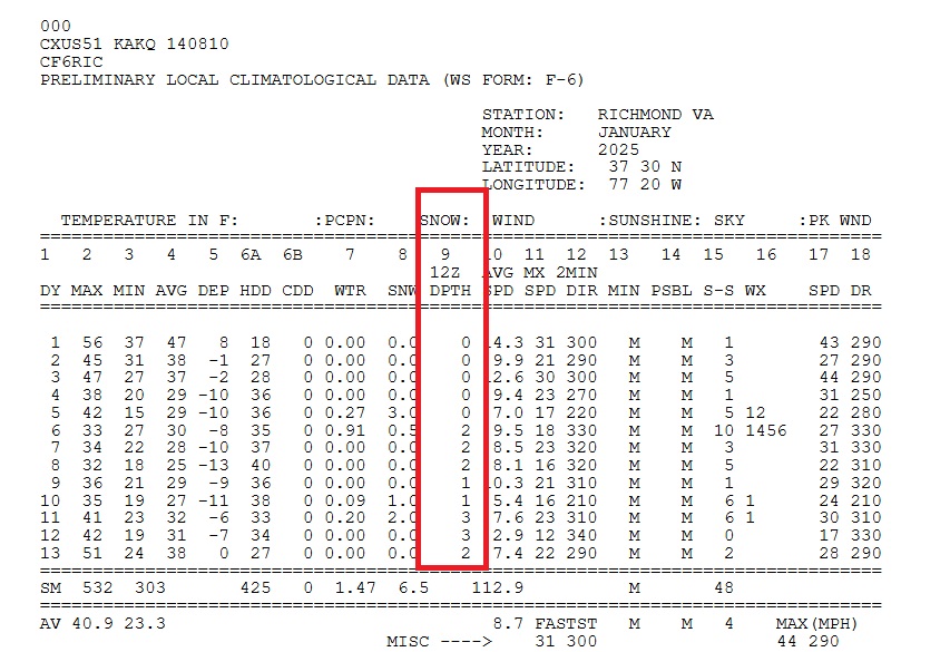
Here's an update! Yesterday morning, the snow depth measured at 12z was 2 inches, bringing the total duration of snow cover to 8 days. This is the longest period of at least 1 inch of snow cover in Richmond since the winter of 2009-2010. Considering that the temperature at RIC reached 51°F yesterday, it is likely that this stretch of snow cover has ended after 8 days. However, a trace of snow may have still been recorded on the ground this morning. We'll see what the CF6 says tomorrow for this morning's measurement. According to the snow measurement guidelines. "When in your judgment, less than 50 percent of the exposed ground is covered by snow, even though the covered areas have a significant depth, the snow depth should be recorded as a trace (T). When no snow or ice is on the ground in exposed areas (snow may be present in surrounding forested or otherwise protected areas), record a "0".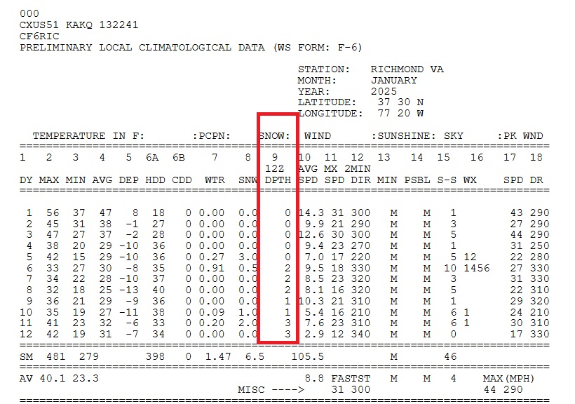
-
Richmond Metro/Hampton Roads Area Discussion
RIC Airport replied to RIC Airport's topic in Mid Atlantic
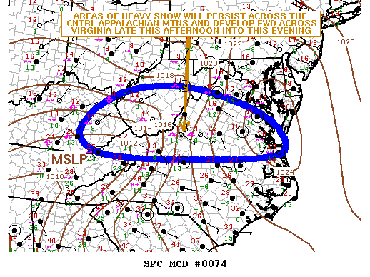
I'm happy to see the threats keep popping up. There have been wild swings and storms on (some blockbuster events) and off, so it's hard to take anything too seriously for now. Come back at 12z , and I think, based on how the Euro has performed overall, I would like to see the Euro get on board before I get excited. -
Richmond Metro/Hampton Roads Area Discussion
RIC Airport replied to RIC Airport's topic in Mid Atlantic
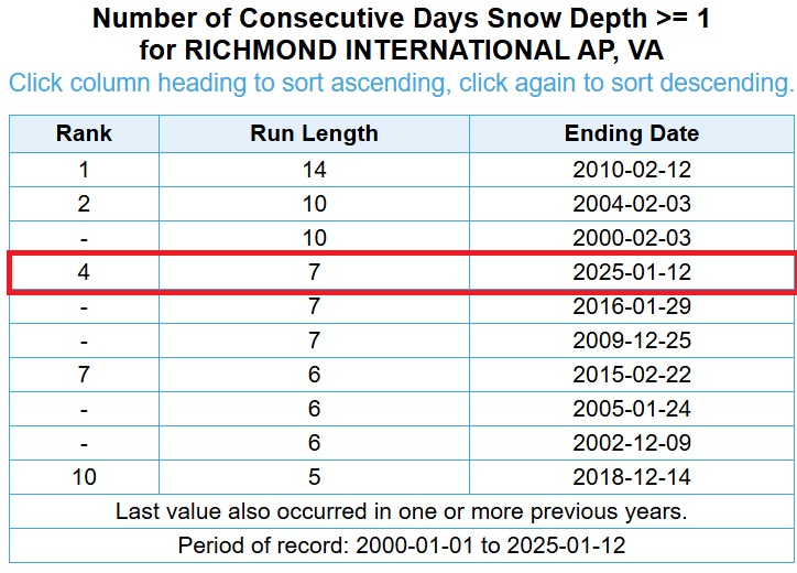
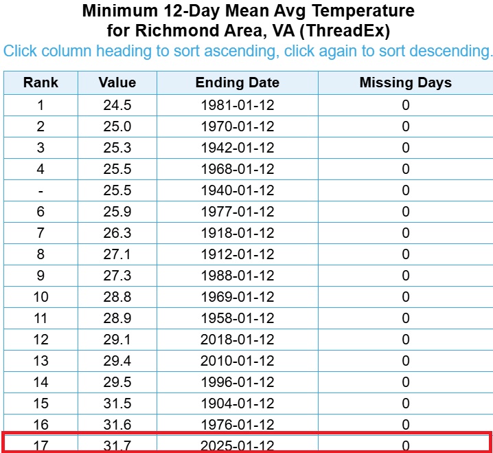
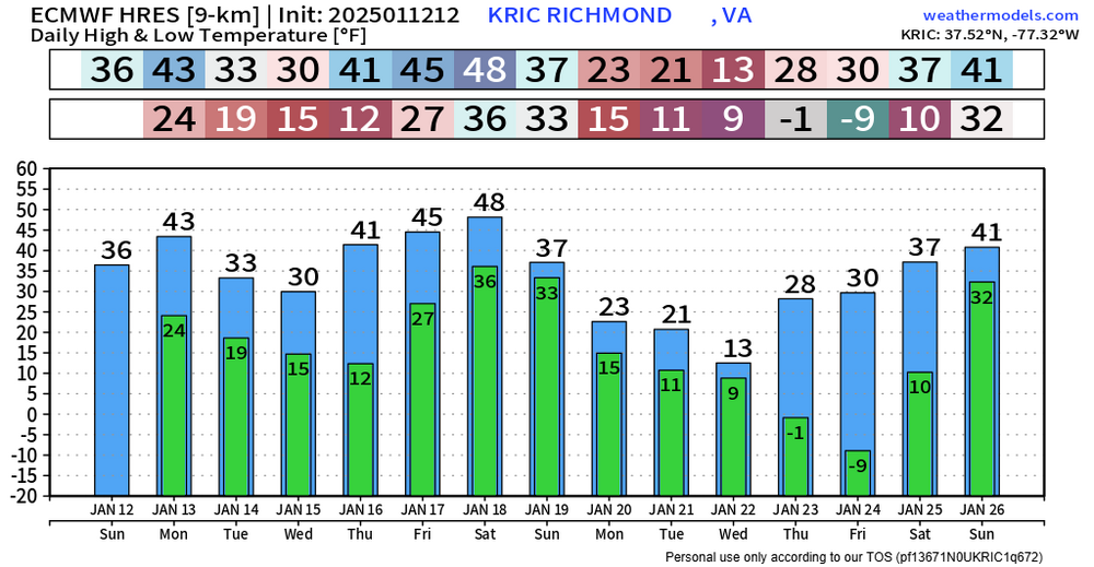
Although there haven’t been any major storms, these light snow events combined with cold temperatures have made January 2025 the best stretch of winter in years. For the first time since the 2016 blizzard, Richmond has officially recorded seven consecutive days with a snow depth of 1 inch or more. Snow depth is measured daily at 7 a.m. (12z), and the recorded depth goes for that calendar date, even if the snow melts later in the day. You can see the 12z daily snow depth in the first attachment below. January 5th has a 0 snow depth because the snow did not begin until later in the evening. The next attachment below shows Richmond's longest snow cover stretches from 2000 to 2025. Two back-to-back snowstorms helped make January 2025 have one of the most consistent snow cover periods over the last 25 years. Notice that the snowy winter of 2009-10 had 1 inch + snow cover lasting 14 days (16 days if you include trace amounts). The record for Richmond is 21 days from the winter of 1947-48. Furthermore, the first 12 days of this month rank among the top 20 coldest first 12 days of January since records began in 1897. With the continued cold temperatures projected over the next two weeks, this January has the potential to be the coldest since at least 1988. So far this month, Richmond has received 6.5 inches of snow. To rank among the top 10 snowiest Januarys, an additional 8 inches of snow would be needed by the end of the month. January 2025 is off to a great start and hopefully we can score in a big way before things are all done, we are due for a 20"+ season.
-
Richmond Metro/Hampton Roads Area Discussion
RIC Airport replied to RIC Airport's topic in Mid Atlantic
Wakefield wrote an excellent summary on this event and tried to explain what happened that led to the precip type issues. Worth a read if you have a few minutes. https://www.weather.gov/akq/jan10_11_2025_winterstorm -
Richmond Metro/Hampton Roads Area Discussion
RIC Airport replied to RIC Airport's topic in Mid Atlantic
18Z GEFS had a slight up tick from 12z in the mean, still quite of few shut outs unfortunately.

-
Richmond Metro/Hampton Roads Area Discussion
RIC Airport replied to RIC Airport's topic in Mid Atlantic
18Z GEFS only really had 2 good hits.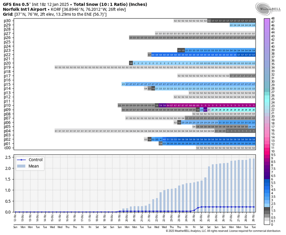

-
Richmond Metro/Hampton Roads Area Discussion
RIC Airport replied to RIC Airport's topic in Mid Atlantic
Wakefield finally provided the ORF airport storm total from the last event. Looks like 1.7" for the 10th-11th and then 0.2" for the 5th-6th. So, the 1"+ drought is over there. -
Richmond Metro/Hampton Roads Area Discussion
RIC Airport replied to RIC Airport's topic in Mid Atlantic
18z GFS was a nice hit as well. Brought back the storm. Temps are cold!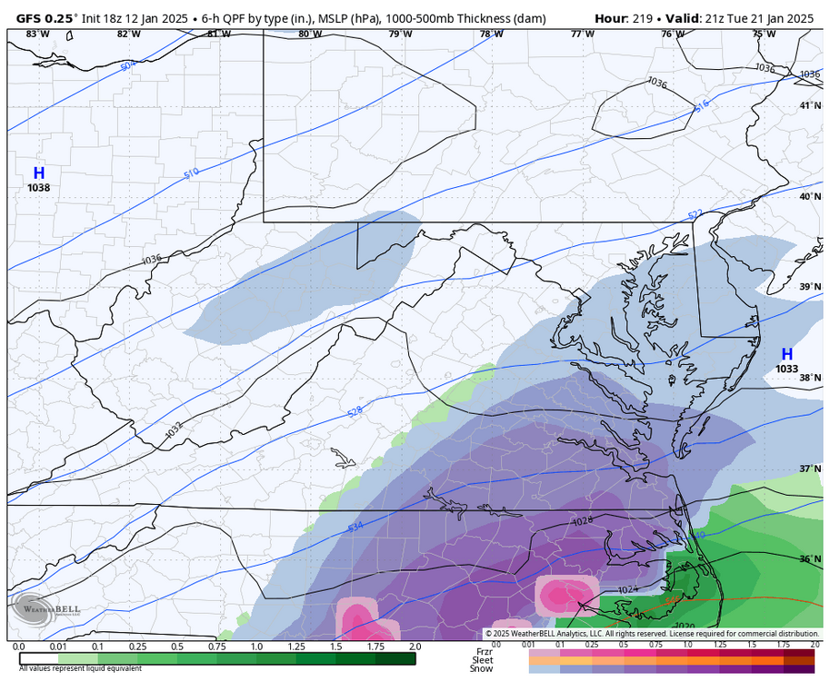


-
Richmond Metro/Hampton Roads Area Discussion
RIC Airport replied to RIC Airport's topic in Mid Atlantic
Yes, and a fresh snowcover with an arctic airmass gets you record cold afterwards. -9°F at RIC and single digits at ORF.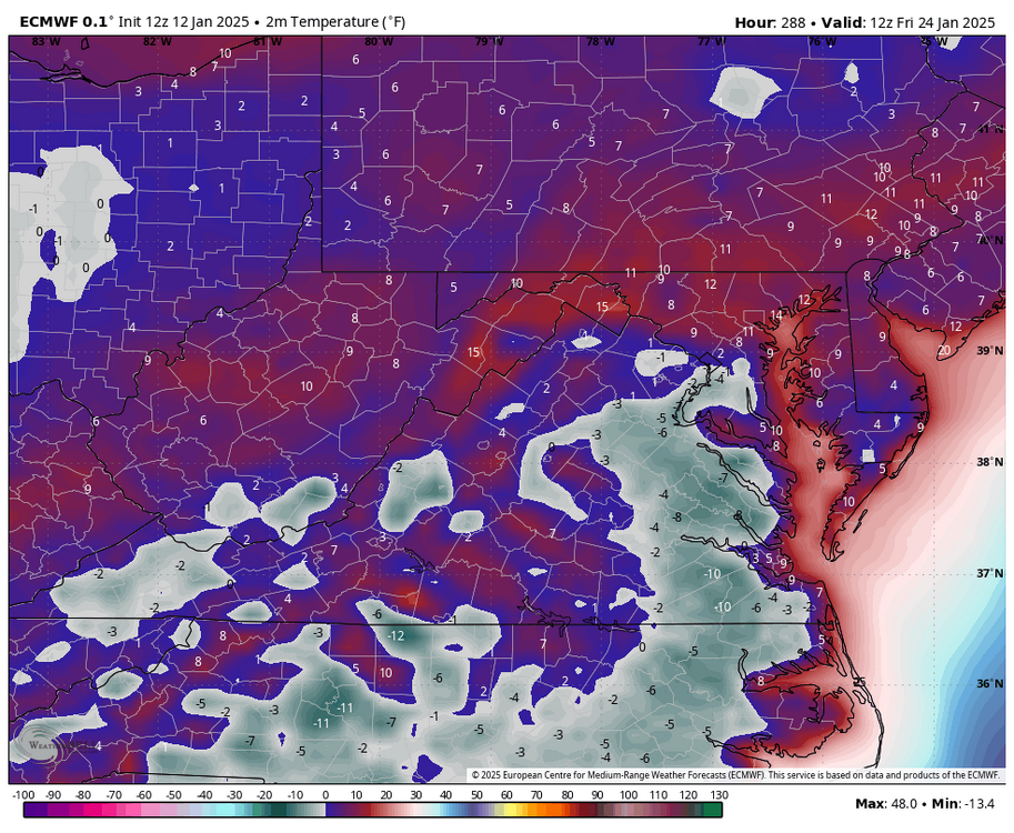

-
Richmond Metro/Hampton Roads Area Discussion
RIC Airport replied to RIC Airport's topic in Mid Atlantic
I found some colder observations from that night. I had to make sure I saved them because snow falling in the low teens in Richmond is exceedingly rare.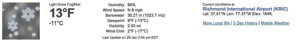
-
Richmond Metro/Hampton Roads Area Discussion
RIC Airport replied to RIC Airport's topic in Mid Atlantic
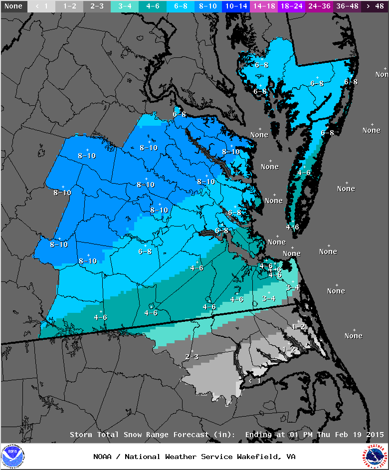
Just looked at the 2/16/2015 storm where RIC finished with 7.2". Temps started in the upper teens and dropped to 13°F at RIC during that event. Notice the time stamp below where RIC, even as early as the 8pm ob, was already at 17°F with moderate snow so very cold storms can happen here..thumb.jpg.f1719499d0a9477f9be63e9b6d39ba02.jpg)
.png.ebd70f156ef30a4f76637be20e938975.png)

-
Richmond Metro/Hampton Roads Area Discussion
RIC Airport replied to RIC Airport's topic in Mid Atlantic
Frigid during the event, @mikeeng92. And if realized, it would be the coldest snowstorm in Richmond since 2/18/1979 (PD1) when temperatures during the height of the event were only around 10°F.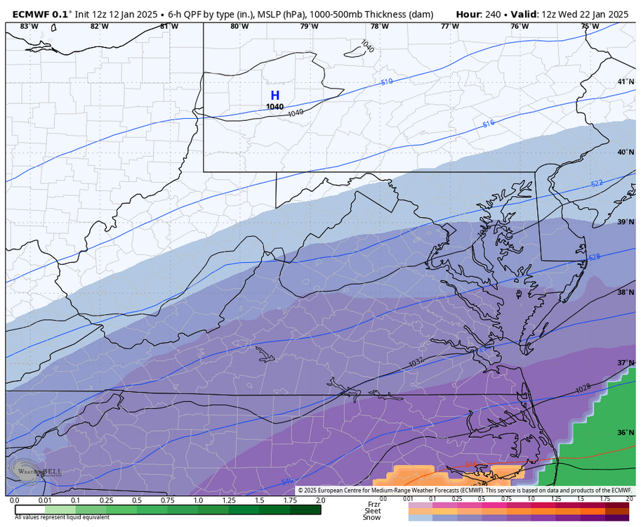

-
Richmond Metro/Hampton Roads Area Discussion
RIC Airport replied to RIC Airport's topic in Mid Atlantic
-
Richmond Metro/Hampton Roads Area Discussion
RIC Airport replied to RIC Airport's topic in Mid Atlantic
12Z Euro is a nice hit! -
When adding the daily snowfall to the initial CLI, the NWS staff on shift received the 3.0" storm total but failed to account for the 1.0" that fell before midnight, which had already been included in yesterday's report.
-
They resent the CLI about 10 mins ago with the correction. So, the 6.5" you had stands.
-
Richmond Metro/Hampton Roads Area Discussion
RIC Airport replied to RIC Airport's topic in Mid Atlantic
I believe warmer oceans make us more prone to mixing than we used to be in past decades, especially at our latitude. And this snow/mix line that tends to set up in each storm seems to be creeping farther north and west. That's why it's imperative we have a strong high pressure over the NE US during our winter storms. Confluence is no substitute for a bona fide high pressure in the right spot. -
Richmond Metro/Hampton Roads Area Discussion
RIC Airport replied to RIC Airport's topic in Mid Atlantic
This is a valid point. I mentioned this in another chat as it was happening. RDU mixing almost out of the gate should have foreshadowed the precip type issues at ORF. There is a strong correlation, even more so than RIC, with ORF snowfall patterns to that of RDU. There are numerous examples where the RDU to ORF corridor had big snows that largely or completely missed RIC. @DownS.EasternVa also rightfully mentioned that it's unusual for ORF, RIC, and DCA to score big simultaneously. 2/7/1936 and 2/11/1899 are two notable exceptions.


.jpg.4227adb7fe53edc4400a19e0e7a9b112.jpg)