RIC Airport
-
Posts
2,586 -
Joined
-
Last visited
Content Type
Profiles
Blogs
Forums
American Weather
Media Demo
Store
Gallery
Everything posted by RIC Airport
-
Richmond Metro/Hampton Roads Area Discussion
RIC Airport replied to RIC Airport's topic in Mid Atlantic
OTS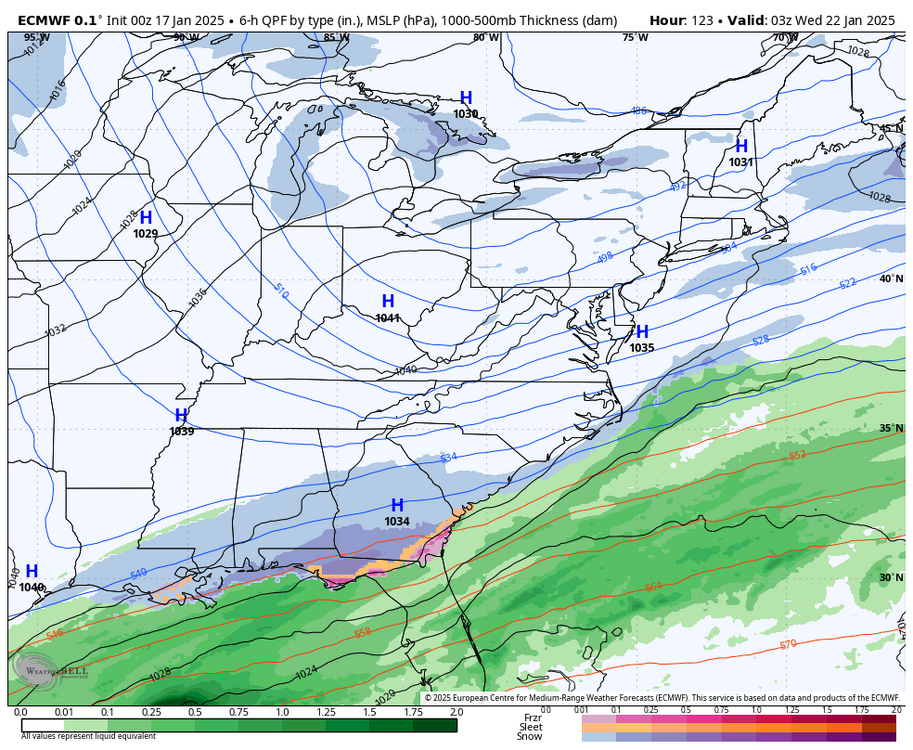
-
Richmond Metro/Hampton Roads Area Discussion
RIC Airport replied to RIC Airport's topic in Mid Atlantic
Crazy! It's like the December 1989 SE storm that traveled farther up the coast.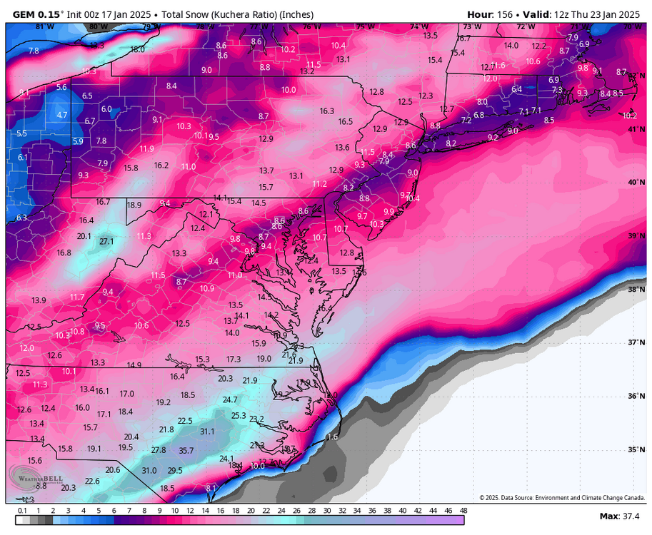
-
Richmond Metro/Hampton Roads Area Discussion
RIC Airport replied to RIC Airport's topic in Mid Atlantic
Will this model finally beat the Euro and GFS?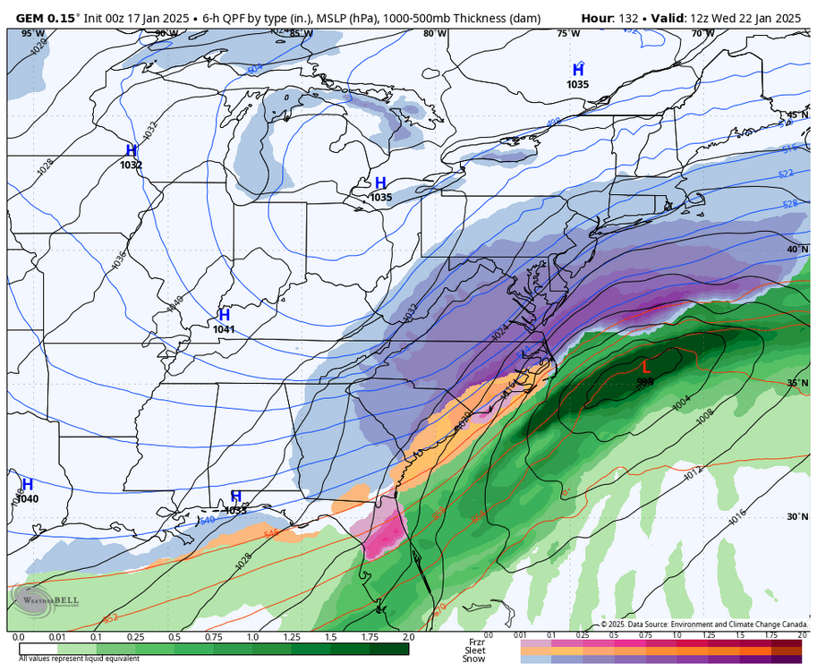
-
Richmond Metro/Hampton Roads Area Discussion
RIC Airport replied to RIC Airport's topic in Mid Atlantic
Houston, we have a problem.
-
Richmond Metro/Hampton Roads Area Discussion
RIC Airport replied to RIC Airport's topic in Mid Atlantic
It's only slightly better than 18z, but not nearly as good as the 12z or even the 6z run from this morning. But, could be a trend back in the right direction. Looks to me for the Richmond metro area, looking at this run only, the best time for accumulating snows is between 3pm and 7pm. We will be fighting boundary layer issues and surface temps above freezing up until ~3pm. Taking this run verbatim.

-
Richmond Metro/Hampton Roads Area Discussion
RIC Airport replied to RIC Airport's topic in Mid Atlantic
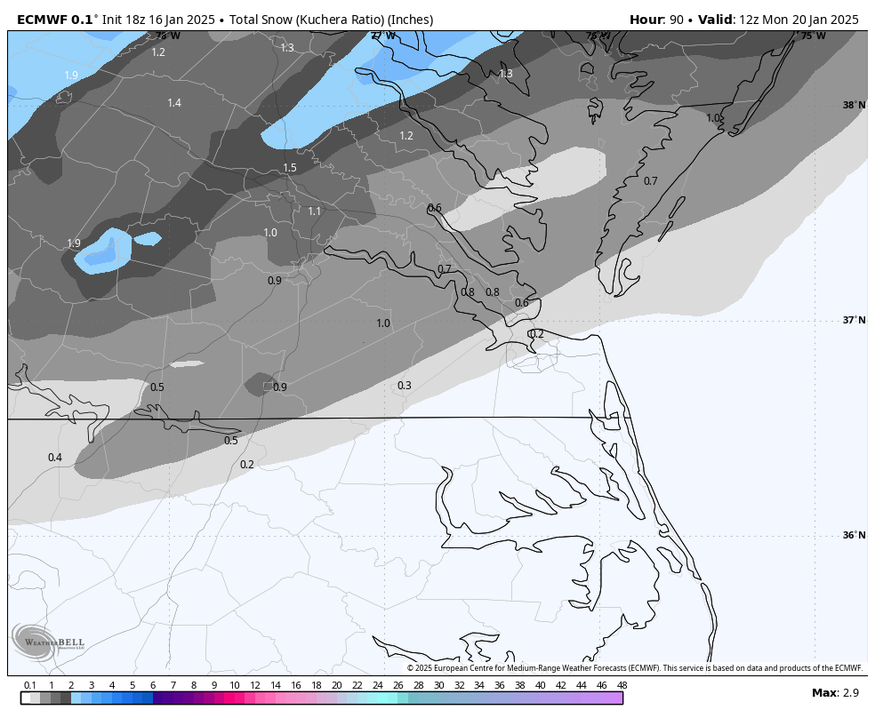
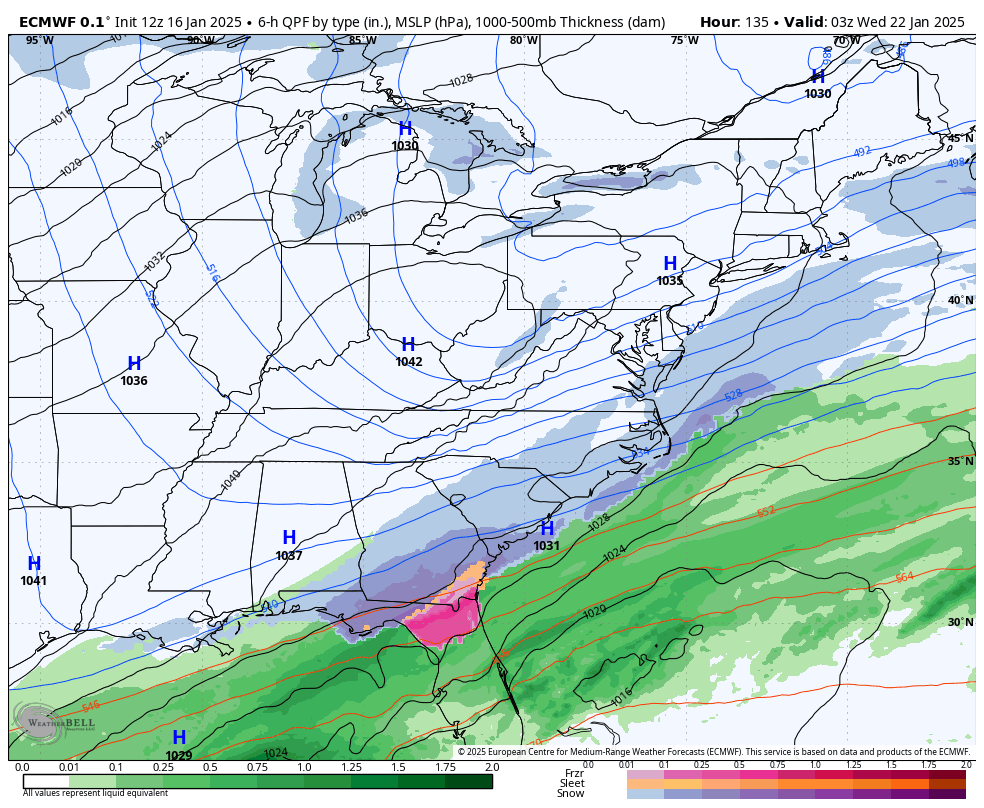
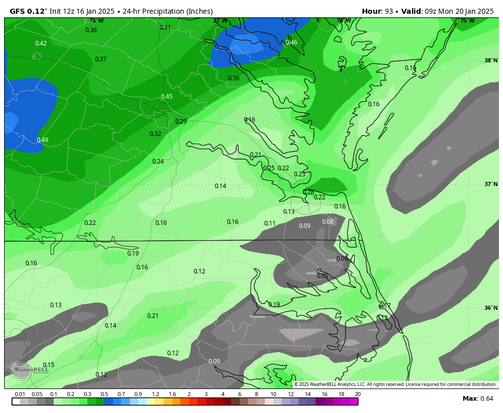
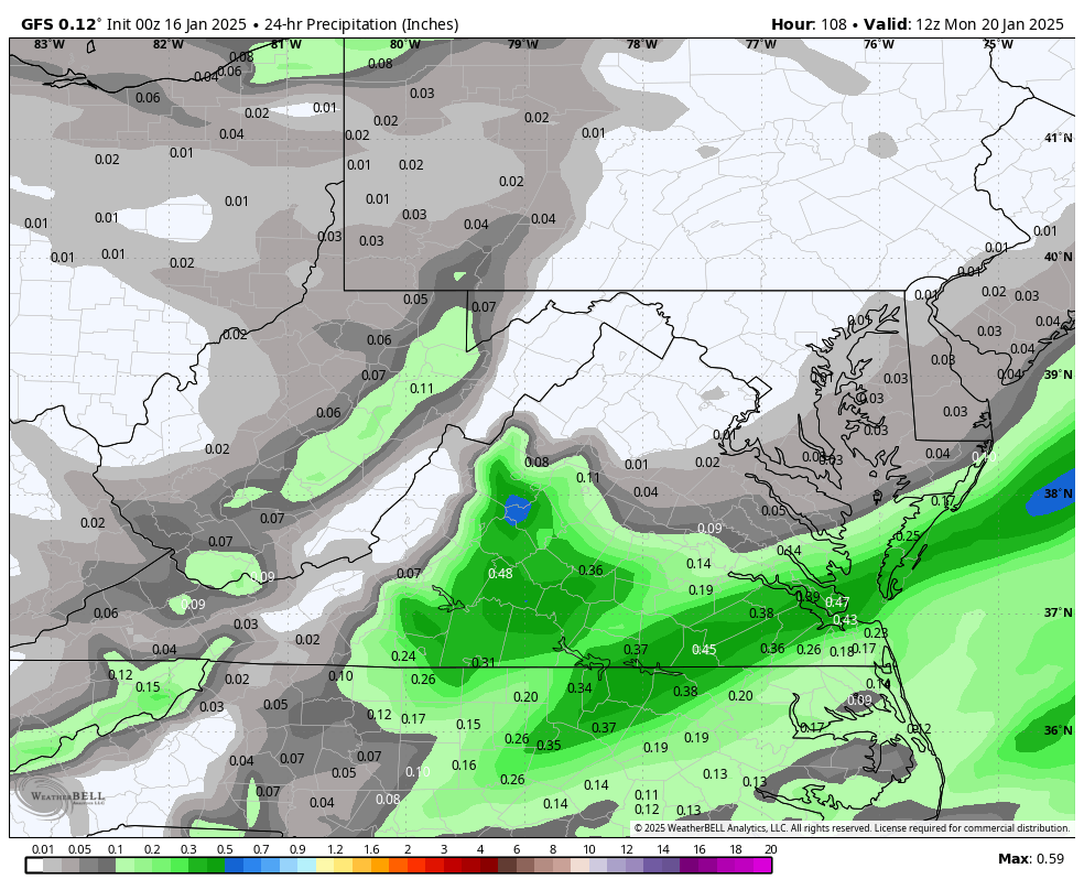
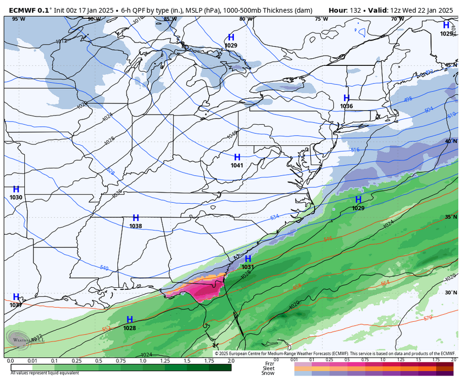
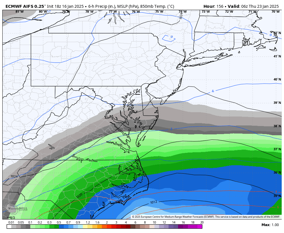
Sunday is not expected to have much impact; however, if enough snow accumulates in areas given this arctic air is moving in, there could be possible delays or cancellations on Tuesday. Most places will be closed on Monday. Meanwhile, the 18z Euro AI suggests a slightly more northern track for the mid-week storm. This is a favorable trend to root for as we get closer to the event. It has 0.20" of QPF for Richmond and between 0.30 and 0.40" for Hampton Roads. With air temperatures ranging from 20 to 30 degrees, this could lead to decent minor event and is worth monitoring.


-
Richmond Metro/Hampton Roads Area Discussion
RIC Airport replied to RIC Airport's topic in Mid Atlantic
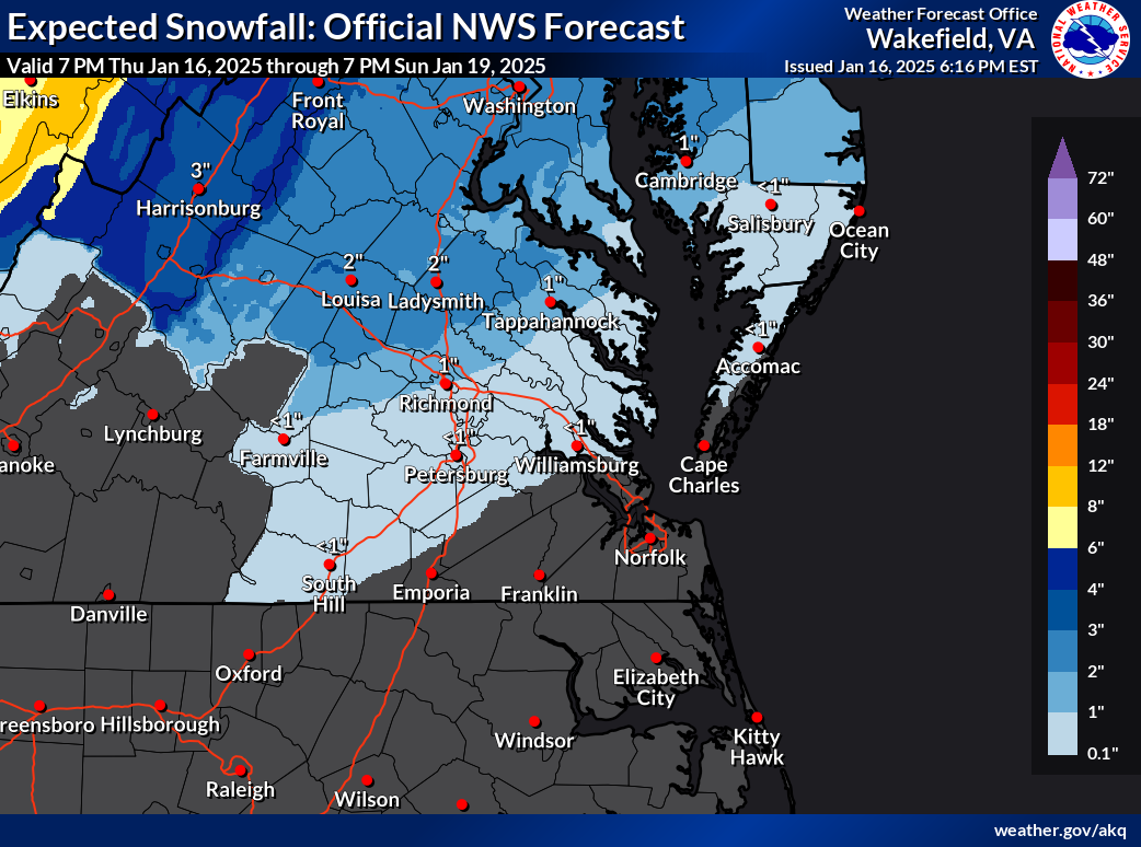
Here is what AKQ is thinking so far, @JFLETCHERbullseye.
.thumb.png.0d8026d530081b752318fecc5081870a.png)
-
Richmond Metro/Hampton Roads Area Discussion
RIC Airport replied to RIC Airport's topic in Mid Atlantic
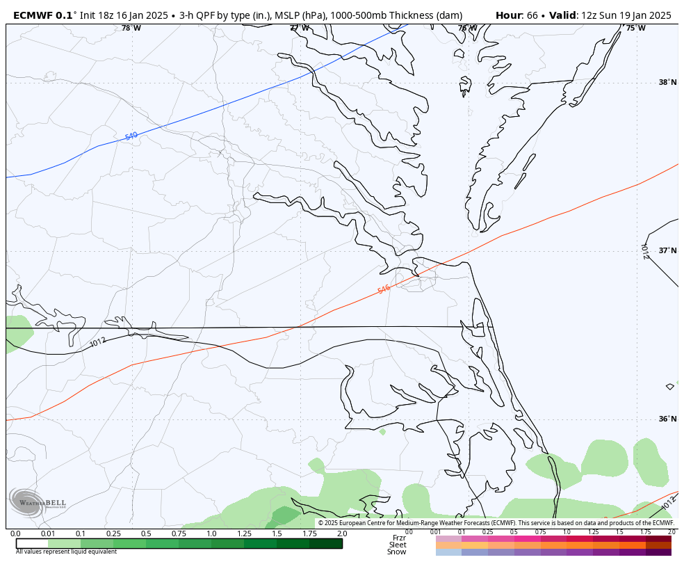
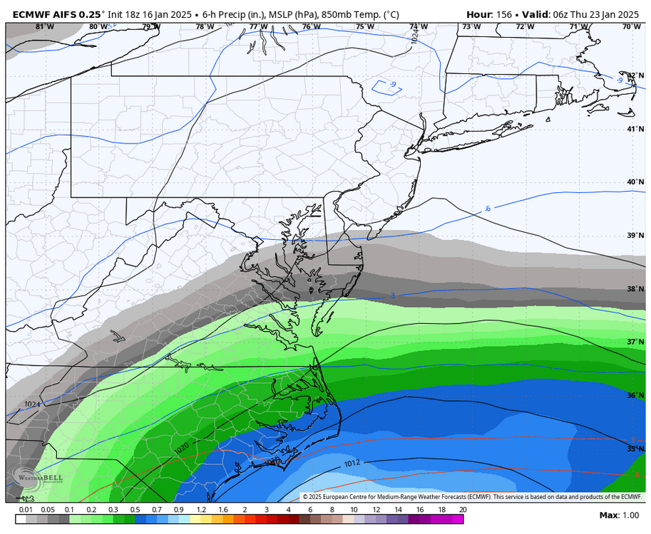
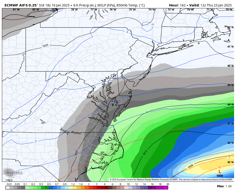
Here is 18z Euro for the Sunday threat.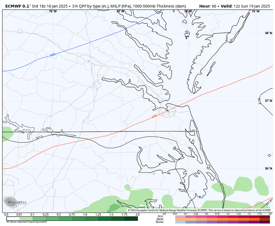

-
Richmond Metro/Hampton Roads Area Discussion
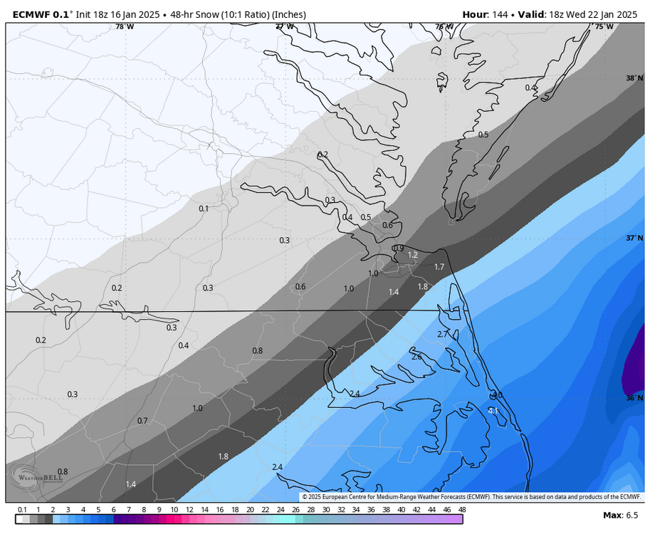
RIC Airport replied to RIC Airport's topic in Mid Atlantic
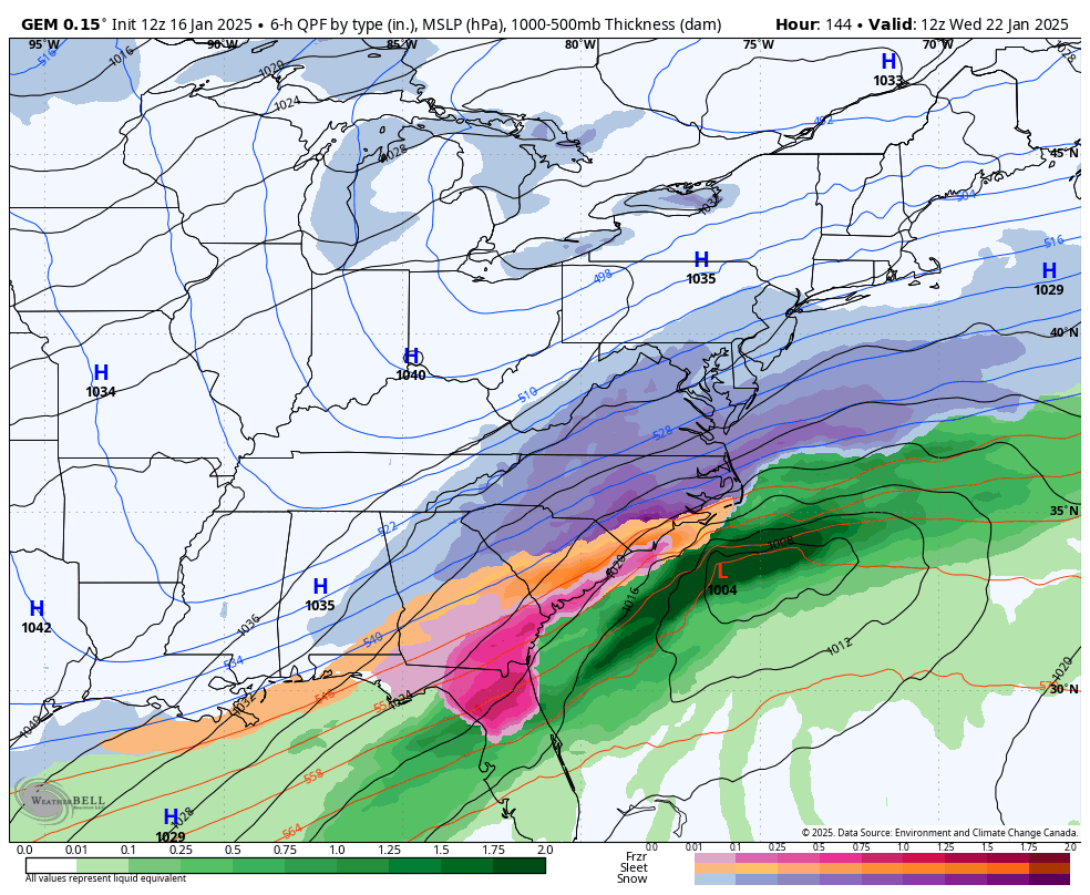
18z Euro is also farther north. Only goes to hour 144 though.

-
Richmond Metro/Hampton Roads Area Discussion
RIC Airport replied to RIC Airport's topic in Mid Atlantic
NBC 12 is on board for the Sunday threat.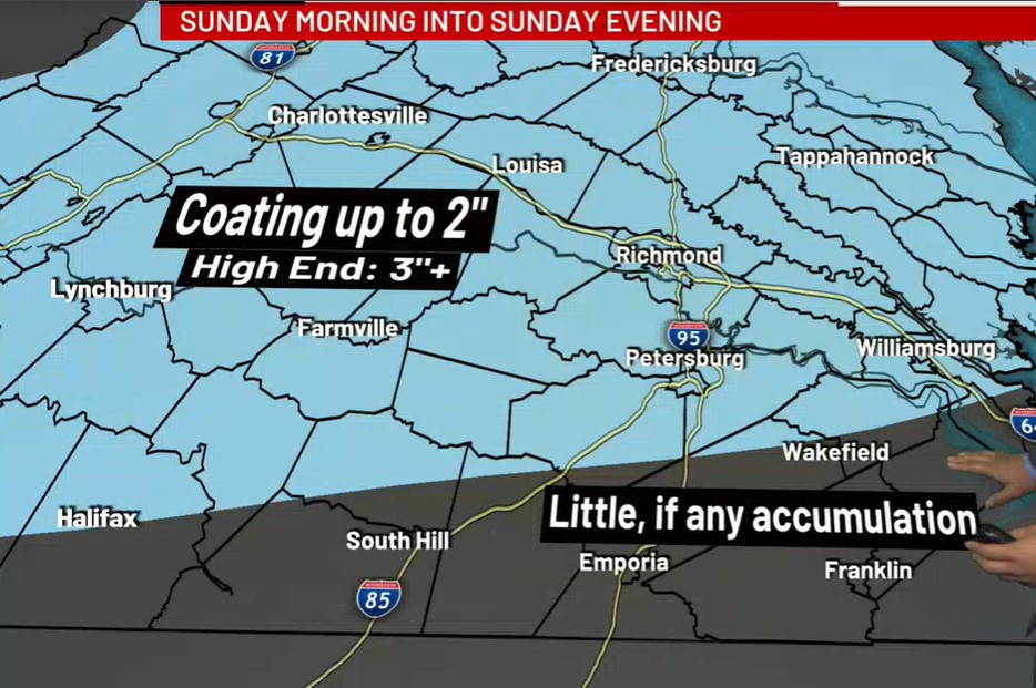
-
Richmond Metro/Hampton Roads Area Discussion
RIC Airport replied to RIC Airport's topic in Mid Atlantic
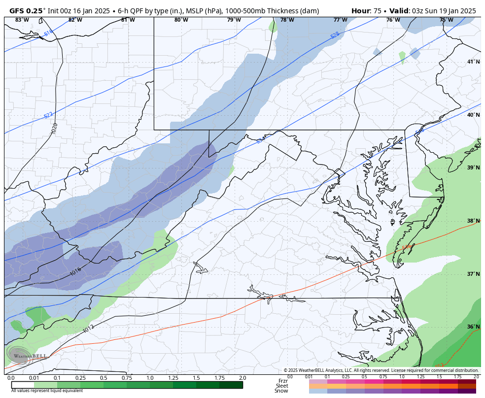
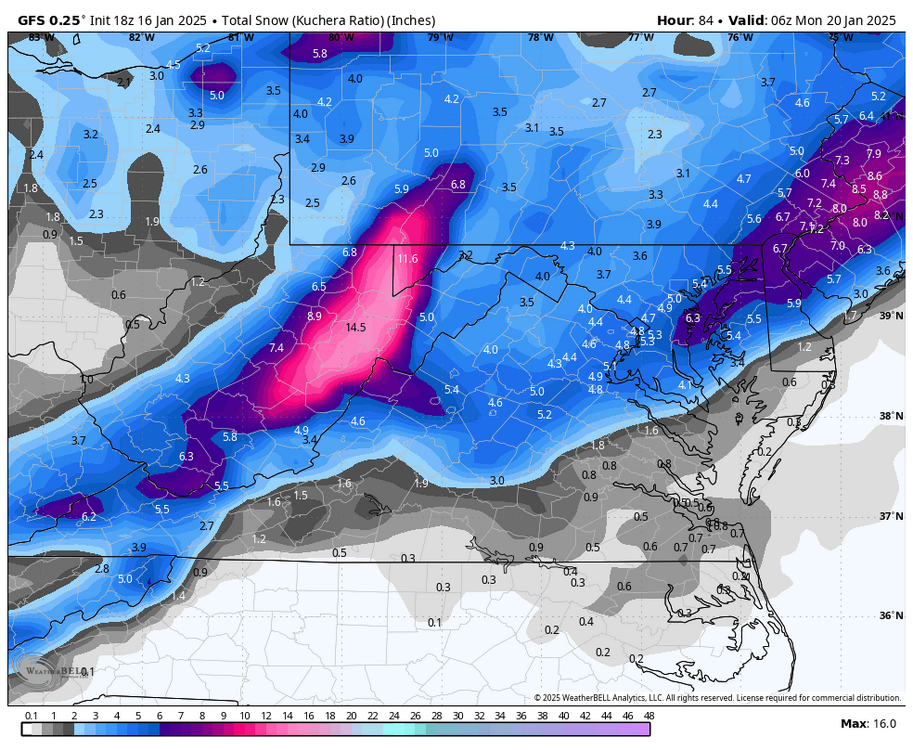
18Z GFS, like the 12z run, has the heaviest precip for Sunday's event north and west of RIC.
-
Richmond Metro/Hampton Roads Area Discussion
RIC Airport replied to RIC Airport's topic in Mid Atlantic
Yes, hopefully the Canadian can score a win. However, I was not terribly impressed with the EPS, signals are there, but I guess I'm just impatient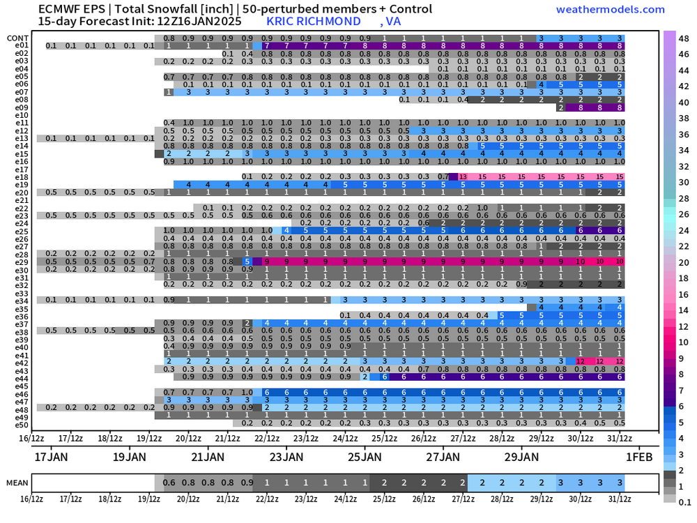
-
Richmond Metro/Hampton Roads Area Discussion
RIC Airport replied to RIC Airport's topic in Mid Atlantic

-
Richmond Metro/Hampton Roads Area Discussion
RIC Airport replied to RIC Airport's topic in Mid Atlantic
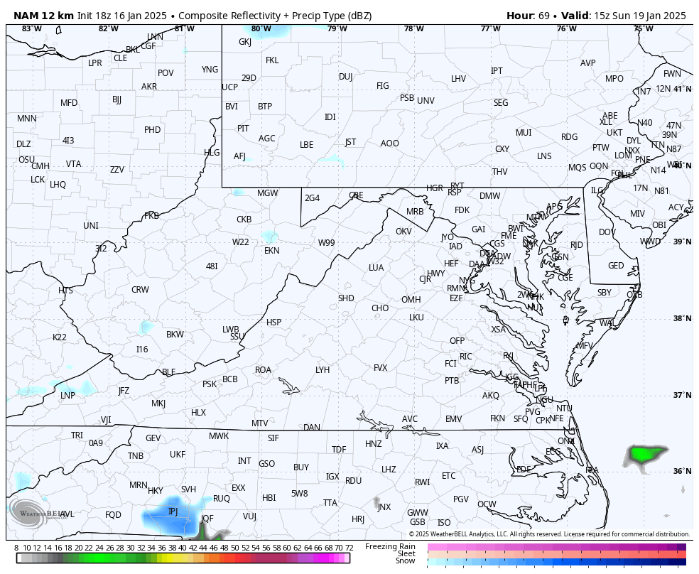
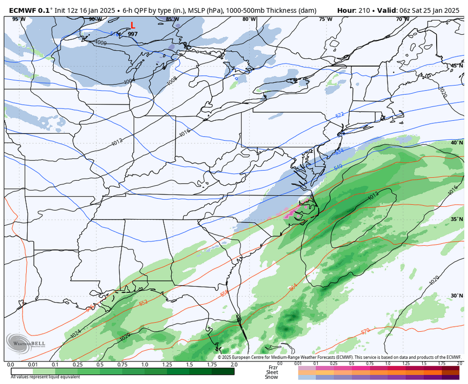
FWIW, the 18Z NAM is within range for the Sunday threat and has the axis of snows over most of our region of the state, except for extreme SE VA. Pretty far out in rage for the NAM, but an interesting development.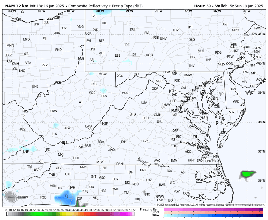

-
Richmond Metro/Hampton Roads Area Discussion
RIC Airport replied to RIC Airport's topic in Mid Atlantic
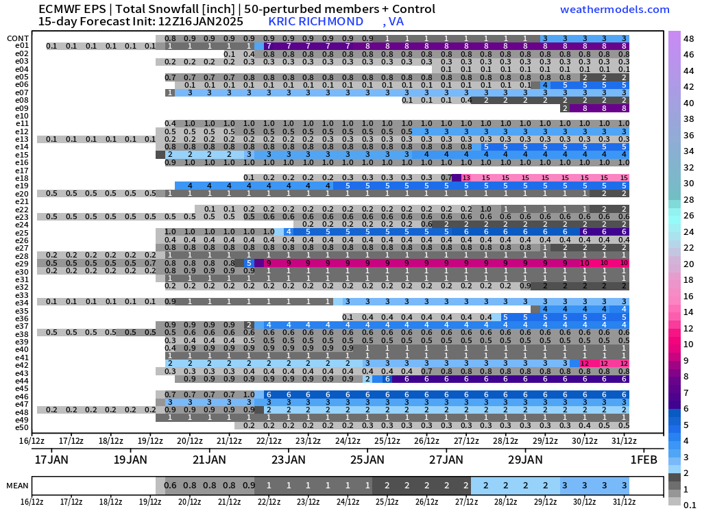
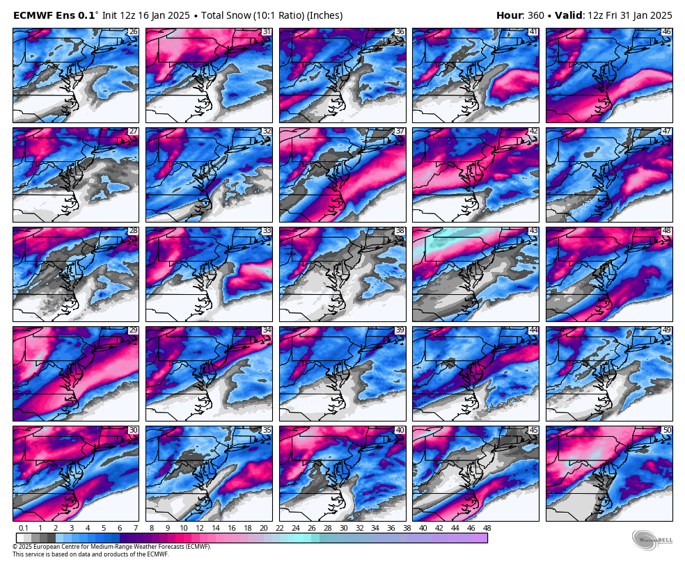
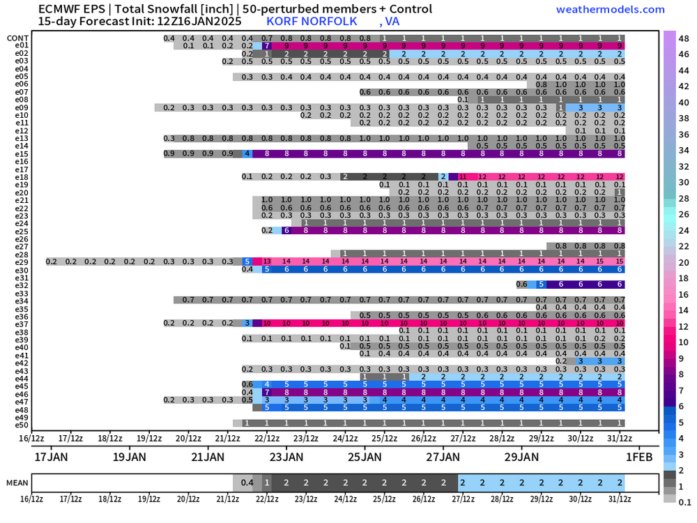
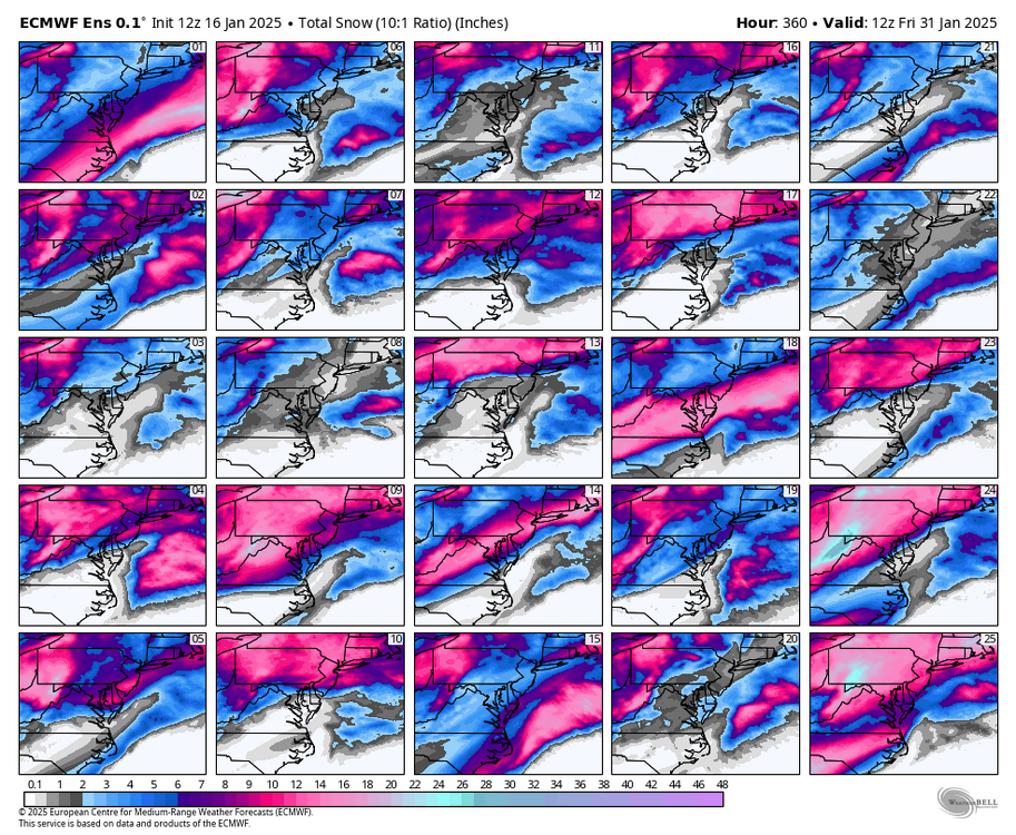
EPS mean thru 360 is pitiful considering all the threats.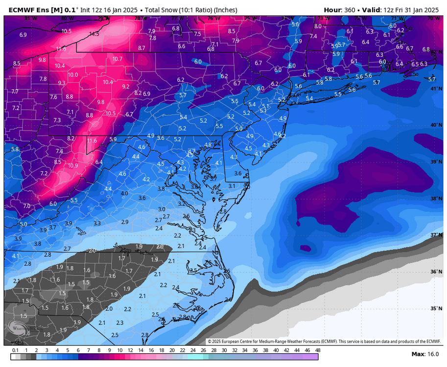

-
Richmond Metro/Hampton Roads Area Discussion
RIC Airport replied to RIC Airport's topic in Mid Atlantic
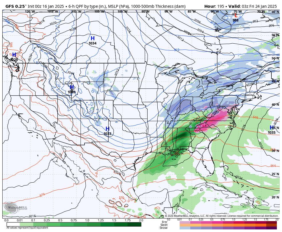
It also has a storm affecting the whole east coast at the end of the run. Wasn't ideal for us, but perhaps it signals the infamous big storm as the pattern begins the collapse?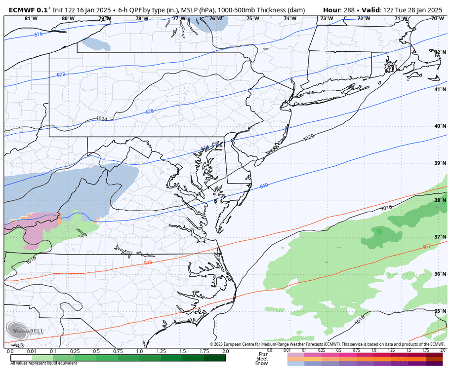

-
Richmond Metro/Hampton Roads Area Discussion
RIC Airport replied to RIC Airport's topic in Mid Atlantic
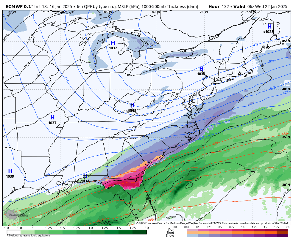
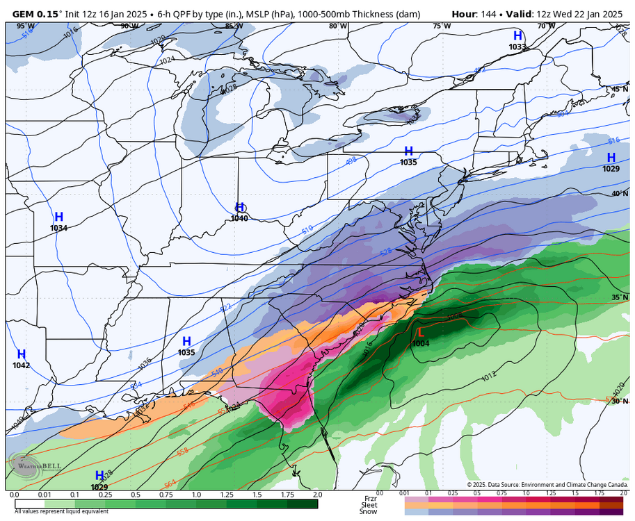
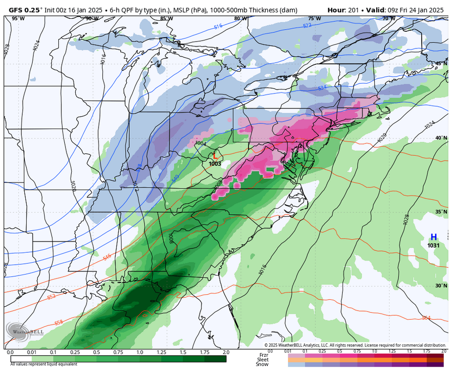
Euro had mid week storm, but too far south. It also had a 3rd threat next Saturday.

-
Richmond Metro/Hampton Roads Area Discussion
RIC Airport replied to RIC Airport's topic in Mid Atlantic
12z Euro breaking hearts for Sunday as well as next week.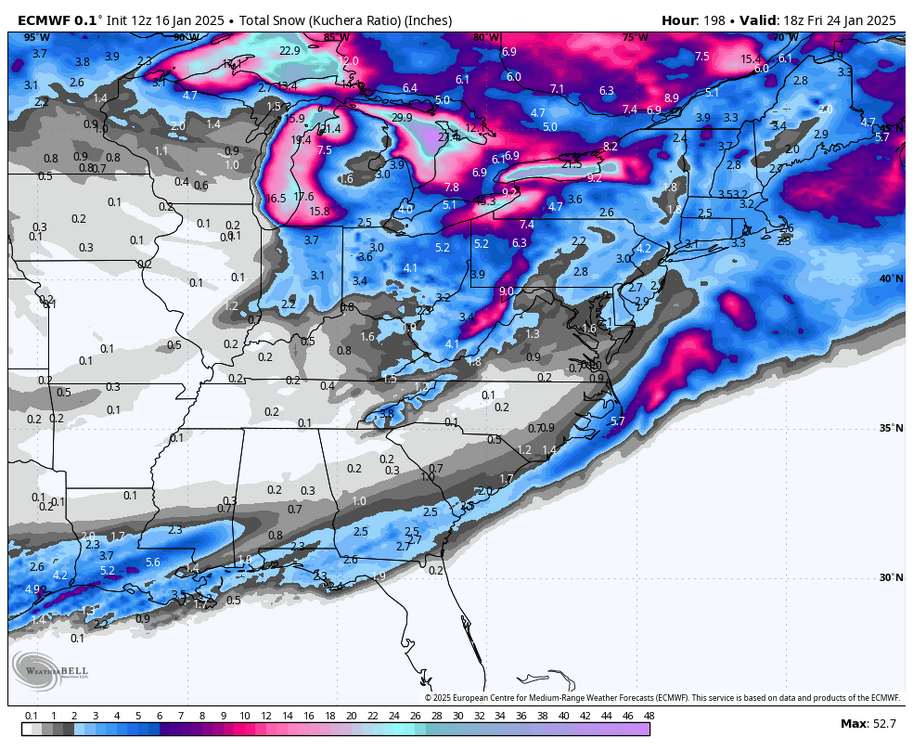
-
Richmond Metro/Hampton Roads Area Discussion
RIC Airport replied to RIC Airport's topic in Mid Atlantic
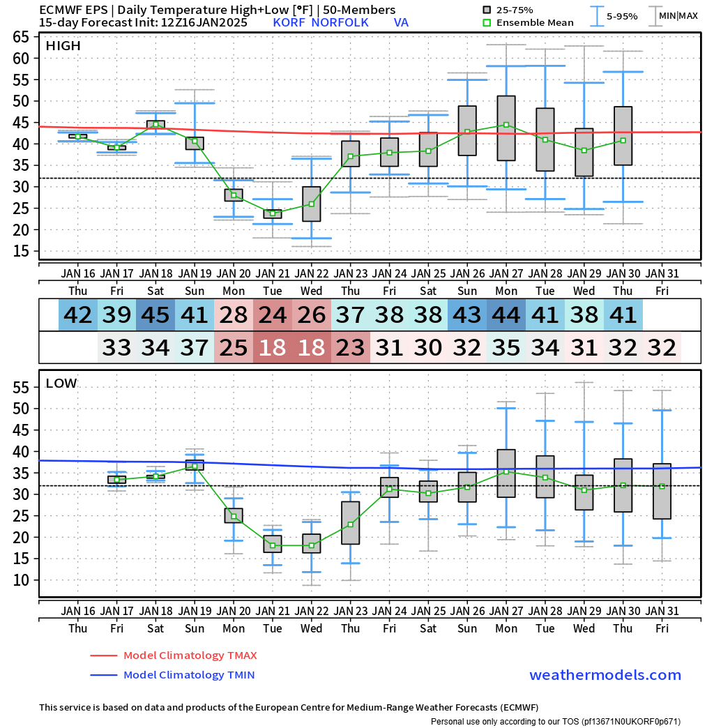
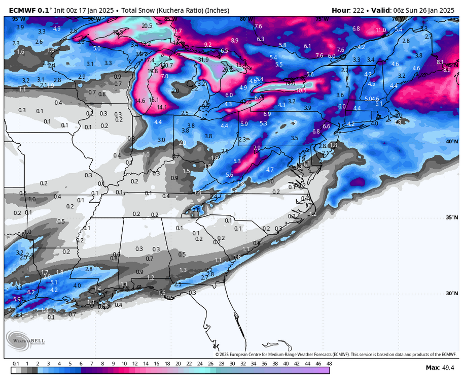
There is indication the pattern will break down toward the end of the month. The question is, will there be a reload later on? But, that's so far out, will need to look at teleconnections and ensembles. I haven't paid much attention to the weeklies this year because of how they performed last year, but the last I saw is that we were on the cooler side of things well into February. -
Richmond Metro/Hampton Roads Area Discussion
RIC Airport replied to RIC Airport's topic in Mid Atlantic
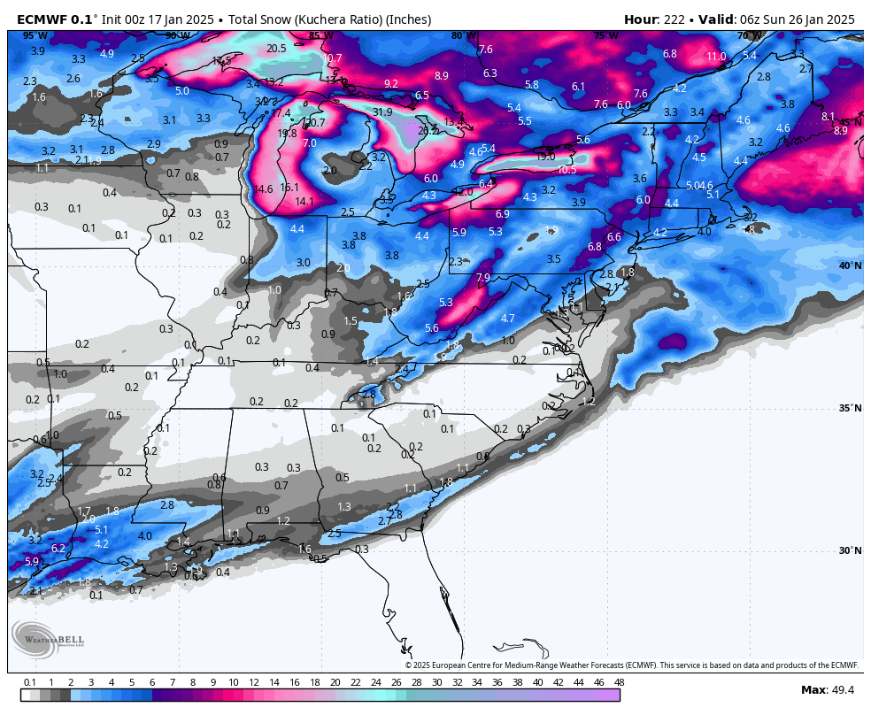
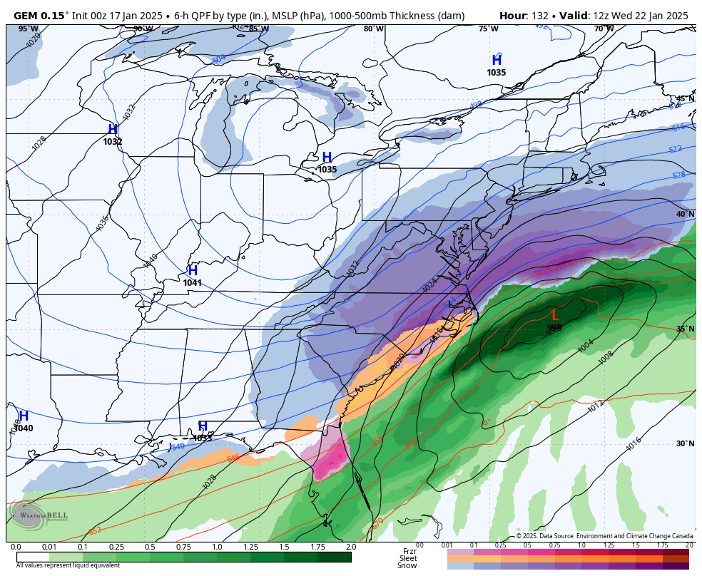
Meanwhile, if you want hope for later next week, here is the Canadian. @chris624wx, @wasnow215, et al.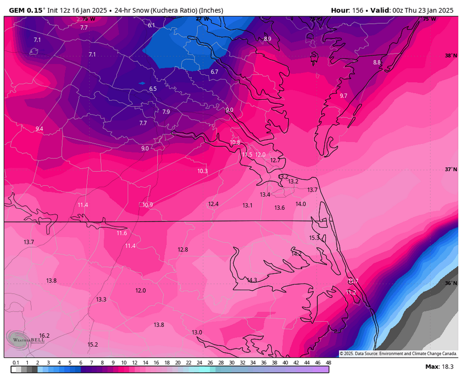
-
Richmond Metro/Hampton Roads Area Discussion
RIC Airport replied to RIC Airport's topic in Mid Atlantic
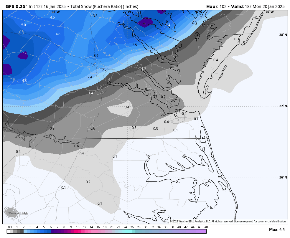
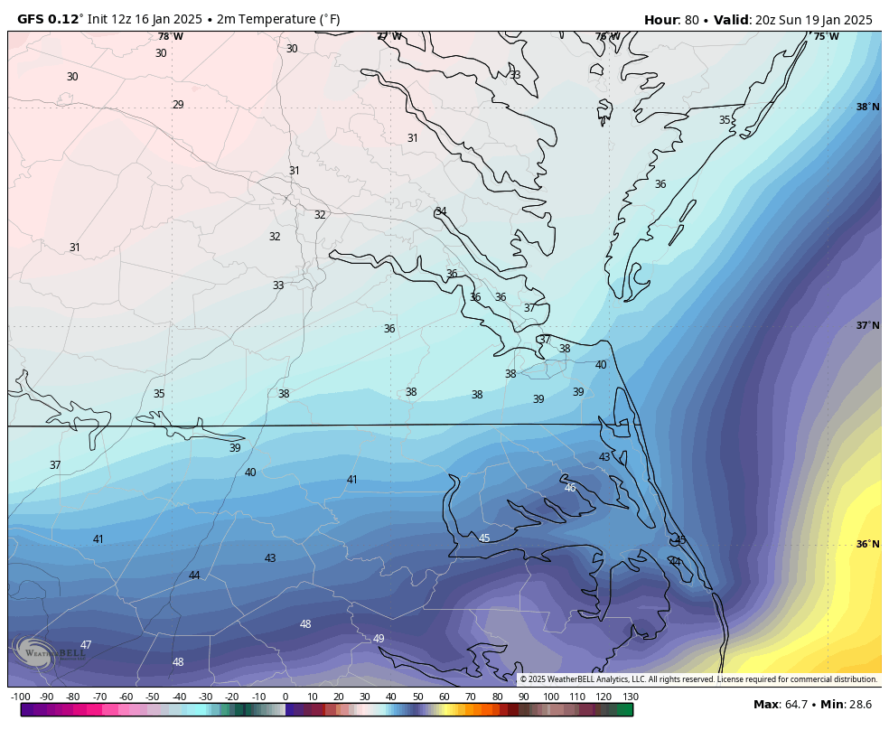
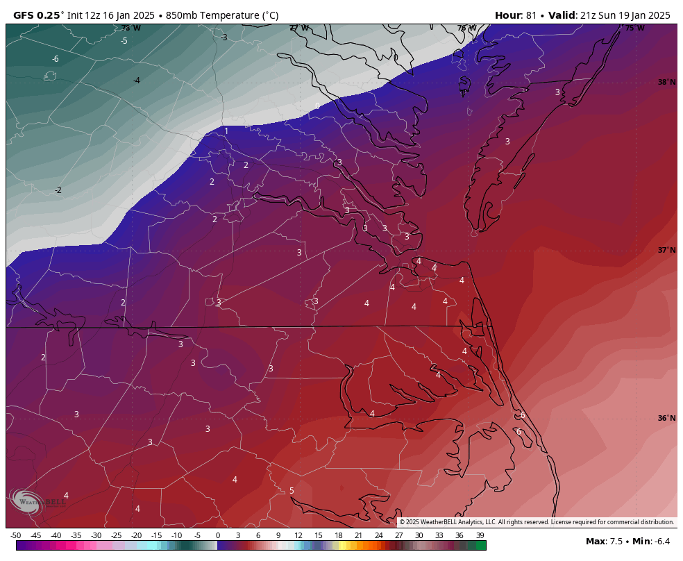
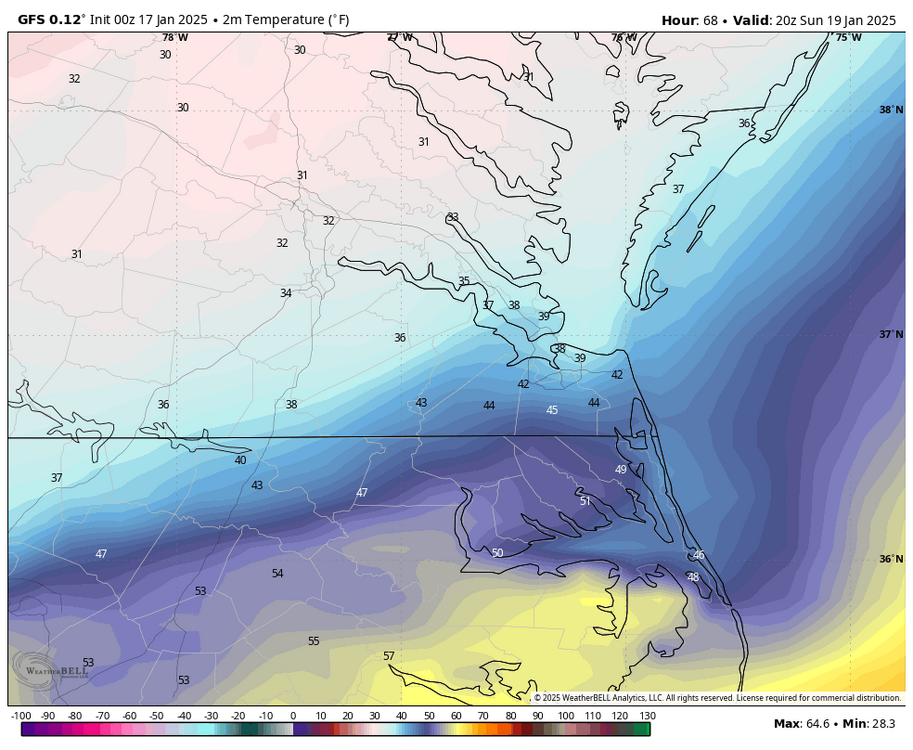
It all depends on where the precip bands are set up. I think the issue with us is the coldest air not arriving in time. This run is warmer; we are 37-40°F when the precip starts around 7 am, instead of 33-34°F that earlier runs had. So, we suffer because we spend too much time trying to cool the atmosphere down to the surface, and by then, most of the precipitation is over, thus lower snow accumulations.. GFS didn't have RIC reach freezing until 20z Sunday (3PM), and there is still a warm layer aloft that bisects the Richmond metro area at that time.


-
Richmond Metro/Hampton Roads Area Discussion
RIC Airport replied to RIC Airport's topic in Mid Atlantic
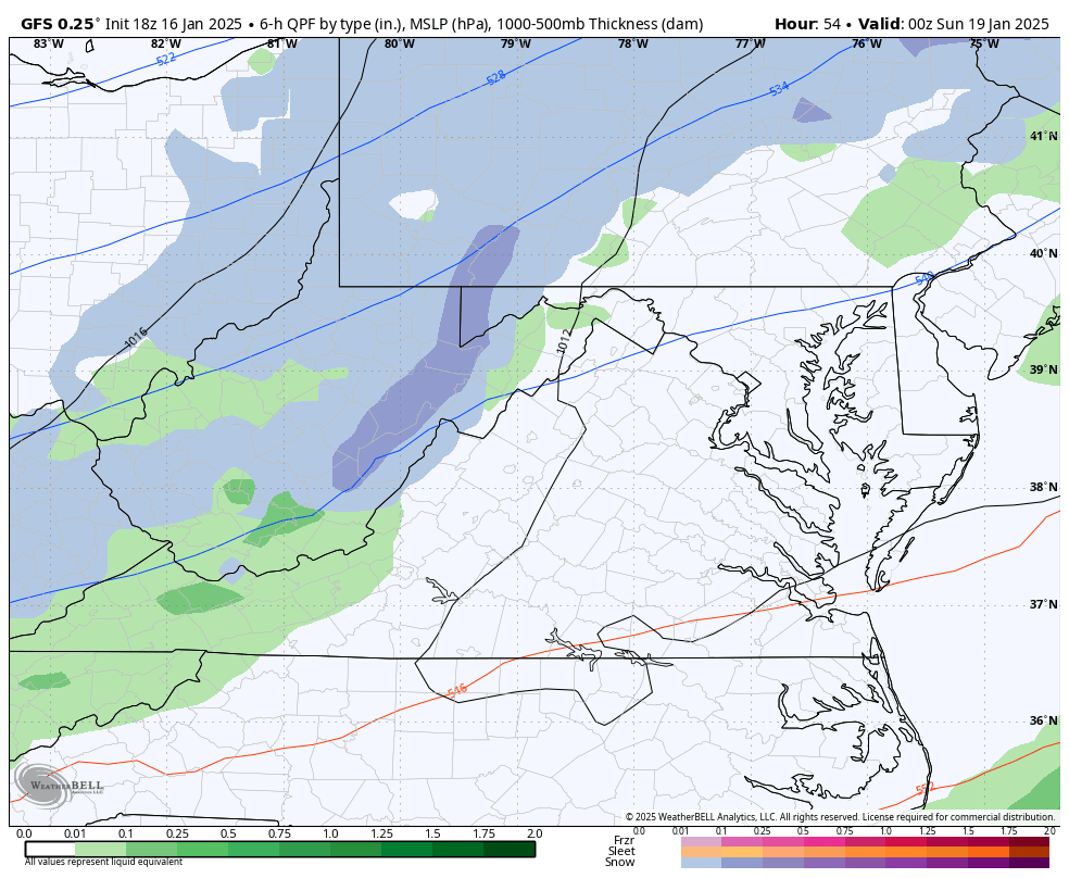
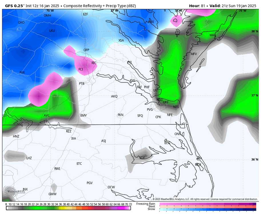
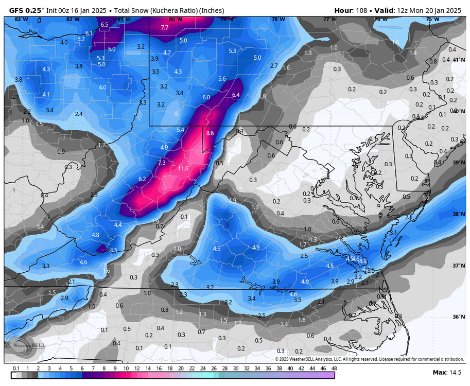
12z GFS has a similar solution to that of the Euro for the Sunday threat. Has the best chance of accumulations north and west of RIC.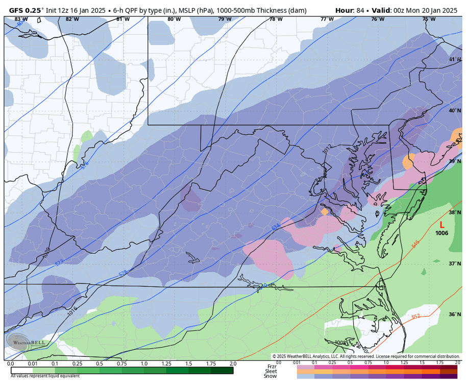

-
Richmond Metro/Hampton Roads Area Discussion
RIC Airport replied to RIC Airport's topic in Mid Atlantic
00z GFS is either going to be a carbon copy of 18z or actually cut well west of us.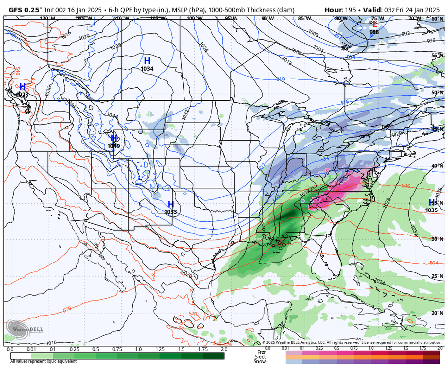
-
Richmond Metro/Hampton Roads Area Discussion
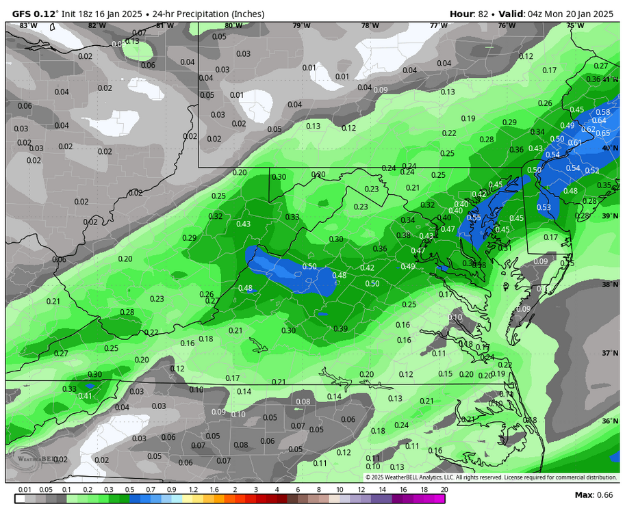
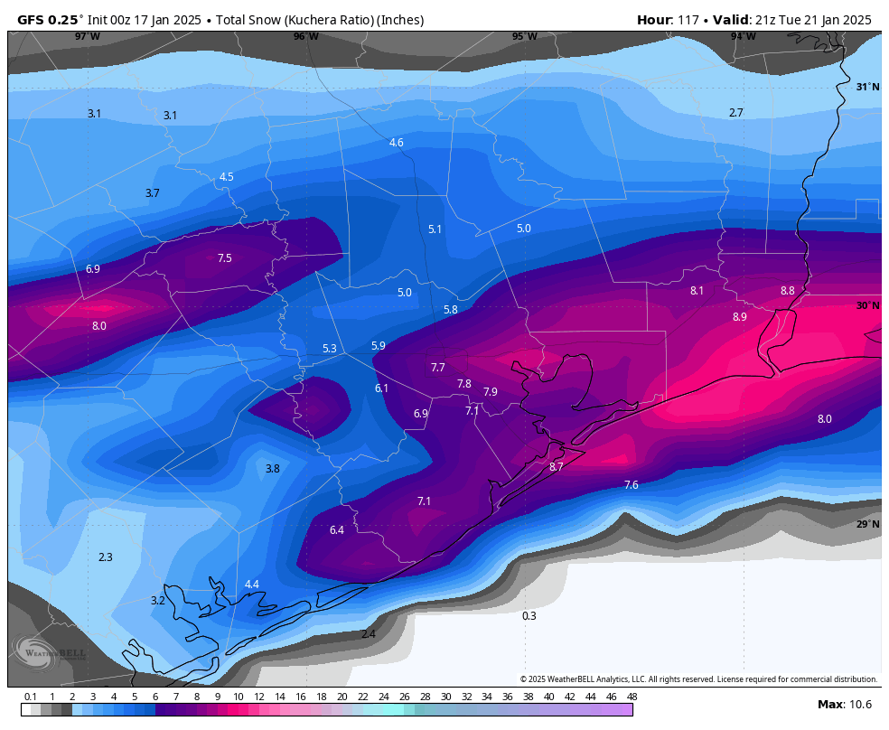
RIC Airport replied to RIC Airport's topic in Mid Atlantic
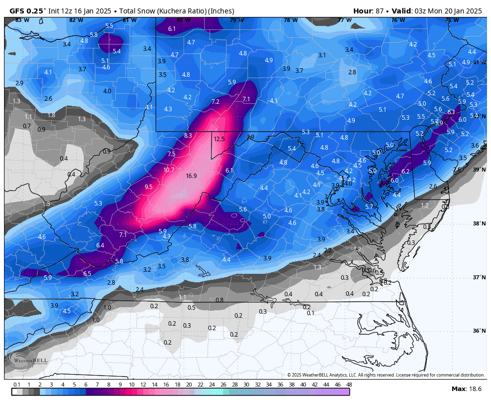
Placement of the higher totals on both GFS and Euro continue to shift from run to run. But, it's good to see they are honing in on our part of the state. -
Richmond Metro/Hampton Roads Area Discussion
RIC Airport replied to RIC Airport's topic in Mid Atlantic
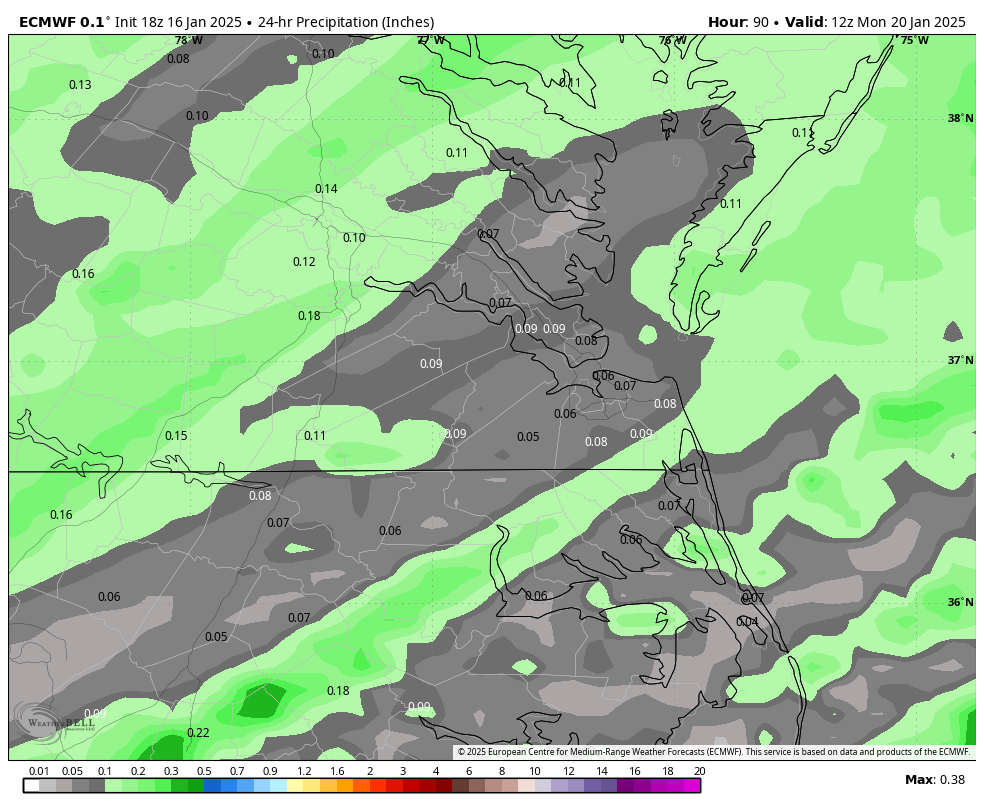
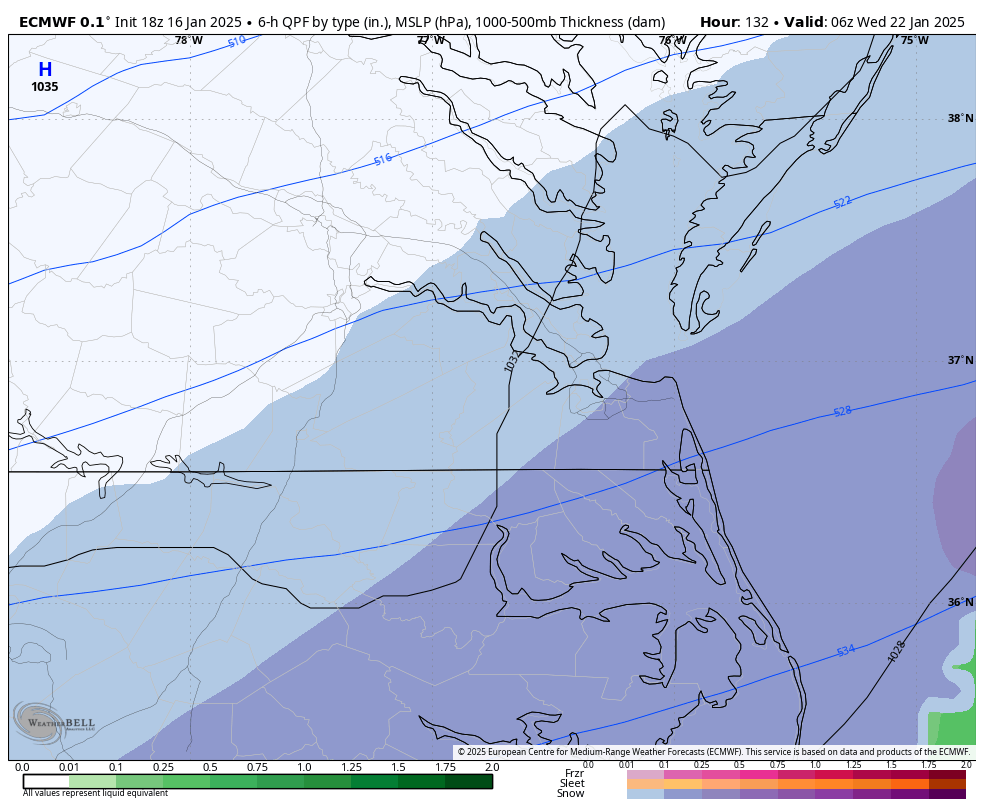
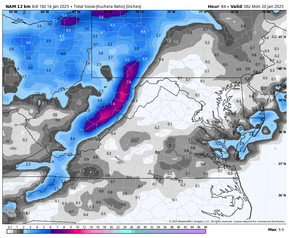
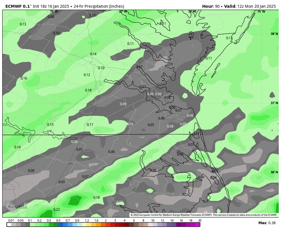
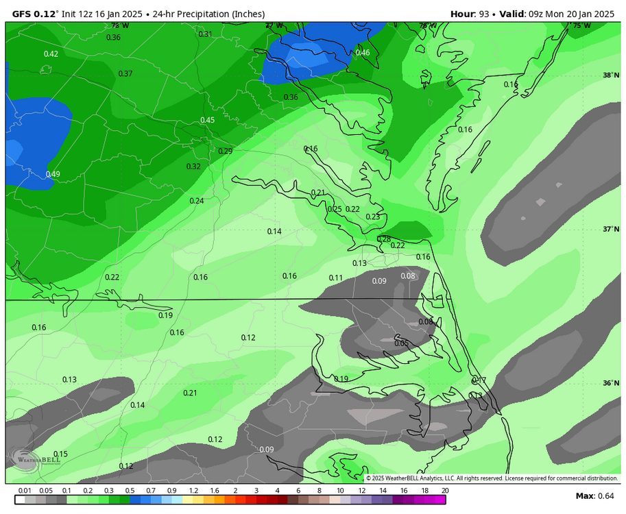
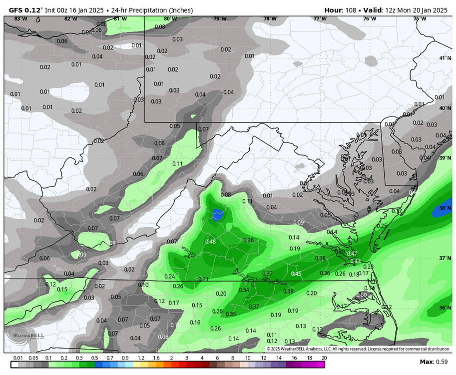
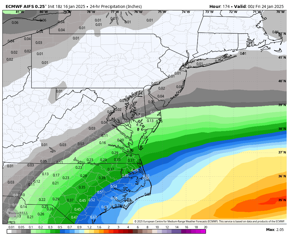
There is no real change on the Sunday snow idea, except that both GFS and Euro have an earlier arrival time on Sunday, and this run of the GFS had a bit more QPF in spots (>0.40"). Temps look to start around freezing at the onset, then drop as colder air filters in.


.png.dd232dc163344f342bc2edee11ba8a3b.png)